Carte Paris
1
to
18
168
71
109
91
66
47
32
30
25
22
21
16
15
13
9
8
8
8
6
6
6
6
6
5
4
4
4
4
3
3
3
3
3
3
2
1
1
1
1
1
1
1
1
1
1
13
13
13
12
8
Sort By
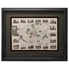
Antique Map of Paris, "Carte Routiere des Environs de Paris" 1841
Located in Colorado Springs, CO
This beautiful hand-colored road map of Paris was published in 1841. The map shows Paris and the
Category
Antique 1840s French Maps
Materials
Paper
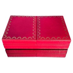
Playing Cards in Box - Les Must de Cartier Paris - circa 1976
By Cartier
Located in Milano, IT
Rara perchè intonsa e ancora sigillata scatola di carte da gioco della Maison Cartier per la linea
Category
Mid-20th Century French Modern Games
Materials
Textile, Paper
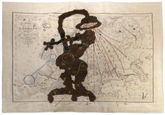
Porter Series: Carte L'Europe (Shower Woman)
By William Kentridge
Located in Palm Desert, CA
"Porter Series: Carte L'Europe (Shower Woman)" is a tapestry by South African artist William
Category
21st Century and Contemporary More Art
Materials
Tapestry, Silk
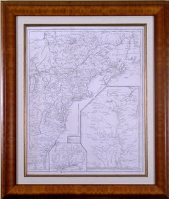
Carte d'une Partie de l'Amerique Septentrionale
By Francois Soules
Located in Florham Park, NJ
).
________________________________________
DATE OF PUBLICATION : R1787 (1781MS)
PLACE OF PUBLICATION : PARIS
DESCRIPTION : THIS MAP SHOWING
Category
18th Century and Earlier Academic Prints and Multiples
Materials
Engraving
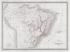
Carte du Bresil, antique 1860s engraved map of Brazil
Located in Melbourne, Victoria
'Carte du Bresil'
Engraving with original outline colouring, circa 1860, by Alexandre Vuillemin
Category
Late 19th Century Victorian More Prints
Materials
Lithograph
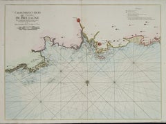
Carte Particuliere Des Coste De Bretagne qui Comprend Morlaix
By Pierre Mortier
Located in Paonia, CO
Carte Particuliere Des Costes De Bretagne qui Comprend Morlaix, Saint Paul de Leon, les Sept
Category
1690s Landscape Prints
Materials
Engraving
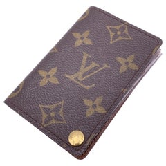
Louis Vuitton Vintage Monogram Porte Carte Pression Card Case Holder
By Louis Vuitton
Located in Rome, Rome
Vintage Louis Vuitton Porte Carte Pression Card Holder. Crafted in brown monogram canvas. Tan
Category
Early 2000s French Tech Accessories and Cases
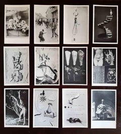
La Carte Surréaliste. Première série. Vingt et une cartes - 1937
Located in Roma, IT
La Carte Surréaliste. Première série. Vingt et une cartes is a collection of iconic surrealist
Category
1930s Modern More Prints
Materials
Lithograph
H 5.52 in W 3.55 in D 0.04 in
Carte de Voeux - Lithograph by Massimo Campigli - Late 20th Century
By Massimo Campigli, 1895-1971
Located in Roma, IT
Carte de Voeux is an original Contemporary Artwork realized in the Second half of the XX Century by
Category
1940s Contemporary Figurative Prints
Materials
Lithograph
H 11.03 in W 14.97 in D 0.04 in
1938 original map titled "Carte du réseau aérien français" Air France
Located in PARIS, FR
The 1938 original map titled "Carte du réseau aérien français" by A. Collinet offers a captivating
Category
1930s Prints and Multiples
Materials
Linen, Paper, Lithograph
Carte de l'Europe by Paulémile Pissarro, 1972 - Graphite on paper
Located in London, GB
THIS WORK IS SOLD UNFRAMED
Carte de l'Europe by Paulémile Pissarro (1884 - 1972)
Graphite on
Category
1970s Post-Impressionist Landscape Drawings and Watercolors
Materials
Paper
"Carte de Voeux #731, " Lithograph by Marc Chagall in Chagall Catalog Raisonne
By Marc Chagall
Located in Milwaukee, WI
"Carte de Voeux #731" is an original lithograph greeting card by Marc Chagall. It is in the Chagall
Category
1970s Modern Figurative Prints
Materials
Lithograph, Lucite
"Carte de Voeux (New Year Greeting Card), " Original Lithograph by Marc Chagall
By Marc Chagall
Located in Milwaukee, WI
"Carte De Voeux (New Year Greeting Card)" is an original color lithograph by Marc Chagall. It is
Category
1980s Modern Figurative Prints
Materials
Lithograph
Carte Particular Des Costes De Bretagne Depuis le Cap de Frehel, Jusques a Perros
By Pierre Mortier
Located in Paonia, CO
Carte Particulaire Des Costes De Bretagne Depuis Le Cap de Frehel, Jusques a Perros, & L’Isle Tome
Category
1690s Landscape Prints
Materials
Engraving
Map of the Holy Land "Carte de la Syrie et de l'Egypte" by Pierre Lapie
By Pierre M. Lapie
Located in Alamo, CA
This is an early 19th century map of ancient Syria and Egypt entitled "Carte de la Syrie et de
Category
1830s Landscape Prints
Materials
Engraving
H 27 in W 21.38 in D 0.75 in
Map of the Holy Land "Carte de la Syrie et de l'Egypte" by Pierre M. Lapie
By Pierre M. Lapie
Located in Alamo, CA
An early 19th century map of ancient Syria and Egypt entitled "Carte de la Syrie et de l'Egypte
Category
Antique Early 19th Century French Maps
Materials
Paper
H 27 in W 21.38 in D 0.75 in
Original Vintage Illustrated Map Poster Railway Travel Normandy Brittany Paris
By Lucien Boucher
Located in London, GB
Tourism Network / Carte Illustre des Chemins de Fer de l'Etat Reseau de la Mer et du Tourisme by Lucien
Category
Vintage 1930s French Posters
Materials
Paper
H 39.38 in W 24.61 in D 0.04 in
Boulevard Montmartre, Paris, Busy Street View, Silver Gelatin B & W Photography
By Wide World Photos
Located in Atlanta, GA
An original silver gelatin black and white photograph by Wide World Photos, Paris. A street view of
Category
1930s Art Deco Black and White Photography
Materials
Silver Gelatin
H 6.54 in W 4.65 in D 0.04 in
Large Folding Map of Paris, France, on Linen, 36 Segments, Published in 1836
Located in Langweer, NL
Antique map Paris titled 'Carte Topographique des Environs de Paris Nouvelle edition rectifié
Category
Antique 1830s Maps
Materials
Paper
H 27.96 in W 39.77 in D 0 in
Globe terrestrre edited in the 1930s by French geographer J. Forest Paris
Located in Milan, IT
Dressé par J. FOREST Editeur Paris 17 – 19 Rue de Buci. Oltre alla mappa territoriale molto ben delineata
Category
Vintage 1930s Globes
Materials
Wood
Original Old Map of Present-Day Mongolia, Northeast China and Korea
Located in Langweer, NL
Antique map titled 'Carte de la Tartarie Chinoise. Projettee et assujettie aux observations
Category
Antique Late 18th Century Maps
Materials
Paper
Antique Map of Grenada, West Indies, 1758
Located in Langweer, NL
"Exquisite 1758 Map: 'CARTE DE L'ISLE DE LA GRENADE'
This alluring map presents a detailed
Category
Antique 1750s Maps
Materials
Paper
Antique Print of the Region of Batavia by Van Schley 'c.1750'
Located in Langweer, NL
Antique print titled 'Carte des Environs de Batavia - Kaart van de Buitenstreeken van Batavia'. Map
Category
Antique Mid-18th Century Prints
Materials
Paper
Decorative Hand-Colored French Map of the English Channel, 1827
Located in Langweer, NL
Antique map titled 'Carte et Coupe du Canal de la Manche'. Original antique map of the English
Category
Antique Mid-19th Century Maps
Materials
Paper
Martinique Island in the Caribbean by Bellin Original Original Antique Map, 1780
Located in Langweer, NL
This mid-18th century map, "Carte de l'Isle de la Martinique pour servir a l'historie generale des
Category
Antique Late 18th Century Maps
Materials
Paper
H 9.85 in W 13.39 in D 0 in
Champagne Sign Jules Bertier, circa 1900, France
Located in Antwerp, BE
Industriels, Paris, France.
Carte Blanche, printed in lithography on embrossed metal, from circa 1900, made in
Category
Early 20th Century French Art Nouveau Signs
Materials
Metal
Antique Map of the Bay of Brusc, France
Located in Langweer, NL
Antique map titled 'Carte de la rade du Brusc'. Original map of the bay of Brusc, France. This map
Category
Antique Mid-18th Century Maps
Materials
Paper
Rare Chart of Indonesia Including Borneo, Java, Celebes, Ceram and More, 1779
Located in Langweer, NL
Antique map titled 'Carte de la Navigation de Batavia a Amboina'.
Rare chart of Indonesia
Category
Antique 1770s Maps
Materials
Paper
H 9.06 in W 29.34 in D 0 in
Antique Map of the Region of Berre-l'Étang, France
Located in Langweer, NL
Antique map titled 'Carte des etangs de Berre de Martigue et environs'. Original map of the region
Category
Antique Mid-18th Century Maps
Materials
Paper
1771 Bonne Map of Poitou, Touraine and Anjou, France, Ric.a015
Located in Norton, MA
, Touraine and Anjou entitled "Carte des Gouvernements D'Anjou et du Saumurois, de la Touraine, du Poitou,du
Category
Antique 17th Century Unknown Maps
Materials
Paper
Antique Map of the Languedoc Canal, Between Touloouse and Marseillette, France
Located in Langweer, NL
Antique map titled 'Carte du canal de Languedoc depuis Toulouse jusqu'a I'etang de Marceillette
Category
Antique Mid-18th Century Maps
Materials
Paper
H 12.49 in W 17.45 in D 0.02 in
Antique Map of Spain by P.F. Tardieu, circa 1798
By Pierre François Tardieu
Located in Langweer, NL
Antique map titled 'Espagne carte comparative', showing river systems, the modern states of Spain
Category
Antique Late 18th Century Maps
Materials
Paper
Antique Coastal Map of Sumatra by De La Haye, circa 1780
Located in Langweer, NL
Antique map titled 'Carte de la Côte Occidentale de l'Isle Sumatra'. Sea chart of the part of the
Category
Antique Late 18th Century French Maps
Materials
Paper
Antique Map of the Tunquin River and Bay by Van Schley 'c.1750'
Located in Langweer, NL
Antique map titled ‘Kaart van den Loop der Rivier van Tonkin van Cacho tot aan de Zee / Carte du
Category
Antique Mid-18th Century Prints
Materials
Paper
Antique Map of France at the Beginning of the 17th Century by Zannoni, 1765
By G. A. Rizzi-zannoni
Located in Langweer, NL
Antique map France titled 'Carte pour servir à intelligence de l'Histoire de France
Category
Antique 18th Century Maps
Materials
Paper
H 11.03 in W 15.75 in D 0 in
Antique Map of Brazil Extending South to the Mouth of the Rio de la Plata
Located in Langweer, NL
Antique map titled 'Carte du Brésil'. ?Beautiful map of Brazil extending south to the mouth of the
Category
Antique Early 19th Century Maps
Materials
Paper
H 23.31 in W 17.33 in D 0.02 in
Map of the Laughlan Islands, Rossel Island & Reef North of New Caledonia, 1833
Located in Langweer, NL
Antique map titled 'Plan de l'extremite septentrionale du Recif de D'entrecasteaux. Carte
Category
Antique 1830s Maps
Materials
Paper
H 25.4 in W 19.02 in D 0 in
Hortense Damiron , "la veuve Heuvrard", 1973
Located in SAINT-SEVER, FR
Conseil constitutionnel, Paris
1984
Carte de vœux du président de la République, François Mitterrand
Category
Vintage 1970s French Paintings
Materials
Canvas
Scarce Antique Map of South America
Located in Langweer, NL
Antique map titled 'Carte de l'Amérique Méridionale'. Scarce map of South America, published in
Category
Antique Early 19th Century Maps
Materials
Paper
Bonne, Map of Middle East, Persia, Red Sea, Egypt, Nubia Hand Coloured
Located in Norwich, GB
Rigobert Bonne.
Carte de L'Arabia du Golfe Persique et de la Mer Rouge, avec l’Egypte, la Nubia
Category
Antique 1780s French Prints
Materials
Paper
Original Antique Map of Peru with Regions Outlined in Color
Located in Langweer, NL
Antique map titled 'Carte du Pérou'. This map of Peru and the surrounding region shows excellent
Category
Antique Early 19th Century Maps
Materials
Paper
French Geographical, Statistical and Historical Map of Pensylvania, 1825
Located in Langweer, NL
Title: Carte geographique, statistique et historique de la Pensylvanie.
Beautiful Hand-Colored
Category
Antique 1820s Maps
Materials
Paper
H 20.08 in W 25.99 in D 0 in
Antique Map of Southern India, the Maldives and Sri Lanka with Currents
Located in Langweer, NL
Antique map titled 'Carte de la Partie Inferieure De L'Inde En Deca Du Gange (..)'. Interesting map
Category
Antique Late 18th Century Maps
Materials
Paper
H 9.77 in W 14.85 in D 0.02 in
Authentique Map by Pilon of The French Colonies in The West Indies, 1876
Located in Langweer, NL
H. Fisquet, published by A. Le Vasseur in Paris.
**Title:** Carte des Colonies Françaises aux
Category
Antique Late 19th Century Maps
Materials
Paper
H 14.38 in W 16.54 in D 0 in
Space Invader Map Ravenna Invasion 2017 Print Street Art Urban Art Contemporary
By Invader
Located in Draper, UT
Size : 1000 folded copies
This map is the 24th carte D'invasion created by Invader and features the 40
Category
2010s Street Art More Art
Materials
Lithograph
Earth globe early 1950s by French publishing geographers Girard et Barrère
Located in Milan, IT
Rue de l’Ancienne Comédie Paris. Oltre alla mappa territoriale molto ben delineata sono raffigurante
Category
Vintage 1950s Globes
Materials
Paper
Antique Map of Persia, Georgia and Kazakhstan, ca.1780
Located in Langweer, NL
Antique map titled 'Carte de la Perse, de la Georgie, et de la Tartarie Independante'.
Map of
Category
Antique 1780s Maps
Materials
Paper
Decorative Antique Map of Central Asia
Located in Langweer, NL
Antique map titled 'Carte de la Tartarie Indépendante (..)'. Decorative map of Central Asia
Category
Antique Late 18th Century Maps
Materials
Paper
Antique Chart of the Voyage of Captain Cook by Benard, 1780
Located in Langweer, NL
Antique map titled 'Carte des Découvertes faites dans la Mer Pacifique sur la Vaisse au de Roi, La
Category
Antique 18th Century Maps
Materials
Paper
Old Engraving of the Track of the Resolution Captain Cook in the Pacific, 1780
Located in Langweer, NL
Antique map titled 'Carte des Découvertes faites dans la Mer Pacifique sur la Vaisse au de Roi, La
Category
Antique 18th Century Maps
Materials
Paper
H 11.82 in W 15.36 in D 0 in
Antique Map of France under the Reign of Henry IV by Zannoni, 1765
Located in Langweer, NL
Antique map France titled 'Carte de la réunion de la Basse Navarre (..)'. Beautiful old map of
Category
Antique 18th Century Maps
Materials
Paper
Antique Map of France under the Reign of Louis XI by Zannoni, 1765
Located in Langweer, NL
Antique map France titled 'Carte de l'Etat de la Monarchie Francoise (..)'. Beautiful old map of
Category
Antique 18th Century Maps
Materials
Paper
Birds - Mixed Media by Pino Settanni - 1970s
By Pino Settanni
Located in Roma, IT
Francais de la Carte À Jouer in Issy les Moulineaux, at the Maison Européenne de la Photographie in Paris
Category
1970s Contemporary Mixed Media
Materials
Ink, Photographic Paper
Antique Engraved Map of the Friendly Islands or Tonga, ca.1785
Located in Langweer, NL
Antique map titled 'Carte des Isles des Amis'.
Map of the Friendly Islands / Tonga. The Tongan
Category
Antique 1780s Maps
Materials
Paper
Antique Map of Eastern Tartary and the Gobi Desert by Van Schley, 1758
By Jakob van der Schley
Located in Langweer, NL
Antique map titled 'Carte de la Tartarie occidentale.' Original antique map of Eastern Tartary and
Category
Antique 18th Century Maps
Materials
Paper
Antique Map of the Buton Strait by Philippe, 1787
Located in Langweer, NL
Antique map titled 'Carte du Détroit de Bouton'. Map of the Buton Strait between Paula Buton and
Category
Antique 18th Century Maps
Materials
Paper
Antique Map of France under the reign of Henry III by Zannoni, 1765
Located in Langweer, NL
Antique map France titled 'Carte de la réunion des Comtés d'Evreux et d'Alencon (..)'. Beautiful
Category
Antique 18th Century Maps
Materials
Paper
Antique Map of France under the Reign of Philip II by Zannoni, 1765
Located in Langweer, NL
Antique map France titled 'Carte de l'accroissement du Domaine sous Philippe Auguste
Category
Antique 18th Century Maps
Materials
Paper
Bedroom Interior - French Mid 20th Century Post Impressionist Oil Painting
Located in Sevenoaks, GB
invested into a 6-month stay in Paris where he frequented the Louvre Museum and became specially interested
Category
1940s Post-Impressionist Interior Paintings
Materials
Oil
Free Shipping
H 25.6 in W 30.32 in
Antique Map of the Mediterranean, Telemachus' Journey, Publ. Early 18th Century
Located in Langweer, NL
Title: Carte des voyages de Télémaque.
Description: Antique map of Telemachus journey, the son
Category
Antique Early 18th Century Maps
Materials
Paper
H 6.5 in W 10.63 in D 0 in
- 1
Get Updated with New Arrivals
Save "Carte Paris", and we’ll notify you when there are new listings in this category.
