Items Similar to Antique Map of Brazil Extending South to the Mouth of the Rio de la Plata
Want more images or videos?
Request additional images or videos from the seller
1 of 8
Antique Map of Brazil Extending South to the Mouth of the Rio de la Plata
About the Item
Antique map titled 'Carte du Brésil'. ?Beautiful map of Brazil extending south to the mouth of the Rio de la Plata and Buenos-Aires in Argentina. Published by Tardieu, 1821.
Pierre Antoine Tardieu (1784-1869), also known to sign his works as PF Tardieu, was a prolific French map engraver and geographer. The Tardieu family, based in Paris, was well known for their talent in engraving, cartography, and illustration. Pierre Antoine’s father, Antoine Francois Tardieu, was an established cartographer who published numerous atlases. His son is said to have collaborated with him for many years before establishing his own independent career.
- Dimensions:Height: 23.31 in (59.2 cm)Width: 17.33 in (44 cm)Depth: 0.02 in (0.5 mm)
- Materials and Techniques:
- Period:
- Date of Manufacture:1821
- Condition:Wear consistent with age and use. General age-related toning. Original folding line. Minor wear and foxing, blank verso. Please study images carefully.
- Seller Location:Langweer, NL
- Reference Number:
About the Seller
5.0
Platinum Seller
These expertly vetted sellers are 1stDibs' most experienced sellers and are rated highest by our customers.
Established in 2009
1stDibs seller since 2017
1,932 sales on 1stDibs
Typical response time: <1 hour
- ShippingRetrieving quote...Ships From: Langweer, Netherlands
- Return PolicyA return for this item may be initiated within 14 days of delivery.
More From This SellerView All
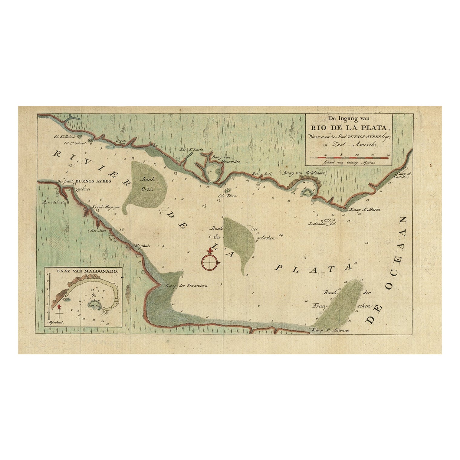
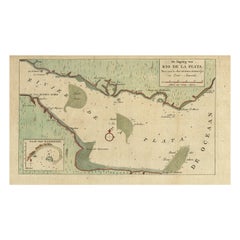
- Rare Antique Map of the Rio De La Plata, Buenos Ayres, Brazil, ca.1760Located in Langweer, NLDescription: Antique map titled 'De Ingang van Rio de la Plata, Waar aan de Stad Buenos Ayres ligt, in Zuid-Amerika'. A map showing the Rio de la Plata es...Category
Antique 1760s Maps
MaterialsPaper
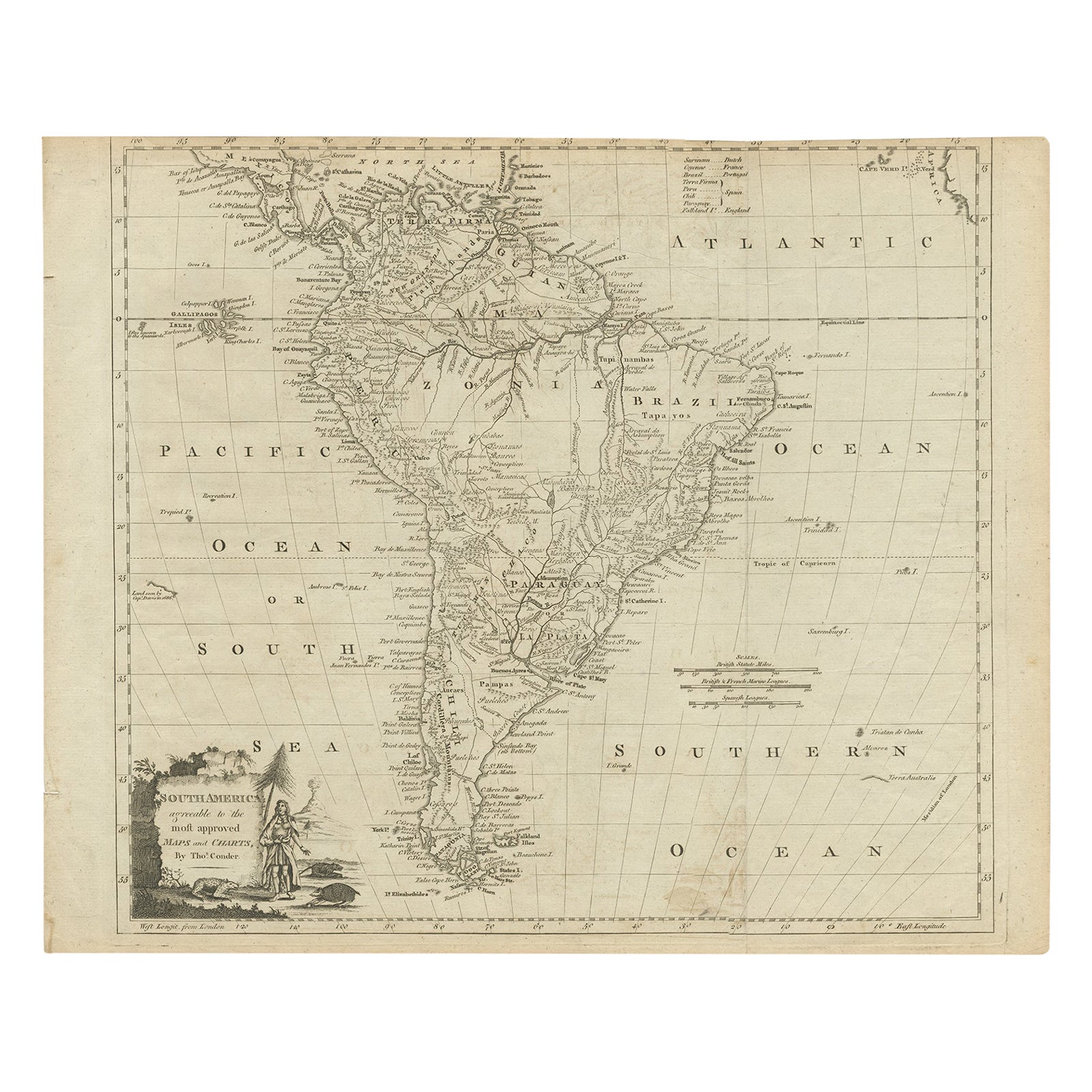
- Rare Map of South America of Chili, La Plata, Paraguay, Brazil, Peru, c.1775Located in Langweer, NLAntique map titled 'South America agreeable to the most approved maps and charts'. Rare map of South America depicting Chili, La Plata, Paraguay, Brazil, ...Category
Antique 1770s Maps
MaterialsPaper
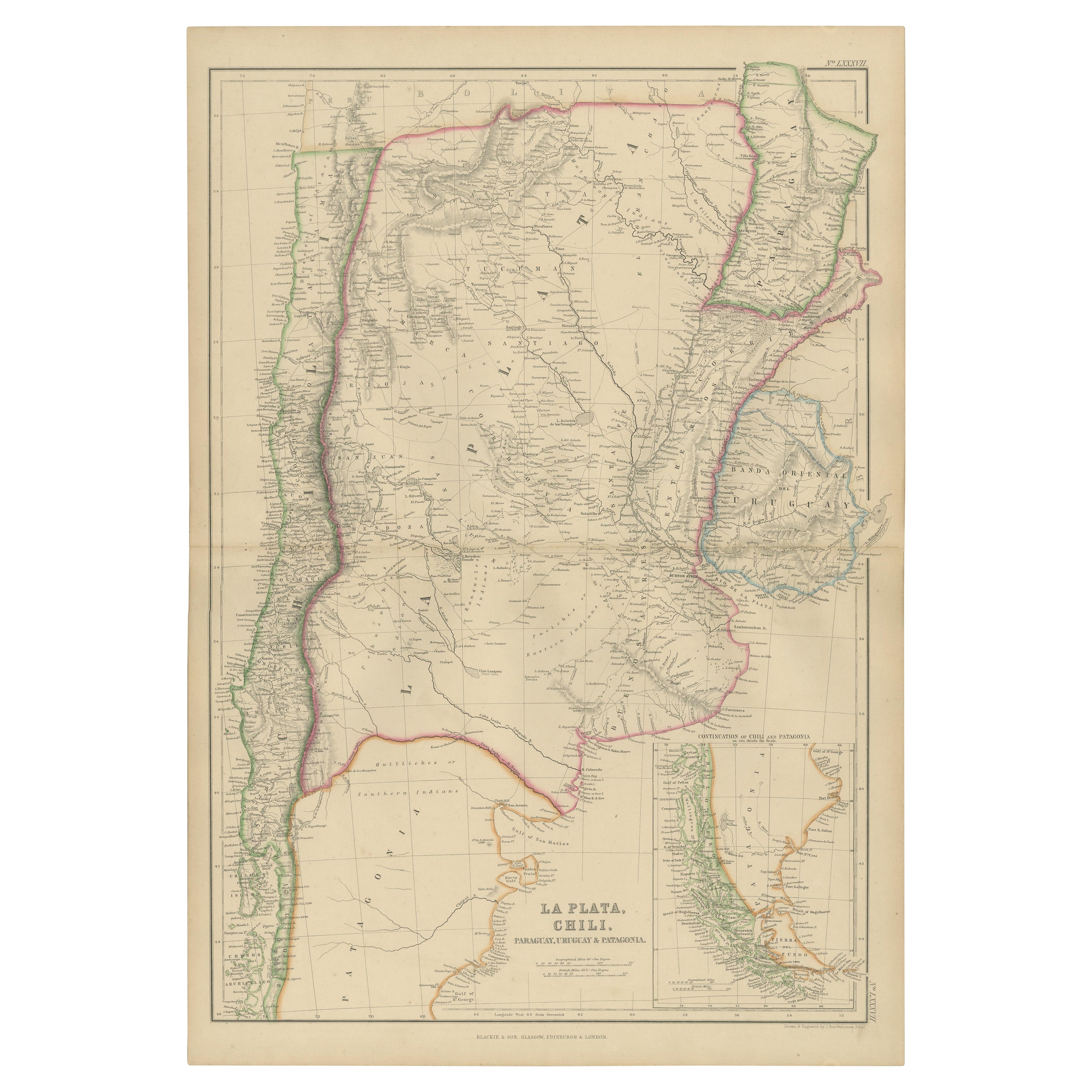
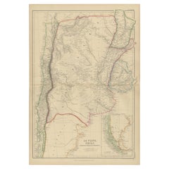
- Antique Map of La Plata, Chili, by W. G. Blackie, 1859Located in Langweer, NLAntique map titled 'La Plata, Chili, Paraguay, Uruguay and Patagonia'. Original antique map of La Plata, Chili, Paraguay, Uruguay and Patagonia with inset m...Category
Antique Mid-19th Century Maps
MaterialsPaper
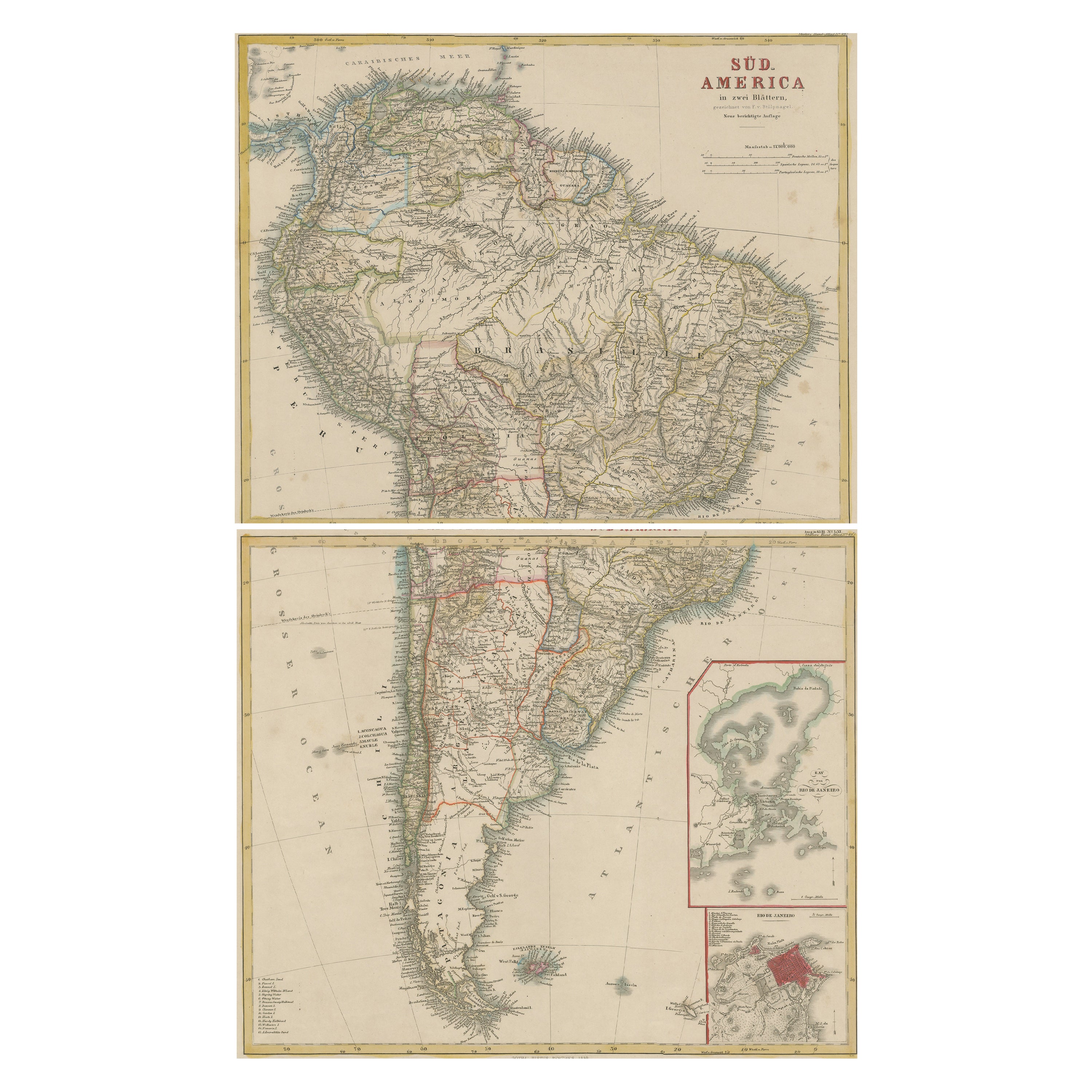
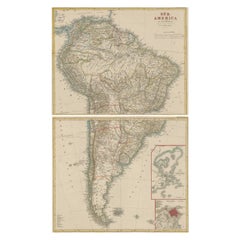
- Set of Two Antique Maps of South America with Inset Maps of Rio de JaneiroLocated in Langweer, NLSet of two antique maps titled 'Süd-America in zwei Blättern'. Two individual sheets of South America. With inset maps of Rio de Janeiro and the Bay of Rio de Janeiro. This map o...Category
Antique Mid-19th Century Maps
MaterialsPaper
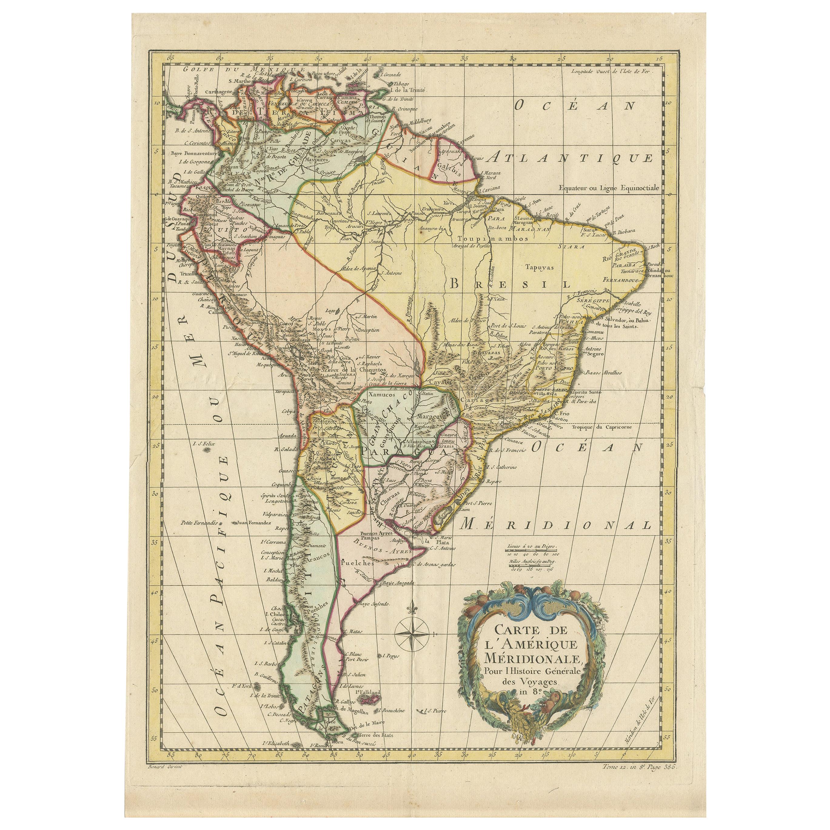
- Antique Map of South America by De la Harpe '1780'Located in Langweer, NLAntique map titled 'Carte de l'Amerique Méridionale'. Original antique map of South America. Note the 'Laguna de Xarayes' is illustrated as the source of the Paraguay river. The laguna is now known as Pantanal, world's largest tropical wetland area. This map orginates from 'Abrégé de l'histoire générale des Voyages' by J.F. de la Harpe.Category
Antique Late 18th Century Maps
MaterialsPaper
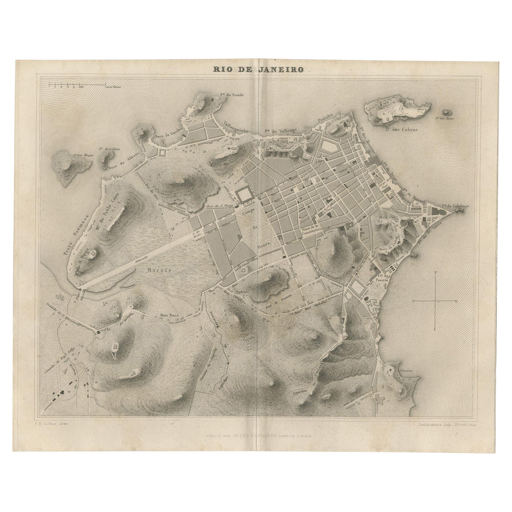
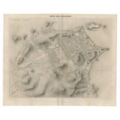
- Antique Map of the City of Rio de Janeiro by Balbi '1847'Located in Langweer, NLAntique map titled 'Rio de Janeiro'. Original antique map of the city of Rio de Janeiro, Brazil. This map originates from 'Abrégé de Géographie (..)' by Adrien Balbi. Published 1847.Category
Antique Mid-19th Century Maps
MaterialsPaper


You May Also Like
- Map "Estuary- Mouth of the Thames"Located in Alessandria, PiemonteST/426 - Antique French Map of the estuary of the Thames, map dated 1769 - "Mape of the entrance of the Thames. Designed by filing of Navy cards fo...Category
Antique Mid-18th Century French Other Prints
MaterialsPaper
- Original Antique Map of South America. C.1780Located in St Annes, LancashireGreat map of South America Copper-plate engraving Published C.1780 Two small worm holes to left side of map Unframed.Category
Antique Early 1800s English Georgian Maps
MaterialsPaper
- Original Antique Map of South America, circa 1830Located in St Annes, LancashireGreat map of South America Copper plate engraving Published by Butterworth, Livesey & Co., circa 1830 Unframed.Category
Antique Early 1800s English Other Maps
MaterialsPaper
- Original Antique Map of South Africa, Arrowsmith, 1820Located in St Annes, LancashireGreat map of South Africa. Drawn under the direction of Arrowsmith. Copper-plate engraving. Published by Longman, Hurst, Rees, Orme and Br...Category
Antique 1820s English Maps
MaterialsPaper
- Map of the Holy Land "Carte de la Syrie et de l'Egypte" by Pierre M. LapieBy Pierre M. LapieLocated in Alamo, CAAn early 19th century map of ancient Syria and Egypt entitled "Carte de la Syrie et de l'Egypte anciennes/dressée par M. Lapie, Colonel d'Etat Major, et...Category
Antique Early 19th Century French Maps
MaterialsPaper
- Original Antique Map of South East Asia, Arrowsmith, 1820Located in St Annes, LancashireGreat map of South East Asia Drawn under the direction of Arrowsmith Copper-plate engraving Published by Longman, Hurst, Rees, Orme and Brown, 1820 Unframed.Category
Antique 1820s English Maps
MaterialsPaper


Recently Viewed
View AllMore Ways To Browse
Brazilian Antiques
Brazil Antique
Argentine Antiques
Antique Argentine
Argentine Antique Furniture
Argentina Plata
France And Son Extending
Carte Paris
Map Of Brazil
Brazil Map
Antique Map Brazil
Antique Map Of Brazil
Argentina Map
Antique Map Of Argentina
Antique Map Argentina
Victorian Fence
Battle Maps
Russian Antique Plates