Antique Map Of Brazil

5
to
11
83
3
48
32
28
19
14
11
9
7
7
7
6
4
4
3
3
2
2
2
2
1
1
1
1
1
1
1
1
1
1
8
3
1
1
1
Sort By
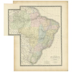
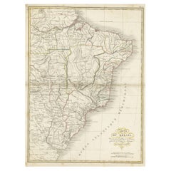
Antique Map of Brazil by Levasseur '1875'
Located in Langweer, NL
Antique map titled 'Carte du Brésil'. Large map of Brazil, with small fold out. This map originates
Category

Late 19th Century Antique Map Of Brazil

Materials

Paper

Antique Map of Brazil by Levasseur '1875'
H 24.02 in W 22.05 in D 0.02 in
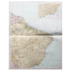
Large Original Vintage Map of Brazil, circa 1920
Located in St Annes, Lancashire
Great map of Brazil Original color. Good condition Published by Alexander Gross Unframed.  
Category

1920s English Edwardian Antique Map Of Brazil

Materials

Paper

Large Original Antique Map of Brazil, circa 1920
Large Original Vintage Map of Brazil, circa 1920
No Reserve
H 25 in W 19.5 in D 0.07 in
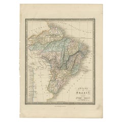
Antique Map of Brazil by Wyld, '1845'
Located in Langweer, NL
Antique map titled 'Empire of Brazil'. Original antique map of Brazil. This map originates from 'An
Category

Mid-19th Century Antique Map Of Brazil

Materials

Paper

Antique Map of Brazil by Wyld, '1845'
H 14.18 in W 10.24 in D 0.02 in
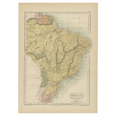
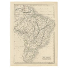
Antique Map of Brazil, Uruguay, Paraguay and Guyana by A & C. Black, 1870
Located in Langweer, NL
Antique map titled 'Brazil'. Original antique map of Brazil, Uruguay, Paraguay and Guyana. This map
Category

Late 19th Century Antique Map Of Brazil

Materials

Paper

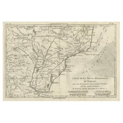
Antique Map of Brazil of Southern Brazil, Uruguay, and Northern Argentina, c1780
Located in Langweer, NL
Antique map titled 'Carte de la Partie Méridionale du Bresil (..)'. This antique map of Brazil
Category

1780s Antique Map Of Brazil

Materials

Paper

Antique Map of Brazil Extending South to the Mouth of the Rio de la Plata
Located in Langweer, NL
Antique map titled 'Carte du Brésil'. ?Beautiful map of Brazil extending south to the mouth of the
Category

Early 19th Century Antique Map Of Brazil

Materials

Paper

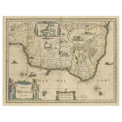
Old Color Engraving of Blaeu's first Map of Brazil, North Oriented to the Right
By Willem Blaeu
Located in Langweer, NL
Antique map titled 'Novus Brasiliae Typus'. Fine old color example of Blaeu's first map of Brazil
Category

Mid-17th Century Antique Map Of Brazil

Materials

Paper

Antique Map of Brazil with Original Outline Hand-Colouring, c.1844
Located in Langweer, NL
Antique map titled 'Brazil'. Beautiful map with outline color of Brazil, engraved by S. Hall
Category

19th Century Antique Map Of Brazil

Materials

Paper

Antique Map of Brazil, Ecuador, Colombia and Venezuela by Lapie, 1842
Located in Langweer, NL
Antique map titled 'Carte de Colombie contenant les Républiques (..)'. Map of northern Brazil
Category

19th Century Antique Map Of Brazil

Materials

Paper

Antique Map of Brazil, Including Part of Colombia, Peru and Chili, c.1880
Located in Langweer, NL
Antique map South America titled 'Brazil'. This map depicts Brazil and its surroundings including
Category

19th Century Antique Map Of Brazil

Materials

Paper

Antique Map of of Brazil, Paraguay and Uruguay
Located in Langweer, NL
Antique map titled 'Bresil Paraguay et Uruguay'. Fine steel engraved map of Brazil, Paraguay and
Category

Mid-19th Century Antique Map Of Brazil

Materials

Paper

Antique Map of of Brazil, Paraguay and Uruguay
H 19.69 in W 12.92 in D 0.02 in
Carte du Bresil, antique 1860s engraved map of Brazil
Located in Melbourne, Victoria
'Carte du Bresil' Engraving with original outline colouring, circa 1860, by Alexandre Vuillemin, published in Paris. 31cm by 41cm (sheet) 21.5cm by 31.5cm (image)
Category

Late 19th Century Victorian Antique Map Of Brazil

Materials

Lithograph

Antique Map of Southern Brazil by Bonne, c.1780
Located in Langweer, NL
"Antique map titled 'Carte de la Partie Méridionale du Bresil (..)'. This antique map of Brazil
Category

18th Century Antique Map Of Brazil

Materials

Paper

Original Antique Map of Brasil, Published in the 16th Century, 1561
Located in Langweer, NL
This important Ruscelli map of Brazil, from his work La Geografia di Claudio Tolomeo Alessandrino
Category

1660s Antique Map Of Brazil

Materials

Paper

Antique Map of Eastern Brazil, 1849
Located in Langweer, NL
Antique map titled 'Eastern Brazil'. Old map of Eastern Brazil. This map originates from 'Sharpe's
Category

19th Century Antique Map Of Brazil

Materials

Paper

Antique Map of Eastern Brazil, 1849
H 18.31 in W 13.98 in D 0 in
Antique Map of the Brazilian Coast by A. Van Krevelt
Located in Langweer, NL
Uncommon edition of this accurate map of part of Brazil, from San Salvador till Rio de Janeiro and
Category

Late 18th Century Brazilian Antique Map Of Brazil

Materials

Paper

Antique Map of the Brazil Railway Company, '1912'
Located in Langweer, NL
Antique map titled 'Brazil Railway Company'. This folding map is attached to the booklet titled
Category

Early 20th Century Antique Map Of Brazil

Materials

Paper

Antique Map of Northern Brazil by Bonne, c.1780
Located in Langweer, NL
Antique map titled 'Carte de la Partie Septentrionale du Bresil.' Detailed map of the northern
Category

18th Century Antique Map Of Brazil

Materials

Paper

Antique Map of the Northern Part of Brazil by Raynal, 1784
Located in Langweer, NL
Antique map titled 'Kaart van het Noordlijk gedeelte van Bresil'. Rare antique map of the northern
Category

18th Century Antique Map Of Brazil

Materials

Paper

Antique Map of La Plata, Chili and Southern Brazil, 1849
Located in Langweer, NL
Antique map titled 'La Plata - Chili and Southern Brazil'. Old map of La Plata, Chili and
Category

19th Century Antique Map Of Brazil

Materials

Paper

Antique Map of the Coast of Southern Brazil by Bellin, c.1755
By Jacques-Nicolas Bellin
Located in Langweer, NL
Antique map titled ‘Suite de Bresil’. Map of the coast of southern Brazil, with Lagoa Mirim, and
Category

18th Century Antique Map Of Brazil

Materials

Paper

Antique Map of Southern Brazil and Uruguay by Bonne, c.1780
Located in Langweer, NL
Voisines Qui en Sont a l'Ouest.' Map of southern Brazil and present-day Uruguay from Porto Seguro in the
Category

18th Century Antique Map Of Brazil

Materials

Paper

Antique Map of the Eastern Part of Brazil by A. Van Krevelt, 1772
Located in Langweer, NL
Rare edition of this accurate map of eastern part of Brazil. This map originates from 'Atlas
Category

Late 18th Century Antique Map Of Brazil

Materials

Paper

Antique Map of the Bahia Todos Santos 'Brazil' by Tirion, circa 1750
Located in Langweer, NL
Antique map titled 'Kaart Van De Aller-Heiligen Baay Waar aan de Hoofdstad legt van Brazil
Category

Mid-18th Century Antique Map Of Brazil

Materials

Paper

Rare Map of South America of Chili, La Plata, Paraguay, Brazil, Peru, c.1775
Located in Langweer, NL
Antique map titled 'South America agreeable to the most approved maps and charts'. Rare map of
Category

1770s Antique Map Of Brazil

Materials

Paper

Rare Antique Map of the Rio De La Plata, Buenos Ayres, Brazil, ca.1760
Located in Langweer, NL
Description: Antique map titled 'De Ingang van Rio de la Plata, Waar aan de Stad Buenos Ayres ligt
Category

1760s Antique Map Of Brazil

Materials

Paper

Antique Map of South America by Johnston '1909'
Located in Langweer, NL
Antique map titled 'South America, Southern Sheet'. Depicting Chile, Argentina, Brazil, Patagonia
Category

Early 20th Century Antique Map Of Brazil

Materials

Paper

Antique Map of South America by Finlayson, 1822
Located in Langweer, NL
America'. This map depicts part of South America (including part of Brazil and Chili) and provides a lot
Category

19th Century Antique Map Of Brazil

Materials

Paper

Antique Map of South America by V. Levasseur, 1854
By Victor Levasseur
Located in Langweer, NL
scenes of natives and their life. Depicting Colombia, Brazil, Chile, Bolivia and more. This map
Category

Mid-19th Century Antique Map Of Brazil

Materials

Paper

Antique Map of South America by Tirion 'circa 1765'
Located in Langweer, NL
Antique map titled 'Kaart van het Onderkoningschap van Peru, zig uitstrekkende over Chili, Paraguay
Category

Mid-18th Century Antique Map Of Brazil

Materials

Paper

Antique Map of South America by Conder, c.1775
Located in Langweer, NL
Antique map titled 'South America agreeable to the most approved maps and charts'. Rare map of
Category

18th Century Antique Map Of Brazil

Materials

Paper

Antique Map of South America Depicting Guayana, c.1780
Located in Langweer, NL
Mayapa, a Brazilian state, and Cap de Nord in the south. This map originates from G. Raynal's 'Atlas de
Category

18th Century Antique Map Of Brazil

Materials

Paper

Antique Map of South America by Wyld, circa 1850
By J. Wyld
Located in Langweer, NL
Beautiful folding map of South America titled 'Colombia Prima or South America Drawn from the Large
Category

Mid-19th Century British Antique Map Of Brazil

Materials

Paper

Antique Map of Part of South America by Archer, C.1860
Located in Langweer, NL
Antique map titled 'South America'. This antique map depicts the north-east of South America
Category

19th Century Antique Map Of Brazil

Materials

Paper

Antique Map of South America by Tirion, c.1765
By Thomas Kitchin
Located in Langweer, NL
Antique map titled 'Kaart van het Onderkoningschap van Peru zig uitstrekkende: over Chile, Paraguay
Category

18th Century Antique Map Of Brazil

Materials

Paper

Antique Map of South America by Tirion, c.1765
No Reserve
H 16.93 in W 21.66 in D 0 in
Antique Map of the City of Rio de Janeiro by Balbi '1847'
Located in Langweer, NL
Antique map titled 'Rio de Janeiro'. Original antique map of the city of Rio de Janeiro, Brazil
Category

Mid-19th Century Antique Map Of Brazil

Materials

Paper

Antique Map of the Northern Part of South America by Delamarche, 1806
Located in Langweer, NL
Antique map titled 'Terre-Ferme, Perou, Bresil, Pays de L'Amazone.' This map shows the northern
Category

19th Century Antique Map Of Brazil

Materials

Paper

Attractive Antique Hand-Coloured Map of South America, ca.1765
Located in Langweer, NL
Antique map titled 'Kaart van het Onderkoningschap van Peru zig uitstrekkende: over Chile, Paraguay
Category

1760s Antique Map Of Brazil

Materials

Paper

Antique Map of South America with inset of the Quito Highlands, Hand-Colored
Located in Langweer, NL
Antique map titled 'Zuid-Amerika'. Original antique map of South America including Brazil, Peru
Category

Mid-19th Century Antique Map Of Brazil

Materials

Paper

Antique Map of South America ‘North’ by A.K. Johnston, 1865
Located in Langweer, NL
Antique map titled 'South America, Northern Sheet'. Depicting Guiana, Ecuador, Brazil, Bolivia the
Category

Mid-19th Century Antique Map Of Brazil

Materials

Paper

Antique Map of the Islands Near Batavia, Capital of the Dutch East Indies, 1682
Located in Langweer, NL
Antique map titled 'Caerte van de Eylanden voor Batavia.' Map of the islands near Batavia
Category

17th Century Antique Map Of Brazil

Materials

Paper

Decorative Original HandColoredAntique Map of South America by J.B. Elwe, 1792
By J.B. Elwe
Located in Langweer, NL
This image depicts 'L'Amerique Meridionale', an antique map of South America. The map is carefully
Category

Late 18th Century Antique Map Of Brazil

Materials

Paper

Exploring South America's North: Antique Map from the Royal Atlas of 1909
Located in Langweer, NL
The antique map titled 'South America, Northern Sheet' is a historical cartographic representation
Category

Early 20th Century Antique Map Of Brazil

Materials

Paper

A Tallis Map of British Guiana with Colonial Vignettes and Other Landmarks, 1851
Located in Langweer, NL
This Tallis map of British Guiana (now known as Guyana) is a richly decorated document, much like
Category

1850s Antique Map Of Brazil

Materials

Paper

Early Bird's-Eye View of Rio Di Janeiro and Guanabara Bay, Brazil, 1702
Located in Langweer, NL
Antique print titled 'Rio Janeiro'. Bird's-eye view of Rio di Janeiro and Guanabara Bay, Brazil
Category

Early 1700s Antique Map Of Brazil

Materials

Paper

Antique Map the Windward or South Caribbean Islands and Guiana, 1859
Located in Langweer, NL
Antique map titled 'The Windward or South Caribbean Islands'. Original antique map of South
Category

Mid-19th Century Antique Map Of Brazil

Materials

Paper

Africa: A Large 17th Century Hand-Colored Map by Sanson and Jaillot
By Nicolas Sanson
Located in Alamo, CA
This large original hand-colored copperplate engraved map of Africa entitled "L'Afrique divisee
Category

1690s French Antique Map Of Brazil

Materials

Paper

Original Antique Print of the Chinese City of Kinnungam with its Ramparts, 1665
Located in Langweer, NL
/ Nieuhoff / Neuhof (1618-1672) was a Dutch traveler who wrote about his journeys to Brazil, China and India
Category

1660s Antique Map Of Brazil

Materials

Paper

Islands of Diversity: Portugal's Atlantic Archipelagos in 1903
Located in Langweer, NL
The image is an original historical map from 1903 depicting Portuguese possessions in the Atlantic
Category

Early 1900s Antique Map Of Brazil

Materials

Paper

Krevelt, Map, Coast of Brazil, South America, Amazon, Hand Coloured
Located in Norwich, GB
Detailed regional map of the coast of Brazil, from Maracana to Baye de Tous les Saints. Covers Capitanie
Category

Late 18th Century French Antique Map Of Brazil

Materials

Paper

Animal painting of a 'Tamanuâguacû (Ant-eater)' late 17th/18th century, Brazil
Located in Amsterdam, NL
anteater, Tamanduá-bandeira, which is illustrated in his “Thier Buch”, with 109 drawings of Brazilian fish
Category

Early 18th Century Old Masters Antique Map Of Brazil

Materials

Paper, India Ink, Gouache

ANGLO-AMERICAN SCHOOL C. 1820'S - PORTRAIT OF MERCHANT ON SHIP WITH GLOBE & MAP
Located in Cirencester, Gloucestershire
chart of the Atlantic dated 1821 and showing the coasts of West Africa and Brazil, with a view of an
Category

Early 19th Century Realist Antique Map Of Brazil

Materials

Canvas, Oil

Map Tabula Asiae IX Pakistan Afghanistan Iran Indian Ocean
Located in Florham Park, NJ
edition. The work was illustrated with 64 double page engraved maps. Twenty-seven were Ptolemaic and
Category

16th Century Realist Antique Map Of Brazil

Materials

Copper

Africa: A Large 17th Century Hand-colored Map By Sanson and Jaillot
By Nicholas Sanson d'Abbeville
Located in Alamo, CA
This large original hand-colored copperplate engraved map of Africa entitled "L'Afrique divisee
Category

1690s Antique Map Of Brazil

Materials

Engraving

Seminal guide to the East and West Indies, with 42 coloured maps and plates
By Jan Huygen van Linschoten
Located in ZWIJNDRECHT, NL
Seminal guide to the East and West Indies, with 42 double-page and folding plates, including 6 maps
Category

Early 17th Century Dutch Dutch Colonial Antique Map Of Brazil

Materials

Paper

Antique Print of Church Valley on the Island of St. Helena and a Hunting Scene
By Johannes Nieuhof
Located in Langweer, NL
) was a Dutch traveler who wrote about his journeys to Brazil, China and India. The most famous of these
Category

18th Century Antique Map Of Brazil

Materials

Paper

Antique Print of Chishui in China by Nieuhof, 1665
Located in Langweer, NL
(1618 in Uelsen-1672) was a Dutch traveler who wrote about his journeys to Brazil, China and India. The
Category

17th Century Antique Map Of Brazil

Materials

Paper

An exceptional pair of BLAEU table globes
By Willem Blaeu
Located in ZWIJNDRECHT, NL
maps, atlases and instruments. Blaeu’s globes were luxury items for wealthy and intellectual merchants
Category

17th Century European Dutch Colonial Antique Map Of Brazil

Materials

Other

        An exceptional pair of BLAEU table globes
        An exceptional pair of BLAEU table globes
Free Shipping
H 15 in Dm 9 in
Antique Print of a Chinese Royal Banquet in Canton, 1668
By Johannes Nieuhof
Located in Langweer, NL
/ Nieuhoff / Neuhof (1618-1672) was a Dutch traveler who wrote about his journeys to Brazil, China and India
Category

17th Century Antique Map Of Brazil

Materials

Paper

Antique Print of Government Houses in Batavia (Jakarta), Indonesia, 1682
By Johannes Nieuhof
Located in Langweer, NL
Brazil, China and India. Condition: Very good, please study image carefully. Dutch text on verso. Date
Category

17th Century Antique Map Of Brazil

Materials

Paper

  • 1
Get Updated with New Arrivals
Save "Antique Map Of Brazil", and we’ll notify you when there are new listings in this category.

Antique Map Of Brazil For Sale on 1stDibs

Find many varieties of an authentic antique map of Brazil available at 1stDibs. An antique map of Brazil — often made from paper — can elevate any home. You’ve searched high and low for the perfect antique map of Brazil — we have versions that date back to the 18th Century alongside those produced as recently as the 20th Century are available.

How Much is a Antique Map Of Brazil?

Prices for an antique map of Brazil can differ depending upon size, time period and other attributes — at 1stDibs, they begin at $111 and can go as high as $774, while the average can fetch as much as $321.

Read More

Pamela Shamshiri Shares the Secrets behind Her First-Ever Book and Its Effortlessly Cool Interiors

The sought-after designer worked with the team at Hoffman Creative to produce a monograph that beautifully showcases some of Studio Shamshiri's most inspiring projects.

Moroccan Artworks and Objects Take Center Stage in an Extraordinary Villa in Tangier

Italian writer and collector Umberto Pasti opens the doors to his remarkable cave of wonders in North Africa.

Montecito Has Drawn Royalty and Celebrities, and These Homes Are Proof of Its Allure

Hollywood A-listers, ex-pat aristocrats and art collectors and style setters of all stripes appreciate the allure of the coastal California hamlet — much on our minds after recent winter floods.

Whaam! Blam! Pow! — a New Book on Pop Art Packs a Punch

Publishing house Assouline and writer Julie Belcove have teamed up to trace the history of the genre, from Roy Lichtenstein, Andy Warhol and Yayoi Kusama to Mickalene Thomas and Jeff Koons.

The Sparkling Legacy of Tiffany & Co. Explained, One Jewel at a Time

A gorgeous new book celebrates — and memorializes — the iconic jeweler’s rich heritage.

What Makes a Gem-Encrusted Chess Set Worth $4 Million?

The world’s most opulent chess set, weighing in at 513 carats, is literally fit for a king and queen.

Tauba Auerbach’s Geometric Pop-Up Book Is Mighty Rare, Thanks to a Hurricane

This sculptural art book has an epic backstory of its own.

Step inside the Storied Mansions of Palm Beach’s Most Effervescent Architect

From Spanish-style courtyards to fanciful fountains, these acclaimed structures abound in surprising and elegant details.