Antique Map Chile

1
to
5
35
23
20
11
7
4
3
3
2
2
1
1
1
1
1
1
1
1
1
Sort By
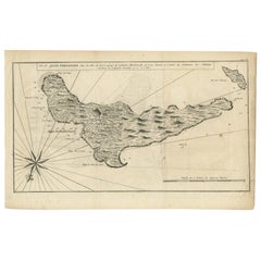
Antique Map of Juan Fernandez, Chile, c.1740
Located in Langweer, NL
Antique map titled 'l'Ile de Juan Fernandes dans la Mer du Sud (..)'. This map depicts Juan
Category

18th Century Antique Map Chile

Materials

Paper

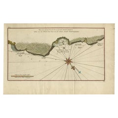
Antique Map of Juan Fernandez Island, Chile, c.1750
Located in Langweer, NL
Antique map titled 'Plan de la Côte du N.E. de l 'Ile de Juan Fernandes'. Map of the northeast
Category

18th Century Antique Map Chile

Materials

Paper

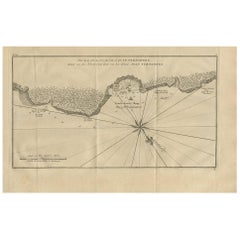
Antique Map of Juan Fernandez Island and Cumberland Bay, Chile - c. '1749'
Located in Langweer, NL
Antique map titled 'Plan de la Côte du N.E. de l 'Ile de Juan Fernandes - Schets van den Noord-Oost
Category

Mid-18th Century Antique Map Chile

Materials

Paper

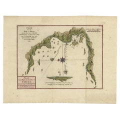
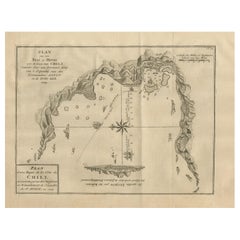
Antique Map of a Bay on the Coast of Chile by Anson, 1749
Located in Langweer, NL
Côte du Chili (..)'. Original antique map of a bay on the coast of Chile discovered by a supply ship of
Category

18th Century Antique Map Chile

Materials

Paper

Antique Map of a Bay on the Coast of Chile, South America, c.1749
Located in Langweer, NL
Côte du Chili (..)'. Original antique map of a bay on the coast of Chile discovered by a supply ship of
Category

18th Century Antique Map Chile

Materials

Paper

Antique Map of Chile, La Plata and Part of Bolivia by A & C. Black, 1870
Located in Langweer, NL
Antique map titled 'Chili, La Plata & Bolivia'. Original antique map of Chile, La Plata and Part of
Category

Late 19th Century Antique Map Chile

Materials

Paper

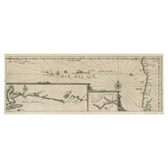
Antique Map of Mar del Sur, Chile, Peru, New Guinea and Tierra del Fuego, 1621
Located in Langweer, NL
Uncommon and rare map of Mar del Sur and the coast of Peru. With inset maps of part of New Guinea
Category

17th Century Antique Map Chile

Materials

Paper

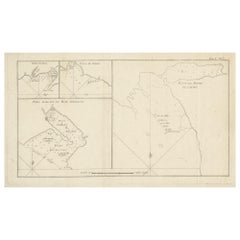
Antique Map of Cordes Bay and Surroundings
Located in Langweer, NL
Antique map titled 'Baye et Havre de Cordes (..)'. Four maps on the one sheet of; Cordes Bay, Port
Category

Late 18th Century Antique Map Chile

Materials

Paper

Antique Map of Cordes Bay and Surroundings
H 10.16 in W 16.74 in D 0.02 in
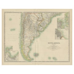
Antique Map of South America by Johnston '1909'
Located in Langweer, NL
Antique map titled 'South America, Southern Sheet'. Depicting Chile, Argentina, Brazil, Patagonia
Category

Early 20th Century Antique Map Chile

Materials

Paper

Antique Map of Chili by Montanus, circa 1671
By Arnoldus Montanus
Located in Langweer, NL
Antique map titled 'Chili'. A very attractive map covering the known coastal region of Chile. The
Category

Mid-17th Century Antique Map Chile

Materials

Paper

Antique Map of Chili by Montanus, circa 1671
H 12.05 in W 14.49 in D 0.02 in
Antique Map of South America by V. Levasseur, 1854
By Victor Levasseur
Located in Langweer, NL
scenes of natives and their life. Depicting Colombia, Brazil, Chile, Bolivia and more. This map
Category

Mid-19th Century Antique Map Chile

Materials

Paper

Antique Map of Juan Fernandez Island by Anson '1749'
Located in Langweer, NL
Antique map titled 'l'Ile de Juan Fernandes dans la Mer du Sud (..) - Het Eiland Juan Fernandes in
Category

Mid-18th Century Antique Map Chile

Materials

Paper

Antique Map of South America by Tirion, c.1765
By Thomas Kitchin
Located in Langweer, NL
Antique map titled 'Kaart van het Onderkoningschap van Peru zig uitstrekkende: over Chile, Paraguay
Category

18th Century Antique Map Chile

Materials

Paper

Antique Map of South America by Tirion, c.1765
No Reserve
H 16.93 in W 21.66 in D 0 in
Attractive Antique Hand-Coloured Map of South America, ca.1765
Located in Langweer, NL
Antique map titled 'Kaart van het Onderkoningschap van Peru zig uitstrekkende: over Chile, Paraguay
Category

1760s Antique Map Chile

Materials

Paper

Antique Map of Peru by van der Aa, 'circa 1720'
Located in Langweer, NL
Antique map titled 'Le Perou, Grand Pays de l Amerique Meridionale (..)'. Decorative map of Peru
Category

Early 18th Century Antique Map Chile

Materials

Paper

Antique Map of Cordes Bay, Port Famine, Woods Bay and Surroundings
Located in Langweer, NL
Famine, Woods Bay, Port Gallant, Fortescue Bay, Chile based on the voyage of John Byron. This map
Category

Late 18th Century Antique Map Chile

Materials

Paper

Original Antique Map of Juan Fernandez by Van Schley, 1757
Located in Langweer, NL
Juan Fernandez'. Map of the Chilean Juan Fernandez Island, topped by a view of its rocky profile and
Category

18th Century Antique Map Chile

Materials

Paper

Orignal Hand-Colored Antique Map of Chili by W. Blaeu, 1658
By Willem Blaeu
Located in Langweer, NL
Very decorative antique map of Chili published by W. Blaeu, 1658. This map depicts Chile from
Category

Mid-17th Century Antique Map Chile

Materials

Paper

Orignal Hand-Colored Antique Map of Chili by W. Blaeu, 1658
Free Shipping
H 21.86 in W 25.99 in D 0.02 in
Rare Handcolored Map of Isle de Juan Fernandes 'Robinson Crusoe Island', Chili
Located in Langweer, NL
Antique map titled 'Die Insel Iuan Fernandes in der Sudsee (..)'. This map depicts Robinson Crusoe
Category

Mid-18th Century Antique Map Chile

Materials

Paper

Antique Map of the Coast of Juan Fernandez by Van Schley, 1757
Located in Langweer, NL
Antique map titled 'Cote du Nord Est de l'Isle de Juan Fernandez (..).' Map of the Chilean South
Category

18th Century Antique Map Chile

Materials

Paper

Decorative Original HandColoredAntique Map of South America by J.B. Elwe, 1792
By J.B. Elwe
Located in Langweer, NL
This image depicts 'L'Amerique Meridionale', an antique map of South America. The map is carefully
Category

Late 18th Century Antique Map Chile

Materials

Paper

Antique Map of South America with inset of the Quito Highlands, Hand-Colored
Located in Langweer, NL
, Colombia, Ecuador, Venezuela, Guyana, Bolivia, Paraguay, Uruguay, Chile, Argentina. Inset map of the
Category

Mid-19th Century Antique Map Chile

Materials

Paper

Antique Map of the Bay of Cordes and Surroundings by Hawkesworth, 1774
Located in Langweer, NL
Antique print titled 'Baye et Havre de Cordes (..)'. Four maps on the one sheet of; Cordes Bay
Category

18th Century Antique Map Chile

Materials

Paper

Navigational Chart of Mexico's Coast, with Acapulco and Port Marquis, 1748
Located in Langweer, NL
Antique map titled 'The Form of cruising off Acapulca on the Coast of Mexico in the South Seas in
Category

1740s Antique Map Chile

Materials

Paper

Antique Print of an Encampment on Juan Fernández Island, Chile, 1748
Located in Langweer, NL
Kommandeur stont‘. View of an encampment on Juan Fernández island, Chile, with tents and European men
Category

18th Century Antique Map Chile

Materials

Paper

Original Antique Engraving of a Woman of Easter Island, Chile, by Cook, 1803
By Cook
Located in Langweer, NL
antique maps to collectors, historians, educators and interior decorators all over the world. Our
Category

19th Century Antique Map Chile

Materials

Paper

Antique Print of a Fortress in Guangzhou in China, c.1850
Located in Langweer, NL
Brazil, Chile, the Marianas, and the Philippines. Although the projected voyage was to be of rather short
Category

19th Century Antique Map Chile

Materials

Paper

Antique Print of a Garden in Guangzhou in China, circa 1850
Located in Langweer, NL
visited, including Brazil, Chile, the Marianas, and the Philippines. Although the projected voyage was to
Category

19th Century Antique Map Chile

Materials

Paper

Antique Print of a Street Kitchen in Guangzhou in China, circa 1850
Located in Langweer, NL
visited, including Brazil, Chile, the Marianas, and the Philippines. Although the projected voyage was to
Category

19th Century Antique Map Chile

Materials

Paper

Antique Print of European Factories in Guangzhou in China, circa 1850
Located in Langweer, NL
countries visited, including Brazil, Chile, the Marianas, and the Philippines. Although the projected voyage
Category

19th Century Antique Map Chile

Materials

Paper

19th-century Carved, Painted and Gilt tortoise shell, 'the Cosmic Turtle'
Located in Amsterdam, NL
many more. On the upper part of the shell, coats-of-arms belonging to China, The United States, Chile
Category

Late 19th Century Antique Map Chile

Materials

Multi-gemstone, Gold Leaf

A truly delightful miniature terrestrial pocket globe
By Nathaniel Mills
Located in ZWIJNDRECHT, NL
turning overhead. In line with its counterpart, the terrestrial globe, celestial globes are mapped by a
Category

Mid-18th Century British Dutch Colonial Antique Map Chile

Materials

Other

Antique Map of Santiago ‘Chile’ by J.N. Bellin, circa 1760
Located in Langweer, NL
Antique map titled 'Plan de la Ville de Santiago (..)'. Early plan of Santiago de Chile, showing
Category

Mid-18th Century Antique Map Chile

Materials

Paper

Antique Map of South America by A.K. Johnston
Located in Langweer, NL
Antique map titled 'South America, Southern Sheet'. Depicting Chile, Argentina, Brazil, Patagonia
Category

Mid-19th Century Antique Map Chile

Antique Map of South America by A.K. Johnston
H 19.1 in W 24.41 in D 0.02 in
Antique Map of Chili and La Plata by J. Tallis, circa 1851
Located in Langweer, NL
A highly decorative and detailed mid-19th century map of northern Argentina and Chile which was
Category

Mid-19th Century Antique Map Chile

Get Updated with New Arrivals
Save "Antique Map Chile", and we’ll notify you when there are new listings in this category.

Antique Map Chile For Sale on 1stDibs

Choose from an assortment of styles, material and more with respect to the antique map chile you’re looking for at 1stDibs. Frequently made of paper, every antique map chile was constructed with great care. There are many kinds of the antique map chile you’re looking for, from those produced as long ago as the 18th Century to those made as recently as the 20th Century. A well-made antique map chile has long been a part of the offerings for many furniture designers and manufacturers, but those produced by Cook, J.B. Elwe and Thomas Kitchin are consistently popular.

How Much is a Antique Map Chile?

The average selling price for an antique map chile at 1stDibs is $314, while they’re typically $121 on the low end and $1,894 for the highest priced.

Read More

Pamela Shamshiri Shares the Secrets behind Her First-Ever Book and Its Effortlessly Cool Interiors

The sought-after designer worked with the team at Hoffman Creative to produce a monograph that beautifully showcases some of Studio Shamshiri's most inspiring projects.

Moroccan Artworks and Objects Take Center Stage in an Extraordinary Villa in Tangier

Italian writer and collector Umberto Pasti opens the doors to his remarkable cave of wonders in North Africa.

Montecito Has Drawn Royalty and Celebrities, and These Homes Are Proof of Its Allure

Hollywood A-listers, ex-pat aristocrats and art collectors and style setters of all stripes appreciate the allure of the coastal California hamlet — much on our minds after recent winter floods.

Whaam! Blam! Pow! — a New Book on Pop Art Packs a Punch

Publishing house Assouline and writer Julie Belcove have teamed up to trace the history of the genre, from Roy Lichtenstein, Andy Warhol and Yayoi Kusama to Mickalene Thomas and Jeff Koons.

The Sparkling Legacy of Tiffany & Co. Explained, One Jewel at a Time

A gorgeous new book celebrates — and memorializes — the iconic jeweler’s rich heritage.

What Makes a Gem-Encrusted Chess Set Worth $4 Million?

The world’s most opulent chess set, weighing in at 513 carats, is literally fit for a king and queen.

Tauba Auerbach’s Geometric Pop-Up Book Is Mighty Rare, Thanks to a Hurricane

This sculptural art book has an epic backstory of its own.

Step inside the Storied Mansions of Palm Beach’s Most Effervescent Architect

From Spanish-style courtyards to fanciful fountains, these acclaimed structures abound in surprising and elegant details.