Items Similar to Antique Map of South America by Tirion, c.1765


Want more images or videos?
Request additional images or videos from the seller
1 of 5
Antique Map of South America by Tirion, c.1765
About the Item
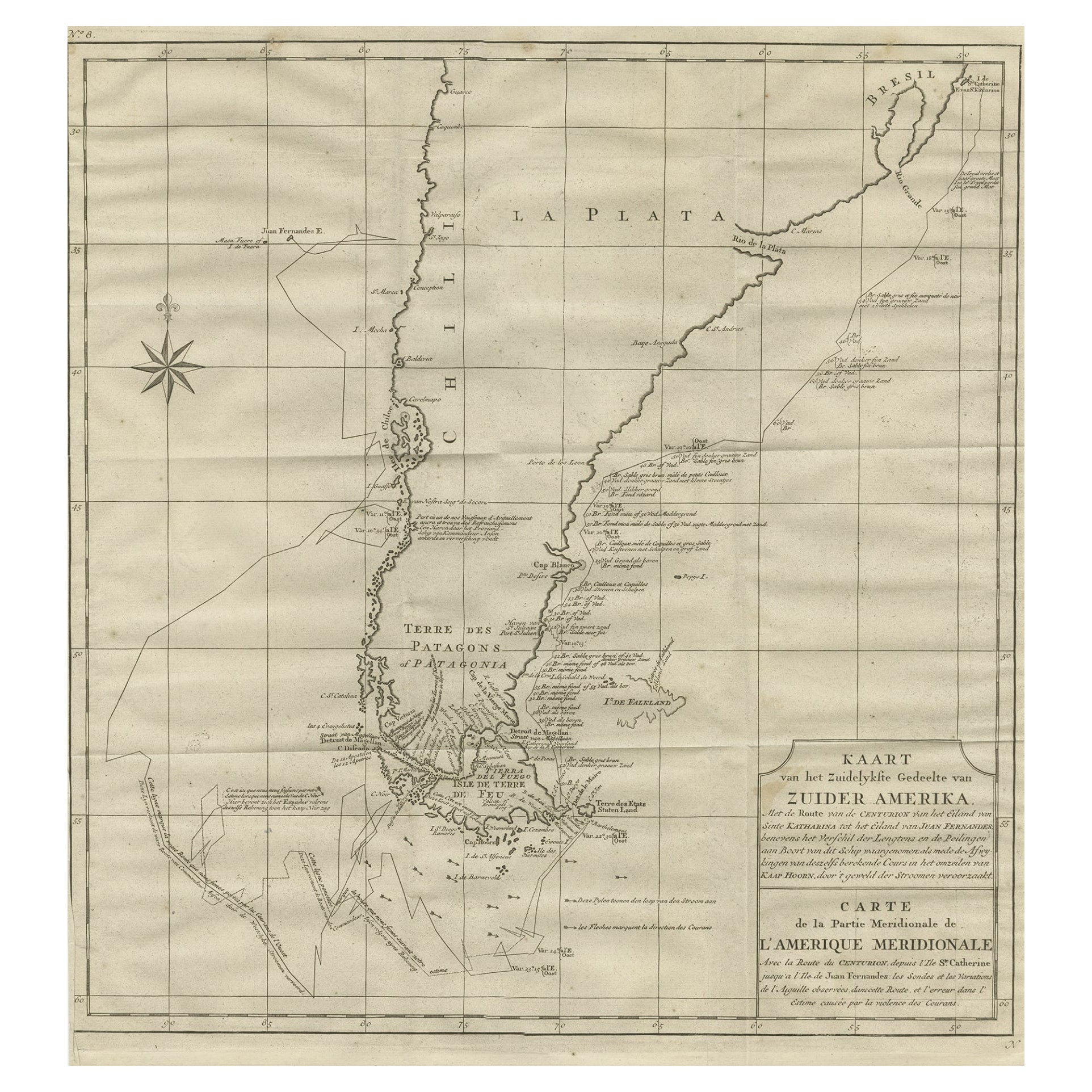
Antique map titled 'Kaart van het Onderkoningschap van Peru zig uitstrekkende: over Chile, Paraguay en andere Spaansche Landen als ook van Brazil en verdere Bezittingen van Portugal in Zuid-Amerika.' Attractive and quite detailed map of most of South America, lacking the northern parts of Venezuela and Columbia. The southern tip is shown in an inset. Artists and Engravers: Isaak Tirion, a Dutch publisher in Amsterdam. He produced serveral Atlases and Dutch town plans.
Artist: Isaak Tirion, a Dutch publisher in Amsterdam. He produced serveral Atlases and Dutch town plans.
Antique prints have long been appreciated for both their aesthetic and investment value. They were the product of engraved, etched or lithographed plates. These plates were handmade out of wood or metal, which required an incredible level of skill, patience and craftsmanship. Whether you have a house with Victorian furniture or more contemporary decor an old engraving can enhance your living space. We offer a wide range of authentic antique prints for any budget
- Creator:Thomas Kitchin (Author)
- Dimensions:Height: 16.93 in (43 cm)Width: 21.66 in (55 cm)Depth: 0 in (0.01 mm)
- Materials and Techniques:
- Period:
- Date of Manufacture:circa 1765
- Condition:Condition: Very good, given age. Edges slightly browned. Original middle fold as issued. General age-related toning and/or occasional minor defects from handling. Please study image carefully.
- Seller Location:Langweer, NL
- Reference Number:Seller: PCT-579841stDibs: LU3054327622162
About the Seller
5.0
Platinum Seller
These expertly vetted sellers are 1stDibs' most experienced sellers and are rated highest by our customers.
Established in 2009
1stDibs seller since 2017
1,916 sales on 1stDibs
Typical response time: <1 hour
- ShippingRetrieving quote...Ships From: Langweer, Netherlands
- Return PolicyA return for this item may be initiated within 14 days of delivery.
Auctions on 1stDibs
Our timed auctions are an opportunity to bid on extraordinary design. We do not charge a Buyer's Premium and shipping is facilitated by 1stDibs and/or the seller. Plus, all auction purchases are covered by our comprehensive Buyer Protection. Learn More
More From This SellerView All
- Antique Map of South America by Tirion 'circa 1765'Located in Langweer, NLAntique map titled 'Kaart van het Onderkoningschap van Peru, zig uitstrekkende over Chili, Paraguay en andere Spaansche Landen: als ook van Brazil en verdere Bezittingen van Portugal...Category
Antique Mid-18th Century Maps
MaterialsPaper
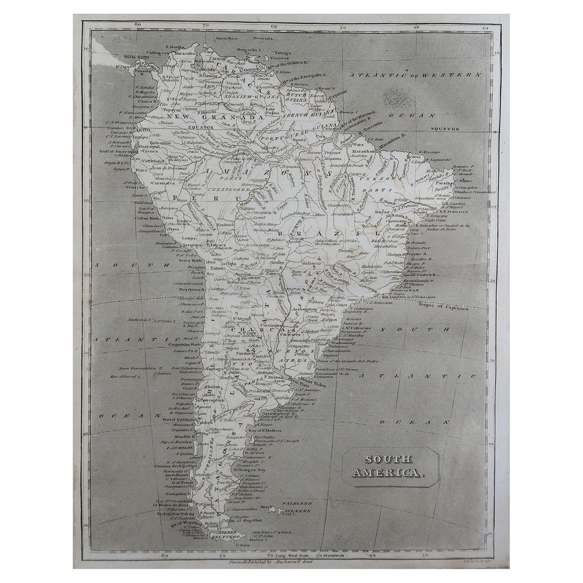
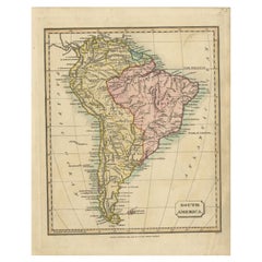
- Antique Map of South America by Walker, 1816By Thomas KitchinLocated in Langweer, NLAntique map titled 'South America'. Old map of South America. This map originates from 'Walker's Universal Atlas'. Artists and Engravers: Printed by Barnard and Farley. Artist: Pr...Category
Antique 19th Century Maps
MaterialsPaper
- Antique Map of South America by Tyrer, 1821By Thomas KitchinLocated in Langweer, NLAntique map titled 'South America'. Beautiful antique map of South America engraved by Tyrer. Artists and Engravers: Published by J. Soute...Category
Antique 19th Century Maps
MaterialsPaper
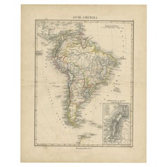
- Antique Map of South America by Petri, c.1873By Thomas KitchinLocated in Langweer, NLAntique map titled 'Zuid-Amerika'. Old map depicting South America, with an inset map of the highland of Quito. This map originates from 'School-Atlas van alle Deelen der Aarde'. Art...Category
Antique 19th Century Maps
MaterialsPaper
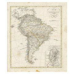
- Antique Map of South America by Reichard, 1820By Thomas KitchinLocated in Langweer, NLAntique map titled 'Süd America'. Decorative antique map of South America with an inset map of Ecuador. Artists and Engravers: Published b...Category
Antique 19th Century Maps
MaterialsPaper
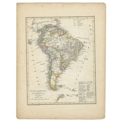
- Antique Map of South America by Petri, 1852By Thomas KitchinLocated in Langweer, NLAntique map titled 'Zuid-Amerika'. Map of South America. This map originates from 'School-Atlas van alle deelen der Aarde' by Otto Petri. Artists and Engrav...Category
Antique 19th Century Maps
MaterialsPaper

You May Also Like
- Antique Lithography Map, South America, English, Framed, Cartography, VictorianLocated in Hele, Devon, GBThis is an antique lithography map of South America. An English, framed atlas engraving of cartographic interest by John Rapkin , dating to the early Victorian period and later, circ...Category
Antique Mid-19th Century British Early Victorian Maps
MaterialsWood
- England, Scotland & Ireland: A Hand Colored Map of Great Britain by TirionBy Isaak TirionLocated in Alamo, CAThis is a hand-colored double page copperplate map of Great Britain entitled "Nieuwe Kaart van de Eilanden van Groot Brittannien Behelzende de Kon...Category
Antique Mid-18th Century Dutch Maps
MaterialsPaper
- Large Antique 1859 Map of North AmericaLocated in Sag Harbor, NYThis Map was made by Augustus Mitchell in 1859 It is in amazing condition for being 163 years old. This price is for the rolled up easy to ship version of this piece. I will be Frami...Category
Antique Mid-19th Century American Maps
MaterialsCanvas, Paper

- 1864 Map of North America, Antique Hand-Colored Map, by Adolphe Hippolyte DufourLocated in Colorado Springs, COOffered is a map of North America entitled Amerique du Nord from 1864. This rare, separately published wall map was produced by Adolphe Hippolyte Dufour. This map includes vibrant an...Category
Antique 1860s French Maps
MaterialsPaper
- North & South America: A 17th Century Hand-colored Map by Jansson & GoosBy Johannes JanssoniusLocated in Alamo, CAA 17th century hand-colored map of North & South America entitled "Americae Descriptio" by the cartographer Johannes Jansson, published in Jansson's Atlas Minor in Amsterdam in 1628....Category
Antique 1620s Dutch Maps
MaterialsPaper
- South America: Hand-colored 18th Century Framed Map by Thomas JefferysBy Thomas JefferysLocated in Alamo, CAThis detailed hand-colored map of South America by Thomas Jefferys was published in London in 1750. The map shows countries, early colonial possessions, towns, rivers, mountains, and...Category
Antique Mid-18th Century English Maps
MaterialsPaper


Recently Viewed
View AllMore Ways To Browse
South America Brazil
Southern America Furniture
Southern American Furniture
Antique American 18th Century Furniture
18th Century American Antiques
18th C American
Southern American Antiques
18th C American Furniture
18th C Dutch
American Server
Antique Plate With Metal Handle
Old American Maps
Antique Wood Server
Antique Tires
Tire Antique
Peruvian Wood Furniture
Thomas Toner
Victorian Server