Items Similar to Antique Map of Tracks of Anson's Ships around South America & Cape Horn, 1749


Want more images or videos?
Request additional images or videos from the seller
1 of 6
Antique Map of Tracks of Anson's Ships around South America & Cape Horn, 1749
About the Item
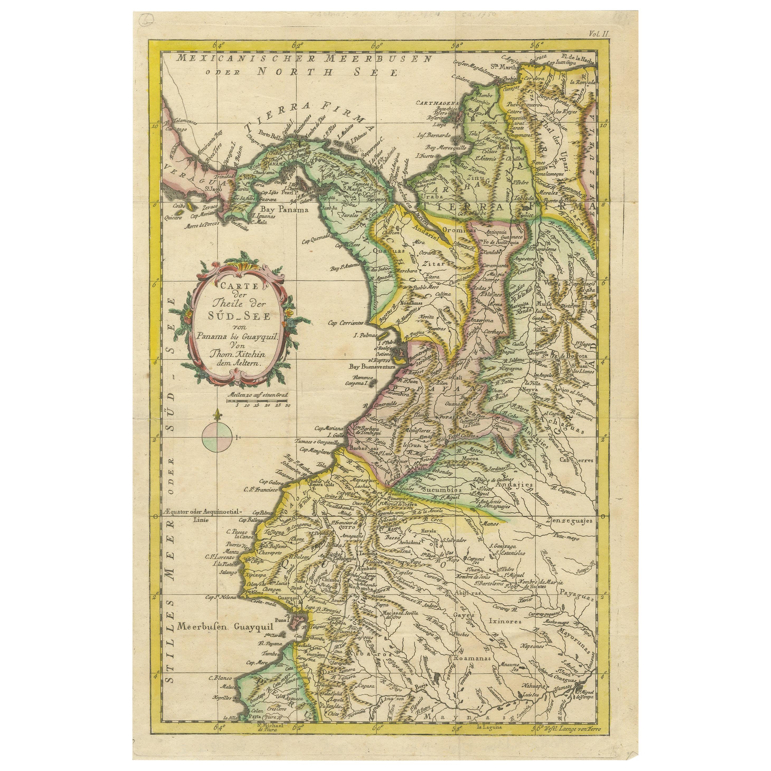
Description: Antique map titled 'Kaart van het Zuidelykste Gedeelte van Zuider Amerika (..) - Carte de la Partie Meridionale de l'Amerique Meridionale (..)'.
Detailed chart tracking the route of Capt. George Anson's ship The Centurion in 1745. The chart shows the tracks of Anson's ships around South America & Cape Horn to the Juan Fernandes Islands, with notes on currents and positions.
In 1740 Capt. George Anson (1697-1762) of the Royal Navy, was given command of a squadron of ships. As England was at war with France and Spain, Anson's task was to intercept and capture a Spanish treasure galleon trading across the Pacific from Acapulco in Mexico to the Philippines. Anson's outward journey took him to the coast of South America, around Cape Horn and up to the Juan Fernandes Islands off the coast of Peru, from whence he sailed to Mexico and then outward across the Pacific to Cape Espiritu Santo on the east coast of the Philippine Islands. In February of 1743, Anson sighted the Spanish ship, the Nuestra Seignora de Cavadonga, which he captured, and the treasure from the ship was so great it made Anson wealthy for life.
This map originates from 'Reize rondsom de Werreld (..)' by George Anson, published 1749.
Artists and Engravers: Admiral of the Fleet George Anson, 1st Baron Anson, PC, FRS (23 April 1697 – 6 June 1762) was a Royal Navy officer.
- Dimensions:Height: 21.66 in (55 cm)Width: 19.69 in (50 cm)Depth: 0 in (0.02 mm)
- Materials and Techniques:
- Period:1740-1749
- Date of Manufacture:1749
- Condition:Condition: Good, general age-related toning. Original folding lines. Minor wear, some foxing. Small repair in left margin, slightly affecting image. Blank verso, please study image carefully.
- Seller Location:Langweer, NL
- Reference Number:Seller: BG-11589-2 1stDibs: LU3054326437052
About the Seller
5.0
Platinum Seller
These expertly vetted sellers are 1stDibs' most experienced sellers and are rated highest by our customers.
Established in 2009
1stDibs seller since 2017
1,928 sales on 1stDibs
Typical response time: <1 hour
- ShippingRetrieving quote...Ships From: Langweer, Netherlands
- Return PolicyA return for this item may be initiated within 14 days of delivery.
Auctions on 1stDibs
Our timed auctions are an opportunity to bid on extraordinary design. We do not charge a Buyer's Premium and shipping is facilitated by 1stDibs and/or the seller. Plus, all auction purchases are covered by our comprehensive Buyer Protection. Learn More
More From This SellerView All
- Antique Map of South America by G. Anson, 1749Located in Langweer, NLAntique map titled 'Kaart van het Zuidelykste Gedeelte van Zuider Amerika (..) - Carte de la Partie Meridionale de l'Amerique Meridionale (..)'. Detailed chart tracking the route of Capt. George Anson's ship The Centurion in 1745. The chart shows the tracks of Anson's ships around South America & Cape Horn to the Juan Fernandes Islands, with notes on currents and positions. This map originates from 'Reize rondsom de Werreld (..)' by George Anson, published 1749. In 1740 Capt. George Anson (1697-1762) of the Royal Navy, was given command of a squadron of ships. As England was at war with France and Spain, Anson's task was to intercept and capture a Spanish treasure...Category
Antique Mid-18th Century Dutch Maps
MaterialsPaper
- Antique Map of the Philippines by Anson '1749'Located in Langweer, NLAntique map titled 'Carte du Canal des Iles Philippines - Kaart van het Kanaal in de Filippynsche Eilanden'. Large detailed chart of the islands of the Philippines. One of the most detailed charts of the Philippines of the era. Shows Islands, bays, reefs, soundings tracks of the Manila Galleon route, etc. Includes a large compass...Category
Antique Mid-18th Century Maps
MaterialsPaper
- Antique Map of Coiba Island by Anson '1749'Located in Langweer, NLAntique map titled 'Plan van de Oost-Zyde van het Eiland Quibo'. Original antique map of the eastside of Coiba Island (Quibo), Panama, showing the shoreline around Port de Dames indi...Category
Antique Mid-18th Century Maps
MaterialsPaper
- Antique Map of Juan Fernandez Island by Anson '1749'Located in Langweer, NLAntique map titled 'l'Ile de Juan Fernandes dans la Mer du Sud (..) - Het Eiland Juan Fernandes in de Zuid Zee (..)'. This map depicts Juan Fernandez Island in the Southern Sea. This...Category
Antique Mid-18th Century Maps
MaterialsPaper
- Antique Map of the Port of Zihuatanejo by Anson '1749'Located in Langweer, NLAntique map titled 'Plan du Port de Chequetan ou Seguataneo - Plan van de Haven van Chequetan of Seguataneo'. Map of the Mexican port of Zihuatanejo. This area was originally named C...Category
Antique Mid-18th Century Maps
MaterialsPaper
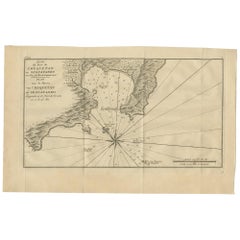
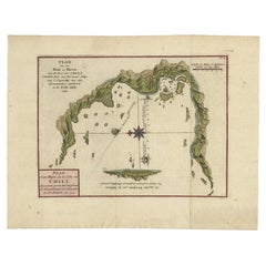
- Antique Map of a Bay on the Coast of Chile by Anson, 1749Located in Langweer, NLAntique map titled 'Plan van een Baai en Haven aan de Kust van Chili (..) - Plan d'une Baye de la Côte du Chili (..)'. Original antique map of a bay on the coast of Chile discovered ...Category
Antique 18th Century Maps
MaterialsPaper


You May Also Like
- Large Antique 1859 Map of North AmericaLocated in Sag Harbor, NYThis Map was made by Augustus Mitchell in 1859 It is in amazing condition for being 163 years old. This price is for the rolled up easy to ship version of this piece. I will be Frami...Category
Antique Mid-19th Century American Maps
MaterialsCanvas, Paper

- North & South America: A 17th Century Hand-colored Map by Jansson & GoosBy Johannes JanssoniusLocated in Alamo, CAA 17th century hand-colored map of North & South America entitled "Americae Descriptio" by the cartographer Johannes Jansson, published in Jansson's Atlas Minor in Amsterdam in 1628....Category
Antique 1620s Dutch Maps
MaterialsPaper
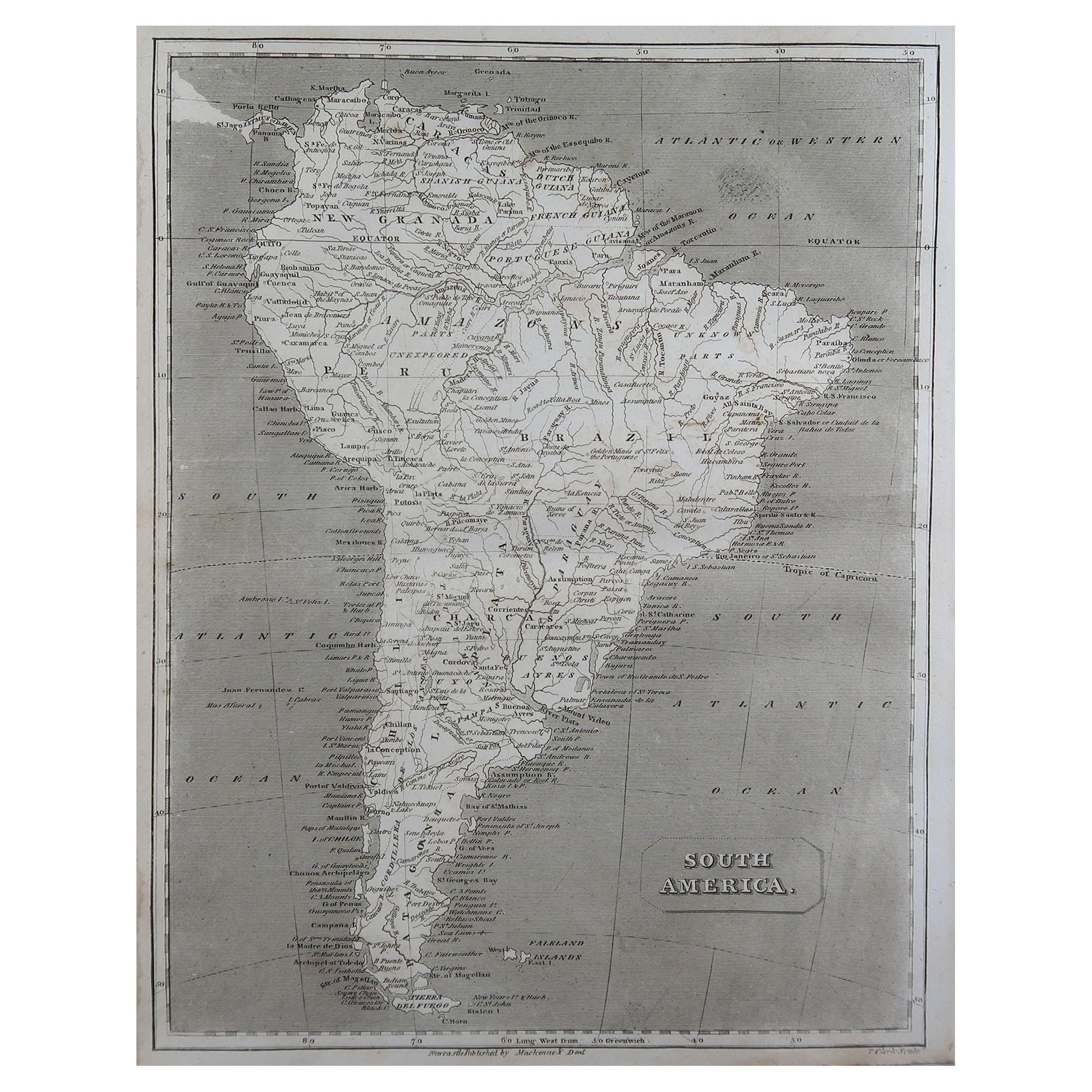
- South America: Hand-colored 18th Century Framed Map by Thomas JefferysBy Thomas JefferysLocated in Alamo, CAThis detailed hand-colored map of South America by Thomas Jefferys was published in London in 1750. The map shows countries, early colonial possessions, towns, rivers, mountains, and...Category
Antique Mid-18th Century English Maps
MaterialsPaper
- Antique Map of Principality of MonacoBy Antonio Vallardi EditoreLocated in Alessandria, PiemonteST/619 - "Old Geographical Atlas of Italy - Topographic map of ex-Principality of Monaco" - ediz Vallardi - Milano - A somewhat special edition ---Category
Antique Late 19th Century Italian Other Prints
MaterialsPaper
- New Map of North America from the Latest Discoveries, 1763Located in Philadelphia, PAA fine antique 18th century map of the North American seaboard. Entitled "A New Map of North America from the Latest Discoveries 1763". By the Cartographer/Engraver - John Spil...Category
Antique Mid-18th Century English Georgian Maps
MaterialsPaper
- Antique Map of Italy by Andriveau-Goujon, 1843By Andriveau-GoujonLocated in New York, NYAntique Map of Italy by Andriveau-Goujon, 1843. Map of Italy in two parts by Andriveau-Goujon for the Library of Prince Carini at Palazzo Carini i...Category
Antique 1840s French Maps
MaterialsLinen, Paper


