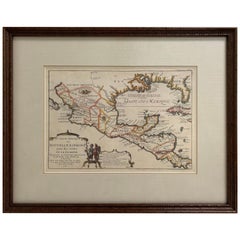
Map Of Mexico

16
206
10
8
to
26
121
96
224
219
221
7
4
3
3
2
2
2
1
50
110
46
18
17
16
3
3
7
4
6
3
2
1
2
166
27
12
11
10
83
72
50
24
14
8
3
3
2
2
Sort By
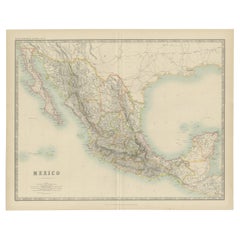
Antique Map of Mexico by Johnston, '1909'
Located in Langweer, NL
Antique map titled 'Mexico'. Original antique map of Mexico. This map originates from the ‘Royal
Category

Early 20th Century Maps

Materials

Paper

Antique Map of Mexico by Johnston, '1909'
H 19.49 in W 24.41 in D 0.02 in
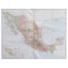
Large Original Vintage Map of Mexico, circa 1920
Located in St Annes, Lancashire
Great map of Mexico Original color. Good condition Published by Alexander Gross Unframed.
Category

Vintage 1920s English Edwardian Maps

Materials

Paper

Large Original Vintage Map of Mexico, circa 1920
No Reserve
H 25 in W 19.5 in D 0.07 in
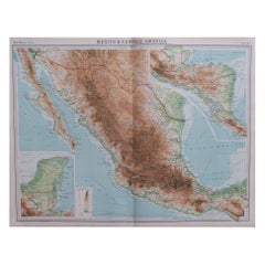
Large Original Vintage Map of Mexico, circa 1920
Located in St Annes, Lancashire
Great maps of Mexico. Unframed. Original color. By John Bartholomew and Co. Edinburgh
Category

Vintage 1920s British Maps

Materials

Paper

Large Original Vintage Map of Mexico, circa 1920
No Reserve
H 18 in W 23 in D 0.07 in
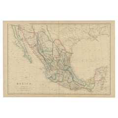
Antique Map of Mexico by W. G. Blackie, 1859
Located in Langweer, NL
Antique map titled 'Mexico'. Original antique map of Mexico. This map originates from ‘The Imperial
Category

Antique Mid-19th Century Maps

Materials

Paper

Antique Map of Mexico by W. G. Blackie, 1859
H 14.57 in W 21.26 in D 0.02 in
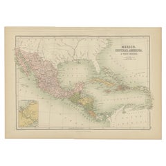
Antique Map of Mexico, Central America and West Indies by A & C. Black, 1870
Located in Langweer, NL
Antique map titled 'Mexico, Central America and West Indies'. Original antique map of Mexico
Category

Antique Late 19th Century Maps

Materials

Paper

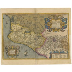
Antique Map of Mexico by Ortelius, circa 1602
By Abraham Ortelius
Located in Langweer, NL
Antique map titled 'Hispaniae Novae Sivae Magnae Recens Et Vera Descriptio 1579'. Map of western
Category

Antique Early 17th Century Belgian Maps

Materials

Paper

Antique Map of Mexico by Ortelius, circa 1602
H 16.93 in W 20.87 in D 0.02 in
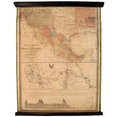
1847 Antique Map of Mexico, Texas and California by Samuel Augustus Mitchell
By Samuel Augustus Mitchell 1
Located in Colorado Springs, CO
Presented is the second edition of Samuel Augustus Mitchell's Map of Mexico, Including Yucatan
Category

Antique 1840s American Maps

Materials

Paper

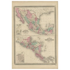
Antique Map of Mexico and Central America by Johnson '1872'
Located in Langweer, NL
Antique map titled 'Johnson's Mexico (..)'. Two maps one one sheet showing Mexico and Central
Category

Antique Late 19th Century Maps

Materials

Paper

1705 Golfe de Mexico and Florida Framed Map
Located in Stamford, CT
Framed map of Mexico & Florida circa 1705, Paris. Small map with Mexico and the Gulf Coast. Inset
Category

Antique Early 1700s French Spanish Colonial Maps

Materials

Glass, Wood, Paper

Framed Mercator Hondius Hispania Nova Atlas Minor Map
Located in Stamford, CT
Framed colored example of this decorative and important minature map. Newly framed in brown wood
Category

Antique 17th Century Dutch Spanish Colonial Maps

Materials

Glass, Wood, Paper

Framed 1838 Mexico & Gulf of Mexico Map
Located in Stamford, CT
Framed 1838 Mexico & Gulf of Mexico map. Printed by Fisher, Son & Co. of London in 1838. As found
Category

Antique 1830s English American Classical Maps

Materials

Glass, Wood, Paper

Antique French Engraving of Mexico with Lots of Details, c.1780
Located in Langweer, NL
.' Detailed map of Mexico, the Yucatan and Central America, prepared under the direction of Rigobert Bonne
Category

Antique 18th Century Maps

Materials

Paper

Antique Map of the United States with inset map of the region of Mexico City
Located in Langweer, NL
Antique map titled 'Verein-Staaten von Nord-America, Mexico, Yucatan u.a.'. Very detailed map of
Category

Antique Mid-19th Century Maps

Materials

Paper

Antique Map of the Port of Acapulco in Mexico, 1749
Located in Langweer, NL
antique map of the Port of Acapulco on the coast of Mexico in the Southern Sea, at 16°.45'. North latitude
Category

Antique 18th Century Maps

Materials

Paper

Antique Map of The Harbour of Acapulco in Mexico, 1749
Located in Langweer, NL
(..)'. Original antique map of the Port of Acapulco on the coast of Mexico in the Southern Sea, at 16°.45'. North
Category

Antique 1740s Maps

Materials

Paper

Original Antique Map of the Western Part of NEW MEXICO & CALIFORNIA
Located in Langweer, NL
Title: "Map of the Western Part of NEW MEXICO and CALIFORNIA According to the Latest Discoveries by
Category

Antique 1760s Maps

Materials

Paper

Large Original Antique Map of New Mexico, Usa, C.1900
Located in St Annes, Lancashire
Fabulous map of New Mexico. Original color. Engraved and printed by the George F. Cram Company
Category

Antique 1890s American Maps

Materials

Paper

Antique Map of the Port of Zihuatanejo in Mexico, c.1740
Located in Langweer, NL
Antique map titled 'Plan du Port de Chequetan ou Seguataneo'. Map of the Mexican port of
Category

Antique 18th Century Maps

Materials

Paper

1830 Mexico and United States Framed Map
Located in Stamford, CT
Map of North America published circa 1830. Map shows United States into Canada. Mexico extending
Category

Antique 1830s American American Classical Maps

Materials

Glass, Wood, Paper

Original Antique Map of the Bay and Rocks of Petatlan, Mexico, 1749
Located in Langweer, NL
(..)'. Original antique map of the bay and rocks of Petatlan, Mexico. This map originates from 'Reize rondsom de
Category

Antique 1740s Maps

Materials

Paper

Antique Map of California, Utah, Nevada, Colorado, New Mexico & Arizona '1872'
Located in Langweer, NL
, New Mexico and Arizona. This map originates from 'Johnson's New Illustrated Family Atlas of the World
Category

Antique Late 19th Century Maps

Materials

Paper

1847 Ornamental Map of the United States & Mexico by H. Phelps
Located in Colorado Springs, CO
States & Mexico" by Humphrey Phelps. The map was issued as an act of Congress by Phelps on Fulton Street
Category

Antique 1840s American Maps

Materials

Paper

Antique Map of the Gulf of Mexico and all the islands of the West Indies
Located in Langweer, NL
Antique map titled 'Carte du Golfe du Mexique'. This uncommon map depicts the Gulf of Mexico and
Category

Antique Early 19th Century Maps

Materials

Paper

1865 "Johnson's California, Utah, Nevada, Colorado, New Mexico, Arizona" Map
Located in Colorado Springs, CO
, New Mexico, and Arizona” map. First published in 1864, this map was issued as pages 66 and 67 in the
Category

Antique Mid-19th Century Maps

Materials

Paper

Old Map the United States and Central America, Including Mexico, ca.1860
Located in Langweer, NL
Antique map titled 'Vereinigte Staaten von Nord America und Mexico'. Old map the United States
Category

Antique 1860s Maps

Materials

Paper

California, Alaska and Mexico: 18th Century Hand-Colored Map by de Vaugondy
By Didier Robert de Vaugondy
Located in Alamo, CA
This an 18th century hand-colored map of the western portions of North America entitled "Carte de
Category

Antique 1770s French Maps

Materials

Paper

1864 Map of North America, Antique Hand-Colored Map, by Adolphe Hippolyte Dufour
Located in Colorado Springs, CO
Offered is a map of North America entitled Amerique du Nord from 1864. This rare, separately
Category

Antique 1860s French Maps

Materials

Paper

Antique Decorative Coloured Map of North America, 1882
Located in Langweer, NL
This original antique map of North America is from the Blackie & Son Atlas published in 1882. Here
Category

Antique 1880s Maps

Materials

Paper

Antique Decorative Coloured Map of North America, 1882
No Reserve
H 14.97 in W 22.45 in D 0 in
Antique Map of The United States of North America, 1882
Located in Langweer, NL
19th century. The map also includes the Gulf of Mexico and parts of adjacent countries such as Canada
Category

Antique 1880s Maps

Materials

Paper

Antique Map of The United States of North America, 1882
Free Shipping
H 14.97 in W 22.45 in D 0 in
1908 "Map of Texas" by The Kenyon Company
Located in Colorado Springs, CO
prominently on this fantastic map. Although uncolored, the bordering states of New Mexico, Oklahoma, Arkansas
Category

Antique Early 1900s American Maps

Materials

Paper

Antique Map of the Port of Zihuatanejo by Anson '1749'
Located in Langweer, NL
Seguataneo'. Map of the Mexican port of Zihuatanejo. This area was originally named Cihuatlán in Aztec, which
Category

Antique Mid-18th Century Maps

Materials

Paper

Antique Map of the Coast of Acapulco by Anson, c.1740
Located in Langweer, NL
vis d'Acapulco en 1742'. This map depicts the coast of Acapulco in Mexico with a decorative cartouche
Category

Antique 18th Century Maps

Materials

Paper

Antique Map of the Pacific Ocean by Anson, 1765
Located in Langweer, NL
Antique map titled 'Carte de la Mer du Sud ou Mer Pacifique - Kaart van de Zuyd-Zee of stille
Category

Antique 18th Century Maps

Materials

Paper

Antique Map of South America by G. Anson, 1749
Located in Langweer, NL
Antique map titled 'Kaart van het Zuidelykste Gedeelte van Zuider Amerika (..) - Carte de la Partie
Category

Antique Mid-18th Century Dutch Maps

Materials

Paper

Antique Map of South America by G. Anson, 1749
H 20.87 in W 20.48 in D 0.02 in
Antique Map of Juan Fernandez Island, Chile, c.1750
Located in Langweer, NL
Antique map titled 'Plan de la Côte du N.E. de l 'Ile de Juan Fernandes'. Map of the northeast
Category

Antique 18th Century Maps

Materials

Paper

1859 "Map of the United States of America..." by J. H. Colton
By J.H. Colton
Located in Colorado Springs, CO
Presented is an 1859 “Map of the United States of America, the British Provinces, Mexico, the West
Category

Antique 1850s American Maps

Materials

Paper

Antique Map of the United States of America, also showing the Caribbean
Located in Langweer, NL
Antique map titled 'Verein-Staaten von Nord-America, Mexico, Yucatan u.a.'. Very detailed map of
Category

Antique Mid-19th Century Maps

Materials

Paper

Antique Map of Part of the United States Including Lower California & Arizona
Located in Langweer, NL
Mexico. This map was part of a set of six individual sheets with maps of the United States and North
Category

Antique Late 19th Century Maps

Materials

Paper

Antique Map of The United States of North America, Pacific States, 1882
Located in Langweer, NL
Mexico would remain territories until 1912. 6. **Natural Features**: The map would showcase significant
Category

Antique 1880s Maps

Materials

Paper

Antique Map of the Bay and Rocks of Petatlan by Anson, 1749
Located in Langweer, NL
(..)'. Original antique map of the bay and rocks of Petatlan, Mexico. This map originates from 'Reize rondsom de
Category

Antique 18th Century Maps

Materials

Paper

Original Engraving of the West Indies, Gulf of Mexico, Antilles, Caribbean, 1780
Located in Langweer, NL
Rigobert Bonne and G. Raynal's 1780 map of the West Indies, Gulf of Mexico, Antilles, and the
Category

Antique Late 18th Century Maps

Materials

Paper

Antique Map of Baja California and parts of Alta California, Arizona and Sonora
Located in Langweer, NL
Antique map titled 'Kaart van het Westelyk Gedeelte van Nieuw Mexico en van California'. Beautiful
Category

Antique Mid-18th Century Maps

Materials

Paper

Original Antique Map of Juan Fernandez by Van Schley, 1757
Located in Langweer, NL
Antique map titled 'Carte Particuliere de l'Isle de Juan Fernandez - Byzondere Kaart van 't Eiland
Category

Antique 18th Century Maps

Materials

Paper

Antique Map of Juan Fernandez Island by Anson, c.1740
Located in Langweer, NL
Antique map titled 'Plan de la Côte du N.E. de l 'Ile de Juan Fernandes'. Map of the northeast
Category

Antique 18th Century Maps

Materials

Paper

Original Antique Map of the West Indies by J. Arrowsmith, 1842
Located in Langweer, NL
landmasses, including Florida, the Gulf of Mexico, and the northern coastline of South America. The map
Category

Antique Early 19th Century Maps

Materials

Paper

Antique Map of Tracks of Anson's Ships around South America & Cape Horn, 1749
Located in Langweer, NL
Description: Antique map titled 'Kaart van het Zuidelykste Gedeelte van Zuider Amerika (..) - Carte
Category

Antique 1740s Maps

Materials

Paper

Victorian Visions of the New World: A Detailed Tallis Map of North America, 1851
Located in Langweer, NL
The map presented here is an intricate example from the series of maps produced by John Tallis
Category

Antique 1850s Maps

Materials

Paper

1812 United States Map, by Pierre Tardieu, Antique French Map Depicting the U.S.
By Pierre François Tardieu
Located in Colorado Springs, CO
fine works including maps of Louisiana, Mexico, Russia, and Asia in addition to his illustrations of
Category

Antique 1810s French Maps

Materials

Paper

1899 Poole Brothers Antique Railroad Map of the Illinois Central Railroad
Located in Colorado Springs, CO
This is an 1899 railroad map of the Illinois Central and Yazoo and Mississippi Valley Railroads
Category

Antique 1890s American Maps

Materials

Paper

Original Antique Map of North and South America in Attractive Old Coloring
By Isaak Tirion
Located in Langweer, NL
Antique map titled 'Nieuwe Kaart van America'. Beautiful map of America. The fabled Quivira is used
Category

Antique Mid-18th Century Maps

Materials

Paper

Antique Railroad Map of the United States by Rand, McNally & Co, 1900
Located in Langweer, NL
portions of The Dominion of Canada, The Republic of Mexico and the West Indies'. Large railroad map of the
Category

20th Century Maps

Materials

Linen, Paper

Antique Map with Hand Coloring of the United States and the Caribbean
Located in Langweer, NL
Antique map titled 'Verein-Staaten von Nord-America, Mexico, Yucatan u.a.'. Very detailed map of
Category

Antique Late 19th Century Maps

Materials

Paper

Decorative Original HandColoredAntique Map of South America by J.B. Elwe, 1792
By J.B. Elwe
Located in Langweer, NL
This image depicts 'L'Amerique Meridionale', an antique map of South America. The map is carefully
Category

Antique Late 18th Century Maps

Materials

Paper

Navigational Chart of Mexico's Coast, with Acapulco and Port Marquis, 1748
Located in Langweer, NL
Antique map titled 'The Form of cruising off Acapulca on the Coast of Mexico in the South Seas in
Category

Antique 1740s Maps

Materials

Paper

Antique Map of Juan Fernandez Island and Cumberland Bay, Chile - c. '1749'
Located in Langweer, NL
Antique map titled 'Plan de la Côte du N.E. de l 'Ile de Juan Fernandes - Schets van den Noord-Oost
Category

Antique Mid-18th Century Maps

Materials

Paper

1875 "North America" Map by J. Bartholomew
Located in Colorado Springs, CO
Presented is an original 1875 map of “North America.” The map was issued in Volume 1 of the Ninth
Category

Antique 1870s Scottish Maps

Materials

Paper

Antique Copper Engraving with a Panoramic View of Mexico City, ca.1760
Located in Langweer, NL
Description: Antique print titled 'Nouveau Mexico'. Copper engraving with a panoramic view of
Category

Antique 1760s Maps

Materials

Paper

America "Amérique Septentrionale": A 19th Century French Map by Delamarche
By Maison Delamarche 1
Located in Alamo, CA
. California and the southwestern states are still part of Mexico at the time this map was published. The map
Category

Antique Mid-19th Century American Other Maps

Materials

Paper

Louisiana: A Framed 19th Century Map by O. W. Gray
By Gray and Co
Located in Alamo, CA
This framed 19th century map of the Louisiana territory was published in "Gray's Atlas of the
Category

Antique Mid-19th Century American Other Maps

Materials

Paper

"The United States from the Latest Authorities" Antique Wall Map, 1835
Located in Colorado Springs, CO
"Oregon District" and several engraved city views and two portraits. The primary map extends to Mexico
Category

Antique 1830s American Maps

Materials

Paper

  • 1
Get Updated with New Arrivals
Save "Map Of Mexico", and we’ll notify you when there are new listings in this category.

Map Of Mexico For Sale on 1stDibs

Choose from an assortment of styles, material and more with respect to the map of mexico you’re looking for at 1stDibs. A map of mexico — often made from paper, canvas and fabric — can elevate any home. Your living room may not be complete without a map of mexico — find older editions for sale from the 18th Century and newer versions made as recently as the 20th Century. A map of mexico made by Mid-Century Modern designers — as well as those associated with Victorian — is very popular. You’ll likely find more than one map of mexico that is appealing in its simplicity, but Abraham Ortelius, J.H. Colton and Samuel Augustus Mitchell produced versions that are worth a look.

How Much is a Map Of Mexico?

A map of mexico can differ in price owing to various characteristics — the average selling price 1stDibs is $463, while the lowest priced sells for $67 and the highest can go for as much as $14,750.
Questions About Map Of Mexico
  • 1stDibs ExpertApril 5, 2022
    The well-known red bracelet from Mexico is a seven-knot bracelet. Crafters produce the bracelet out of red string, and people wear it on their ankle or wrist to help ward off evil spirits. You'll find a range of vintage and designer bracelets on 1stDibs.
  • 1stDibs ExpertFebruary 27, 2024
    Taxco, Mexico, is known as being home to silversmith shops that produce high-end jewelry, tableware and decorative objects. The tradition of crafting silver in Taxco began in the 1930s after William Spratling relocated there and set up his workshop, eventually encouraging other smiths to do the same. Silver pieces produced in Taxco are commonly referred to as Taxco silver. Find a diverse assortment of Taxco silver jewelry on 1stDibs.
  • 1stDibs ExpertApril 5, 2022
    Whether or not Flexsteel furniture is made in Mexico depends on the piece. The South Haven line comes from factories in Mexico. Chinese factories produce most of the other lines offered by the furniture maker. Find a range of Flexsteel furniture on 1stDibs.
  • 1stDibs ExpertApril 26, 2024
    On jewelry, Mexico 925 means that the piece is Mexican silver. The word Mexico denotes the country of origin, the place where the jewelry was produced. 925 is the hallmark for sterling silver due to the fact that the alloy is 92.5% pure silver. On 1stDibs, explore a large selection of sterling silver jewelry.
  • 1stDibs ExpertApril 5, 2022
    Paper mache has its roots in China, with the inventors of paper itself. It then became popular in Europe, and it was through the Spaniards that paper mache entered Mexico. In Mexico, cartoneria or paper-mache sculptures are a traditional craft that goes back to the colonial period when the Spanish brought the art overseas. Shop a range of antique and modern paper mache on 1stDibs.
  • 1stDibs ExpertApril 5, 2022
    Francisco Toledo was one of a group of artists who established the Museo de Arte Contemporáneo de Oaxaca which helped bridge the gap between local artists and the global contemporary art community. You can shop a selection of Francisco Toledo’s pieces from some of the world’s top art dealers on 1stDibs.

Read More

Pamela Shamshiri Shares the Secrets behind Her First-Ever Book and Its Effortlessly Cool Interiors

The sought-after designer worked with the team at Hoffman Creative to produce a monograph that beautifully showcases some of Studio Shamshiri's most inspiring projects.

Moroccan Artworks and Objects Take Center Stage in an Extraordinary Villa in Tangier

Italian writer and collector Umberto Pasti opens the doors to his remarkable cave of wonders in North Africa.

Montecito Has Drawn Royalty and Celebrities, and These Homes Are Proof of Its Allure

Hollywood A-listers, ex-pat aristocrats and art collectors and style setters of all stripes appreciate the allure of the coastal California hamlet — much on our minds after recent winter floods.

Whaam! Blam! Pow! — a New Book on Pop Art Packs a Punch

Publishing house Assouline and writer Julie Belcove have teamed up to trace the history of the genre, from Roy Lichtenstein, Andy Warhol and Yayoi Kusama to Mickalene Thomas and Jeff Koons.

The Sparkling Legacy of Tiffany & Co. Explained, One Jewel at a Time

A gorgeous new book celebrates — and memorializes — the iconic jeweler’s rich heritage.

What Makes a Gem-Encrusted Chess Set Worth $4 Million?

The world’s most opulent chess set, weighing in at 513 carats, is literally fit for a king and queen.

Tauba Auerbach’s Geometric Pop-Up Book Is Mighty Rare, Thanks to a Hurricane

This sculptural art book has an epic backstory of its own.

Step inside the Storied Mansions of Palm Beach’s Most Effervescent Architect

From Spanish-style courtyards to fanciful fountains, these acclaimed structures abound in surprising and elegant details.