Items Similar to Antique Map of Mexico by Ortelius, circa 1602


Want more images or videos?
Request additional images or videos from the seller
1 of 7
Antique Map of Mexico by Ortelius, circa 1602
About the Item
Antique map titled 'Hispaniae Novae Sivae Magnae Recens Et Vera Descriptio 1579'. Map of western New Spain, showing the recently-created Spanish settlements, many rivers, and large lakes, including Lake Chapala and a mythical sea with islands in the northwest. Originates from 'Theatrum Orbis Terrarum'. Spanish text on the verso provides additional information regarding New Spain. Original, contemporary hand coloring.
- Creator:Abraham Ortelius (Artist)
- Dimensions:Height: 16.93 in (43 cm)Width: 20.87 in (53 cm)Depth: 0.02 in (0.5 mm)
- Materials and Techniques:Paper,Engraved
- Place of Origin:
- Period:Early 17th Century
- Date of Manufacture:circa 1602
- Condition:General age-related toning, some stains. Old hand coloring. Repair and split on folding line. Spanish text on verso. Please study image carefully.
- Seller Location:Langweer, NL
- Reference Number:
About the Seller
5.0
Platinum Seller
These expertly vetted sellers are 1stDibs' most experienced sellers and are rated highest by our customers.
Established in 2009
1stDibs seller since 2017
1,933 sales on 1stDibs
Typical response time: <1 hour
- ShippingRetrieving quote...Ships From: Langweer, Netherlands
- Return PolicyA return for this item may be initiated within 14 days of delivery.
More From This SellerView All
- Antique Map of Southeast Asia by Ortelius '1587'By Abraham OrteliusLocated in Langweer, NLAntique map titled 'Indiae Orientalis Insularumque Adiacientium Typus'. Ortelius includes early European depictions of both Japan and China and is the first to name Formosa (Taiwan). The Philippines and East Indies or Spice Islands are shown based upon Portuguese and Spanish sources, and before their penetration by the Dutch. Japan is shown in kite form, as a large oval island...Category
Antique 16th Century Maps
MaterialsPaper

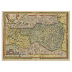
- Antique Map of Austria by Ortelius, c.1612Located in Langweer, NLAntique map titled 'Austriae Descrip. per Wolfgangum Lazium' Original antique map of Austria. Published by A. Ortelius, circa 1612. Artists a...Category
Antique 17th Century Maps
MaterialsPaper
- Antique Map of the Region of Salzburg by Ortelius 'circa 1606'Located in Langweer, NLAntique map titled 'Salisburgensis Iurisdictionis'. Original antique map of the region of Salzburg, Austria. Published by A. Ortelius, circa 1606.Category
Antique Early 17th Century Maps
MaterialsPaper
- Antique Map of the Region of Poitou by Ortelius, circa 1600Located in Langweer, NLAntique map titled 'Poictou'. Original antique map of the region of Poitou, a former province of west-central France whose capital city was Poitiers. Published by A. Ortelius, circa ...Category
Antique Early 17th Century Maps
MaterialsPaper
- Antique Map of East Frisia by Ortelius, c.1595Located in Langweer, NLAntique print, titled: 'Frisia Orientalis.' Map of East Frisia originating from 'Theatrum Orbis Terrarum'. It is based on the manuscript map by Jon Bloe...Category
Antique 16th Century Maps
MaterialsPaper
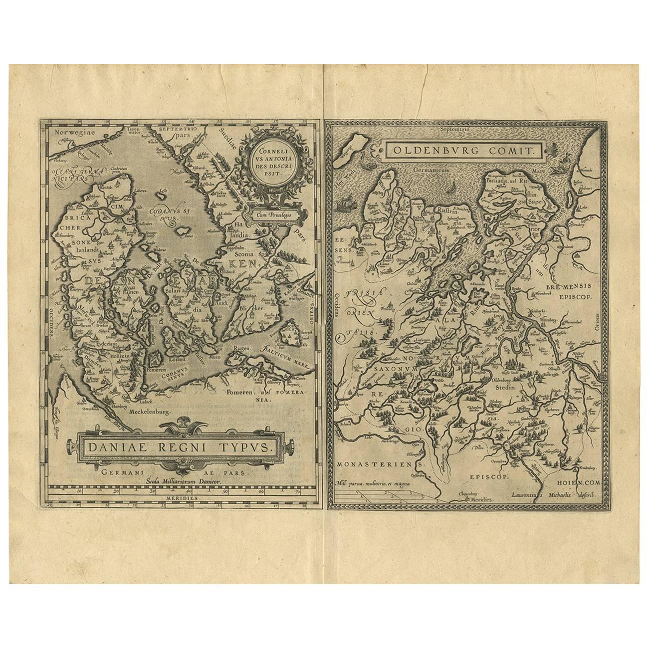
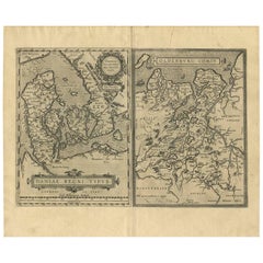
- Antique Map of Denmark and Oldenburg ‘Germany’ by A. Ortelius, circa 1598Located in Langweer, NLAntique map titled 'Daniae Regni Typus' and 'Oldenburg Comit'. A nice example of Ortelius maps of Denmark and Oldenburg, which first appeared in the 1584 edition of his Theatrum Orbi...Category
Antique 16th Century Maps
MaterialsPaper


You May Also Like
- Original Antique Map of Belgium by Tallis, Circa 1850Located in St Annes, LancashireGreat map of Belgium Steel engraving Many lovely vignettes Published by London Printing & Publishing Co. ( Formerly Tallis ), C.1850 Origin...Category
Antique 1850s English Maps
MaterialsPaper
- Original Antique Map of South America, circa 1830Located in St Annes, LancashireGreat map of South America Copper plate engraving Published by Butterworth, Livesey & Co., circa 1830 Unframed.Category
Antique Early 1800s English Other Maps
MaterialsPaper
- Original Antique Map of South East Asia by Becker, circa 1840Located in St Annes, LancashireGreat map of South East Asia Steel engraving with original color outline Engraved by Becker Published by Virtue, circa 1840. Unframed.Category
Antique 1840s English Other Maps
MaterialsPaper
- Original Antique Map / City Plan of Brussels by Tallis, circa 1850Located in St Annes, LancashireGreat map of Brussels. Steel engraving. Published by London Printing & Publishing Co. (Formerly Tallis), C.1850 Free shipping.Category
Antique 1850s English Maps
MaterialsPaper
- Original Antique Map of Spain and Portugal, circa 1790Located in St Annes, LancashireSuper map of Spain and Portugal Copper plate engraving by A. Bell Published, circa 1790. Unframed.Category
Antique 1790s English Other Maps
MaterialsPaper
- Original Antique Map of Russia By Arrowsmith. 1820Located in St Annes, LancashireGreat map of Russia Drawn under the direction of Arrowsmith Copper-plate engraving Published by Longman, Hurst, Rees, Orme and Brown, 1820 Unframed.Category
Antique 1820s English Maps
MaterialsPaper


