Antique Map New
65
to
161
791
184
461
293
209
181
146
138
101
82
73
62
58
56
48
30
29
25
24
23
22
22
20
19
18
18
16
15
15
14
14
11
10
10
10
10
8
8
7
6
6
6
5
5
5
5
5
5
4
4
3
3
3
3
2
2
2
2
2
2
2
2
2
1
42
42
22
21
20
Sort By
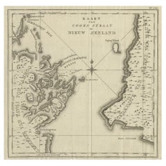
Antique Map of Cook's Strait in New Zealand, 1803
Located in Langweer, NL
Antique map New Zealand titled 'Kaart van Cooks Straat in Nieuw Zeeland'. Antique map of Cook's
Category
Antique 19th Century Maps
Materials
Paper
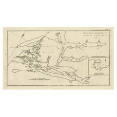
Antique Map of the Dusky Bay or Dusky Sound of New Zealand by Captain Cook, 1803
Located in Langweer, NL
Antique map New Zealand titled 'Schets van de Donkere Baai in Nieuw Zeeland 1773'.
Antique map
Category
Antique Early 1800s Maps
Materials
Paper
H 11.03 in W 19.3 in D 0 in
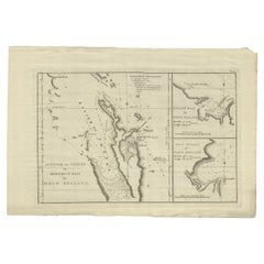
Detailed Map of New Zealand Showing the Route of Capt. Cook's First Voyage, 1803
Located in Langweer, NL
Antique map New Zealand titled 'De Rivier de Theems en Mercurius Baai in Nieuw Zeeland'. Detailed
Category
Antique 19th Century Maps
Materials
Paper
H 13.78 in W 20.48 in D 0 in
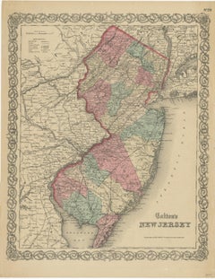
Antique Map of New Jersey
Located in Langweer, NL
Antique map titled 'Colton's New Jersey'. This rare hand colored map of New Jersey is a copper
Category
Antique Mid-19th Century Maps
Materials
Paper
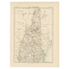
Antique Map of New Hampshire
Located in Langweer, NL
Antique map titled 'New Hampshire'. Original antique map of New Hampshire, United States. This
Category
Antique Late 19th Century Maps
Materials
Paper
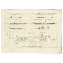
Antique Map of New Ireland, 1774
Located in Langweer, NL
Antique print titled 'Neu Irrland (..)'. Antique map of New Ireland with 7 coastal profiles, Papua
Category
Antique 18th Century Maps
Materials
Paper
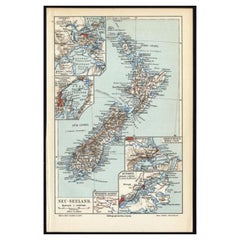
Antique Map of New Zealand, 1895
Located in Langweer, NL
Antique map titled 'Neu-Seeland.' Map of New Zealand. With inset maps of the large cities. This
Category
Antique 19th Century Maps
Materials
Paper
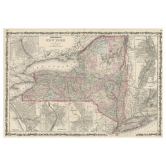
Large Antique Map of New York State with Inset Maps
Located in Langweer, NL
Antique map titled 'Johnson's New York' Large map of New York State. With insets of Albany, Oswego
Category
Antique Mid-19th Century Maps
Materials
Paper
Antique Map of New Zealand by Johnston '1909'
Located in Langweer, NL
Antique map titled 'New Zealand'. Original antique map of New Zealand. With inset maps of Chatham
Category
Early 20th Century Maps
Materials
Paper
Antique Map of New York by Johnson '1872'
Located in Langweer, NL
Antique map titled 'Johnson's New York'. Original map showing New York, with an inset map of Long
Category
Antique Late 19th Century Maps
Materials
Paper
Antique Map of New Zealand by Arrowsmith '1844'
Located in Langweer, NL
Antique map titled 'Map of the colony of New Zealand from official documents'. A scarce map of New
Category
Antique Mid-19th Century Maps
Materials
Paper
Antique Map of New Zealand and Tasmania, 1904
Located in Langweer, NL
This large antique map is taken from; 'Andrees Allgemeiner Handatlas in 126 Haupt-Und 139
Category
20th Century Maps
Materials
Paper
Antique Map of New Westville, Gettysburg, New Hope & Fair Haven, 1871
Located in Langweer, NL
Antique map titled 'New Westville, Gettysburg, New Hope, Fair Haven'. Original antique map of
Category
Antique Late 19th Century Maps
Materials
Paper
H 14.97 in W 12.41 in D 0.02 in
Antique Map of West Russia, with Title a New Map of Moskovy, 1741
Located in Langweer, NL
Antique map Russia titled 'A New Map of Moscovy from the latest observations'.
Muscovy is an
Category
Antique 1740s Maps
Materials
Paper
Antique Map of Australia and New Zealand, c.1860
Located in Langweer, NL
Antique map titled 'Australia and New Zealand'. Unusual edition of this map of Australia and New
Category
Antique 19th Century Maps
Materials
Paper
Antique Map of New South Wales by Johnston, '1909'
Located in Langweer, NL
Antique map titled 'South Australia, New South Wales, Victoria and Queensland'. Original antique
Category
Early 20th Century Maps
Materials
Paper
Large Antique Map of New England with decorative Vignettes
Located in Langweer, NL
Antique map titled 'Johnson's New England'. Large map of New England, comprising the states
Category
Antique Mid-19th Century Maps
Materials
Paper
Antique Map of New Paris and Morning Sun, 1871
Located in Langweer, NL
Antique map titled 'New Paris, Morning Sun'. Original antique map of villages and communities of
Category
Antique Late 19th Century Maps
Materials
Paper
Antique Map of New South Wales by Lowry, '1852'
Located in Langweer, NL
Antique map titled 'New South Wales north'. Original map of New South Wales, Australia. This map
Category
Antique Mid-19th Century Maps
Materials
Paper
German Antique Map of Australia and New Zealand, 1857
Located in Langweer, NL
Antique map Australia titled 'Festland von Australien und benachbarte Inseln'. Detailed map of
Category
Antique 19th Century Maps
Materials
Paper
Antique Miniature Map of New Guinea by Bertius, '1618'
Located in Langweer, NL
Antique miniature map titled 'Nova Guinea et Ins. Salomonis'. Rare miniature map of New Guinea
Category
Antique Early 17th Century Maps
Materials
Paper
Antique Map of New South Wales by Lowry, 1852
Located in Langweer, NL
Antique map titled 'New South Wales and part of Victoria'. Two individual sheets of New South Wales
Category
Antique Mid-19th Century Maps
Materials
Paper
Antique Map of New Ireland with 7 Coastal Profiles
Located in Langweer, NL
Antique print titled 'l'Isle St. Jean (..) - Cap St. George (..)'. Antique map of New Ireland, an
Category
Antique Late 18th Century Maps
Materials
Paper
Large Original Antique Map of New Hampshire, USA, 1894
By Rand McNally & Co.
Located in St Annes, Lancashire
Fabulous map of New Hampshire
Original color
By Rand, McNally & Co.
Published, 1894
Unframed
Category
Antique 1890s American Maps
Materials
Paper
Large Original Antique Map of New York, USA, 1894
By Rand McNally & Co.
Located in St Annes, Lancashire
Fabulous map of New York.
Original color.
By Rand, McNally & Co.
Published, 1894
Unframed
Free
Category
Antique 1890s American Maps
Materials
Paper
Antique Map of New Zealand by A & C. Black, 1870
Located in Langweer, NL
Antique map titled 'New Zealand'. Original antique map of New Zealand with inset Maps of Australia
Category
Antique Late 19th Century Maps
Materials
Paper
Antique Map of New Guinea and New Britain by P. Carteret, circa 1773
Located in Langweer, NL
Antique map titled 'A chart of captn Carteret's Discoveries at New Britain'. Philip Carterets map
Category
Antique Late 18th Century Maps
Materials
Paper
Antique Map of New South Wales 'Australia' by Wyld '1845'
Located in Langweer, NL
Antique map titled 'British Settlements in New South Wales'. Original antique map of New South
Category
Antique Mid-19th Century Maps
Materials
Paper
Antique Map of New Brunswick by W. G. Blackie, 1859
Located in Langweer, NL
Antique map titled 'New Brunswick, Nova Scotia, Prince Edward Island and Part of Canada east
Category
Antique Mid-19th Century Maps
Materials
Paper
Antique Map of Pennsylvania and New Jersey by Johnson, 1872
Located in Langweer, NL
Antique map titled 'Johnson's Pennsylvania and New Jersey'. Original map showing Pennsylvania and
Category
Antique Late 19th Century Maps
Materials
Paper
Antique Map of New Ireland Island in the Bismarck Archipelago, New Guinea, 1772
Located in Langweer, NL
Antique map titled 'Nova Hibernia'. Antique map of New Ireland, an island in the Bismarck
Category
Antique 18th Century Maps
Materials
Paper
H 17.52 in W 11.03 in D 0 in
Large Original Antique Map of New Mexico, Usa, C.1900
Located in St Annes, Lancashire
Fabulous map of New Mexico.
Original color.
Engraved and printed by the George F. Cram Company
Category
Antique 1890s American Maps
Materials
Paper
Antique Map of New South Wales by Tallis, circa 1851
Located in Langweer, NL
Antique map titled 'New South Wales'. Decorative and detailed map of New South Wales which was
Category
Antique Mid-19th Century Maps
Materials
Paper
Antique Map of New South Wales with Inset Maps of Australia and Swan River, 1854
Located in Langweer, NL
Antique map titled 'Colony of New South Wales'. Map of New South Wales with inset maps of Australia
Category
Antique 19th Century Maps
Materials
Paper
H 18.31 in W 14.57 in D 0 in
Large Original Antique Map of New Jersey, USA, circa 1900
Located in St Annes, Lancashire
Fabulous map of New Jersey
Original color
Engraved and printed by the George F. Cram Company
Category
Antique 1890s American Maps
Materials
Paper
Antique Map of New Zealand by Scottish Geographer Johnston, 1882
Located in Langweer, NL
Antique map titled 'New Zealand'.
Old map of New Zealand. This map originates from 'The Royal
Category
Antique 19th Century Maps
Materials
Paper
Antique Map of New South Wales in Australia, ca. 1850
Located in Langweer, NL
Antique map of Victoria, or Port Phillip (12.7 x 10.0") in Australia. Superb map of Victoria
Category
Antique Mid-19th Century European Maps
Materials
Paper
Original Antique Map of New Brunswick and Nova Scotia, 1889
Located in St Annes, Lancashire
Great map of New Brunswick and Nova Scotia
Drawn and Engraved by W. & A.K. Johnston
Published
Category
Antique 1880s Scottish Victorian Maps
Materials
Paper
Antique "New Plan of London" Map by John Bartholomew, 1900
Located in Bridgeport, CT
Produced for the W.H. Smith guide, folded in the original. The map here is unfolded and framed flat
Category
Antique Early 1900s English Victorian Maps
Materials
Paper
Antique Detailed Map of New South Wales, Queensland & Victoria, Australia, 1865
Located in Langweer, NL
Antique map Australia titled 'South Australia, New South Wales, Victoria & Queensland'. Old map
Category
Antique 19th Century Maps
Materials
Paper
H 24.41 in W 19.49 in D 0 in
Antique Map of New Jersey, Delaware and Maryland by Johnson, 1872
Located in Langweer, NL
Antique map titled 'Johnson's New Jersey (..). Two maps on one sheet showing New Jersey, Delaware
Category
Antique Late 19th Century Maps
Materials
Paper
Antique Map of College Corner, Sugar Valley, New Lexington & Verona '1871'
Located in Langweer, NL
Antique map titled 'College Corner, Sugar Valley, New Lexington, Verona'. Original antique map of
Category
Antique Late 19th Century Maps
Materials
Paper
H 14.97 in W 12.41 in D 0.02 in
Antique Map of California, Utah, Nevada, Colorado, New Mexico & Arizona '1872'
Located in Langweer, NL
Antique map titled 'Johnson's California (..)'. Original map of California, Utah, Nevada, Colorado
Category
Antique Late 19th Century Maps
Materials
Paper
H 18.12 in W 26.38 in D 0.02 in
Antique Map of the Passenger Transportation Systems of New York, 1901
Located in Langweer, NL
Antique map titled 'Map of New York City except Richmond Borough showing Passenger Transportation
Category
20th Century Maps
Materials
Paper
Large Antique Map of New Guinea and New Britain Showing Capt. Cooks Tract, 1773
Located in Langweer, NL
Antique map titled 'A Chart of Captain Carteret's Discoveries at New Britain, with part of Captain
Category
Antique 18th Century Maps
Materials
Paper
H 27.96 in W 11.42 in D 0 in
1903 Antique National Publishing Road Map of New Jersey Geological Survey
Located in Dayton, OH
1903 antique New Jersey road map by The National Publishing Company of Boston Massachusettes, No
Category
Antique Early 1900s Victorian Maps
Materials
Paper
Antique Map of Australasia, New Zealand, Polynesia & the Pacific Ocean, 1840
Located in Langweer, NL
Antique map titled 'The Pacific Ocean'.
This map depicts Australasia, New Zealand, Polynesia
Category
Antique 1840s Maps
Materials
Abalone, Paper
H 13.39 in W 16.15 in D 0 in
Original Antique Map of the Western Part of NEW MEXICO & CALIFORNIA
Located in Langweer, NL
Title: "Map of the Western Part of NEW MEXICO and CALIFORNIA According to the Latest Discoveries by
Category
Antique 1760s Maps
Materials
Paper
Antique Map of the Coast of New Ireland, Earlier Part of German New Guinea, 1833
Located in Langweer, NL
Antique map titled 'Plan du Havre Carteret sur la Cote occidentale de la Nelle Irlande
Category
Antique 19th Century Maps
Materials
Paper
H 18.86 in W 25.44 in D 0 in
Antique Map of Australia and New Zealand by W. G. Blackie, 1859
Located in Langweer, NL
Antique map titled 'Australia and New Zealand'. Original antique map of Australia and New Zealand
Category
Antique Mid-19th Century Maps
Materials
Paper
Original Antique Map of the State of New Jersey Published in France
Located in Langweer, NL
Original antique map titled 'Carte Géographique Statistique et Historique du New-Jersey'. One of
Category
Antique Early 19th Century Maps
Materials
Paper
Antique Map of New Brunswick, Nova Scotia and Surroundings by Johnson, 1872
Located in Langweer, NL
Antique map titled 'Johnson's Quebec, of the dominion of Canada (..)'. Original map of New
Category
Antique Late 19th Century Maps
Materials
Paper
H 18.12 in W 26.58 in D 0.02 in
Antique Map of Canada, New Brunswick and Nova Scotia by Lowry, 1852
Located in Langweer, NL
Antique map titled 'Canada, New Brunswick & Nova Scotia'. Two individual sheets of Canada, New
Category
Antique Mid-19th Century Maps
Materials
Paper
No Reserve
H 12.21 in W 9.65 in D 0.02 in
Antique Map of American Cities, Vignette of New York City, circa 1920
Located in St Annes, Lancashire
Great maps of American Cities
Unframed
Original color
By John Bartholomew and Co
Category
Vintage 1920s British Maps
Materials
Paper
No Reserve
H 18 in W 23 in D 0.07 in
Antique Map of South Australia, Victoria, Queensland and New South Wales, c.1860
Located in Langweer, NL
Antique map Australia titled 'South Australia, New South Wales, Victoria & Queensland'. Old map
Category
Antique 19th Century Maps
Materials
Paper
H 18.71 in W 14.57 in D 0 in
Antique Map of New South Wales and Victoria by W. G. Blackie, 1859
Located in Langweer, NL
Antique map titled 'New South Wales and Victoria'. Original antique map of New South Wales and
Category
Antique Mid-19th Century Maps
Materials
Paper
Antique Map of Endeavour River and Botany Bay, New South Wales, Australia, 1803
Located in Langweer, NL
in Nieuw Zuid Wales'. Antique map of the Endeavour river and a map of Botany Bay, New South Wales
Category
Antique 19th Century Maps
Materials
Paper
H 9.65 in W 19.49 in D 0 in
Antique Map of New England and Eastern Canada by Homann Heirs, circa 1755
Located in Langweer, NL
Antique map titled 'Partie Orientale de la Nouvelle France ou du Canada (..)'. Original antique map
Category
Antique Mid-18th Century Maps
Materials
Paper
No Reserve
H 21.07 in W 24.22 in D 0.02 in
Antique Map of New South Wales with an Inset of Sydney, Australia, 1833
Located in Langweer, NL
Antique map of Australia titled 'New South Wales'. Old map of New South Wales, Australia. With an
Category
Antique 19th Century Maps
Materials
Paper
Antique Map of New England and Part of Canada by Vaugondy 'circa 1755'
Located in Langweer, NL
Antique map titled 'Partie de l'Amérique septent qui comprend la nouvelle France ou le Canada
Category
Antique Mid-18th Century Maps
Materials
Paper
No Reserve
H 20.08 in W 25.99 in D 0.02 in
- 1
- ...
Get Updated with New Arrivals
Save "Antique Map New", and we’ll notify you when there are new listings in this category.
Antique Map New For Sale on 1stDibs
Find many varieties of an authentic antique map new available at 1stDibs. Each antique map new for sale was constructed with extraordinary care, often using paper, wood and fabric. You’ve searched high and low for the perfect antique map new — we have versions that date back to the 18th Century alongside those produced as recently as the 20th Century are available. An antique map new is a generally popular piece of furniture, but those created in Victorian styles are sought with frequency. Many designers have produced at least one well-made antique map new over the years, but those crafted by Rand McNally & Co., Beers Atlas Co. and Charles Magnus are often thought to be among the most beautiful.
How Much is a Antique Map New?
An antique map new can differ in price owing to various characteristics — the average selling price 1stDibs is $303, while the lowest priced sells for $36 and the highest can go for as much as $12,000.
More Ways To Browse
Antique Maps Caribbean Islands
Antique Great Lakes Map
Antique Newfoundland Canada
Peru Map
Antique Alaska Maps
Antique Map Poland
Alaska Antique Map
Antique Map Texas
Brooklyn Map
Elephant Salt
Antique Ecuador
Antique Map Of Texas
Martin Brothers Bird
Antique Furniture Leicestershire
Carolina Map
Antique Geological Maps
Antique Maps Massachusetts
Antique Maps Of Massachusetts
