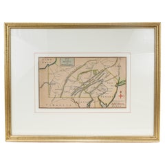
Antique Great Lakes Map

5
to
10
34
23
35
26
19
10
10
9
6
5
5
5
4
3
3
3
3
3
3
2
2
2
2
2
1
1
1
1
1
1
1
2
1
1
1
1
Sort By
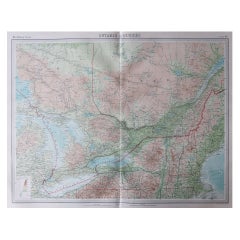
Large Original Vintage Map of the Great Lakes, Canada, circa 1920
Located in St Annes, Lancashire
Great map of The Great Lakes. Unframed. Original color. By John Bartholomew and Co
Category

1920s British Antique Great Lakes Map

Materials

Paper

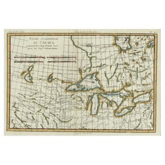
Old Map of the Great Lakes and Upper Mississippi Valley, Northern America, c1780
Located in Langweer, NL
Guilleme Raynal's 1780 map of the Great Lakes and upper Mississippi Valley. A map of considerable
Category

1780s Antique Great Lakes Map

Materials

Paper

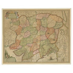
Antique Map of the Empire of the Great Mogul
Located in Langweer, NL
Antique map titled 'Magni Mogolis Imperium'. This map depicts the Empire of the Great Mogul in
Category

Late 17th Century Antique Great Lakes Map

Materials

Paper

Antique Map of the Empire of the Great Mogul
H 22.17 in W 25.79 in D 0.2 in
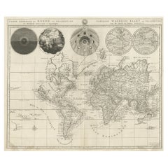
Antique Detailed World Map Drawn on Mercator's Projection, 1700
Located in Langweer, NL
well as an early, open-ended version of the Great Lakes named Mer Douce. A small coastline of New
Category

17th Century Antique Great Lakes Map

Materials

Paper

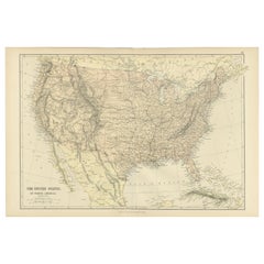
Antique Map of The United States of North America, 1882
Located in Langweer, NL
, showing the varied landscapes across the country. The Great Lakes are also prominently featured in the
Category

1880s Antique Great Lakes Map

Materials

Paper

Antique Map of The United States of North America, 1882
Free Shipping
H 14.97 in W 22.45 in D 0 in
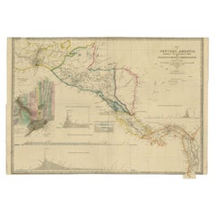
Antique Map of Central America Showing the Communication Lines, 1850
Located in Langweer, NL
map-seller, best known for Wyld's Great Globe. He was successor to William Faden, one of the
Category

19th Century Antique Great Lakes Map

Materials

Paper

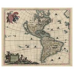
Original Hand-Colored Antique Map of America by Danckerts, circa 1680
Located in Langweer, NL
'. Striking map of America. California is shown as an island, Based Upon Sanson's model. The Great Lakes are
Category

Late 17th Century Antique Great Lakes Map

Materials

Paper

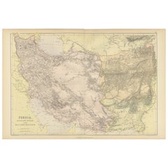
Oriental Realms: A Detailed Map of Persia, Afghanistan, and Beloochistan, 1882
Located in Langweer, NL
This historical map from the 1882 atlas published by Blackie & Son is a comprehensive depiction of
Category

1880s Antique Great Lakes Map

Materials

Paper

Antique 18th Century Map of the Province of Pensilvania 'Pennsylvania State'
Located in Philadelphia, PA
A fine antique of the colony of Pennsylvania. Noted at the top of the sheet as a 'Map of the
Category

18th Century British American Colonial Antique Great Lakes Map

Materials

Paper

Antique Map of America with California as an Island by Homann '1710'
Located in Langweer, NL
Lakes and Mississippi River**: The map provides detailed information about the Great Lakes and the
Category

Early 18th Century Antique Great Lakes Map

Materials

Paper

Antique Map of Canada, The Province of Ontario and Part of Quebec, 1882
Located in Langweer, NL
vital for communication and transportation during that period. The map features Lake Ontario
Category

1880s Antique Great Lakes Map

Materials

Paper

Gorgeous Antique World Map by the Dutch Mapmaker Visscher, published circa 1679
Located in Langweer, NL
. There is only one open ended Great Lake. Australia and New Zealand are substantially incomplete
Category

Late 17th Century Antique Great Lakes Map

Materials

Paper

Antique Map with Details of Berings' Expedition into Russians' Far East, 1737
Located in Langweer, NL
Antique map titled 'Carte Des Pays traverses par le Capne. Beerings depuis la Ville de Tobolsk
Category

1730s Antique Great Lakes Map

Materials

Paper

1847 Antique Map of Mexico, Texas and California by Samuel Augustus Mitchell
By Samuel Augustus Mitchell 1
Located in Colorado Springs, CO
two small areas of loss below Great Salt Lake that have been reinstated in facsimile, along with two
Category

1840s American Antique Great Lakes Map

Materials

Paper

"Africae Accurata", a Hand-Colored 17th Century Map of Africa by Visscher
By Nicolaes Visscher II
Located in Alamo, CA
An 18th century hand-colored map of Africa entitled "Africae Accurata Tabula ex officina" by
Category

Late 17th Century Dutch Antique Great Lakes Map

Materials

Paper

Antique Map of New England and Part of Canada by Vaugondy 'circa 1755'
Located in Langweer, NL
large inset map of the Great Lakes. The map covers the Gulf of St. Lawrence, St. Lawrence River, and
Category

Mid-18th Century Antique Great Lakes Map

Materials

Paper

Excellent Antique Map of America with Unusual Northwest Coast of America, c.1754
Located in Langweer, NL
Northwest Passage via the Great Lakes. The rest of the NW coast is virtually due North, with notations
Category

1750s Antique Great Lakes Map

Materials

Paper

Antique Map of Cities of the Province of Che-Kiang in China, 1738
Located in Langweer, NL
Antique map titled 'Cities of the Province of Che-Kyang'. Old map depicting four walled cities of
Category

18th Century Antique Great Lakes Map

Materials

Paper

Antique Map of Cities of the Province of Che-Kyang in China, 1738
Located in Langweer, NL
Antique print China titled 'Cities of the Province of Che-Kyang'. Old map depicting four walled
Category

18th Century Antique Great Lakes Map

Materials

Paper

Miniature Terrestrial Globe Newton & Son London, Post 1833, Ante 1858
By Newton and Son
Located in Milano, IT
great lakes Tanganyika and Victoria are not marked (Europeans would begin to explore the area after 1858
Category

1840s English Early Victorian Antique Great Lakes Map

Materials

Bronze

Pair of Miniature Globes Lane’s on Tripod Bases, London post 1833, ante 1858
By Lane's
Located in Milano, IT
Much of central Africa is empty and the great lakes Tanganyika and Victoria are not marked (Europeans
Category

1840s English Early Victorian Antique Great Lakes Map

Materials

Paper, Wood

Northern Italy: A 16th Century Hand-colored Map by Abraham Ortelius
By Abraham Ortelius
Located in Alamo, CA
This is a framed 16th century hand-colored copperplate map of northern Italy entitled "Veronae
Category

16th Century Old Masters Antique Great Lakes Map

Materials

Engraving

one of the earliest large-scale English maps of North America
By John Senex
Located in London, GB
depiction of the Great Lakes region and the most accurate definition of the lower Mississippi River and its
Category

1710s Naturalistic Antique Great Lakes Map

Materials

Watercolor, Engraving

Siberia as Explored by Behring: Original 18th Century Hand-colored Map by Bowen
Located in Alamo, CA
This is an original 18th century hand-colored map entitled "An Exact Chart of all the Countries
Category

Mid-18th Century Old Masters Antique Great Lakes Map

Materials

Engraving

Gilpin, Wm: Observations... on Great Britain, and High-Lands of Scotland, 2 vols
Located in Middletown, NY
the River Wye and continued with the Lake District and many other parts of England and Scotland
Category

Late 18th Century English Antique Great Lakes Map

Materials

Leather, Paper

North and South America: An 18th Century Hand-colored Map by Johann Homann
By Johann Baptist Homann
Located in Alamo, CA
Great Lakes are just now being explored in detail. Many Native American names are used for regions and
Category

Early 18th Century Old Masters Antique Great Lakes Map

Materials

Engraving

The 4000km Exploration of Ernest Giles from Beltena to Perth, Australia in 1875
Located in Langweer, NL
the continent. The details on the map include topographical features like salt lakes and the Great
Category

1870s Antique Great Lakes Map

Materials

Paper

Original Antique Montreux Oberland Bernois Railway Travel Poster MOB Switzerland
Located in London, GB
trees with a sailing boat on a lake below and a map of the railway route on the other side of the
Category

Early 1900s Swiss Antique Great Lakes Map

Materials

Paper

Keating, William. Narrative of an Expedition to the Source of St. Peter's River
Located in Middletown, NY
American Philosophical Society. He is best known for his account of the 1823 expedition to the Great Lakes
Category

Early 19th Century English Antique Great Lakes Map

Materials

Leather, Paper

Pocket Globe, Nicholas Lane, London, post 1779
By Nicholas Lane
Located in Milano, IT
Africa is empty, and the Great Lakes Tanganyika and Victoria (which Europeans would begin to explore
Category

1780s English Other Antique Great Lakes Map

Materials

Leather, Wood, Paper

A truly delightful miniature terrestrial pocket globe
By Nathaniel Mills
Located in ZWIJNDRECHT, NL
large lakes engraved in Africa that may longer exist. The Celestial Gores. The celestial gores, housed
Category

Mid-18th Century British Dutch Colonial Antique Great Lakes Map

Materials

Other

Original 1900s Montreux Oberland Bernois Railway Poster, Switzerland MOB Railway
Located in London, GB
trees with a sailing boat on a lake below and a map of the railway route on the other side of the
Category

Early 1900s Antique Great Lakes Map

Materials

Paper

Hydrographic map of the Croton Aqueduct
By Nathaniel Currier
Located in New York, NY
"Hydrographic map of the counties of New-York, Westchester and Putnam, also showing the line of the
Category

1840s Realist Antique Great Lakes Map

Materials

Lithograph

1730 Hand-Colored Antique Map of the Americas
Located in La Jolla, CA
the map. The Mississippi flows into the Gulf of Mexico on the Texas coast. The Great Lakes are well
Category

1730s Dutch Baroque Antique Great Lakes Map

Materials

Paper

Highly Decorative Italian Wall Map of the World
By Paolo Petrini
Located in La Jolla, CA
, with all five of the great lakes delineated. The Mississippi river is present, although its mouth is
Category

Early 1700s Italian Baroque Antique Great Lakes Map

Materials

Paper

L' Amerique Septentrionale (North America with California as an Island)
Located in New York, NY
the Great Salt Lake. While existing, neither New York, Boston, Philadelphia, nor Montreal are
Category

Early 1700s Realist Antique Great Lakes Map

Materials

Engraving

Pair of Topographical Portraits of the Pavillion and Village of Vaux-Sur-Seine
Located in London, Middlesex
below show. De Cotte had also studied garden design under the great André Le Notre and his drawings
Category

Early 18th Century French Louis XIV Antique Great Lakes Map

Materials

Canvas

Interesting and Decorative Dutch Antique Map of the Americas
By Isaak Tirion
Located in Langweer, NL
via the Great Lakes. The rest of the NW coast is virtually due North, with notations regarding Russian
Category

Mid-18th Century Antique Great Lakes Map

Materials

Paper

Atwood's Pictorial Map of the United States, circa 1854
Located in Colorado Springs, CO
as this map went to press. Salt Lake City itself is identified as 'Utah City of the Great Salt Lake
Category

1850s American Antique Great Lakes Map

Antique Map of Texas, the Rocky Mountains, Southwest and Mexico
Located in Langweer, NL
Cheyenne area and the Great Salt Lake. Includes both Salt Lake and the mytical lake to its south, with what
Category

Early 19th Century Antique Great Lakes Map

Materials

Paper

Republic of Texas and Mexico, Antique French Map, circa 1840
Located in Colorado Springs, CO
its depiction of fur trader Jedediah Smith's travels in the Great Basin region. The map shows his epic
Category

1840s French Antique Great Lakes Map

Materials

Paper

1855 Pictorial Map of the United States, Pub by Ensign, Bridgman & Fanning
Located in Colorado Springs, CO
Salt Lake is presented in an embryonic form and indicative of the generally poor knowledge of the Great
Category

1850s American Antique Great Lakes Map

Materials

Paper

English Pocket Globe by Lane, London, between 1817 and 1833
By Lane's
Located in Milano, IT
] On the globe, much of central Africa is empty and the great lakes Tanganyika and Victoria are not
Category

1820s English George IV Antique Great Lakes Map

Materials

Shagreen, Paper

Rare Engraved "Map of North America", Emanuel Bowen & John Gibson Published 1776
By Emanuel Bowen
Located in Shippensburg, PA
careful attention to detail throughout the map includes the various towns, rivers, smaller villages, lakes
Category

18th Century British Neoclassical Antique Great Lakes Map

Materials

Wood, Paper, Glass

Original Antique Map of the Great Lakes, Canada by T. Ettling, 1861
Located in St Annes, Lancashire
Great map of The Great Lakes Steel engraving with original color outline Drawn and engraved
Category

1860s English Other Antique Great Lakes Map

Materials

Paper

Original Antique Map of Salt Lake City, Utah, 1861
Located in St Annes, Lancashire
Great map of Salt lake City Drawn and engraved by Edward Weller Original color Published
Category

1860s English Victorian Antique Great Lakes Map

Materials

Paper

Original Antique Map of Salt Lake City, Utah, 1861
1 bid
No Reserve
H 18.5 in W 13 in D 0.07 in
1886 Skeleton Map of the Union Pacific Railway
Located in Colorado Springs, CO
. The map is filled with numerous pictorial scenes from the Great Plains and the West, including
Category

1880s American Antique Great Lakes Map

Materials

Paper

Old Print Showing New Zealand, Cuba, Iceland etc. Lakes, Mountains, Rivers, 1851
Located in Langweer, NL
Antique map titled 'A comparative view of the principal Waterfalls, Islands, Lakes, Rivers and
Category

1850s Antique Great Lakes Map

Materials

Paper

Antique Map of the British Colonies in North America by Homann Heirs, 1756
Located in Langweer, NL
Great Lakes region and Canada. Extensive annotations in German give details on the various American
Category

Mid-18th Century Antique Great Lakes Map

Materials

Paper

Antique Map of North America and the West Indies by Homann, circa 1720
Located in Langweer, NL
, Virginiae et Pensylvaniae (..)'. This superb map covers the region from the Great Lakes and Nova Scotia
Category

Early 18th Century Antique Great Lakes Map

Materials

Paper

Antique Framed Hand Colored Map of the Americas by Frederick De Wit, circa 1675
By Frederick de Wit
Located in Morristown, NJ
include all five Great Lakes; Lac Superieur (Lake Superior), Lac des Puans (Lake Michigan), Mare Dulce
Category

1670s Dutch Baroque Antique Great Lakes Map

Materials

Glass, Wood, Giltwood, Paint, Paper

Antique Map of American Northwest, 1752
Located in Houston, TX
Siberia to the Great Lakes region. Original antique map displayed on a white mat with a gold border
Category

18th Century and Earlier Other Art Style Antique Great Lakes Map

Materials

Ink, Paper, Watercolor

Antique Map of Asia by Hederichs, 'circa 1740'
Located in Langweer, NL
Antique map titled 'Asiae Nova delineatio'. Rare miniature map of Asia. This map covers the
Category

Mid-18th Century Antique Great Lakes Map

Materials

Paper

Danckerts Map of Florida, the West Indies and the Caribbean.
Located in Coral Gables, FL
Everglades nor any of Florida's great lakes. The interesting cartographic decision to discard all previous
Category

18th Century and Earlier Dutch Antique Great Lakes Map

1706 de La Feuille Map of the World
Located in New York, NY
rivers and lakes delineated. In North America the Great Lakes region is depicted as what was believed to
Category

Early 1700s Realist Antique Great Lakes Map

Materials

Engraving

Carte de la Nouvelle France (Map of New France)
By Henri-Abraham Chatelain
Located in New York, NY
major landmarks and environs. In the upper left another inset shows the Great Lakes and Mississippi
Category

1710s Realist Antique Great Lakes Map

Materials

Engraving

La Louisiane et Pays Voisins (Louisiana and surrounding areas) by Bellin
By Jacques-Nicolas Bellin
Located in New York, NY
Original 1764 map of French Louisiana by the French cartographer Jacques-Nicholas Bellin. Centered
Category

1760s Realist Antique Great Lakes Map

Materials

Engraving

Get Updated with New Arrivals
Save "Antique Great Lakes Map", and we’ll notify you when there are new listings in this category.

Antique Great Lakes Map For Sale on 1stDibs

At 1stDibs, there are many versions of the ideal antique great lakes map for your home. Each antique great lakes map for sale was constructed with extraordinary care, often using paper, wood and glass. Whether you’re looking for an older or newer antique great lakes map, there are earlier versions available from the 18th Century and newer variations made as recently as the 20th Century. An antique great lakes map made by Victorian designers — as well as those associated with Baroque — is very popular. Many designers have produced at least one well-made antique great lakes map over the years, but those crafted by Emanuel Bowen, Frederick de Wit and Lane's are often thought to be among the most beautiful.

How Much is a Antique Great Lakes Map?

An antique great lakes map can differ in price owing to various characteristics — the average selling price 1stDibs is $1,598, while the lowest priced sells for $50 and the highest can go for as much as $17,893.

Read More

Pamela Shamshiri Shares the Secrets behind Her First-Ever Book and Its Effortlessly Cool Interiors

The sought-after designer worked with the team at Hoffman Creative to produce a monograph that beautifully showcases some of Studio Shamshiri's most inspiring projects.

Moroccan Artworks and Objects Take Center Stage in an Extraordinary Villa in Tangier

Italian writer and collector Umberto Pasti opens the doors to his remarkable cave of wonders in North Africa.

Montecito Has Drawn Royalty and Celebrities, and These Homes Are Proof of Its Allure

Hollywood A-listers, ex-pat aristocrats and art collectors and style setters of all stripes appreciate the allure of the coastal California hamlet — much on our minds after recent winter floods.

Whaam! Blam! Pow! — a New Book on Pop Art Packs a Punch

Publishing house Assouline and writer Julie Belcove have teamed up to trace the history of the genre, from Roy Lichtenstein, Andy Warhol and Yayoi Kusama to Mickalene Thomas and Jeff Koons.

The Sparkling Legacy of Tiffany & Co. Explained, One Jewel at a Time

A gorgeous new book celebrates — and memorializes — the iconic jeweler’s rich heritage.

What Makes a Gem-Encrusted Chess Set Worth $4 Million?

The world’s most opulent chess set, weighing in at 513 carats, is literally fit for a king and queen.

Tauba Auerbach’s Geometric Pop-Up Book Is Mighty Rare, Thanks to a Hurricane

This sculptural art book has an epic backstory of its own.

Step inside the Storied Mansions of Palm Beach’s Most Effervescent Architect

From Spanish-style courtyards to fanciful fountains, these acclaimed structures abound in surprising and elegant details.