Items Similar to one of the earliest large-scale English maps of North America


Want more images or videos?
Request additional images or videos from the seller
1 of 5
John Senexone of the earliest large-scale English maps of North America 1710 [-1728].
1710 [-1728].
About the Item
one of the earliest large-scale English maps of North America
SENEX, John.
North America Corrected from the Observations Communicated to the Royal Society at London, and the Royal Academy at Paris. By John Senex F.R.S. 1710. To the Honorable Anthony Hammond Esq. One of the Comissioners of Her Maj[es]ties Navy. This Map his humbly Dedicated and Presented by his Obliged Servants.
John Senex F.R.S., 1710 [-1728].
A fine map of North and Central America, with the West Indies.
One of the earliest large-scale English maps of North America. It represents a British attempt to consolidate new information about the region and borrows data from such recently published sources as Delisle’s landmark Carte du Mexique et de la Floride and Carte de la Canada. Senex improves upon De L'Isle's work with a fine depiction of the Great Lakes region and the most accurate definition of the lower Mississippi River and its delta by an English cartographer of the period. Several of the most important and controversial cartographic discoveries of the period are discussed at length, including Lahontan’s mythical Long River and the Salt Lake east of the Country of the Mozeemleck’s, both of which are also depicted in remarkable (albeit fanciful) detail. Sir William Phipps discovery of Spanish wrecks off the coast of the Caicos and Southern Bahamas is also noted. Senex also extended the map’s coverage to the Canadian Arctic and the Terra Incognita above Baffin’s Bay. Present-day Oklahoma and Texas are part of La Floride, considered at the time to be a possession of the French. The Red River and the Indian villages of East Texas are portrayed accurately, but Senex, following Delisle, incorrectly placed many Texas rivers, in addition to depicting some strange and unrecognizable names.
John Senex (1678-1740) was one of the foremost mapmakers in England in the early eighteenth century. He was also a surveyor, globemaker, and geographer. As a young man, he was apprenticed to Robert Clavell, a bookseller. He worked with several mapmakers over the course of his career, including Jeremiah Seller and Charles Price. In 1728, Senex was elected as a Fellow of the Royal Society, a rarity for mapmakers. The Fellowship reflects his career-long association as engraver to the Society and publisher of maps by Edmund Halley, among other luminaries. He is best known for his English Atlas (1714), which remained in print until the 1760s. After his death in 1740 his widow, Mary, carried on the business until 1755. Thereafter, his stock was acquired by William Herbert and Robert Sayer (maps) and James Ferguson (globes).
Double-page engraved map on 2 sheets joined, with full contemporary hand-colouring, decorative title cartouche with the armorial crest of Anthony Hammond. Some light staining and soiling, small tears repaired, split at folds, otherwise good. Size: 950 mm by 647mm, sheet size: 992 by 680 mm.
- Creator:
- Creation Year:1710 [-1728].
- Dimensions:Height: 38.5 in (97.79 cm)Width: 26.75 in (67.95 cm)
- Medium:
- Movement & Style:
- Period:1710-1719
- Condition:
- Gallery Location:London, GB
- Reference Number:
About the Seller
5.0
Vetted Seller
These experienced sellers undergo a comprehensive evaluation by our team of in-house experts.
Established in 1979
1stDibs seller since 2020
11 sales on 1stDibs
Typical response time: 1 hour
- ShippingRetrieving quote...Ships From: London, United Kingdom
- Return PolicyA return for this item may be initiated within 14 days of delivery.
More From This SellerView All
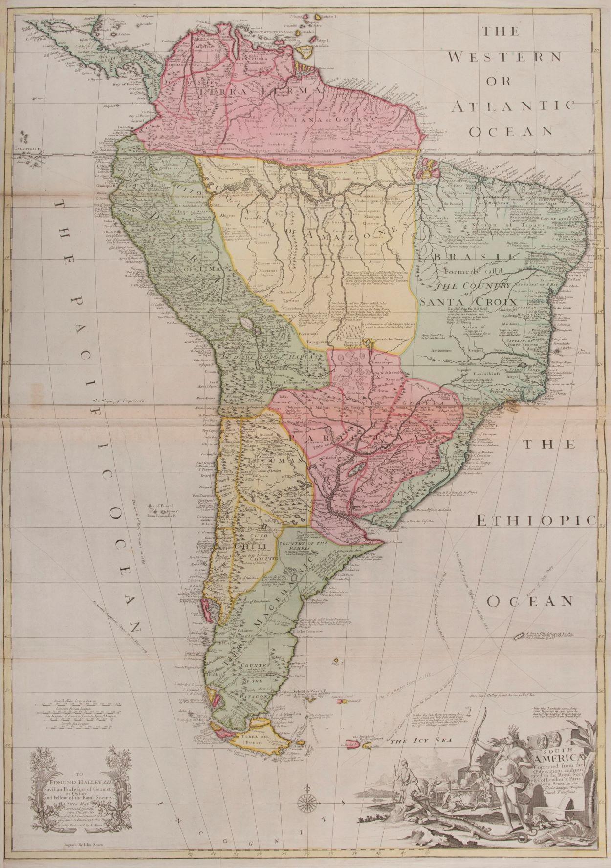
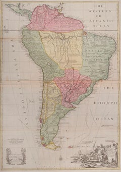
- South AmericaBy John SenexLocated in London, GBSouth America SENEX, John. South America Corrected from the Observations Communicated to the Royal Society’s of London & Paris. By John Senex. To Edmund Halley. LLD. Savilian Professor of Geometry in Oxford and Fellow of the Royal Society. This Map corrected from His own Discoveries In gratefull Acknowledgement of his Ready assistance to Encourage this Designe is Humbly Dedicated. John Senex, at the Globe against St Dunstans Church, Fleetstreet, London 1710 [-1728]. John Senex (1678-1740) was one of the foremost mapmakers in England in the early eighteenth century. He was also a surveyor, globemaker, and geographer. As a young man, he was apprenticed to Robert Clavell, a bookseller. He worked with several mapmakers over the course of his career, including Jeremiah Seller and Charles...Category
1710s Naturalistic More Art
MaterialsWatercolor, Engraving
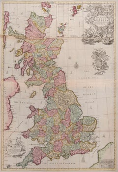
- Great BritainBy John SenexLocated in London, GBGreat Britain SENEX, John. A New Map of Great Britain Corrected from the Observations communicated to the Royal Society at London. By John Senex F.R.S. To the Right Hono[ra]ble William Connelly ESQ. One of the Commissioners of His Maj[es]ties Revenue, Speakerof the Hono[a]ble House of Commons, and one of His Maj[es]ties most Hono[ra]ble Privy Council for Ye Kingdom of Ireland. This Map is dedicated by John Senex. John Senex F.R.S. 1710 [-1728]. John Senex (1678-1740) was one of the foremost mapmakers in England in the early eighteenth century. He was also a surveyor, globemaker, and geographer. As a young man, he was apprenticed to Robert Clavell, a bookseller. He worked with several mapmakers over the course of his career, including Jeremiah Seller and Charles Price...Category
1710s Naturalistic More Art
MaterialsWatercolor, Engraving
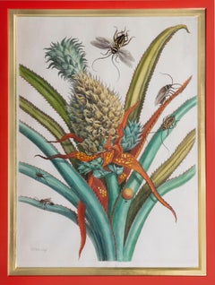
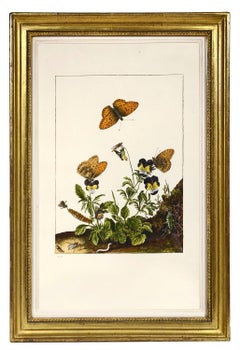
- Pineapple with foliage.By Maria Sibylla MerianLocated in London, GB[MERIAN, Maria Sibyl]. Pineapple with foliage. The Hague, Gosse, 1719. Engraving of a Pineapple with foliage by J. Mulder, P. Sluyter and D. Stoopendaal after Merian, with later hand-colour, from Dissertatio de Generatione et Metamorphasibus Insectorum Surinamensium. Framed and glazed, overall dimensions: 40cm by 53.2cm by 4.5cm. Superb engravings which depict the metamorphoses of South American insects and the exotic plants on which they feed. Maria Sybilla, daughter of the German engraver and publisher Matthias Merian, devoted herself to the study of European insects and their metamorphoses. As a result of the wealth of tropical varieties being brought back by the Dutch West Indies Company...Category
1710s Naturalistic Still-life Prints
MaterialsWatercolor, Handmade Paper, Engraving
- Group of Six InsectsBy Jacob L'AdmiralLocated in London, GBL’ADMIRAL, Jacob. Group of Six Insects. Johannes Sluyter [Amsterdam 1774]. Group of six insects, copper engraved plates with fine original colour, showing the metamorphosis of bu...Category
1770s Naturalistic Animal Prints
MaterialsWatercolor, Laid Paper, Engraving
- Group of Six Insects.By Jacob L'AdmiralLocated in London, GBL’ADMIRAL, Jacob. Group of Six Insects. [Amsterdam, Johannes Sluyter, 1774]. Group of six copper engravings with fine original colour, showing the metamorphosis of butterflies, m...Category
1770s Naturalistic Animal Prints
MaterialsWatercolor, Laid Paper, Engraving
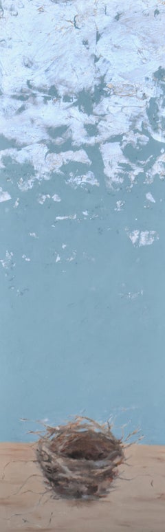
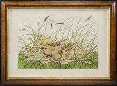
- A Group of Four engraved and hand-coloured Birds Nests.By Cornelis Nozeman and Jan Christiaan SeppLocated in London, GBNOZEMAN, Cornelius and Jan Christian SEPP. A Group of Four Birds Nests: NIDUS ARDEAE, Nycticoracis; NIDUS PLATALEA, Leucorodia; NIDUS ARDEAE STELLARIS and NIDUS PELECANI, Carbonis f...Category
1770s Naturalistic Animal Prints
MaterialsWatercolor, Engraving
You May Also Like
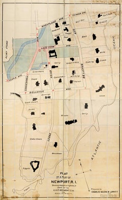
- Plan of a Part of Newport, R. I. Showing Changes... O. H. P, Belmont, Esq.Located in New York, NYPLAN OF A PART OF NEWPORT, R.I. SHOWING CHANGES IN HIGHWAYS ASKED FOR BY O.H.P. BELMONT, ESQ. The original ink and watercolor plan on paper from 1907. The plan is extremely large; if fully assembled it would measure no less than 11.5 feet in height and 6.5 feet in breadth. Segmented and backed on modern linen in four sections – each section is 70 x 39 inches. This grand oversized folding map can be folded down to four sections each 17.5 x 11 inches and stored in a modern made leather and marble paper case 18 x 11.75 x 3 inches. Text continues, "Prepared for Charles Warren Lippitt at the office of J. P. Cotton, C.E. Newport, R.I. Oct. 28, 1907." A fine manuscript plan of the Bellevue neighborhood of Newport, depicting the street layout and the detailed footprints of the area’s many mansions. The plan was produced at the behest of Charles Warren Lippett (1846-1924), who served as governor of Rhode Island from 1895-1897. The Lippett “Breakwater” mansion is also shown on this plan, situated at the southernmost tip of the peninsula. Though the circumstances are unclear, Lippitt seems to have requested the plan be drawn out of some concern for road construction proposed by Oliver Hazard Perry...Category
Early 20th Century Naturalistic More Art
MaterialsInk, Watercolor
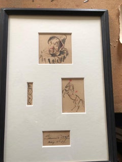
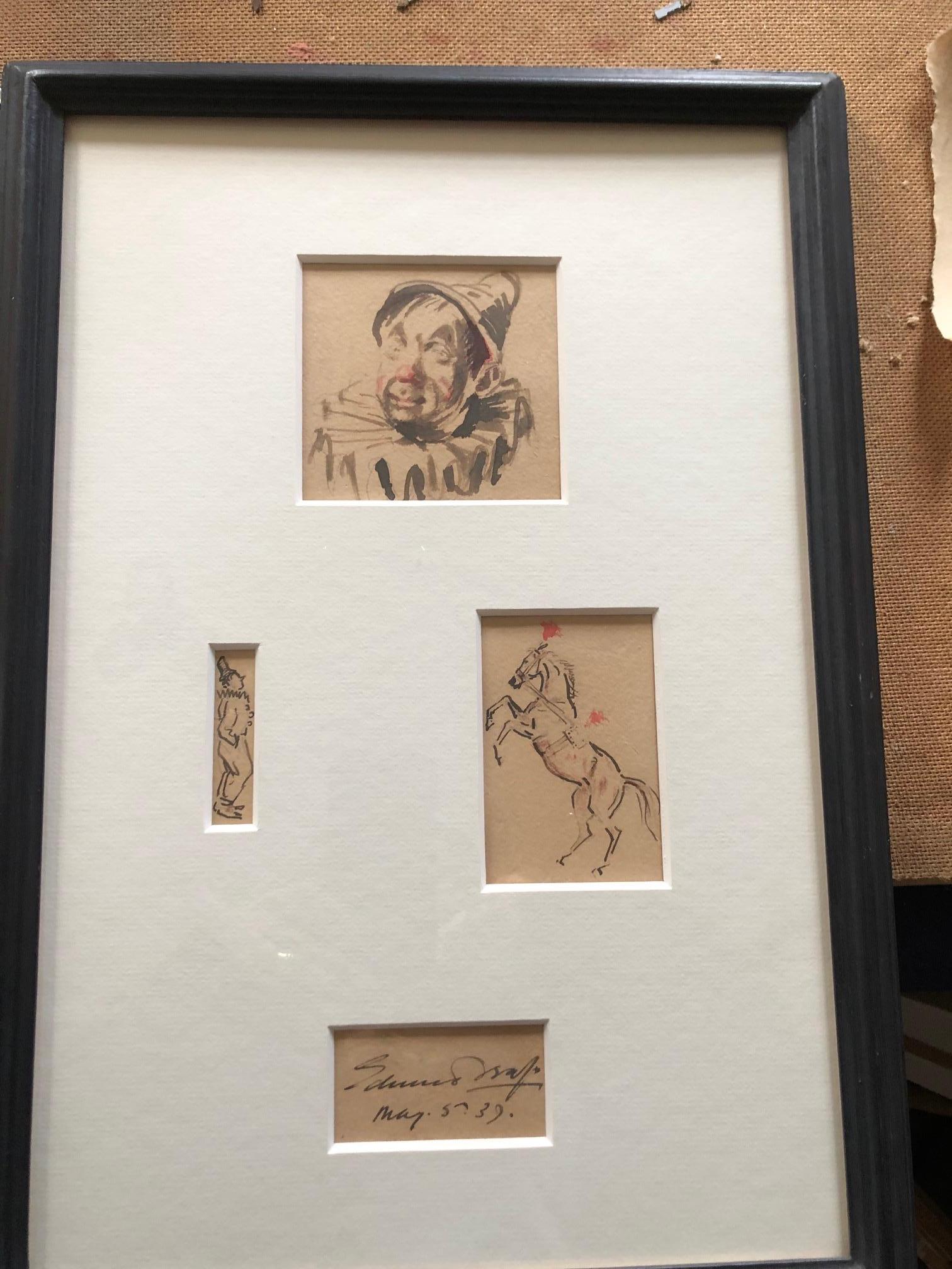
- Clowns and Circus Horse Watercolour StudyBy Edward SeagoLocated in ludlow, GBEdward Seago is a giant of 20th Century British paintings. He was collected by the Queen Mother, the Duke of Edinburgh and he taught Kin...Category
Early 20th Century Naturalistic Figurative Paintings
MaterialsWatercolor
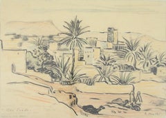
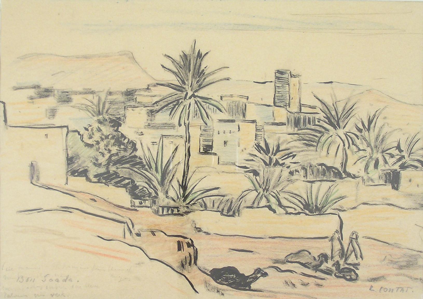
- Léonie Contat (1878 - 1969) Bou Saada, Algeria - Orientalist SwitzerlandLocated in Meinisberg, CHLéonie Contat (Swiss, * 12.9.1878 Montreux, † 27.7.1969 Köniz) Bou Saada, Algeria • Watercolour on Paper, mounted behind glased frame, ca. 42.5 x 50.5 cm •...Category
Mid-20th Century Naturalistic Landscape Drawings and Watercolors
MaterialsPaper, Ink, Watercolor
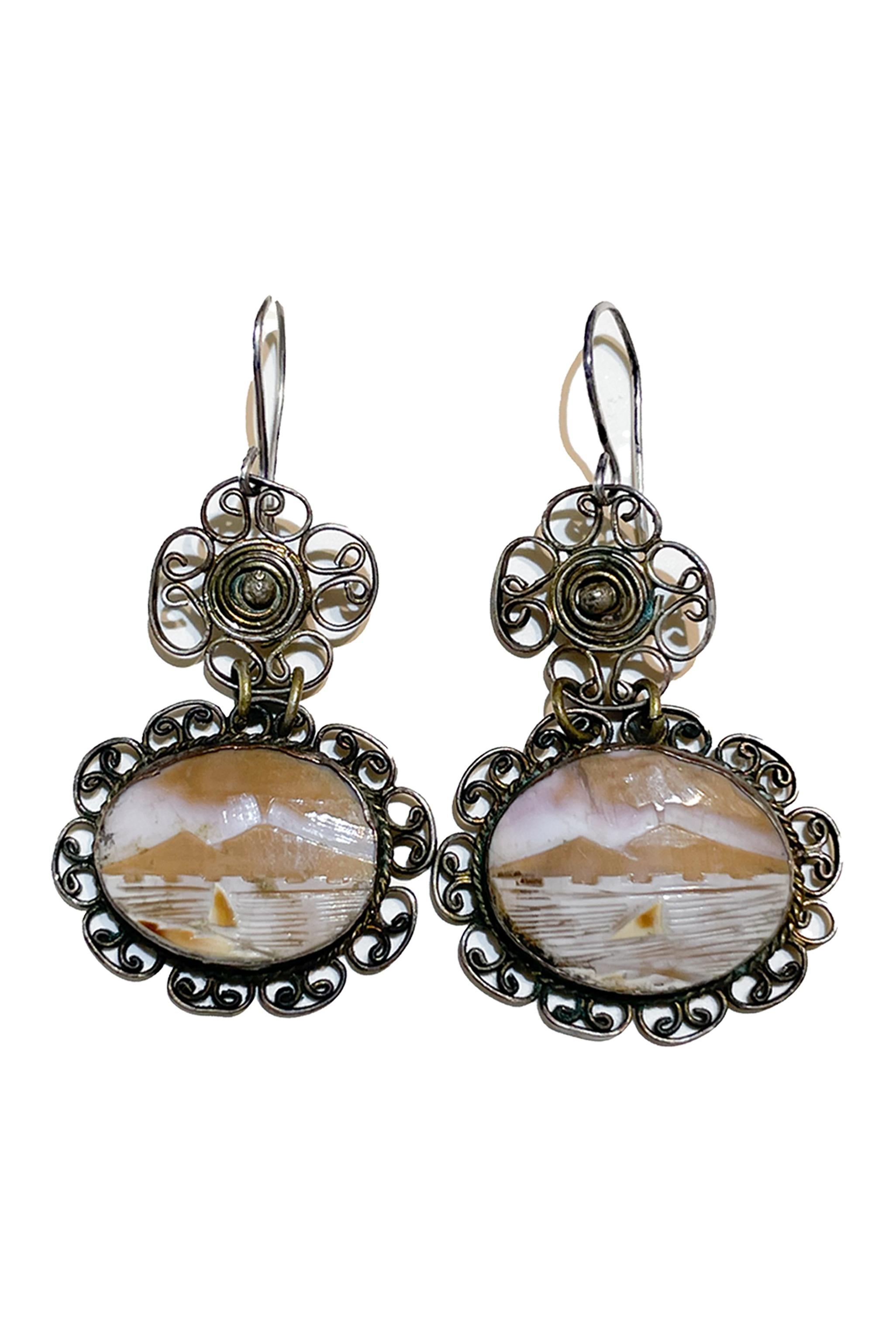
- Vintage shell cameo earringsLocated in Firenze, ITEarrings with cameos depicting Vesuvius and the sea with the sailing ship. Antique cameos, hand carved at the end of the 19th century. Cameo hand engraved on shell and filigree. Ital...Category
Late 19th Century Naturalistic More Art
MaterialsSteel

- Aegidius Sadeler II (1570 1629) 16thC Engraving - Woodland Scene with TravelersBy Aegidius Sadeler IILocated in Meinisberg, CHAegidius Sadeler (Flemish, 1570–1629) Romantic woodland scene with traveler and his laden mule passing by a seated figure resting on the roadside • 16th, possibly early 17th century • Copper plate engraving on laid paper with circular watermark • Trimmed sheet, ca. 17 x 21 cm • No bothersome stains, damages or restorations Worldwide shipping is complimentary - There are no additional charges for handling & delivery. Aegidius Sadeler also known as Aegidius Sadeler II was a prolific Flemish engraver who was principally active at the Prague court of Rudolf II. The scene engraved is after an image created by Roelant Savery (1576 - 1639). also known as Roeland(t) Maertensz Saverij, was a Flanders-born Dutch Golden Age painter. The print was published by the Sadeler family member Marco Sadeler...Category
16th Century Naturalistic Landscape Prints
MaterialsInk, Laid Paper, Engraving
- Don’t Come In, It’s a MessBy Shanna D'AntonioLocated in East Hampton, NY“Don’t Come In, It’s a Mess” oil and silver leaf on wood 28” x 9.5” framed About the Artist: Shanna E. D'Antonio is a mixed-media artist living and working in Hammond, Louisiana. ...Category
2010s Naturalistic Animal Paintings
MaterialsSilver