Items Similar to Antique Map of Australia and New Zealand, c.1860
Want more images or videos?
Request additional images or videos from the seller
1 of 6
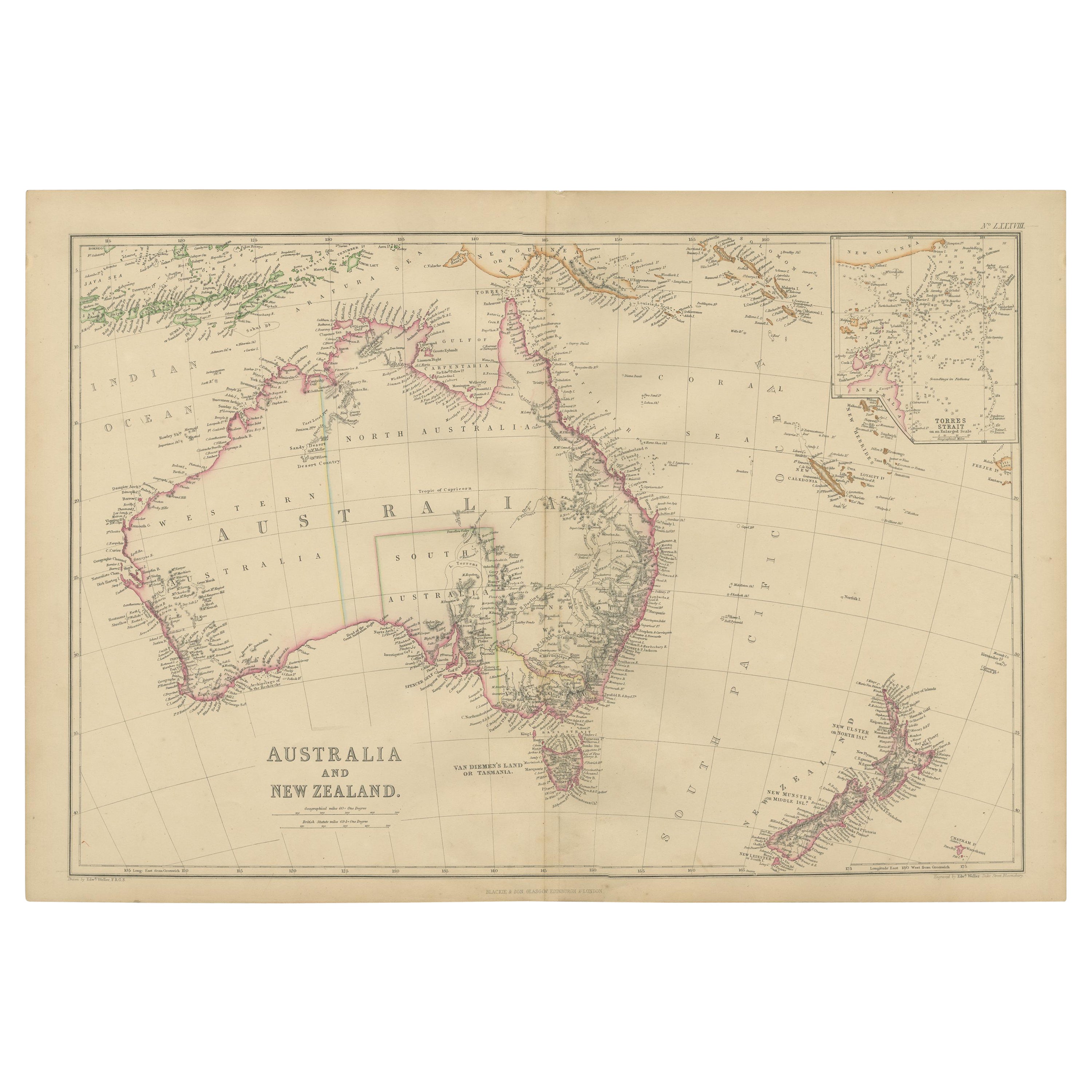
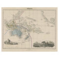
Antique Map of Australia and New Zealand, c.1860
About the Item
Antique map titled 'Australia and New Zealand'. Unusual edition of this map of Australia and New Zealand, on very thin paper and multiple folding lines. Source unknown, to be determined.
Artists and Engravers: Engraved by E. Weller. Published by Blackie & Son, Edinburgh & London.
Condition: Good, few tiny tears and repairs. Please study image carefully.
We sell original antique maps to collectors, historians, educators and interior decorators all over the world. Our collection includes a wide range of authentic antique maps from the 16th to the 20th centuries. Buying and collecting antique maps is a tradition that goes back hundreds of years. Antique maps have proved a richly rewarding investment over the past decade, thanks to a growing appreciation of their unique historical appeal. Today the decorative qualities of antique maps are widely recognized by interior designers who appreciate their beauty and design flexibility. Depending on the individual map, presentation, and context, a rare or antique map can be modern, traditional, abstract, figurative, serious or whimsical. We offer a wide range of authentic antique maps for any budget.
- Dimensions:Height: 14.97 in (38 cm)Width: 20.48 in (52 cm)Depth: 0 in (0.01 mm)
- Materials and Techniques:
- Period:
- Date of Manufacture:c.1860
- Condition:Repaired: Few tiny tears and repairs. Condition: Good, few tiny tears and repairs. Please study image carefully.
- Seller Location:Langweer, NL
- Reference Number:
About the Seller
5.0
Platinum Seller
These expertly vetted sellers are 1stDibs' most experienced sellers and are rated highest by our customers.
Established in 2009
1stDibs seller since 2017
1,916 sales on 1stDibs
Typical response time: <1 hour
- ShippingRetrieving quote...Ships From: Langweer, Netherlands
- Return PolicyA return for this item may be initiated within 14 days of delivery.
More From This SellerView All
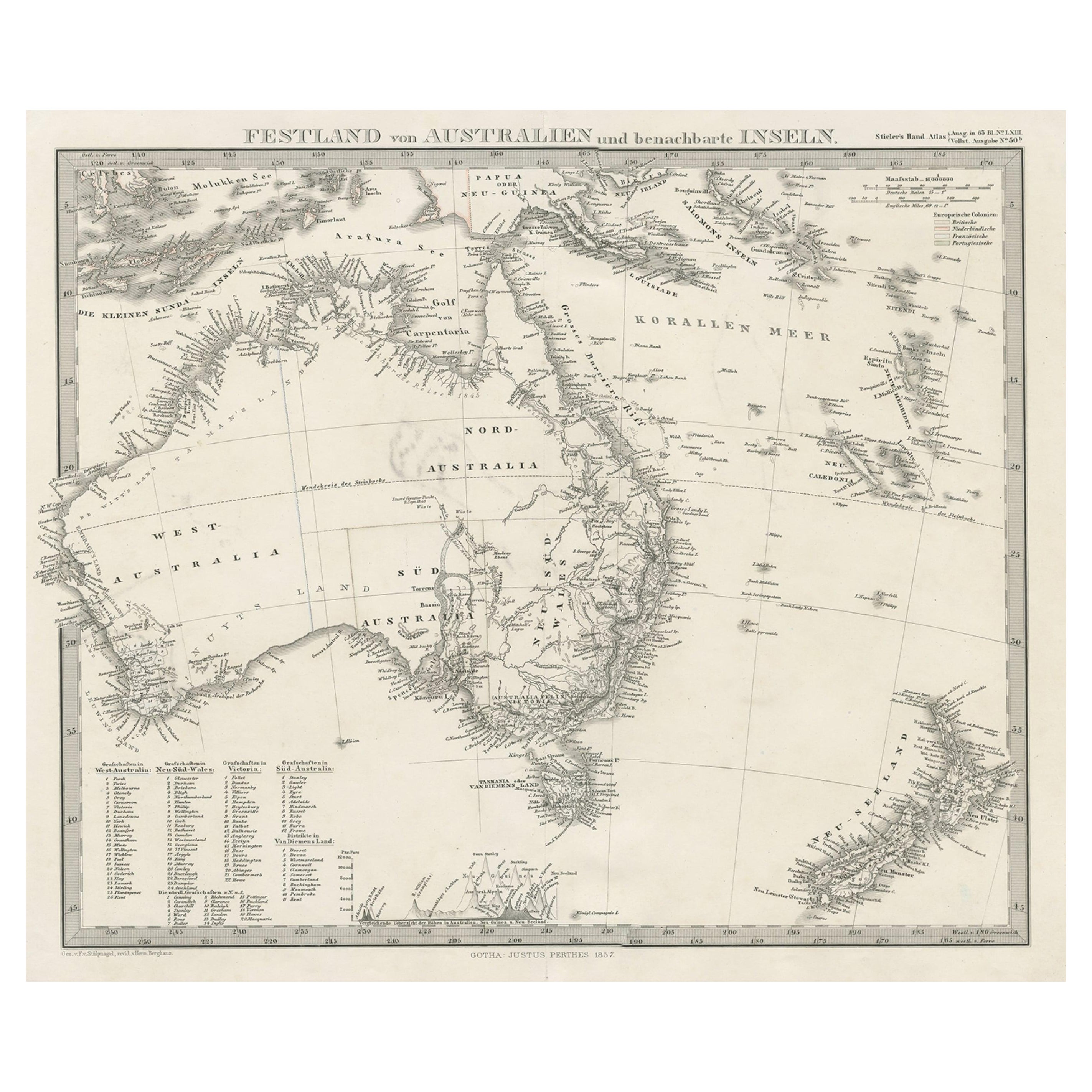
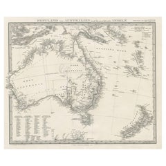
- German Antique Map of Australia and New Zealand, 1857Located in Langweer, NLAntique map Australia titled 'Festland von Australien und benachbarte Inseln'. Detailed map of Australia and New Zealand, including excellent det...Category
Antique 19th Century Maps
MaterialsPaper
- Antique Map of Australia and New Zealand by W. G. Blackie, 1859Located in Langweer, NLAntique map titled 'Australia and New Zealand'. Original antique map of Australia and New Zealand with inset map of the Torres Strait. This map originates from ‘The Imperial Atlas of...Category
Antique Mid-19th Century Maps
MaterialsPaper
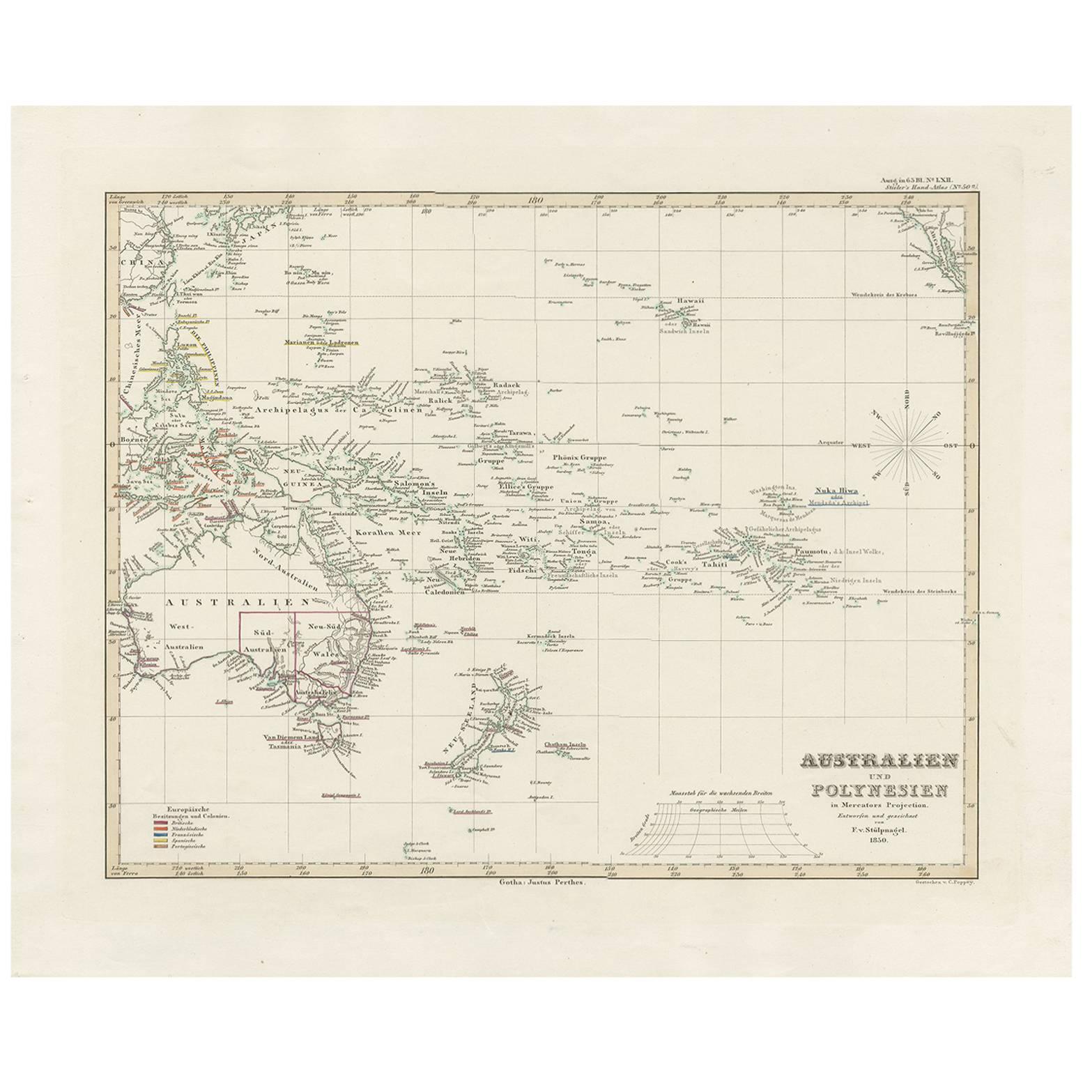
- Antique Map of Australia, New Zealand and Oceania by F. von Stülpnagel, 1850Located in Langweer, NLAntique map titled 'Australien und Polynesien in Mercators Projection'. A map of Australia, New Zealand and Oceania. This includes Fiji, Tahiti and several other island groups in the...Category
Antique Mid-19th Century Maps
MaterialsPaper
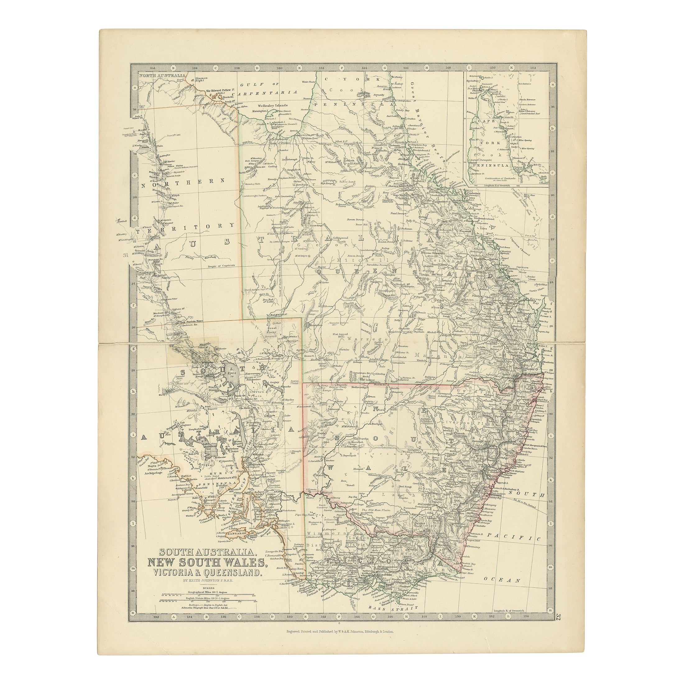
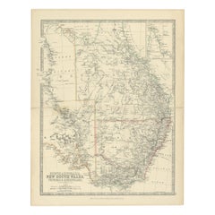
- Antique Map of South Australia, Victoria, Queensland and New South Wales, c.1860Located in Langweer, NLAntique map Australia titled 'South Australia, New South Wales, Victoria & Queensland'. Old map depicting South Australia including New South Wal...Category
Antique 19th Century Maps
MaterialsPaper
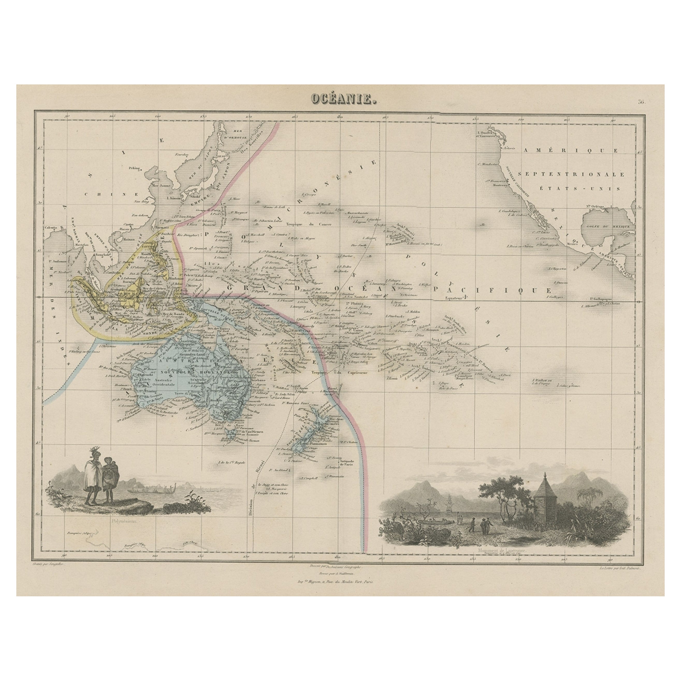
- Old Map of the Oceans Around Australia, Indonesia and New Zealand, 1880Located in Langweer, NLAntique map titled 'Océanie'. Old map of the oceans around Australia, Indonesia and New Zealand. With vignettes of people from Polynesia and the old monument Laparouse. This map ...Category
Antique 1880s Maps
MaterialsPaper
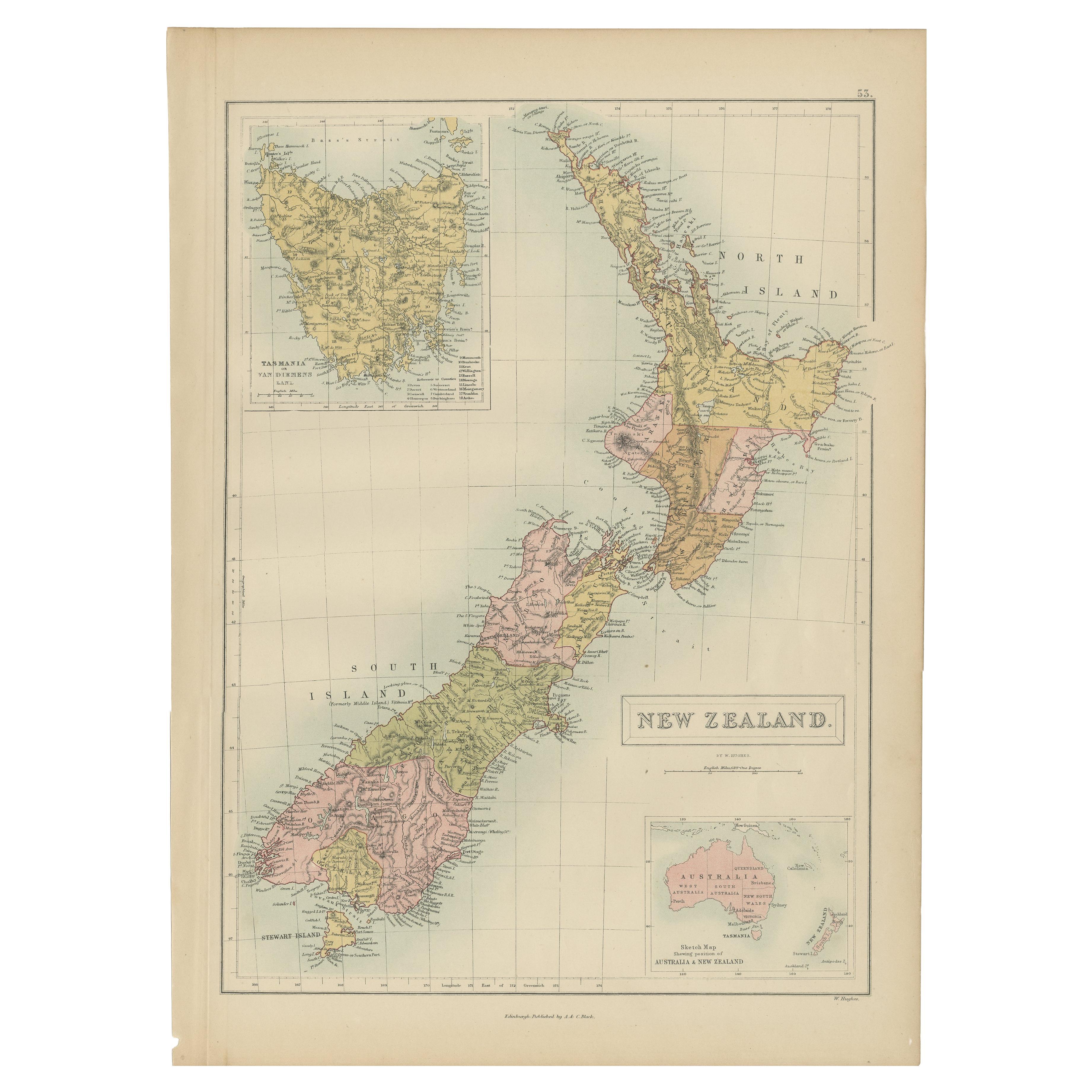
- Antique Map of New Zealand by A & C. Black, 1870Located in Langweer, NLAntique map titled 'New Zealand'. Original antique map of New Zealand with inset Maps of Australia, New Zealand and Tasmania. This map origi...Category
Antique Late 19th Century Maps
MaterialsPaper


You May Also Like
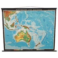
- Vintage Mural Map Rollable Wall Chart Poster Australia New Zealand IndonesiaLocated in Berghuelen, DEVintage Mural Map Rollable Wall Chart Poster Australia New Zealand Indonesia The vintage pull-down map shows Australia and Oceania, published by Haack-Painke Justus Perthes Darmstadt. Colorful print on paper reinforced with canvas. This wallchart is a wonderful holiday memory decoration item. Measurements: Width 122 cm (48.03 inch) Height 100 cm (39.37 inch) The measurements shown refer just to the canvas and do not include the poles. Background information on the history of school wall charts: The idea to upgrade every day school life by using pictures was supported in the late 18th century by Johann Bernhard Basedow. In 1774 he published a four-volume book "Elementarwerk" which combined pictures, text and information with merely hundred copperplates. Modern printing methods enabled the spread from rich private schools to rural grade schools...Category
Vintage 1970s German Country Posters
MaterialsCanvas, Wood, Paper
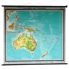
- Map Mural Rollable Poster Vintage Wall Chart Australia New Zealand PolynesiaLocated in Berghuelen, DEMap Mural Rollable Poster Vintage Wall Chart Australia New Zealand Polynesia A beautiful vintage school map illustrating the popular region of Aust...Category
Vintage 1970s German Country Posters
MaterialsCanvas, Wood, Paper
- Antique 1901 National Publishing Company's Road Map of New Jersey GeologicalLocated in Dayton, OHThe National Publishing Company's road map of New Jersey, showing all county and township divisions, cities villages and post-offices, railroads, ste...Category
Antique Early 1900s Victorian Prints
MaterialsPaper
- Antique Map of Principality of MonacoBy Antonio Vallardi EditoreLocated in Alessandria, PiemonteST/619 - "Old Geographical Atlas of Italy - Topographic map of ex-Principality of Monaco" - ediz Vallardi - Milano - A somewhat special edition ---Category
Antique Late 19th Century Italian Other Prints
MaterialsPaper
- Original Antique Map of Spain and Portugal, circa 1790Located in St Annes, LancashireSuper map of Spain and Portugal Copper plate engraving by A. Bell Published, circa 1790. Unframed.Category
Antique 1790s English Other Maps
MaterialsPaper
- Original Antique Map of Ireland- Tipperary and Waterford. C.1840Located in St Annes, LancashireGreat map of Tipperary and Waterford Steel engraving Drawn under the direction of A.Adlard Published by How and Parsons, C.1840 Unframed.Category
Antique 1840s English Maps
MaterialsPaper


Recently Viewed
View AllMore Ways To Browse
New Today
New Zealand Artist
Australian Designer Furniture
Australian Designers
19th Century Australian Furniture
Antique New Zealand
Antique Furniture New Zealand
New Zealand Antique Furniture
Antique Collectors Australia
Map Zealand
New Zealand Map
Map Of New Zealand
Antique New Zealand Map
Antique Maps New Zealand
New Zealand Antique Map
Antique Map Of New Zealand
Antique Map New Zealand
Used Nautical Charts