Items Similar to Antique Map of South Australia, Victoria, Queensland and New South Wales, c.1860


Want more images or videos?
Request additional images or videos from the seller
1 of 6
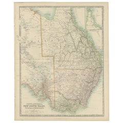
Antique Map of South Australia, Victoria, Queensland and New South Wales, c.1860
About the Item
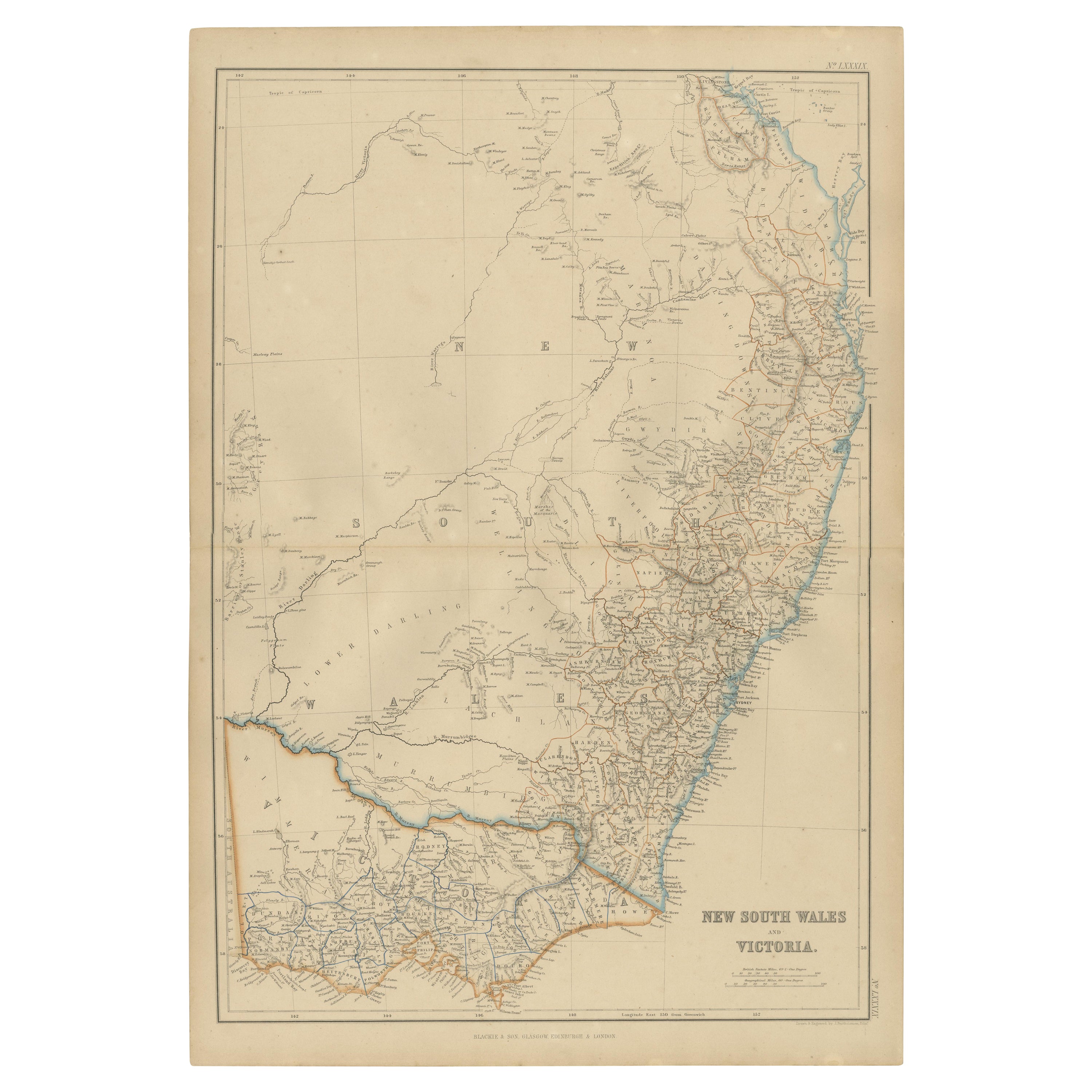
Antique map Australia titled 'South Australia, New South Wales, Victoria & Queensland'. Old map depicting South Australia including New South Wales, Victoria and Queensland. Orginates from Keith Johnston's 'General Atlas'.
Artists and Engravers: Engraved, printed and published by W. & A.K. Johnston.
Condition: Good, general age-related toning. Few tiny tears, please study image carefully.
Date: c.1860
Overall size: 37 x 47.5 cm.
Image size: 32 x 42.5 cm.
We sell original antique maps to collectors, historians, educators and interior decorators all over the world. Our collection includes a wide range of authentic antique maps from the 16th to the 20th centuries. Buying and collecting antique maps is a tradition that goes back hundreds of years. Antique maps have proved a richly rewarding investment over the past decade, thanks to a growing appreciation of their unique historical appeal. Today the decorative qualities of antique maps are widely recognized by interior designers who appreciate their beauty and design flexibility. Depending on the individual map, presentation, and context, a rare or antique map can be modern, traditional, abstract, figurative, serious or whimsical. We offer a wide range of authentic antique maps for any budget.
- Dimensions:Height: 18.71 in (47.5 cm)Width: 14.57 in (37 cm)Depth: 0 in (0.01 mm)
- Materials and Techniques:
- Period:
- Date of Manufacture:circa 1860
- Condition:Condition: Good, general age-related toning. Few tiny tears, please study image carefully.
- Seller Location:Langweer, NL
- Reference Number:
About the Seller
5.0
Platinum Seller
These expertly vetted sellers are 1stDibs' most experienced sellers and are rated highest by our customers.
Established in 2009
1stDibs seller since 2017
1,929 sales on 1stDibs
Typical response time: <1 hour
- ShippingRetrieving quote...Ships From: Langweer, Netherlands
- Return PolicyA return for this item may be initiated within 14 days of delivery.
More From This SellerView All
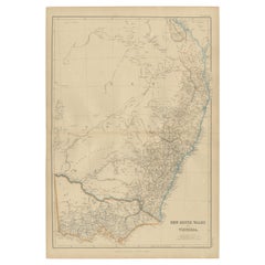
- Antique Detailed Map of New South Wales, Queensland & Victoria, Australia, 1865Located in Langweer, NLAntique map Australia titled 'South Australia, New South Wales, Victoria & Queensland'. Old map depicting South Australia including New South Wal...Category
Antique 19th Century Maps
MaterialsPaper
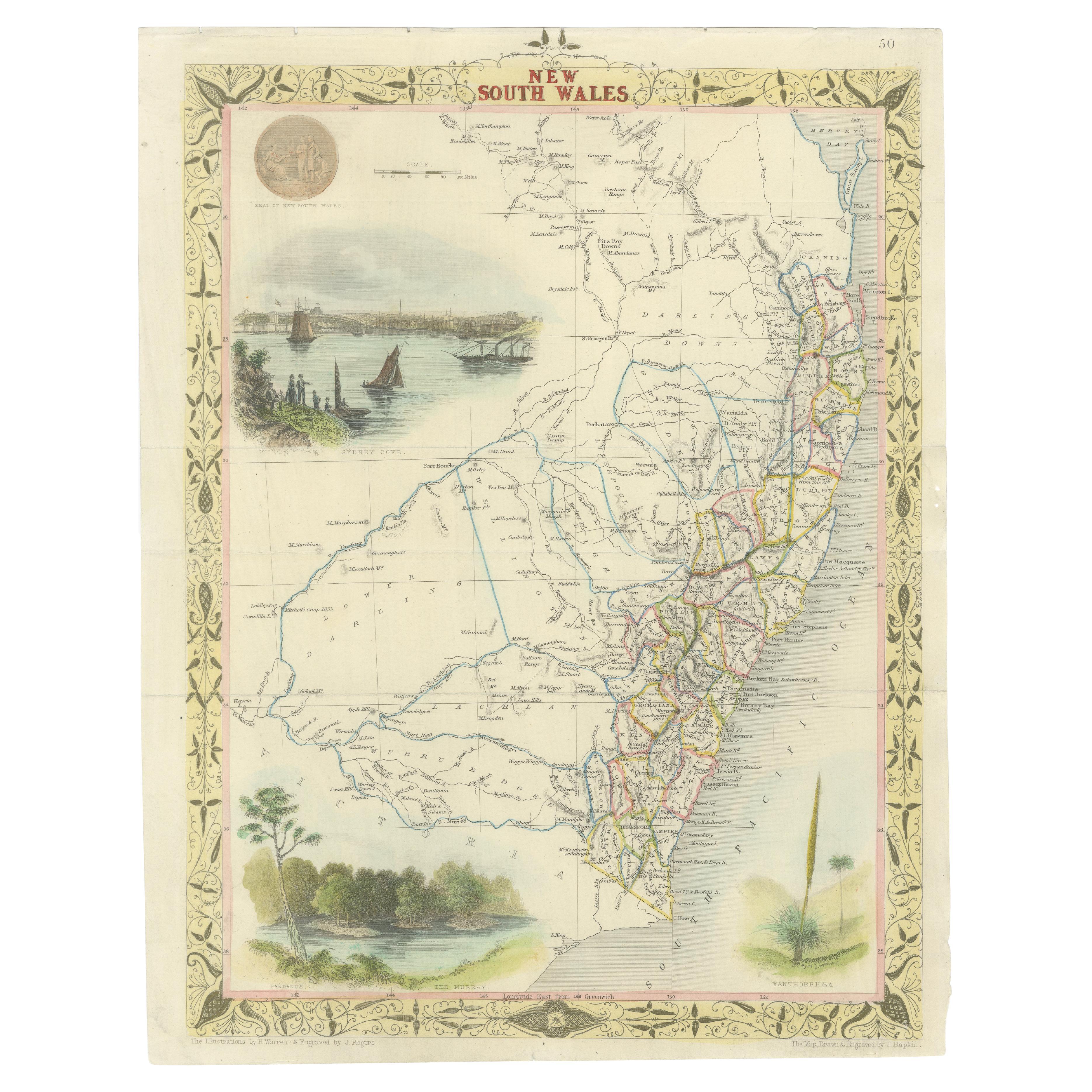
- Antique Map of New South Wales and Victoria by W. G. Blackie, 1859Located in Langweer, NLAntique map titled 'New South Wales and Victoria'. Original antique map of New South Wales and Victoria. This map originates from ‘The Imperial Atlas of Modern Geography’. Published ...Category
Antique Mid-19th Century Maps
MaterialsPaper
- Antique Map of New South Wales 'Australia' by Wyld '1845'Located in Langweer, NLAntique map titled 'British Settlements in New South Wales'. Original antique map of New South Wales, Australia. This map originates from 'An Atlas of ...Category
Antique Mid-19th Century Maps
MaterialsPaper
- Antique Map of New South Wales in Australia, ca. 1850Located in Langweer, NLAntique map of Victoria, or Port Phillip (12.7 x 10.0") in Australia. Superb map of Victoria roughly centered on Melbourne. Vignettes of Aborigines, a ...Category
Antique Mid-19th Century European Maps
MaterialsPaper
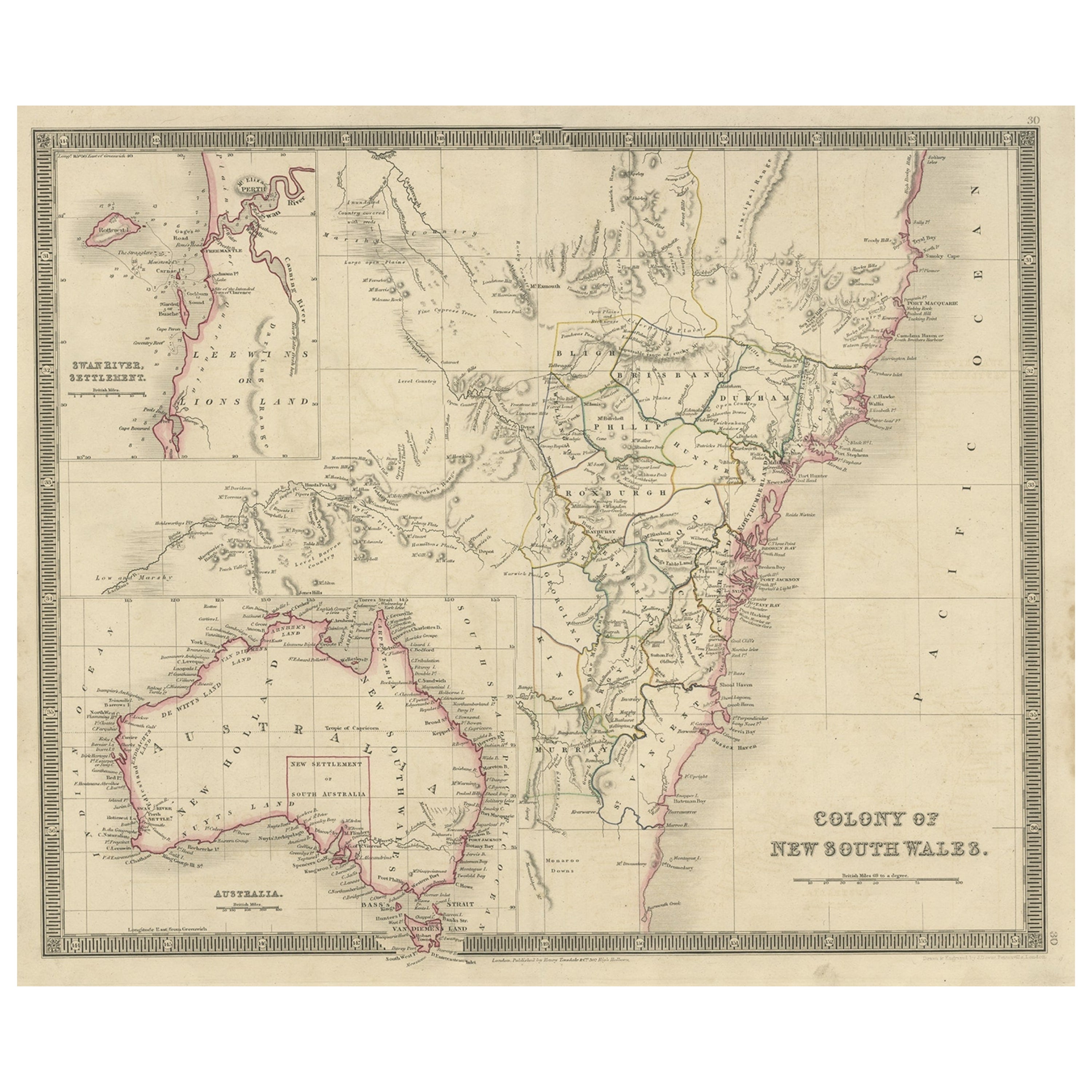
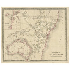
- Antique Map of New South Wales with Inset Maps of Australia and Swan River, 1854Located in Langweer, NLAntique map titled 'Colony of New South Wales'. Map of New South Wales with inset maps of Australia and Swan River. Artists and Engravers: Drawn and engrave...Category
Antique 19th Century Maps
MaterialsPaper
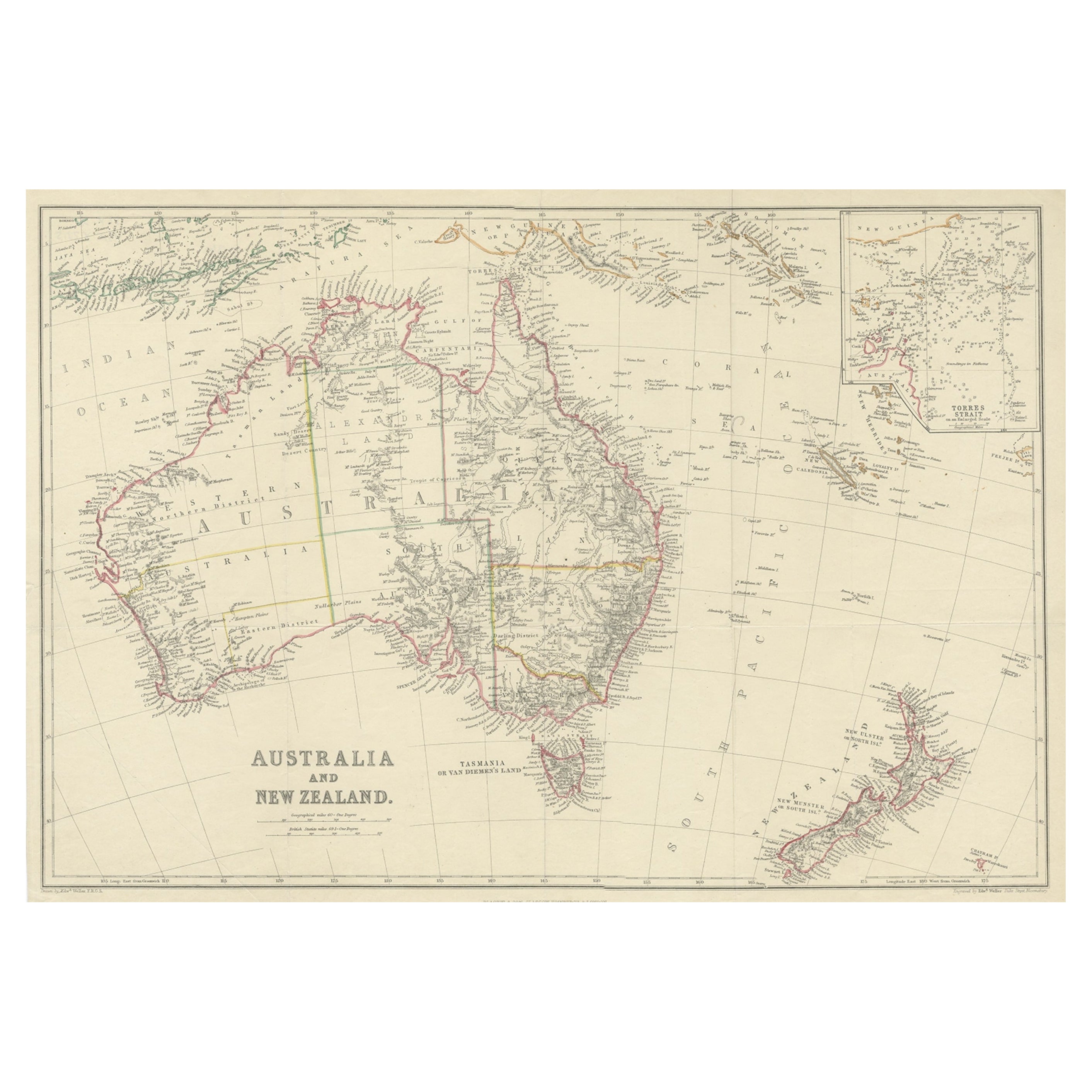
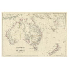
- Antique Map of Australia and New Zealand, c.1860Located in Langweer, NLAntique map titled 'Australia and New Zealand'. Unusual edition of this map of Australia and New Zealand, on very thin paper and multiple folding lines. Source unknown, to be determi...Category
Antique 19th Century Maps
MaterialsPaper


You May Also Like
- Large Original Vintage Map of New South Wales, Australia, circa 1920Located in St Annes, LancashireGreat map of New South Wales Original color. Good condition Published by Alexander Gross Unframed.Category
Vintage 1920s English Edwardian Maps
MaterialsPaper
- Original Antique Map of South America, circa 1830Located in St Annes, LancashireGreat map of South America Copper plate engraving Published by Butterworth, Livesey & Co., circa 1830 Unframed.Category
Antique Early 1800s English Other Maps
MaterialsPaper
- Original Antique Map of South Africa, Arrowsmith, 1820Located in St Annes, LancashireGreat map of South Africa. Drawn under the direction of Arrowsmith. Copper-plate engraving. Published by Longman, Hurst, Rees, Orme and Br...Category
Antique 1820s English Maps
MaterialsPaper
- Original Antique Map of South East Asia, Arrowsmith, 1820Located in St Annes, LancashireGreat map of South East Asia Drawn under the direction of Arrowsmith Copper-plate engraving Published by Longman, Hurst, Rees, Orme and Brown, 1820 Unframed.Category
Antique 1820s English Maps
MaterialsPaper
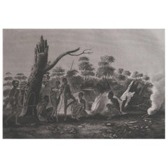
- Original Antique Ethnographical Print, Figures, New South Wales, Australia, 1809Located in St Annes, LancashireWonderful ethnographical print. A copper-plate engraving after Lesieur Published by Sherwood, Neely & Jones. Dated 1809 Unframed.Category
Antique Early 1800s English Folk Art Prints
MaterialsPaper
- Original Antique Map of South America by Thomas Clerk, 1817Located in St Annes, LancashireGreat map of South America Copper-plate engraving Drawn and engraved by Thomas Clerk, Edinburgh. Published by Mackenzie And Dent, 1817 Unframed.Category
Antique 1810s English Maps
MaterialsPaper


Recently Viewed
View AllMore Ways To Browse
Furniture Used Victoria
Used Victoria Furniture
Victoria Antique Furniture
Used Victoria Antiques
Australian Designer Furniture
Used Victoria Furniture Antiques
Used Victoria Antique Furniture
19th Century Australian Furniture
Used Furniture South Wales
Antique Furniture South Wales
Maps Wales
Map Of Wales
Antique Collectors Australia
Antique Maps Wales
Antique Map Wales
Antique Map Of Wales
Antique Maps Of Wales
Map Of Victoria