Large Maps On Paper

26
739
19
17
to
107
558
215
775
760
760
13
9
8
5
5
5
5
3
2
1
1
1
331
183
225
36
45
106
50
14
9
11
23
18
23
17
17
6
3
751
93
87
62
31
255
127
127
86
71
9
9
4
4
4
Sort By
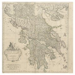
Large Scale Map of Greece with Inset Map of Macedonia, c.1786
Located in Langweer, NL
Antique map titled 'Graeciae Antiquae'. Large scale map of Greece, extends south to the island of
Category

Antique 18th Century Maps

Materials

Paper

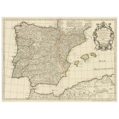
Large Decorative Map of the Iberian Peninsula
Located in Langweer, NL
Antique map titled 'L'Espagne (..)'. Large map of the Iberian Peninsula, including the Balearic
Category

Antique Mid-18th Century Maps

Materials

Paper

 Large Decorative Map of the Iberian Peninsula
 Large Decorative Map of the Iberian Peninsula
Free Shipping
H 19.61 in W 26.3 in D 0.02 in
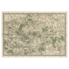
Large Folding Map of Paris, France, on Linen, 36 Segments, Published in 1836
Located in Langweer, NL
Antique map Paris titled 'Carte Topographique des Environs de Paris Nouvelle edition rectifié
Category

Antique 1830s Maps

Materials

Paper

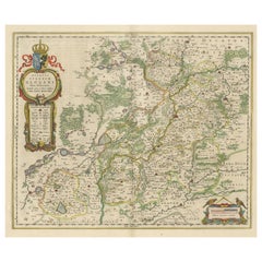
Antique Map of Silesia centered on Glogau
Located in Langweer, NL
Antique map titled 'Ducatus Silesiae Glogani vera delineatio'. This decorative map shows the Odra
Category

Antique Mid-17th Century Maps

Materials

Paper

Antique Map of Silesia centered on Glogau
H 19.97 in W 23.51 in D 0.02 in
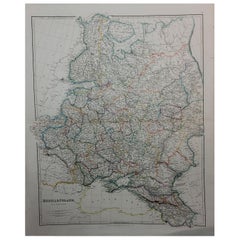
1832 Large Map "Russian & Poland" Ric. R0012
Located in Norton, MA
Large map 1832 "Russian & Poland" Ric.r0012 Russia & Poland, by J. Arrowsmith. London, pubd
Category

Antique 19th Century Unknown Maps

Materials

Paper

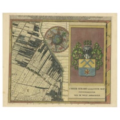
Large Antique Map of Delfland by Cruquius, 1712
Located in Langweer, NL
Map no. 20 of a large wall map of Delfland, The Netherlands. The map covers the region of Pijnacker
Category

Antique 18th Century Maps

Materials

Paper

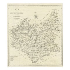
Large Antique County Map of Leicestershire, England, 1805
Located in Langweer, NL
Explore Leicestershire's Past: Antique Map by John Cary Step into the history of Leicestershire
Category

Antique Early 19th Century Maps

Materials

Paper

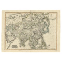
Large Antique Map of the Asian Continent, 1814
Located in Langweer, NL
Antique map titled 'Asia'. Large antique map of the Asian continent. Drawn under the direction of
Category

Antique 19th Century Maps

Materials

Paper

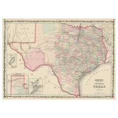
Large Antique Map of the State of Texas, 1861
Located in Langweer, NL
Antique map titled 'Johnson's New Map of the State of Texas' Large map of Texas, shows railroads
Category

Antique Mid-19th Century Maps

Materials

Paper

Large Antique Map of the State of Texas, 1861
Free Shipping
H 18.04 in W 26.58 in D 0.02 in
Antique Detailed World Map Drawn on Mercator's Projection, 1700
Located in Langweer, NL
Antique world map titled 'Carte generale du monde, ou description du monde terrestre & Aquatique
Category

Antique 17th Century Maps

Materials

Paper

Large Antique Map of Denmark by Bowles, c.1780
By Thomas
Located in Langweer, NL
Antique map titled 'Bowles's new pocket map of the Kingdom of Denmark (..)' Large map of Denmark
Category

Antique 18th Century Maps

Materials

Paper

Large Decorative Antique Map of the Mediterranean, ca.1770
Located in Langweer, NL
fine engraved double-page and folding maps that join to create a large wall map of the Mediterranean
Category

Antique 1770s Maps

Materials

Paper

Large Original Antique Map of Massachusetts, USA, circa 1900
Located in St Annes, Lancashire
Fabulous map of Massachusetts In 2 sheets. They can be joined but I have not done it Original
Category

Antique 1890s American Maps

Materials

Paper

Large Original Antique Map of Colorado, USA circa 1900
Located in St Annes, Lancashire
Fabulous map of Colorado Original color Engraved and printed by the George F. Cram Company
Category

Antique 1890s American Maps

Materials

Paper

Large Original Antique Map of Colorado, USA circa 1900
No Reserve
H 14.75 in W 22 in D 0.07 in
Large Detailed Map of Australia Wint Inset of Tasmania, 1937
Located in Langweer, NL
Antique map titled 'Australia'. Large folding map of Australia. With inset map of Tasmania. Printed
Category

20th Century Maps

Materials

Paper

Large Antique Map of France by De Wit, c.1680
By Frederick de Wit
Located in Langweer, NL
Antique map titled 'Accuratissima Galliae Tabula vulgo Royaume de France'. Detailed map of France
Category

Antique 17th Century Maps

Materials

Paper

Large Original Antique Folding Map of Manchester, England, Dated 1793
Located in St Annes, Lancashire
Superb map of Manchester and Salford Folding map. Printed on paper laid on to the original
Category

Antique 1790s English Georgian Maps

Materials

Canvas, Paper

Large Scale Antique Scroll Map of Lincolnshire, England, Dated 1778
Located in St Annes, Lancashire
paper laid on canvas Original ebonized wood frame with lovely turned finials The map can be rolled
Category

Antique 1770s English Georgian Maps

Materials

Wood, Paper

Large Original Vintage Map of The South Pacific, circa 1920
Located in St Annes, Lancashire
Great map of The South Pacific Original color. Good condition / repairs to minor edge tears
Category

Vintage 1920s English Edwardian Maps

Materials

Paper

Antique Map of the Area centered on the Rhine River, Germany
Located in Langweer, NL
. The map also covers a large stretch of the Moselle River (from Nancy to Coblentz) and the Main River
Category

Antique Early 18th Century Maps

Materials

Paper

Large Map of Castile's Southern Realms - Granada, Andalusia, and Murcia, 1652
Located in Langweer, NL
This antique map, titled 'Les Etats de la Couronne de Castille', represents the southern regions of
Category

Antique Mid-17th Century Maps

Materials

Paper

Large Antique Wall Map of Friesland by Vegelin van Claerbergen, 1739
Located in Langweer, NL
. Heeren Gedeputeerde Staeten'. Rare and large attractive wall map of Friesland, the so-called 'Vegelin
Category

Antique 18th Century Maps

Materials

Paper

Large Original Antique Map of Java and Borneo, Fullarton, C.1870
Located in St Annes, Lancashire
Great map of Java and Borneo Wonderful figurative borders From the celebrated Royal Illustrated
Category

Antique 1870s Scottish Maps

Materials

Paper

Large Antique Map of Bass Strait, Tasmania, Australia by Cook, 1803
Located in Langweer, NL
Antique map Australia titled 'Kaart van Basses Straat tusschen Nieuw Zuid Wales en van Diemensland
Category

Antique 19th Century Maps

Materials

Paper

Large Wall Map of Europe by George Philip & Son, circa 1920
Located in Langweer, NL
Antique map titled 'Philips' New Commercial Map of Europe'. Very large wall map of Europe including
Category

Early 20th Century Maps

Materials

Linen, Paper

Large Wall Map of Europe by George Philip & Son, circa 1920
No Reserve
H 72.05 in W 66.15 in D 0.02 in
Large Antique Map of the City of Bremen and Surroundings, Germany
Located in Langweer, NL
Original antique map titled 'Prospect und Grundris der Keiserl Freyen Reichs und Ansee Stadt Bremen
Category

Antique Early 18th Century Maps

Materials

Paper

Large Original Vintage Map of New Zealand, South Island, circa 1920
Located in St Annes, Lancashire
Great map of South Island, New Zealand Original color. Good condition / repair to a minor
Category

Vintage 1920s English Edwardian Maps

Materials

Paper

Large Antique Map of Asia including All of Southeast Asia, c.1792
Located in Langweer, NL
Antique map titled 'L' Asie Divisee en ses Empires, Royaumes, et Etats'. Attractive, large map of
Category

Antique 18th Century Maps

Materials

Paper

Large Original Antique Map of the Dutchy of Holstein, Germany, ca.1840
Located in Langweer, NL
Antique map titled 'A Map of the Dutchy of Holstein, with the Territories of the Imperial Towns
Category

Antique 1840s Maps

Materials

Paper

Rare Authentic Engraved Map of Large Part of Indonesia by Stavorinus, 1779
Located in Langweer, NL
Antique map titled 'Carte de la Navigation de Batavia a Amboina'. Rare chart of Indonesia including
Category

Antique 18th Century Maps

Materials

Paper

Portugal: A Large 17th Century Hand-colored Map by Sanson and Jaillot
By Nicolas Sanson
Located in Alamo, CA
This large hand-colored map entitled "Le Royaume de Portugal et des Algarves Divisee en see
Category

Antique 1690s French Maps

Materials

Paper

Africa: A Large 17th Century Hand-Colored Map by Sanson and Jaillot
By Nicolas Sanson
Located in Alamo, CA
This large original hand-colored copperplate engraved map of Africa entitled "L'Afrique divisee
Category

Antique 1690s French Maps

Materials

Paper

Antique Map of Denmark with an Inset Map of Iceland, 1832
Located in Langweer, NL
Antique map titled 'Denmark'. Large map of Denmark with an inset map of Iceland. Artists and
Category

Antique 19th Century Maps

Materials

Paper

Antique Map of the Area centered on the Rhine River with original coloring
Located in Langweer, NL
on the Rhine River, from Strassbourg to Wesel and Duisburg, Germany. The map also covers a large
Category

Antique Early 18th Century Maps

Materials

Paper

Large and Rare Antique Map of Northern India in Original Coloring, c.1825
Located in Langweer, NL
Antique map titled 'No. 82 Pays d'Ajemeer d'Agra'. Detailed map of Northern India. Originates from
Category

Antique 19th Century Maps

Materials

Paper

Antique Map of England and London with Two Large Allegorical Views, c.1720
Located in Langweer, NL
, with map of England and two large allegorical views. This map originates from Chatelain's 'Atlas
Category

Antique 18th Century Maps

Materials

Paper

"Clason's Guide Map of Montana" by The Clason Map Company, Circa 1920s
Located in Colorado Springs, CO
locations throughout Montana, each circled in navy. On the right hand side of the map is a large index, to
Category

Vintage 1920s American Art Deco Maps

Materials

Paper

Large Antique Map of the Lower Nile Valley Including Egypt and Nubia, 1842
Located in Langweer, NL
Antique map titled 'Carte de l'Égypte, de la Nubie, de l'Abissinie'. Map of Egypt, covering the
Category

Antique 19th Century Maps

Materials

Paper

Antique Hemisphere Map of the World 'Two on One Sheet' by Levasseur, '1875'
Located in Langweer, NL
la projection polaire'. Large map with two hemisphere world maps on one sheet. This map originates
Category

Antique Late 19th Century Maps

Materials

Paper

Antique Map of the Savoy and Piedmont Regions, Centered on Torino, ca.1735
Located in Langweer, NL
publishing in Germany. Apart from the atlases the firm published a very large number of individual maps. The
Category

Antique 1730s Maps

Materials

Paper

Vienna, Austria: A Large 17th Century Hand-Colored Map by Sanson and Jaillot
By Nicolas Sanson
Located in Alamo, CA
This large 17th century hand-colored map of Vienna, Austria and the surrounding countryside and
Category

Antique 1690s French Maps

Materials

Paper

Large Italian Map of Islands of Oceania, incl Papua, Timor, Banda, Ceram, 1855
Located in Langweer, NL
Description: Antique map titled 'Carta di una parte dell'Oceania'. Beautiful large map of the
Category

Antique 1850s Maps

Materials

Paper

Southern & Eastern Europe: A Large 17th C. Hand-colored Map by Sanson & Jaillot
By Nicolas Sanson
Located in Alamo, CA
This large hand-colored map entitled "Estats de L'Empire des Turqs en Europe, ou sont les
Category

Antique 1690s French Maps

Materials

Paper

Southern Greece: A Large 17th C. Hand-colored Map by Sanson and Jaillot
By Nicolas Sanson
Located in Alamo, CA
This large original hand-colored copperplate engraved map of southern Greece and the Pelopponese
Category

Antique 1690s French Maps

Materials

Paper

Old Map of the American Railroad Network and All Weather Roads on Verso, 1931
Located in Langweer, NL
This is the “New Census Edition” of Clason’s United States Green Guide. It features two large maps
Category

Vintage 1930s Maps

Materials

Paper

Antique Map of Asia, 1846
Located in Langweer, NL
Antique map titled 'Asie'. Original antique map of Asia. Source unknown, to be determined
Category

Antique 19th Century Maps

Materials

Paper

Antique Map of Asia, 1846
H 9.85 in W 12.41 in D 0 in
Antique Map of Scotland With an Inset Map of the Shetland Islands, 1854
Located in Langweer, NL
: Large Antique map titled 'Scotland with its Islands, drawn from the Topographical surveys by James Wyld
Category

Antique 1850s Maps

Materials

Paper

Map of Duchy of Brabant Centered on Fortress of Louvain or Leuven, Belgium, 1720
Located in Langweer, NL
published a very large number of individual maps. The Homanns produced a Neuer Atlas in 1714, a Grosser
Category

Antique 1720s Maps

Materials

Paper

Large Antique Map of Asia The Royal Atlas of Modern Geography by Johnston, 1882
Located in Langweer, NL
Antique map titled 'Asia'. Old map of the Asian continent. This map originates from 'The Royal
Category

Antique 19th Century Maps

Materials

Paper

Spectacular Large Map of Upper and Lower Austria between Passau and Wien, c.1700
Located in Langweer, NL
Antique map titled 'Austriae Archiducatus pars superior in omnes ejusdem (..).' Spectacular large
Category

Antique Early 1700s Maps

Materials

Paper

Beautiful Large Scale Map of Spain and Portugal Published by Herman Moll in 1711
Located in Langweer, NL
issued quatrefolds, surface dirt, minor creasing throughout,. Large engraved map on two conjoined sheets
Category

Antique 1710s Maps

Materials

Paper

Old Decorative Map of Austria, Centered on the Danube River and Vienna, Ca.1720
Located in Langweer, NL
atlases the firm published a very large number of individual maps. The Homanns produced a Neuer Atlas in
Category

Antique 1720s Maps

Materials

Paper

Old Map of Prussia, Embellished with a Large Cartouche and Compass Rose, ca.1680
Located in Langweer, NL
Antique map titled 'Prussiae nova Tabula'. Later edition of Blaeu's map of Prussia, embellished
Category

Antique 1680s Maps

Materials

Paper

Large Antique Map of New Guinea and New Britain Showing Capt. Cooks Tract, 1773
Located in Langweer, NL
Antique map titled 'A Chart of Captain Carteret's Discoveries at New Britain, with part of Captain
Category

Antique 18th Century Maps

Materials

Paper

Antique Map of New Zealand, 1895
Located in Langweer, NL
Antique map titled 'Neu-Seeland.' Map of New Zealand. With inset maps of the large cities. This
Category

Antique 19th Century Maps

Materials

Paper

Antique Map of New Zealand, 1895
H 9.65 in W 6.3 in D 0 in
Old Map of Southern Australia, with an Inset Map of Cape York Peninsula, 1882
Located in Langweer, NL
Antique map titled 'South Australia, New South Wales, Victoria & Queensland'. Old map of
Category

Antique 1880s Maps

Materials

Paper

1812 United States Map, by Pierre Tardieu, Antique French Map Depicting the U.S.
By Pierre François Tardieu
Located in Colorado Springs, CO
Map by Tardieu This attractive map, published in Paris in 1812, is one of the most rare large
Category

Antique 1810s French Maps

Materials

Paper

Large1852 Map "Russian Empire" Ric.r0011
Located in Norton, MA
Large 1852 map "Russian Empire" George Phillips & Son 1852 Ric.r0011 Dimension: Paper: 67 cm
Category

Antique 19th Century Unknown Maps

Materials

Paper

Antique Map of Greece with an Inset Map of the Upper Danube Region, c.1720
Located in Langweer, NL
on map publishing in Germany. Apart from the atlases the firm published a very large number of
Category

Antique 18th Century Maps

Materials

Paper

Antique Map of Delfland by Cruquius, 1712
Located in Langweer, NL
Map no. 25 of a large wall map of Delfland, The Netherlands. The map covers the region of Polder
Category

Antique 18th Century Maps

Materials

Paper

  • 1
  • ...
Get Updated with New Arrivals
Save "Large Maps On Paper", and we’ll notify you when there are new listings in this category.

Large Maps On Paper For Sale on 1stDibs

With a vast inventory of beautiful furniture at 1stDibs, we’ve got just the large maps on paper you’re looking for. Each large maps on paper for sale was constructed with extraordinary care, often using paper, fabric and wood. If you’re shopping for a large maps on paper, we have 603 options in-stock, while there are 18 modern editions to choose from as well. There are many kinds of the large maps on paper you’re looking for, from those produced as long ago as the 18th Century to those made as recently as the 21st Century. A large maps on paper, designed in the Baroque, mid-century modern or Art Deco style, is generally a popular piece of furniture. You’ll likely find more than one large maps on paper that is appealing in its simplicity, but Nicolas Sanson, Homann Heirs and Johannes Janssonius produced versions that are worth a look.

How Much is a Large Maps On Paper?

Prices for a large maps on paper can differ depending upon size, time period and other attributes — at 1stDibs, they begin at $35 and can go as high as $250,000, while the average can fetch as much as $712.

Read More

Pamela Shamshiri Shares the Secrets behind Her First-Ever Book and Its Effortlessly Cool Interiors

The sought-after designer worked with the team at Hoffman Creative to produce a monograph that beautifully showcases some of Studio Shamshiri's most inspiring projects.

Moroccan Artworks and Objects Take Center Stage in an Extraordinary Villa in Tangier

Italian writer and collector Umberto Pasti opens the doors to his remarkable cave of wonders in North Africa.

Montecito Has Drawn Royalty and Celebrities, and These Homes Are Proof of Its Allure

Hollywood A-listers, ex-pat aristocrats and art collectors and style setters of all stripes appreciate the allure of the coastal California hamlet — much on our minds after recent winter floods.

Whaam! Blam! Pow! — a New Book on Pop Art Packs a Punch

Publishing house Assouline and writer Julie Belcove have teamed up to trace the history of the genre, from Roy Lichtenstein, Andy Warhol and Yayoi Kusama to Mickalene Thomas and Jeff Koons.

The Sparkling Legacy of Tiffany & Co. Explained, One Jewel at a Time

A gorgeous new book celebrates — and memorializes — the iconic jeweler’s rich heritage.

What Makes a Gem-Encrusted Chess Set Worth $4 Million?

The world’s most opulent chess set, weighing in at 513 carats, is literally fit for a king and queen.

Tauba Auerbach’s Geometric Pop-Up Book Is Mighty Rare, Thanks to a Hurricane

This sculptural art book has an epic backstory of its own.

Step inside the Storied Mansions of Palm Beach’s Most Effervescent Architect

From Spanish-style courtyards to fanciful fountains, these acclaimed structures abound in surprising and elegant details.