Items Similar to Large Map of Castile's Southern Realms - Granada, Andalusia, and Murcia, 1652

Want more images or videos?
Request additional images or videos from the seller
1 of 7
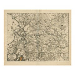
Large Map of Castile's Southern Realms - Granada, Andalusia, and Murcia, 1652
About the Item
This antique map, titled 'Les Etats de la Couronne de Castille', represents the southern regions of the Crown of Castile, specifically the territories of Andalusia, Granada, and Murcia. Created by the renowned French cartographer Nicolas Sanson and published by Pierre Mariette, it is a piece dating back to around 1652.
The map is intricately detailed, featuring the names of many towns and geographical features in a dense, script-like font. The boundaries of each region are outlined in colored lines, with Andalusia, Granada, and Murcia distinctly marked. Major rivers and mountain ranges are illustrated, providing a sense of the varied topography of the region.
The cartouche in the upper left corner is an elegant design, typical of the period's style, with the title of the map inscribed within. The map includes a scale bar (‘Echelle’) in the upper right corner, which would allow the viewer to understand distances on the map.
While the map itself is designed for practical use, it also serves as a historical document, showing the division of territories and the extent of the Spanish empire's reach in the mid-17th century. It's a fine example of cartographic artistry from the time, combining functionality with aesthetic detail.
When people search for antique maps or historical information about the area covered in the map, which represents the southern parts of the Crown of Castile during the mid-17th century, they often look for famous cities and landmarks that are still relevant and popular today. From the current sources, several key locations stand out as statistically significant:
1. **Granada**: Known for the Alhambra fortress complex, the old town Albaicin neighborhood, and its cathedral, Granada is a city rich in history and culture. Its Moorish influence and beautiful landscapes make it a frequent search subject for those interested in Andalusian heritage
2. **Cádiz**: As one of the oldest cities in Western Europe, founded by the Phoenicians around 1100 BC, Cádiz is renowned for its beaches like La Caleta, historic quarter, and ancient buildings such as the Santa Catalina Fortress. The intricate network of narrow streets and landmarks like the church of Santa Cruz and the Roman theater make it a city of interest
3. **Jerez de la Frontera**: Known as the birthplace of sherry, this city is celebrated for its sherry bodegas, the Alcázar, and its cathedral. It's also considered the cradle of flamenco dance, adding to its cultural allure
4. **Marbella**: Famous for its Old Town and beaches, Marbella strikes a balance between modern luxury and traditional Andalusian charm, featuring whitewashed buildings and flower-laden streets
5. **Malaga**: As the birthplace of Picasso, Malaga is a culturally dynamic city with historic sites such as the Alcazaba fortress and the old Roman Amphitheater. It's also a hub for galleries, restaurants, and nightlife
6. **Ronda**: This town is known for its dramatic location on the El Tajo Gorge and its historical association with bandoleros (bandits). It's famous for its Puente Nuevo bridge and its place in the tradition of bullfighting
These cities, among others like Seville and Cordoba, are not only key historical locations but also remain vibrant and sought-after travel destinations today.
- Dimensions:Height: 17.64 in (44.8 cm)Width: 23.75 in (60.3 cm)Depth: 0.02 in (0.5 mm)
- Materials and Techniques:
- Period:Mid-17th Century
- Date of Manufacture:c.1652
- Condition:General age-related toning. Original folding line. Two small defects in right margin. Minor wear, blank verso. Please study image carefully.
- Seller Location:Langweer, NL
- Reference Number:
About the Seller
5.0
Platinum Seller
These expertly vetted sellers are 1stDibs' most experienced sellers and are rated highest by our customers.
Established in 2009
1stDibs seller since 2017
1,919 sales on 1stDibs
Typical response time: <1 hour
- ShippingRetrieving quote...Ships From: Langweer, Netherlands
- Return PolicyA return for this item may be initiated within 14 days of delivery.
More From This SellerView All
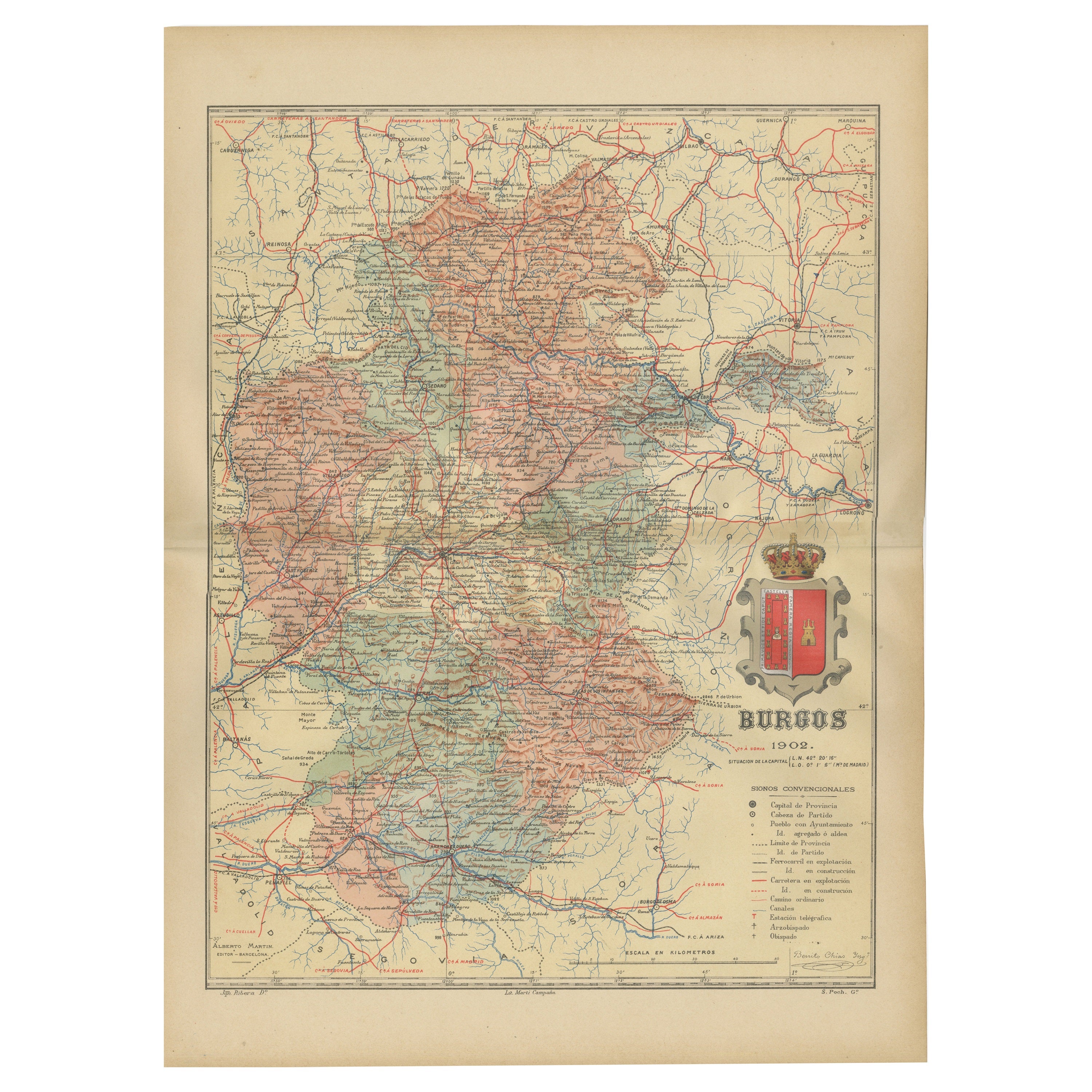
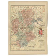
- Burgos 1902: Geographic Map of Castile's Historic Heartland in SpainLocated in Langweer, NLThe map of the province of Burgos in the autonomous community of Castile and León in Spain, dated 1902. It includes the following features: The map highlights the varied terrain wit...Category
Antique Early 1900s Maps
MaterialsPaper
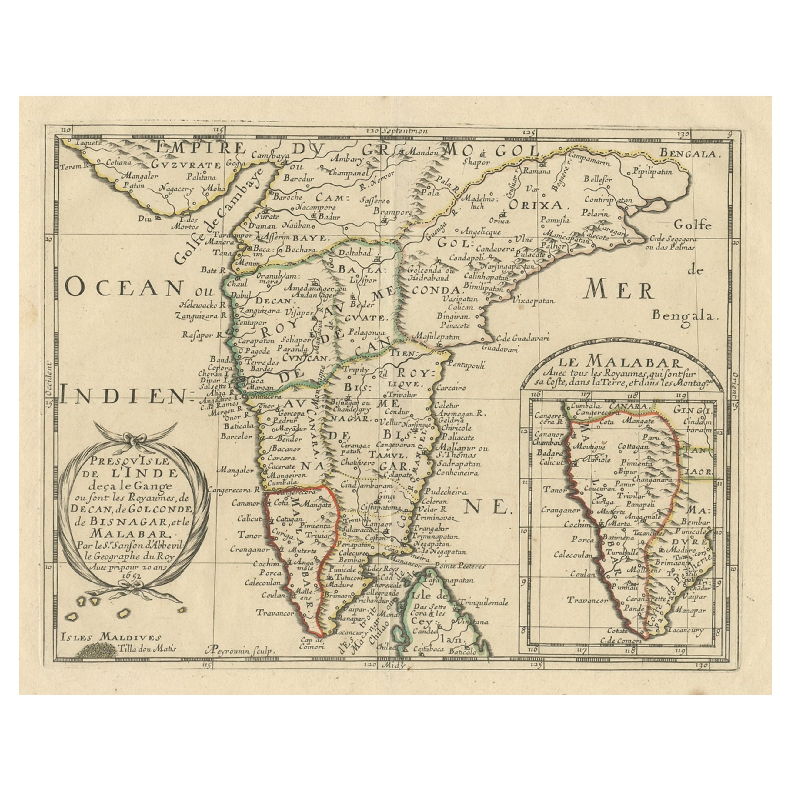
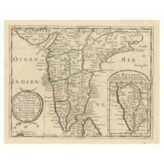
- Original Antique Map showing Southern India, Northern Sri Lanka & Malabar, 1652Located in Langweer, NLAntique map titled 'Presqu'Isle de l'Inde deca le Gange (..)'. Old map showing the southern part of India, including the northern part of Sri Lanka. With inset map of Southern India (Malabar). This map covers the subcontinent from the Bay of Bengal and the Gulf of Cambay to Ceylon. The Mogul Empire can be found in the north. Further south...Category
Antique 1650s Maps
MaterialsPaper
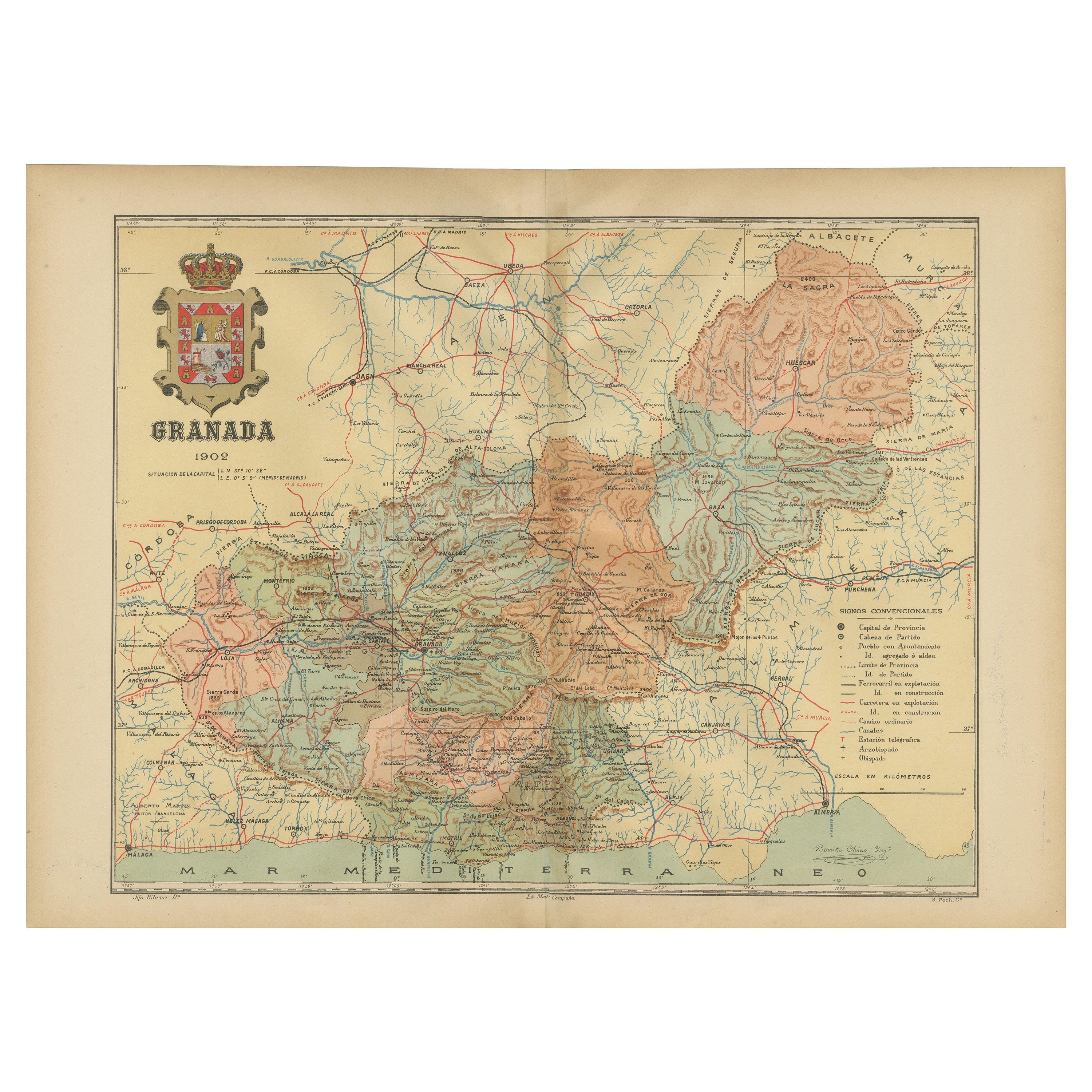
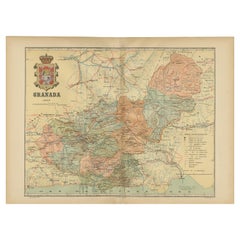
- Granada 1902: A Cartographic Exploration of Andalusia's Mountainous ProvinceLocated in Langweer, NLThis original antique map depicts the province of Granada, part of the autonomous community of Andalusia in southern Spain, as of 1902. The map features several important details: I...Category
Antique Early 1900s Maps
MaterialsPaper
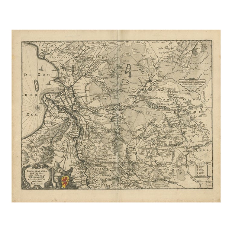
- Antique Map of Overijssel by Visscher, c.1652Located in Langweer, NLAntique map titled 'Transisalania provincia vulgo Over-yssel'. Original antique map of the province of Overijssel, the Netherlands. Published by N. Visscher after N. ten Have, circa ...Category
Antique 17th Century Maps
MaterialsPaper
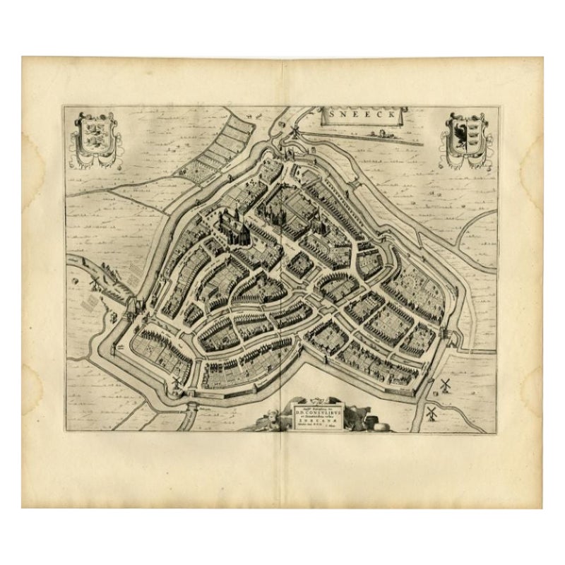
- Antique Map of the City of Sneek by Blaeu, 1652Located in Langweer, NLAntique map titled: 'Sneeck.' Bird's-eye view plan of Sneek, Friesland, The Netherlands. From a Latin edition of the town atlas 'Toneel der Steden', published by Joan Blaeu, Amsterda...Category
Antique 17th Century Maps
MaterialsPaper
- Antique Map of the City of Franeker by Blaeu, 1652Located in Langweer, NLAntique map titled 'Franekera'. Old map of the city of Franeker, Friesland. Also shows two cartouches, coats of arms and legend. This map originates from a Latin edition of the town ...Category
Antique 17th Century Maps
MaterialsPaper
You May Also Like
- 17th Century Hand-Colored Map of Valencia and Murcia, Spain by Mercator/HondiusBy Gerard MercatorLocated in Alamo, CAA 17th century hand-colored map entitled "Regni Valentiae Typus, Valentia and Murcia" by Gerard Mercator and Joducus Hondius, published in Amsterdam in 1635 in 'Cosmographicall Descr...Category
Antique Mid-17th Century Dutch Maps
MaterialsPaper
- Southern Greece: A Large 17th C. Hand-colored Map by Sanson and JaillotBy Nicolas SansonLocated in Alamo, CAThis large original hand-colored copperplate engraved map of southern Greece and the Pelopponese Peninsula entitled "La Moree Et Les Isles De Zante, Cefalonie, Ste. Marie, Cerigo & C...Category
Antique 1690s French Maps
MaterialsPaper
- Southern & Eastern Europe: A Large 17th C. Hand-colored Map by Sanson & JaillotBy Nicolas SansonLocated in Alamo, CAThis large hand-colored map entitled "Estats de L'Empire des Turqs en Europe, ou sont les Beglerbeglicz our Gouvernements" was originally created by Nicholas Sanson d'Abbeville and t...Category
Antique 1690s French Maps
MaterialsPaper
- Map Southern Scotland Thomas Conder Alex Hogg 1795Located in BUNGAY, SUFFOLKA new map of the southern part of Scotland containing the counties of Stirling, Lanerk, Renfrew, Linlithgow, Edinburgh, Peebles, Haddingtoun, Berwick, Selkirk, Roxburgh, Dumfries, Wigtoun, Kirkudbright & Air Published by Alex Hogg at the Kings Arms...Category
Antique 18th Century English Georgian Maps
MaterialsPaper
- The Kingdom of Naples and Southern Italy: A Hand-Colored 18th Century Homann MapBy Johann Baptist HomannLocated in Alamo, CA"Novissima & exactissimus Totius Regni Neapolis Tabula Presentis Belli Satui Accommo Data" is a hand colored map of southern Italy and the ancient Kingdom of Naples created by Johann...Category
Antique Early 18th Century German Maps
MaterialsPaper
- 18th Century Map of the Southern Balkans by Giovanni Maria CassiniBy Giovanni Maria CassiniLocated in Hamilton, Ontario18th century map by Italian engraver Giovanni Maria Cassini (Italy 1745-1824). Map of the Southern Balkans: Rome. Hand colored and copper engraved print done in the year 1788. It in...Category
Antique 18th Century Italian Maps
MaterialsPaper


