Items Similar to Burgos 1902: Geographic Map of Castile's Historic Heartland in Spain


Want more images or videos?
Request additional images or videos from the seller
1 of 7
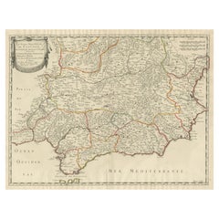
Burgos 1902: Geographic Map of Castile's Historic Heartland in Spain
About the Item
The map of the province of Burgos in the autonomous community of Castile and León in Spain, dated 1902. It includes the following features:
The map highlights the varied terrain with the northern part of the province being more mountainous, which includes the Cantabrian Mountains, and the southern part consisting of the northern Meseta Central, a high plateau.
Blue lines represent rivers and lakes, including the notable Arlanzón River which passes through the city of Burgos. Red lines trace the roads and railways, indicating the transportation infrastructure connecting Burgos with other areas. Various symbols mark the locations of cities, towns, and villages, with the capital city of Burgos likely being the most prominent.
The legend (Signos Convencionales) explains the symbols used on the map for provincial capitals, roads, railways, and boundaries.
The coat of arms of Burgos is displayed, featuring a castle, representative of the Castile region, and two keys, which may symbolize authority and guardianship. It is highlighted with gold.
About the province of Burgos:
Burgos is historically significant as part of the former Crown of Castile. It is renowned for its architectural landmarks, particularly the Burgos Cathedral, which is a UNESCO World Heritage Site. The province's landscape is diverse, with parts of the fertile Ribera del Duero wine region to the southwest and scenic natural areas like the Sierra de la Demanda. The region has a rich history, with several archaeological sites dating back to the earliest human settlements in Europe, including the Sierra de Atapuerca, another UNESCO World Heritage Site. The traditional economy of Burgos has been based on agriculture, but it also has a developed industrial sector, and the service sector has grown, particularly around tourism, driven by the province's cultural heritage and natural beauty.
- Dimensions:Height: 14.77 in (37.5 cm)Width: 20.08 in (51 cm)Depth: 0 in (0.02 mm)
- Materials and Techniques:
- Period:1900-1909
- Date of Manufacture:1902
- Condition:Good condition. Central vertical folding lines as issued. Aged paper with typically warm, yellowish-brown hue, especially around the edges. Check the images carefully.
- Seller Location:Langweer, NL
- Reference Number:
About the Seller
5.0
Platinum Seller
These expertly vetted sellers are 1stDibs' most experienced sellers and are rated highest by our customers.
Established in 2009
1stDibs seller since 2017
1,919 sales on 1stDibs
Typical response time: <1 hour
- ShippingRetrieving quote...Ships From: Langweer, Netherlands
- Return PolicyA return for this item may be initiated within 14 days of delivery.
More From This SellerView All
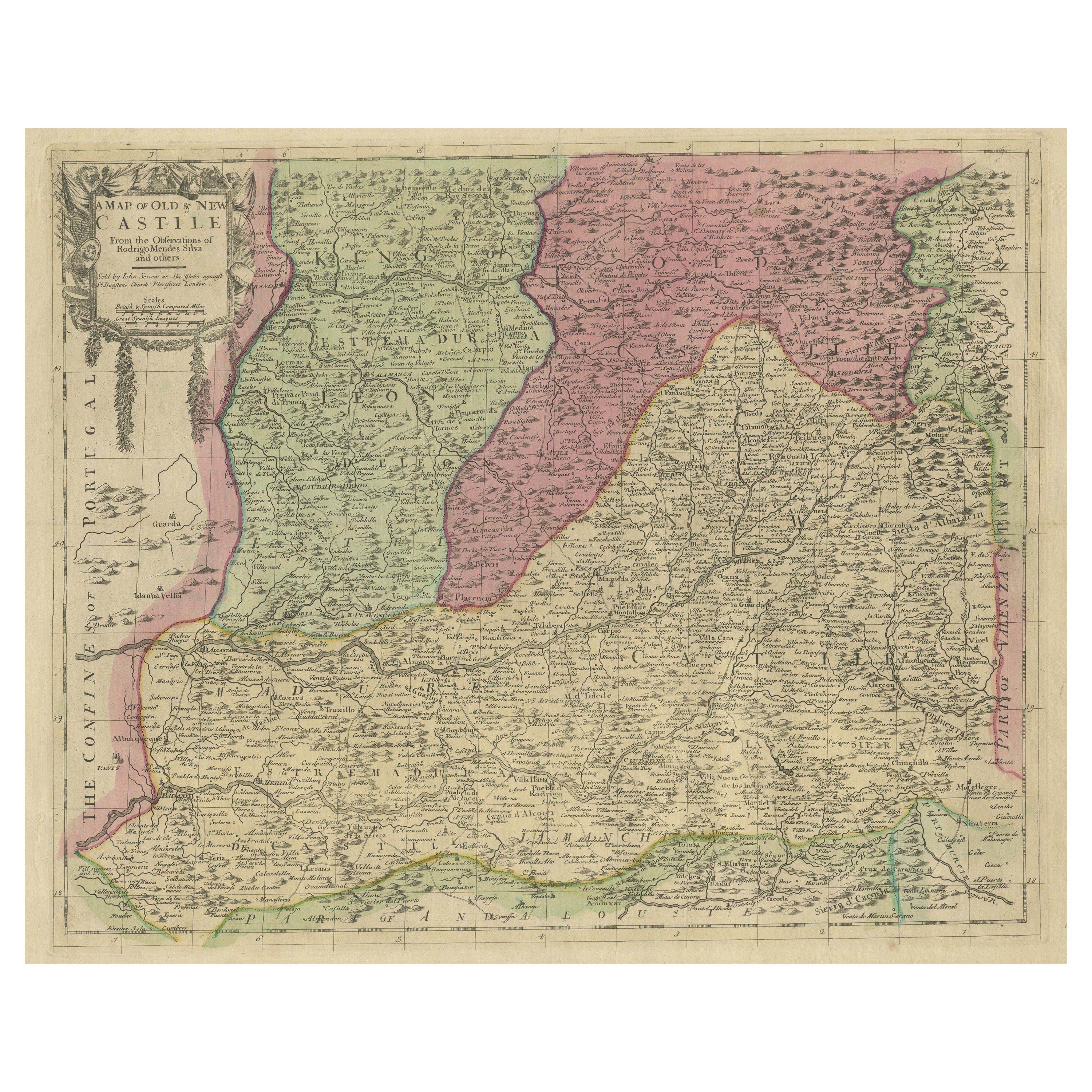
- Senex Map of Castile, Leon & La Mancha in The Spanish Heartland, 1714Located in Langweer, NLThis antique map, titled "A Map of Old & New Castile from the Observations of Rodrigo Mendes Silva and others," depicts the regions of Old Castile and New Castile in Spain, along wit...Category
Antique Early 18th Century Maps
MaterialsPaper
- Large Map of Castile's Southern Realms - Granada, Andalusia, and Murcia, 1652Located in Langweer, NLThis antique map, titled 'Les Etats de la Couronne de Castille', represents the southern regions of the Crown of Castile, specifically the territories of Andalusia, Granada, and Murc...Category
Antique Mid-17th Century Maps
MaterialsPaper
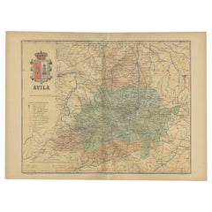
- Ávila in a Historical Map of 1902: A Geographic and Administrative OverviewLocated in Langweer, NLThe map is of the province of Ávila, one of the provinces of the autonomous community of Castile and León in Spain, and it is dated from 1902. The map illustrates several geographic ...Category
Antique Early 1900s Maps
MaterialsPaper
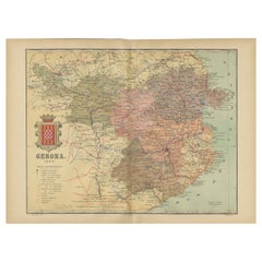
- Girona 1902: Geographic and Infrastructural Map of Catalonia’s Northern ProvinceLocated in Langweer, NLThe map provided is of the province of Girona (in Catalan, Girona), located in the northeast of Spain, within the autonomous community of Catalonia, as of the year 1902. Here are the...Category
Antique Early 1900s Maps
MaterialsPaper
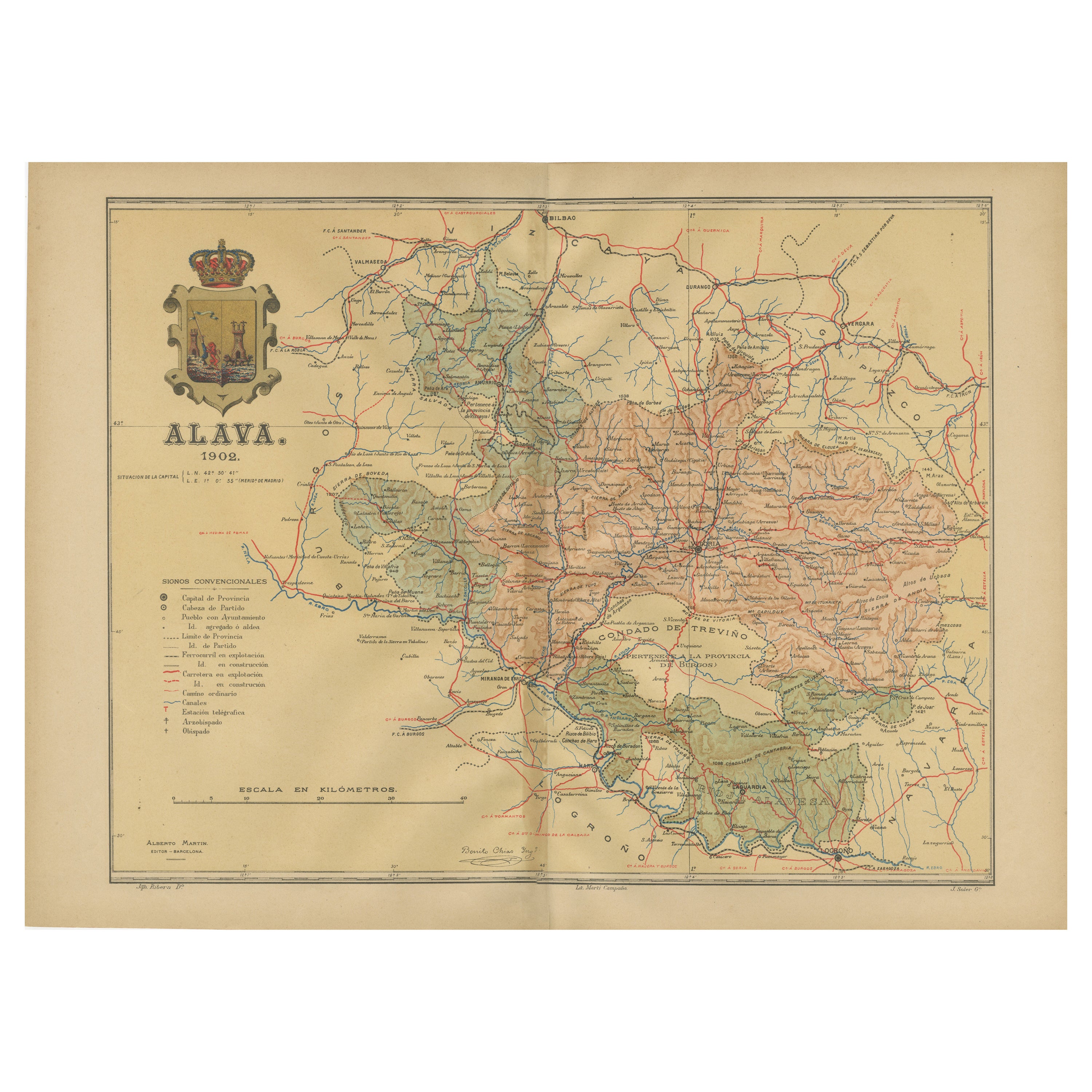
- Álava in Northern Spain: The Geography of Basque Heritage and Terrain, 1902Located in Langweer, NLThis original antique map is a historical depiction of the province of Álava (in Basque: Araba), which is one of the provinces of the Basque Country in northern Spain, as indicated b...Category
Antique Early 1900s Maps
MaterialsPaper
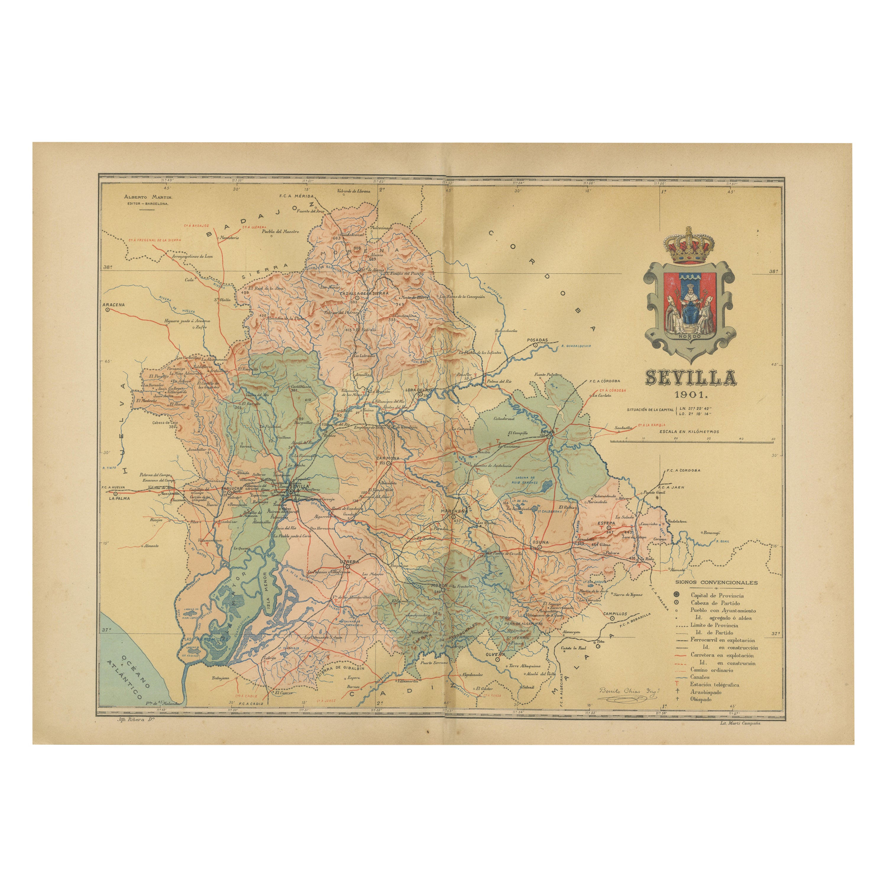
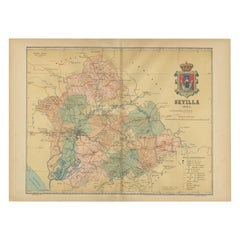
- Map of Sevilla Province, 1901: A Depiction of The Spanish Cultural HeartlandLocated in Langweer, NLThe print for sale here depicts a historical map of the province of Sevilla (Seville) from the year 1901. Sevilla is located in the southern part of Spain and is part of the autonomo...Category
Antique Early 1900s Maps
MaterialsPaper

You May Also Like
- Geographical Antique Map of Principality of MonacoBy Bruno SantiniLocated in Alessandria, PiemonteST/609 - Interesting antique color map of Monaco Principality in French language : "Carte qui contient le Principauté de Piémont, le Monferrat et la comté de...Category
Antique Late 18th Century Italian Other Maps
MaterialsPaper
- Christ of Burgos. Wood, metal. Spanish school, 19th century.Located in Madrid, ESChrist of Burgos. Wood, metal. Spanish school, 19th century. A rectangular base serves as the base for a Latin cross with finials at the three upper ends. This has the usual “INRI” ...Category
Antique 19th Century Spanish Other Religious Items
MaterialsMetal
- Set of 4 Antique Geographical Maps French-German War 1870-71Located in Casale Monferrato, ITElegant late 19th century set of four antique geographical maps relating to the positioning of the armies in the Franco-German War 1870-71. A...Category
Antique 1890s Italian Maps
MaterialsPaper
- School Chart or Pull Down Map of Geography of the Netherlands, 1950sLocated in Hemiksem, VANA beautiful old school map of the Netherlands, painted on linen. The map shows the 3 different reliefs (low, middle, high) of the Netherlands. The beau...Category
Vintage 1950s Belgian Mid-Century Modern Maps
MaterialsLinen, Paint
- Large Original Vintage Map of Spain, circa 1920Located in St Annes, LancashireGreat map of Spain Original color. Good condition Published by Alexander Gross Unframed.Category
Vintage 1920s English Maps
MaterialsPaper
- Antique Folding London Map, English, Cartography, Historic, Georgian, Dated 1783Located in Hele, Devon, GBThis is an antique folding London map. An English, paper on linen cartographical study of the London metropolis and the surrounding area, published in the mid Georgian period, dated ...Category
Antique Late 18th Century British Georgian Maps
MaterialsLinen, Paper


Recently Viewed
View AllMore Ways To Browse
Map Of Old Armenia
Teak Wood Sphere
Nova Guinea Maps
Antique Map Of Illinois
Petite Point Hand Bag
Antique Map Of Southeastern Us
Antique Map Alabama
Antique Map Of Sydney
Malay Archipelago Map
Gambia Antique Map
Uruguay Antique Map
Guyana Antique Map
Ruscelli Map
Masque Theatre No
Nova Scotia Map
Antique Map Tuscany
Berkshire Antique Map
Cornwall Map