Items Similar to Ávila in a Historical Map of 1902: A Geographic and Administrative Overview

Want more images or videos?
Request additional images or videos from the seller
1 of 6
Ávila in a Historical Map of 1902: A Geographic and Administrative Overview
About the Item
The map is of the province of Ávila, one of the provinces of the autonomous community of Castile and León in Spain, and it is dated from 1902. The map illustrates several geographic and man-made features:
It shows the varying elevations within the province, with mountain ranges prominently displayed, likely including parts of the Sierra de Gredos.
The gold highlighted coat of arms of Ávila is prominently displayed in the upper left corner, featuring elements that are likely of historical and cultural significance to the province.
About the province of Ávila:
Ávila is known for its medieval city walls, which are among the best-preserved in Spain and have been designated a UNESCO World Heritage Site. The capital city, also named Ávila, is famous for being the birthplace of Saint Teresa of Jesus, an important Catholic saint, and for its Romanesque and Gothic churches.
The province itself is characterized by a rugged landscape, with the Sierra de Gredos providing a dramatic backdrop and a haven for outdoor activities like hiking and bird watching. The economy historically has been based on agriculture, with a focus on livestock, especially the renowned Ávila beef.
Ávila's cultural heritage includes not only its impressive architecture but also its culinary traditions, with local dishes such as "Judías del Barco" (beans from Barco) and "Chuletón de Ávila" (Ávila T-bone steak) being well-known in Spanish gastronomy.
- Dimensions:Height: 14.77 in (37.5 cm)Width: 20.08 in (51 cm)Depth: 0 in (0.02 mm)
- Materials and Techniques:
- Period:1900-1909
- Date of Manufacture:1902
- Condition:Good condition. Central vertical folding lines as issued. Aged paper with typically warm, yellowish-brown hue, especially around the edges. Part of the folding line is brownish, adding to its patina -check the images carefully.
- Seller Location:Langweer, NL
- Reference Number:
About the Seller
5.0
Platinum Seller
These expertly vetted sellers are 1stDibs' most experienced sellers and are rated highest by our customers.
Established in 2009
1stDibs seller since 2017
1,928 sales on 1stDibs
Typical response time: <1 hour
- ShippingRetrieving quote...Ships From: Langweer, Netherlands
- Return PolicyA return for this item may be initiated within 14 days of delivery.
More From This SellerView All
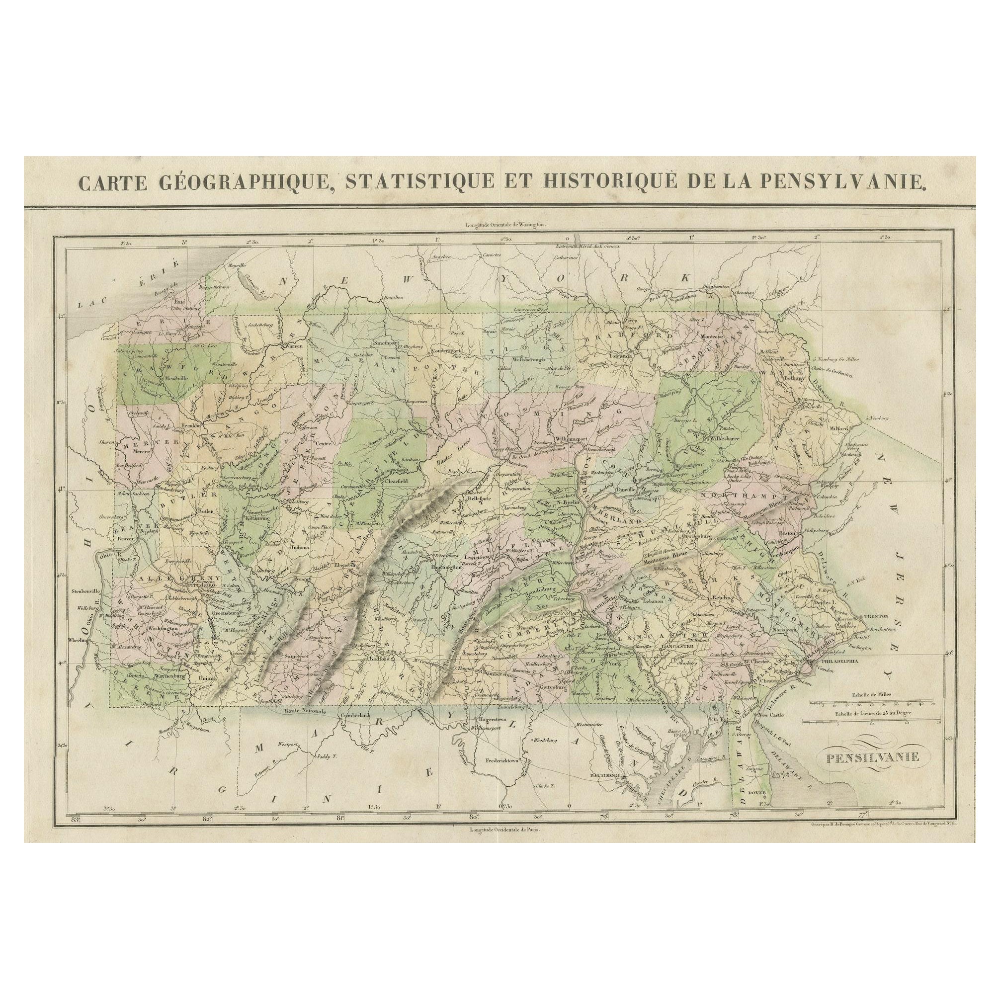
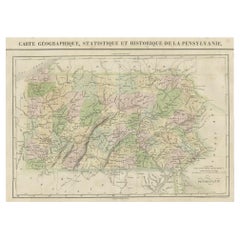
- French Geographical, Statistical and Historical Map of Pensylvania, 1825Located in Langweer, NLTitle: Carte geographique, statistique et historique de la Pensylvanie. Beautiful Hand-Colored 1825 French Map of Pennsylvania, with a List of Prominent Rivers, Descriptions of Mountains, Climate and Government as well as a list of Colonial and post-American Revolution Governors Produced by: J. Carez in Paris. (1825) Hand colored engraved map. Relief shown by hachures. Text and tables at sides and bottom. Prime meridians: Washington and Paris. A very interesting 1825 French hand-colored map of Pennsylvania from Lucas' 1822 map, which breaks down county populations by Whites and Free Blacks. "Carte Geographique, Statistique et Historique de la Pensylvanie" Originally published in 1822 by Carey and Lea and then revised and republished in 1825 by J. A. C. Buchon (1791-1846 ) in a French edition entitled Atlas Geographique des Deux Ameriques, printed by J. Carez. Fielding Lucas, Jr. (1781-1854), a Baltimore mapmaker and publisher, drew the map. original hand-coloring. Shown on the map are parts of Maryland, Delaware, New York and New jersey. Printed on the same page as the map is geographical, statistical, and historical information about Pennsylvania, such as descriptions of the state's important rivers, a list of Governors since its founding as well as important French and Indian...Category
Antique 1820s Maps
MaterialsPaper
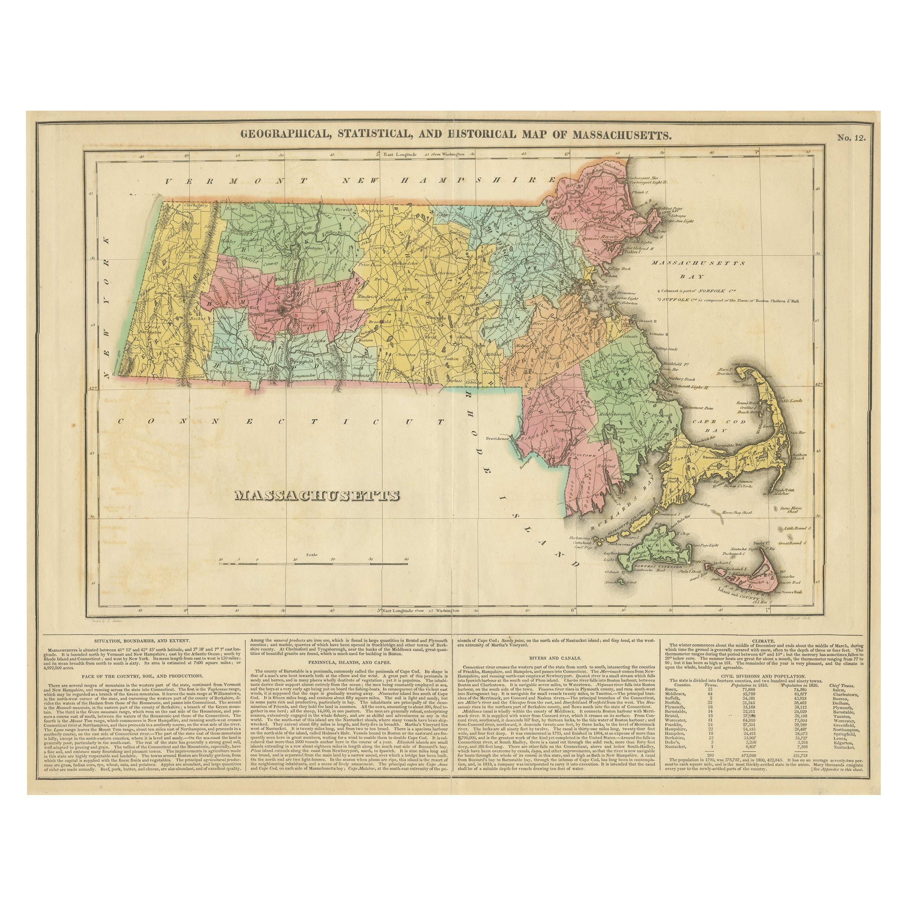
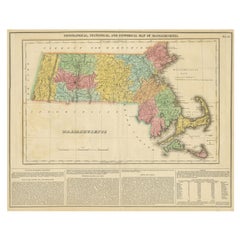
- Antique Geographical, Historical and Statistical Map of Massachusetts, 1822Located in Langweer, NLThis attractive map of Massachusetts presents a finely detailed overview of the state in the first quarter of the 19th century. Transportation ...Category
Antique 1820s Maps
MaterialsPaper
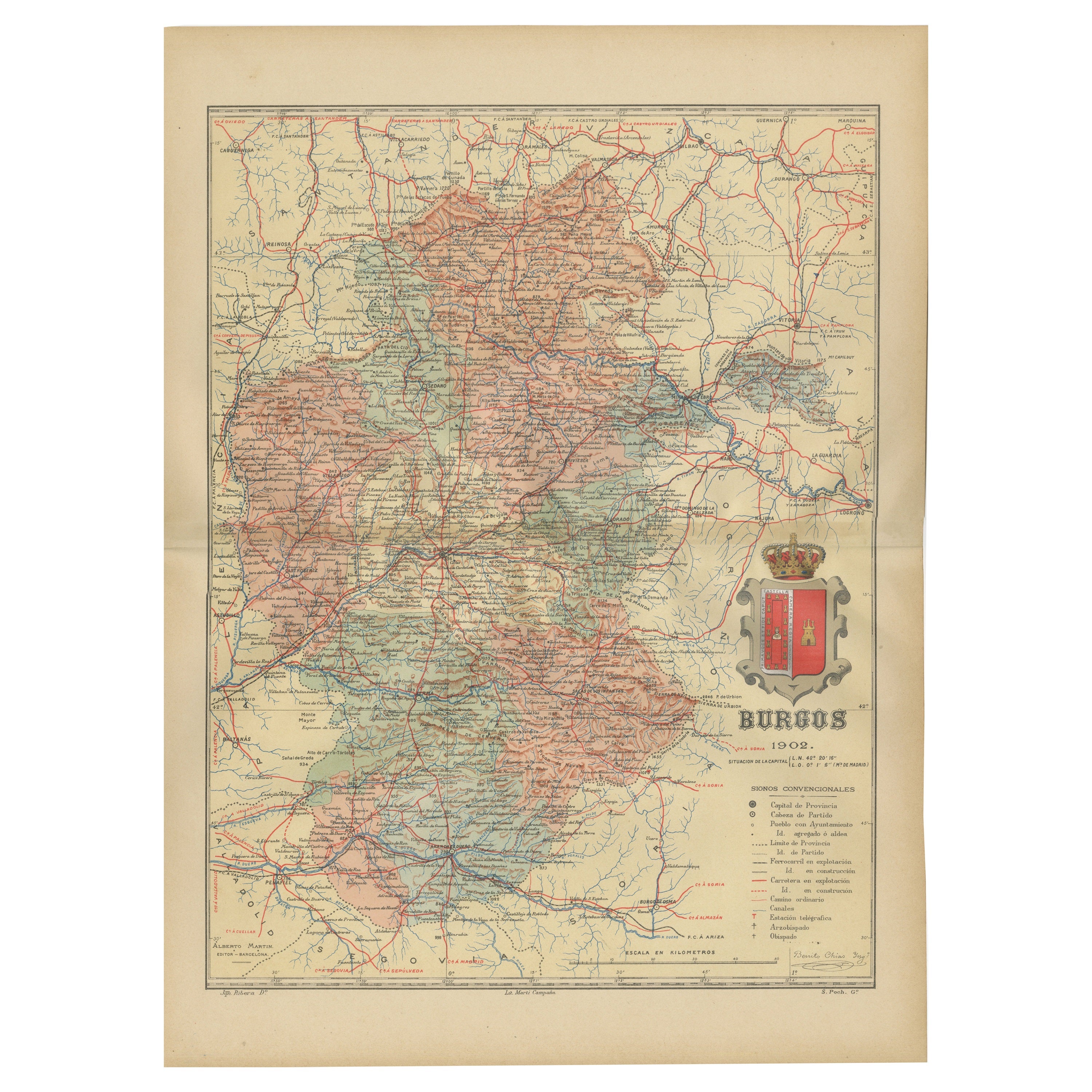
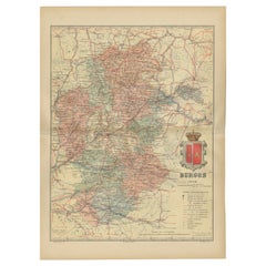
- Burgos 1902: Geographic Map of Castile's Historic Heartland in SpainLocated in Langweer, NLThe map of the province of Burgos in the autonomous community of Castile and León in Spain, dated 1902. It includes the following features: The map highlights the varied terrain wit...Category
Antique Early 1900s Maps
MaterialsPaper
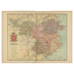
- Girona 1902: Geographic and Infrastructural Map of Catalonia’s Northern ProvinceLocated in Langweer, NLThe map provided is of the province of Girona (in Catalan, Girona), located in the northeast of Spain, within the autonomous community of Catalonia, as of the year 1902. Here are the...Category
Antique Early 1900s Maps
MaterialsPaper
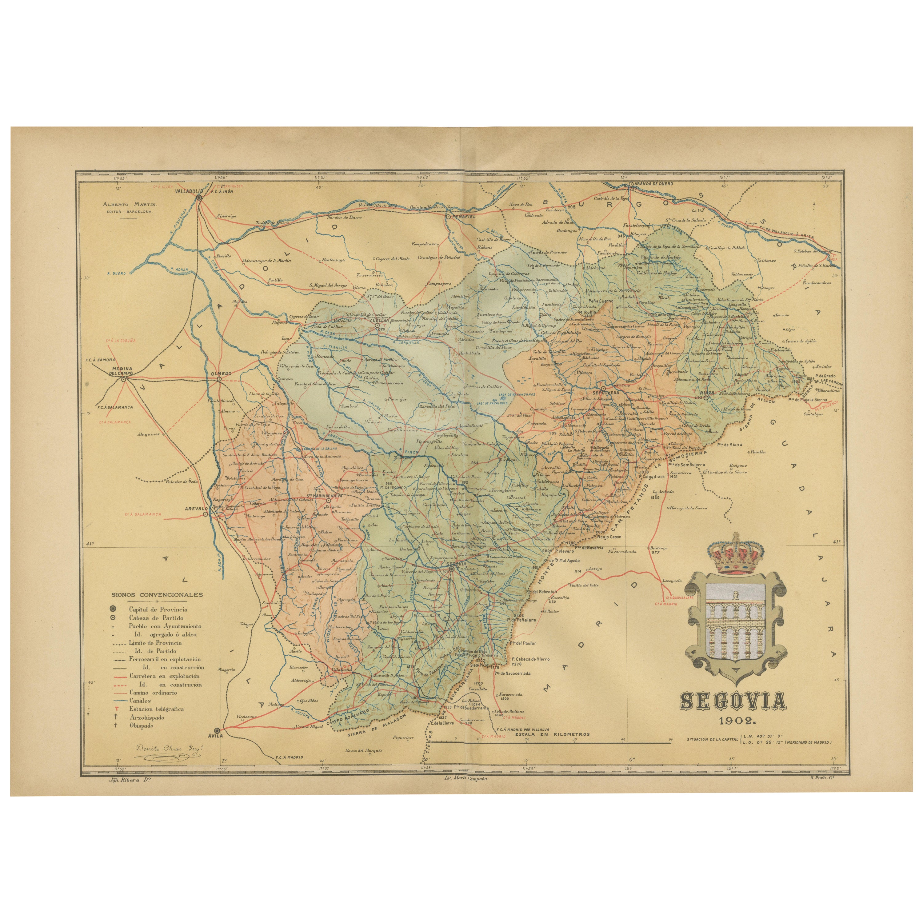
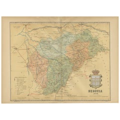
- Topographical and Administrative Cartography of Segovia in Spain, 1902Located in Langweer, NLAn original old map of the province of Segovia from the year 1902. Segovia is a historic area located in the central part of Spain, northwest of Madrid. Known for its rich history, a...Category
Antique Early 1900s Maps
MaterialsPaper
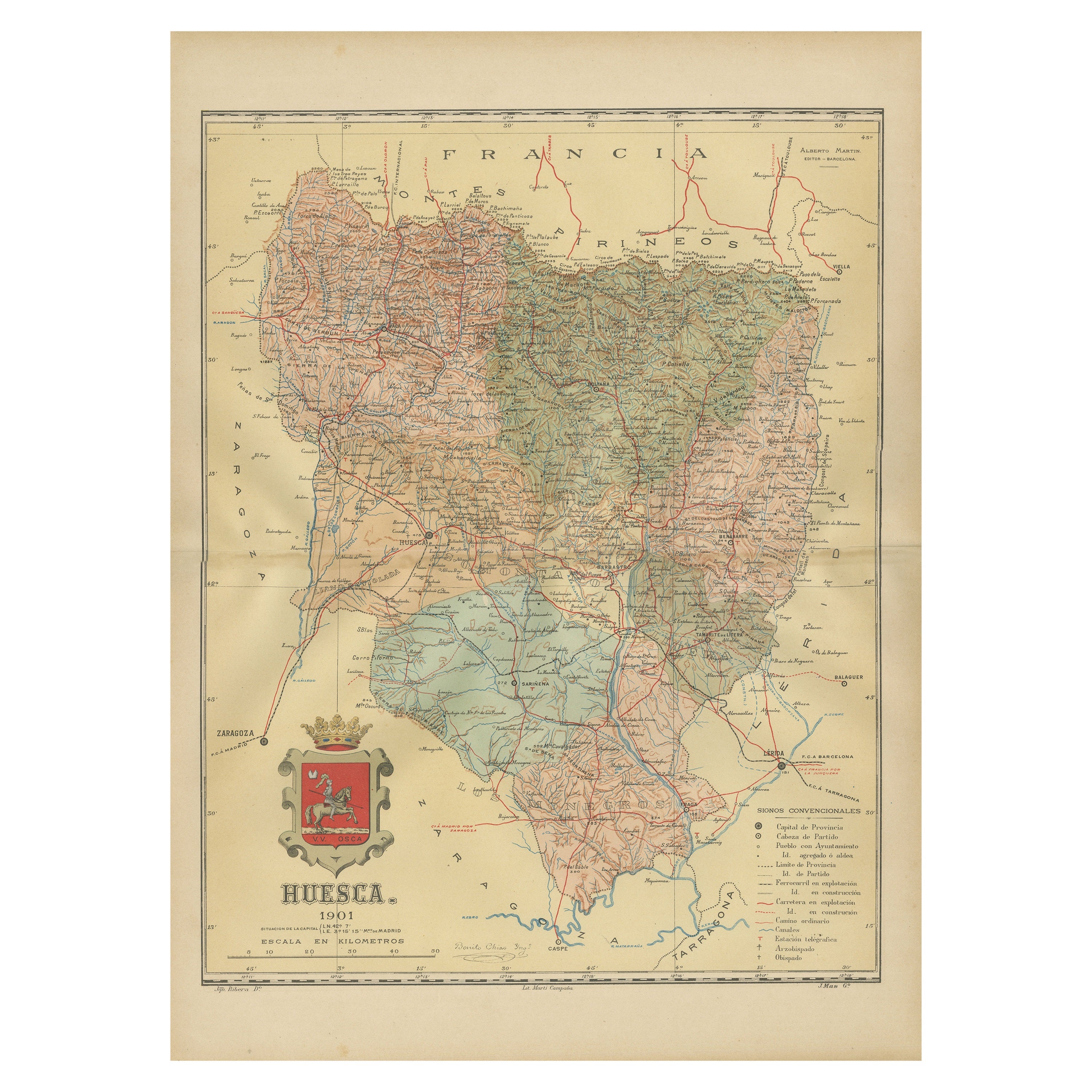
- Huesca 1901: A Geographic Overview of Aragon's Northern Frontier in SpainLocated in Langweer, NLThe map provided is of the province of Huesca, located in the northeastern part of Spain, within the autonomous community of Aragon, as of the year 1901. Here are some of the key fea...Category
Antique Early 1900s Maps
MaterialsPaper

You May Also Like
- Geographical Antique Map of Principality of MonacoBy Bruno SantiniLocated in Alessandria, PiemonteST/609 - Interesting antique color map of Monaco Principality in French language : "Carte qui contient le Principauté de Piémont, le Monferrat et la comté de...Category
Antique Late 18th Century Italian Other Maps
MaterialsPaper
- Set of 4 Antique Geographical Maps French-German War 1870-71Located in Casale Monferrato, ITElegant late 19th century set of four antique geographical maps relating to the positioning of the armies in the Franco-German War 1870-71. A...Category
Antique 1890s Italian Maps
MaterialsPaper
- School Chart or Pull Down Map of Geography of the Netherlands, 1950sLocated in Hemiksem, VANA beautiful old school map of the Netherlands, painted on linen. The map shows the 3 different reliefs (low, middle, high) of the Netherlands. The beau...Category
Vintage 1950s Belgian Mid-Century Modern Maps
MaterialsLinen, Paint
- 1877 "Geological and Geographical Atlas of Colorado" by F. V. HaydenLocated in Colorado Springs, COThis is F. V. Hayden's Geological and Geographical Atlas of Colorado and Portions of Adjacent Territory, an unmatched geological record for its time. Published by the Department of the Interior in 1877, the Atlas of Colorado consists of twenty double elephant sized sheets, divided into two series. The first series, four sheets, embrace the entire area on a scale of twelve miles to an inch, and include Triangulations, Drainage, an Economic Map, and a General Geological map...Category
Antique 1870s American Maps
MaterialsPaper
- 2 Hand Carved Antique Statuette & Sculpture of Saint Teresa of Avila / of JesusLocated in Lisse, NLRare pair of hand-carved works of devotional art with an amazing patina. Saint Teresa of Ávila, born Teresa Sánchez de Cepeda y Ahumada, also called Saint Teresa of Jesus (1515-1582...Category
Early 20th Century European Renaissance Revival Religious Items
MaterialsWood, Nutwood
- Map of Boston and Surrounding TownsLocated in Norwell, MALater copy of a nineteenth century map of Boston and surrounding towns. Showing parts of Quincy, Milton, Hyde Park, Winthrop and Revere. Showing all of B...Category
Antique 19th Century North American Maps
MaterialsPaper


Recently Viewed
View AllMore Ways To Browse
Map Of Old Armenia
Teak Wood Sphere
Nova Guinea Maps
Antique Map Of Illinois
Petite Point Hand Bag
Antique Map Of Southeastern Us
Antique Map Alabama
Antique Map Of Sydney
Malay Archipelago Map
Fiji Map
Map Prussia Germany
Small Map
The Malay Archipelago
Bad Bentheim
Johannes Janssonius On Sale
Albania Map
Antique Map Argentina
Antique Map Of Argentina