Items Similar to Huesca 1901: A Geographic Overview of Aragon's Northern Frontier in Spain


Want more images or videos?
Request additional images or videos from the seller
1 of 6
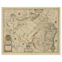
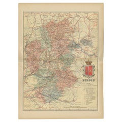
Huesca 1901: A Geographic Overview of Aragon's Northern Frontier in Spain
About the Item
The map provided is of the province of Huesca, located in the northeastern part of Spain, within the autonomous community of Aragon, as of the year 1901. Here are some of the key features depicted on the map:
The map illustrates the province's varied topography, including the Pyrenees mountains along the northern border with France. Blue lines represent rivers and lakes, likely including the Ebro River basin, which is significant in the region. Red lines indicate roads and railways, showing the infrastructure that connects Huesca's towns and cities both internally and with neighboring regions. Various symbols denote the locations of cities, towns, and villages, with the capital city, also named Huesca, presumably highlighted.
The coat of arms of Huesca is prominently displayed, reflecting the historical significance of the region with symbols such as the bell and the cross.
About the province of Huesca:
Huesca is known for its stunning natural landscapes, including part of the Ordesa y Monte Perdido National Park, which is a UNESCO World Heritage Site. The province is characterized by its high peaks, deep valleys, and glacial lakes in the Pyrenees, as well as the semi-arid central plain. Huesca's economy has traditionally been based on agriculture and livestock, but it has also developed a significant tourism sector focused on winter sports and mountain recreation. The region is culturally rich, with a history that includes Romanesque art and architecture, particularly in the old churches and monasteries scattered throughout the province. It is also home to the historic city of Jaca, which has played a crucial role in the history of the Pyrenees.
- Dimensions:Height: 20.08 in (51 cm)Width: 14.77 in (37.5 cm)Depth: 0 in (0.02 mm)
- Materials and Techniques:
- Period:1900-1909
- Date of Manufacture:1901
- Condition:Good condition. Central vertical folding lines as issued. Aged paper with typically warm, yellowish-brown hue, especially around the edges. Check the images carefully.
- Seller Location:Langweer, NL
- Reference Number:
About the Seller
5.0
Platinum Seller
These expertly vetted sellers are 1stDibs' most experienced sellers and are rated highest by our customers.
Established in 2009
1stDibs seller since 2017
1,922 sales on 1stDibs
Typical response time: <1 hour
- ShippingRetrieving quote...Ships From: Langweer, Netherlands
- Return PolicyA return for this item may be initiated within 14 days of delivery.
More From This SellerView All
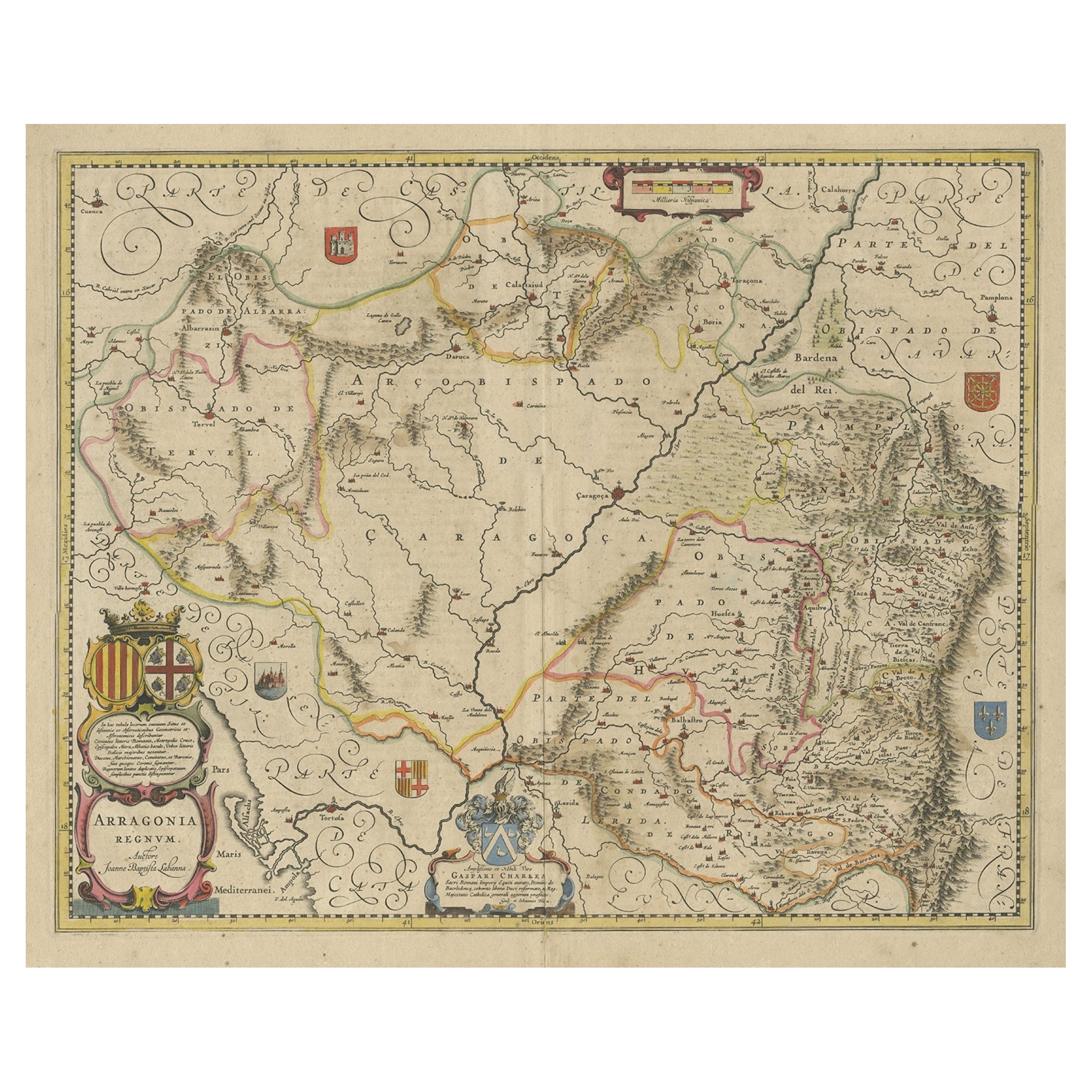
- Detailed Antique Map of Northern Spanish Region of Aragon, c.1650Located in Langweer, NLAntique map titled 'Arragonia Regnum'. Detailed map of northern Spanish region of Aragon. The map is centered on the city of Zaragoza, aka, Saragossa. Shows towns, rivers, castle...Category
Antique 1650s Maps
MaterialsPaper
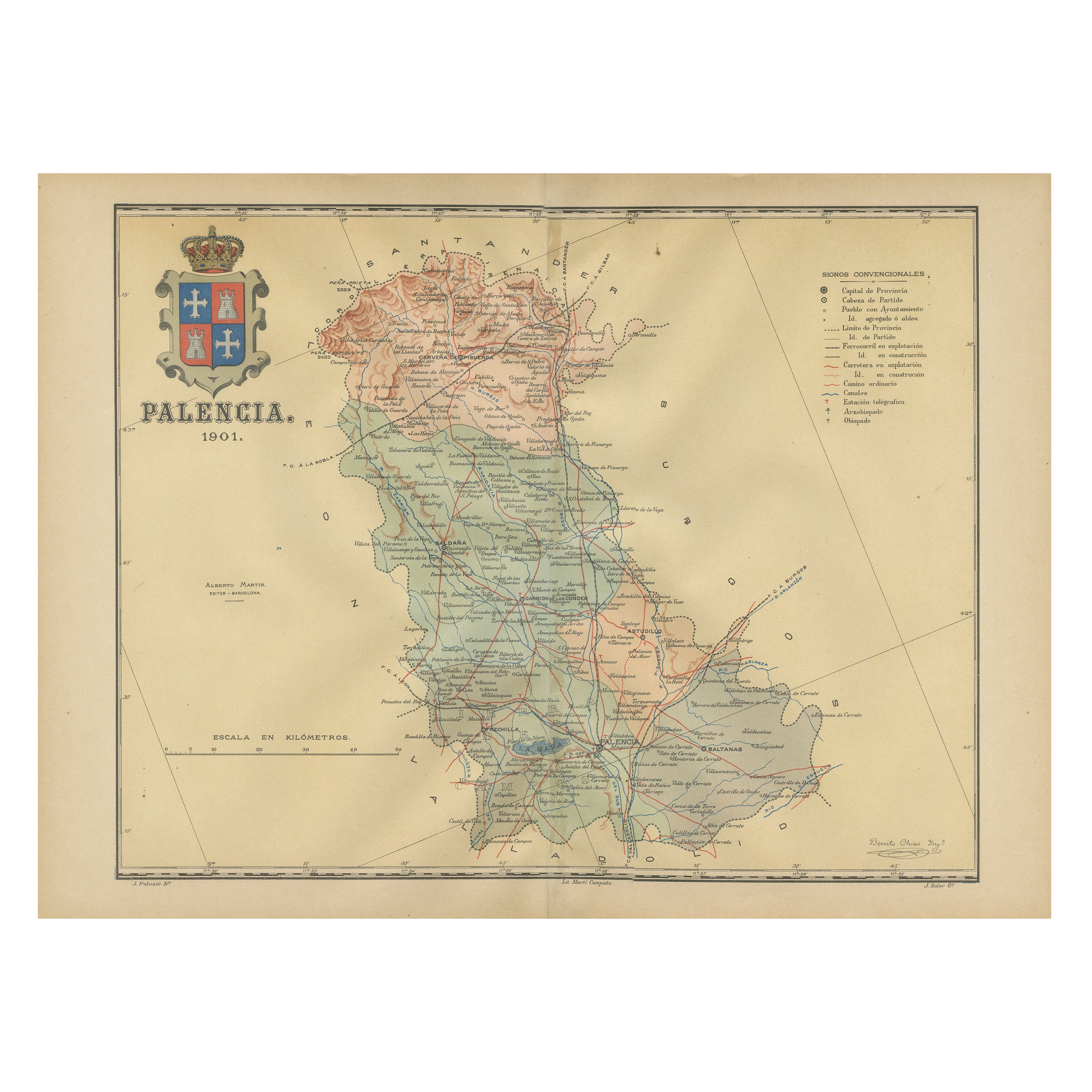
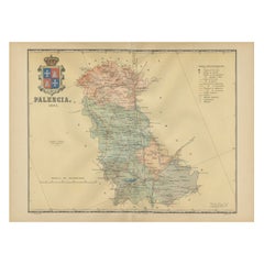
- Original Antique Map of Palencia Province, in Northern Spain, 1901Located in Langweer, NLThis historical map is of Palencia, a province in the northern part of Spain. Palencia is situated within the autonomous community of Castilla y León. It is bordered by the provinc...Category
Antique Early 1900s Maps
MaterialsPaper
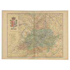
- Ávila in a Historical Map of 1902: A Geographic and Administrative OverviewLocated in Langweer, NLThe map is of the province of Ávila, one of the provinces of the autonomous community of Castile and León in Spain, and it is dated from 1902. The map illustrates several geographic ...Category
Antique Early 1900s Maps
MaterialsPaper
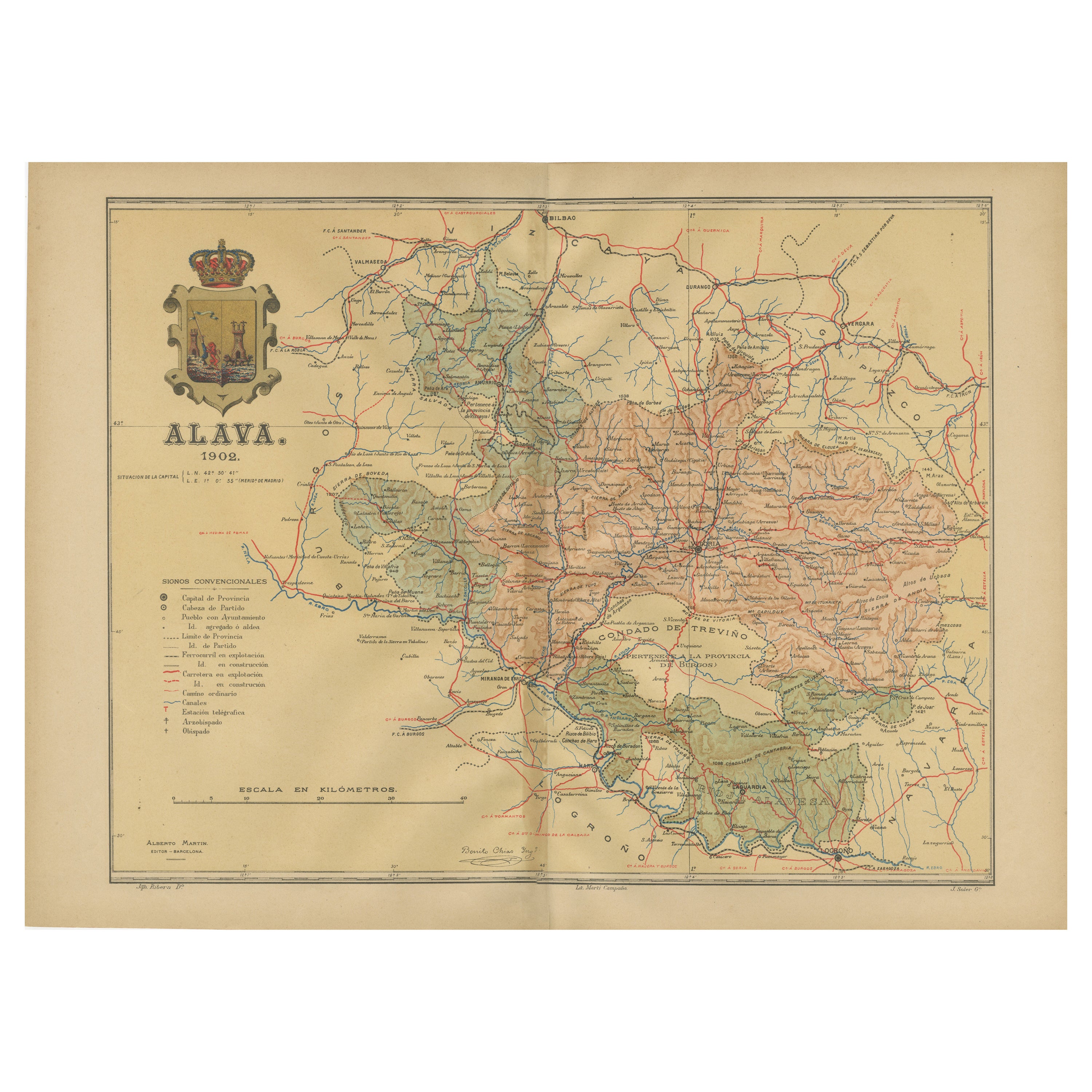
- Álava in Northern Spain: The Geography of Basque Heritage and Terrain, 1902Located in Langweer, NLThis original antique map is a historical depiction of the province of Álava (in Basque: Araba), which is one of the provinces of the Basque Country in northern Spain, as indicated b...Category
Antique Early 1900s Maps
MaterialsPaper
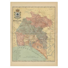
- Huelva 1901: A Cartographic Presentation of Andalusia's Atlantic FrontierLocated in Langweer, NLThe map displays the province of Huelva, located in the southwestern part of the autonomous community of Andalusia in Spain, as of the year 1901. It outlines various geographic and m...Category
Antique Early 1900s Maps
MaterialsPaper
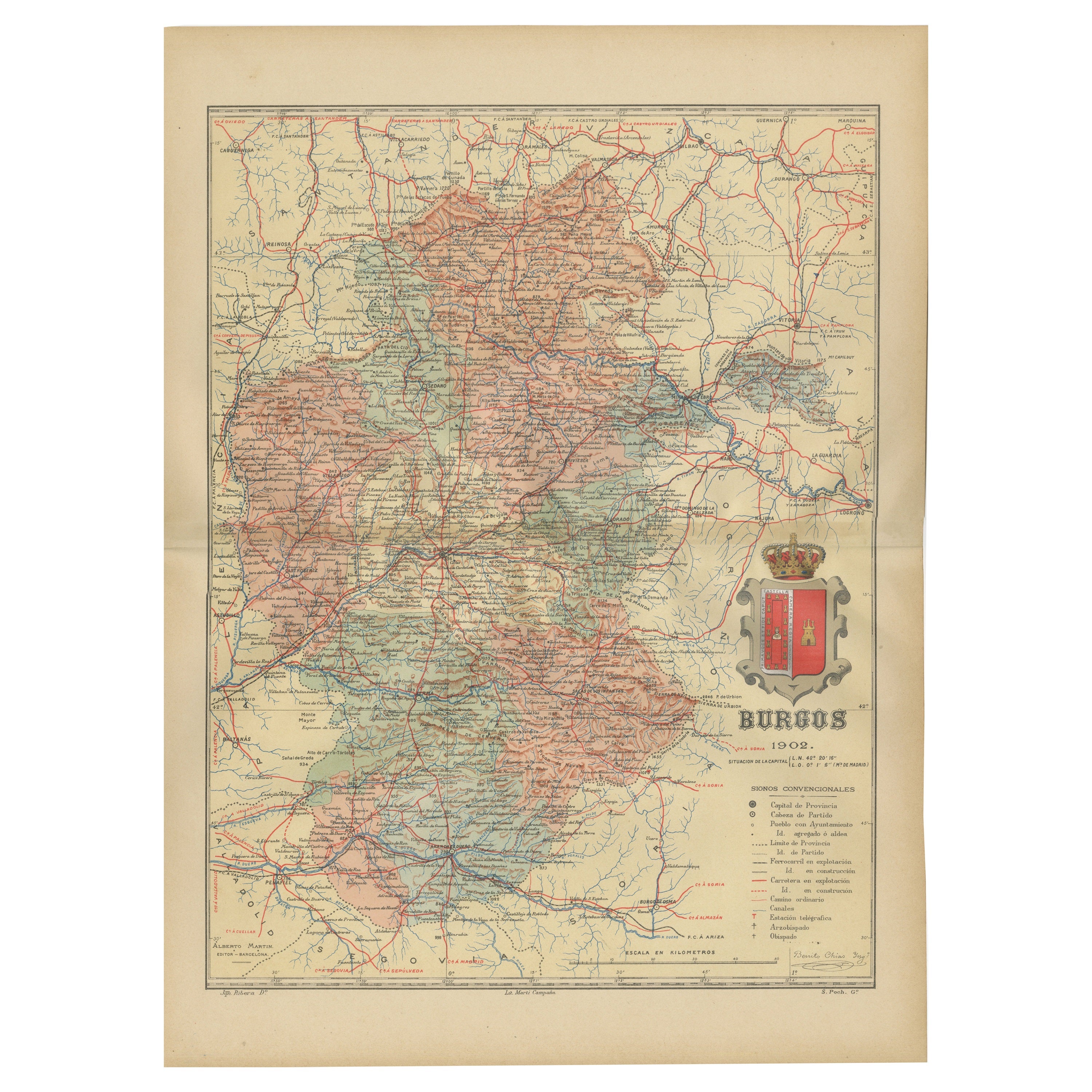
- Burgos 1902: Geographic Map of Castile's Historic Heartland in SpainLocated in Langweer, NLThe map of the province of Burgos in the autonomous community of Castile and León in Spain, dated 1902. It includes the following features: The map highlights the varied terrain wit...Category
Antique Early 1900s Maps
MaterialsPaper

You May Also Like
- Processional Cross, Silver, Barbastro, Aragón, Spain, 16th CenturyLocated in Madrid, ESWith hallmarks. It is necessary to indicate the survival in this piece of some details from the Spanish Gothic silverware (cresting, which appears around the XV century; the endings ...Category
Antique 16th Century Spanish Renaissance Religious Items
MaterialsSilver
- Geographical Antique Map of Principality of MonacoBy Bruno SantiniLocated in Alessandria, PiemonteST/609 - Interesting antique color map of Monaco Principality in French language : "Carte qui contient le Principauté de Piémont, le Monferrat et la comté de...Category
Antique Late 18th Century Italian Other Maps
MaterialsPaper
- Soapy Smith: King of the Frontier Con Men BookLocated in Seguin, TXSoapy Smith: King of the Frontier Con Men by Frank C. Robertson and Beth Kay Harris. Published by Hastings House, New York, 1961. 1880's con man working from Denver to Skagway. Re...Category
Mid-20th Century American Rustic Books
MaterialsPaper
- 1877 "Geological and Geographical Atlas of Colorado" by F. V. HaydenLocated in Colorado Springs, COThis is F. V. Hayden's Geological and Geographical Atlas of Colorado and Portions of Adjacent Territory, an unmatched geological record for its time. Published by the Department of the Interior in 1877, the Atlas of Colorado consists of twenty double elephant sized sheets, divided into two series. The first series, four sheets, embrace the entire area on a scale of twelve miles to an inch, and include Triangulations, Drainage, an Economic Map, and a General Geological map...Category
Antique 1870s American Maps
MaterialsPaper
- 1901-03 The Novels of Jane AustenLocated in Bath, GBA smart set of the major novels of beloved author, Jane Austen, this set with the lively illustrations of Hugh Thomson. A smart set containing the major novels of Austen, complete w...Category
Antique Early 1900s British Books
MaterialsPaper
- "Teammates in Mankind's Greatest Adventure" Signed Poster by National GeographicLocated in Colorado Springs, COPresented is an original autographed poster from a 1973 issue of National Geographic magazine, celebrating the historic Apollo missions from the fir...Category
Vintage 1970s American Mid-Century Modern Posters
MaterialsPaper


Recently Viewed
View AllMore Ways To Browse
Map Of Old Armenia
Teak Wood Sphere
Nova Guinea Maps
Antique Map Of Illinois
Petite Point Hand Bag
Antique Map Of Southeastern Us
Antique Map Alabama
Antique Map Of Sydney
Malay Archipelago Map
Gambia Antique Map
Uruguay Antique Map
Guyana Antique Map
Ruscelli Map
Masque Theatre No
Nova Scotia Map
Antique Map Tuscany
Berkshire Antique Map
Cornwall Map