Items Similar to Topographical and Administrative Cartography of Segovia in Spain, 1902


Want more images or videos?
Request additional images or videos from the seller
1 of 6
Topographical and Administrative Cartography of Segovia in Spain, 1902
About the Item
An original old map of the province of Segovia from the year 1902. Segovia is a historic area located in the central part of Spain, northwest of Madrid. Known for its rich history, architectural landmarks, and strategic importance throughout the centuries, Segovia is home to several notable sites. One of the most renowned is the Roman Aqueduct of Segovia, one of the best-preserved elevated Roman aqueducts and a symbol of the city.
Additionally, the province is characterized by a varied landscape that includes parts of the Guadarrama mountain range and the Duratón River. The map would have been used for navigation and administrative purposes, showing not only geographical features but also infrastructural elements such as roads, railways, and the boundaries of municipalities.
More about Segovia:
Segovia is a province full of historical and cultural wealth, located within the autonomous community of Castile and León in Spain. Here are some additional details and highlights:
1. **Roman Aqueduct**: Perhaps the most iconic landmark of Segovia is the Roman Aqueduct, which dates back to the late 1st or early 2nd century AD. This engineering marvel was used to transport water from the Frío River to the city and is a testament to the advanced engineering skills of the Romans.
2. **Alcázar of Segovia**: The Alcázar is a medieval castle situated on a rocky crag above the confluence of two rivers near the Guadarrama mountains. It is one of the most distinctive castle-palaces in Spain by virtue of its shape – like the bow of a ship. The Alcázar was originally built as a fortress but has served as a royal palace, a state prison, and a military academy over the centuries.
3. **Segovia Cathedral**: Known as the "Lady of the Cathedrals," it is a superb example of Gothic architecture and is located in the main square of the city, the Plaza Mayor. It was built in the mid-16th century and is noted for its size and the beauty of its interior.
4. **Cuisine**: Segovia is renowned for its traditional dishes, especially roasted suckling pig (cochinillo asado), which is a culinary staple and a must-try for visitors. The province is also known for its delicious lamb dishes and judiones de La Granja, a type of large white bean served as a stew.
5. **La Granja de San Ildefonso**: This royal palace and gardens are located in the town of San Ildefonso and are often referred to as the Versailles of Spain. The palace was the summer residence of the Spanish monarchs, and the gardens are famous for their fountains and sculpted hedges.
6. **Cultural Heritage**: The old city of Segovia and its Aqueduct have been declared a World Heritage Site by UNESCO. The city's layout is a testament to its Roman and medieval past.
7. **Natural Landscapes**: Beyond the city, the province offers a variety of landscapes, from the peaks of the Sierra de Guadarrama to the rolling plains. It provides opportunities for outdoor activities such as hiking, skiing in the nearby ski resorts, and bird watching in natural parks.
8. **Festivals and Traditions**: Segovia has a rich calendar of festivals, including religious processions during Semana Santa (Holy Week) and other celebrations that showcase its folklore and traditions.
These characteristics define Segovia as a place where history and tradition are palpable in every corner, offering a rich experience to those interested in exploring Spain's cultural and natural heritage.
- Dimensions:Height: 14.77 in (37.5 cm)Width: 20.08 in (51 cm)Depth: 0 in (0.02 mm)
- Materials and Techniques:
- Period:1900-1909
- Date of Manufacture:1902
- Condition:Good condition. Central vertical folding lines as issued. Aged paper with typically warm, yellowish-brown hue, especially around the edges. Slightly wrinkled at the middle top. Check the images carefully.
- Seller Location:Langweer, NL
- Reference Number:
About the Seller
5.0
Platinum Seller
These expertly vetted sellers are 1stDibs' most experienced sellers and are rated highest by our customers.
Established in 2009
1stDibs seller since 2017
1,932 sales on 1stDibs
Typical response time: <1 hour
- ShippingRetrieving quote...Ships From: Langweer, Netherlands
- Return PolicyA return for this item may be initiated within 14 days of delivery.
More From This SellerView All
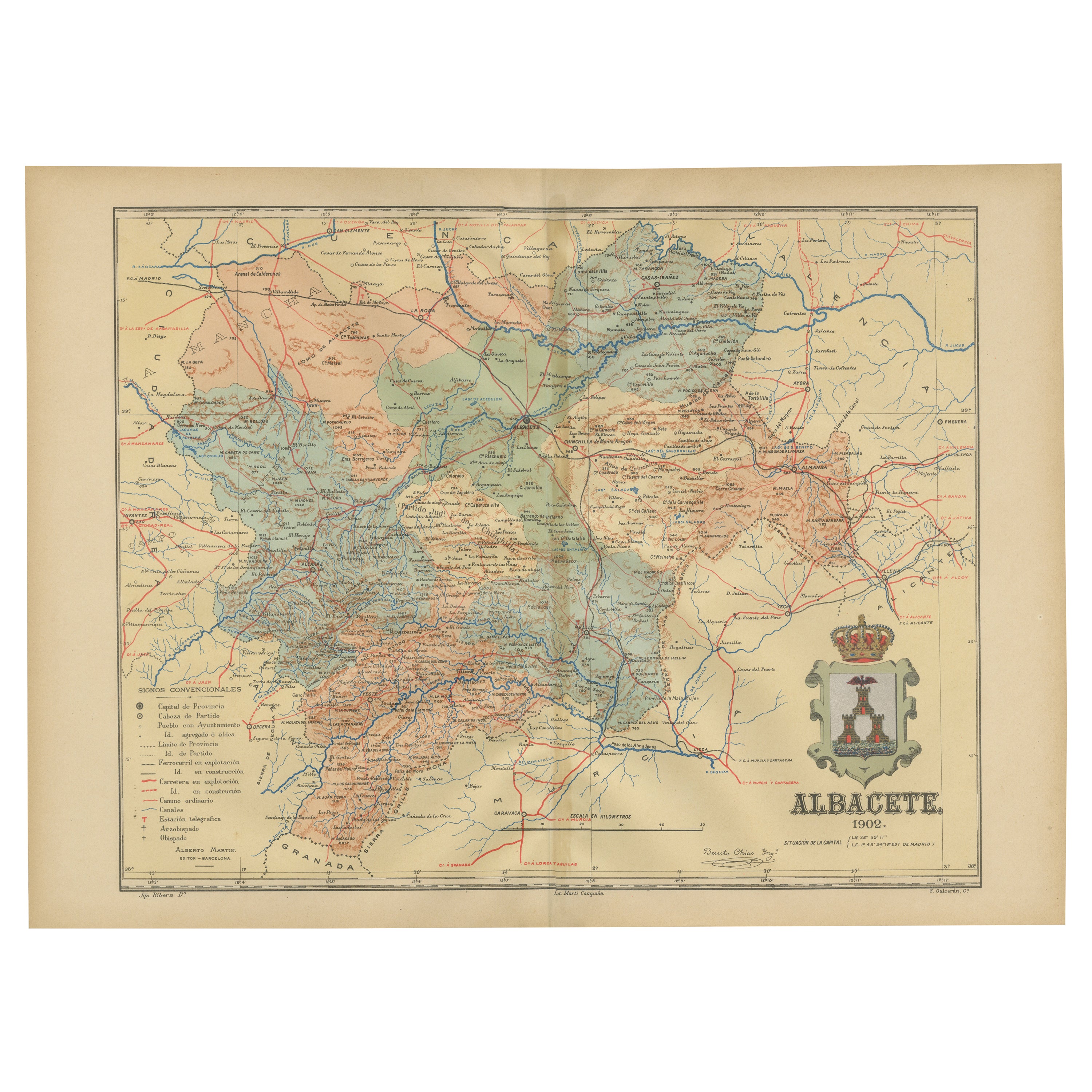
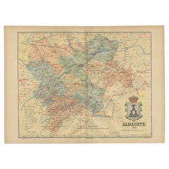
- Albacete, Spain - 1902: A Cartographic Depiction of Landscape and InfrastructureLocated in Langweer, NLAlbacete, Spain - 1902: A Cartographic Depiction of Landscape and Infrastructure An original and historical map of the province of Albacete, dated 1902, from the "Atlas Geográfico I...Category
Antique Early 1900s Maps
MaterialsPaper
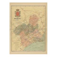
- 1902 Murcia: A Cartographic Snapshot of Spain's Southeastern ProvinceLocated in Langweer, NLThe map represents the province of Murcia, Spain, as it was in 1902. Here's an overview of its characteristics: - **Geography**: It displays the varied terrain of Murcia, from the c...Category
Antique Early 1900s Maps
MaterialsPaper
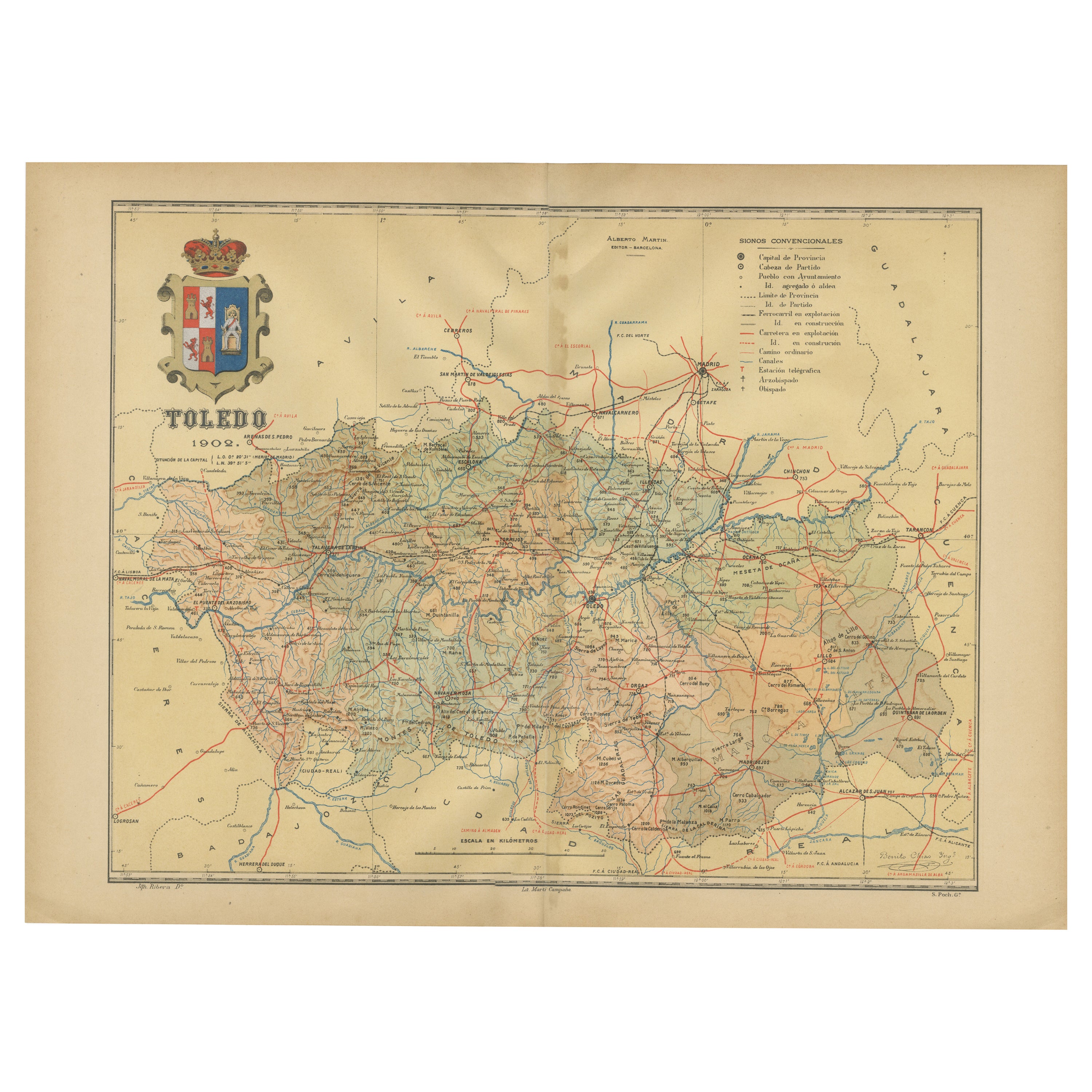
- Toledo 1902: A Historical Cartographic Study of this Spanish ProvinceLocated in Langweer, NLThe print is a historical map of the province of Toledo from 1902. It's a detailed, colored map, highlighting topographical features, such as mountain ranges and rivers, as well as i...Category
Antique Early 1900s Maps
MaterialsPaper
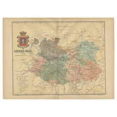
- Ciudad Real 1902: A Detailed Cartographic Survey of La Mancha in SpainLocated in Langweer, NLThis original antitque map presents the province of Ciudad Real, located in the autonomous community of Castilla-La Mancha in central Spain, as of 1902. It includes several notable f...Category
Antique Early 1900s Maps
MaterialsPaper
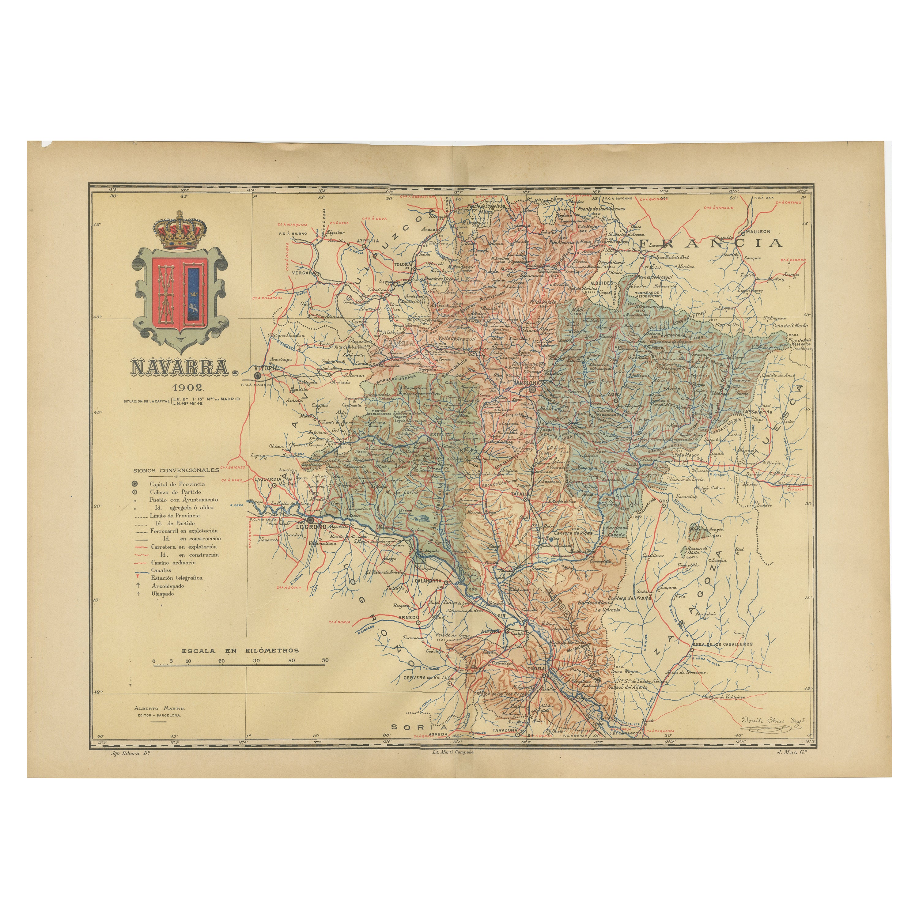
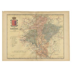
- Navarra in Cartographic Detail: A 1902 Map of the Crossroads of Northern SpainLocated in Langweer, NLThe original antique map for sale shows the Spanish province of Navarra as it was in 1902. Here's a brief description and a potential title for the map: Description: - The map detai...Category
Antique Early 1900s Maps
MaterialsPaper
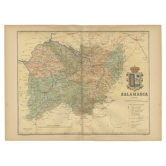
- 1902 Cartographic View of Salamanca: The Golden Province of SpainLocated in Langweer, NLThis map showcases the province of Salamanca in the year 1902. Salamanca is located in the autonomous community of Castile and León in western Spain. It is bordered by the provinces ...Category
Antique Early 1900s Maps
MaterialsPaper

You May Also Like
- Sun and Moon a Story of Astronomy, Photography and CartographyLocated in New York City, NYA unique pictorial history of astronomical exploration from the earliest Prehistoric observatories to the latest satellite images with 280 spectacular images and an inspiring story i...Category
21st Century and Contemporary European Books
MaterialsPaper
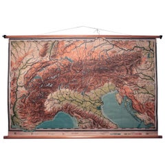
- Vintage Swedish Topographic School Map of European Alps, Made in Sweden 1922Located in Los Angeles, CAVintage Swedish Topographic School map of European Alps, Made in Sweden 1922 This vintage Swedish school map is so unique and a great example of why these are so collectible. W...Category
Vintage 1920s Swedish Maps
MaterialsLinen, Wood, Paper
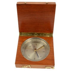
- End 19th Century Antique Magnetic Topographic Compass Made in Brass and OakLocated in Milan, ITMagnetic topographic compass, of oak and brass; instrument consisting of a magnetized needle free to rotate on a horizontal plane, marking with the tip of the needle the direction of magnetic north, compass card with eight winds complete with goniometric circle divided into 360 °, complete with the compass needle lock. Italian manufacture of the late 19th century. Very good condition. Measure 3.1x3.1 height 1. Shipping is insured by Lloyd's London; our gift box is free (look at the last picture). The invention of the compass is mysterious but it is well known that magnetite was discovered in Magnesia, a city of Asia Minor. We can find the first indications about the use in Europe of the magnetic force for orientation at the end of the XII century...Category
Antique 1890s Italian Scientific Instruments
MaterialsOak
- Antique Lithography Map, Isle of Wight, English, Framed, Engraving, CartographyLocated in Hele, Devon, GBThis is an antique lithography map of the Isle of Wight. An English, framed atlas engraving of cartographic interest, dating to the early 19th century and later. Superb lithography ...Category
Antique Early 19th Century British Regency Maps
MaterialsWood
- Antique Lithography Map, Isle of Thanet, Kent, English, Cartography, VictorianLocated in Hele, Devon, GBThis is an antique lithography map of The Isle of Thanet in Kent. An English, framed atlas engraving of cartographic interest, dating to the mid 19th century and later. Superb litho...Category
Antique Mid-19th Century British Victorian Maps
MaterialsWood
- Very Large Vintage Map of Canada, German, Education, Institution, CartographyLocated in Hele, Devon, GBThis is a very large vintage map of Canada. A German, quality printed educational or institution map, dating to the mid 20th century, circa 1965....Category
Mid-20th Century German Maps
MaterialsPaper


Recently Viewed
View AllMore Ways To Browse
Map Of Old Armenia
Teak Wood Sphere
Nova Guinea Maps
Antique Map Of Illinois
Petite Point Hand Bag
Antique Map Of Southeastern Us
Antique Map Alabama
Antique Map Of Sydney
Malay Archipelago Map
Gambia Antique Map
Uruguay Antique Map
Guyana Antique Map
Ruscelli Map
Masque Theatre No
Nova Scotia Map
Antique Map Tuscany
Berkshire Antique Map
Cornwall Map