Items Similar to Toledo 1902: A Historical Cartographic Study of this Spanish Province

Want more images or videos?
Request additional images or videos from the seller
1 of 6
Toledo 1902: A Historical Cartographic Study of this Spanish Province
About the Item
The print is a historical map of the province of Toledo from 1902. It's a detailed, colored map, highlighting topographical features, such as mountain ranges and rivers, as well as infrastructural elements like roads and railways. The map includes symbols that represent cities, towns, and other points of interest, with a key explaining these symbols typically found on one side of the map.
The map uses contour lines to depict elevation, with different shades or colors often used to indicate various altitude ranges. Rivers and bodies of water are clearly marked, and the map likely shows the boundaries of the province with neighboring provinces and regions.
The prominence of certain elements, such as railways and roads, suggests the map's practical use for navigation and travel at the time of its creation. The presence of a coat of arms or heraldic shield usually indicates the importance and pride of the region, often containing symbols of local history and identity.
Such maps are valuable for historical research, providing insight into the geography, infrastructure, and administrative divisions of a region at a specific point in time. They can be used to study changes in the landscape, urban development, and the evolution of transportation networks over time.
Toledo is a province located in central Spain, part of the autonomous community of Castilla-La Mancha. It is particularly significant for its historical, cultural, and architectural heritage. The city of Toledo, the capital of the province, is often called the "Imperial City" for having been the main venue of the court of Charles V, Holy Roman Emperor in Spain, and the "City of the Three Cultures", having been influenced by a historical co-existence of Christians, Muslims, and Jews.
Toledo's old city is a UNESCO World Heritage Site, where you can find a rich array of monuments dating from the Roman, Visigothic, Moorish, and Renaissance periods. The Toledo Cathedral and the Alcázar of Toledo are two notable landmarks. Toledo is also famous for its production of steel and the manufacturing of swords, a craft that dates back to the Roman period.
The province is characterized by a varied landscape that includes the Montes de Toledo and part of the Tagus River, which provides a scenic backdrop to many of its towns and villages. It's a province that encapsulates much of Spain's rich and tumultuous history, with a wealth of stories to explore.
- Dimensions:Height: 14.77 in (37.5 cm)Width: 20.08 in (51 cm)Depth: 0 in (0.02 mm)
- Materials and Techniques:
- Period:1900-1909
- Date of Manufacture:1902
- Condition:Good condition. Central vertical folding lines as issued. Aged paper with typically warm, yellowish-brown hue, especially around the edges and folding lines. Top middle a wrinkle. Check the images carefully.
- Seller Location:Langweer, NL
- Reference Number:
About the Seller
5.0
Platinum Seller
These expertly vetted sellers are 1stDibs' most experienced sellers and are rated highest by our customers.
Established in 2009
1stDibs seller since 2017
1,919 sales on 1stDibs
Typical response time: <1 hour
- ShippingRetrieving quote...Ships From: Langweer, Netherlands
- Return PolicyA return for this item may be initiated within 14 days of delivery.
More From This SellerView All
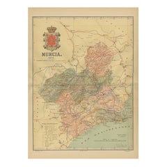
- 1902 Murcia: A Cartographic Snapshot of Spain's Southeastern ProvinceLocated in Langweer, NLThe map represents the province of Murcia, Spain, as it was in 1902. Here's an overview of its characteristics: - **Geography**: It displays the varied terrain of Murcia, from the c...Category
Antique Early 1900s Maps
MaterialsPaper
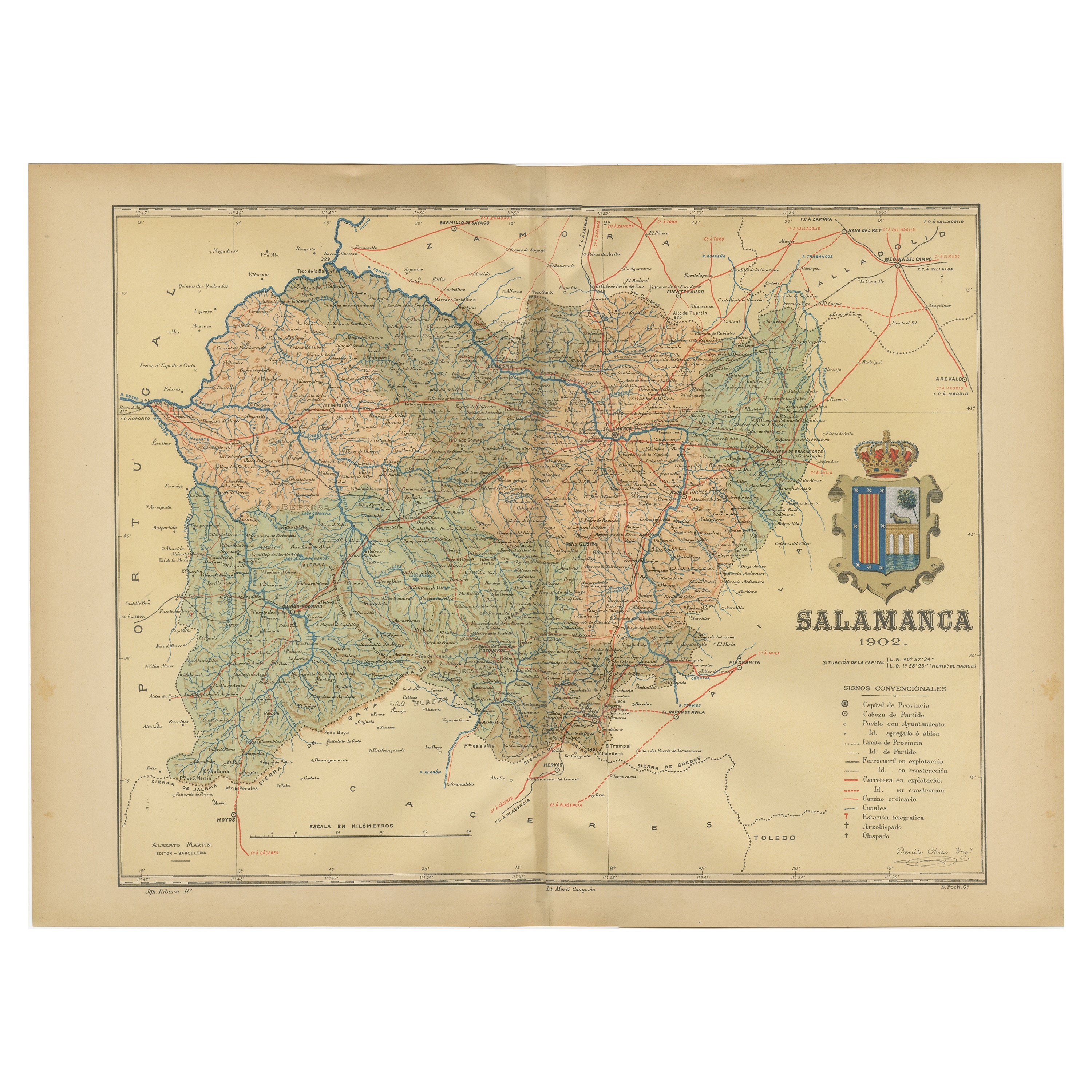
- 1902 Cartographic View of Salamanca: The Golden Province of SpainLocated in Langweer, NLThis map showcases the province of Salamanca in the year 1902. Salamanca is located in the autonomous community of Castile and León in western Spain. It is bordered by the provinces ...Category
Antique Early 1900s Maps
MaterialsPaper
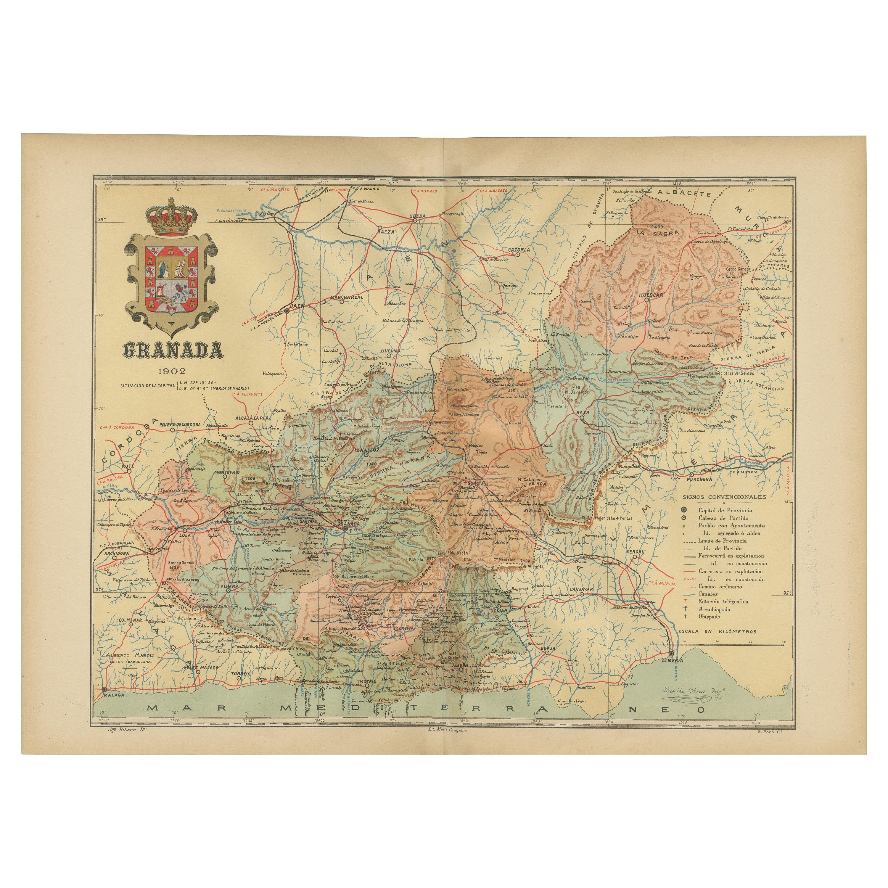
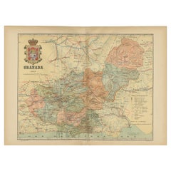
- Granada 1902: A Cartographic Exploration of Andalusia's Mountainous ProvinceLocated in Langweer, NLThis original antique map depicts the province of Granada, part of the autonomous community of Andalusia in southern Spain, as of 1902. The map features several important details: I...Category
Antique Early 1900s Maps
MaterialsPaper
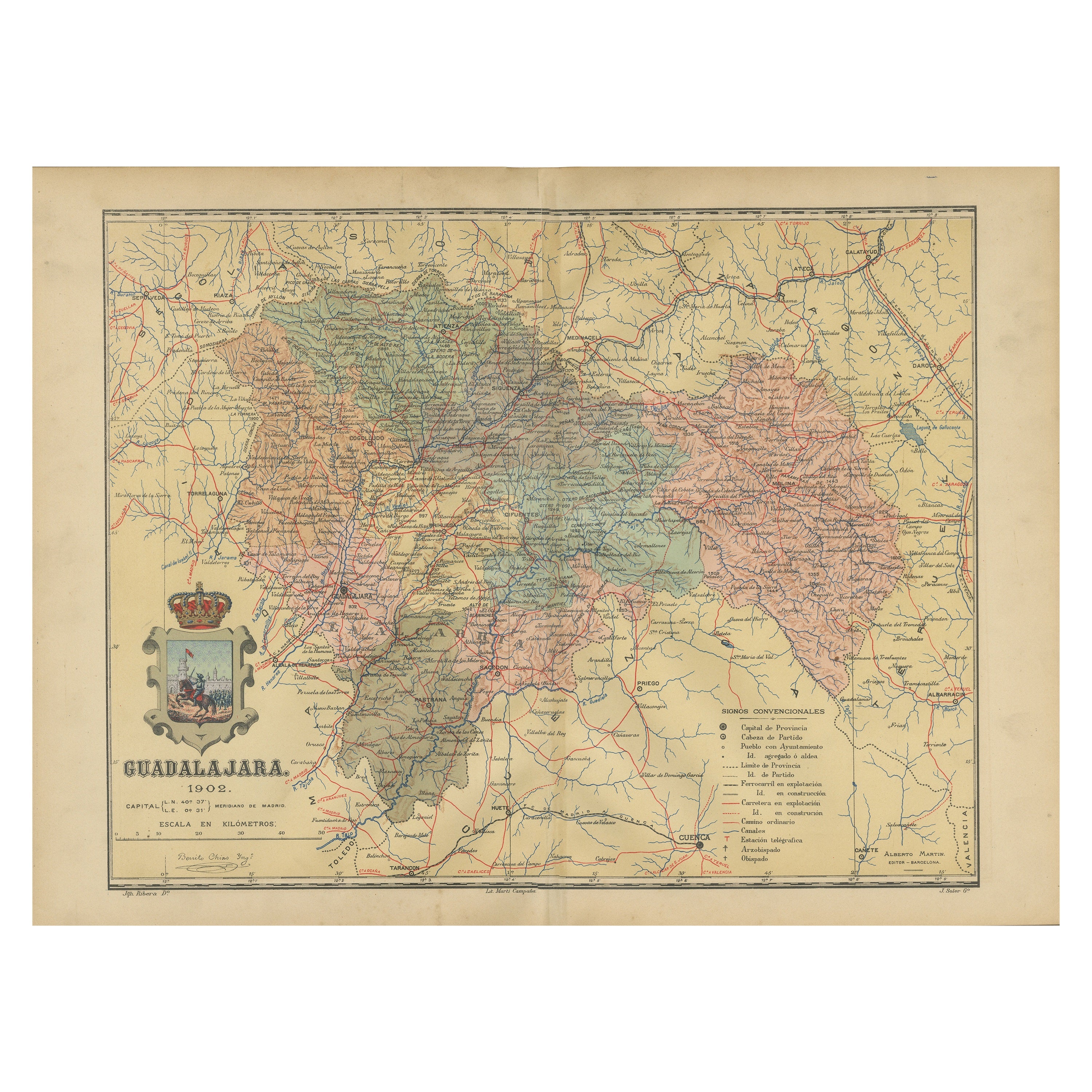
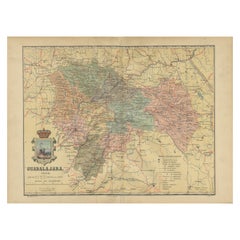
- Guadalajara 1902: A Cartographic Image of Castilla-La Mancha's Northern ProvinceLocated in Langweer, NLThe map illustrates the province of Guadalajara, part of the autonomous community of Castilla-La Mancha in Spain, as of 1902. The map includes various geographic and infrastructural ...Category
Antique Early 1900s Maps
MaterialsPaper
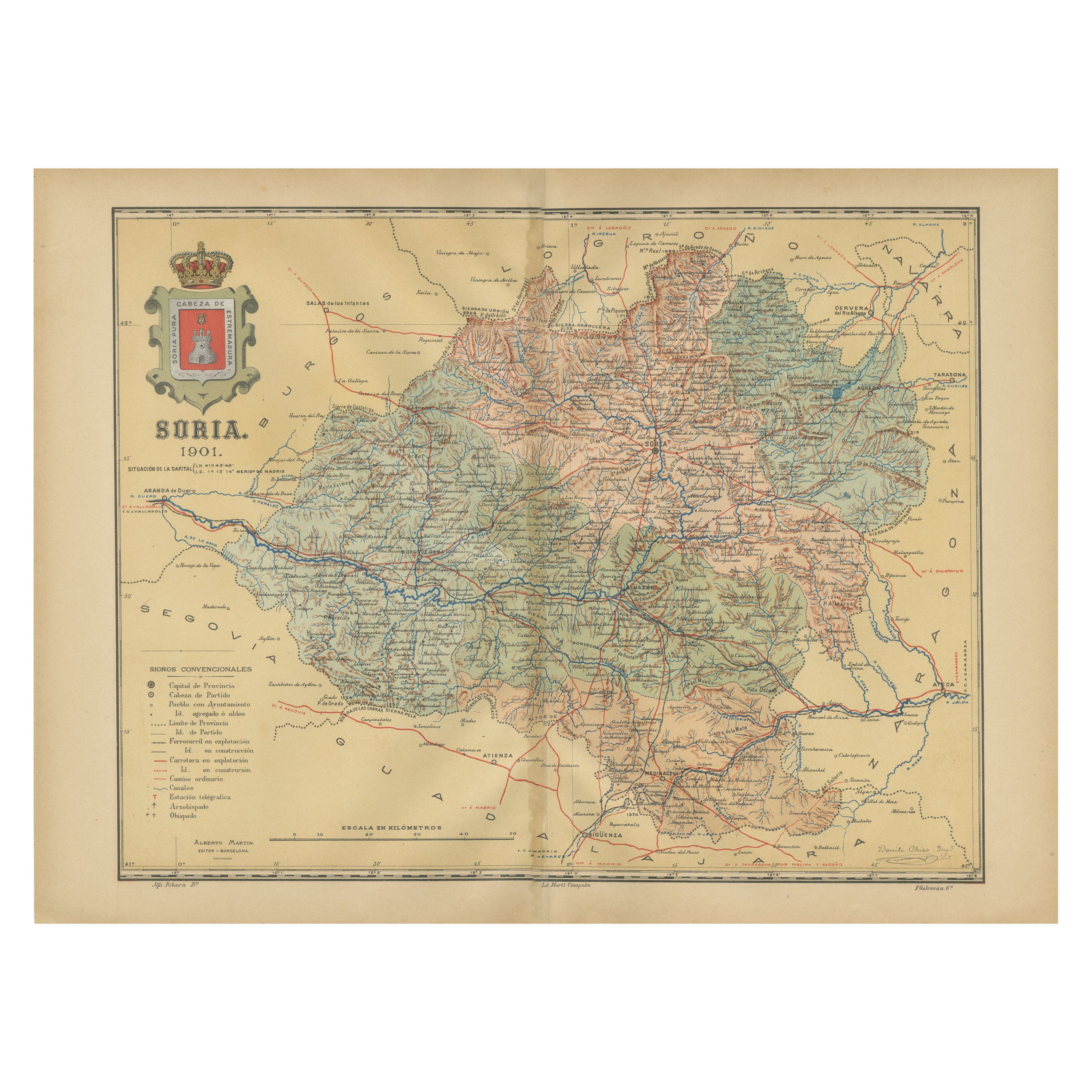
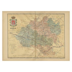
- Map of Soria Province, 1901: Detailed Cartography of Northeastern SpainLocated in Langweer, NLThe map is a historical map of the province of Soria from 1901. A decorative coat of arms enhances the aesthetic of the map, signifying the historical and cultural significance of ...Category
Antique Early 1900s Maps
MaterialsPaper
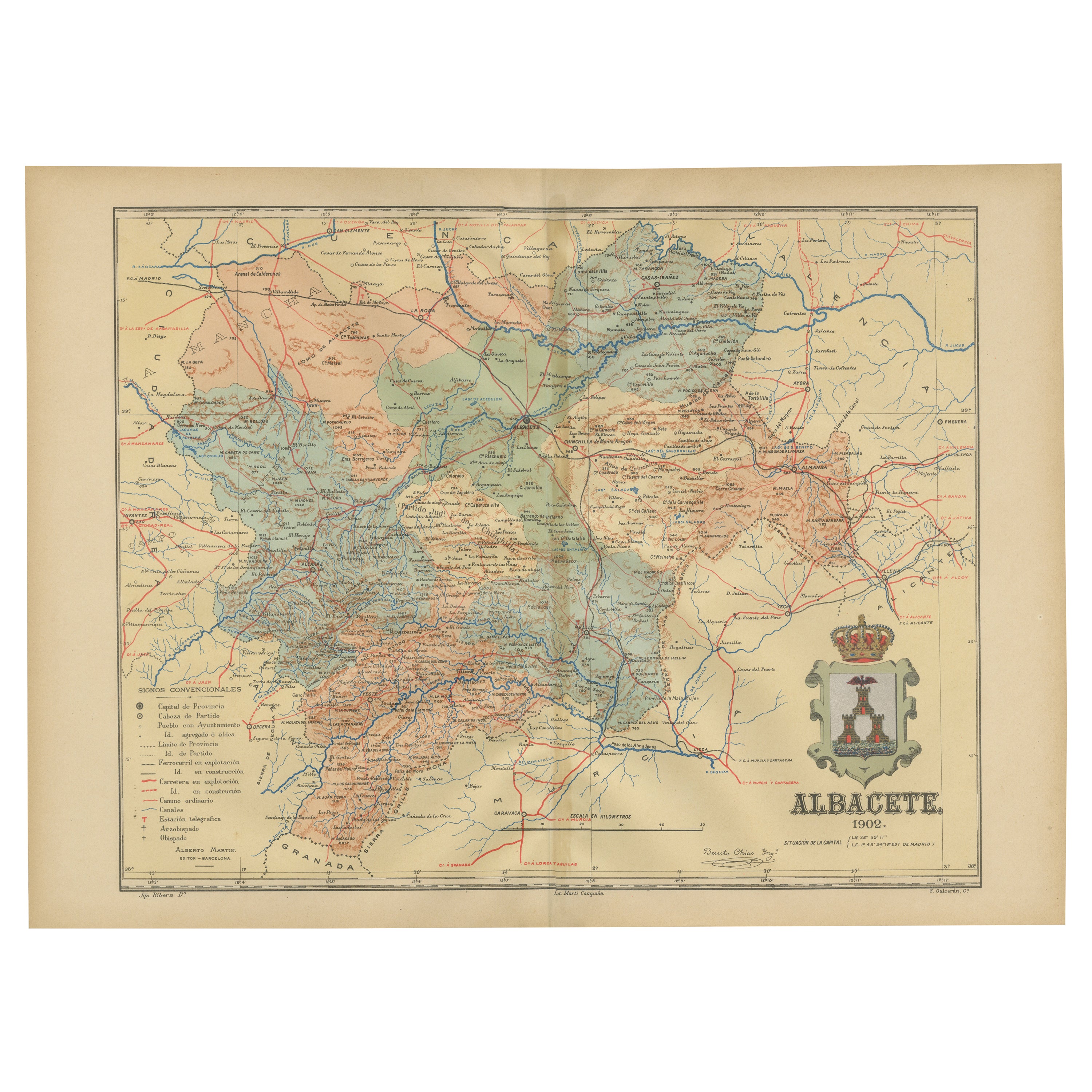
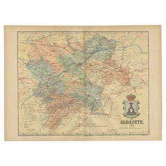
- Albacete, Spain - 1902: A Cartographic Depiction of Landscape and InfrastructureLocated in Langweer, NLAlbacete, Spain - 1902: A Cartographic Depiction of Landscape and Infrastructure An original and historical map of the province of Albacete, dated 1902, from the "Atlas Geográfico I...Category
Antique Early 1900s Maps
MaterialsPaper

You May Also Like
- Spanish Wrought Iron Shotgun Bayonet with Hilt and Made in ToledoLocated in Marbella, ESSpanish Wrought Iron Shotgun Bayonet with Hilt and Made in Toledo.Category
Mid-20th Century Spanish Arms, Armor and Weapons
MaterialsWrought Iron
- Antique Lithography Map of Cheshire, English, Framed, Cartography, VictorianLocated in Hele, Devon, GBThis is an antique lithography map of Cheshire. An English, framed atlas engraving of cartographic interest, dating to the mid 19th century and lat...Category
Antique Mid-19th Century British Victorian Maps
MaterialsWood
- Sun and Moon a Story of Astronomy, Photography and CartographyLocated in New York City, NYA unique pictorial history of astronomical exploration from the earliest Prehistoric observatories to the latest satellite images with 280 spectacular images and an inspiring story i...Category
21st Century and Contemporary European Books
MaterialsPaper
- Antique Lithography Map, Isle of Wight, English, Framed, Engraving, CartographyLocated in Hele, Devon, GBThis is an antique lithography map of the Isle of Wight. An English, framed atlas engraving of cartographic interest, dating to the early 19th century and later. Superb lithography ...Category
Antique Early 19th Century British Regency Maps
MaterialsWood
- Very Large Vintage Map of Canada, German, Education, Institution, CartographyLocated in Hele, Devon, GBThis is a very large vintage map of Canada. A German, quality printed educational or institution map, dating to the mid 20th century, circa 1965....Category
Mid-20th Century German Maps
MaterialsPaper
- Antique Lithography Map, Isle of Thanet, Kent, English, Cartography, VictorianLocated in Hele, Devon, GBThis is an antique lithography map of The Isle of Thanet in Kent. An English, framed atlas engraving of cartographic interest, dating to the mid 19th century and later. Superb litho...Category
Antique Mid-19th Century British Victorian Maps
MaterialsWood


Recently Viewed
View AllMore Ways To Browse
Map Of Old Armenia
Teak Wood Sphere
Nova Guinea Maps
Antique Map Of Illinois
Petite Point Hand Bag
Antique Map Of Southeastern Us
Antique Map Alabama
Antique Map Of Sydney
Malay Archipelago Map
Gambia Antique Map
Uruguay Antique Map
Guyana Antique Map
Ruscelli Map
Masque Theatre No
Nova Scotia Map
Antique Map Tuscany
Berkshire Antique Map
Cornwall Map