Items Similar to 1902 Cartographic View of Salamanca: The Golden Province of Spain


Want more images or videos?
Request additional images or videos from the seller
1 of 6
1902 Cartographic View of Salamanca: The Golden Province of Spain
About the Item
This map showcases the province of Salamanca in the year 1902. Salamanca is located in the autonomous community of Castile and León in western Spain. It is bordered by the provinces of Zamora, Valladolid, Ávila, and Cáceres, and is situated close to the Portuguese border.
Salamanca is renowned for its rich cultural heritage, including the University of Salamanca, which is one of the oldest universities in Europe and contributes to the province's reputation as a center of learning and education. The province features a varied landscape with mountains, such as the Sierra de Francia, and the Duero and Tormes rivers providing natural beauty and resources.
The historical city of Salamanca, the province's capital, is known for its golden sandstone architecture, which has earned it the nickname "La Dorada" (The Golden City). It's a UNESCO World Heritage site, replete with historic buildings, including two cathedrals, the Casa de las Conchas, and the Plaza Mayor, which is one of the most beautiful squares in Spain.
The map details the geography of the province with its road networks, railway lines, and natural features like rivers and mountain ranges, as they existed in the early 20th century.
- Dimensions:Height: 14.77 in (37.5 cm)Width: 20.08 in (51 cm)Depth: 0 in (0.02 mm)
- Materials and Techniques:
- Period:1900-1909
- Date of Manufacture:1902
- Condition:Good condition. Central vertical folding lines as issued. Aged paper with typically warm, yellowish-brown hue, especially around the edges. Check the images carefully.
- Seller Location:Langweer, NL
- Reference Number:
About the Seller
5.0
Platinum Seller
These expertly vetted sellers are 1stDibs' most experienced sellers and are rated highest by our customers.
Established in 2009
1stDibs seller since 2017
1,933 sales on 1stDibs
Typical response time: <1 hour
- ShippingRetrieving quote...Ships From: Langweer, Netherlands
- Return PolicyA return for this item may be initiated within 14 days of delivery.
More From This SellerView All
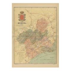
- 1902 Murcia: A Cartographic Snapshot of Spain's Southeastern ProvinceLocated in Langweer, NLThe map represents the province of Murcia, Spain, as it was in 1902. Here's an overview of its characteristics: - **Geography**: It displays the varied terrain of Murcia, from the c...Category
Antique Early 1900s Maps
MaterialsPaper
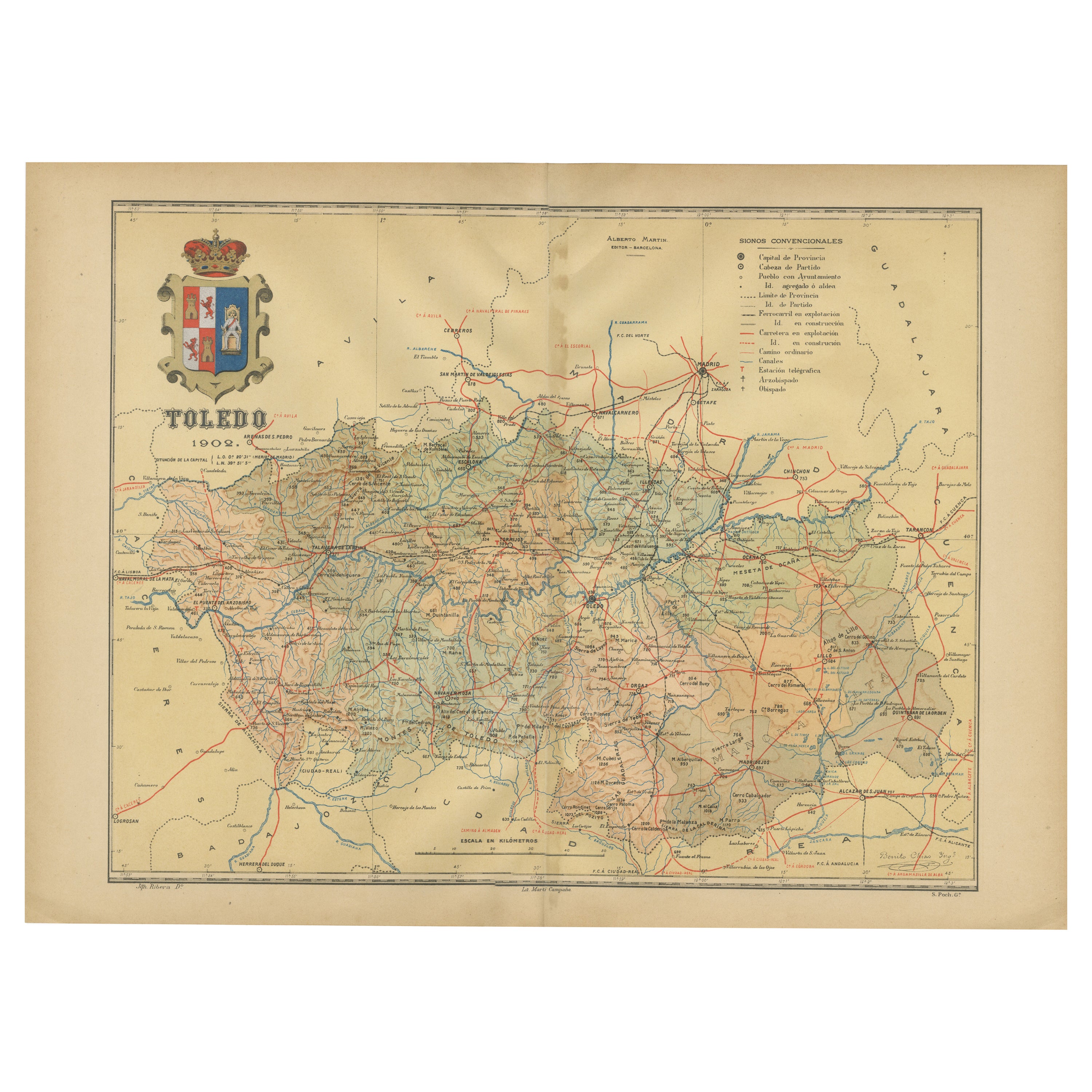
- Toledo 1902: A Historical Cartographic Study of this Spanish ProvinceLocated in Langweer, NLThe print is a historical map of the province of Toledo from 1902. It's a detailed, colored map, highlighting topographical features, such as mountain ranges and rivers, as well as i...Category
Antique Early 1900s Maps
MaterialsPaper
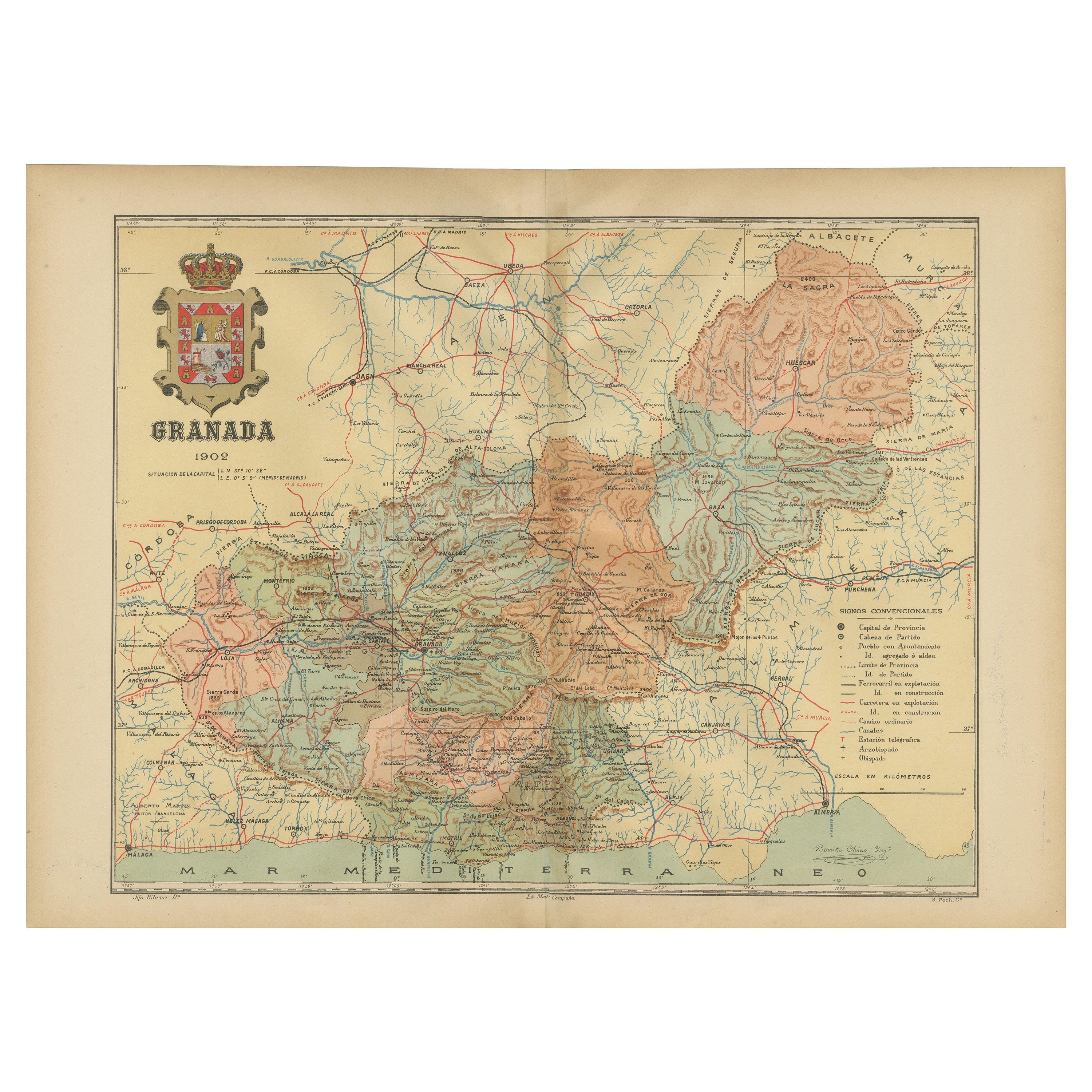
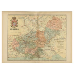
- Granada 1902: A Cartographic Exploration of Andalusia's Mountainous ProvinceLocated in Langweer, NLThis original antique map depicts the province of Granada, part of the autonomous community of Andalusia in southern Spain, as of 1902. The map features several important details: I...Category
Antique Early 1900s Maps
MaterialsPaper
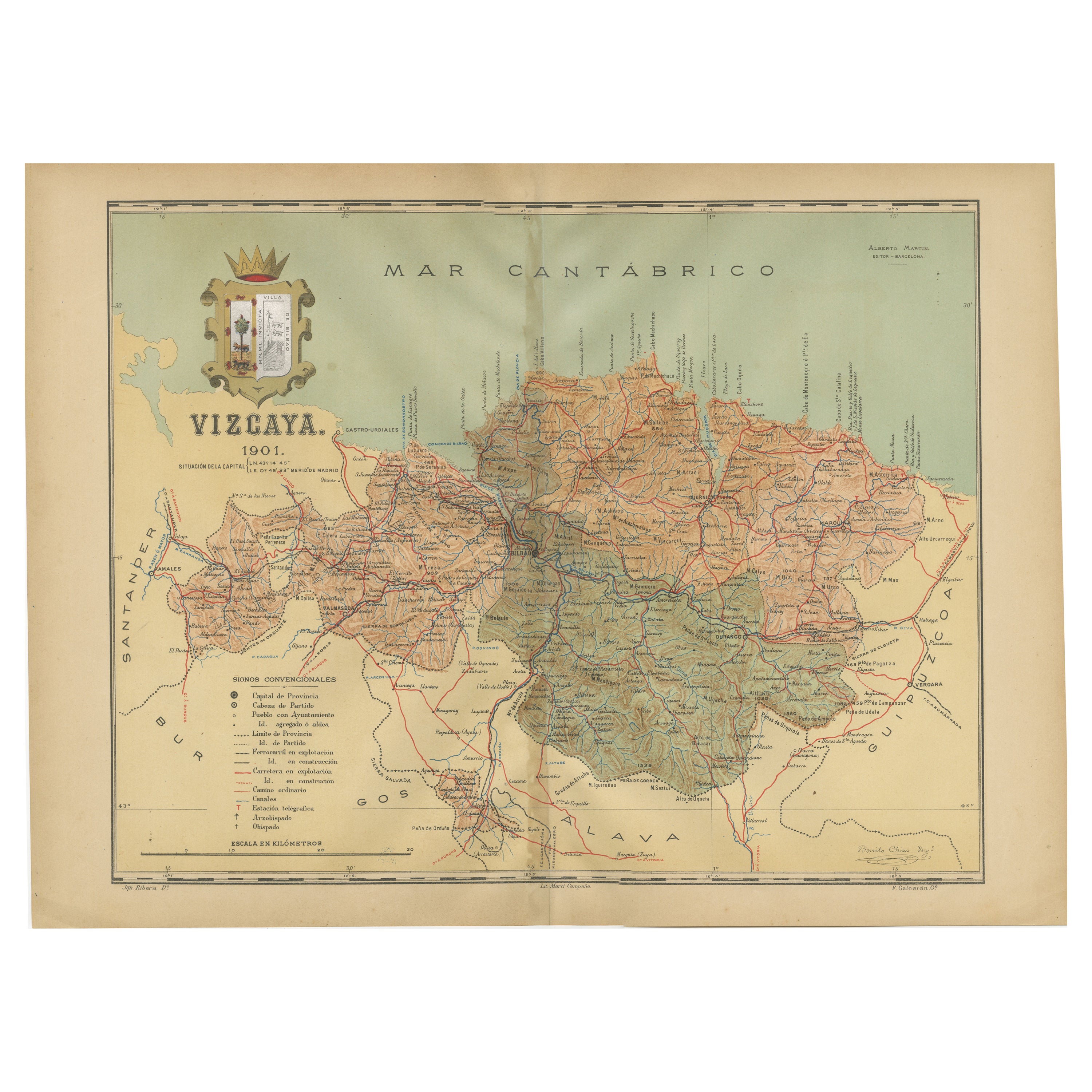
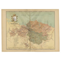
- Cartographic Heritage: The 1901 Map of the Vizcaya Province in SpainLocated in Langweer, NLThis is a historical map of the province of Vizcaya (Biscay) in Spain, dated 1901. The title on the map is "VIZCAYA. 1901." It shows the topographical details of the region with cont...Category
Antique Early 1900s Maps
MaterialsPaper
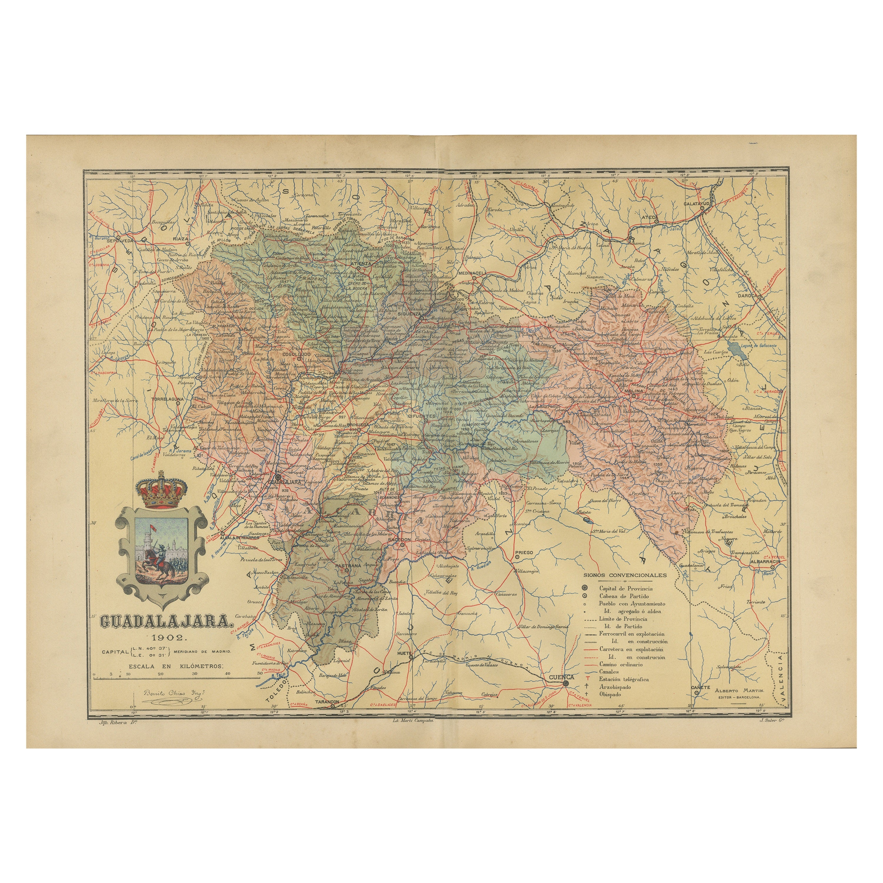
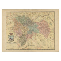
- Guadalajara 1902: A Cartographic Image of Castilla-La Mancha's Northern ProvinceLocated in Langweer, NLThe map illustrates the province of Guadalajara, part of the autonomous community of Castilla-La Mancha in Spain, as of 1902. The map includes various geographic and infrastructural ...Category
Antique Early 1900s Maps
MaterialsPaper
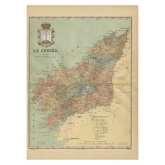
- La Coruña 1901: A Cartographic View of Galicia's Maritime ProvinceLocated in Langweer, NLThis antique map for sale showcases the province of La Coruña (in Galician, A Coruña), located in the northwest of Spain, within the autonomous community of Galicia, as of the year 1...Category
Antique Early 1900s Maps
MaterialsPaper

You May Also Like
- Antique Oarsman's Map of the River Thames, English, Cartography, Published 1912Located in Hele, Devon, GBThis is an antique copy of The Oarsman's and Angler's Map of the River Thames - New Edition. An English, bound map book, published in English by Edward Stanford, London, this new edi...Category
Early 20th Century British Other Books
MaterialsPaper
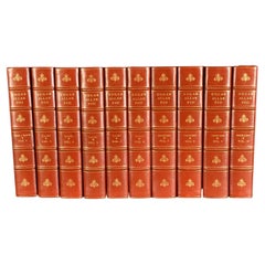
- 1902 The Complete Works of Edgar Allan PoeLocated in Bath, GBA beautiful limited edition set of the complete works of Edgar Allan Poe, illustrated with ten plates to each volume, and signed by the publisher. The Arnheim Edition of Poe's works...Category
Antique Early 1900s Books
MaterialsPaper
- Antique 18th Century Map of the Province of Pensilvania 'Pennsylvania State'Located in Philadelphia, PAA fine antique of the colony of Pennsylvania. Noted at the top of the sheet as a 'Map of the province of Pensilvania'. This undated and anonymous map is thought to be from the Gentleman's Magazine, London, circa 1775, although the general appearance could date it to the 1760's. The southern boundary reflects the Mason-Dixon survey (1768), the western boundary is placed just west of Pittsburgh, and the northern boundary is not marked. The map has a number of reference points that likely refer to companion text and appear to be connected to boundaries. The western and southern boundaries are marked Q, R, S, for example. A diagonal line runs from the Susquehanna R to the Lake Erie P. A broken line marked by many letters A, B, N, O, etc., appears in the east. There are no latitude or longitude markings, blank verso. Framed in a shaped contemporary gilt wooden frame and matted under a cream colored matte. Bearing an old Graham Arader Gallery...Category
Antique 18th Century British American Colonial Maps
MaterialsPaper
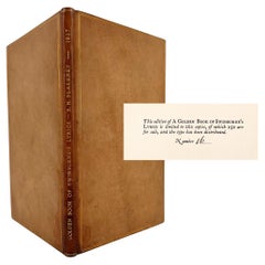
- The Golden Book of Swinburne's LyricsLocated in Middletown, NYA beautiful Zaehnsdorf-bound collection of the poetry of Algernon Charles Swinburne (1837 – 1909) whose works often handled Victorian taboos, such as lesbianism, sado-masochism, and ...Category
Early 20th Century English Books
MaterialsGold Leaf
- Sun and Moon a Story of Astronomy, Photography and CartographyLocated in New York City, NYA unique pictorial history of astronomical exploration from the earliest Prehistoric observatories to the latest satellite images with 280 spectacular images and an inspiring story i...Category
21st Century and Contemporary European Books
MaterialsPaper
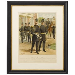
- Original "1902-1907 Officers of the Staff Corps" by C. Ogden, 1908Located in Colorado Springs, CO1908 "1902-1907 Officers of the Staff Corps & Departments, General Staff and Chaplain in Full Dress" Chromolithograph by C. Ogden This colorful lithograph by H. A. Ogden was publish...Category
Antique Early 1900s American Prints
MaterialsPaper


Recently Viewed
View AllMore Ways To Browse
Map Of Old Armenia
Teak Wood Sphere
Nova Guinea Maps
Antique Map Of Illinois
Petite Point Hand Bag
Antique Map Of Southeastern Us
Antique Map Alabama
Antique Map Of Sydney
Malay Archipelago Map
Gambia Antique Map
Uruguay Antique Map
Guyana Antique Map
Ruscelli Map
Masque Theatre No
Nova Scotia Map
Antique Map Tuscany
Berkshire Antique Map
Cornwall Map