Items Similar to Guadalajara 1902: A Cartographic Image of Castilla-La Mancha's Northern Province


Want more images or videos?
Request additional images or videos from the seller
1 of 6
Guadalajara 1902: A Cartographic Image of Castilla-La Mancha's Northern Province
About the Item
The map illustrates the province of Guadalajara, part of the autonomous community of Castilla-La Mancha in Spain, as of 1902. The map includes various geographic and infrastructural features:
It highlights the diverse landscape, which includes part of the Iberian System mountain range. Blue lines likely represent rivers, including the Henares, which runs through the province. Red lines indicate the roads and railways, showing the infrastructure that connects Guadalajara's towns and cities both internally and with neighboring regions. Symbols mark the locations of cities, towns, and villages, with the capital city of Guadalajara indicated.
The coat of arms of Guadalajara is prominently featured, reflecting the historical significance of the region with symbols like the castle and the lion.
About the province of Guadalajara:
Guadalajara is known for its rich history and cultural heritage, which includes medieval castles, churches, and the walled town of Sigüenza. The province's geography features significant natural spaces, such as the Alto Tajo Natural Park. Guadalajara's economy has traditionally been based on agriculture and livestock, but also includes industry and services, partly due to its proximity to Madrid. The area is known for its traditional festivals, such as La Caballada de Atienza, and for crafts like black pottery from Cogolludo. The architecture of the province bears witness to various cultural influences over the centuries, including Romanesque and Cistercian monuments.
- Dimensions:Height: 14.77 in (37.5 cm)Width: 20.08 in (51 cm)Depth: 0 in (0.02 mm)
- Materials and Techniques:
- Period:1900-1909
- Date of Manufacture:1902
- Condition:Good condition. Central vertical folding lines as issued. Aged paper with typically warm, yellowish-brown hue, especially around the edges. Some soiling on the borders and one small tear, not affecting the image. Check the images carefully.
- Seller Location:Langweer, NL
- Reference Number:
About the Seller
5.0
Platinum Seller
These expertly vetted sellers are 1stDibs' most experienced sellers and are rated highest by our customers.
Established in 2009
1stDibs seller since 2017
1,928 sales on 1stDibs
Typical response time: <1 hour
- ShippingRetrieving quote...Ships From: Langweer, Netherlands
- Return PolicyA return for this item may be initiated within 14 days of delivery.
More From This SellerView All
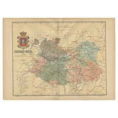
- Ciudad Real 1902: A Detailed Cartographic Survey of La Mancha in SpainLocated in Langweer, NLThis original antitque map presents the province of Ciudad Real, located in the autonomous community of Castilla-La Mancha in central Spain, as of 1902. It includes several notable f...Category
Antique Early 1900s Maps
MaterialsPaper
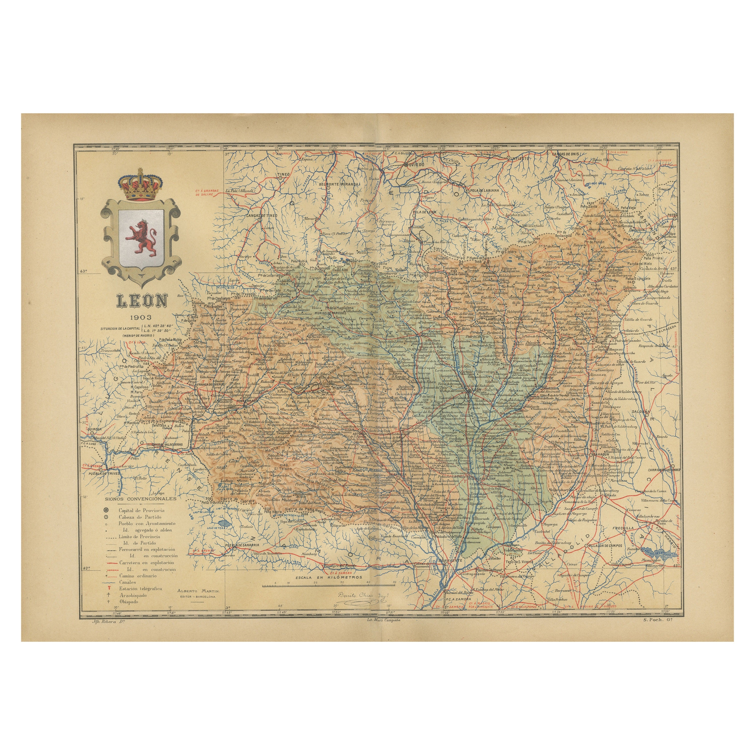
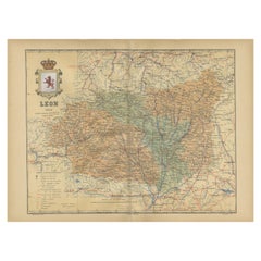
- León 1903: A Cartographic Detailing of Castilla y León's Mountainous ProvinceLocated in Langweer, NLThe map depicts the province of León, which is located in the northwest of Spain and forms part of the autonomous community of Castilla y León, as of 1903. Notable features of the ma...Category
Antique Early 1900s Maps
MaterialsPaper
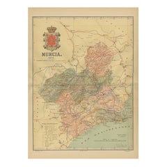
- 1902 Murcia: A Cartographic Snapshot of Spain's Southeastern ProvinceLocated in Langweer, NLThe map represents the province of Murcia, Spain, as it was in 1902. Here's an overview of its characteristics: - **Geography**: It displays the varied terrain of Murcia, from the c...Category
Antique Early 1900s Maps
MaterialsPaper
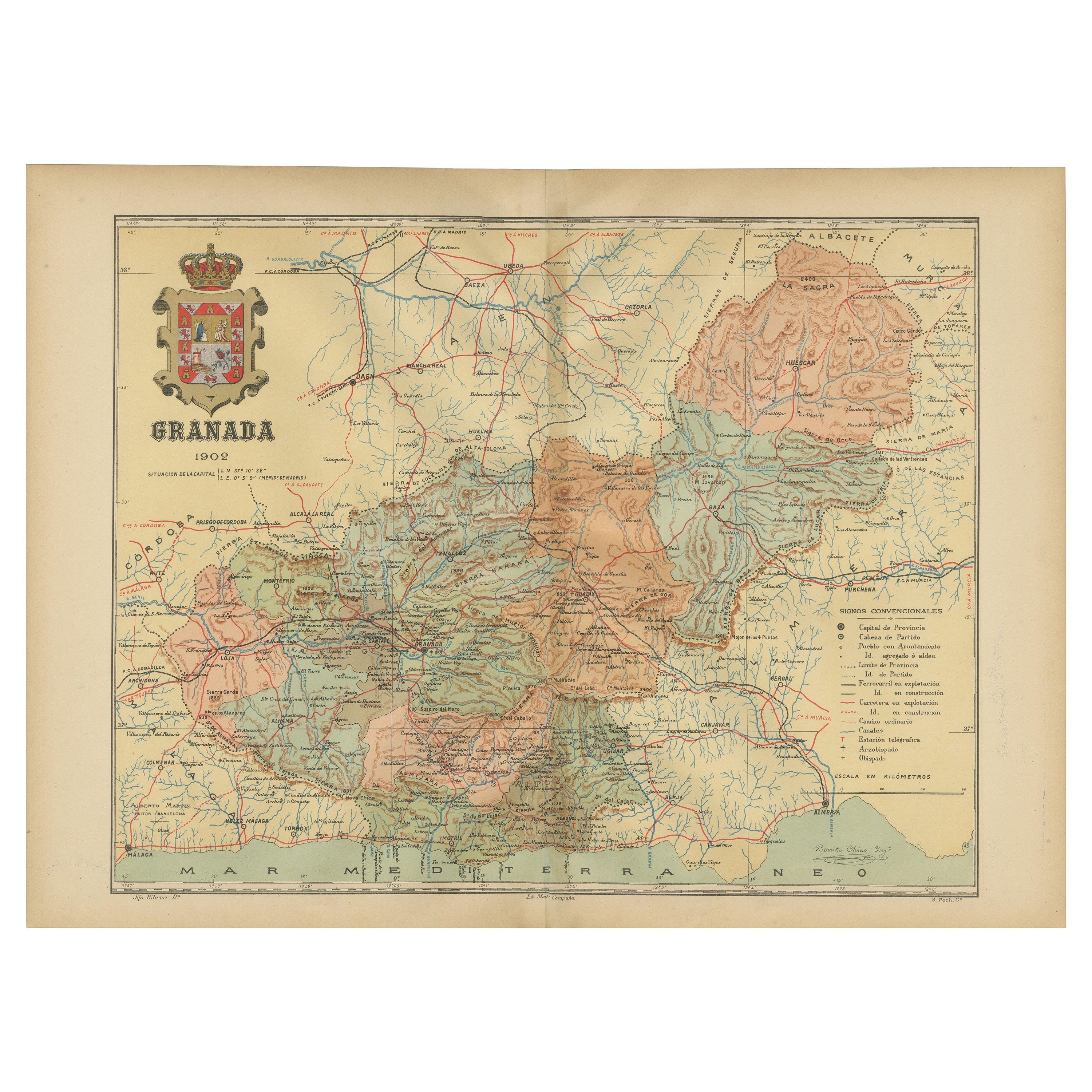
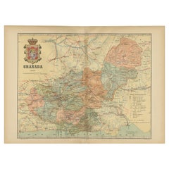
- Granada 1902: A Cartographic Exploration of Andalusia's Mountainous ProvinceLocated in Langweer, NLThis original antique map depicts the province of Granada, part of the autonomous community of Andalusia in southern Spain, as of 1902. The map features several important details: I...Category
Antique Early 1900s Maps
MaterialsPaper
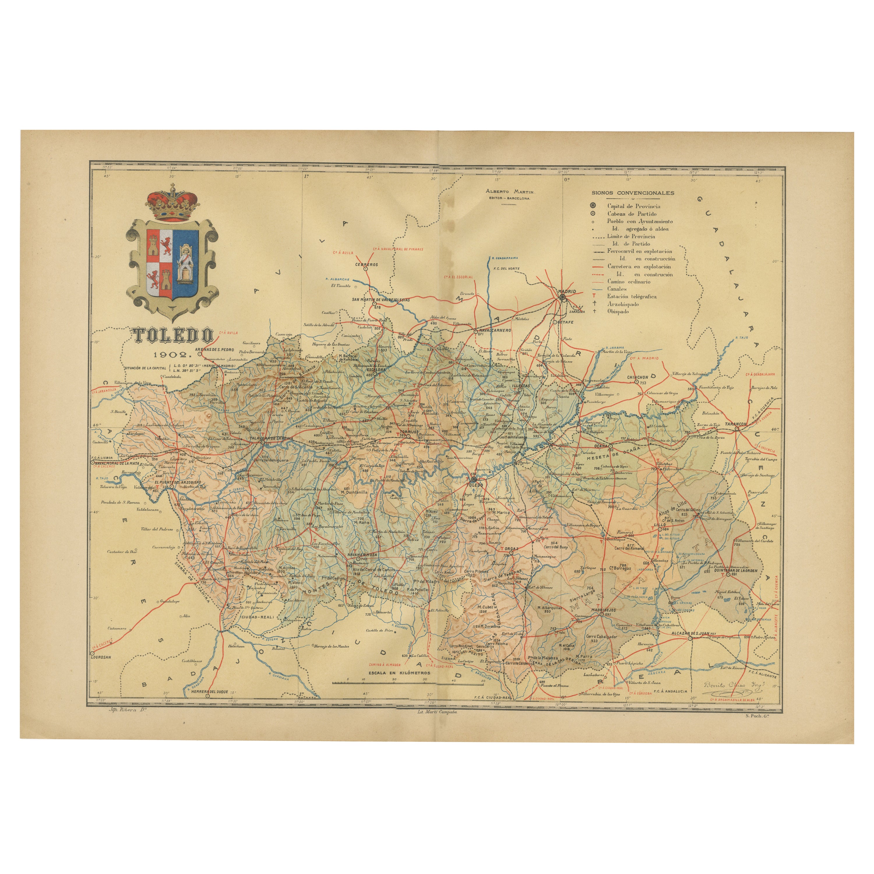
- Toledo 1902: A Historical Cartographic Study of this Spanish ProvinceLocated in Langweer, NLThe print is a historical map of the province of Toledo from 1902. It's a detailed, colored map, highlighting topographical features, such as mountain ranges and rivers, as well as i...Category
Antique Early 1900s Maps
MaterialsPaper
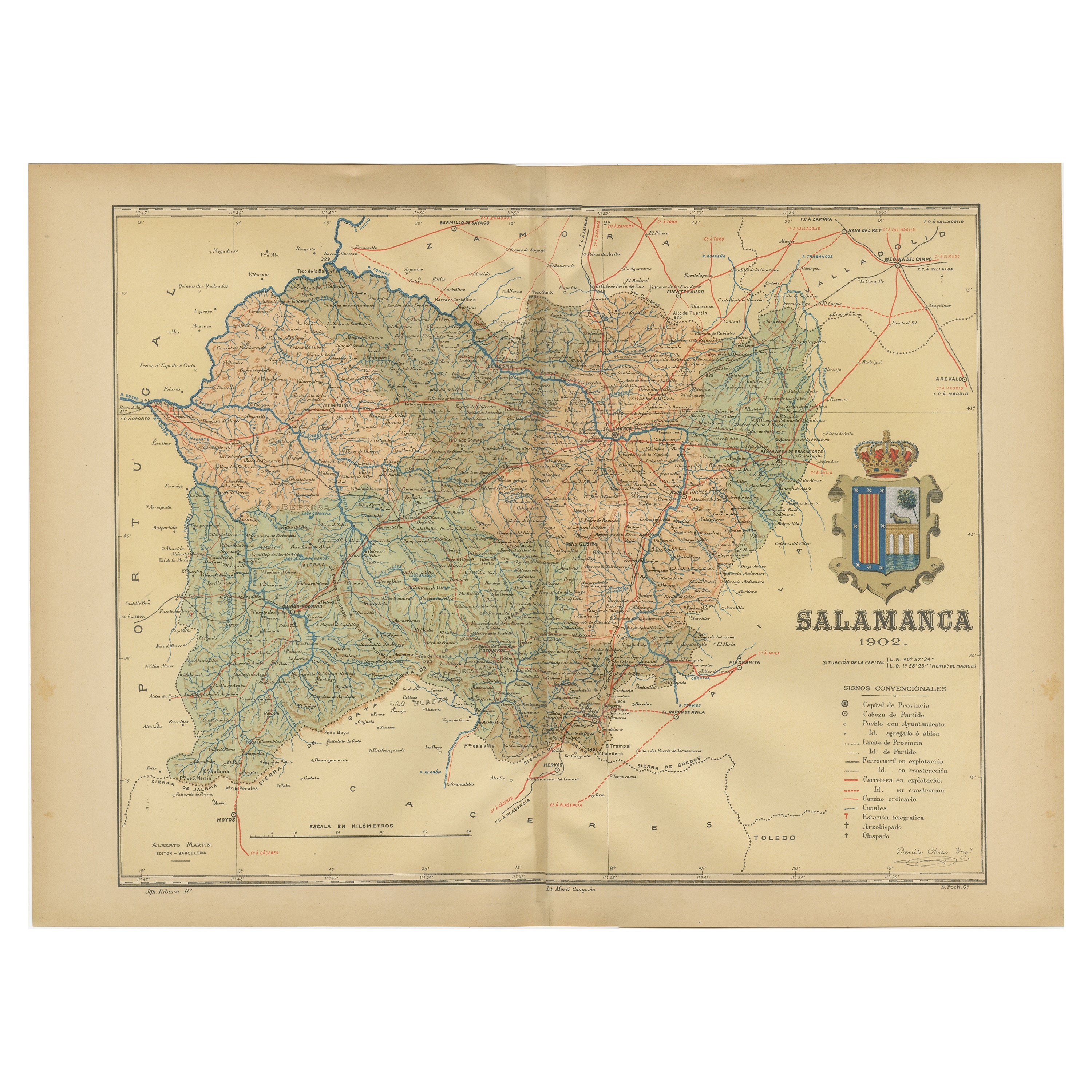
- 1902 Cartographic View of Salamanca: The Golden Province of SpainLocated in Langweer, NLThis map showcases the province of Salamanca in the year 1902. Salamanca is located in the autonomous community of Castile and León in western Spain. It is bordered by the provinces ...Category
Antique Early 1900s Maps
MaterialsPaper


You May Also Like
- 4 Volumes, Cervantes, Don Quixote De La ManchaLocated in New York, NY4 Volumes. Cervantes.Don Quixote De La Mancha.Edition Deluxe, limited to 25 Sets, this is #3. Translated From The Spanish By P.A. Motteux. Bound in 3/4 wine ...Category
20th Century American Books
MaterialsLeather
- Sun and Moon a Story of Astronomy, Photography and CartographyLocated in New York City, NYA unique pictorial history of astronomical exploration from the earliest Prehistoric observatories to the latest satellite images with 280 spectacular images and an inspiring story i...Category
21st Century and Contemporary European Books
MaterialsPaper
- Antique Lithography Map of Cheshire, English, Framed, Cartography, VictorianLocated in Hele, Devon, GBThis is an antique lithography map of Cheshire. An English, framed atlas engraving of cartographic interest, dating to the mid 19th century and lat...Category
Antique Mid-19th Century British Victorian Maps
MaterialsWood
- Antique Lithography Map, Isle of Wight, English, Framed, Engraving, CartographyLocated in Hele, Devon, GBThis is an antique lithography map of the Isle of Wight. An English, framed atlas engraving of cartographic interest, dating to the early 19th century and later. Superb lithography ...Category
Antique Early 19th Century British Regency Maps
MaterialsWood
- Very Large Vintage Map of Canada, German, Education, Institution, CartographyLocated in Hele, Devon, GBThis is a very large vintage map of Canada. A German, quality printed educational or institution map, dating to the mid 20th century, circa 1965....Category
Mid-20th Century German Maps
MaterialsPaper
- Antique Lithography Map, Isle of Thanet, Kent, English, Cartography, VictorianLocated in Hele, Devon, GBThis is an antique lithography map of The Isle of Thanet in Kent. An English, framed atlas engraving of cartographic interest, dating to the mid 19th century and later. Superb litho...Category
Antique Mid-19th Century British Victorian Maps
MaterialsWood


Recently Viewed
View AllMore Ways To Browse
Map Of Old Armenia
Teak Wood Sphere
Nova Guinea Maps
Antique Map Of Illinois
Petite Point Hand Bag
Antique Map Of Southeastern Us
Antique Map Alabama
Antique Map Of Sydney
Malay Archipelago Map
Gambia Antique Map
Uruguay Antique Map
Guyana Antique Map
Ruscelli Map
Masque Theatre No
Nova Scotia Map
Antique Map Tuscany
Berkshire Antique Map
Cornwall Map