Items Similar to Albacete, Spain - 1902: A Cartographic Depiction of Landscape and Infrastructure

Want more images or videos?
Request additional images or videos from the seller
1 of 6
Albacete, Spain - 1902: A Cartographic Depiction of Landscape and Infrastructure
About the Item
Albacete, Spain - 1902: A Cartographic Depiction of Landscape and Infrastructure
An original and historical map of the province of Albacete, dated 1902, from the "Atlas Geográfico Ibero-Americano España" by D. Benito Chias y Carbo.
Albacete is a province in the southeastern part of the Castilla-La Mancha region in Spain. It is known for several key features and historical elements:
The province has a varied landscape, including parts of the plains of La Mancha to the north and mountainous areas to the south. It also encompasses parts of the Iberian plateau.
The capital city, also named Albacete, is a significant urban center in the region and has been historically important as a hub for the manufacturing of knives and other bladed tools.
Traditionally, the economy of Albacete has been based on agriculture and the production of wine and cheese. In recent times, the services sector and industrial development have grown, diversifying the provincial economy.
Albacete is known for its rich cultural heritage, including traditional festivals like the Feria de Albacete, which is declared of International Tourist Interest by Spain, and features bullfighting, music, and regional cuisine.
There are notable archaeological sites in the province, including prehistoric rock paintings in the municipality of Hellín, which are part of the Rock Art of the Mediterranean Basin on the Iberian Peninsula, a UNESCO World Heritage site.
It contains important natural parks and reserves, such as the Lagunas de Ruidera and the Calares del Mundo y de la Sima Natural Parks, which are significant for their biodiversity and geological formations.
Albacete is the site of the Los Llanos Air Base, which has been used by the Spanish Air Force and has hosted NATO training operations.
The province also hosts an international motorcycle racing circuit known as Circuito de Albacete, which is popular for various motor racing events.
Albacete serves as a transportation hub, with significant road and rail networks connecting it to major cities like Madrid and Valencia.
The province combines a mix of traditional rural life with modern development, and its history spans from ancient times through the Roman and Moorish periods to the present day, with each era leaving its mark on the culture and architecture of the region.
- Dimensions:Height: 14.77 in (37.5 cm)Width: 20.08 in (51 cm)Depth: 0 in (0.02 mm)
- Materials and Techniques:
- Period:1900-1909
- Date of Manufacture:1902
- Condition:Good condition. Central vertical folding lines as issued. Light brown discoloring in the fold line. Aged paper with typically warm, yellowish-brown hue, especially around the edges.
- Seller Location:Langweer, NL
- Reference Number:
About the Seller
5.0
Platinum Seller
These expertly vetted sellers are 1stDibs' most experienced sellers and are rated highest by our customers.
Established in 2009
1stDibs seller since 2017
1,928 sales on 1stDibs
Typical response time: <1 hour
- ShippingRetrieving quote...Ships From: Langweer, Netherlands
- Return PolicyA return for this item may be initiated within 14 days of delivery.
More From This SellerView All
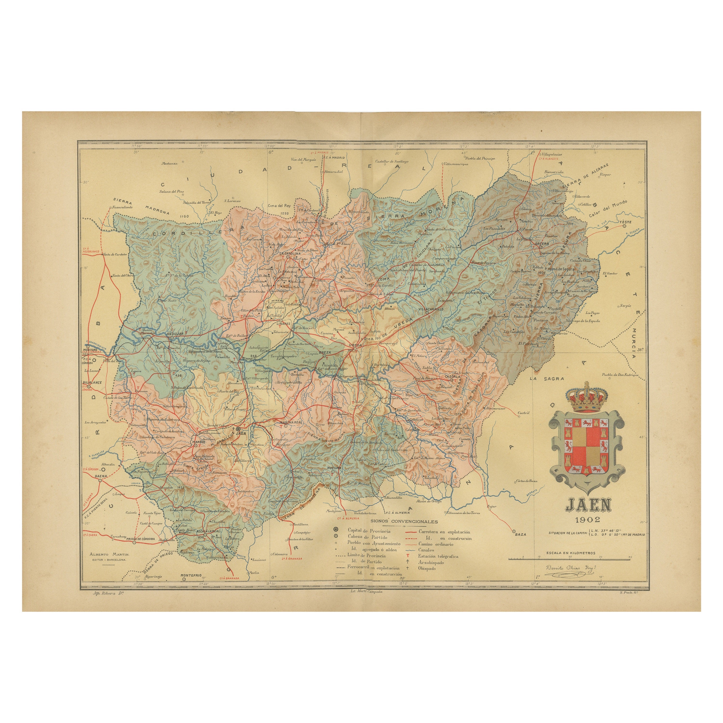
- Jaén 1902: A Cartographic Depiction of Andalusia's Olive HeartlandLocated in Langweer, NLThis original antique map displays the province of Jaén, located in the autonomous community of Andalusia in southern Spain, as of the year 1902. It contains various geographic and i...Category
Antique Early 1900s Maps
MaterialsPaper
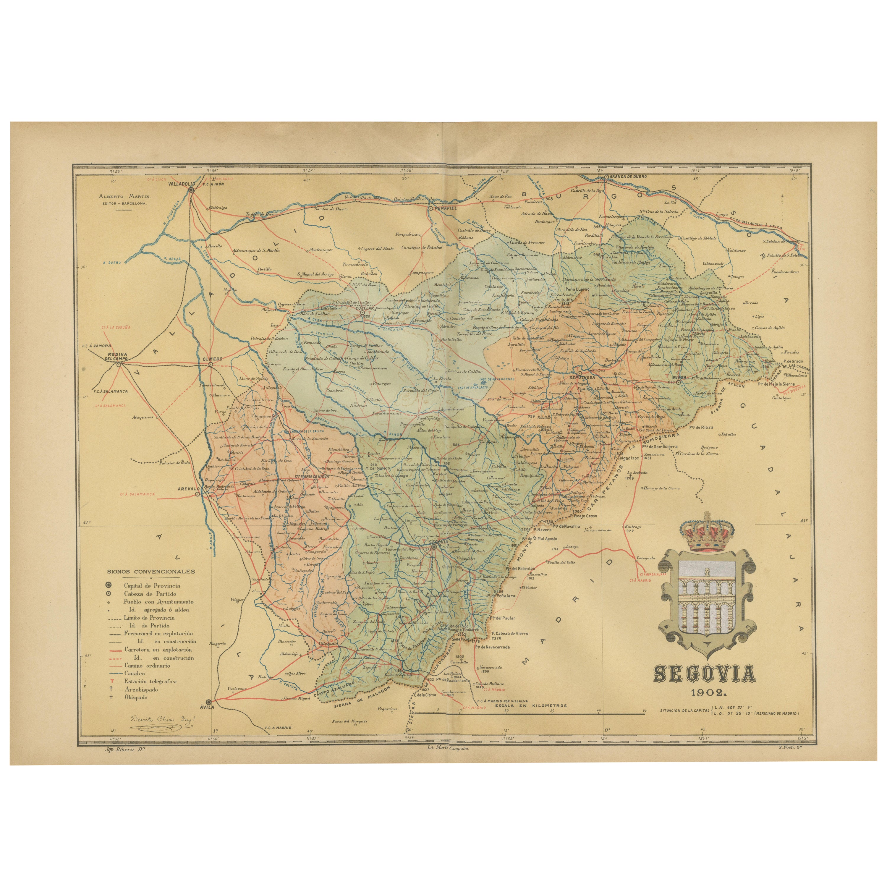
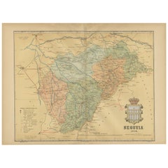
- Topographical and Administrative Cartography of Segovia in Spain, 1902Located in Langweer, NLAn original old map of the province of Segovia from the year 1902. Segovia is a historic area located in the central part of Spain, northwest of Madrid. Known for its rich history, a...Category
Antique Early 1900s Maps
MaterialsPaper
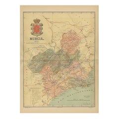
- 1902 Murcia: A Cartographic Snapshot of Spain's Southeastern ProvinceLocated in Langweer, NLThe map represents the province of Murcia, Spain, as it was in 1902. Here's an overview of its characteristics: - **Geography**: It displays the varied terrain of Murcia, from the c...Category
Antique Early 1900s Maps
MaterialsPaper
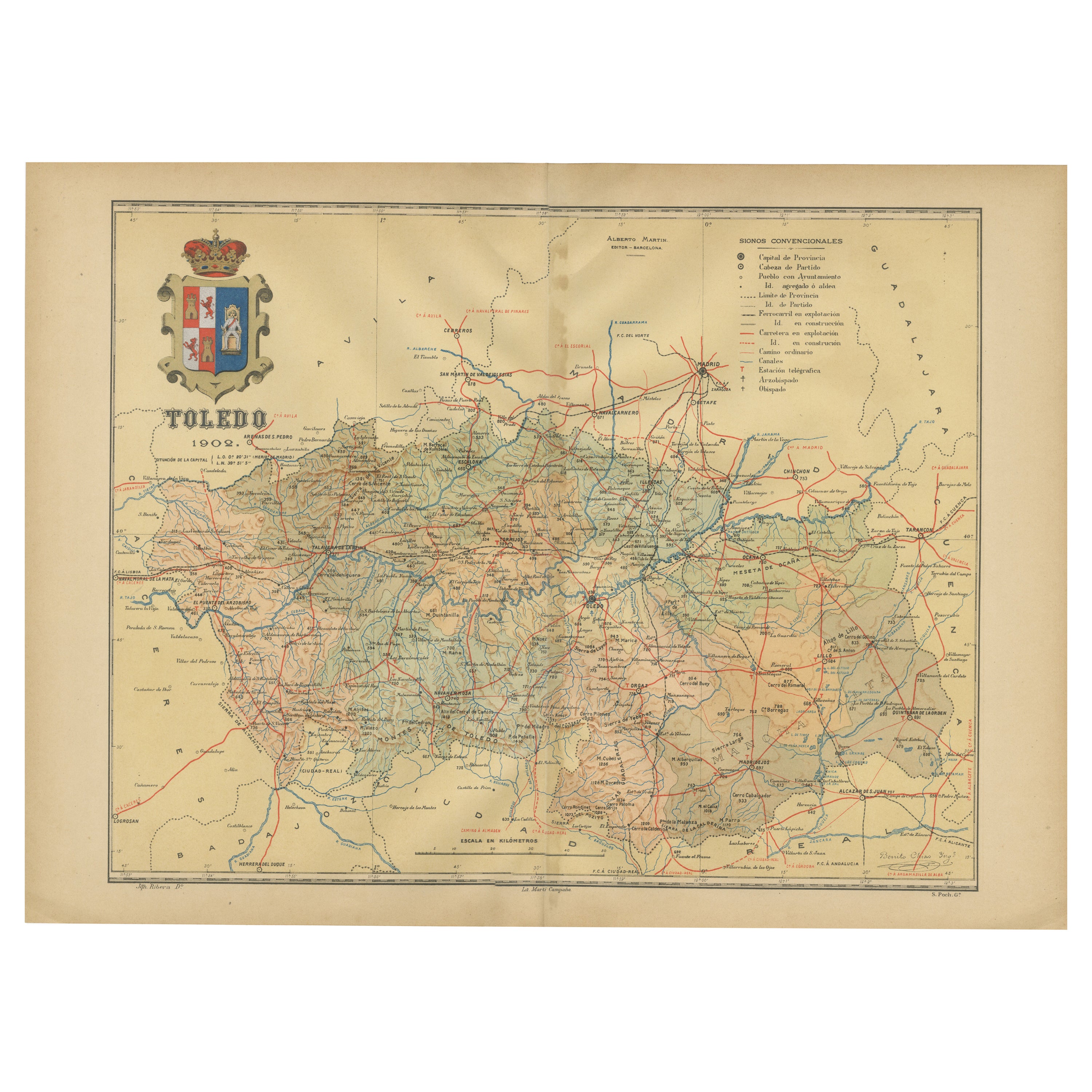
- Toledo 1902: A Historical Cartographic Study of this Spanish ProvinceLocated in Langweer, NLThe print is a historical map of the province of Toledo from 1902. It's a detailed, colored map, highlighting topographical features, such as mountain ranges and rivers, as well as i...Category
Antique Early 1900s Maps
MaterialsPaper
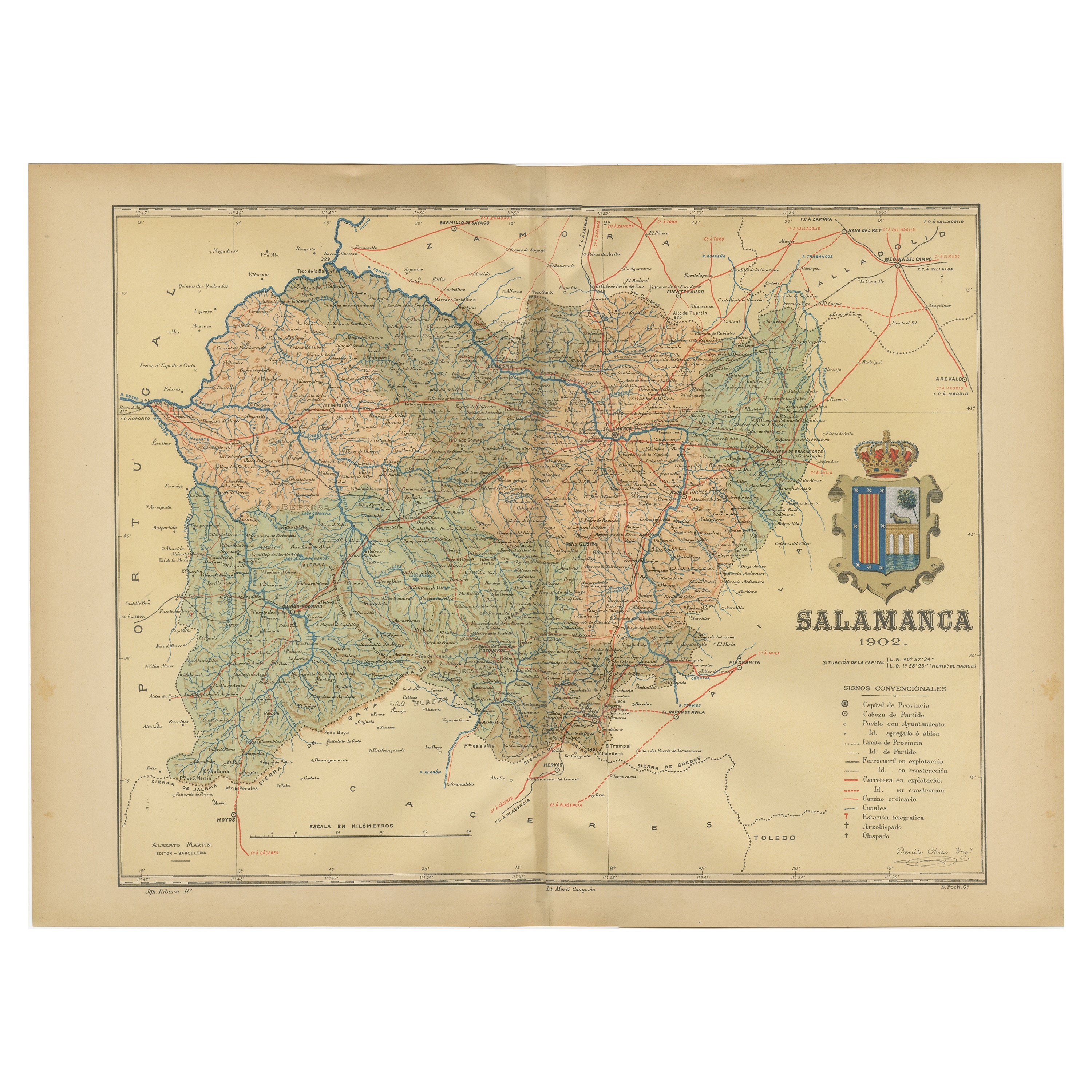
- 1902 Cartographic View of Salamanca: The Golden Province of SpainLocated in Langweer, NLThis map showcases the province of Salamanca in the year 1902. Salamanca is located in the autonomous community of Castile and León in western Spain. It is bordered by the provinces ...Category
Antique Early 1900s Maps
MaterialsPaper
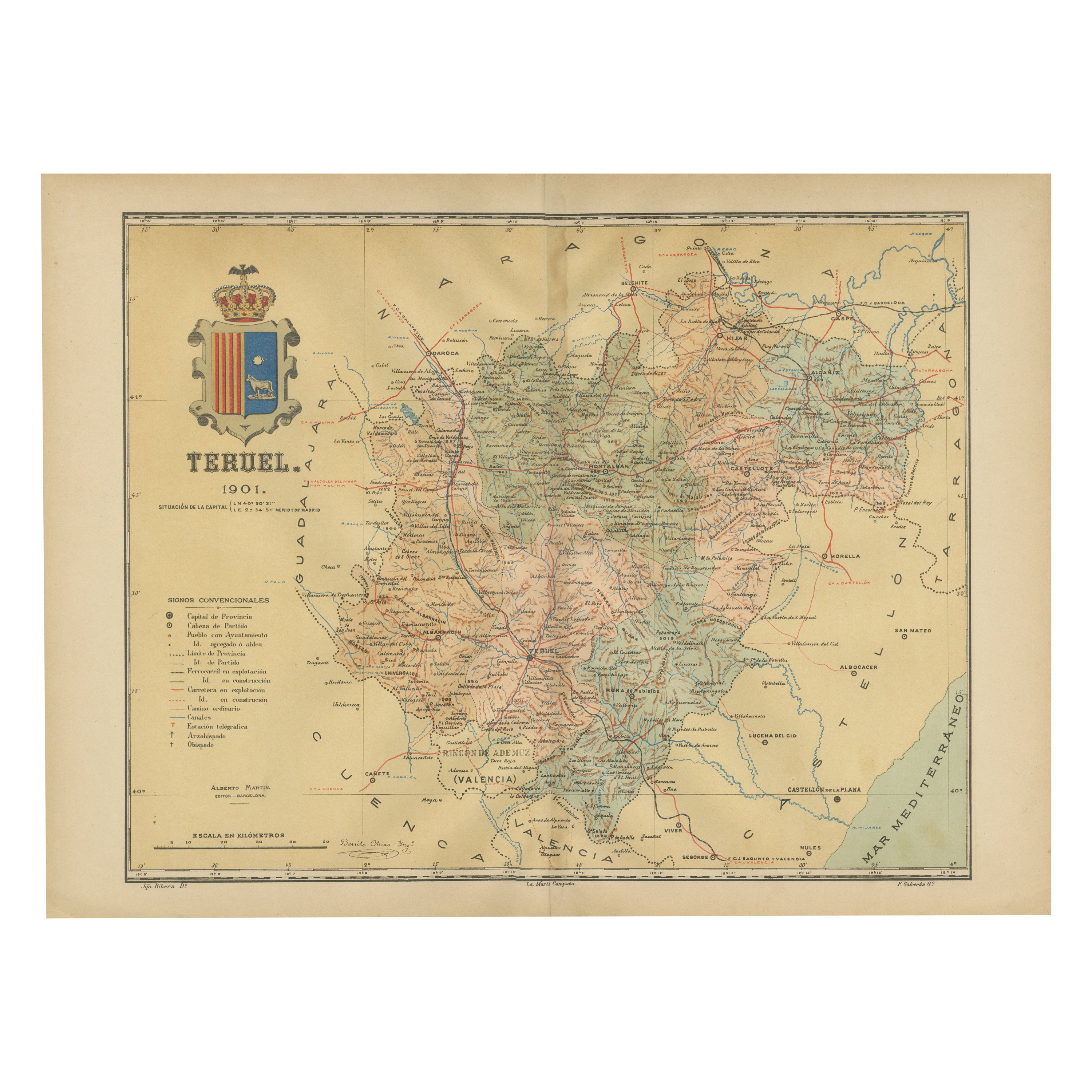
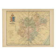
- Teruel 1901: A Cartographic Depiction of Heritage and Natural Splendor in SpainLocated in Langweer, NLOriginal antique map of Teruel in Spain, with highlighted gold. The province of Teruel, located in the region of Aragon in eastern Spain, is known for several unique features: 1. **Mudejar Architecture**: Teruel is famous for its well-preserved Mudejar architecture, which is a style that is a fusion of Christian and Islamic design. This includes notable examples like the Tower of El Salvador and the Teruel Cathedral, both of which are UNESCO World Heritage sites. 2. **Dinopolis**: It hosts Dinópolis, a paleontological park that is one of the largest of its kind in Europe, featuring dinosaur fossils and interactive...Category
Antique Early 1900s Maps
MaterialsPaper


You May Also Like
- Sun and Moon a Story of Astronomy, Photography and CartographyLocated in New York City, NYA unique pictorial history of astronomical exploration from the earliest Prehistoric observatories to the latest satellite images with 280 spectacular images and an inspiring story i...Category
21st Century and Contemporary European Books
MaterialsPaper
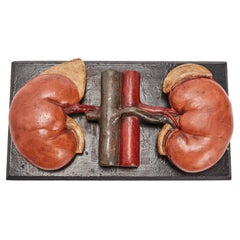
- Anatomic Model for Class, Depicting the Kidneys, Spain 1890Located in Milan, ITAnatomic model for class, depicting the kidneys, made out of painted papier maché and mounted over a black painted wooden base. Spain circa 1890.Category
Antique Late 19th Century Spanish Scientific Instruments
MaterialsPlaster, Wood
- Antique Lithography Map, Isle of Wight, English, Framed, Engraving, CartographyLocated in Hele, Devon, GBThis is an antique lithography map of the Isle of Wight. An English, framed atlas engraving of cartographic interest, dating to the early 19th century and later. Superb lithography ...Category
Antique Early 19th Century British Regency Maps
MaterialsWood
- Antique Lithography Map, Isle of Thanet, Kent, English, Cartography, VictorianLocated in Hele, Devon, GBThis is an antique lithography map of The Isle of Thanet in Kent. An English, framed atlas engraving of cartographic interest, dating to the mid 19th century and later. Superb litho...Category
Antique Mid-19th Century British Victorian Maps
MaterialsWood
- Very Large Vintage Map of Canada, German, Education, Institution, CartographyLocated in Hele, Devon, GBThis is a very large vintage map of Canada. A German, quality printed educational or institution map, dating to the mid 20th century, circa 1965....Category
Mid-20th Century German Maps
MaterialsPaper
- Vintage Reproduction 17th Century Map of Europe, American, Cartography, BlaeuwLocated in Hele, Devon, GBThis is a vintage reproduction map of Europe. An American, paper stock cartography print in frame after the work by Blaeuw, dating to the late 20t...Category
Late 20th Century Central American Mid-Century Modern Maps
MaterialsGlass, Wood, Paper


Recently Viewed
View AllMore Ways To Browse
Map Of Old Armenia
Teak Wood Sphere
Nova Guinea Maps
Antique Map Of Illinois
Petite Point Hand Bag
Antique Map Of Southeastern Us
Antique Map Alabama
Antique Map Of Sydney
Malay Archipelago Map
Fiji Map
Map Prussia Germany
Small Map
The Malay Archipelago
Bad Bentheim
Johannes Janssonius On Sale
Albania Map
Antique Map Argentina
Antique Map Of Argentina