Items Similar to Navarra in Cartographic Detail: A 1902 Map of the Crossroads of Northern Spain

Want more images or videos?
Request additional images or videos from the seller
1 of 6
Navarra in Cartographic Detail: A 1902 Map of the Crossroads of Northern Spain
About the Item
The original antique map for sale shows the Spanish province of Navarra as it was in 1902. Here's a brief description and a potential title for the map:
Description:
- The map details the topography, roadways, and rail lines of Navarra.
- Geographic features, such as mountains and rivers, are colored and contoured, indicating varied elevation and terrain.
- Red lines mark the railways, and thicker red lines denote major roads, reflecting the transportation network of the era.
- Populated places such as towns and cities are labeled, showing the urban landscape.
- The boundary of Navarra is outlined, demarcating it from neighboring provinces and France to the north.
- The map includes a scale of kilometers for distance measurement, a legend (Signos Convencionales), and the coat of arms of Navarra featuring the chains from the historic Kingdom of Navarre.
About Navarra:
Navarra is a region known for its rich history, including its former status as an independent kingdom. The province is characterized by diverse landscapes, from the Pyrenees mountains in the north to the Ebro river valley in the south. It is home to the famous San Fermín festival in Pamplona, where the running of the bulls takes place. The region has a unique cultural identity, with a strong Basque influence in the north. Navarra has been known for its agricultural produce, including vineyards producing renowned wines.
- Dimensions:Height: 14.77 in (37.5 cm)Width: 20.08 in (51 cm)Depth: 0 in (0.02 mm)
- Materials and Techniques:
- Period:1900-1909
- Date of Manufacture:1902
- Condition:Good condition. Central vertical folding lines as issued. Aged paper with typically warm, yellowish-brown hue, especially around the edges. Check the images carefully.
- Seller Location:Langweer, NL
- Reference Number:
About the Seller
5.0
Platinum Seller
These expertly vetted sellers are 1stDibs' most experienced sellers and are rated highest by our customers.
Established in 2009
1stDibs seller since 2017
1,932 sales on 1stDibs
Typical response time: <1 hour
- ShippingRetrieving quote...Ships From: Langweer, Netherlands
- Return PolicyA return for this item may be initiated within 14 days of delivery.
More From This SellerView All
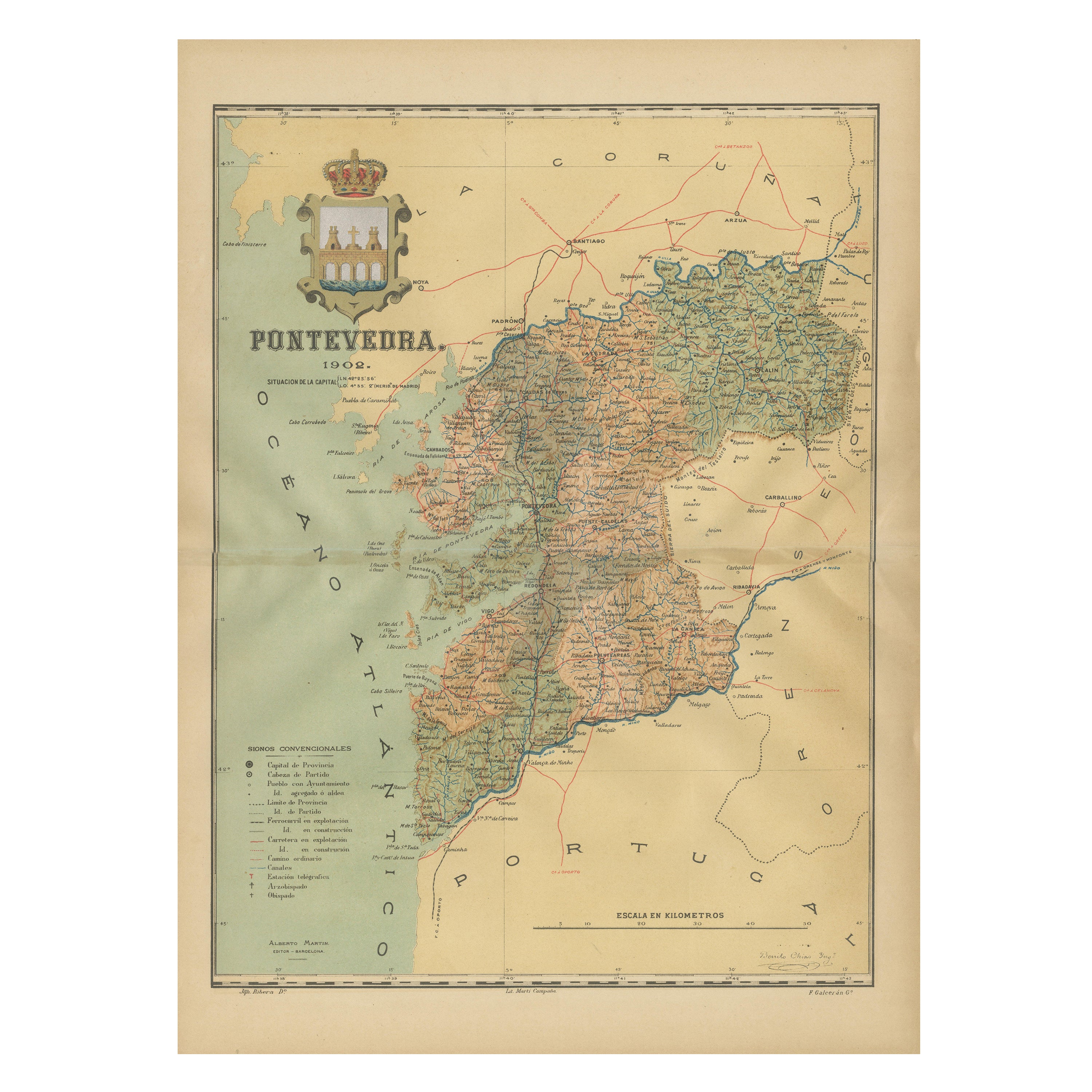
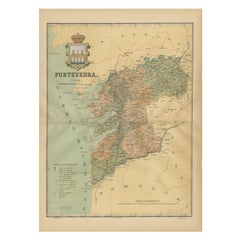
- Cartographic Survey of Pontevedra, 1902: Crossroads of Galicia"Located in Langweer, NLThis original old map of over 100 years old depicts the province of Pontevedra as it was in 1902. Pontevedra is located in the northwest of Spain, in the autonomous community of Gali...Category
Antique Early 1900s Maps
MaterialsPaper
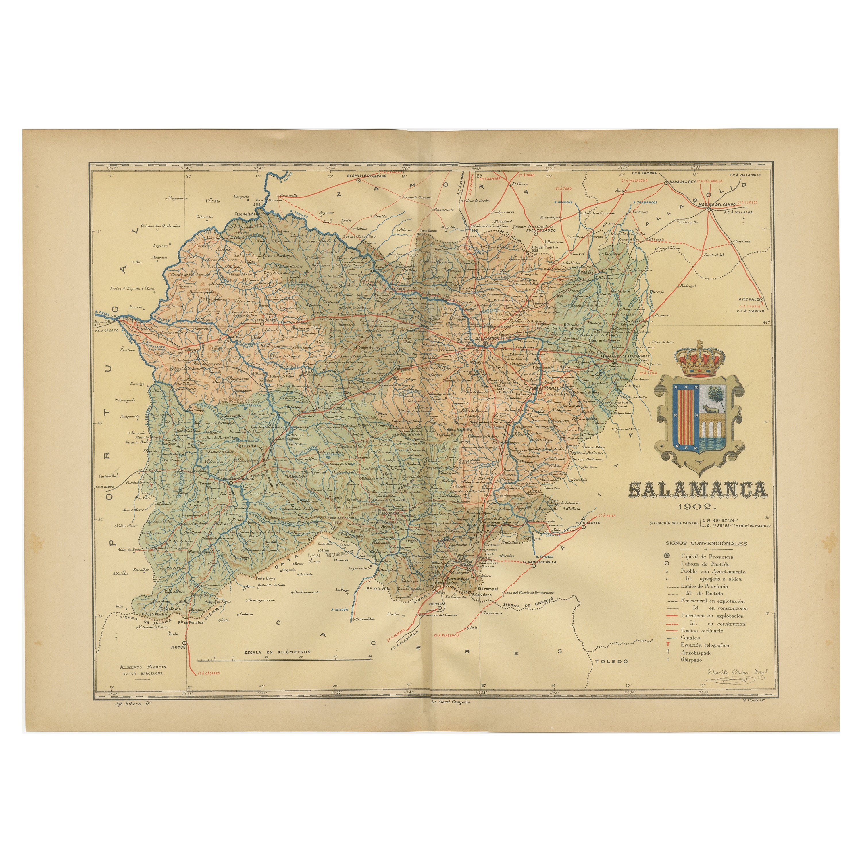
- 1902 Cartographic View of Salamanca: The Golden Province of SpainLocated in Langweer, NLThis map showcases the province of Salamanca in the year 1902. Salamanca is located in the autonomous community of Castile and León in western Spain. It is bordered by the provinces ...Category
Antique Early 1900s Maps
MaterialsPaper
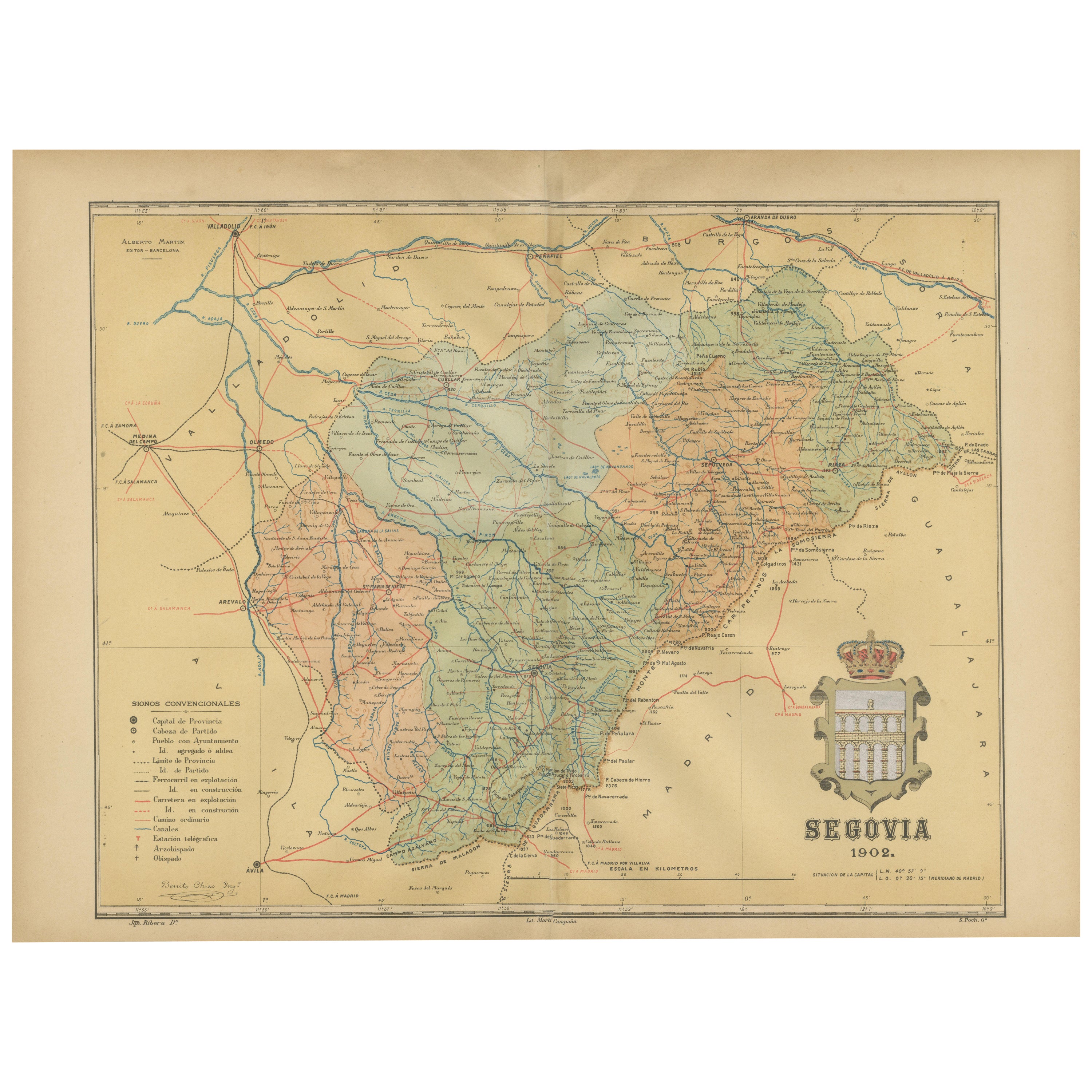
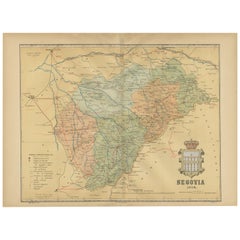
- Topographical and Administrative Cartography of Segovia in Spain, 1902Located in Langweer, NLAn original old map of the province of Segovia from the year 1902. Segovia is a historic area located in the central part of Spain, northwest of Madrid. Known for its rich history, a...Category
Antique Early 1900s Maps
MaterialsPaper
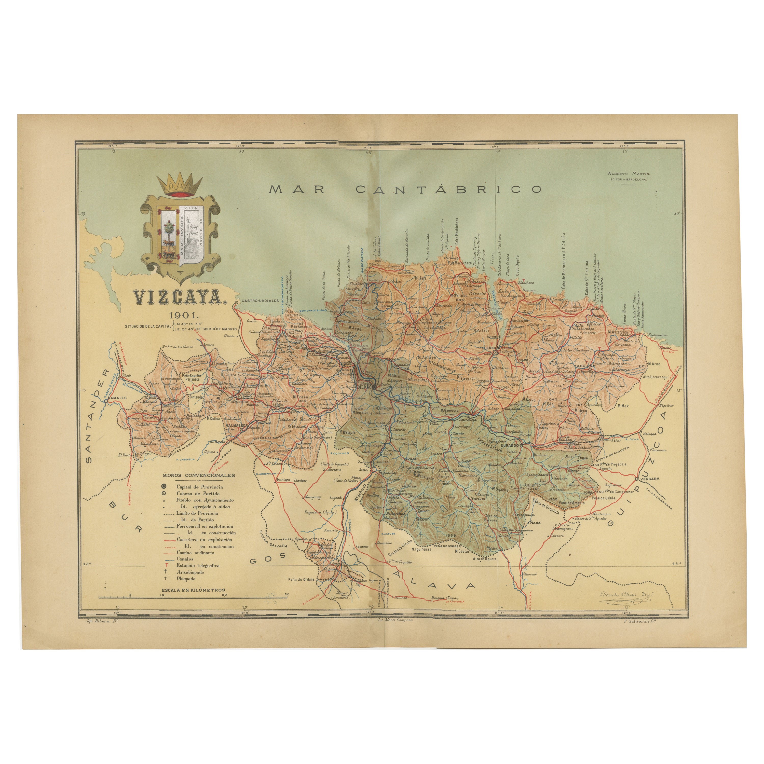
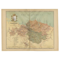
- Cartographic Heritage: The 1901 Map of the Vizcaya Province in SpainLocated in Langweer, NLThis is a historical map of the province of Vizcaya (Biscay) in Spain, dated 1901. The title on the map is "VIZCAYA. 1901." It shows the topographical details of the region with cont...Category
Antique Early 1900s Maps
MaterialsPaper
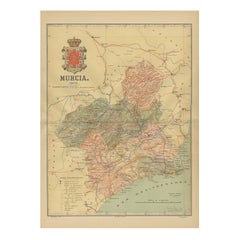
- 1902 Murcia: A Cartographic Snapshot of Spain's Southeastern ProvinceLocated in Langweer, NLThe map represents the province of Murcia, Spain, as it was in 1902. Here's an overview of its characteristics: - **Geography**: It displays the varied terrain of Murcia, from the c...Category
Antique Early 1900s Maps
MaterialsPaper
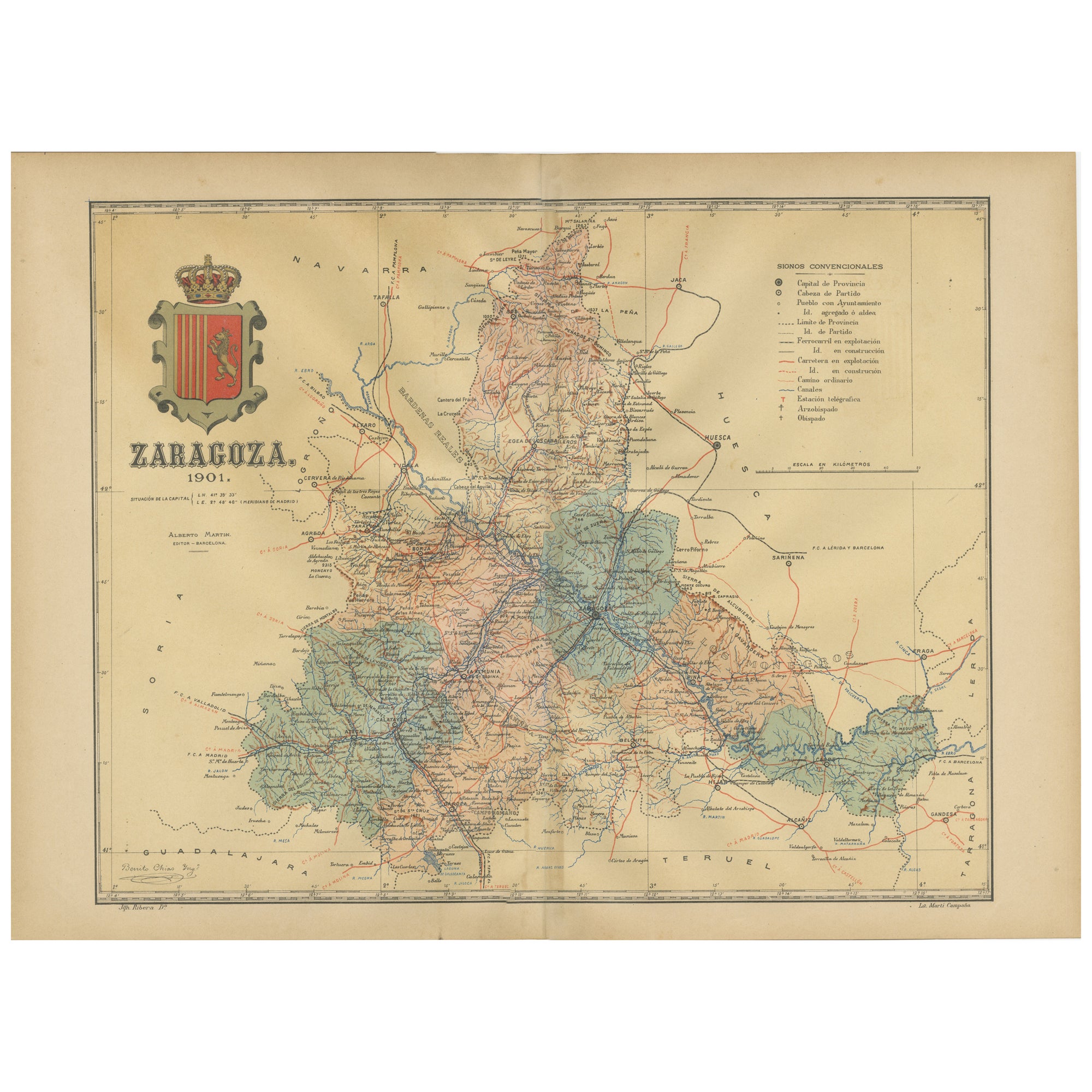
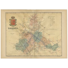
- Zaragoza: Crossroads of Heritage - The 1901 Cartographic ChronicleLocated in Langweer, NLThe print on sale is a historical map of the province of Zaragoza, Spain, dated 1901. The title on the map is "ZARAGOZA. 1901." This map details the geo...Category
Antique Early 1900s Maps
MaterialsPaper

You May Also Like
- Antique Oarsman's Map of the River Thames, English, Cartography, Published 1912Located in Hele, Devon, GBThis is an antique copy of The Oarsman's and Angler's Map of the River Thames - New Edition. An English, bound map book, published in English by Edward Stanford, London, this new edi...Category
Early 20th Century British Other Books
MaterialsPaper
- Antique Lithography Map, Isle of Wight, English, Framed, Engraving, CartographyLocated in Hele, Devon, GBThis is an antique lithography map of the Isle of Wight. An English, framed atlas engraving of cartographic interest, dating to the early 19th century and later. Superb lithography ...Category
Antique Early 19th Century British Regency Maps
MaterialsWood
- Antique Lithography Map, Isle of Thanet, Kent, English, Cartography, VictorianLocated in Hele, Devon, GBThis is an antique lithography map of The Isle of Thanet in Kent. An English, framed atlas engraving of cartographic interest, dating to the mid 19th century and later. Superb litho...Category
Antique Mid-19th Century British Victorian Maps
MaterialsWood
- Very Large Vintage Map of Canada, German, Education, Institution, CartographyLocated in Hele, Devon, GBThis is a very large vintage map of Canada. A German, quality printed educational or institution map, dating to the mid 20th century, circa 1965....Category
Mid-20th Century German Maps
MaterialsPaper
- Antique Lithography Map, Bedfordshire, English, Framed Engraving, CartographyLocated in Hele, Devon, GBThis is an antique lithography map of Bedfordshire. An English, framed atlas engraving of cartographic interest, dating to the mid 19th century and...Category
Antique Mid-19th Century British Victorian Maps
MaterialsWood
- Antique Lithography Map, Lincolnshire, English, Framed, Engraving, CartographyLocated in Hele, Devon, GBThis is an antique lithography map of Lincolnshire. An English, framed atlas engraving of cartographic interest, dating to the mid 19th century and...Category
Antique Mid-19th Century British Victorian Maps
MaterialsWood


Recently Viewed
View AllMore Ways To Browse
Map Of Old Armenia
Teak Wood Sphere
Nova Guinea Maps
Antique Map Of Illinois
Petite Point Hand Bag
Antique Map Of Southeastern Us
Antique Map Alabama
Antique Map Of Sydney
Malay Archipelago Map
Gambia Antique Map
Uruguay Antique Map
Guyana Antique Map
Ruscelli Map
Masque Theatre No
Nova Scotia Map
Antique Map Tuscany
Berkshire Antique Map
Cornwall Map