Items Similar to Cartographic Survey of Pontevedra, 1902: Crossroads of Galicia"


Want more images or videos?
Request additional images or videos from the seller
1 of 7
Cartographic Survey of Pontevedra, 1902: Crossroads of Galicia"
About the Item
This original old map of over 100 years old depicts the province of Pontevedra as it was in 1902. Pontevedra is located in the northwest of Spain, in the autonomous community of Galicia. This coastal province is bordered by the Atlantic Ocean to the west and Portugal to the south. It is a region known for its rugged coastline, which includes the famous Rías Baixas, a series of four estuarine inlets that are known for their scenic beauty, beaches, and seafood. The interior of the province is characterized by a hilly landscape that gradually rises from the coast to the interior.
Pontevedra's capital, which shares the same name, is renowned for its well-preserved old town, rich medieval history, and the iconic Sanctuary of the Pilgrim Virgin. The map likely details various geographical features such as rivers, mountain ranges, and infrastructures like roads and railways, marking a snapshot of the province's topography and human geography at the beginning of the 20th century.
This title captures the essence of Pontevedra as a key maritime province with significant land features and cultural intersections.
- Dimensions:Height: 20.08 in (51 cm)Width: 14.77 in (37.5 cm)Depth: 0 in (0.02 mm)
- Materials and Techniques:
- Period:1900-1909
- Date of Manufacture:1902
- Condition:Good condition. Central vertical folding lines as issued. Aged paper with typically warm, yellowish-brown hue, especially around the edges. A light brown discoloring along the fold. Check the images carefully.
- Seller Location:Langweer, NL
- Reference Number:
About the Seller
5.0
Platinum Seller
These expertly vetted sellers are 1stDibs' most experienced sellers and are rated highest by our customers.
Established in 2009
1stDibs seller since 2017
1,932 sales on 1stDibs
Typical response time: <1 hour
- ShippingRetrieving quote...Ships From: Langweer, Netherlands
- Return PolicyA return for this item may be initiated within 14 days of delivery.
More From This SellerView All
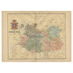
- Ciudad Real 1902: A Detailed Cartographic Survey of La Mancha in SpainLocated in Langweer, NLThis original antitque map presents the province of Ciudad Real, located in the autonomous community of Castilla-La Mancha in central Spain, as of 1902. It includes several notable f...Category
Antique Early 1900s Maps
MaterialsPaper
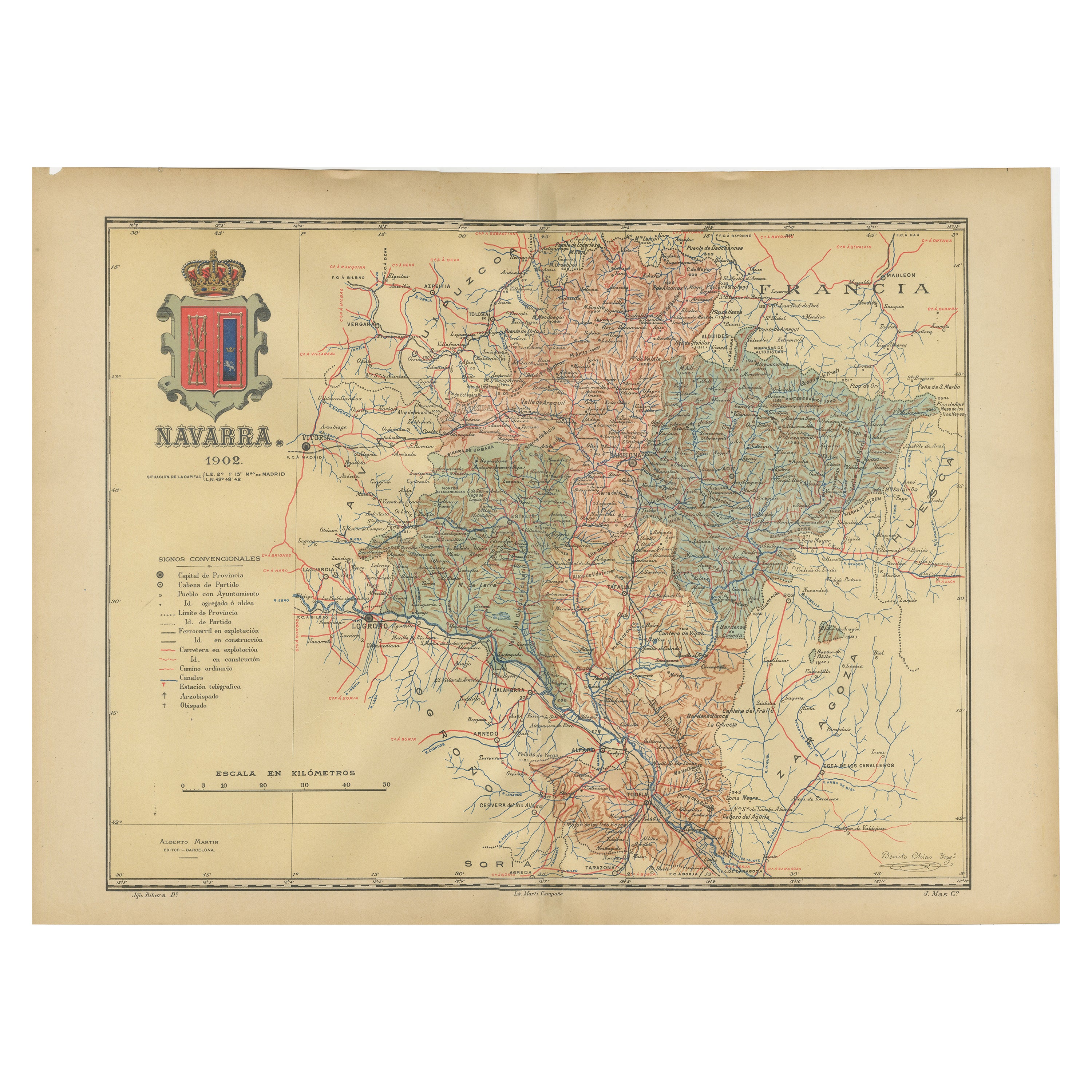
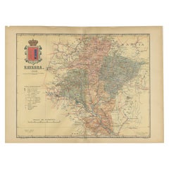
- Navarra in Cartographic Detail: A 1902 Map of the Crossroads of Northern SpainLocated in Langweer, NLThe original antique map for sale shows the Spanish province of Navarra as it was in 1902. Here's a brief description and a potential title for the map: Description: - The map detai...Category
Antique Early 1900s Maps
MaterialsPaper
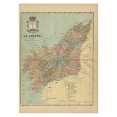
- La Coruña 1901: A Cartographic View of Galicia's Maritime ProvinceLocated in Langweer, NLThis antique map for sale showcases the province of La Coruña (in Galician, A Coruña), located in the northwest of Spain, within the autonomous community of Galicia, as of the year 1...Category
Antique Early 1900s Maps
MaterialsPaper
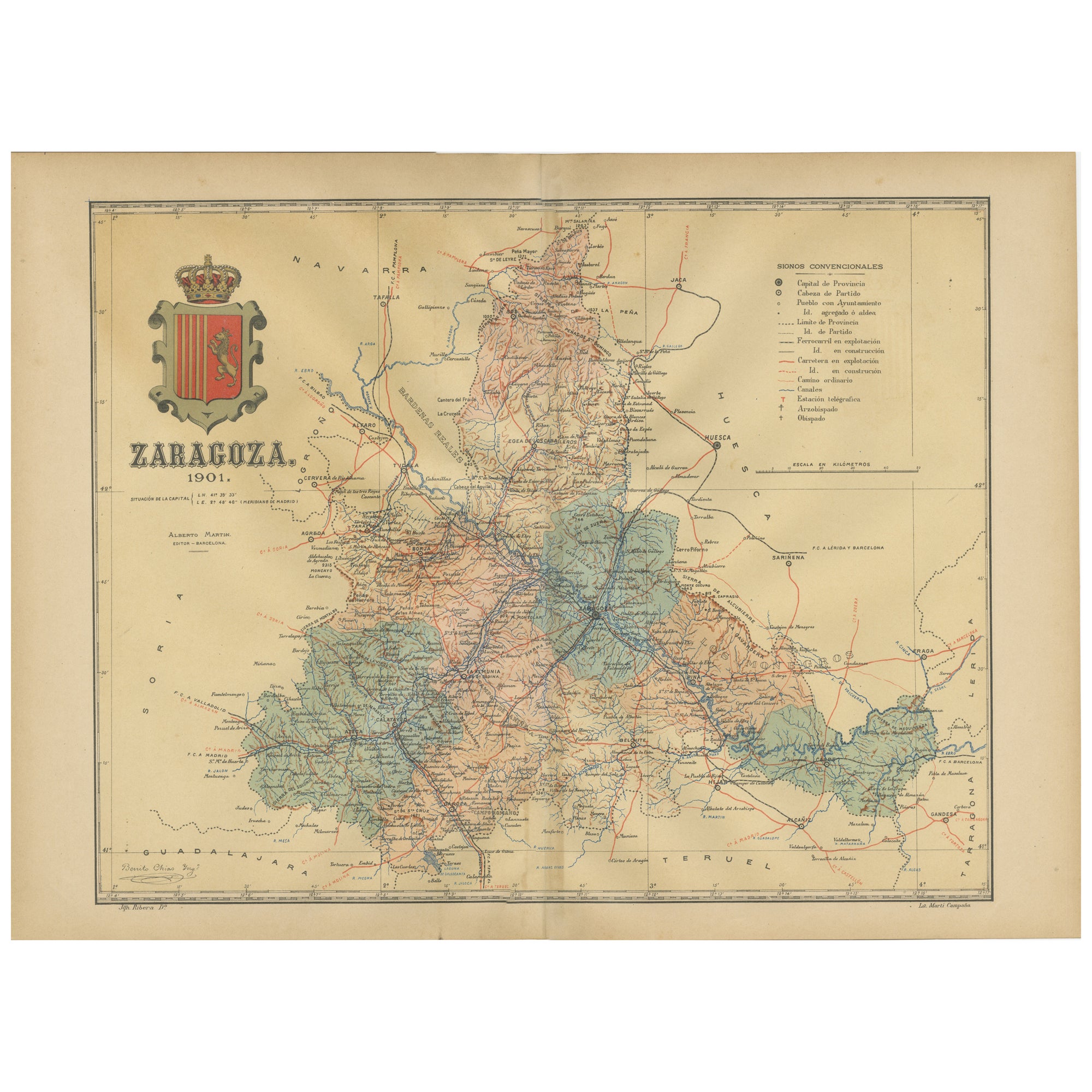
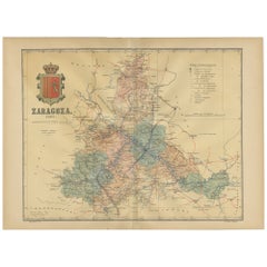
- Zaragoza: Crossroads of Heritage - The 1901 Cartographic ChronicleLocated in Langweer, NLThe print on sale is a historical map of the province of Zaragoza, Spain, dated 1901. The title on the map is "ZARAGOZA. 1901." This map details the geo...Category
Antique Early 1900s Maps
MaterialsPaper
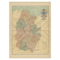
- Lugo 1901: A Cartographic Chronicle of Galicia's Ancient Roman Walled CityLocated in Langweer, NLThe map presents the province of Lugo, located in the autonomous community of Galicia in northwestern Spain, as it was in 1901. Notable features include: - **Topography**: The provi...Category
Antique Early 1900s Maps
MaterialsPaper
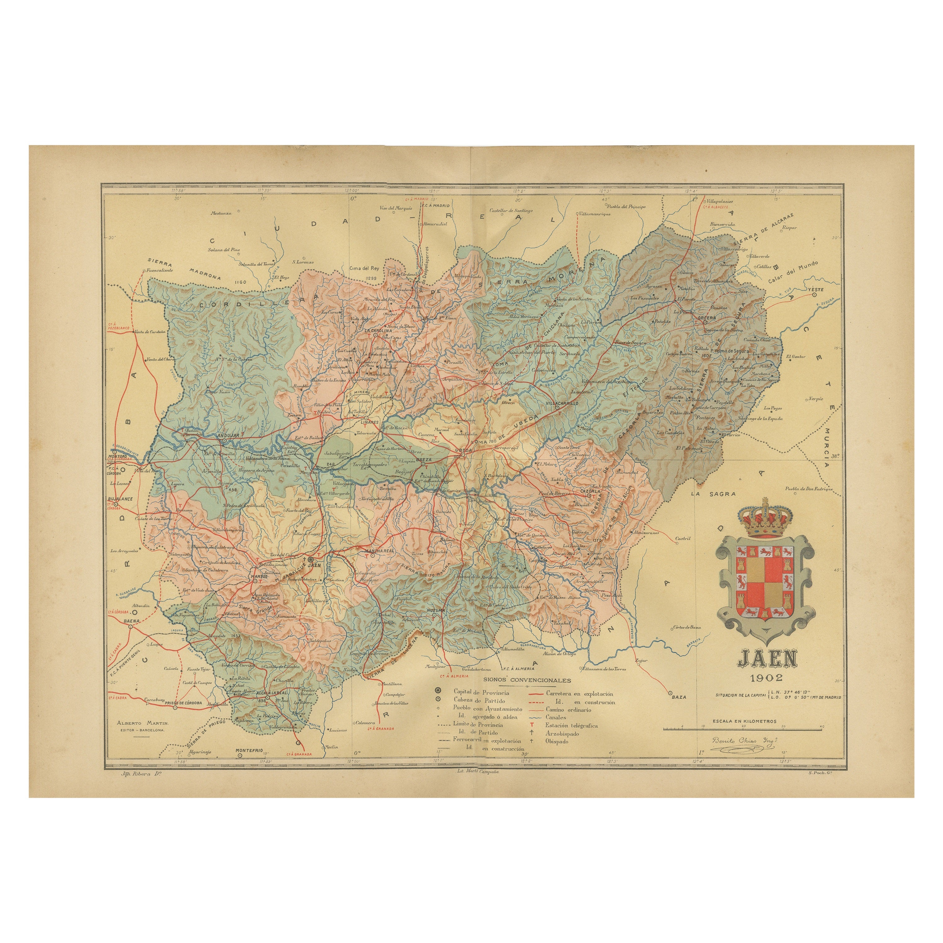
- Jaén 1902: A Cartographic Depiction of Andalusia's Olive HeartlandLocated in Langweer, NLThis original antique map displays the province of Jaén, located in the autonomous community of Andalusia in southern Spain, as of the year 1902. It contains various geographic and i...Category
Antique Early 1900s Maps
MaterialsPaper

You May Also Like
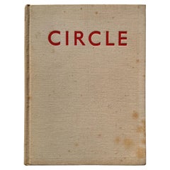
- Circle: International Survey of Constructive ArtBy Ben Nicholson, Henry MooreLocated in New York, NYFoundational text of twentieth century modernism in art, architecture, town planning, housing, interior design, and design; edited by Ben Nicholson, Naum Gabo, and J.L. Martin. Layou...Category
Vintage 1930s English Machine Age Books
MaterialsPaper
- Jean-Michel Basquiat CrossroadsBy Rizzoli International PublicationsLocated in New York, NYAuthor Lee Jaffe, Foreword by Franklin Sirmans, Contributions by J. Faith Almiron A rare and poignant compilation of photography and written anecdotes by American photographer and...Category
21st Century and Contemporary Books
MaterialsPaper
- Antique Lithography Map of Cheshire, English, Framed, Cartography, VictorianLocated in Hele, Devon, GBThis is an antique lithography map of Cheshire. An English, framed atlas engraving of cartographic interest, dating to the mid 19th century and lat...Category
Antique Mid-19th Century British Victorian Maps
MaterialsWood
- Sun and Moon a Story of Astronomy, Photography and CartographyLocated in New York City, NYA unique pictorial history of astronomical exploration from the earliest Prehistoric observatories to the latest satellite images with 280 spectacular images and an inspiring story i...Category
21st Century and Contemporary European Books
MaterialsPaper
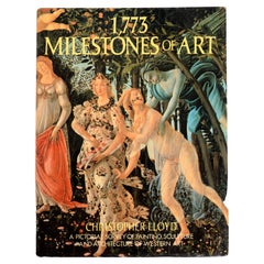
- 1, 773 Milestones of Art A Pictorial Survey of Painting, Sculpture & ArchitectureLocated in valatie, NY1,773 Milestones of Art: A Pictorial Survey of Painting, Sculpture and Architecture. Published by Harrison House, New York, 1985. Hardcover with dust jacket. Presents the great works...Category
Vintage 1980s American Books
MaterialsPaper
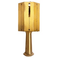
- A land surveying square, France 1880.Located in Milan, ITOctagonal brass land surveying square. Each side has a slot, which allows to aim the distance and evaluate 90 and 45 degrees when measuring the field. ...Category
Antique Late 19th Century French Scientific Instruments
MaterialsBrass


Recently Viewed
View AllMore Ways To Browse
Map Of Old Armenia
Teak Wood Sphere
Nova Guinea Maps
Antique Map Of Illinois
Petite Point Hand Bag
Antique Map Of Southeastern Us
Antique Map Alabama
Antique Map Of Sydney
Malay Archipelago Map
Gambia Antique Map
Uruguay Antique Map
Guyana Antique Map
Ruscelli Map
Masque Theatre No
Nova Scotia Map
Antique Map Tuscany
Berkshire Antique Map
Cornwall Map