Items Similar to Lugo 1901: A Cartographic Chronicle of Galicia's Ancient Roman Walled City


Want more images or videos?
Request additional images or videos from the seller
1 of 6
Lugo 1901: A Cartographic Chronicle of Galicia's Ancient Roman Walled City
About the Item
The map presents the province of Lugo, located in the autonomous community of Galicia in northwestern Spain, as it was in 1901. Notable features include:
- **Topography**: The province's terrain is depicted, which ranges from the coastal areas by the Cantabrian Sea to the mountainous interior regions.
- **Hydrography**: Blue lines likely represent the province's rivers, which would include the Miño, the province's main river, and its tributaries.
- **Transportation**: Red lines indicating roads and railways show the transport links within Lugo and to other regions.
- **Urban Centers**: Various symbols mark the locations of cities, towns, and villages, with the capital, also named Lugo, indicated.
- **Political Boundaries**: Dotted lines may show administrative boundaries within the province.
- **Legend**: The map contains a legend (Signos Convencionales) that explains the symbols used for provincial capitals, roads, railways, and other features.
- **Scale**: There is a scale in kilometers for distance measurement.
- **Coat of Arms**: The coat of arms of Lugo, featuring a chalice and a sacred host, is prominently displayed, symbolizing the province's cultural and historical heritage.
About the province of Lugo:
Lugo is renowned for its well-preserved Roman walls, which encircle the old town and are a UNESCO World Heritage site. The province is characterized by its lush green landscape, part of the Green Spain, and its relatively cool and wet climate. The economy of Lugo is traditionally based on agriculture and fishing, with dairy farming, beef production, and the cultivation of crops such as potatoes and corn being significant. The coastal areas are known for their high-quality seafood. Lugo is also a stop on the Camino Primitivo, one of the routes of the Camino de Santiago pilgrimage. The region's culture reflects a strong Celtic influence, evident in its music, folklore, and festivals such as the 'Arde Lucus', which celebrates the province's Roman history.
- Dimensions:Height: 20.08 in (51 cm)Width: 14.77 in (37.5 cm)Depth: 0 in (0.02 mm)
- Materials and Techniques:
- Period:1900-1909
- Date of Manufacture:1901
- Condition:Good condition. Central vertical folding lines as issued. Aged paper with typically warm, yellowish-brown hue, especially around the edges. Check the images carefully.
- Seller Location:Langweer, NL
- Reference Number:
About the Seller
5.0
Platinum Seller
These expertly vetted sellers are 1stDibs' most experienced sellers and are rated highest by our customers.
Established in 2009
1stDibs seller since 2017
1,916 sales on 1stDibs
Typical response time: <1 hour
- ShippingRetrieving quote...Ships From: Langweer, Netherlands
- Return PolicyA return for this item may be initiated within 14 days of delivery.
More From This SellerView All
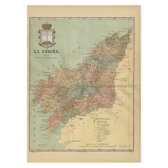
- La Coruña 1901: A Cartographic View of Galicia's Maritime ProvinceLocated in Langweer, NLThis antique map for sale showcases the province of La Coruña (in Galician, A Coruña), located in the northwest of Spain, within the autonomous community of Galicia, as of the year 1...Category
Antique Early 1900s Maps
MaterialsPaper
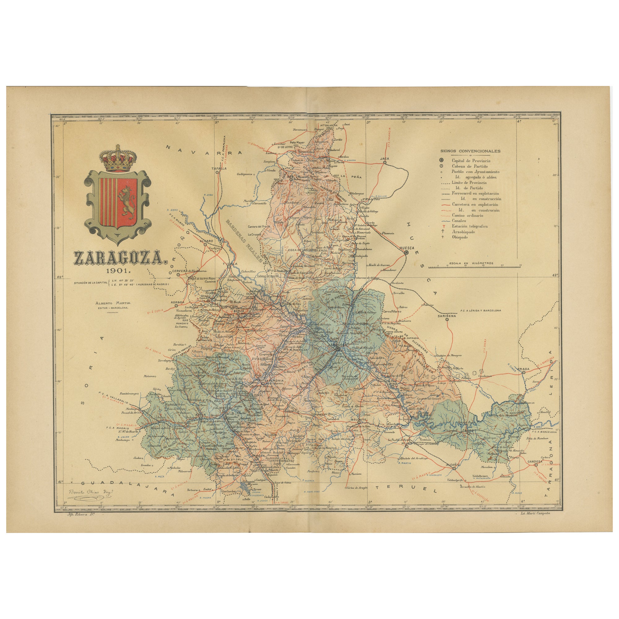
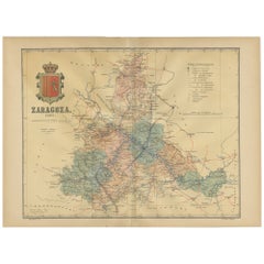
- Zaragoza: Crossroads of Heritage - The 1901 Cartographic ChronicleLocated in Langweer, NLThe print on sale is a historical map of the province of Zaragoza, Spain, dated 1901. The title on the map is "ZARAGOZA. 1901." This map details the geo...Category
Antique Early 1900s Maps
MaterialsPaper
- Orense in Depth: A 1902 Topographical Map of Galicia's Mountainous ProvinceLocated in Langweer, NLThe map is a detailed cartographic representation of the province of Orense (Ourense in Galician), located in the northwest of Spain, as it was in 1902. Here's a brief description an...Category
Antique Early 1900s Maps
MaterialsPaper
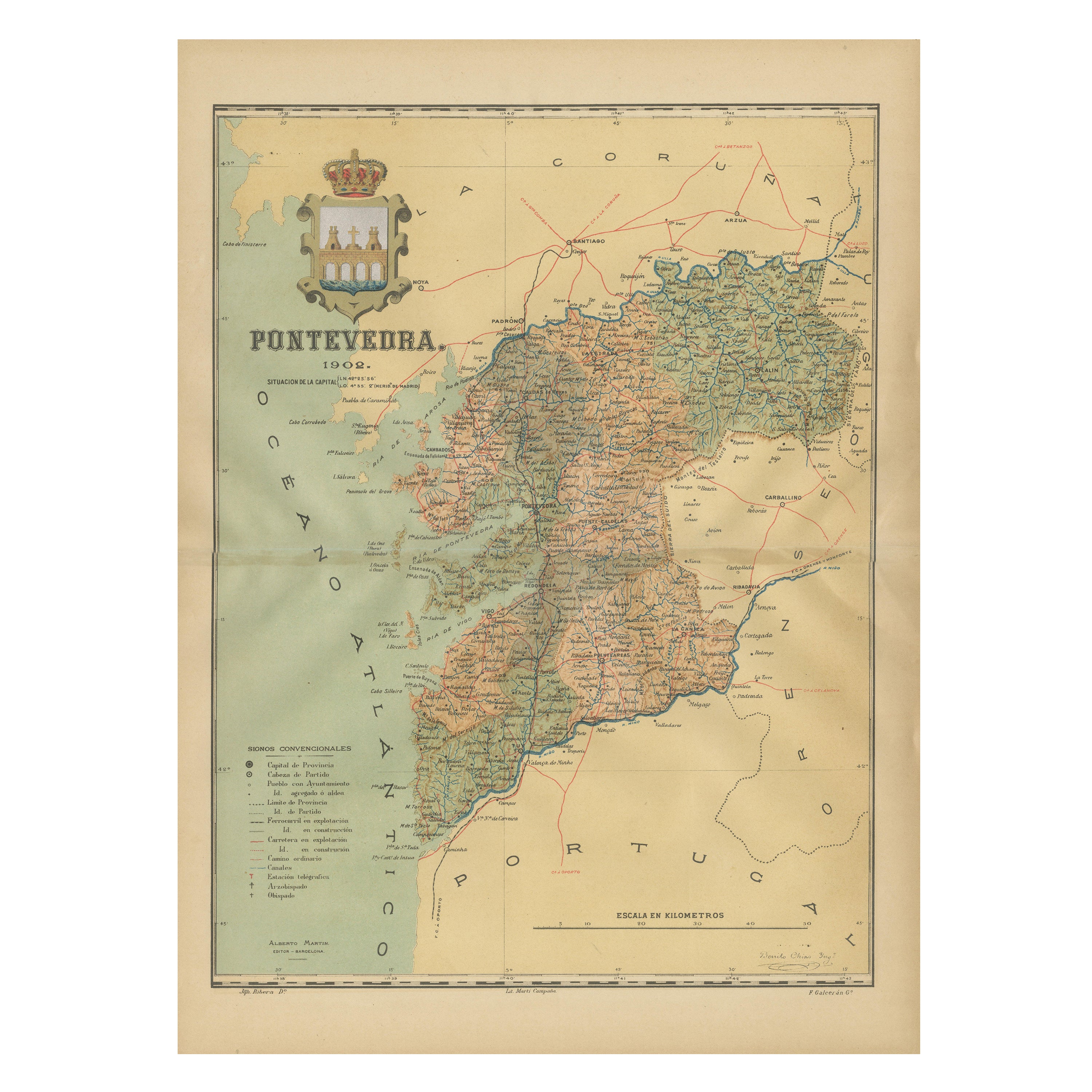
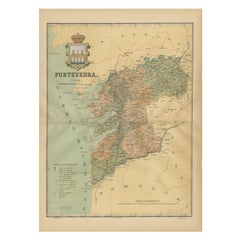
- Cartographic Survey of Pontevedra, 1902: Crossroads of Galicia"Located in Langweer, NLThis original old map of over 100 years old depicts the province of Pontevedra as it was in 1902. Pontevedra is located in the northwest of Spain, in the autonomous community of Gali...Category
Antique Early 1900s Maps
MaterialsPaper
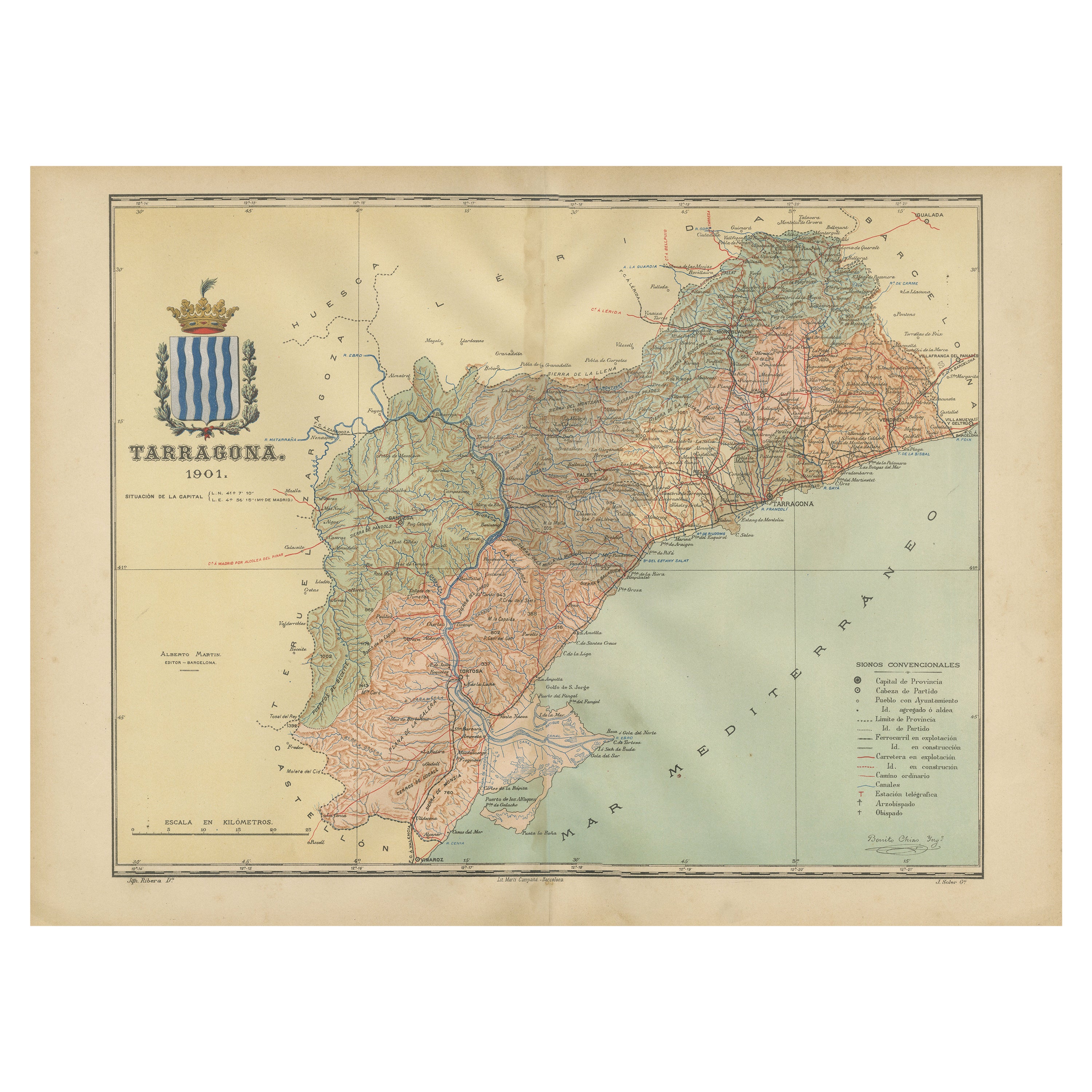
- A Catalonian Cartographic Depiction of Tarragona Province, 1901Located in Langweer, NLThis image depicts a historical map of the province of Tarragona, which is in the northeastern part of Spain, within the autonomous community of Catalonia. The map is dated 1901, sug...Category
Antique Early 1900s Maps
MaterialsPaper
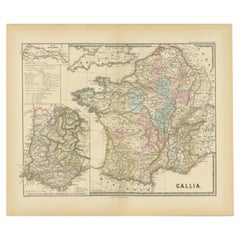
- Ancient Gaul: A Cartographic Overview of Gallic Tribes and Roman Provinces, 1880Located in Langweer, NLThe print titled "GALLIA," is a historical map of ancient Gaul, which corresponds to modern-day France and parts of its surrounding countries. Here are the features and details noted...Category
Antique 1880s Maps
MaterialsPaper


You May Also Like
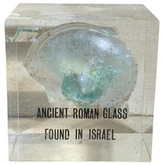
- Ancient Roman GlassLocated in Delray Beach, FLBeautiful original ancient Roman glass embedded in Lucite cube, was used for containing perfume. Exceptional object of art for display.Category
Antique 15th Century and Earlier Israeli Glass
MaterialsMurano Glass
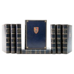
- 1879 The Chronicles of BarsetshireBy Anthony TrollopeLocated in Bath, GBA fine Bayntun-Riviere set of Anthony Trollope's noted series 'The Chronicles of Barsetshire'. With an illustrated frontispiece to all volumes. Anthony Trollope (1815-1882) was an...Category
Antique 1870s English Books
MaterialsPaper
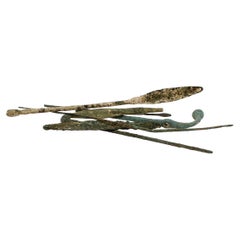
- Group of Ancient Roman Bronze Tools & Hair PinsLocated in Philadelphia, PAA fine group of ancient Roman bronze implements and artifacts. Consisting of pins & several small scale tools. From the private collection of Lawrence Majewski, who was a former co...Category
Antique 15th Century and Earlier Italian Classical Roman Antiquities
MaterialsBronze
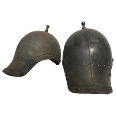
- Pair of 1930s Reproduction Ancient Roman Soldiers HelmetsLocated in Tarrytown, NYPair of 1930s metal reproduction ancient Roman soldiers helmets.Category
Vintage 1930s Arms, Armor and Weapons
MaterialsMetal
- 8 Volumes. Jean Froissart, Froissart's Chronicles.Located in New York, NY8 Volumes. Jean Froissart, Froissart's Chronicles. Limited Leather Private Press. Bound in full crushed blue morocco, raised bands, gilt ruled and tooled spine and boards, 14th centu...Category
Early 20th Century English Books
MaterialsLeather
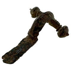
- Ancient Roman Bronze Crossbow Fibula or Toga PinLocated in Philadelphia, PAA fine ancient Roman bronze fibula. A so-called 'crossbow' fibula. From the private collection of Lawrence Majewski, who was a former conservator at the Metropolitan Museum of Art....Category
Antique 15th Century and Earlier Italian Classical Roman Antiquities
MaterialsBronze

Recently Viewed
View AllMore Ways To Browse
Map Of Old Armenia
Teak Wood Sphere
Nova Guinea Maps
Antique Map Of Illinois
Petite Point Hand Bag
Antique Map Of Southeastern Us
Antique Map Alabama
Antique Map Of Sydney
Malay Archipelago Map
Gambia Antique Map
Uruguay Antique Map
Guyana Antique Map
Ruscelli Map
Masque Theatre No
Nova Scotia Map
Antique Map Tuscany
Berkshire Antique Map
Cornwall Map