Items Similar to Orense in Depth: A 1902 Topographical Map of Galicia's Mountainous Province


Want more images or videos?
Request additional images or videos from the seller
1 of 6
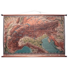
Orense in Depth: A 1902 Topographical Map of Galicia's Mountainous Province
About the Item
The map is a detailed cartographic representation of the province of Orense (Ourense in Galician), located in the northwest of Spain, as it was in 1902. Here's a brief description and a potential title for the map:
Description:
- The map is a colorful, topographic illustration, highlighting the varied terrain of Orense with shading and contour lines.
- Blue lines indicate water bodies like rivers and streams, while red lines depict railway lines, and thicker red lines seem to represent primary roads.
- Populated areas, including cities, towns, and villages, are marked and named, showcasing the province's human settlements.
- The map includes a distance scale in kilometers, aiding in the estimation of distances between various points.
- The province's boundaries are outlined, distinguishing it from neighboring regions and countries.
- A legend (Signos Convencionales) details the symbols used on the map, such as railway lines, roads, telegraph lines, etc.
- The ornate coat of arms of Orense is prominently displayed, adding a heraldic touch to the cartography.
About Orense:
Orense, known for its hot springs and thermal baths, is one of the four provinces of the autonomous community of Galicia. Its landscape is characterized by rugged terrain, with the Miño River running through it. The region has a rich Roman and medieval history, with numerous landmarks that reflect its past. The province is also known for its vineyards and the production of Ribeiro wines. The city of Ourense, the capital of the province, is a historical city with thermal baths that date back to Roman times.
- Dimensions:Height: 14.77 in (37.5 cm)Width: 20.08 in (51 cm)Depth: 0 in (0.02 mm)
- Materials and Techniques:
- Period:1900-1909
- Date of Manufacture:1902
- Condition:Good condition. Central vertical folding lines as issued. Aged paper with typically warm, yellowish-brown hue, especially around the edges. Two light folds in the top middle. Check the images carefully.
- Seller Location:Langweer, NL
- Reference Number:
About the Seller
5.0
Platinum Seller
These expertly vetted sellers are 1stDibs' most experienced sellers and are rated highest by our customers.
Established in 2009
1stDibs seller since 2017
1,928 sales on 1stDibs
Typical response time: <1 hour
- ShippingRetrieving quote...Ships From: Langweer, Netherlands
- Return PolicyA return for this item may be initiated within 14 days of delivery.
More From This SellerView All
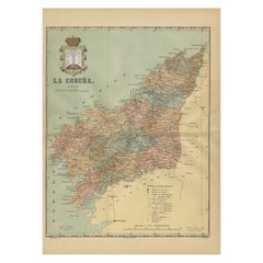
- La Coruña 1901: A Cartographic View of Galicia's Maritime ProvinceLocated in Langweer, NLThis antique map for sale showcases the province of La Coruña (in Galician, A Coruña), located in the northwest of Spain, within the autonomous community of Galicia, as of the year 1...Category
Antique Early 1900s Maps
MaterialsPaper
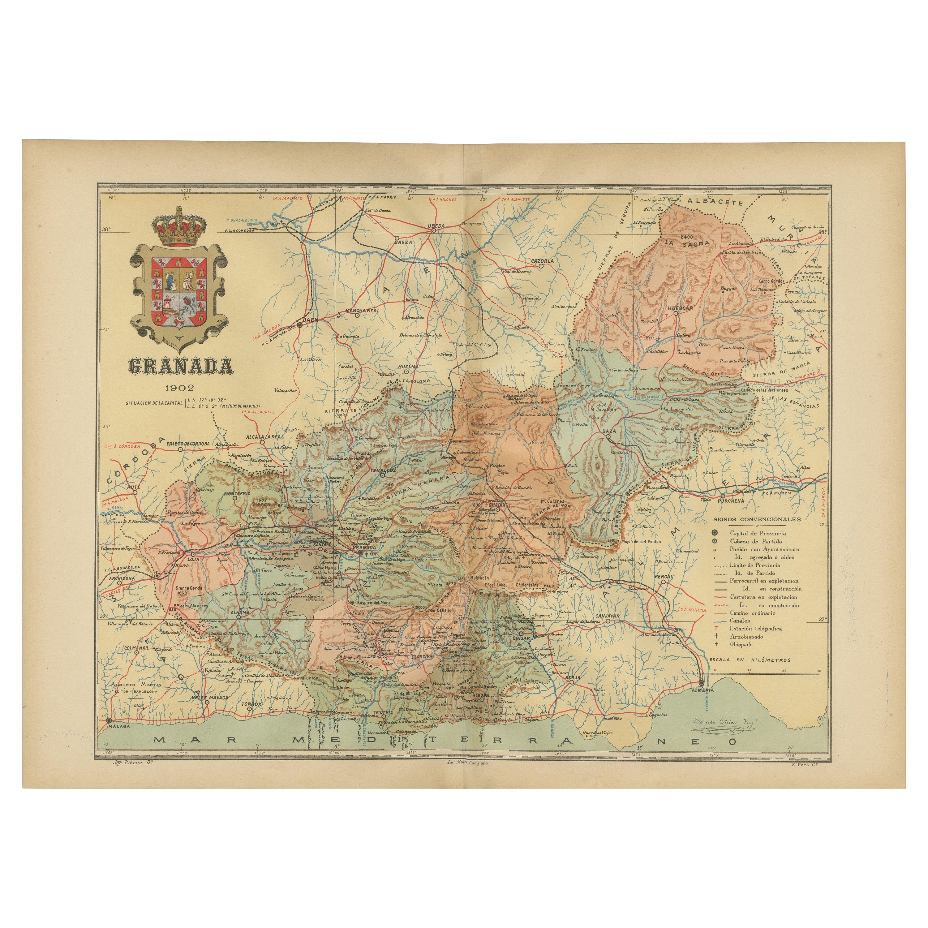
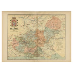
- Granada 1902: A Cartographic Exploration of Andalusia's Mountainous ProvinceLocated in Langweer, NLThis original antique map depicts the province of Granada, part of the autonomous community of Andalusia in southern Spain, as of 1902. The map features several important details: I...Category
Antique Early 1900s Maps
MaterialsPaper
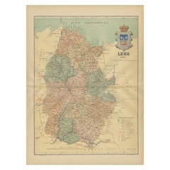
- Lugo 1901: A Cartographic Chronicle of Galicia's Ancient Roman Walled CityLocated in Langweer, NLThe map presents the province of Lugo, located in the autonomous community of Galicia in northwestern Spain, as it was in 1901. Notable features include: - **Topography**: The provi...Category
Antique Early 1900s Maps
MaterialsPaper
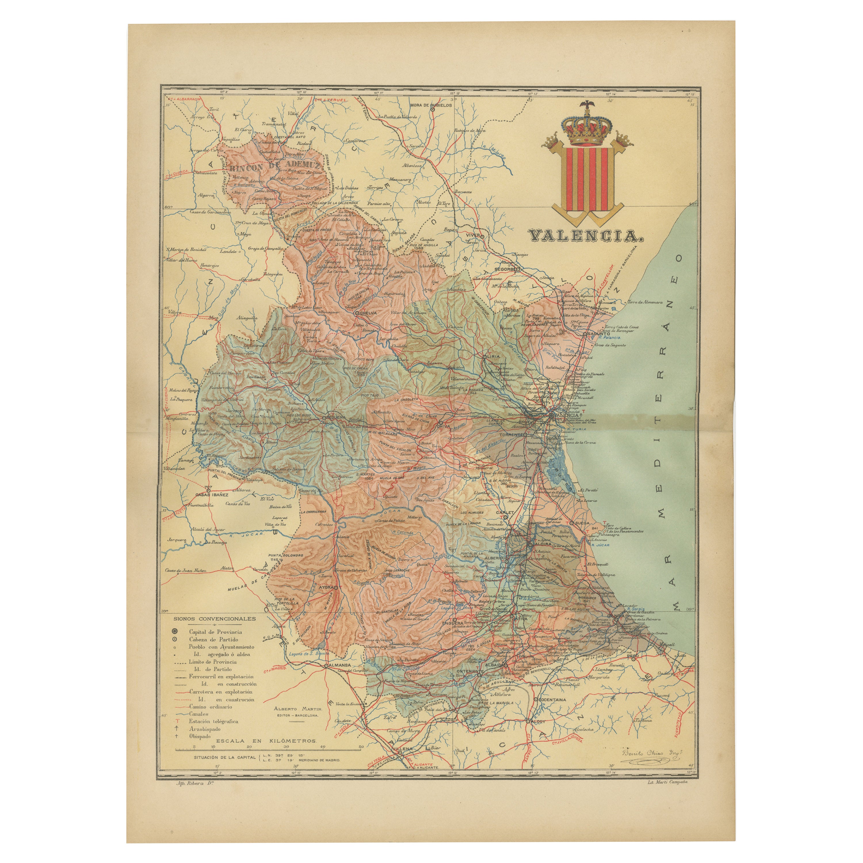
- Topographical and Infrastructure Map of the Province of Valencia, 1901Located in Langweer, NLA historical map of the province of Valencia, dated 1901. The map includes intricate details such as topographical features, with mountain ranges and river systems prominently marked...Category
Antique Early 1900s Maps
MaterialsPaper
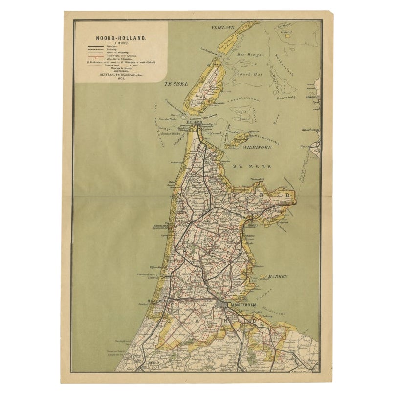
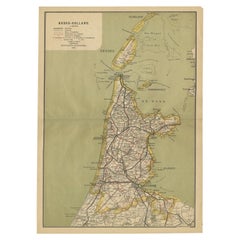
- Antique Map of Noord-Holland, Province of The Netherlands, 1902Located in Langweer, NLAntique map titled 'Noord-Holland'. Lithographed map of the province of Noord-Holland, the Netherlands. This map originates from 'Atlas van Nederland'. Artists and Engravers: Publish...Category
20th Century Maps
MaterialsPaper
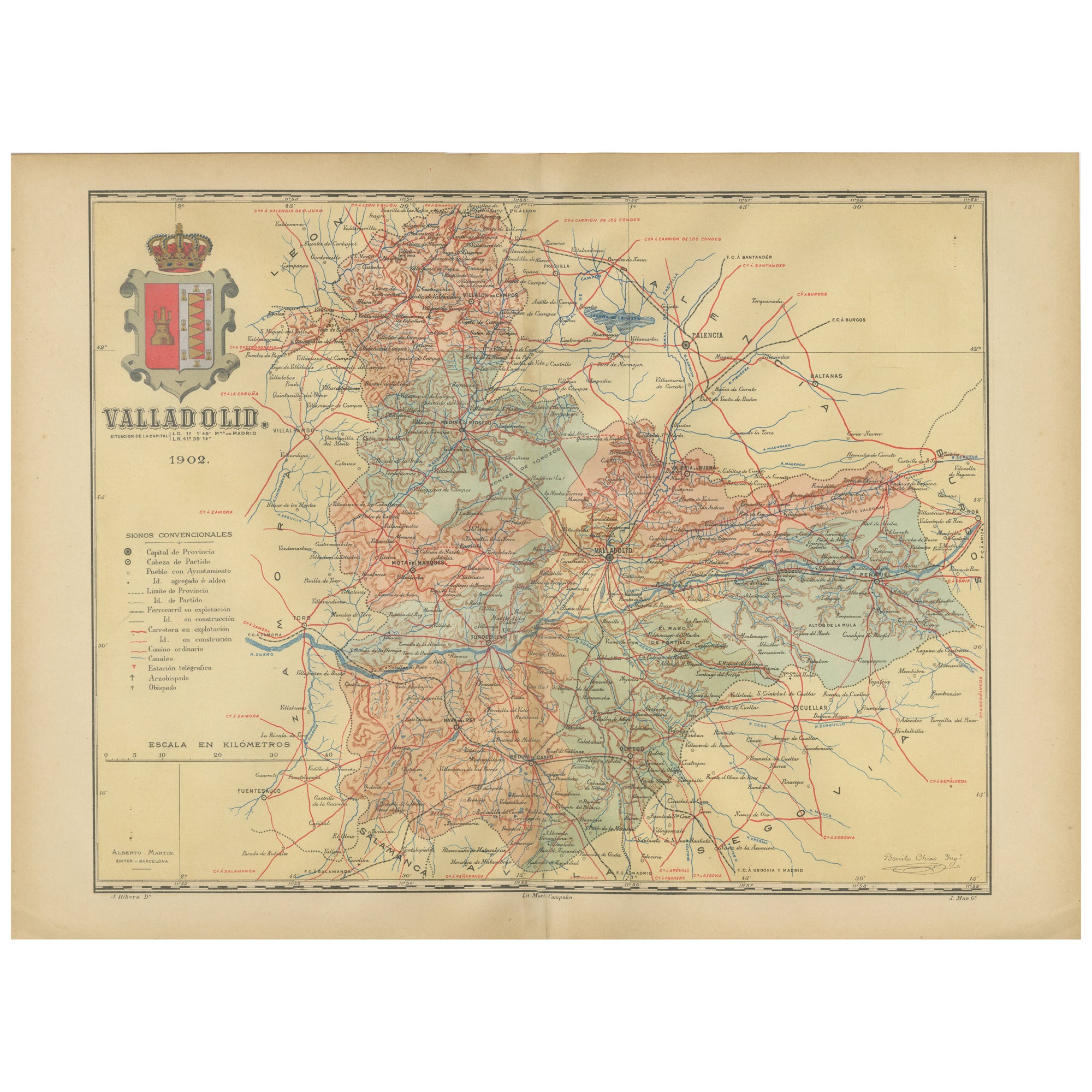
- Anrtique Map of the Province of Valladolid, Central Spain, 1902Located in Langweer, NLA historical or archival map of the province of Valladolid, Spain, from the year 1902. Valladolid is a province located in the central part of Spain, within the autonomous community ...Category
Antique Early 1900s Maps
MaterialsPaper


You May Also Like
- 1907 Map of Colorado, Antique Topographical Map, by Louis NellLocated in Colorado Springs, COThis highly detailed pocket map is a topographical map of the state of Colorado by Louis Nell from 1907. The map "has been complied from all availabl...Category
Antique Early 1900s American Maps
MaterialsPaper
- 1861 Topographical Map of the District of Columbia, by Boschke, Antique MapLocated in Colorado Springs, COPresented is an original map of Albert Boschke's extremely sought-after "Topographical Map of the District of Columbia Surveyed in the Years 1856 ...Category
Antique 1860s American Historical Memorabilia
MaterialsPaper
- Vintage Swedish Topographic School Map of European Alps, Made in Sweden 1922Located in Los Angeles, CAVintage Swedish Topographic School map of European Alps, Made in Sweden 1922 This vintage Swedish school map is so unique and a great example of why these are so collectible. W...Category
Vintage 1920s Swedish Maps
MaterialsLinen, Wood, Paper
- Antique 18th Century Map of the Province of Pensilvania 'Pennsylvania State'Located in Philadelphia, PAA fine antique of the colony of Pennsylvania. Noted at the top of the sheet as a 'Map of the province of Pensilvania'. This undated and anonymous map is thought to be from the Gentleman's Magazine, London, circa 1775, although the general appearance could date it to the 1760's. The southern boundary reflects the Mason-Dixon survey (1768), the western boundary is placed just west of Pittsburgh, and the northern boundary is not marked. The map has a number of reference points that likely refer to companion text and appear to be connected to boundaries. The western and southern boundaries are marked Q, R, S, for example. A diagonal line runs from the Susquehanna R to the Lake Erie P. A broken line marked by many letters A, B, N, O, etc., appears in the east. There are no latitude or longitude markings, blank verso. Framed in a shaped contemporary gilt wooden frame and matted under a cream colored matte. Bearing an old Graham Arader Gallery...Category
Antique 18th Century British American Colonial Maps
MaterialsPaper
- 17th Century Topographical Map, French Champagne Region, Epernay, Iohan PeetersLocated in New York, NYFine topographical 17th century map by Iohan Peeters of the towns of Epernay and Lametz in the Champagne Region of North Eastern France. Fabulous period engraving for a Wine Cellar,...Category
Antique 17th Century Dutch Maps
MaterialsPaper
- 17th Century Topographical Map, Champagne-Ardenne, Marsal, Maubert Iohan PeetersLocated in New York, NYFine topographical 17th century map by Iohan Peeters of Marsal and Maubert Fontaine in the Champagne-Ardennes Region of North Eastern France. Fabulous period engraving for a Wine Ce...Category
Antique 17th Century Dutch Maps
MaterialsPaper


Recently Viewed
View AllMore Ways To Browse
Map Of Old Armenia
Teak Wood Sphere
Nova Guinea Maps
Antique Map Of Illinois
Petite Point Hand Bag
Antique Map Of Southeastern Us
Antique Map Alabama
Antique Map Of Sydney
Malay Archipelago Map
Gambia Antique Map
Uruguay Antique Map
Guyana Antique Map
Ruscelli Map
Masque Theatre No
Nova Scotia Map
Antique Map Tuscany
Berkshire Antique Map
Cornwall Map