Items Similar to Senex Map of Castile, Leon & La Mancha in The Spanish Heartland, 1714


Want more images or videos?
Request additional images or videos from the seller
1 of 6
Senex Map of Castile, Leon & La Mancha in The Spanish Heartland, 1714
About the Item
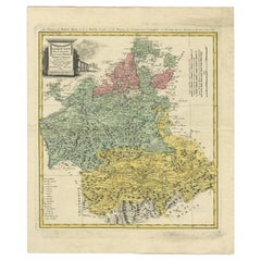
This antique map, titled "A Map of Old & New Castile from the Observations of Rodrigo Mendes Silva and others," depicts the regions of Old Castile and New Castile in Spain, along with the Kingdom of Leon, Estremadura, La Mancha, among others. The map dates back to the early 18th century, a period marked by significant political shifts and territorial changes in Europe, particularly illustrated by the War of the Spanish Succession (1701–1714) that reshaped Spain’s governance and regional boundaries.
The map itself was published in 1714 by John Senex, a prominent English mapmaker, surveyor, globemaker, and geographer of the early eighteenth century. He was apprenticed as a young man to bookseller Robert Clavell and collaborated with notable mapmakers such as Jeremiah Seller and Charles Price. In 1728, Senex's contributions to geography and mapping were recognized when he was elected a Fellow of the Royal Society, an exceptional honor for a mapmaker, underlining his significant role as the Society's engraver and a publisher of maps by Edmund Halley and other notable figures.
John Senex is renowned for his English Atlas, first published in the same year as this map, 1714, and continued to be printed until the 1760s. Following his death in 1740, his widow Mary Senex managed the business until 1755. Afterward, the stock passed to William Herbert and Robert Sayer for maps, and to James Ferguson for globes.
The map serves not just as a geographical record but also as a historical document, reflecting the territorial divisions significant to Spain's political and economic structure at the time. The focus on Old and New Castile underscores their importance during a transformative era in Spanish history.
Here are some potentially significant places and features of this map:
1. **Old Castile (Castilla la Vieja)**: Historically significant as part of the former Kingdom of Castile, this region includes major cities such as Burgos and Valladolid. These cities could be popular search terms due to their historical importance.
2. **New Castile (Castilla la Nueva)**: Incorporating the capital city of Madrid, this area would naturally generate search interest given Madrid's prominence as both a historical and modern capital.
3. **Kingdom of Leon**: Once a separate kingdom, Leon has a rich history and includes significant cities like León and Salamanca, which might be key search terms related to historical maps.
4. **Estremadura**: Known for its Roman history and figures like Hernán Cortés, searches related to this region could be high for those interested in the history of the Conquistadors.
5. **La Mancha**: Internationally known through literature, especially due to "Don Quixote" by Miguel de Cervantes, La Mancha is a culturally significant region that may be frequently searched for.
6. **Major Rivers**: Rivers such as the Tagus (Tajo) and the Duero (Douro) are notable geographical features that might be commonly searched for and therefore, featured in map searches.
7. **Portugal and the Portugal Border**: The border with Portugal and prominent Portuguese cities near the border might also be a focal point for searchers due to the historical and geographical significance of the Iberian Peninsula.
- Dimensions:Height: 19.81 in (50.3 cm)Width: 26.89 in (68.3 cm)Depth: 0.02 in (0.5 mm)
- Materials and Techniques:Paper,Engraved
- Period:
- Date of Manufacture:1714
- Condition:Refinished. Age-related toning. Shows wear, soiling and a few defects, adding to its patina. Backed with linen. Please study image carefully.
- Seller Location:Langweer, NL
- Reference Number:
About the Seller
5.0
Platinum Seller
These expertly vetted sellers are 1stDibs' most experienced sellers and are rated highest by our customers.
Established in 2009
1stDibs seller since 2017
1,919 sales on 1stDibs
Typical response time: <1 hour
- ShippingRetrieving quote...Ships From: Langweer, Netherlands
- Return PolicyA return for this item may be initiated within 14 days of delivery.
More From This SellerView All
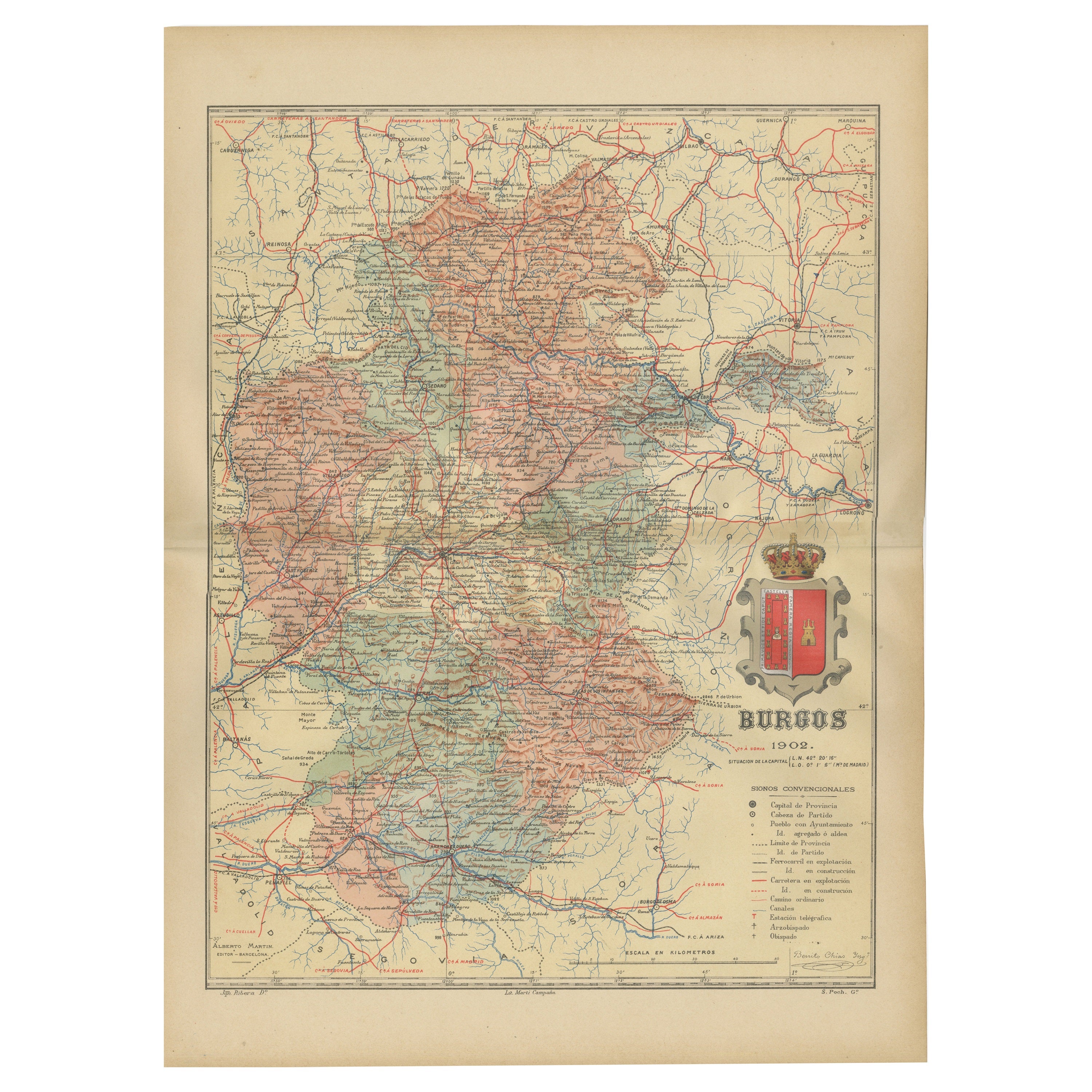
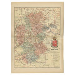
- Burgos 1902: Geographic Map of Castile's Historic Heartland in SpainLocated in Langweer, NLThe map of the province of Burgos in the autonomous community of Castile and León in Spain, dated 1902. It includes the following features: The map highlights the varied terrain wit...Category
Antique Early 1900s Maps
MaterialsPaper
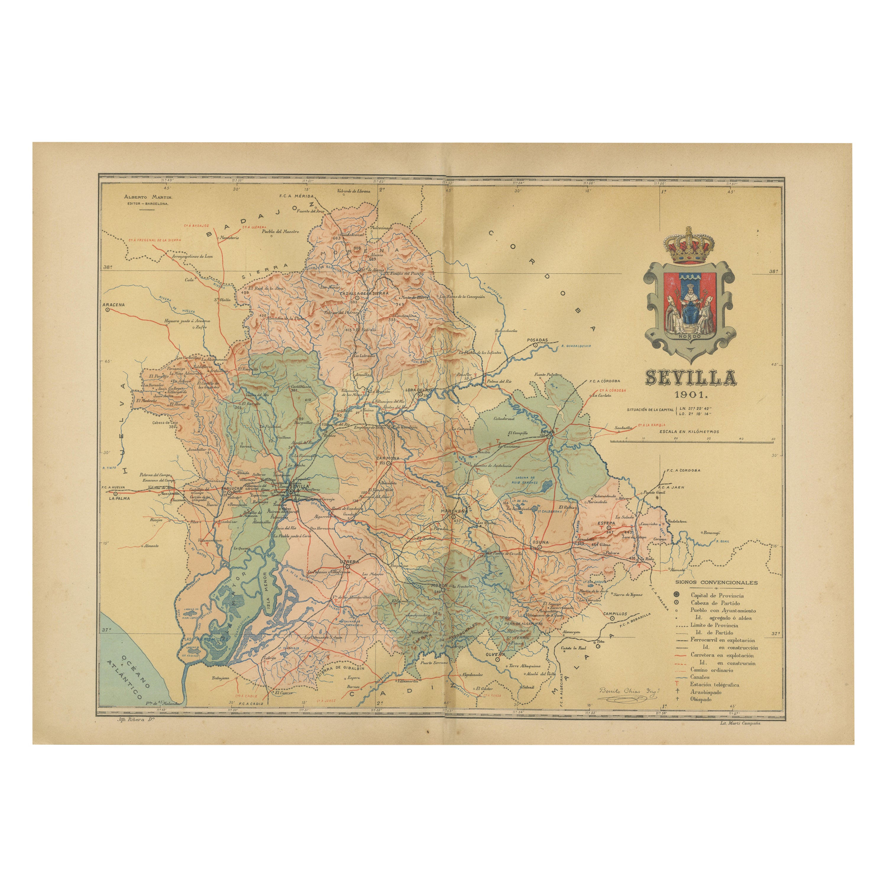
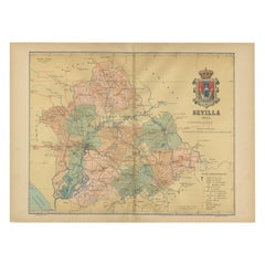
- Map of Sevilla Province, 1901: A Depiction of The Spanish Cultural HeartlandLocated in Langweer, NLThe print for sale here depicts a historical map of the province of Sevilla (Seville) from the year 1901. Sevilla is located in the southern part of Spain and is part of the autonomo...Category
Antique Early 1900s Maps
MaterialsPaper
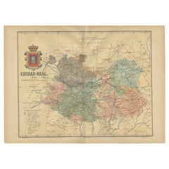
- Ciudad Real 1902: A Detailed Cartographic Survey of La Mancha in SpainLocated in Langweer, NLThis original antitque map presents the province of Ciudad Real, located in the autonomous community of Castilla-La Mancha in central Spain, as of 1902. It includes several notable f...Category
Antique Early 1900s Maps
MaterialsPaper
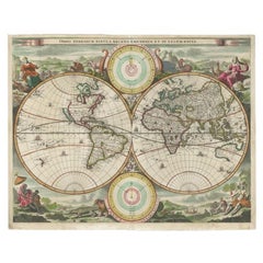
- Antique Map of the World by Stoopendaal, c.1714Located in Langweer, NLAntique world map titled 'Orbis Terrarum Tabula Recens Emendata et in Lucem Edita'. Decorative double hemisphere world map. Illustrated with numerous exotic animals and four female a...Category
Antique 18th Century Maps
MaterialsPaper
- Antique Map of the Provinces of Madrid, Toledo and La Mancha by Homann, 1781Located in Langweer, NLAntique map titled 'Castilliae Novae pars Occidentalis provincias Madrit, Toledo et Mancha (..)'. Antique map of the central Spanish provinces of Madrid, Toledo and La Mancha with pi...Category
Antique 18th Century Maps
MaterialsPaper
- Antique Map of the Maluku Islands by Van der Aa, 1714By Pieter Van Der AaLocated in Langweer, NLAntique Map Moluccas titled 'Les Isles Moluques'. Rare map of the Spice Islands made after a map engraved by Pieter van den Keere and published in the 1628 edition of the Mercator At...Category
Antique 18th Century Maps
MaterialsPaper

You May Also Like
- 4 Volumes, Cervantes, Don Quixote De La ManchaLocated in New York, NY4 Volumes. Cervantes.Don Quixote De La Mancha.Edition Deluxe, limited to 25 Sets, this is #3. Translated From The Spanish By P.A. Motteux. Bound in 3/4 wine ...Category
20th Century American Books
MaterialsLeather
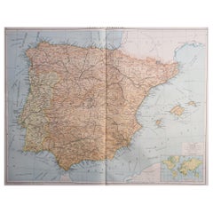
- Large Original Vintage Map of Spain, circa 1920Located in St Annes, LancashireGreat map of Spain Original color. Good condition Published by Alexander Gross Unframed.Category
Vintage 1920s English Maps
MaterialsPaper
- Map of the Republic of GenoaLocated in New York, NYFramed antique hand-coloured map of the Republic of Genoa including the duchies of Mantua, Modena, and Parma. Europe, late 18th century. Dimension: 25...Category
Antique Late 18th Century European Maps
- Original Antique Map of Spain and Portugal, circa 1790Located in St Annes, LancashireSuper map of Spain and Portugal Copper plate engraving by A. Bell Published, circa 1790. Unframed.Category
Antique 1790s English Other Maps
MaterialsPaper
- Large Framed Map of the MediterraneanLocated in New York, NYLarge map/chart chart of The Mediterranean and the Grecian Archipelago showing Italy, Sardinia, Corsica, part of France, etc. in a black frame.Category
20th Century French Mid-Century Modern Maps
- Colored wall map of the WORLDBy ChambonLocated in ZWIJNDRECHT, NL“Mappe Monde, contenant les Parties Connues du Globe Terrestre” CHAMBON, Gobert-Denis (France, 17.. - 1781) Paris, Longchamps et Janvier, 1754 Size H. 115 x W. 145 cm. Gobert-Denis Chambon made copper engraving after the work of Guillaume De L’Isle, published in 1754 by Jean Janvier and S.G. Longschamps. A huge wall map of the world in two hemispheres printed on two sheets, depicting the Eastern and Western hemispheres supported by two male figures, decorated at the bottom right and left with two celestial hemispheres (boreal and southern) and at the bottom in the middle with an armillary sphere, in addition. This map is most notable for its depiction of the Sea of Japan labeled "Mer de Corée" and of "Mer de L'Ouest" or Sea of the West - a great sea, easily the size of the Mediterranean, to flow from the then-known Strait of Juan de Fuca...Category
Antique Mid-18th Century French French Provincial Maps
MaterialsWood, Paper