Hungary Map
2
to
12
49
20
30
22
18
17
9
8
8
6
6
6
5
5
5
4
4
4
3
3
3
3
2
2
2
2
2
2
2
2
2
2
2
1
1
1
1
1
1
3
2
2
2
2
Sort By
Original Antique Map of Hungary, Arrowsmith, 1820
Located in St Annes, Lancashire
Great map of Hungary
Drawn under the direction of Arrowsmith.
Copper-plate engraving.
Published
Category
Antique 1820s English Maps
Materials
Paper
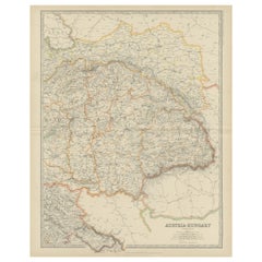
Antique Map of Austria- Hungary by Johnston, '1909'
Located in Langweer, NL
Antique map titled 'Austria- Hungary'. Original antique map of Austria- Hungary. This map
Category
Early 20th Century Maps
Materials
Paper
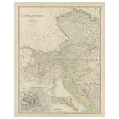
Antique Map of Austria- Hungary by Johnston '1909'
Located in Langweer, NL
Antique map titled 'Austria- Hungary'. Original antique map of Austria- Hungary. With inset maps of
Category
Early 20th Century Maps
Materials
Paper
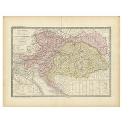
Antique Map of Austria-Hungary by Levasseur, '1875'
Located in Langweer, NL
-Hungary. This map originates from 'Atlas de Géographie Moderne Physique et Politique' by A. Levasseur
Category
Antique Late 19th Century Maps
Materials
Paper
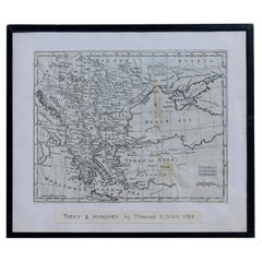
Map Turkey in Europe & Hungary Thomas Kitchin, 1783
Located in BUNGAY, SUFFOLK
Thomas Kitchen (1718 - 1784) : Map of Turkey in Europe & Hungary 1783
Visible sheet within the
Category
Antique 18th Century English Georgian Maps
Materials
Paper
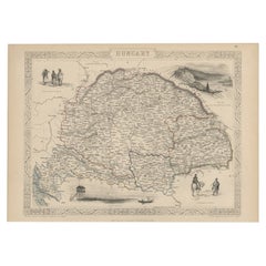
Old Engraved Map of Hungary with Decorative Vignettes, 1851
Located in Langweer, NL
Antique map titled Hungary. Includes decorative vignettes titled Hungarian Peasants, Pesth and the
Category
Antique 19th Century Maps
Materials
Paper
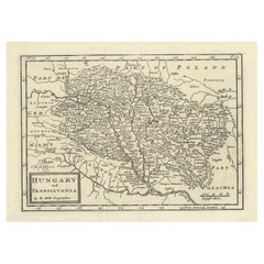
Antique Engraved Map of Hungary and Transylvania or Romania, c.1710
Located in Langweer, NL
Antique map titled 'Hungary and Transilvania'. Original antique map of Hungary and Transylvania
Category
Antique 18th Century Maps
Materials
Paper
Antique Map of Hungary Incl Surroundings like Croatia, Bosnia, Servia, 1730
Located in Langweer, NL
ontdekkingen'.
This map depicts Hungary including surroundings like Croatia, Bosnia, Servia, Bulgaria and
Category
Antique 18th Century Maps
Materials
Paper
No Reserve
H 21.66 in W 17.13 in D 0 in
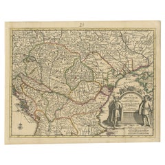
Antique French Map of Hungary with Decorative Title Cartouche, c.1730
Located in Langweer, NL
Antique map titled 'La Hongrie suivant les Nouvelles Observations (..)'. Antique map of Hungary
Category
Antique 18th Century Maps
Materials
Paper
Antique Map of Hungary, Transylvania and Dalmatia by W. G. Blackie, 1859
Located in Langweer, NL
Antique map titled 'Hungary, Transylvania, Dalmatia'. Original antique map of Hungary, Transylvania
Category
Antique Mid-19th Century Maps
Materials
Paper
H 14.57 in W 21.26 in D 0.02 in
Original Antique Map of Hungary and Transylvania 'Modern Day Romania', C.1710
Located in Langweer, NL
Antique map titled 'Hungary and Transilvania'.
Original antique map of Hungary and Transylvania
Category
Antique 1710s Maps
Materials
Paper
H 9.45 in W 14.38 in D 0 in
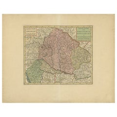
Antique Map of the Kingdom of Hungary by Keizer & de Lat, 1788
Located in Langweer, NL
Hungary. This map originates from 'Nieuwe Natuur- Geschied- en Handelkundige Zak- en Reisatlas' by Gerrit
Category
Antique Late 18th Century Maps
Materials
Paper
Antique Map of the Region of Elbogen & Eger, Czech Republic & Hungary, 1742
Located in Langweer, NL
Antique map titled 'Repraesentatio Geographica Circuli Egerani, nec non Elnbogensis : in quo simul
Category
Antique 1740s Maps
Materials
Paper
H 20.67 in W 23.04 in D 0 in
Old Engraved Map of Hungary, European Balkan Countries, Greece and Crete, 1806
Located in Langweer, NL
Antique map titled 'Hongrie, Turquie Europe'.
Decorative map of Hungary, southeast European
Category
Antique 19th Century Maps
Materials
Paper
H 15.08 in W 11.34 in D 0 in
Antique Map of Germany, Bohemia, Hungary and Part of Poland by R. Bonne ‘1780’
Located in Langweer, NL
Antique map titled "L'Allemagne, La Bohême, et la Hongrie avec une partie de la Pologne" by
Category
Antique Late 18th Century Maps
Materials
Paper
H 10.24 in W 15.04 in D 0.02 in
Antique Map of Eastern Europe, Incl Montenegro & Serbia & a Budapest Map, 1890
Located in Langweer, NL
Antique map titled 'Osterreich-Ungarn in 4 Blattern, Blatt 4.'
Map of Eastern Europe, with
Category
Antique 1890s Maps
Materials
Paper
H 15.63 in W 19.22 in D 0 in
Antique Map of Eastern Europe by Stieler, 1890
Located in Langweer, NL
Antique map titled 'Osterreich-Ungarn in 4 Blattern, Blatt 4.' Map of Eastern Europe, with
Category
Antique 19th Century Maps
Materials
Paper
17th Century Nicolas Visscher Map of Southeastern Europe
Located in Hamilton, Ontario
A beautiful, highly detailed map of southeastern Europe by Nicolas Visscher. Includes regions of
Category
Antique 17th Century Dutch Maps
Materials
Paper
Antique Map of Turkey in Europe by Russell, circa 1795
Located in Langweer, NL
Antique map titled 'Turkey in Europe and Hungary'. Original map of Turkey in Europe. Covers present
Category
Antique Late 18th Century Maps
Materials
Paper
Antique Map of the War Situation in Europe and Asia, 1944
Located in Langweer, NL
Antique map titled 'Newsmap for the Armed Forces'. This "newsmap" was issued on Monday, December 18
Category
20th Century Maps
Materials
Paper
Antique Map of Germany During the Mid-18th Century, Published in 1747
Located in Langweer, NL
Antique map Germany titled 'A New & Accurate Map of Germany'. It covers Germany during the mid-18th
Category
Antique 18th Century Maps
Materials
Paper
Southern & Eastern Europe: A Large 17th C. Hand-colored Map by Sanson & Jaillot
By Nicolas Sanson
Located in Alamo, CA
This large hand-colored map entitled "Estats de L'Empire des Turqs en Europe, ou sont les
Category
Antique 1690s French Maps
Materials
Paper
H 24.88 in W 38 in D 0.13 in
Hand Colored 18th Century Homann Map of Austria Including Vienna and the Danube
By Johann Baptist Homann
Located in Alamo, CA
"Archiducatus Austriae inferioris" is a hand colored map of Austria created by Johann Baptist
Category
Antique Early 18th Century German Maps
Materials
Paper
H 20.25 in W 23.63 in D 0.07 in
Original Copper Engraving of Koroni 'or Corone', Greece, 1688
Located in Langweer, NL
contemporary eyewitness accounts of the Balkans (Hungary, Dalmatia, Greece) during 1683-88.
Artists and
Category
Antique 1680s Maps
Materials
Paper
Old Engraving of the Trarbach Battle in Rhineland-Palatinate, Germany, c.1710
Located in Langweer, NL
French armies and those of its Bavarian allies, together with a revolt in Austrian-controlled Hungary
Category
Antique 1710s Maps
Materials
Paper
H 7.88 in W 9.45 in D 0 in
View of the Island Onrust Near Batavia 'Jakarta', Indonesia, 1739
Located in Langweer, NL
Netherlands were attacked by Germany. In the Dutch East Indies thousands of Germans, Hungarians, Czechs
Category
Antique 1730s Maps
Materials
Paper
Original Vintage Travel Poster Visit Hungary Pictorial Map Budapest Lake Balaton
Located in London, GB
Original vintage travel poster - Visit Hungary! - featuring a pictorial map of the country
Category
Vintage 1960s Hungarian Posters
Materials
Paper
H 26.38 in W 38.59 in D 0.04 in
Austria-Hungary, Western Part. Century Atlas antique vintage map
Located in Melbourne, Victoria
'The Century Atlas. Austria-Hungary, Western Part'
Original antique map, 1903.
Central fold as
Category
Early 20th Century Victorian More Prints
Materials
Lithograph
Budapest, Hungary. Antique Map City Plan Chromolithograph, circa 1901.
Located in Melbourne, Victoria
lithograph plan of Budapest, Hungary.
Central horizontal fold.
Category
Late 19th Century Victorian More Prints
Materials
Lithograph
Hungary & Eastern Europe: A Large 17th C. Hand-colored Map by Sanson & Jaillot
By Nicholas Sanson d'Abbeville
Located in Alamo, CA
This large hand-colored map entitled "Le Royaume De Hongrie et les Estats qui en ont este sujets et
Category
1690s Landscape Prints
Materials
Engraving
Antique Portrait of Matthias I of Hungary by Janszoon, 1615
Located in Langweer, NL
Antique portrait titled 'Matthias I (..)'. Portrait of Matthias I of Hungary. This print originates
Category
Antique 17th Century Prints
Materials
Paper
Geobond - Colorful Authentic Urban Map Currency Painting
By Fabio Coruzzi
Located in Los Angeles, CA
– Hungary
2nd Guanlan International Print Biennial – Guanlan Museum – Shenzen – China
Category
21st Century and Contemporary Pop Art Figurative Paintings
Materials
Canvas, Oil Pastel, Mixed Media, Acrylic, Ink, Graphite
Broke - Mixed Media Credit Card Map Original Artwork
By Fabio Coruzzi
Located in Los Angeles, CA
– Hungary
2nd Guanlan International Print Biennial – Guanlan Museum – Shenzen – China
Category
21st Century and Contemporary Pop Art Mixed Media
Materials
Mixed Media, Spray Paint, Panel
Buda, Antique Map from "Civitates Orbis Terrarum" - 1572-1617
By Franz Hogenberg
Located in Roma, IT
, 1572-1617.
Very fine B/W aquatint showing a view of Buda, an actual part of Budapest, Hungary, on the
Category
16th Century Landscape Prints
Materials
Etching
H 8.08 in W 20.87 in D 0.04 in
Broke 2 - Mixed Media Credit Card Map Original Artwork
By Fabio Coruzzi
Located in Los Angeles, CA
– Hungary
2nd Guanlan International Print Biennial – Guanlan Museum – Shenzen – China
Category
21st Century and Contemporary Pop Art Mixed Media
Materials
Mixed Media, Spray Paint, Panel
Pathfinder - Abstract Map - Mid 20th Century Mixed Media by George De Goya
By George De Goya
Located in Watford, Hertfordshire
conveyance of great situations by great personalities.”
He came to England due to the Hungarian uprising in
Category
1960s Abstract Abstract Paintings
Materials
Mixed Media, Board
H 18.86 in W 20.28 in D 1.3 in
Hand Colored 18th Century Homann Map of Austria Including Vienna & the Danube
By Johann Baptist Homann
Located in Alamo, CA
"Archiducatus Austriae inferioris" is a hand colored map of Austria created by Johann Baptist
Category
Early 18th Century Old Masters Landscape Prints
Materials
Engraving
Southern & Eastern Europe: A Large 17th C. Hand-colored Map by Sanson & Jaillot
By Nicholas Sanson d'Abbeville
Located in Alamo, CA
This large hand-colored map entitled "Estats de L'Empire des Turqs en Europe, ou sont les
Category
1690s Landscape Prints
Materials
Engraving
Antique Portrait of Ferdinand II by Goltzius, 1645
Located in Langweer, NL
, King of Bohemia and King of Hungary. This print originates from 'Icones Imperatorvm Romanorvm (..)' by
Category
Antique 17th Century Prints
Materials
Paper
Lineage Mapping - delicate, copper, oil ink, sketch, monoprint on archival paper
By Susan Collett
Located in Bloomfield, ON
map-like narrative in this unique printed image.
This monoprint began with images carved into
Category
2010s Contemporary Still-life Drawings and Watercolors
Materials
Archival Paper, Monoprint
Original Antique World War One Poster Hark The Dogs Do Bark WWI Dogs Of War
Located in London, GB
- featuring a serio-comic map of Europe at war with military soldier caricature portraits and some countries
Category
Vintage 1910s British Posters
Materials
Paper
H 22.05 in W 29.93 in D 0.04 in
Antique Brass Czech Orrery Astronomical Instruments Made by Jan Felkl in 1870
By Jan Felkl
Located in Milan, IT
the nineteenth century. Cast iron base, papier mâché´ globe, with detailed territorial map and oceanic
Category
Antique 1860s Czech Scientific Instruments
Materials
Iron
H 18.9 in W 29.53 in D 11.03 in
"BLUEBONNET" #10 OF COMFORT TEXAS Volkenburg Mountain
By Dwight Holmes
Located in San Antonio, TX
his medium. His awards include First Prize in Map Drawing, Oregon State Fair 1912; First Prize in Pen
Category
1980s American Impressionist Landscape Paintings
Materials
Oil
“Americana”
By Ralph Fabri
Located in Southampton, NY
was born Fabri Reszo in Hungary in 1894. He was educated in Budapest, first studying architecture at
Category
1940s American Modern Figurative Prints
Materials
Etching, Archival Paper
Israeli Contemporary Art Photograph, Architecture with Hand Painting Shul Sade
By Shuli Sade
Located in Surfside, FL
urbanism. Her work creates maps of urban memory, reflecting the DNA of a city. She mixes mediums including
Category
1990s Contemporary Mixed Media
Materials
Paint, Photographic Paper
"Cenizo" San Carlos Mexico area Burros Mts. in the Distance
By Dwight Holmes
Located in San Antonio, TX
of landscapes, using oils as his medium. His awards include First Prize in Map Drawing, Oregon State
Category
1980s Impressionist Landscape Paintings
Materials
Oil
H 31 in W 43 in D 4 in
Original Vintage Travel Poster Visit Hungary Pictorial Map Budapest Lake Balaton
Located in London, GB
Original vintage travel poster - Visit Hungary! - featuring a pictorial map of the country
Category
1960s More Prints
Materials
Paper
Original Antique World War One Poster Hark The Dogs Do Bark WWI Dogs Of War
Located in London, GB
- featuring a serio-comic map of Europe at war with military soldier caricature portraits and some countries
Category
1910s More Prints
Materials
Paper
H 22.05 in W 29.93 in
1970s Framed Antique Map of Hungaria Hungary 1629 Original
Located in Nuernberg, DE
Hungary. Map is dated 1629 and approx. 7 ¼" wide and 6 ?" high in viewable size. Framed in a handmade
Category
Vintage 1970s Decorative Art
Materials
Glass, Wood
1732 Map of Brussels
Located in New York, NY
Map of Brussels, 1732, with decorated cartouche. Full title: "Brussels A Large and Beautiful City
Category
1730s Realist Landscape Prints
Materials
Engraving
Rare 1710 Hand-Colored Map of Europe
By Frederick de Wit
Located in La Jolla, CA
this state of the map is similar to an example in a 150 map De Wit Atlas in the Hungarian State Library
Category
Antique 1710s Dutch Northern Renaissance Prints
Materials
Paper
Ptolemaic map of Balkan coast extending north by Mercator - Engraving - 17th c.
By Gerard Mercator
Located in Zeeland, Noord-Brabant
, Dalmatia, cum Italiae parte. (…).' - A beautiful Ptolemaic map of the Balkan coast and northern Italy along
Category
1690s Old Masters More Prints
Materials
Engraving
Jerusalem Diary
By Diane Samuels
Located in New York, NY
Pencil on Gampi silk tissue.
Hand-tracings of regional maps and handwritten responses of 194
Category
2010s Contemporary Mixed Media
Materials
Archival Paper, Graphite
Old Map of the Austro-Hungarian Empire with an Inset Map Dalmatia, 1882
Located in Langweer, NL
Antique map titled 'Austro-Hungarian Monarchy'.
Old map of the Austro-Hungarian Empire with an
Category
Antique 1880s Maps
Materials
Paper
Antique Map of Austria and Hungary by Ortelius, c.1590
Located in Langweer, NL
map of Austria and Hungary, following the Danube from Lintz to Bratislava and extending north to the
Category
Antique 16th Century Maps
Materials
Paper
Old Map of the Austro-Hungarian Monarchy with an Inset of Vienna, 1882
Located in Langweer, NL
Antique map titled 'Austro-Hungarian Monarchy'.
Old map of the Austro-Hungarian Monarchy with
Category
Antique 1880s Maps
Materials
Paper
Antique Map of Poland and Lithuania, c.1744
Located in Langweer, NL
Antique map titled 'A New and Accurate Map of Poland, Lithuania & c'. Old map of Poland and
Category
Antique 18th Century Maps
Materials
Paper
Antique Map of the Austrian Empire by A.K. Johnston, 1865
Located in Langweer, NL
Antique map titled 'Austrian Empire (Eastern Sheet)'. Depicting Hungary, Servia, Transylvania and
Category
Antique Mid-19th Century Maps
Materials
Paper
Six Framed Maps of Europe
Located in Essex, MA
, Hungary by Guillaume De Lisle , Spain By De Lisle.
Category
Antique 1680s European Decorative Art
Imperial Map Desk of the Habsburg Empire
Located in New Orleans, LA
This monumental, one-of-a-kind map desk hails from the Imperial Palace of the Habsburg Emperor
Category
Antique 19th Century Austrian Other Desks
Materials
Wood, Satinwood, Walnut
- 1
Get Updated with New Arrivals
Save "Hungary Map", and we’ll notify you when there are new listings in this category.
Hungary Map For Sale on 1stDibs
At 1stDibs, there are many versions of the ideal hungary map for your home. Each hungary map for sale was constructed with extraordinary care, often using paper, glass and wood. Whether you’re looking for an older or newer hungary map, there are earlier versions available from the 18th Century and newer variations made as recently as the 20th Century. Many designers have produced at least one well-made hungary map over the years, but those crafted by Nicholas Sanson d'Abbeville are often thought to be among the most beautiful.
How Much is a Hungary Map?
The average selling price for a hungary map at 1stDibs is $301, while they’re typically $98 on the low end and $2,175 for the highest priced.

