Map Greece
to
71
135
14
92
50
50
34
24
17
15
15
14
10
10
8
7
6
6
5
4
4
3
3
3
3
2
2
2
2
2
1
1
1
1
1
1
1
1
1
1
1
3
2
2
2
1
Sort By
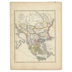
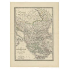
Small Antique Map of the European Turkey, Greece & Ionian Islands – c.1860
Located in Langweer, NL
Antique Map of the European Turkey, Greece & Ionian Islands – Stieler, c.1860
Original antique map
Category
Antique 1860s Maps
Materials
Paper
$114 Sale Price
20% Off
H 9.26 in W 11.66 in D 0.01 in
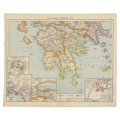
Antique Map of Southern Greece, 1892
Located in Langweer, NL
Antique map of Greece titled 'Griechenland. Südlicher Theil'. Old map of Southern Greece with inset
Category
Antique 19th Century Maps
Materials
Paper
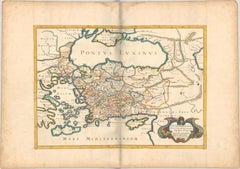
1667 Melchior Tavernier Map of the Patriarchate of Constantinople – Black Sea, G
Located in Langweer, NL
map, Greece map, antique map, historical map, Eastern Orthodox, ancient geography, ecclesiastical
Category
Antique 1660s Maps
Materials
Paper
$743 Sale Price
20% Off
H 14.3 in W 20.01 in D 0 in
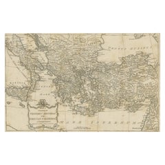
Antique Map of the Ancient Greek Colonization
Located in Langweer, NL
'. Original antique map of the ancient Greek colonization. Frontispiece map of 'The History of Ancient Greece
Category
Antique Late 18th Century Maps
Materials
Paper
Antique Map of Turkey and Greece, 1852
Located in Langweer, NL
Antique map titled 'Europisch Turkije en Griekenland'. Map of Turkey in Europe and Greece. This map
Category
Antique 19th Century Maps
Materials
Paper
Antique Map of Turkey and Greece, 1842
By Pierre M. Lapie
Located in Langweer, NL
Antique map titled 'Carte de la Turquie d'Europe et de la Grèce Moderne'. Map of Turkey and Greece
Category
Antique 19th Century Maps
Materials
Paper
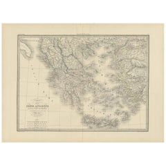
Antique Map of Greece by Lapie, 1842
Located in Langweer, NL
Antique map titled 'Carte de la Grèce Ancienne'. Map of Greece. This map originates from 'Atlas
Category
Antique Mid-19th Century Maps
Materials
Paper
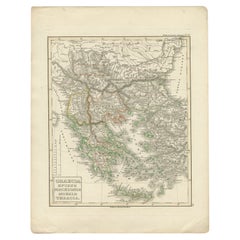
Antique Map of Greece and Macedonia, 1848
Located in Langweer, NL
Antique map titled 'Graecia Epirus Macedonia Moesia Thracia'. Old map of Greece originating from
Category
Antique 19th Century Maps
Materials
Paper
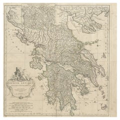
Large Scale Map of Greece with Inset Map of Macedonia, c.1786
Located in Langweer, NL
Antique map titled 'Graeciae Antiquae'. Large scale map of Greece, extends south to the island of
Category
Antique 18th Century Maps
Materials
Paper
Antique Map of Greece by Allard (c.1698)
Located in Langweer, NL
Antique map titled 'Hellas seu Graecia Universa' Detailed map of Greece, with Crete, the Aegean
Category
Antique Late 17th Century Maps
Materials
Paper
Charming 18th Century Miniature Map of Greece, 1685
Located in Langweer, NL
Antique map titled 'Graeciae Descriptio.' Charming miniature map of Greece from the pocket atlas
Category
Antique 17th Century Maps
Materials
Paper
Greece and Ottoman Balkans Map – Homann Engraving ca. 1720
Located in Langweer, NL
Greece and the Danube Basin Map c.1720 – Antique Engraving of the Balkans
This remarkable early
Category
Antique 18th Century European Maps
Materials
Paper
Antique Map of Greece and the Cyclades, 1903, with Many Details and Inset Maps
Located in Langweer, NL
Title: Antique Map of Greece and the Cyclades, 1903, with Intricate Detail and Inset Maps
Category
Early 20th Century Maps
Materials
Paper
$345
H 14.49 in W 18.51 in D 0.01 in
Large Original Antique Map of The Greek Islands. 1894
Located in St Annes, Lancashire
Superb Antique map of The Greek Islands
Published Edward Stanford, Charing Cross, London 1894
Category
Antique 1890s English Maps
Materials
Paper
Antique Map of Greece with Two Small Inset Maps of Athens, c.1870
Located in Langweer, NL
Antique map titled 'Graecia'. Old map of Greece with two small inset maps of Athens. This map
Category
Antique 19th Century Maps
Materials
Paper
Original Antique Map of Greece and part of Turkey
Located in Langweer, NL
Greece and part of Turkey. This map originates from 'Le nouveau et curieux Atlas Geographique et
Category
Antique Early 18th Century Maps
Materials
Paper
$362 Sale Price
20% Off
H 7.88 in W 10.16 in D 0.02 in
Antique Map of Greece by J. Jansson, circa 1653
Located in Langweer, NL
This is an authentic antique map of the Greece by Jan Jansson. The map was published in Amsterdam
Category
Antique Mid-17th Century Maps
Materials
Paper
$838 Sale Price
20% Off
H 20.67 in W 24.81 in D 0.02 in
Antique Map of Greece by Keizer & de Lat, 1788
Located in Langweer, NL
antique map of Greece. This map originates from 'Nieuwe Natuur- Geschied- en Handelkundige Zak- en
Category
Antique Late 18th Century Maps
Materials
Paper
European Turkey and Greece Map – Balkans and Ionian Islands 1857
Located in Langweer, NL
European Turkey and Greece Map – Balkans and Ionian Islands 1857
This detailed antique print shows
Category
Antique Mid-19th Century German Maps
Materials
Paper
Original Antique Map of Ancient Greece- Boeotia, Thebes, 1787
Located in St Annes, Lancashire
Great map of Ancient Greece. Showing the region of Boeotia, including Thebes
Drawn by J.D
Category
Antique 1780s French Other Maps
Materials
Paper
Original Antique Map of Ancient Greece, Achaia, Corinth, 1786
Located in St Annes, Lancashire
Great map of Ancient Greece. Showing the region of Thessaly, including Mount Olympus
Drawn by
Category
Antique 1780s French Other Maps
Materials
Paper
Rare Original 16th Century Antique Map of Greece, 1598
Located in Langweer, NL
Beautiful and rare antique map of Greece with Albania, Mecedonia, Romania, Dalmatia and the
Category
Antique 16th Century Maps
Materials
Paper
$343 Sale Price
20% Off
H 11.58 in W 7.8 in D 0.02 in
1710 Edward Wells Detailed Ancient Greece Map with Ornate Cartouche
Located in Langweer, NL
"1710 Edward Wells Map of Ancient Greece: A New Map of Antient Greece, Tirana, Morea, Ilyricum
Category
Antique 1710s Maps
Materials
Paper
$733 Sale Price
20% Off
H 17.92 in W 23.23 in D 0 in
Antique Map of Greece from Ortelius's Theatrum Orbis Terrarum, 1595
Located in Langweer, NL
atlases, with maps that were the most up-to-date of their time.
The map depicts ancient Greece, and
Category
Antique 16th Century Maps
Materials
Paper
$1,639 Sale Price
20% Off
H 17.92 in W 21.86 in D 0 in
Original Antique Map in Frame of Greece by Smith '1818'
Located in Langweer, NL
Nicely framed map titled 'Greece'. Original antique map of Greece published by C. Smith, 1818
Category
Antique Early 19th Century Maps
Materials
Paper
$333 Sale Price
20% Off
H 17.33 in W 20.08 in D 0.4 in
Antique Map of European Turkey and Greece by Lowry '1852'
Located in Langweer, NL
Antique map titled 'European Turkey and Greece with the Ionian Islands'. Original map of European
Category
Antique Mid-19th Century Maps
Materials
Paper
$95 Sale Price
20% Off
H 12.21 in W 9.65 in D 0.02 in
Antique Map of Greece, Turkey and surroundings with original coloring
Located in Langweer, NL
gebracht'. Antique map of Greece with Crete and Cyprus, Turkey and the Black Sea. Published by I. Tirion
Category
Antique Mid-18th Century Maps
Materials
Paper
$657 Sale Price
20% Off
H 15.67 in W 21.58 in D 0.02 in
Antique Map of Turkey and Greece by Petri, c.1873
Located in Langweer, NL
Greece. This map originates from 'School-Atlas van alle Deelen der Aarde'.
Artists and Engravers
Category
Antique 19th Century Maps
Materials
Paper
Antique Map of Greece by Seutter or Lotter, 'c.1740'
Located in Langweer, NL
Antique map titled 'Graecia pars Septentrionalis'. Original antique map of Greece, uncommon. Signed
Category
Antique Mid-18th Century Maps
Materials
Paper
$657 Sale Price
35% Off
H 20.28 in W 25.6 in D 0.02 in
Antique Map of Peloponnesus, Greece by Pierre Antoine Tardieu, 1797
Located in Langweer, NL
This antique map, titled "Carte Ancienne d'Allemagne," represents ancient Germany and surrounding
Category
Antique 1790s Maps
Materials
Paper
$324 Sale Price
20% Off
H 16.23 in W 21.26 in D 0.01 in
Antique Map of Thracia ‘Greece’ by J. Janssonius, circa 1650
Located in Langweer, NL
mainly Thracia in Northern Greece and parts of Romania. The map is ornated with three cartouches, in the
Category
Antique Mid-17th Century Maps
Materials
Paper
$810 Sale Price
20% Off
H 20.75 in W 25.2 in D 0.02 in
Historical Map of Greece and the Eastern Mediterranean by Delisle - 1780
Located in Langweer, NL
Historical Map of Greece and the Eastern Mediterranean by Guillaume Delisle - 1780 Reissue
This
Category
Antique 1780s Maps
Materials
Paper
$276 Sale Price
20% Off
H 19.69 in W 26.54 in D 0.01 in
Original Old Map of Northeastern Greece & Northwestern Turkey, Published in 1661
Located in Langweer, NL
covers the ancient region of Thrace, present-day European Turkey and part of Greece. The map is graced
Category
Antique 1660s Maps
Materials
Paper
$400 Sale Price
20% Off
H 6.42 in W 8 in D 0 in
Antique Map of Greece and Its Colonies, with Frame Style Border
Located in Langweer, NL
Antique map titled 'La Grèce'. Attractive map of Greece and its Colonies. The map covers from the
Category
Antique Mid-19th Century Maps
Materials
Paper
$162 Sale Price
20% Off
H 10.12 in W 13.31 in D 0.02 in
Antique Map of Epirus 'Albania, Greece' by J. Janssonius, circa 1650
Located in Langweer, NL
This map covers the northwestern coast of Greece and part of present-day Albania. The map was drawn
Category
Antique Mid-17th Century Maps
Materials
Paper
$798
H 20.79 in W 25.04 in D 0.02 in
Greece 1660 Jan Jansson Watercolour Map Peloponesus Sive Morea I Laurenbergio
Located in West Sussex, Pulborough
We are delighted to offer for sale this Jan Jansson Date: 1660 (published) Amsterdam map of Greece
Category
Antique 1660s Danish Dutch Colonial Maps
Materials
Copper
$1,037
H 20.08 in W 23.43 in D 0.79 in
Antique Map of the Islands of Schiatti and Scopoli, Greece, 1687
Located in Langweer, NL
Antique map titled 'Schiatti - Scopoli.' This original antique map shows the islands Schiatti and
Category
Antique 17th Century Maps
Materials
Paper
$166 Sale Price
20% Off
H 6.11 in W 7.88 in D 0 in
Antique Map of Greece from an Old French School Atlas, 1880
Located in Langweer, NL
Antique map titled 'Grèce Moderne '. Old map of Greece and surroundings. This map originates from
Category
Antique 19th Century Maps
Materials
Paper
$104 Sale Price
20% Off
H 13.59 in W 18.71 in D 0 in
Greece, "Graeciae Antiquae"" A 17th Century Hand-colored Map by Sanson
By Nicolas Sanson
Located in Alamo, CA
This is an original 17th century hand colored copperplate engraved map of Greece entitled "Graeciae
Category
Antique Mid-17th Century French Maps
Materials
Paper
$1,575
H 24.75 in W 29.75 in D 0.13 in
Map of Constantinople, Bosphorus, the Coasts of Greece and the Archipelago, 1785
Located in Langweer, NL
Marmara, and the coasts of Greece and the Aegean Archipelago. The map offers a comprehensive view of one
Category
Antique 1780s Maps
Materials
Paper
$2,335 Sale Price
20% Off
H 25.6 in W 37.41 in D 0 in
Antique Map of Italy and Greece by H. Kiepert, circa 1870
By Heinrich Kiepert
Located in Langweer, NL
Antique map titled 'Italiae pars media'. This map originates from 'Atlas Antiquus. Zwölf Karten zur
Category
Antique Late 19th Century Maps
Materials
Paper
$142 Sale Price
20% Off
H 14.38 in W 18.31 in D 0.02 in
Antique Map of Greece and Ionian Islands by A & C. Black, 1870
Located in Langweer, NL
Antique map titled 'Hellas or Greece'. Original antique map of Greece and Ionian Islands with inset
Category
Antique Late 19th Century Maps
Materials
Paper
$166 Sale Price
20% Off
H 13 in W 17.52 in D 0.02 in
Antique Map of Macedonia, Northern Greece and part of Turkey in Europe
Located in Langweer, NL
Antique map titled 'Macedonia Epirus et Achaia'. Original old map of Macedonia, northern Greece
Category
Antique Mid-17th Century Maps
Materials
Paper
$762 Sale Price
20% Off
H 18.59 in W 23.04 in D 0.02 in
Hand-Colored 18th Century Homann Map of the Danube, Italy, Greece, Croatia
By Johann Baptist Homann
Located in Alamo, CA
decorative cartouche and a large inset map of the Upper Danube region and excellent detail of the Greek and
Category
Antique Early 18th Century German Maps
Materials
Paper
$875
H 20 in W 23.88 in D 0.07 in
Old Engraved Map of Hungary, European Balkan Countries, Greece and Crete, 1806
Located in Langweer, NL
Antique map titled 'Hongrie, Turquie Europe'.
Decorative map of Hungary, southeast European
Category
Antique 19th Century Maps
Materials
Paper
$428 Sale Price
20% Off
H 15.08 in W 11.34 in D 0 in
Antique Map of Nisari, Le Simie, Carchi Elimoia and Piscopia, Greece, 1687
Located in Langweer, NL
Antique map titled 'Carchi Elimoia, Nisari, Le Simie, Piscopia.' Sheet with four maps on one page
Category
Antique 17th Century Maps
Materials
Paper
$400 Sale Price
20% Off
H 15.24 in W 12.09 in D 0 in
Original Antique Map of Leros and Kalimnos, and other islands, Greece, 1687
Located in Langweer, NL
Antique map titled 'Lero, Calamo, Zanara e Levita, Amorgo.'
heet with four maps on one page
Category
Antique 17th Century Maps
Materials
Paper
$524 Sale Price
20% Off
H 15.56 in W 12.09 in D 0 in
Original Antique Map of Greece and Epirus after the Persian Wars, Published 1880
Located in Langweer, NL
The map titled "GRAECIA, EPIRUS post bella Persica," translates to "Greece and Epirus after the
Category
Antique 1880s Maps
Materials
Paper
$352 Sale Price
20% Off
H 18.51 in W 15.56 in D 0 in
Antique Map of Asia Minor including part of the Greek Archipelago and Cyprus
Located in Langweer, NL
Antique map titled 'Chersonesi quae hodie Natolia Descriptio'. Decorative, smaller map of Asia
Category
Antique Mid-18th Century Maps
Materials
Paper
$324 Sale Price
20% Off
H 9.69 in W 11.42 in D 0.02 in
Old Map of the Balkans Incl Greece, Turkey, Serbia, Montenegro, Bulgaria, C.1900
Located in Langweer, NL
antique map of the Balkans including Greece, Turkey, Serbia, Montenegro, Bulgaria and surroundings
Category
Antique Early 1900s Maps
Materials
Paper
$619 Sale Price
20% Off
H 45 in W 49 in D 0.002 in
Southern Greece: A Large 17th C. Hand-colored Map by Sanson and Jaillot
By Nicolas Sanson
Located in Alamo, CA
This large original hand-colored copperplate engraved map of southern Greece and the Pelopponese
Category
Antique 1690s French Maps
Materials
Paper
$1,975
H 24.88 in W 38 in D 0.13 in
Original Map of Greece at the Time of the Dorian Migration, Published in 1880
Located in Langweer, NL
The map titled "GRAECIA TEMPORI MIGRATIONIS DORICAE," translates to "Greece at the Time of the
Category
Antique 1880s Maps
Materials
Paper
$352 Sale Price
20% Off
H 15.56 in W 18.51 in D 0 in
Large Scale Map of Greece, Extending to Cythera with Inset of Macedonia, ca.1786
Located in Langweer, NL
Antique map titled 'Graeciae Antiquae'.
Large scale map of Greece, extends south to the island
Category
Antique 1780s Maps
Materials
Paper
$591 Sale Price
20% Off
H 21.26 in W 21.26 in D 0 in
Original Antique Map of the Coast of Part of Greece, with Athens and Thebes
Located in Langweer, NL
part of Greece. With inset maps of Athens and Thebes. This map originates from 'Philippi Cluveri
Category
Antique Early 18th Century Maps
Materials
Paper
$419 Sale Price
20% Off
H 9.77 in W 14.38 in D 0.02 in
Map of the Ottoman Empire in Europe, incl. the Balkans, Greece & Turkey, c.1760
Located in Langweer, NL
'.
Map of the Ottoman Empire in Europe, the Balkans, Greece, and Turkey in Europe. Engraved for the 'New
Category
Antique 1760s Maps
Materials
Paper
$438 Sale Price
20% Off
H 8.67 in W 13.59 in D 0 in
Antique Map of Turkey with Cyprus and Greece Islands by N. Sanson, circa 1652
Located in Langweer, NL
Antique map of Turkey, Anatolie with Cyprus and the Greece islands. Attractive scrolled title
Category
Antique Mid-17th Century Maps
Materials
Paper
$324
H 8.08 in W 10.56 in D 0.02 in
Antique Map of Greece, Albania, Macedonia and Parts of Turkey and Cyprus, c.1745
Located in Langweer, NL
Antique map titled 'Accurata Totius Archipelagi Et Graeciae Universae Tabula'.
Detailed map of
Category
Antique 18th Century Maps
Materials
Paper
$810 Sale Price
20% Off
H 21.86 in W 25.79 in D 0 in
Antique Engraved Map of the Northern Part of Greece and the Aegean Sea, Ca.1730
Located in Langweer, NL
Title: "GRÆCIÆ PARS Septentrionalis".
Hand Coloured Engraved map by G. Delisle of the northern
Category
Antique 1730s Maps
Materials
Paper
$619 Sale Price
20% Off
H 16.93 in W 20.08 in D 0 in
- 1
Get Updated with New Arrivals
Save "Map Greece", and we’ll notify you when there are new listings in this category.
Map Greece For Sale on 1stDibs
Choose from an assortment of styles, material and more with respect to the map greece you’re looking for at 1stDibs. Frequently made of paper, every map greece was constructed with great care. You’ve searched high and low for the perfect map greece — we have versions that date back to the 18th Century alongside those produced as recently as the 19th Century are available. Each map greece bearing hallmarks is very popular. You’ll likely find more than one map greece that is appealing in its simplicity, but Heinrich Kiepert, Johann Baptist Homann and Nicolas Sanson produced versions that are worth a look.
How Much is a Map Greece?
Prices for a map greece can differ depending upon size, time period and other attributes — at 1stDibs, they begin at $71 and can go as high as $1,575, while the average can fetch as much as $272.
More Ways To Browse
Antique Chart Table
Crescent Line Antique
Turkish Copper Plates
Nile Crocodile
Antique Turkish Basin
King James Bible
Charles Miner
Waring & Gillow On Sale
Warrior Clock
Wavy Front Dresser
Wedgwood Jasperware Box
Weiss Claire
Welsh Plate Dresser
White Terracotta Dog
Wigmore Of London
William Tonks Sons
Willy Guhl Concrete Urn
Willy Rizzo Bar Cart

