Items Similar to Original Old Map of Northeastern Greece & Northwestern Turkey, Published in 1661


Want more images or videos?
Request additional images or videos from the seller
1 of 6
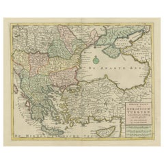
Original Old Map of Northeastern Greece & Northwestern Turkey, Published in 1661
About the Item
This small map was engraved by Petrus Kaerius and is based on Ortelius' map of the same title. It covers the ancient region of Thrace, present-day European Turkey and part of Greece. The map is graced with two attractive strapwork cartouches.
- Dimensions:Height: 6.42 in (16.3 cm)Width: 8 in (20.3 cm)Depth: 0 in (0.02 mm)
- Materials and Techniques:
- Period:1660-1669
- Date of Manufacture:1661
- Condition:A sharp impression with light toning along the edges and a narrow left margin, as issued.
- Seller Location:Langweer, NL
- Reference Number:
About the Seller
5.0
Platinum Seller
These expertly vetted sellers are 1stDibs' most experienced sellers and are rated highest by our customers.
Established in 2009
1stDibs seller since 2017
1,933 sales on 1stDibs
Typical response time: <1 hour
- ShippingRetrieving quote...Ships From: Langweer, Netherlands
- Return PolicyA return for this item may be initiated within 14 days of delivery.
More From This SellerView All
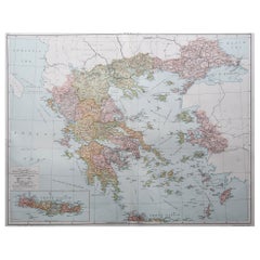
- Original Antique Map of Greece and part of TurkeyLocated in Langweer, NLOriginal antique map titled 'La Grece ou partie meridionale de la Turquie d'Europe'. Small map of Greece and part of Turkey. This map originates from 'Le nouveau et curieux Atlas Geo...Category
Antique Early 18th Century Maps
MaterialsPaper
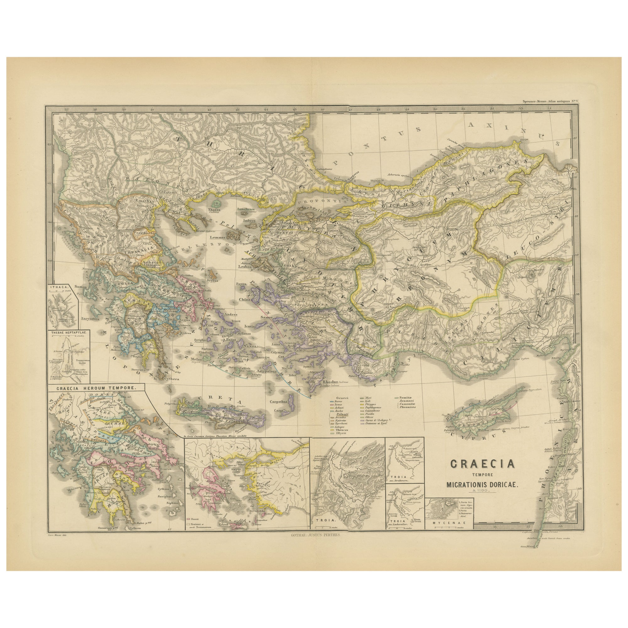
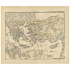
- Original Map of Greece at the Time of the Dorian Migration, Published in 1880Located in Langweer, NLThe map titled "GRAECIA TEMPORI MIGRATIONIS DORICAE," translates to "Greece at the Time of the Dorian Migration." This map showcases the regions of ancient Greece during the period f...Category
Antique 1880s Maps
MaterialsPaper
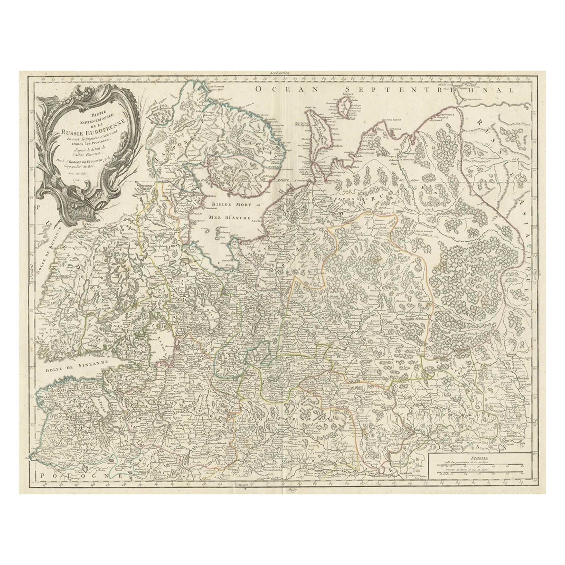
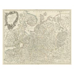
- Original Antique Map of the Northwestern Part of Russia in Europe, 1753Located in Langweer, NLAntique map titled 'Partie septentrionale de la Russie Européenne'. Detailed map of the Northwestern part of Russia, from the Gulf of Finland and Poland, to the western part of Asian Russia. Artists and Engravers: Gilles Robert de Vaugondy (1688-1766) was the head of a leading family of geographers in eighteenth century France. Gilles got his start when he jointly inherited the shop of Pierre-Moullart Sanson, grandson of the famous geographer Nicholas Sanson. The inheritance included the business, its stock of plates, and a roller press...Category
Antique 1750s Maps
MaterialsPaper
- Original Antique Map of Southern Asia, Published in 1833Located in Langweer, NLAntique map titled 'Carte de l'Inde'. Detailed map extending from India in the west to Vietnam and the Malay Peninsula in the east. This map originates from 'Atlas universel de geogr...Category
Antique Mid-19th Century Maps
MaterialsPaper
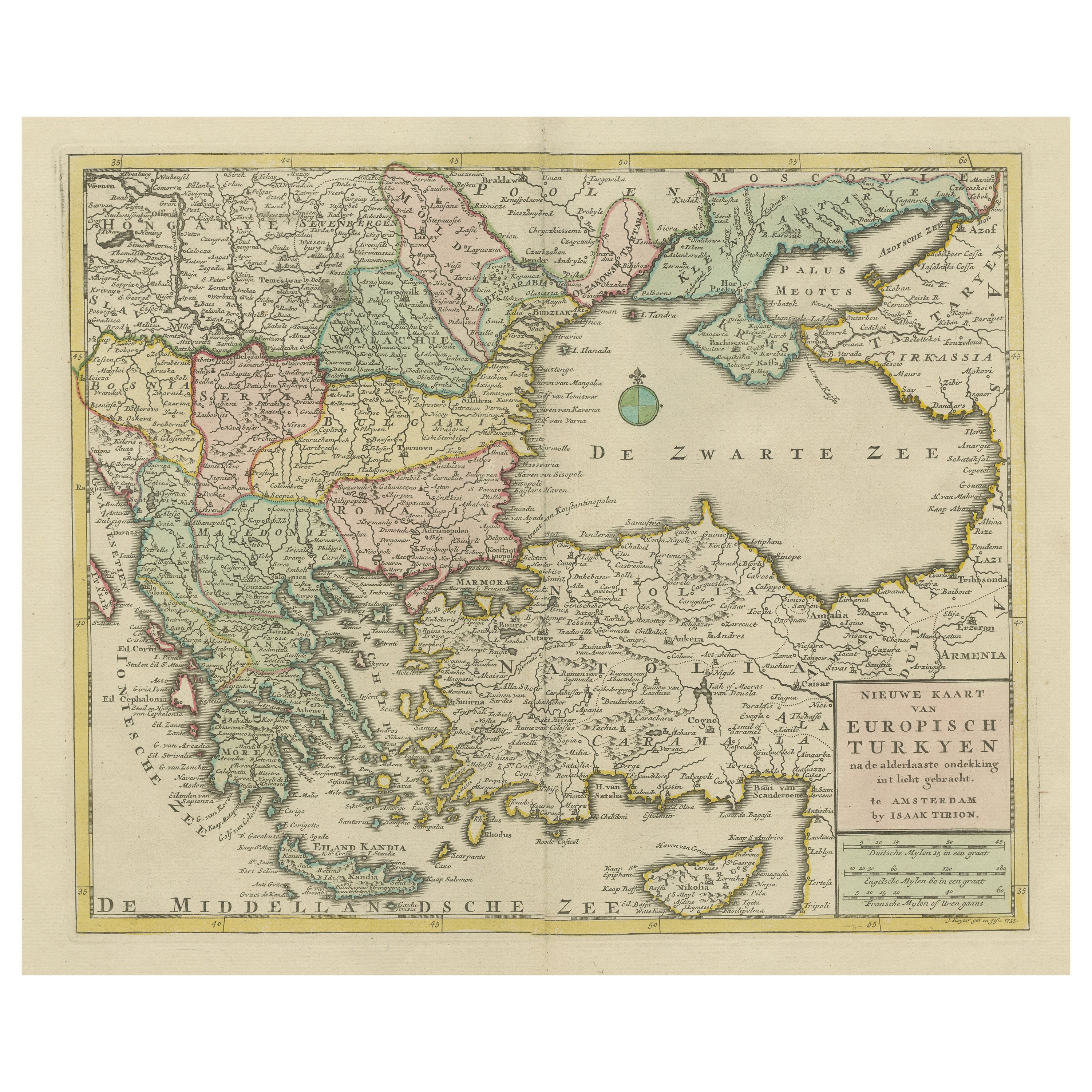
- Antique Map of Greece, Turkey and surroundings with original coloringLocated in Langweer, NLAntique map titled 'Nieuwe Kaart van Europisch Turkyen na de alderlaatste ontdekking in t licht gebracht'. Antique map of Greece with Crete and Cyprus, Turkey and the Black Sea. Publ...Category
Antique Mid-18th Century Maps
MaterialsPaper
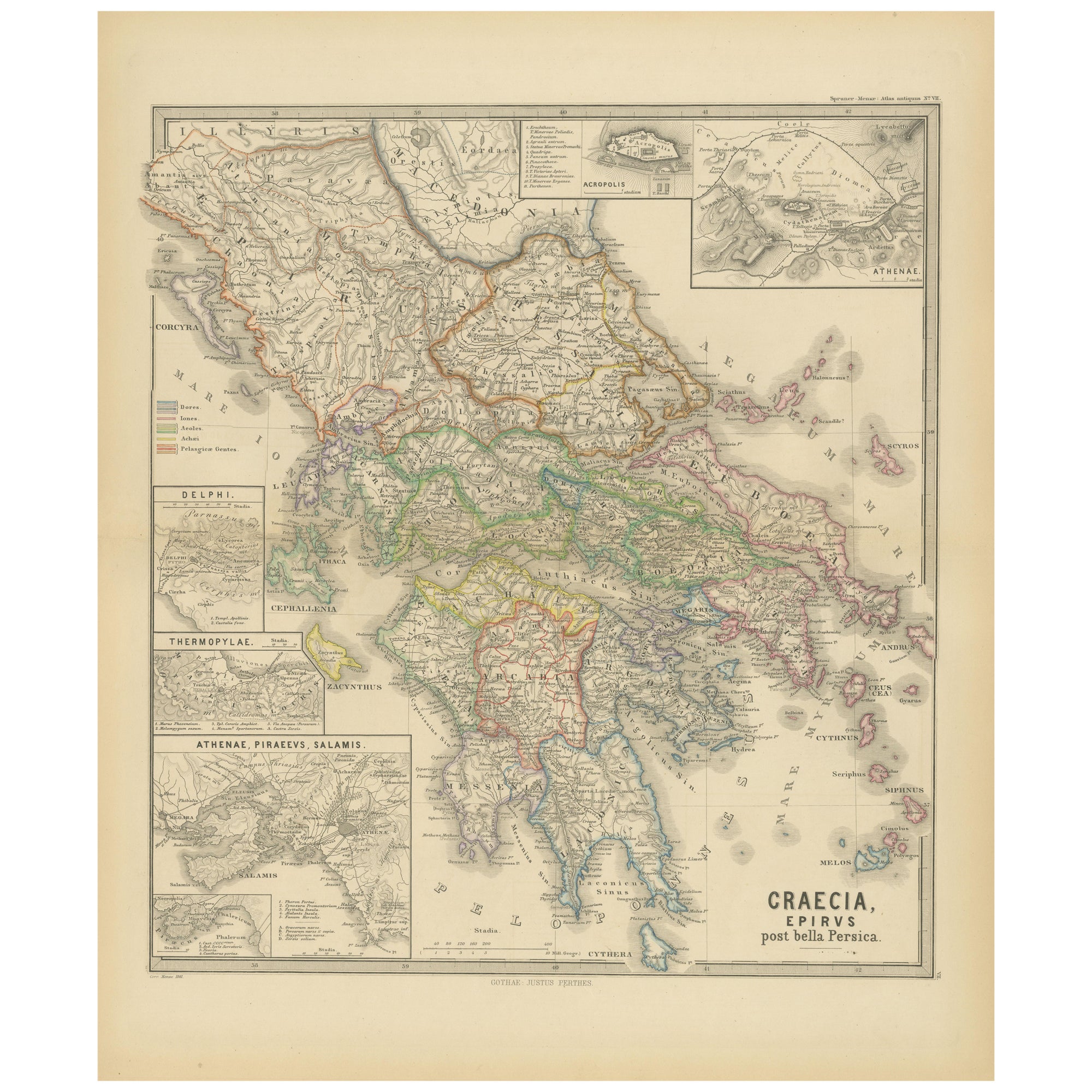
- Original Antique Map of Greece and Epirus after the Persian Wars, Published 1880Located in Langweer, NLThe map titled "GRAECIA, EPIRUS post bella Persica," translates to "Greece and Epirus after the Persian Wars." It covers the regions of ancient Greece and Epirus following the Greco-Persian Wars, a series of conflicts between the Greek city-states and the Persian Empire during the 5th century BC. What makes this map interesting: 1. **Historical Context**: The period after the Persian Wars was pivotal for ancient Greece, leading to the rise of Athens as a major power and the Golden Age of Athens. 2. **Inset Maps**: Detailed insets, such as the one showing the Acropolis of Athens, provide close-up views of historically significant locations. 3. **Topography**: It features the diverse terrain of Greece, from the rugged mountain ranges to the intricate coastlines and islands, influencing the development of Greek city-states. 4. **City-States**: The map likely details the various polis or city-states, such as Athens, Sparta, Thebes, and others, which played critical roles in the Persian Wars. 5. **Battle Sites**: It might mark important battle sites from the wars, like Marathon, Thermopylae, Salamis, and Plataea. 6. **Latin Labels**: The use of Latin for place names and descriptions adds to the map's scholarly quality. 7. **Cultural Landmarks**: The map may include locations of significant cultural and historical landmarks from the era, such as temples, theatres, and agoras. This map is from the "Spruner-Menke Atlas Antiquus," compiled by Karl Spruner von Merz and edited by Theodorus Menke. The atlas, known for its detailed maps of historical and ancient geographies, was a significant educational tool in the 19th century. The Greco-Persian Wars, which included famous battles such as Marathon and Salamis, were crucial for the preservation of Greek independence...Category
Antique 1880s Maps
MaterialsPaper


You May Also Like
- Large Original Vintage Map of Greece, circa 1920Located in St Annes, LancashireGreat map of Greece Original color. Good condition Published by Alexander Gross Unframed.Category
Vintage 1920s English Maps
MaterialsPaper
- Original Antique Map of Ancient Greece, Achaia, Corinth, 1786Located in St Annes, LancashireGreat map of Ancient Greece. Showing the region of Thessaly, including Mount Olympus Drawn by J.D. Barbie Du Bocage Copper plate engraving by P.F Tardieu Original hand color...Category
Antique 1780s French Other Maps
MaterialsPaper
- Original Antique Map of Ancient Greece- Boeotia, Thebes, 1787Located in St Annes, LancashireGreat map of Ancient Greece. Showing the region of Boeotia, including Thebes Drawn by J.D. Barbie Du Bocage Copper plate engraving by P.F T...Category
Antique 1780s French Other Maps
MaterialsPaper
- Original Antique Map of Ancient Greece, Phocis, Gulf of Corinth, 1787Located in St Annes, LancashireGreat map of Ancient Greece. Showing the region of Phocis, including the Gulf of Corinth Drawn by J.D. Barbie Du Bocage Copper plate engraving by P.F Tardieu Original hand c...Category
Antique 1780s French Other Maps
MaterialsPaper
- Old Nautical Map of CorsicaLocated in Alessandria, PiemonteST/556/1 - Old map of Corsica isle, surveyed by Captain Hell, of the French Royal Navy in 1824, engraved and published on 1874, with additions and corre...Category
Antique Early 19th Century English Other Prints
MaterialsPaper
- Old Horizontal Map of EnglandBy TassoLocated in Alessandria, PiemonteST/520 - Old rare Italian map of England, dated 1826-1827 - by Girolamo Tasso, editor in Venise, for the atlas of M.r Le-Sage.Category
Antique Early 19th Century Italian Other Prints
MaterialsPaper


Recently Viewed
View AllMore Ways To Browse
Bolivian Antique
St Thomas Cross
Map Of Liverpool
Georgetown Antique
Map Of Gulf Of Mexico
Authentic Pirate
Historic Map Virginia
Map Of Indonesia
United States Antique Map
Antique Map Coats Of Arms
Antique Book Map France
Old Maps England
Map Sumatra
Scotland Coat Of Arms
Malaysia Antique
Map Of Siam
Antique Map Of Sri Lanka
Globes Antique Terrestre