Items Similar to Greece 1660 Jan Jansson Watercolour Map Peloponesus Sive Morea I Laurenbergio
Want more images or videos?
Request additional images or videos from the seller
1 of 20
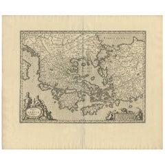
Greece 1660 Jan Jansson Watercolour Map Peloponesus Sive Morea I Laurenbergio
About the Item
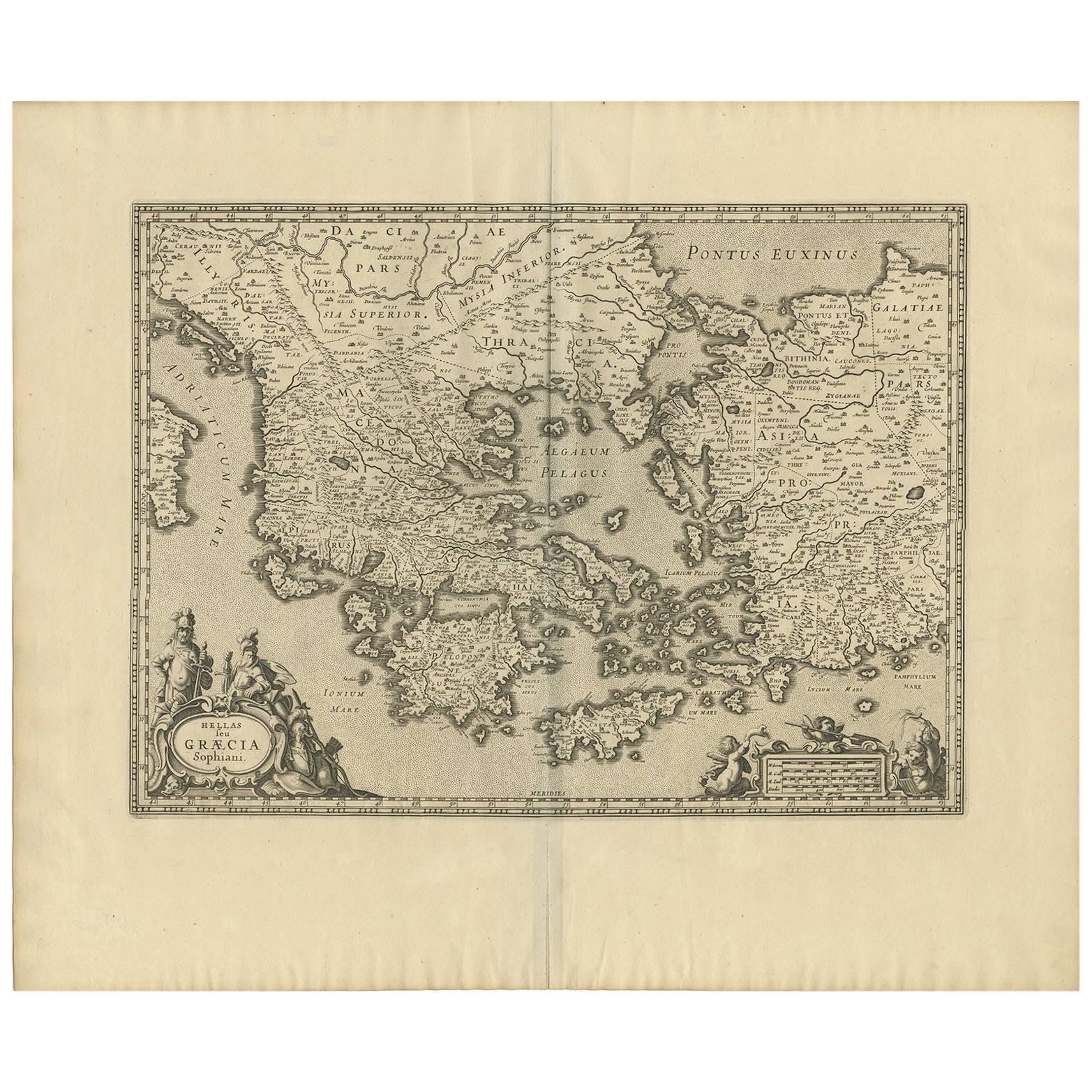
We are delighted to offer for sale this Jan Jansson Date: 1660 (published) Amsterdam map of Greece.
This is an authentic antique map of Peloponnese or the Morea peninsula by Jan Jansson. The map was published in Jansson's "Atlantis majoris" in Amsterdam, circa 1660.
This striking map shows southern Greece from Thebes and Athens in the north, to the southern coast of Peloponnese and includes several islands surrounding the massive peninsula. Rivers, forests, cities, and villages are noted throughout and regional borders within Peloponnese are delineated.
Decorative elements include several ships, some of which appear in battle and decorative cartouches.
The condition is excellent so far as I can see, there will naturally be age related patina, it looks to be a hand watercolour piece.
Dimensions
Height:- 51cm
Width:- 59.5cm
Depth:- 2cm
Please note all measurements are taken at the widest point.
This item is available for collection from our Pulborough warehouses.
CONDITION
Please view the very detailed pictures as they form part of the description pertaining to the condition.
Please note vintage period and original items such as leather seating will always have natural patina in the form of creasing and wear, we recommend annual waxing to ensure no moisture is lost, also hand dyed leather is not recommended to sit in direct sunlight for prolonged periods of time as it will dry out and fade.
- Dimensions:Height: 20.08 in (51 cm)Width: 23.43 in (59.5 cm)Depth: 0.79 in (2 cm)
- Style:Dutch Colonial (Of the Period)
- Materials and Techniques:Copper,Hand-Crafted
- Place of Origin:Denmark
- Period:1660-1669
- Date of Manufacture:1660
- Condition:Wear consistent with age and use. Minor fading.
- Seller Location:GB
- Reference Number:1stDibs: LU2823329915052
About the Seller
4.6
Gold Seller
These expertly vetted sellers are highly rated and consistently exceed customer expectations.
Established in 2012
1stDibs seller since 2017
1,718 sales on 1stDibs
Typical response time: <1 hour
- ShippingRetrieving quote...Ships From: United Kingdom
- Return PolicyA return for this item may be initiated within 14 days of delivery.
More From This SellerView All
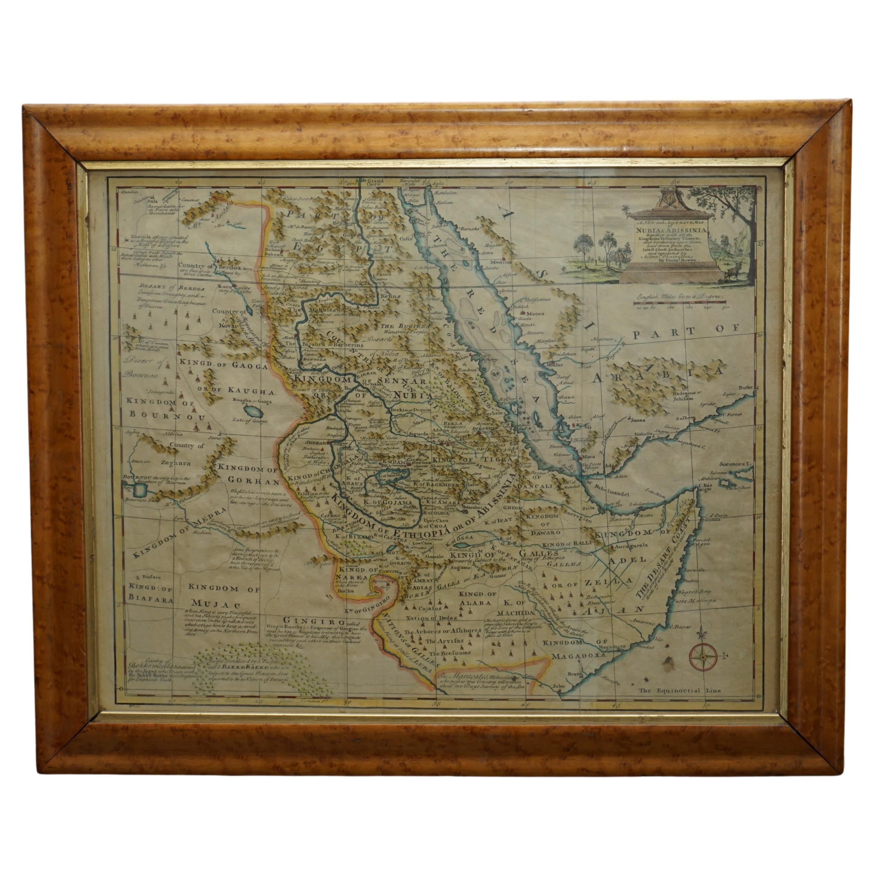
- London 1744 Published Watercolour Antique Map of East Africa by Eman BowenLocated in GBWe are delighted to offer for sale this New and Accurate Map of Nubia & Abissinia, together with all the Kingdoms Tributary Thereto, and bordering upon them published in 1744 by Emanuel Bowen This is a decorative antique engraved map of East Africa...Category
Antique 1740s English George III Maps
MaterialsPaper
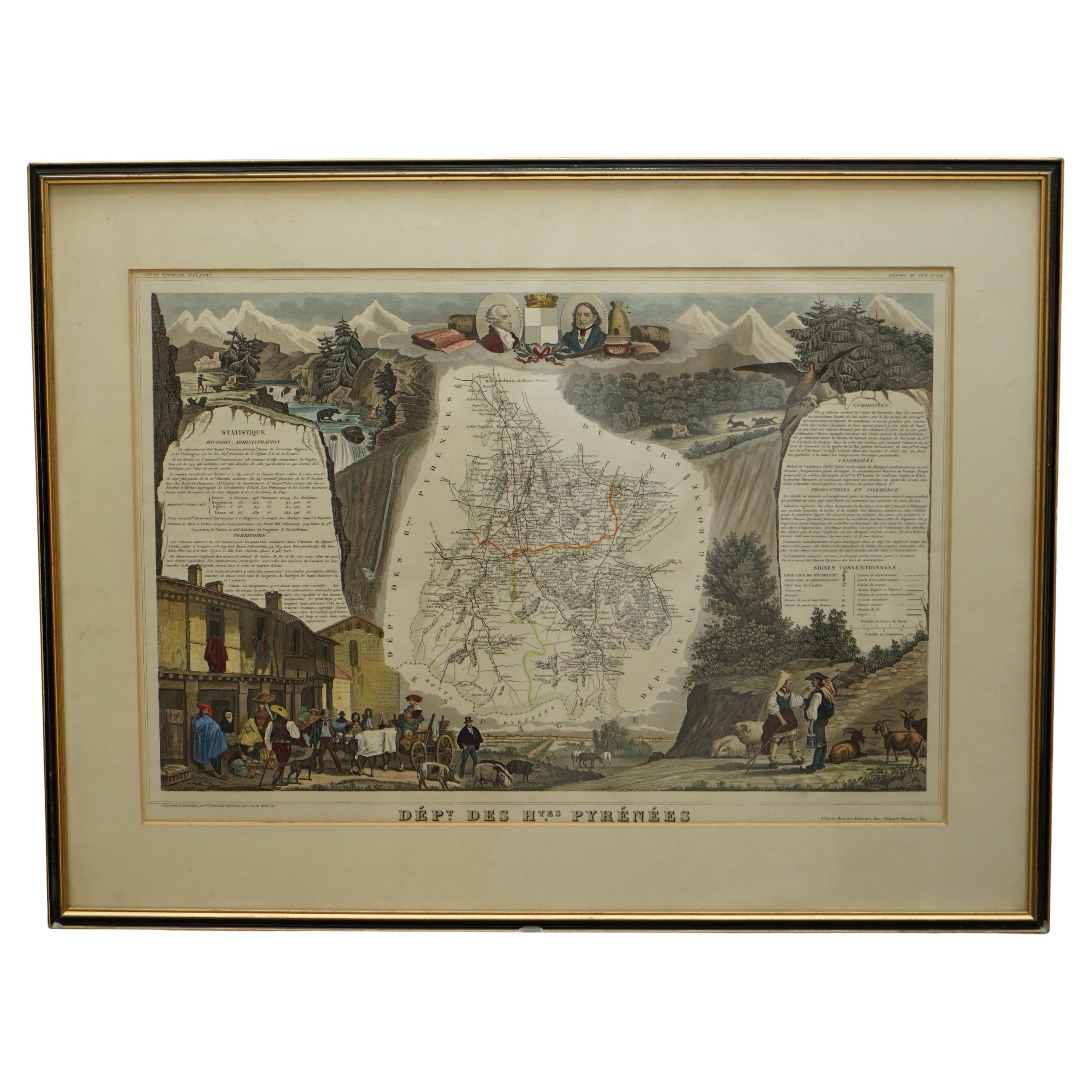
- Fine French Antique 1856 Hand Watercolour Map of Dept Des Hautes PyreneesLocated in GBWe are delighted to offer for sale this stunning 1856 hand watercolour map of the Austrian Alps titled Dept Des Hautes Pyrenees taken from the Atlas Nat...Category
Antique 1850s French Early Victorian Maps
MaterialsPaper
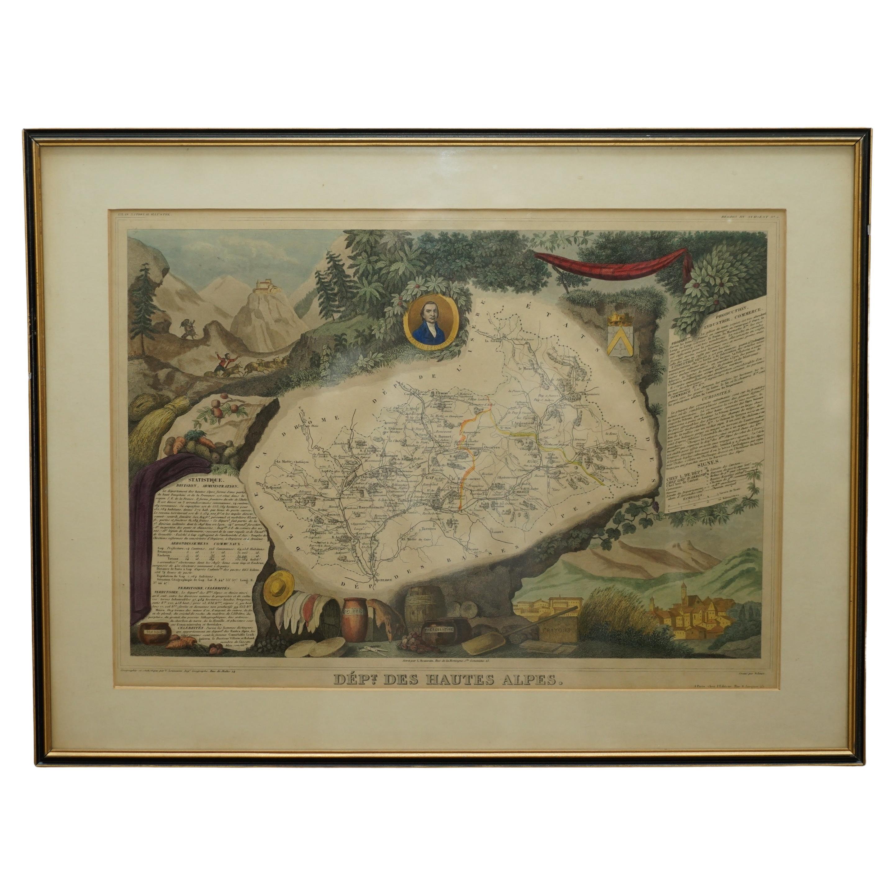
- Fine Antique 1856 Hand Watercolour Map of Dept Des Hautes Alpes by Levasseur'sLocated in GBWe are delighted to offer for sale this stunning 1856 hand watercolour map of the Austrian Alps titled Dept Des Hautes Alpes taken from the Atlas National...Category
Antique 1850s French Early Victorian Maps
MaterialsPaper
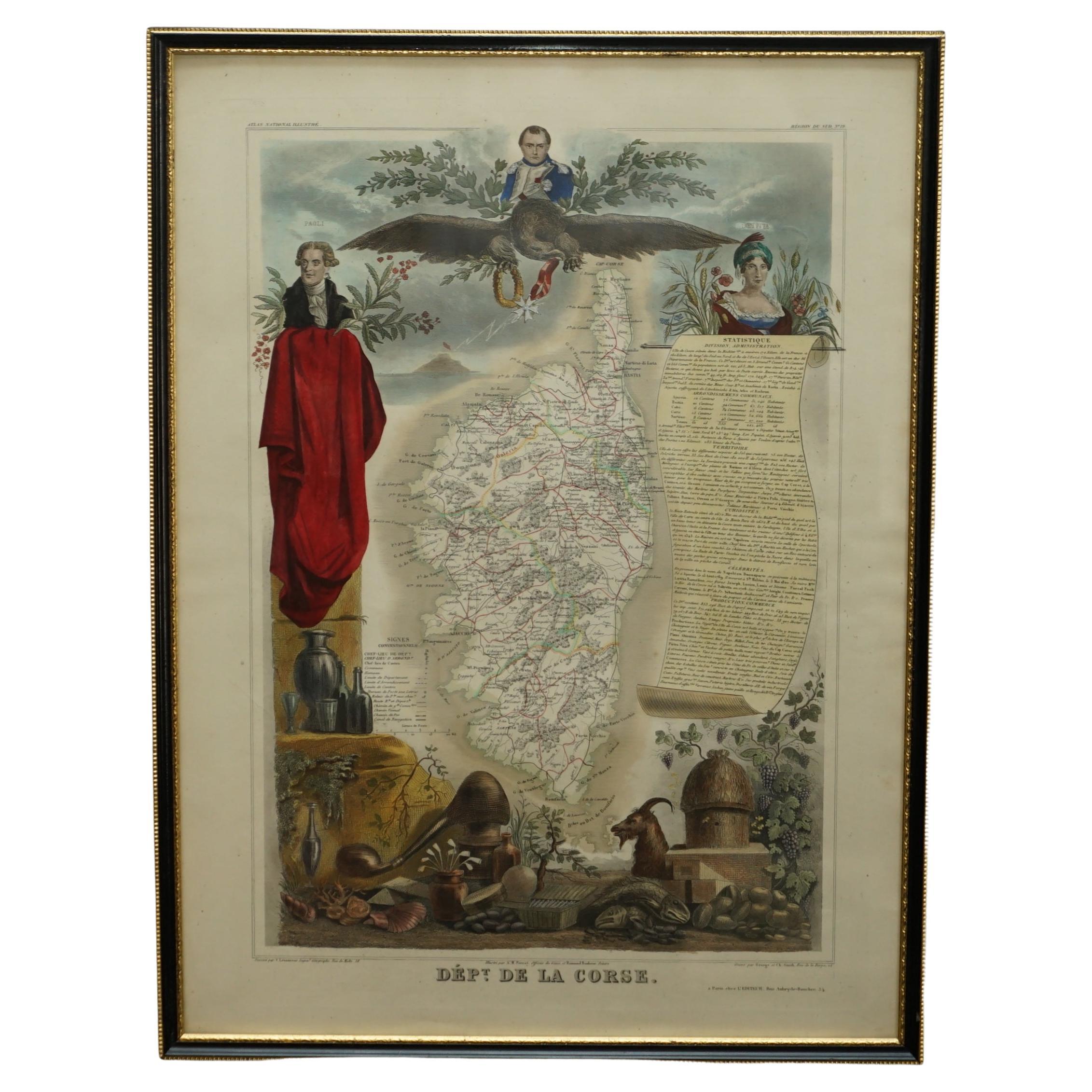
- Beautiful Colour French Antique 1856 Hand Watercolour Map of Dept Des La CorseLocated in GBWe are delighted to offer for sale this stunning 1856 hand watercolour map of the Austrian Alps titled Dept Des La Course taken from the Atlas National ...Category
Antique 1850s French Early Victorian Maps
MaterialsPaper
- World Map Silver Leaf Print Based on Original Willem Blaeu Wall Map 1571-1638Located in GBWe are delighted to offer for sale this lovely Antique style pictorial plan map of the globe based on the original Willem Blaeu 1571-1638 engraved in silver leaf foil This is a v...Category
20th Century English Campaign Maps
MaterialsSilver Leaf
- Staffordshire 1645 Hand Colored Antique Print Staffordiensis Comitatvs MapLocated in GBWe are delighted to offer for sale this lovely antique Atlas page map of Staffordshire printed in 1645 Amsterdam Staffordiensis Comitatvs Vulgo This o...Category
Antique Early 1800s English Georgian Maps
MaterialsPaper


You May Also Like
- Antique Map of Greece by J. Jansson, circa 1653Located in Langweer, NLThis is an authentic antique map of the Greece by Jan Jansson. The map was published in Amsterdam, circa 1653. This striking 17th century map of Greece was based on “Totius Graeciae ...Category
Antique Mid-17th Century Maps
MaterialsPaper
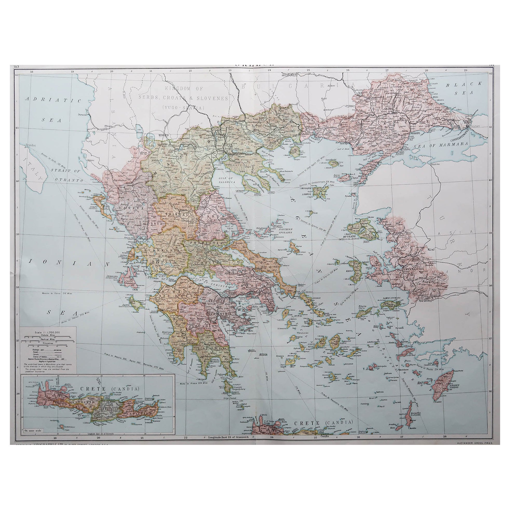
- Large Original Vintage Map of Greece, circa 1920Located in St Annes, LancashireGreat map of Greece Original color. Good condition Published by Alexander Gross Unframed.Category
Vintage 1920s English Maps
MaterialsPaper
- World Relief MapLocated in Antwerp, BELarge world relief map. Measures: Width 232 cm. Height 158 cm.Category
Mid-20th Century German Mid-Century Modern Maps
MaterialsAcrylic
- 1646 Jansson Map Entitled "Procinvia Connactiae, " Ric.a006Located in Norton, MA1646 Jansson map entitled "Procinvia connactiae," Ric.a006 Description: The PROVINCE of CONNAVGT 490 x 380From vol 4 of Jansson's Atlas Novus 1646, published in Amsterdam with...Category
Antique 17th Century Unknown Maps
MaterialsPaper
- Antique Map of Overijssel by Visscher, c.1660Located in Langweer, NLAntique map titled 'Transisalania provincia vulgo Over-yssel'. Original antique map of the province of Overijssel, the Netherlands. Published by N. Visscher after N. ten Have, circa ...Category
Antique 17th Century Maps
MaterialsPaper
- Original Antique Map of Indonesia, 1861Located in St Annes, LancashireGreat map of Indonesia Drawn and engraved by Edward Weller Original color Published in The Weekly Dispatch Atlas, 1861 Repairs to minor e...Category
Antique 1860s English Victorian Maps
MaterialsPaper


Recently Viewed
View AllMore Ways To Browse
Greek Ship
Greek Border
Southern Colonial
Authentic Greek
Vintage Antique And Collectible Items
Original Vintage Maps
Jans Antiques
Antique Ship Pictures
Greek Copper
Danish Vintage Antique Furniture
Leather Amsterdam
Copper River
Dutch Battle
Dutch Antique Seating
Antique Dutch Colonial
Island Colonial
Antique Dutch Copper
Battle Maps