Items Similar to Antique Map of Turkey in Europe by Russell, circa 1795


Want more images or videos?
Request additional images or videos from the seller
1 of 5
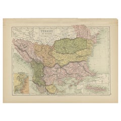
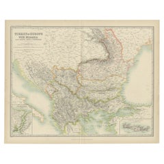
Antique Map of Turkey in Europe by Russell, circa 1795
About the Item
Antique map titled 'Turkey in Europe and Hungary'. Original map of Turkey in Europe. Covers present day Northern Turkey, Greece, Albania, Romania, Hungary, Croatia, Bosnia Herzogovina, etc. This map originates from 'A New Geographical, Historical & Commercial Grammar & Present State of the Several Kingdoms of the World' by J. Russell. Published circa 1795.
Frame included. We carefully pack our framed items to ensure safe shipping.
- Dimensions:Height: 14.38 in (36.5 cm)Width: 14.97 in (38 cm)Depth: 0.79 in (2 cm)
- Materials and Techniques:
- Period:
- Date of Manufacture:circa 1795
- Condition:General age-related toning. Frame included, lightly used. Please study images carefully.
- Seller Location:Langweer, NL
- Reference Number:
About the Seller
5.0
Platinum Seller
These expertly vetted sellers are 1stDibs' most experienced sellers and are rated highest by our customers.
Established in 2009
1stDibs seller since 2017
1,947 sales on 1stDibs
Typical response time: <1 hour
- ShippingRetrieving quote...Ships From: Langweer, Netherlands
- Return PolicyA return for this item may be initiated within 14 days of delivery.
More From This SellerView All
- Antique Map of Turkey in Europe by Wyld, '1845'Located in Langweer, NLAntique map titled 'Turkey in Europe'. Original antique map of Turkey in Europe. This map originates from 'An Atlas of the World, Comprehending S...Category
Antique Mid-19th Century Maps
MaterialsPaper
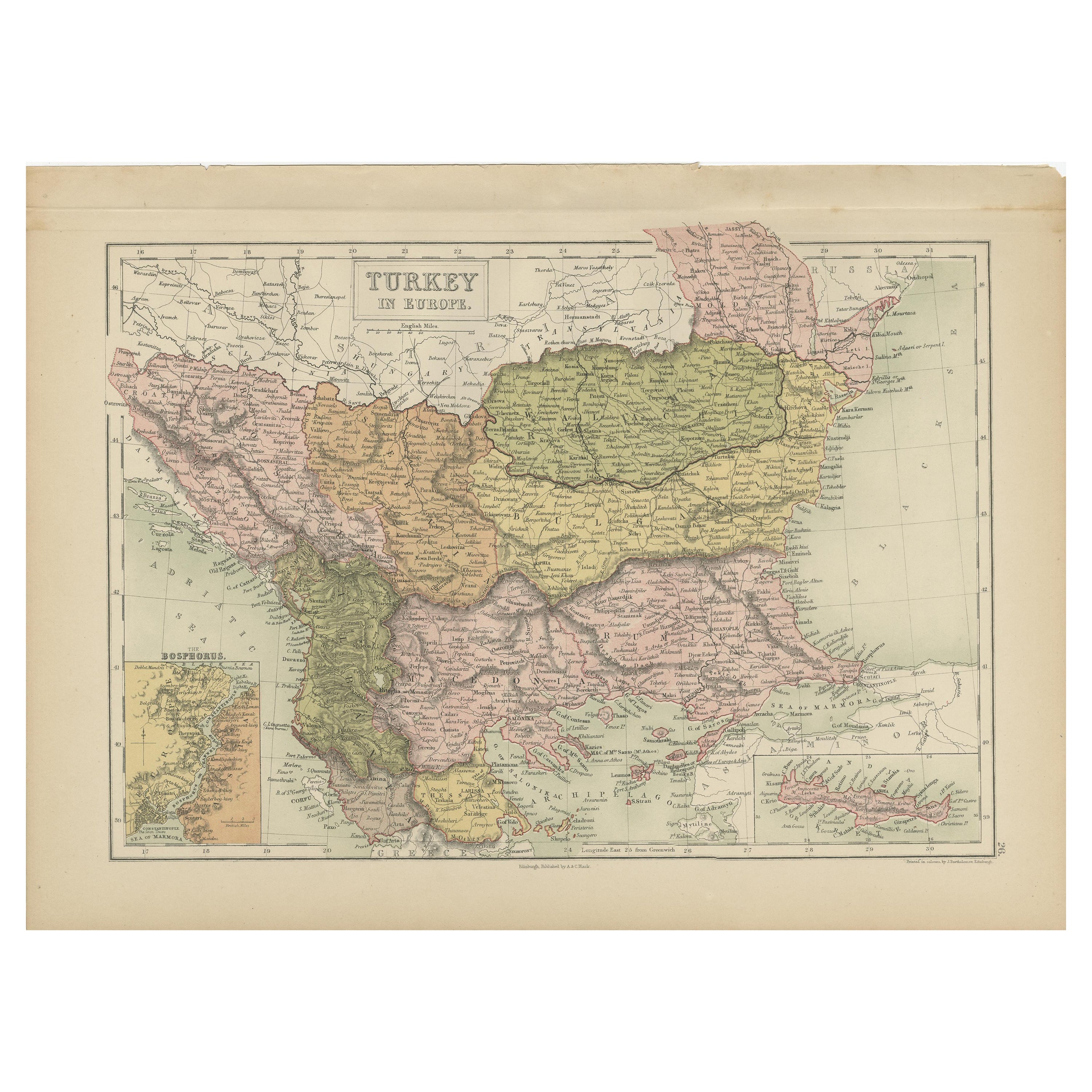
- Antique Map of Turkey in Europe by A & C. Black, 1870Located in Langweer, NLAntique map titled 'Turkey in Europe'. Original antique map of Turkey in Europe with inset maps of the Bosporus and Crete or Candia. This map originates from ‘Black's General Atlas o...Category
Antique Late 19th Century Maps
MaterialsPaper
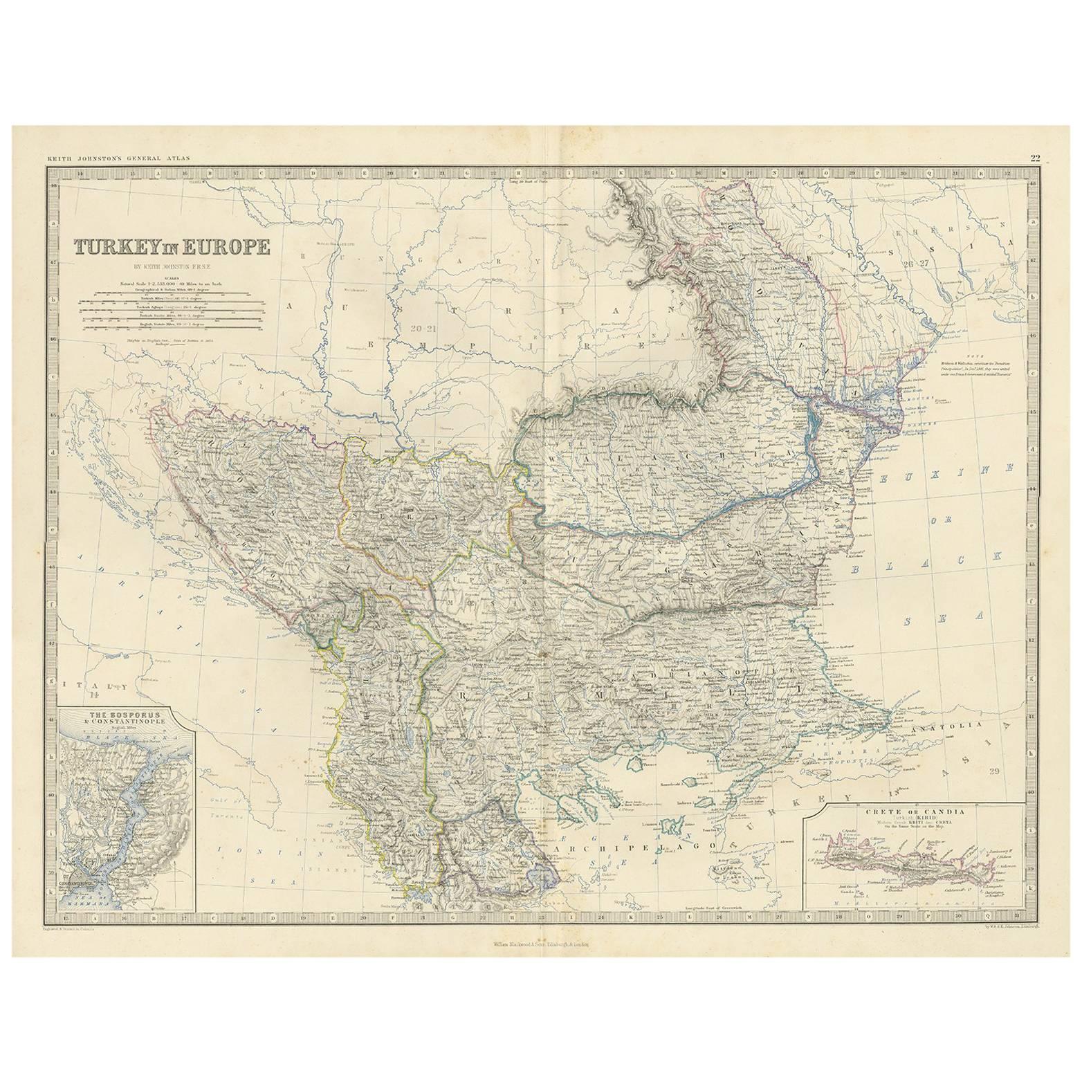
- Antique Map of Turkey in Europe by A.K. JohnstonLocated in Langweer, NLAntique map titled 'Turkey in Europe'. With an inset map of Crete, the Bosporus and Constantinople. This map originates from the ‘Royal Atlas of Modern Geography’ by Alexander Keith ...Category
Antique Mid-19th Century Maps
MaterialsPaper
- Antique Map of Spain and Portugal by Tardieu, circa 1795Located in Langweer, NLThe image is an antique map titled "Hispanie Betique et Lusitanie", which depicts the Iberian Peninsula during the Roman times, highlighting the provinces of Hispania Baetica (Betiqu...Category
Antique Late 18th Century Maps
MaterialsPaper
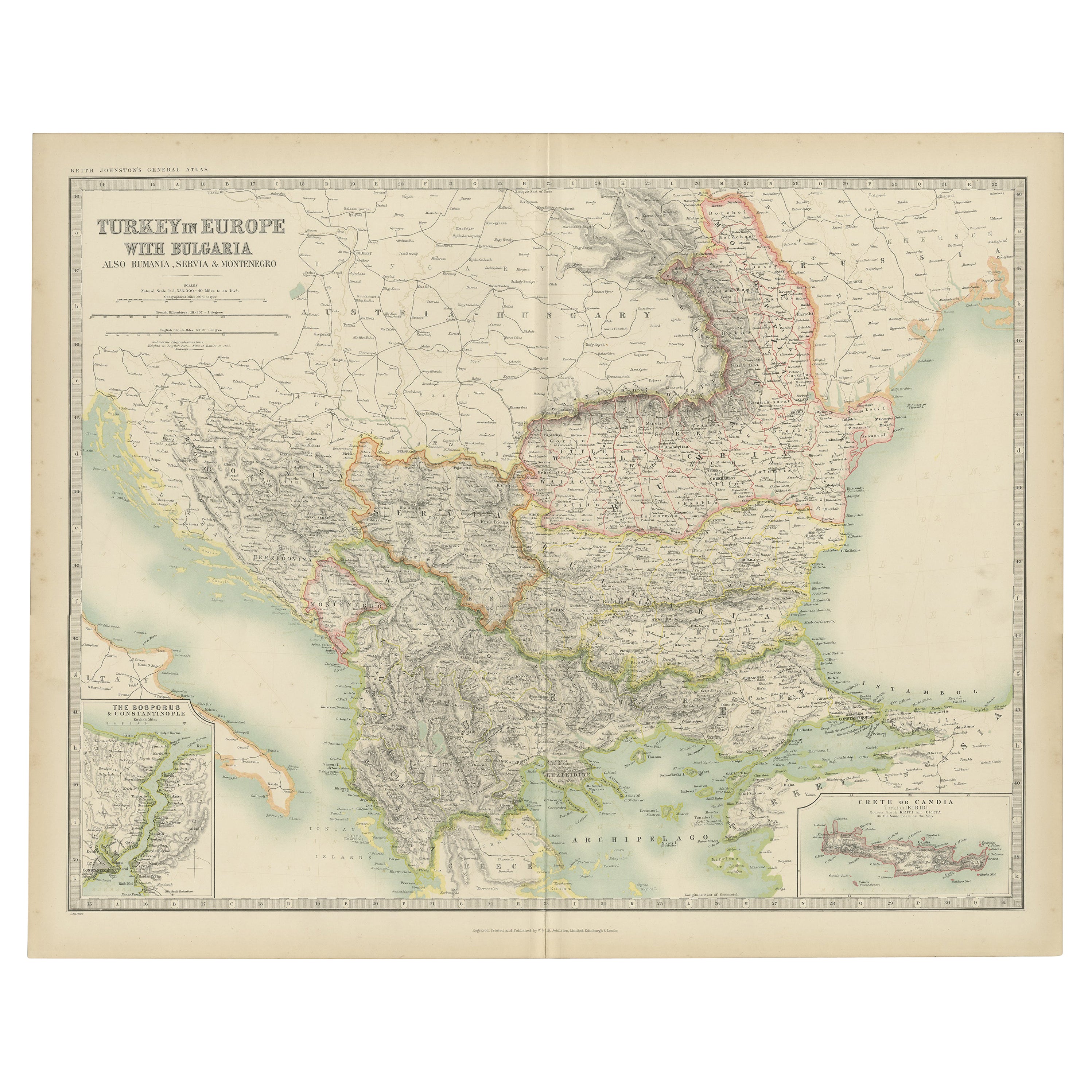
- Antique Map of Turkey in Europe with Bulgaria by Johnston '1909'Located in Langweer, NLAntique map titled 'Turkey in Europe with Bulgaria'. Original antique map of Turkey in Europe with Bulgaria. With inset maps of The Bosporus & Constantinople, and Crete (or Candia). ...Category
Early 20th Century Maps
MaterialsPaper
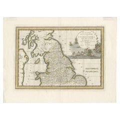
- Antique Map of Northern England and Wales by Cassini, 'circa 1795'By Giovanni Maria CassiniLocated in Langweer, NLAntique map titled 'La Parte Settentrionale dell' Inghilterra e del Principato di Galles'. Engraved map of Northern England and Wales. Shows Northum...Category
Antique Late 18th Century Maps
MaterialsPaper


You May Also Like
- Original Antique Map of Europe, Arrowsmith, 1820Located in St Annes, LancashireGreat map of Europe Drawn under the direction of Arrowsmith. Copper-plate engraving. Published by Longman, Hurst, Rees, Orme and Brown, 1820 ...Category
Antique 1820s English Maps
MaterialsPaper
- Original Antique Map of Belgium by Tallis, Circa 1850Located in St Annes, LancashireGreat map of Belgium Steel engraving Many lovely vignettes Published by London Printing & Publishing Co. ( Formerly Tallis ), C.1850 Origin...Category
Antique 1850s English Maps
MaterialsPaper
- Original Antique Map of South America, circa 1830Located in St Annes, LancashireGreat map of South America Copper plate engraving Published by Butterworth, Livesey & Co., circa 1830 Unframed.Category
Antique Early 1800s English Other Maps
MaterialsPaper
- Original Antique Map of South East Asia by Becker, circa 1840Located in St Annes, LancashireGreat map of South East Asia Steel engraving with original color outline Engraved by Becker Published by Virtue, circa 1840. Unframed.Category
Antique 1840s English Other Maps
MaterialsPaper
- Original Antique Map / City Plan of Brussels by Tallis, circa 1850Located in St Annes, LancashireGreat map of Brussels. Steel engraving. Published by London Printing & Publishing Co. (Formerly Tallis), C.1850 Free shipping.Category
Antique 1850s English Maps
MaterialsPaper
- Original Antique Map of Spain and Portugal, circa 1790Located in St Annes, LancashireSuper map of Spain and Portugal Copper plate engraving by A. Bell Published, circa 1790. Unframed.Category
Antique 1790s English Other Maps
MaterialsPaper


