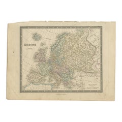
Maps Europe
30
to
165
1,011
805
545
528
436
352
342
300
285
180
107
95
91
86
84
74
69
64
57
56
48
43
41
39
38
36
34
30
30
26
21
15
15
14
13
13
12
12
10
10
10
10
9
8
8
8
8
7
7
7
6
6
6
5
5
5
5
5
4
4
3
3
3
2
103
45
43
42
42
Sort By
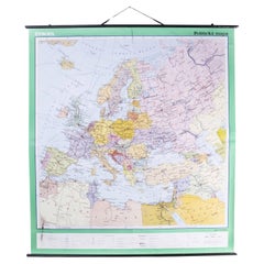
Late 20th Century Educational Geographic Map - European Countries
Located in Hook, Hampshire
Late 20th Century Educational Geographic Map – European Countries
Late 20th Century Educational
Category
Late 20th Century Czech Posters
Materials
Cotton
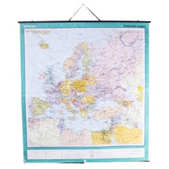
Late 20th Century Educational Geographic Map - European Countries (1728.14)
Located in Hook, Hampshire
Late 20th Century Educational Geographic Map – European Countries (1728.14)
Late 20th Century
Category
Late 20th Century Czech Posters
Materials
Cotton
H 68.51 in W 63 in D 0.4 in
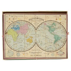
Antique Puzzle of Colored Cardboard Depicting World Map, Europe and France
Located in Milan, IT
Educational puzzle of colored cardboard composed of three folders depicting world map, Europe and
Category
Antique 1850s French Games
Materials
Paper
H 0.99 in W 13.98 in D 10.36 in
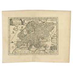
Antique Map of Celtic Europe by Cluver, 1678
Located in Langweer, NL
Antique map Europe titled 'Europam sive Celticam Veterem'. Rare map of Celtic Europe. Made after A
Category
Antique 17th Century Maps
Materials
Paper
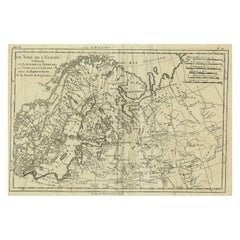
Antique Map of Northern Europe and European Russia, ca.1780
Located in Langweer, NL
Antique map titled 'Le Nord de L'Europe, Contenant Le Danemark, La Norwege; La Suede et La Laponie
Category
Antique 1780s Maps
Materials
Paper
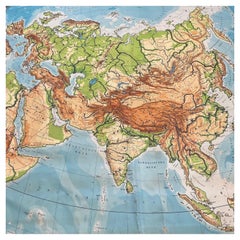
Huge Europe and Asia Vintage Wall Map
Located in San Diego, CA
A huge Europe and Asia vintage wall map, circa 1950s. The map is in fair vintage condition and
Category
Mid-20th Century American Maps
Materials
Paper
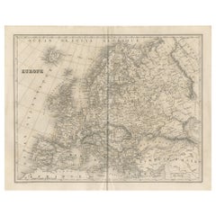
Antique Map of Europe by Balbi '1847'
Located in Langweer, NL
Antique map titled 'Europe'. Original antique map of Europe. This map originates from 'Abrégé de
Category
Antique Mid-19th Century Maps
Materials
Paper
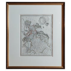
Antique Map of Europe by Lapie, '1809'
Located in Langweer, NL
Antique map titled 'Europe'. Original antique map of Europe by P. Lapie, published 1809. Frame
Category
Antique Early 19th Century Maps
Materials
Paper
Antique Map of Europe by Wyld '1845'
Located in Langweer, NL
Antique map titled 'Europe'. Original antique map of Europe. This map originates from 'An Atlas of
Category
Antique Mid-19th Century Maps
Materials
Paper
Antique Map of Europe by Johnson, '1872'
Located in Langweer, NL
Antique map titled 'Johnson's Europe'. Original map of Europe. This map originates from 'Johnson's
Category
Antique Late 19th Century Maps
Materials
Paper
Antique Map of Europe by Lowry, 1852
Located in Langweer, NL
Antique map titled 'Europe'. Original map of Europe. This map originates from 'Lowry's Table Atlas
Category
Antique Mid-19th Century Maps
Materials
Paper
Antique Map of Europe by Levasseur, '1875'
Located in Langweer, NL
Antique map titled 'Carte générale de l'Europe'. Large map of Europe. This map originates from
Category
Antique Late 19th Century Maps
Materials
Paper
Eason's War Map of Europe, circa 1914
Located in Langweer, NL
Antique map titled 'Eason's War Map of Europe'. Printed in Ireland. Source unknown, to be
Category
20th Century Maps
Materials
Paper
Antique Map of Germany and Central Europe
Located in Langweer, NL
Königreichen und Provincien'. Original antique map of Germany covering the central part of Europe with Germany
Category
Antique Late 17th Century Maps
Materials
Paper
Antique Map of Europe by Krevelt '1786'
Located in Langweer, NL
Antique map titled 'Nieuwe Generale Kaart van Europa (..)'. Original antique map of Europe. This
Category
Antique Late 18th Century Maps
Materials
Paper
Antique Map of Europe by Lapie, 1842
Located in Langweer, NL
Antique map titled 'Carte de l'Europe'. Map of Europe. This map originates from 'Atlas universel de
Category
Antique Mid-19th Century Maps
Materials
Paper
Original Antique Map of Europe, Arrowsmith, 1820
Located in St Annes, Lancashire
Great map of Europe
Drawn under the direction of Arrowsmith.
Copper-plate engraving
Category
Antique 1820s English Maps
Materials
Paper
Antique Map of the Europe Continent, 1880
Located in Langweer, NL
Antique map titled 'Europe'. Old map of the European continent. This map originates from
Category
Antique 19th Century Maps
Materials
Paper
Antique Map of Old European Russia, 1846
Located in Langweer, NL
Antique map titled 'Russia in Europe'. Old map of European Russia. This map originates from 'A New
Category
Antique 19th Century Maps
Materials
Paper
Antique Map of the European Continent, 1882
Located in Langweer, NL
Antique map titled 'Europe'. Old map of the European continent. This map originates from 'The Royal
Category
Antique 19th Century Maps
Materials
Paper
Antique Map of Russia in Europe, 1842
Located in Langweer, NL
Antique map titled 'Carte de la Russie d'Europe'. Map of Russia in Europe. This map originates from
Category
Antique 19th Century Maps
Materials
Paper
Antique European War Folding Map, ‘circa 1915’
Located in Langweer, NL
Antique folding map of the European War (1914-1915) titled 'The Eastern Campaign '. From Petrograd
Category
Early 20th Century Maps
Materials
Paper
1849 Map of "Europaische Russland", 'Meyer Map of European Russia', Ric. R017
Located in Norton, MA
1849 Map of
"Europaische Russland"
( Meyer Map of European Russia)
Ric.r017
A lovely map of
Category
Antique 19th Century Unknown Maps
Materials
Paper
H 11.82 in W 9.06 in D 0.4 in
Antique Map of Eastern Europe, Incl Montenegro & Serbia & a Budapest Map, 1890
Located in Langweer, NL
Antique map titled 'Osterreich-Ungarn in 4 Blattern, Blatt 4.'
Map of Eastern Europe, with
Category
Antique 1890s Maps
Materials
Paper
H 15.63 in W 19.22 in D 0 in
Original Antique Map of Russia in Europe, 1882
Located in Langweer, NL
Embark on an enthralling journey with an original Antique Map of European Russia from the esteemed
Category
Antique 1880s Maps
Materials
Paper
Antique Hand Colored Framed Map of Europe
Located in West Palm Beach, FL
Antique reproduction copied from an edition dated 1595 by Ortelius.
Category
Antique Late 19th Century Maps
Old Original Map of Russia in Europe, 1849
Located in Langweer, NL
Antique map titled 'Russia in Europe'.
Old map of Russia in Europe. This map originates from
Category
Antique 1840s Maps
Materials
Paper
Antique Rain Map of Europe by Johnston '1850'
Located in Langweer, NL
Antique map titled 'Hyetographic or Rain Map of Europe'. Original antique rain map of Europe. This
Category
Antique Mid-19th Century Maps
Materials
Paper
Antique Map of Europe by Levasseur 'c.1840'
Located in Langweer, NL
Antique map titled 'Europe'. Original antique map of Europe. Decorative map of the continent
Category
Antique Mid-19th Century Maps
Materials
Paper
Antique Map of Turkey in Europe, c.1780
Located in Langweer, NL
Antique map titled 'Bowles's new pocket map of Turky in Europe divided into its Provinces'. Large
Category
Antique 18th Century Maps
Materials
Paper
Original Antique Map of West Europe, circa 1870
Located in Langweer, NL
Antique map titled 'Gallia, Britannia, Germania'. Old map of West Europe including France, Germany
Category
Antique 19th Century Maps
Materials
Paper
Antique Map of Europe by Hederichs, circa 1740
Located in Langweer, NL
Antique map titled 'Europa Christiani Orbis Domina'. Rare miniature map of Europe. This map
Category
Antique Mid-18th Century Maps
Materials
Paper
Map Turkey in Europe & Hungary Thomas Kitchin, 1783
Located in BUNGAY, SUFFOLK
Thomas Kitchen (1718 - 1784) : Map of Turkey in Europe & Hungary 1783
Visible sheet within the
Category
Antique 18th Century English Georgian Maps
Materials
Paper
Antique Map of Eastern Europe by Stieler, 1890
Located in Langweer, NL
Antique map titled 'Osterreich-Ungarn in 4 Blattern, Blatt 4.' Map of Eastern Europe, with
Category
Antique 19th Century Maps
Materials
Paper
17th Century Nicolas Visscher Map of Southeastern Europe
Located in Hamilton, Ontario
A beautiful, highly detailed map of southeastern Europe by Nicolas Visscher. Includes regions of
Category
Antique 17th Century Dutch Maps
Materials
Paper
Antique Map of Europe by R. Bonne, 1780
Located in Langweer, NL
A fine example of Rigobert Bonne and Guilleme Raynal’s 1780 map of Europe. Drawn by R. Bonne for G
Category
Antique Late 18th Century Maps
Materials
Paper
Colorful Detailed Antique Map of Europe, Published in 1882
Located in Langweer, NL
"The Antique Map of Europe from 'The Comprehensive Atlas and Geography of the World,' published in
Category
Antique 1880s Maps
Materials
Paper
Antique Map of Europe by W. G. Blackie, 1859
Located in Langweer, NL
Antique map titled 'Europe'. Original antique map of Europe. This map originates from ‘The Imperial
Category
Antique Mid-19th Century Maps
Materials
Paper
Antique Map of Russia in Europe by Johnston (1909)
Located in Langweer, NL
Antique map titled 'European Russia'. Original antique map of Russia in Europe. With inset maps of
Category
Early 20th Century Maps
Materials
Paper
Antique Map of European Russia with Picture Frame Border
Located in Langweer, NL
Antique map titled 'La Moscovie Septentrionale (..)'. Decorative example of van der Aa's map of the
Category
Antique Early 18th Century Maps
Materials
Paper
Antique Map of Turkey in Europe by Wyld, '1845'
Located in Langweer, NL
Antique map titled 'Turkey in Europe'. Original antique map of Turkey in Europe. This map
Category
Antique Mid-19th Century Maps
Materials
Paper
Antique Map of Russia in Europe by Lowry, 1852
Located in Langweer, NL
Antique map titled 'Russia in Europe'. Original map of Russia in Europe. This map originates from
Category
Antique Mid-19th Century Maps
Materials
Paper
Antique Map of Russia in Europe by Levasseur, '1875'
Located in Langweer, NL
Antique map titled 'Carte générale de la Russie d'Europe (..)'. Large map of Russia in Europe. This
Category
Antique Late 19th Century Maps
Materials
Paper
Old Colourful Decorative Map of Turkey in Europe, 1846
Located in Langweer, NL
Antique map titled 'Turkey in Europe'. Old map of Turkey in Europe.
This map originates from 'A
Category
Antique 1840s Maps
Materials
Paper
Antique Map of Europe by Keizer & de Lat, 1788
Located in Langweer, NL
Antique map titled 'Kaartje van Europa (..)'. Uncommon original antique map of Europe. This map
Category
Antique Late 18th Century Maps
Materials
Paper
French Antique Map of France and Western Europe, 1765
By G. A. Rizzi-zannoni
Located in Langweer, NL
France and western Europe. This map originates from 'Atlas Historique de la France Ancienne et Moderne
Category
Antique 18th Century Maps
Materials
Paper
Antique Map of European Russia by Tirion, c.1725
Located in Langweer, NL
te Amsterdam by Isaak Tirion'. Detailed map of European Russia.
Artists and Engravers: Isaak
Category
Antique 18th Century Maps
Materials
Paper
Antique Map of Russia in Europe by Tallis, '1851'
Located in Langweer, NL
Antique map titled 'Russia in Europe'. Map of European Russia. Showing vignettes of the Neoskoi
Category
Antique Mid-19th Century Maps
Materials
Paper
Antique Map of Russia in Europe by Migeon, 1880
Located in Langweer, NL
Antique map titled 'Russie d'Europe'. Old map of Russia in Europe. This map originates from
Category
Antique 19th Century Maps
Materials
Paper
Antique Map of Southwest Europe by Kiepert, c.1870
Located in Langweer, NL
"Antique map titled 'Romanisches Südwest-Europa'. Old map of Southwest Europe. This map originates
Category
Antique 19th Century Maps
Materials
Paper
Antique Map of Northwest Europe by Kiepert, c.1870
Located in Langweer, NL
Antique map titled 'Germanisches Nordwest-Europa'. Old map of North-West Europe depicting the
Category
Antique 19th Century Maps
Materials
Paper
Antique Map of Northern Europe by Bonne, c.1780
Located in Langweer, NL
Antique map titled 'Le Nord de L'Europe, Contenant Le Danemark, La Norwege; La Suede et La Laponie
Category
Antique 18th Century Maps
Materials
Paper
Antique Map of Africa with European Language Borders, 1852
Located in Langweer, NL
Antique map titled 'Afrika'. Map of Africa. This map originates from 'School-Atlas van alle deelen
Category
Antique 19th Century Maps
Materials
Paper
Antique Map of Southern Europe by F. Delamarche, 1837
Located in Langweer, NL
exquisite antique map offers a unique glimpse into the historical and biblical geography as understood in
Category
Antique Mid-19th Century Maps
Materials
Paper
Vintage Reproduction 17th Century Map of Europe, American, Cartography, Blaeuw
Located in Hele, Devon, GB
This is a vintage reproduction map of Europe. An American, paper stock cartography print in frame
Category
Late 20th Century Central American Mid-Century Modern Maps
Materials
Glass, Wood, Paper
H 30.32 in W 38.39 in D 1.38 in
Antique Map of Russia in Europe, with Frame Style Border
Located in Langweer, NL
Antique map titled 'Russie d'Europe'. Attractive map of Russia in Europe, covers the European
Category
Antique Mid-19th Century Maps
Materials
Paper
Large Antique Map of Europe, Showing the Empire of Charlemagne
Located in Langweer, NL
Antique map titled 'Imperium Caroli Magni (..)'. Large antique map of Europe, showing the Empire of
Category
Antique Late 18th Century Maps
Materials
Paper
1790 Thomas Stackhouse Map, Entitled "Russia in Europe, " , Ric.a004
Located in Norton, MA
1790 Thomas Stackhouse map, entitled
"Russia in Europe"
Ric.a004
Stackhouse, Thomas
Russia
Category
Antique 17th Century Unknown Maps
Materials
Paper
Antique Map of European Turkey and Greece by Lowry '1852'
Located in Langweer, NL
Antique map titled 'European Turkey and Greece with the Ionian Islands'. Original map of European
Category
Antique Mid-19th Century Maps
Materials
Paper
Detailed Original Antique Map of Turkey in Europe, circa 1740
Located in Langweer, NL
Antique map Turkish Empire tilted 'Turky in Europe'. Beautiful, small antique map depicting modern
Category
Antique 18th Century Maps
Materials
Paper
- 1
- ...
Get Updated with New Arrivals
Save "Maps Europe", and we’ll notify you when there are new listings in this category.
Maps Europe For Sale on 1stDibs
Find many varieties of an authentic maps Europe available at 1stDibs. Each maps Europe for sale was constructed with extraordinary care, often using paper, wood and fabric. There are 91 variations of the antique or vintage maps Europe you’re looking for, while we also have 1 modern editions of this piece to choose from as well. Whether you’re looking for an older or newer maps Europe, there are earlier versions available from the 18th Century and newer variations made as recently as the 21st Century. When you’re browsing for the right maps Europe, those designed in Mid-Century Modern, Baroque and Industrial styles are of considerable interest. You’ll likely find more than one maps Europe that is appealing in its simplicity, but Jacques-Nicolas Bellin, Covens & Mortier and Frederick de Wit produced versions that are worth a look.
How Much is a Maps Europe?
Prices for a maps Europe can differ depending upon size, time period and other attributes — at 1stDibs, they begin at $60 and can go as high as $10,000, while the average can fetch as much as $554.
