Items Similar to Finely Engraved Antique Map of Europe with inset of America, c.1745


Want more images or videos?
Request additional images or videos from the seller
1 of 5
Finely Engraved Antique Map of Europe with inset of America, c.1745
About the Item
Antique map titled 'Theatrum Historicum pars Occidentalis.' Finely engraved historical map with a profusion of details. It shows western Europe and the northern Mediterranean basin as far as Crete. The southern Mediterranean shores are also meticulously represented and extend eastward as far as Libya. To the left of the decorative title cartouche is an inset showing the Western hemisphere, including an undefined Western coast in North America. Published in Amsterdam by Covens & Mortier.
Artists and Engravers: Made by 'Guillaume de l'Isle' after an anonymous artist. The de L'Isle family was one of the most influential Geographers of the early 18th century in France. Claude de L'Isle, born 1644, had four sons, of which Guillaume was the most notable. Guillaume was born 1675 and became member of the ""Academie Royale des Sciences"" with the age of twenty-seven, and was honoured later with the title ""Premier Geographe du Roi"". His largest project, the ""Atlas de Geographie"", was published until 1774 in Paris and Amsterdam (Covens and Mortier). He died in 1726.
Condition: Good, given age. Edges reinforced on verso with acid free tape. A few small spots. Top margin slightly damp stained, outside the image. Original middle fold as issued. General age-related toning and/or occasional minor defects from handling. Please study image carefully.
Date: c.1745
Overall size: 61.5 x 54 cm.
Image size: 60.5 x 49.2 cm.
- Creator:Guillaume De L'Isle (Artist)
- Dimensions:Height: 21.26 in (54 cm)Width: 24.22 in (61.5 cm)Depth: 0 in (0.01 mm)
- Materials and Techniques:
- Period:
- Date of Manufacture:circa 1745
- Condition:
- Seller Location:Langweer, NL
- Reference Number:
About the Seller
5.0
Platinum Seller
These expertly vetted sellers are 1stDibs' most experienced sellers and are rated highest by our customers.
Established in 2009
1stDibs seller since 2017
1,916 sales on 1stDibs
Typical response time: <1 hour
- ShippingRetrieving quote...Ships From: Langweer, Netherlands
- Return PolicyA return for this item may be initiated within 14 days of delivery.
More From This SellerView All
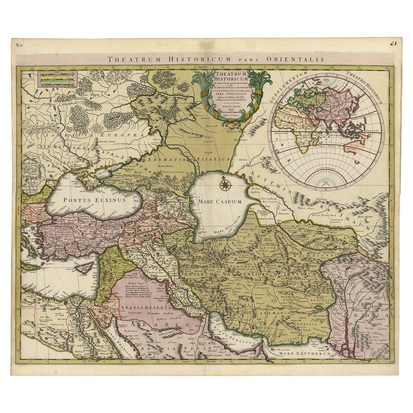
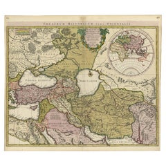
- Finely Engraved Historical Map of Middle East and Asia, c.1745Located in Langweer, NLDescription: Antique map titled'Theatrum Historicum pars Orientalis.' Finely engraved historical map with a profusion of details. It shows the Middle East and Asia. Decorative ti...Category
Antique 1740s Maps
MaterialsPaper
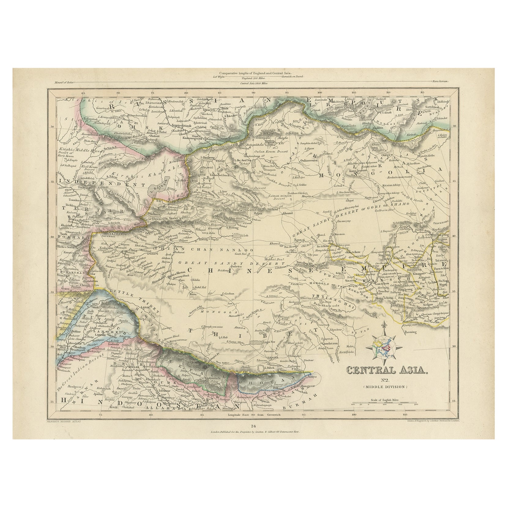
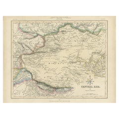
- Antique Map of Central Asia, Finely Engraved, 1841Located in Langweer, NLAntique map titled 'Central Asia, Middle Division'. A finely engraved and attractive mid 19th Century map of Central Asia which was drawn and engraved by Joshua Archer and published ...Category
Antique 19th Century Maps
MaterialsPaper
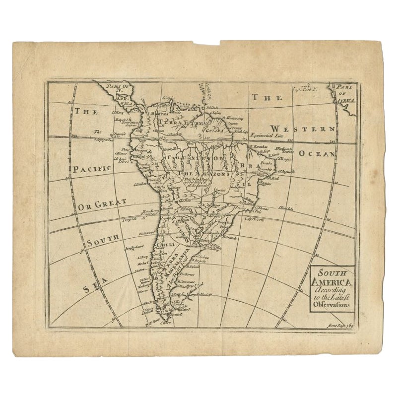
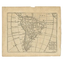
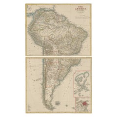
- Antique Map of South America by Gordon, c.1745Located in Langweer, NLAntique map titled 'South America according to the latest observations'. Antique map of South America originating from 'Geography Anatomiz'd: or, The Geographical Grammar'. Artists a...Category
Antique 18th Century Maps
MaterialsPaper
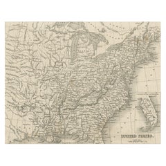
- Steel Engraved Map of the United States with Inset Map of FloridaLocated in Langweer, NLAntique map titled 'United States'. Steel engraved map of the United States. With small inset map of the continuation of Florida. Source unknown, to be determined. Published circa 1843.Category
Antique Mid-19th Century Maps
MaterialsPaper
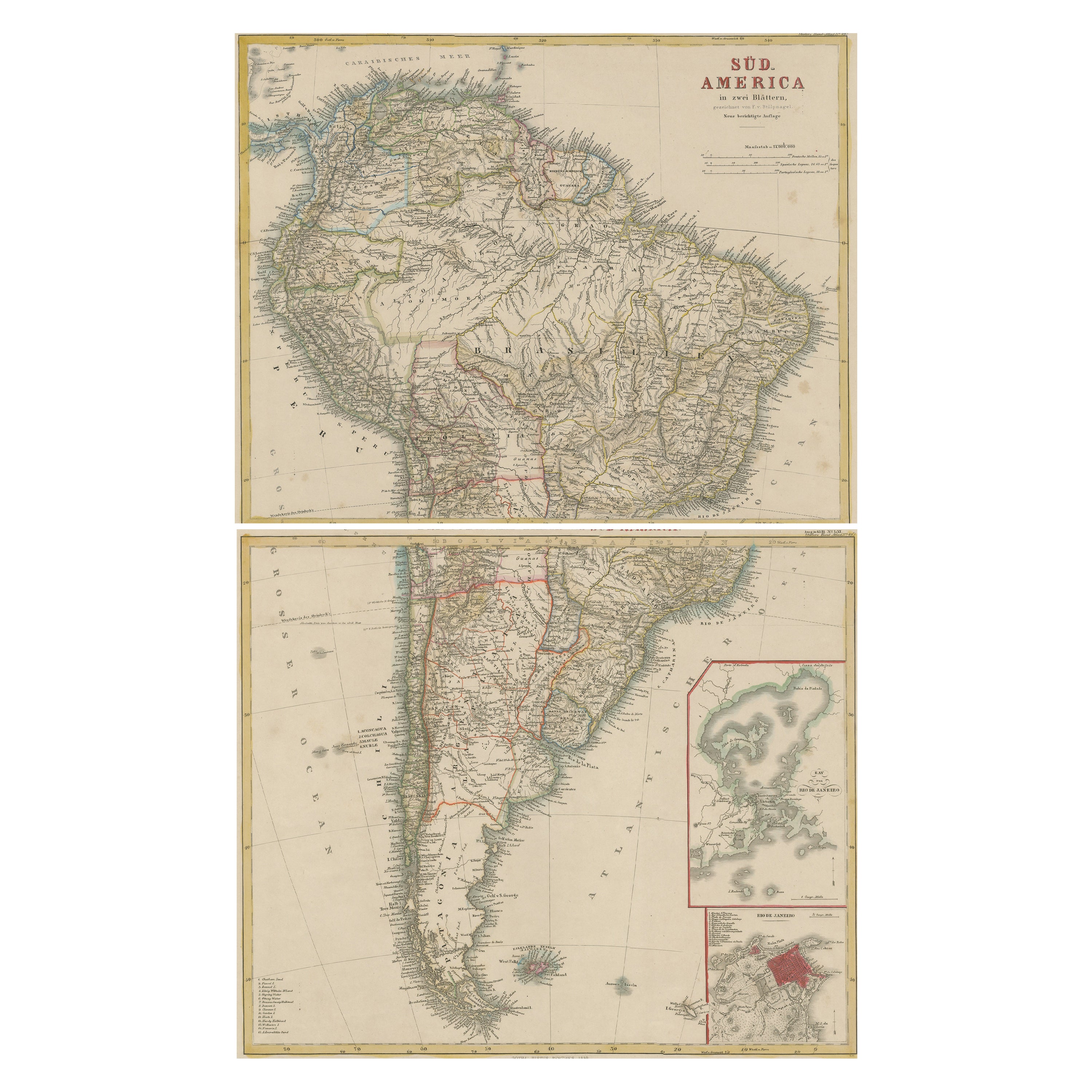
- Set of Two Antique Maps of South America with Inset Maps of Rio de JaneiroLocated in Langweer, NLSet of two antique maps titled 'Süd-America in zwei Blättern'. Two individual sheets of South America. With inset maps of Rio de Janeiro and the Bay of Rio de Janeiro. This map o...Category
Antique Mid-19th Century Maps
MaterialsPaper
- Antique Map of Wisconsin with Inset Geological Map of WisconsinLocated in Langweer, NLAntique map titled 'Wisconsin'. Original antique map of Wisconsin, United States. With inset geological map of Wisconsin. This print originates from '...Category
Antique Late 19th Century Maps
MaterialsPaper

You May Also Like
- Antique Hand Colored Framed Map of EuropeLocated in West Palm Beach, FLAntique reproduction copied from an edition dated 1595 by Ortelius.Category
Antique Late 19th Century Maps
- Original Antique Map of Europe, Arrowsmith, 1820Located in St Annes, LancashireGreat map of Europe Drawn under the direction of Arrowsmith. Copper-plate engraving. Published by Longman, Hurst, Rees, Orme and Brown, 1820 ...Category
Antique 1820s English Maps
MaterialsPaper
- Original Antique Map of Sweden, Engraved by Barlow, 1806Located in St Annes, LancashireGreat map of Sweden Copper-plate engraving by Barlow Published by Brightly & Kinnersly, Bungay, Suffolk. 1806 Unframed.Category
Antique Early 1800s English Maps
MaterialsPaper
- Large Antique 1859 Map of North AmericaLocated in Sag Harbor, NYThis Map was made by Augustus Mitchell in 1859 It is in amazing condition for being 163 years old. This price is for the rolled up easy to ship version of this piece. I will be Frami...Category
Antique Mid-19th Century American Maps
MaterialsCanvas, Paper

- Original Antique Map of South America. C.1780Located in St Annes, LancashireGreat map of South America Copper-plate engraving Published C.1780 Two small worm holes to left side of map Unframed.Category
Antique Early 1800s English Georgian Maps
MaterialsPaper
- Original Antique Map of Switzerland, Engraved By Barlow, Dated 1807Located in St Annes, LancashireGreat map of Switzerland Copper-plate engraving by Barlow Published by Brightly & Kinnersly, Bungay, Suffolk. Dated 1807 Unframed.Category
Antique Early 1800s English Maps
MaterialsPaper


Recently Viewed
View AllMore Ways To Browse
Antique L
Engraved L
Southern America Furniture
Southern American Furniture
54 L
Antique American 18th Century Furniture
18th Century American Antiques
Twenty Seven
18th C American
Southern American Antiques
Antique Europe Map
Antique Maps Europe Maps
Europe Map Antique
Antique European Maps
Antique European Map
Antique Maps Of Europe
Antique Western Collectibles
Map North America