Items Similar to Antique Map of Eastern Europe by Stieler, 1890


Want more images or videos?
Request additional images or videos from the seller
1 of 5
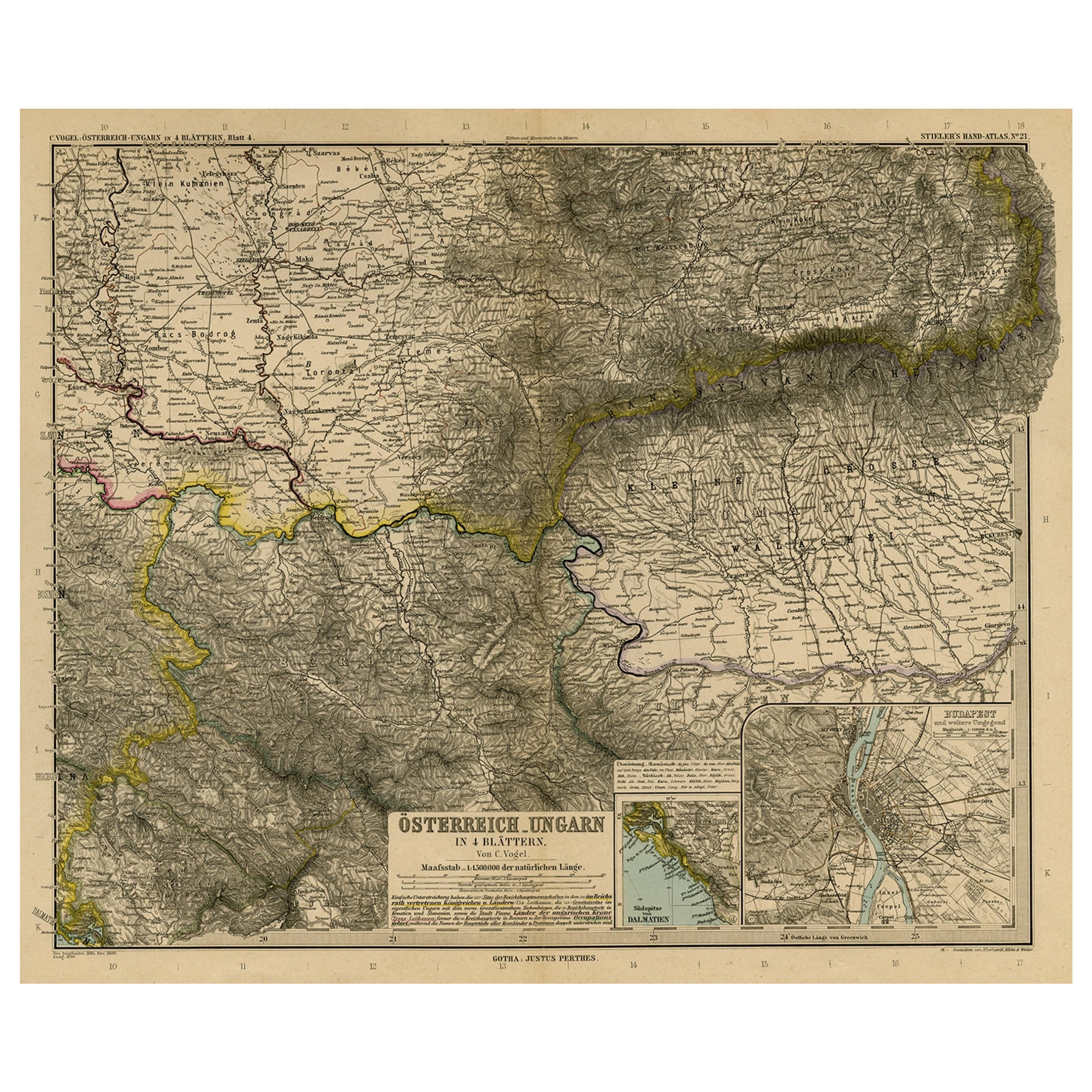
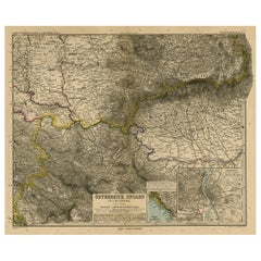
Antique Map of Eastern Europe by Stieler, 1890
About the Item
Antique map titled 'Osterreich-Ungarn in 4 Blattern, Blatt 4.' Map of Eastern Europe, with Montenegro in the lower left corner, the southern edge of Hungary (area Baja and Szeged) and Serbia and Bulgaria. With a small inset map of Budapest and another of the southern tip of Croatia.Sheet 21 from 'Stieler's Hand-Atlas', published in Gotha: Justus Perthes, 1890.
Artists and Engravers: Made by 'C. Vogel' after 'Eberhardt, Kuhn & Weiler'.
Condition: Good, given age. Original middle fold, as issued. Paper separation in the top and lower edge of the middle fold (closed with archival tape on the rear). Top edge reinforced on the rear. A few small closed tears in the margin edges (not affecting image). Some creasing in the top right margin corner. General age-related toning and/or occasional minor defects from handling. Please study image carefully.
Date: 1890
Overall size: 48.8 x 39.7 cm
Image size: 0.001 x 43 x 35.5 cm.
- Dimensions:Height: 15.63 in (39.7 cm)Width: 19.22 in (48.8 cm)Depth: 0 in (0.01 mm)
- Materials and Techniques:
- Period:
- Date of Manufacture:1890
- Condition:Repaired: Paper separation in the top and lower edge of the middle fold (closed with archival tape on the rear). Top edge reinforced on the rear. A few small closed tears in the margin edges. Condition: Good, given age. Original middle fold, as issued.
- Seller Location:Langweer, NL
- Reference Number:
About the Seller
5.0
Platinum Seller
These expertly vetted sellers are 1stDibs' most experienced sellers and are rated highest by our customers.
Established in 2009
1stDibs seller since 2017
1,922 sales on 1stDibs
Typical response time: <1 hour
- ShippingRetrieving quote...Ships From: Langweer, Netherlands
- Return PolicyA return for this item may be initiated within 14 days of delivery.
More From This SellerView All
- Antique Map of Eastern Europe, Incl Montenegro & Serbia & a Budapest Map, 1890Located in Langweer, NLAntique map titled 'Osterreich-Ungarn in 4 Blattern, Blatt 4.' Map of Eastern Europe, with Montenegro in the lower left corner, the southern ...Category
Antique 1890s Maps
MaterialsPaper
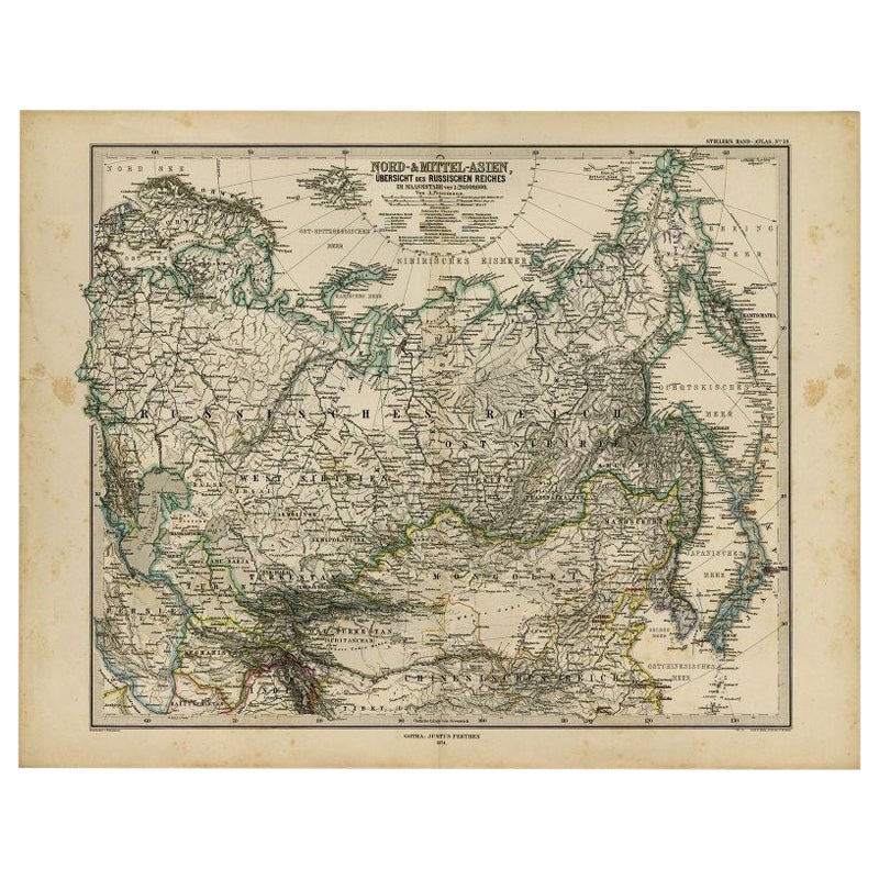
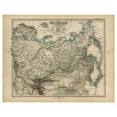
- Antique Map of Russia and Surroundings by Stieler, 1874Located in Langweer, NLAntique map titled 'Nord- & Mittal-Asien, Ubersicht des Russischen Reiches.' A map of Russia in scale 1:20.000.000. The depicted area spans from Iran and Sweden in the left edge of t...Category
Antique 19th Century Maps
MaterialsPaper
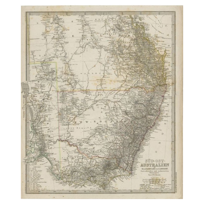
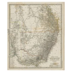
- Antique Map of South East Australia by Stieler, c.1848By Thomas KitchinLocated in Langweer, NLAntique map Australia titled 'Süd-Ost Australien'. Detailed map of South East Australia. Orginates from 'Stieler's Hand Atlas', published in Germ...Category
Antique 19th Century Maps
MaterialsPaper
- Antique Map of Eastern Persia, 1852Located in Langweer, NLAntique map titled 'Eastern Persia'. Original map of Eastern Persia. This map originates from 'Lowry's Table Atlas constructed and engraved from the most recent Authorities' by J.W. ...Category
Antique Mid-19th Century Maps
MaterialsPaper
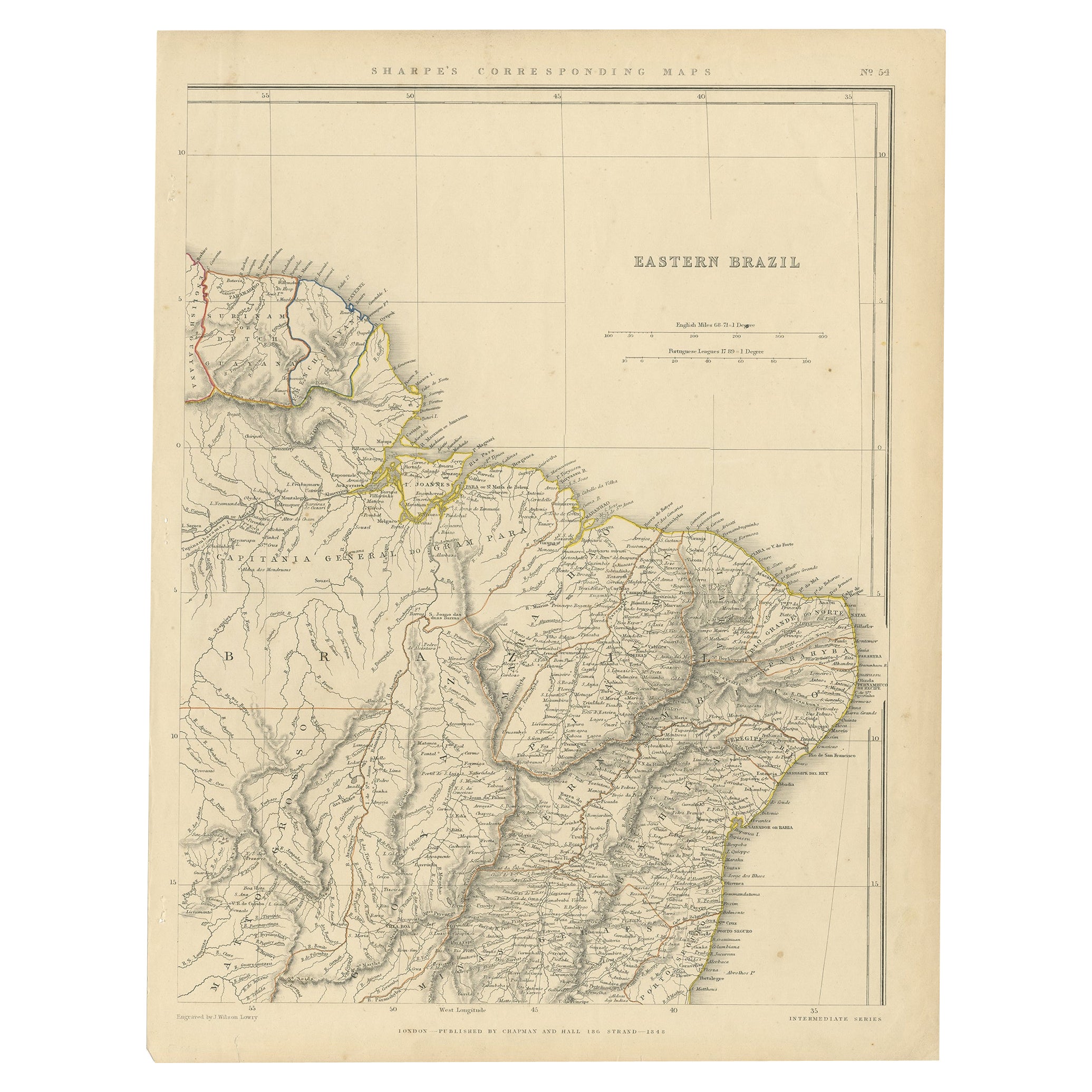
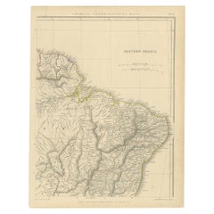
- Antique Map of Eastern Brazil, 1849Located in Langweer, NLAntique map titled 'Eastern Brazil'. Old map of Eastern Brazil. This map originates from 'Sharpe's Corresponding Atlas (..)' by J. Sharpe. Artists and Engravers: Published by Chap...Category
Antique 19th Century Maps
MaterialsPaper
- Antique Map of Eastern Polynesia, 1849Located in Langweer, NLAntique map titled 'Ost-Polynesien'. Interesting variant issue, with large detailed insets top right of Hawaii volcanos near Kilauea. Insets lower right of Honolulu harbour, island o...Category
Antique Mid-19th Century Maps
MaterialsPaper


You May Also Like
- 1900s Stielers Hand Atlas 100 MapsLocated in Seguin, TXStielers Hand Atlas, Gotha: Justus Perthes, Germany, circa 1905. Linen covered wood box containing 100 folded individual loose leaf maps of the world, text in german. Box made to loo...Category
Early 20th Century German Victorian Maps
MaterialsPaper
- Southern & Eastern Europe: A Large 17th C. Hand-colored Map by Sanson & JaillotBy Nicolas SansonLocated in Alamo, CAThis large hand-colored map entitled "Estats de L'Empire des Turqs en Europe, ou sont les Beglerbeglicz our Gouvernements" was originally created by Nicholas Sanson d'Abbeville and t...Category
Antique 1690s French Maps
MaterialsPaper
- Scandinavia & Portions of Eastern Europe: 18th Century Hand-Colored Homann MapBy Johann Baptist HomannLocated in Alamo, CAAn early 18th century hand-colored copper-plate map entitled "Regni Sueciae in omnes suas Subjacentes Provincias accurate divisi Tabula Generalis" by Johann Baptist Homann (1663-1724...Category
Antique Early 18th Century German Maps
MaterialsPaper
- Antique Hand Colored Framed Map of EuropeLocated in West Palm Beach, FLAntique reproduction copied from an edition dated 1595 by Ortelius.Category
Antique Late 19th Century Maps
- Original Antique Map of Europe, Arrowsmith, 1820Located in St Annes, LancashireGreat map of Europe Drawn under the direction of Arrowsmith. Copper-plate engraving. Published by Longman, Hurst, Rees, Orme and Brown, 1820 ...Category
Antique 1820s English Maps
MaterialsPaper
- Large Original Antique Map of Europe by Sidney Hall, 1847Located in St Annes, LancashireGreat map of Europe Drawn and engraved by Sidney Hall Steel engraving Original colour outline Published by A & C Black. 1847 Unframed Free shipping.Category
Antique 1840s Scottish Maps
MaterialsPaper


Recently Viewed
View AllMore Ways To Browse
Eastern Europe
Eastern European
Eastern Antiques
Eastern European Furniture
Antique Middle Eastern Furniture
Antique European Maps
Antique European Map
Antique Maps Europe Maps
Europe Map Antique
Antique Europe Map
Antique Maps Of Europe
Middle Eastern Antiques
Antique Eastern European Furniture
Bulgaria Antique
Antique Map Europe
Antique Map Of Europe
Eastern European Antiques
Antique Budapest