Items Similar to Antique Map of Russia and Surroundings by Stieler, 1874


Want more images or videos?
Request additional images or videos from the seller
1 of 5
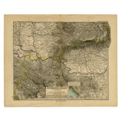
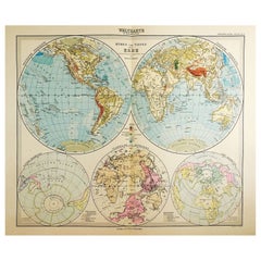
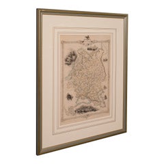
Antique Map of Russia and Surroundings by Stieler, 1874
About the Item
Antique map titled 'Nord- & Mittal-Asien, Ubersicht des Russischen Reiches.' A map of Russia in scale 1:20.000.000. The depicted area spans from Iran and Sweden in the left edge of the image to the Bering Street and Japan in the right edge of the map.Sheet 59 from 'Stieler's Hand-Atlas' published in Gotha: Justus Perthes, 1874. Artists and Engravers: Made by 'Kuhn & Kramer' after 'A. Petermann'.
Artist: Made by 'Kuhn & Kramer' after 'A. Petermann'.
Condition: Good, given age. Original middle fold, as issued. Margins quite stained. A few faint stains in the image. Faintly browned around the middle fold. A small tear in the left margin (closed with acid-free archival tape). Some small tears in the margin edges (not affecting image). General age-related toning and/or occasional minor defects from handling. Please study image carefully.
Antique prints have long been appreciated for both their aesthetic and investment value. They were the product of engraved, etched or lithographed plates. These plates were handmade out of wood or metal, which required an incredible level of skill, patience and craftsmanship. Whether you have a house with Victorian furniture or more contemporary decor an old engraving can enhance your living space. We offer a wide range of authentic antique prints for any budget.
- Dimensions:Height: 14.97 in (38 cm)Width: 19.1 in (48.5 cm)Depth: 0 in (0.01 mm)
- Materials and Techniques:
- Period:
- Date of Manufacture:1874
- Condition:Repaired: A small tear in the left margin (closed with acid-free archival tape). Original middle fold, as issued. Margins quite stained. A few faint stains in the image. Faintly browned around the middle fold. Some small tears in the margin edges.
- Seller Location:Langweer, NL
- Reference Number:
About the Seller
5.0
Platinum Seller
These expertly vetted sellers are 1stDibs' most experienced sellers and are rated highest by our customers.
Established in 2009
1stDibs seller since 2017
1,933 sales on 1stDibs
Typical response time: <1 hour
- ShippingRetrieving quote...Ships From: Langweer, Netherlands
- Return PolicyA return for this item may be initiated within 14 days of delivery.
More From This SellerView All
- Antique Map of Belgium and Surroundings, 1692Located in Langweer, NLAntique map titled 'Provincie Meridionali de Paesi Bassi Intese sotto nome di Fiandra overo Li Paesi Bassi Cattolici con li confini di Francia di Allemagna et di Hollanda'. Uncommon map of Belgium...Category
Antique 17th Century Maps
MaterialsPaper
- Antique Map of Afghanistan and Surroundings, '1845'Located in Langweer, NLAntique map titled 'Map of Persia and Caubul'. Original antique map of Afghanistan and surroundings. This map originates from 'An Atlas of the World, Comprehending Separate Maps of...Category
Antique Mid-19th Century Maps
MaterialsPaper
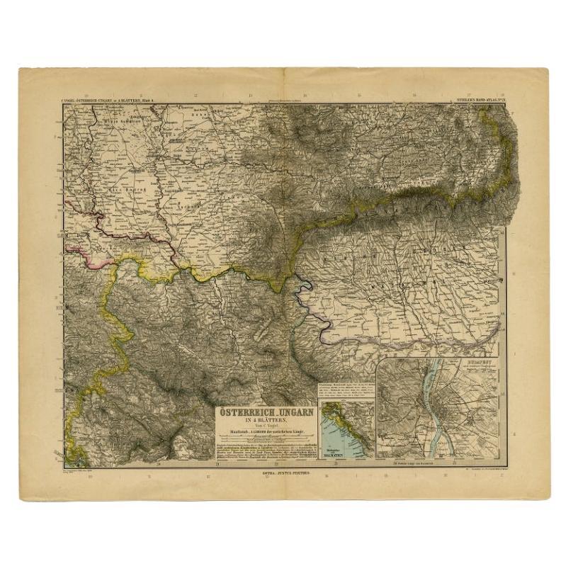
- Antique Map of Eastern Europe by Stieler, 1890Located in Langweer, NLAntique map titled 'Osterreich-Ungarn in 4 Blattern, Blatt 4.' Map of Eastern Europe, with Montenegro in the lower left corner, the southern edge...Category
Antique 19th Century Maps
MaterialsPaper
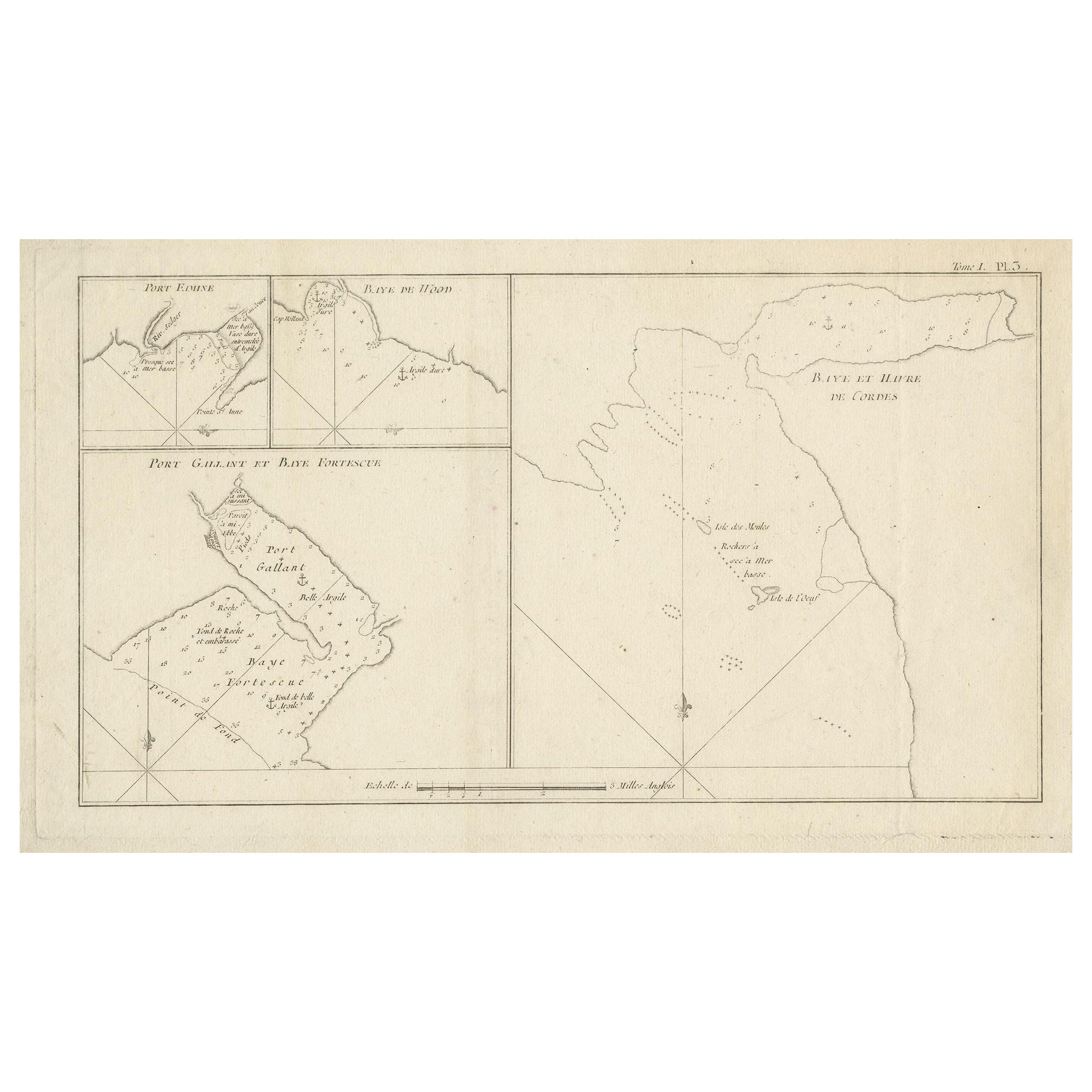
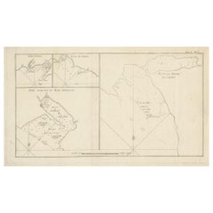
- Antique Map of Cordes Bay and SurroundingsLocated in Langweer, NLAntique map titled 'Baye et Havre de Cordes (..)'. Four maps on the one sheet of; Cordes Bay, Port Famine, Woods Pay, Port Gallant, Fortescue Bay, Chile based on the voyage of John B...Category
Antique Late 18th Century Maps
MaterialsPaper
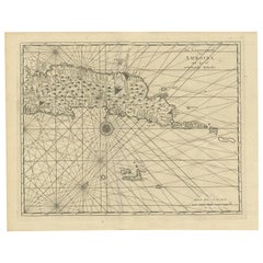
- Antique Map of Ambon and Surroundings by Valentijn '1726'By F. ValentijnLocated in Langweer, NLAntique map titled 'De landvoogdy van Amboina met de elf onderhoorige Eylanden'. Decorative map of the eastern tip of the islands of Ambon, Indonesia. This print originates from 'Oud...Category
Antique Early 18th Century Dutch Maps
MaterialsPaper
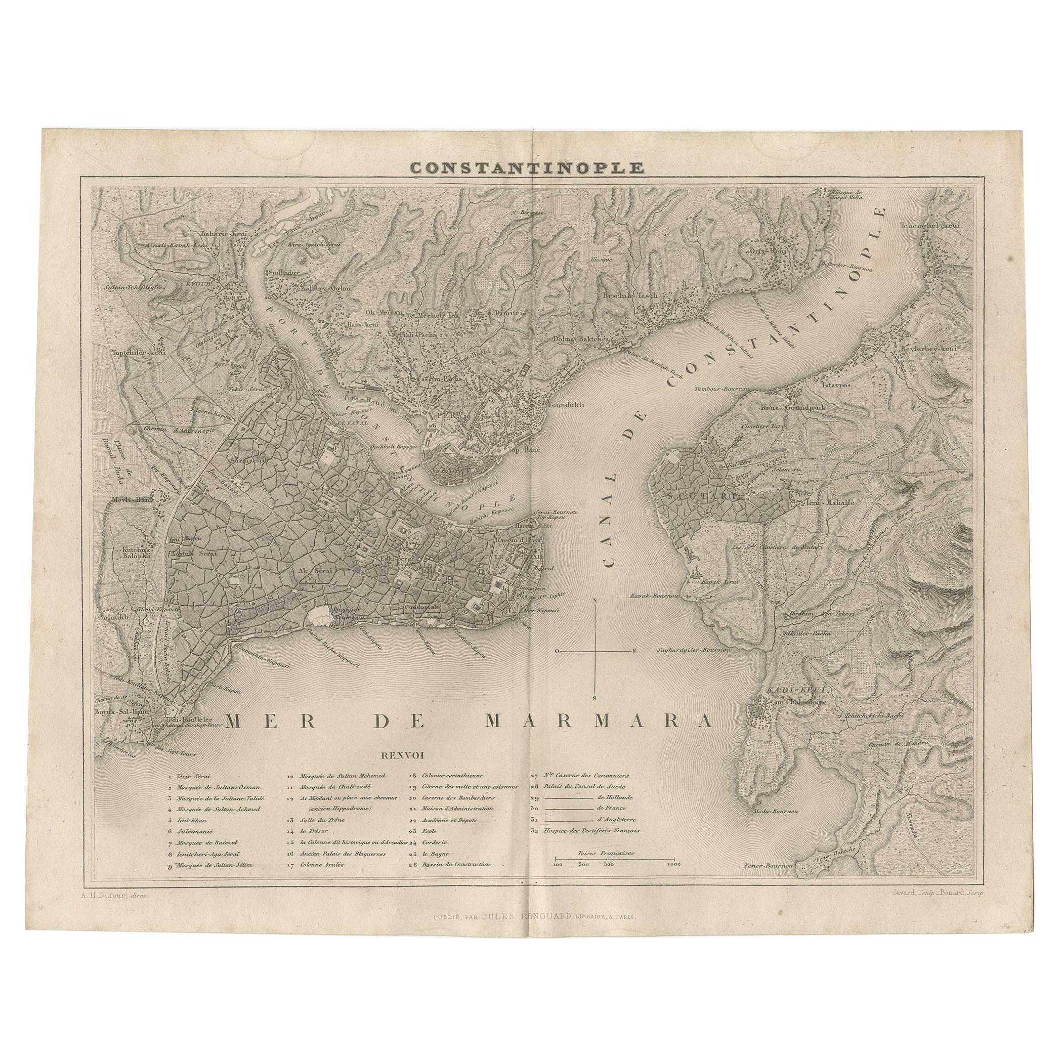
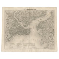
- Antique Map of Constantinople and Surroundings by Balbi '1847'Located in Langweer, NLAntique map titled 'Constantinople'. Original antique map of Constantinople and surroundings. This map originates from 'Abrégé de Géographie (..)...Category
Antique Mid-19th Century Maps
MaterialsPaper


You May Also Like
- 1900s Stielers Hand Atlas 100 MapsLocated in Seguin, TXStielers Hand Atlas, Gotha: Justus Perthes, Germany, circa 1905. Linen covered wood box containing 100 folded individual loose leaf maps of the world, text in german. Box made to loo...Category
Early 20th Century German Victorian Maps
MaterialsPaper
- Original Antique Map of Russia By Arrowsmith. 1820Located in St Annes, LancashireGreat map of Russia Drawn under the direction of Arrowsmith Copper-plate engraving Published by Longman, Hurst, Rees, Orme and Brown, 1820 Unframed.Category
Antique 1820s English Maps
MaterialsPaper
- 1814 Map of "Russian Empire" Ric.r032Located in Norton, MA1814 Map of "Russian Empire" Ric.r032 Russian Empire. Description: This is an 1814 John Thomson map of the Russian Empire. The map depicts the region from the Baltic Sea, Prussia, and Sweden to the Aleutian Islands and from the Arctic Ocean to the Yellow River. Highly detailed, myriad cities, towns, and villages are labeled throughout, including St. Petersburg, Moscow, Minsk, Kiev, and Kharkov. Rivers and mountain ranges are also identified, as are islands and numerous locations along the coastlines. It is important to note that the long-disputed sea between Korea and Japan is identified as the 'Sea of Japan. Historical Context: In 1815, Tsarist Russia emerged from the Napoleonic Wars economically insolvent and politically fearful of the Revolutionary fervor that had just swept through Europe. In order to shore up Russia's economic position, the Tsars began an aggressive series of expansions into the Caucuses and Central Asia that would vastly increase the landmass of the Russian Empire. Publication History Thomson maps are known for their stunning color, awe inspiring size, and magnificent detail. Thomson's work, including this map, represents some of the finest cartographic art...Category
Antique 19th Century Unknown Maps
MaterialsPaper
- Antique Lithography Map, Western Russia, English, Framed, Cartography, VictorianLocated in Hele, Devon, GBThis is an antique lithography map of Western Russia. An English, framed atlas engraving of cartographic interest by John Rapkin, dating to the early Victorian period and later, circ...Category
Antique Mid-19th Century British Early Victorian Maps
MaterialsWood
- 1849 Map of "Europaische Russland", 'Meyer Map of European Russia', Ric. R017Located in Norton, MA1849 Map of "Europaische Russland" ( Meyer Map of European Russia) Ric.r017 A lovely map of European Russia dating to 1849 by Joseph Meyer. It covers the European portions of...Category
Antique 19th Century Unknown Maps
MaterialsPaper
- 1861 Topographical Map of the District of Columbia, by Boschke, Antique MapLocated in Colorado Springs, COPresented is an original map of Albert Boschke's extremely sought-after "Topographical Map of the District of Columbia Surveyed in the Years 1856 ...Category
Antique 1860s American Historical Memorabilia
MaterialsPaper


Recently Viewed
View AllMore Ways To Browse
Antique Decor And More
Antique Russian Plate
Antique Russian Plates
Antique Plate With Metal Handle
Antique Russian Wood Furniture
Antique Russian Wood
Antique Russian Map
Antique Japanese Map
Antique Japanese Maps
Antique Map Of Japan
Antique Street Maps
Antique Map Russia
Iran Metal
Antique Map Of Russia
Antique Swedish Plates
Antique Swedish Print
Antique Map Japan
Antique Maps Of Russia