Antique Map Of Japan
15
to
65
210
43
205
104
89
67
36
36
29
26
25
24
23
23
21
18
16
12
12
12
8
8
6
6
5
5
5
3
3
3
2
2
2
2
2
2
2
2
1
1
1
1
1
6
5
4
2
2
Sort By
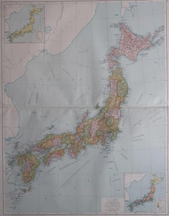
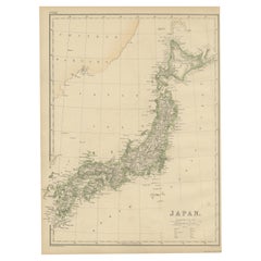
Large Original Vintage Map of Japan, circa 1920
Located in St Annes, Lancashire
Great map of Japan
Original color. Good condition
Published by Alexander Gross
Unframed.
Category
1920s English Antique Map Of Japan
Materials
Paper
Large Original Vintage Map of Japan, circa 1920
Located in St Annes, Lancashire
Great map of Japan
Original color. Good condition
Published by Alexander Gross
Unframed.
Category
1920s English Victorian Antique Map Of Japan
Materials
Paper
Antique Woodblock Print Map of Japan 'circa 1860'
Located in Langweer, NL
Original Japanese woodblock print map of Japan. Very large and fascinating map, rebacking with
Category
Late 19th Century Antique Map Of Japan
Materials
Paper
Large Original Vintage Map of Japan, circa 1920
Located in St Annes, Lancashire
Great map of Japan
Unframed
Original color
By John Bartholomew and Co. Edinburgh Geographical
Category
1920s British Antique Map Of Japan
Materials
Paper
Original Antique Decorative Map of Japan, Fullarton, C.1870
Located in St Annes, Lancashire
Great map of Japan
Wonderful figural border
From the celebrated Royal Illustrated Atlas
Category
1870s Scottish Antique Map Of Japan
Materials
Paper
Antique Map of Japan by W. G. Blackie, 1859
Located in Langweer, NL
Antique map titled 'Japan'. Original antique map of Japan. This map originates from ‘The Imperial
Category
Mid-19th Century Antique Map Of Japan
Materials
Paper
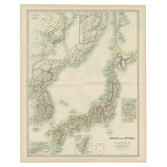
Antique Map of Japan and Korea by Johnston '1909'
Located in Langweer, NL
Antique map titled 'Japan and Korea'. Original antique map of Japan and Korea. With inset maps of
Category
Early 20th Century Antique Map Of Japan
Materials
Paper
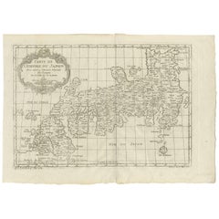
Antique Map of Japan by J.N. Bellin, 1752
Located in Langweer, NL
Bellin's wonderfully detailed map of Japan from the atlas of Prevost d'Exiles' influential
Category
Mid-18th Century Antique Map Of Japan
Materials
Paper
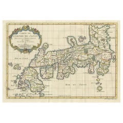
Attractive Hand-Tinted Antique Map of Japan, Published in 1752
Located in Langweer, NL
Nice decorative hand tinted map of Japan with the title (in French): Carte de L'Empire du Japon
Category
1750s Antique Map Of Japan
Materials
Paper
Antique Map of Japan with Scale and Compass Rose, c.1730
Located in Langweer, NL
Antique map titled 'Naauwkeurige Kaart van 'T Keizerryk Japan (..).'
Attractive detailed map of
Category
18th Century Antique Map Of Japan
Materials
Paper
Rare Antique Map of Japan with Place Names Given in Dutch Nomenclature, 1726
Located in Langweer, NL
Antique map titled 'Nieuwe Kaart van het Eyland Japan'.
Rare map of Japan, it shows each of the
Category
18th Century Antique Map Of Japan
Materials
Paper
H 23.23 in W 19.69 in D 0 in
Antique Map of Japan by A.M. Mallet, 1683
Located in Langweer, NL
A charming late 17th century French map with a very decorative title cartouche showing trumpet
Category
Late 17th Century Antique Map Of Japan
Materials
Paper
Old Map of Japan with the Track from Yedo to the Mount Fusi-Yama, 1861
Located in Langweer, NL
Antique map titled ?Japan?. Old map of Japan to illustrate a journey from the City of Yedo to the
Category
19th Century Antique Map Of Japan
Materials
Paper
Antique Map of Japan and Korea by Sanson, 'c.1690'
Located in Langweer, NL
Antique map titled 'Les Iles du Iapon (..)'. Original antique map, with beautiful (later) hand
Category
Late 17th Century Antique Map Of Japan
Materials
Paper
Antique Map of Japan, the Kurile Islands and Liu Kiu Islands, 1886
Located in Langweer, NL
The map is an exquisite piece, showcasing Japan's vibrant geography. Engraved by J. Bartholomew and
Category
Late 19th Century Antique Map Of Japan
Materials
Paper
Map of Japanese Coast from Osaka to Tokyo & the Kyushu and Shikoku Islands, 1669
Located in Langweer, NL
.'
Two maps on one sheet. The top map shows the Japanese coast from Osaka to Tokyo (Jedo). The lower map
Category
1660s Antique Map Of Japan
Materials
Paper
H 17.92 in W 21.66 in D 0 in
Antique Map Depicting Burma, Siam, Annam (Vietnam) and Japan, 1882
Located in Langweer, NL
titled "BURMAH SIAM AND ANAM," while the one on the right is labeled "JAPAN."
**BURMAH SIAM AND ANAM Map
Category
1880s Antique Map Of Japan
Materials
Paper
Free Shipping
H 14.97 in W 22.45 in D 0 in
Map of North and East coast of Asia with Japan & inset maps of Kamchatka, c1750
Located in Langweer, NL
east coast of Asia, showing an oddly shaped Japan and inset maps of Kamchatka. This old antique print
Category
1750s Antique Map Of Japan
Materials
Paper
H 14.77 in W 17.45 in D 0 in
Old Map of the Chinese Empire and Japan, 1882
Located in Langweer, NL
An original antique map titled "The Chinese Empire and Japan," dating from an 1882 atlas by Blackie
Category
1880s Antique Map Of Japan
Materials
Paper
Antique Map of China and Japan by Wyld '1845'
Located in Langweer, NL
Antique map titled 'Map of the Empires of China and Japan'. Original antique map of China and Japan
Category
Mid-19th Century Antique Map Of Japan
Materials
Paper
Antique Map of China and Japan by Johnson, 1872
Located in Langweer, NL
Antique map titled 'Johnson's China and Japan'. Map of China and Japan, with an inset map of the
Category
Late 19th Century Antique Map Of Japan
Materials
Paper
Antique Map of the Region of Hokkaido, Island of Japan, 1812
Located in Langweer, NL
(Mororan, Hokkaido, Japan). This map originates from Volume 38 of 'Allgemeine geographische Ephemeriden' by
Category
19th Century Antique Map Of Japan
Materials
Paper
Antique Map of the Chinese Empire and Japan, '1875'
Located in Langweer, NL
Empire and Japan. This map originates from 'Atlas de Géographie Moderne Physique et Politique' by A
Category
Late 19th Century Antique Map Of Japan
Materials
Paper
Antique Map of China and Japan by Tardieu, 1821
Located in Langweer, NL
Antique map titled 'Carte de la Chine et du Japon'. Detailed map of China, showing Korea, Japan and
Category
Early 19th Century Antique Map Of Japan
Materials
Paper
Antique Map of China and Japan by Meyer, 1895
Located in Langweer, NL
Antique map titled 'China und Japan'. Map of China, Mongolia, Taiwan and Japan. With an inset map
Category
19th Century Antique Map Of Japan
Materials
Paper
Antique Map of the Region of Wakayama, Nara and Osaka 'Japan'
Located in Langweer, NL
Geological folding map of the area with Wakayama, Nara, Osaka, Mie, and Shiga in Japan, circa 1880
Category
Late 19th Century Antique Map Of Japan
Materials
Linen, Paper
Antique Map of China and Japan, with Frame Style Border
Located in Langweer, NL
Antique map titled 'Empires Chinois et Japonnais'. Attractive map of China and Japan. This map
Category
Mid-19th Century Antique Map Of Japan
Materials
Paper
Large Antique Map of Kyoto in Japan by Kobayashi, '1905'
Located in Langweer, NL
Old map of Kyoto, Japan. Published by Kobayashi, 1905.
Category
Early 20th Century Antique Map Of Japan
Materials
Paper
Antique Street Map of the City of Edo 'Modern Tokyo' in Japan
Located in Langweer, NL
Antique map titled 'Plan de Jedo - Platte Grond van Jedo'. A detailed street map of the city of Edo
Category
Mid-18th Century Antique Map Of Japan
Materials
Paper
Antique Map of Northern Asia, with Russia, Korea and Northern Japan
Located in Langweer, NL
Antique map titled 'Nieuwe Kaart van Tartarie'. Map op Siberia and Chinese tartary. In the north
Category
Mid-18th Century Antique Map Of Japan
Materials
Paper
Antique Map of China and Japan by A.K. Johnston, 1865
Located in Langweer, NL
Antique map titled 'China and Japan'. Depicting Eastern China, the Islands of Japan and more. This
Category
Mid-19th Century Antique Map Of Japan
Materials
Paper
Antique Map of the Chinese Empire and Japan by Lapie, 1842
Located in Langweer, NL
Japan. This map originates from 'Atlas universel de géographie ancienne et moderne (..)' by Pierre M
Category
Mid-19th Century Antique Map Of Japan
Materials
Paper
Antique Map of Chinese and Independent Tartary, Korea and Japan, 1806
Located in Langweer, NL
Antique map titled 'A New Map of Chinese & Independent Tartary'. Beautiful map of Chinese Tartary
Category
19th Century Antique Map Of Japan
Materials
Paper
Antique Map of the Region of Osaka and Hirado Island in Japan, 1725
By Pieter Van Der Aa
Located in Langweer, NL
. The upper map shows the region of Osaka, Japan. The lower map shows the region of Hirado Island
Category
18th Century Antique Map Of Japan
Materials
Paper
Map of Australia, New Zealand, Part of China, Japan and Southeast Asia, 1857
Located in Langweer, NL
German Antique map titled 'Australien'. Map of Australia, New Zealand, part of China, Japan and
Category
19th Century Antique Map Of Japan
Materials
Paper
No Reserve
H 23.23 in W 27.96 in D 0 in
Decorative Map of the Empire of China, Korea, Japan, Taiwan, Lucon, Macau, 1780
Located in Langweer, NL
Antique map titled 'Carte de L'Empire de la Chine.'
Decorative map of the Empire of China
Category
1780s Antique Map Of Japan
Materials
Paper
H 14.97 in W 10.24 in D 0 in
Extremely Rare Map of The land of Eso or Hokkaido in Japan, 1725
Located in Langweer, NL
Plate 46: 'Le Pais d' Eso.' (The land of Eso / Hokkaido in Japan.) Extremely rare in this edition
Category
18th Century Antique Map Of Japan
Materials
Paper
Antique Map of China, Korea, Japan and the Northern Philippines, circa 1780
Located in Langweer, NL
'. Interesting and detailed map of China, Korea, Japan and the Northern Philippines. Published circa 1780.
Category
Late 18th Century Antique Map Of Japan
Materials
Paper
H 15.56 in W 9.85 in D 0.02 in
Old Map of the East Coast of Honshu with an Inset, Japan, c.1785
Located in Langweer, NL
Antique map titled ‘Part of Japan or Nippon'.
View of the Coast of Japan when we first saw it
Category
1780s Antique Map Of Japan
Materials
Paper
Original Antique Map of the Empire of Japan, Centered on the Bay of Osaka, c1752
Located in Langweer, NL
Antique map titled 'Carte de L'Empire de Japon (..).'
Map of the Empire of Japan. Centered on
Category
1750s Antique Map Of Japan
Materials
Paper
H 10.63 in W 15.36 in D 0 in
Map of the East Coast of Hanshu or Honshu & a View of the Japanese Coast, 1803
Located in Langweer, NL
Antique map titled 'Gedeelte van Japan of Nipon'.
Map of the east coast of Hanshu, with a view
Category
Early 1800s Antique Map Of Japan
Materials
Paper
H 17.13 in W 10.63 in D 0 in
Nice Antique Map of the Empire of Japan. Centered on the Bay of Osaka, ca.1752
Located in Langweer, NL
Antique map titled 'Carte de L'Empire de Japon (..).'
Map of the Empire of Japan. Centered on the
Category
1750s Antique Map Of Japan
Materials
Paper
H 9.45 in W 13.78 in D 0 in
Antique Map of Continental Asia, with Japan, Arabia, India, Russia, etc c.1702
Located in Langweer, NL
Antique map titled 'Totius Asiae Continens (..).' On this map of continental Asia and the adjacent
Category
18th Century Antique Map Of Japan
Materials
Paper
H 10.75 in W 15.95 in D 0 in
Map of Southeast Asia, Extending from India to Tibet & Japan to New Guinea, 1640
Located in Langweer, NL
, extending from India to Tibet to Japan to New Guinea. This map is one of the first to show a number of the
Category
1640s Antique Map Of Japan
Materials
Paper
H 19.89 in W 23.63 in D 0 in
Old Map of The Kurile Islands, from Hokkaido, Japan to Kamchatka, Russia, c.1750
Located in Langweer, NL
Antique map titled 'Carte des Iles Kouriles'. Original antique map of the Kuril Islands.
The
Category
1750s Antique Map Of Japan
Materials
Paper
Free Shipping
H 10.67 in W 11.89 in D 0 in
Original Old China Map, From Korea and the Sea of Japan to Teypin Island, 1803
Located in Langweer, NL
Antique map titled 'China, Contains 15 Subject Provinces Including the 2 Islands of Hainan, Formosa
Category
Early 1800s Antique Map Of Japan
Materials
Paper
H 10.63 in W 12.01 in D 0 in
Original Blaeu Map of Southeast Asia from India to Tibet and Japan to New Guinea
Located in Langweer, NL
Southeast Asia, extending from India to Tibet to Japan to New Guinea. It was the first popular map to depict
Category
1640s Antique Map Of Japan
Materials
Paper
H 19.49 in W 23.63 in D 0 in
Colored wall map of the WORLD
By Chambon
Located in ZWIJNDRECHT, NL
map is most notable for its depiction of the Sea of Japan labeled "Mer de Corée" and of "Mer de
Category
Mid-18th Century French French Provincial Antique Map Of Japan
Materials
Wood, Paper
Antique Map of Asia by Johnston '1909'
Located in Langweer, NL
Antique map titled 'Asia'. Depicting China, Japan, Indonesia, India, Arabia and more. This map
Category
Early 20th Century Antique Map Of Japan
Materials
Paper
1814 Map of "Russian Empire" Ric.r032
Located in Norton, MA
1814 Map of
"Russian Empire"
Ric.r032
Russian Empire. Description: This is an 1814 John
Category
19th Century Unknown Antique Map Of Japan
Materials
Paper
Antique Map of China by Wilkinson '1803'
Located in Langweer, NL
Antique map titled 'China, Contains 15 Subject Provinces Including the 2 Islands of Hainan, Formosa
Category
Early 19th Century Antique Map Of Japan
Materials
Paper
Antique Map of Siberia and Russia, c.1885
Located in Langweer, NL
Antique map titled 'Siberie ou Russie d?Asie'. This is a fine example of J. Migeon's map of Russia
Category
19th Century Antique Map Of Japan
Materials
Paper
Antique Map of Southeast Asia by Ortelius '1587'
By Abraham Ortelius
Located in Langweer, NL
Antique map titled 'Indiae Orientalis Insularumque Adiacientium Typus'. Ortelius includes early
Category
16th Century Antique Map Of Japan
Materials
Paper
Antique Map of North and East Asia, 1751
Located in Langweer, NL
maps on one sheet, showing California, Alaska and Siberia, Korea and Japan. South to Korea the island
Category
18th Century Antique Map Of Japan
Materials
Paper
Antique Map of Asia Showing Its Political Divisions, 1874
Located in Langweer, NL
Travel between London & India, China & Japan & c'. This map covers from the Arabian Peninsula and Turkey
Category
19th Century Antique Map Of Japan
Materials
Paper
Antique Map of the Empire of China by Bonne, c.1780
By Rigobert Bonne
Located in Langweer, NL
Antique map titled 'Carte de L'Empire de la Chine.' Decorative map of the Empire of China
Category
18th Century Antique Map Of Japan
Materials
Paper
Antique Map of Asia by Pierre du Val, '1663'
Located in Langweer, NL
Antique map titled 'L'Asie'. Antique map of the Asian continent by Pierre Duval, dated 1663. Most
Category
Mid-17th Century Antique Map Of Japan
Materials
Paper
Antique Map of Russia and Siberia by Migeon, 1880
Located in Langweer, NL
Antique map titled 'Sibérie ou Russie d'Asie'. Migeon's map covers the Russian empire in Asia from
Category
19th Century Antique Map Of Japan
Materials
Paper
Antique Map of Asia by A. Blondeau, circa 1800
Located in Langweer, NL
This is a fine circa 1800 map of Asia by Alexandre Blondeau. It covers the entire continent from
Category
Early 19th Century Antique Map Of Japan
Materials
Paper
Antique Map of Southeast Asia by Blaeu, c.1640
Located in Langweer, NL
, extending from India to Tibet to Japan to New Guinea. This map is one of the first to show a number of the
Category
17th Century Antique Map Of Japan
Materials
Paper
- 1
Get Updated with New Arrivals
Save "Antique Map Of Japan", and we’ll notify you when there are new listings in this category.
Antique Map Of Japan For Sale on 1stDibs
Choose from an assortment of styles, material and more with respect to the antique map of Japan you’re looking for at 1stDibs. Each antique map of Japan for sale was constructed with extraordinary care, often using paper, fabric and linen. There are many kinds of the antique map of Japan you’re looking for, from those produced as long ago as the 18th Century to those made as recently as the 20th Century. Each antique map of Japan bearing hallmarks is very popular.
How Much is a Antique Map Of Japan?
Prices for an antique map of Japan start at $67 and top out at $4,500 with the average selling for $616.
More Ways To Browse
Ceiling Room Divider
18th Century Portuguese Table
Wabi Sabi Japanese Pottery
Japanese Red Lacquer Antiques
Japanese Scroll Box
Red Ware Pottery Antique
Antique Chinese Porcelain Prints
Antique Cat Table
Japan Portugal
Portuguese Japan
Decorative Plates Sun
Table 17century English
2 Porcelain Wall Light
Grand Haven
Used Map Cabinet
16th Century Chinese Porcelain
Bay W Germany
Japanese Tea Ware
