Items Similar to Antique Street Map of the City of Edo 'Modern Tokyo' in Japan
Want more images or videos?
Request additional images or videos from the seller
1 of 6
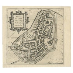
Antique Street Map of the City of Edo 'Modern Tokyo' in Japan
About the Item
Antique map titled 'Plan de Jedo - Platte Grond van Jedo'. A detailed street map of the city of Edo (modern Tokyo) in Japan, originally engraved by Bellin and Schley and reissued for Dutch editions of Prévost's monumental 'l'Histoire Géneral des Voyages. The map shows the city as it would have been during the Tokugawa Shogunate, also known as the Edo period. The map centres on the sprawling Edo Castle, here referrred to as the 'Palais de l'Empereur' and shown improbably with a French-style garden in parterre. The only other features of the city to be labelled are two of the early stages of the famous Tokaido road between Tokyo and Kyoto, these being the Nihonbashi Bridge and post town of Shinagawa. The rest of the city is mainly shown as a network of streets, though a number of pagodas, temples, and fortifications are also shown. Published circa 1750.
- Dimensions:Height: 10.52 in (26.7 cm)Width: 10.63 in (27 cm)Depth: 0.02 in (0.5 mm)
- Materials and Techniques:
- Period:
- Date of Manufacture:c.1750
- Condition:General age-related toning, original folding lines. Shows some wear, sl. affecting image. Bottom margin trimmed, narrow margins. Blank verso. Please study image carefully.
- Seller Location:Langweer, NL
- Reference Number:
About the Seller
5.0
Platinum Seller
These expertly vetted sellers are 1stDibs' most experienced sellers and are rated highest by our customers.
Established in 2009
1stDibs seller since 2017
1,919 sales on 1stDibs
Typical response time: <1 hour
- ShippingRetrieving quote...Ships From: Langweer, Netherlands
- Return PolicyA return for this item may be initiated within 14 days of delivery.
More From This SellerView All
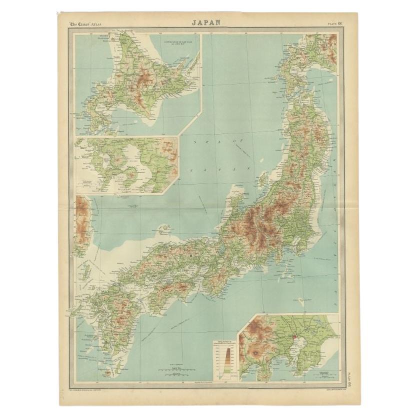
- Antique Map of the Region of Tokyo and Nagasaki in Japan, 1922Located in Langweer, NLAntique map of Japan titled 'Japan - Environs of Tokio & Nagasaki'. Old map of Japan, includes inset maps of Tokyo, Nagasaki and surroundings. This map or...Category
20th Century Maps
MaterialsPaper
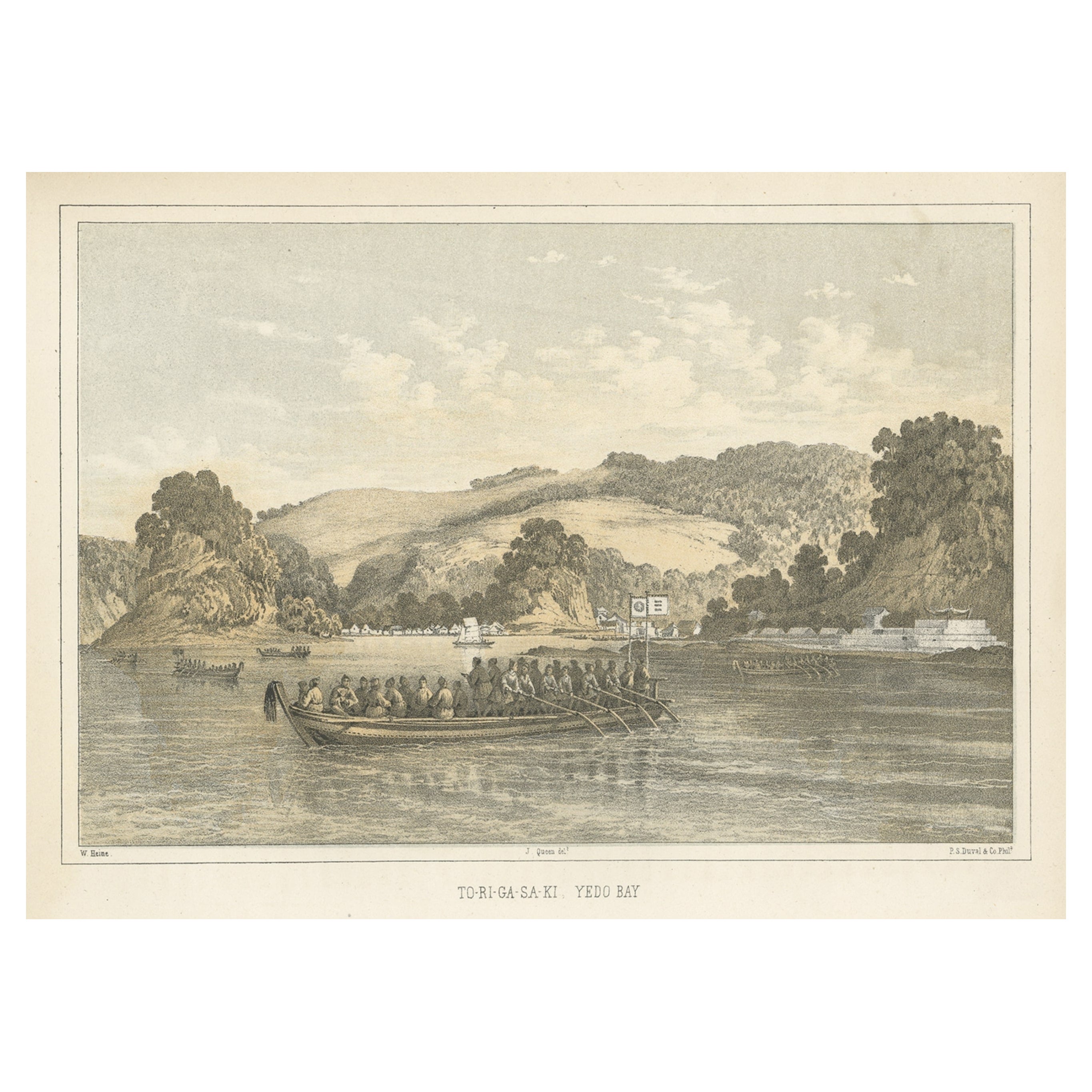
- Antique Print of Tokyo Bay 'or Edo Bay', Located in Southern Kantō, Japan, 1856Located in Langweer, NLAntique print titled 'To-Ri-Ga-Sa-Ki, Yedo Bay'. View of Tokyo Bay (or Edo Bay), a bay located in the southern Kanto region of Japan, and spans the coasts of Tokyo, Kanagawa Prefectu...Category
Antique 1850s Maps
MaterialsPaper
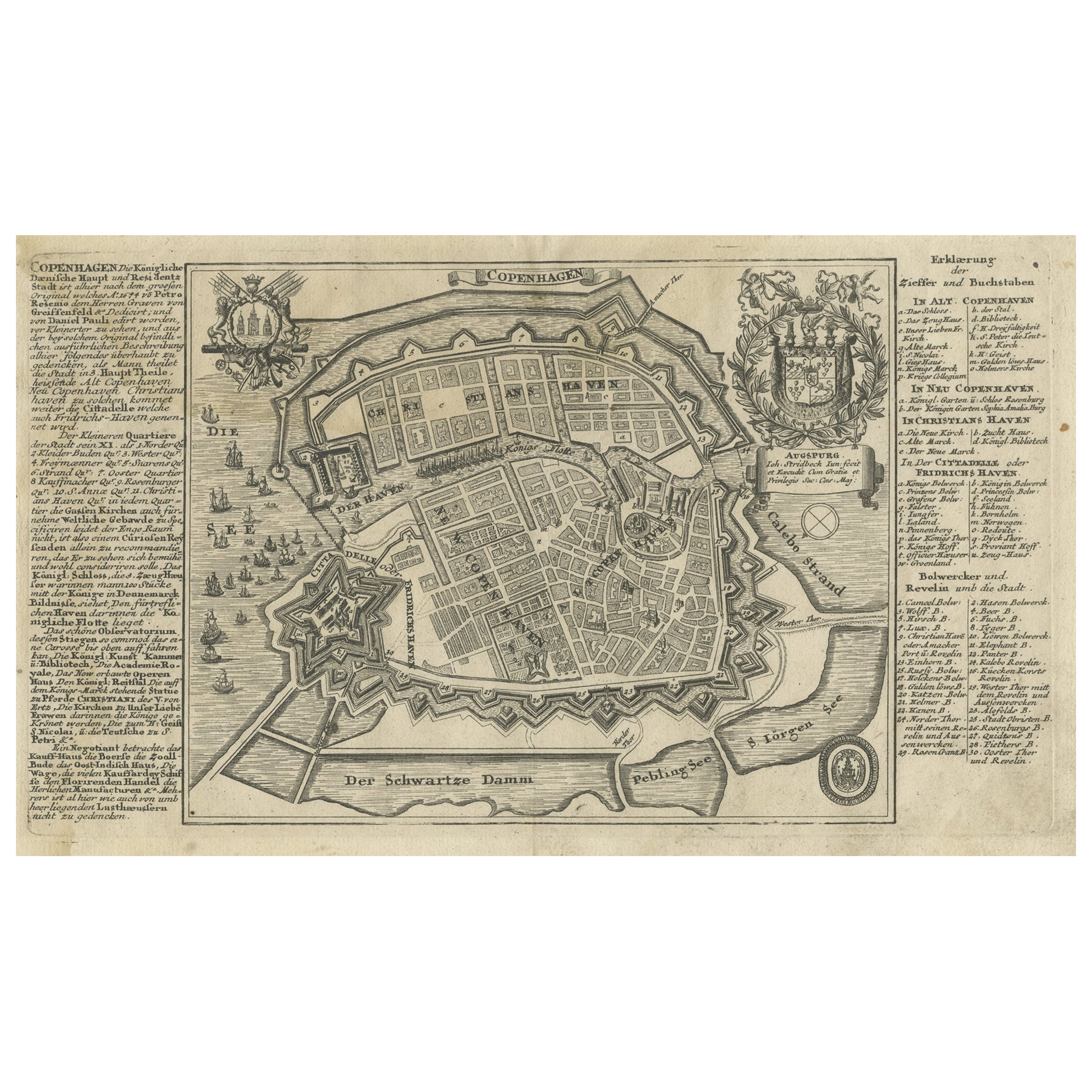
- Antique Map of the City of Copenhagen in Denmark c.1720Located in Langweer, NLAntique map titled 'Copenhagen'. Original antique map of the city of Copenhagen, Denmark. This map originates from 'Unterschiedliche dieser Zeit Beruffene Laender, Gegenden, Staedte ...Category
Antique 18th Century Maps
MaterialsPaper
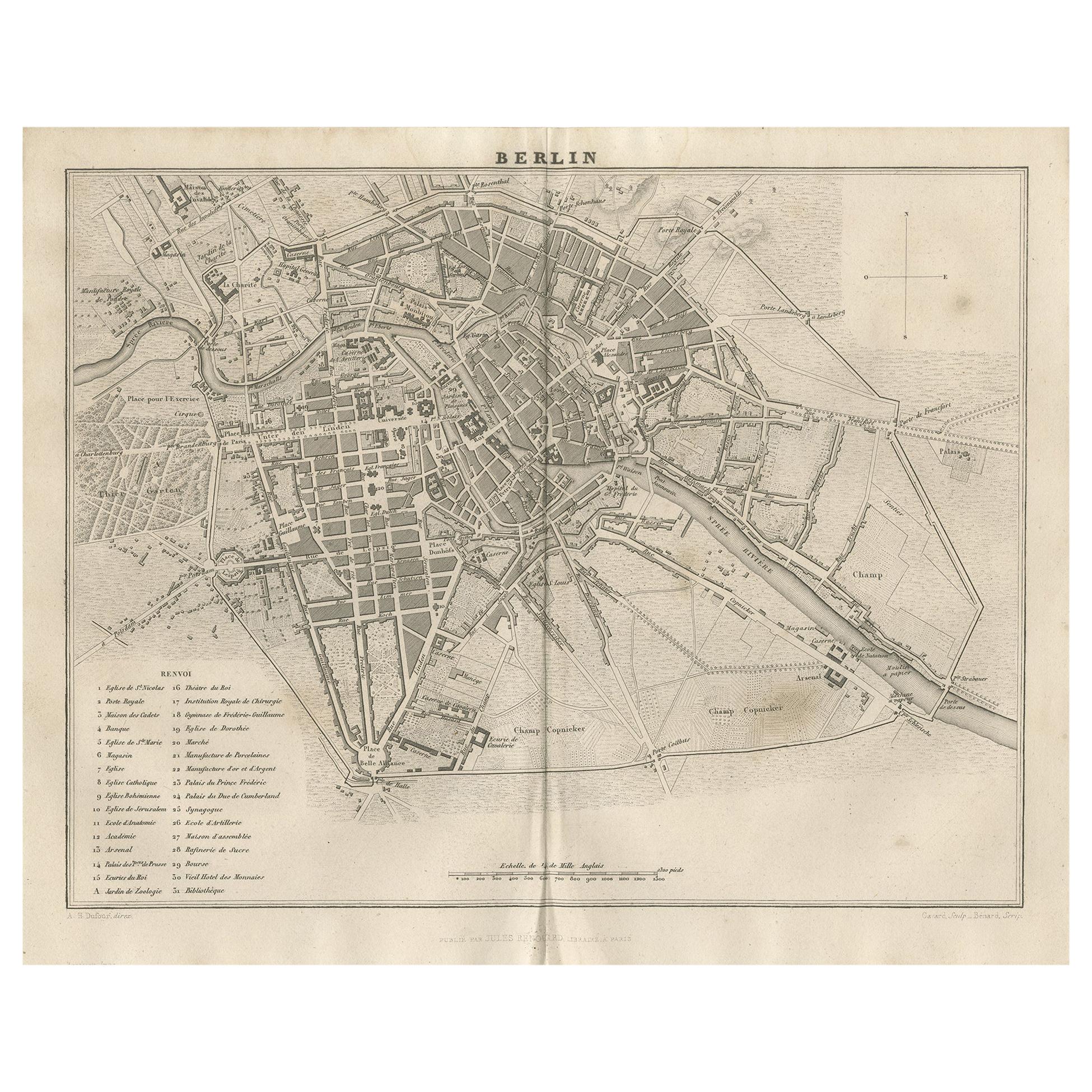
- Antique Map of the City of Berlin in Germany, '1847'Located in Langweer, NLAntique map titled 'Berlin'. Original antique map of the city of Berlin, Germany. This map originates from 'Abrégé de Géographie (..)' by Adrien Balbi. Published 1847.Category
Antique Mid-19th Century Maps
MaterialsPaper
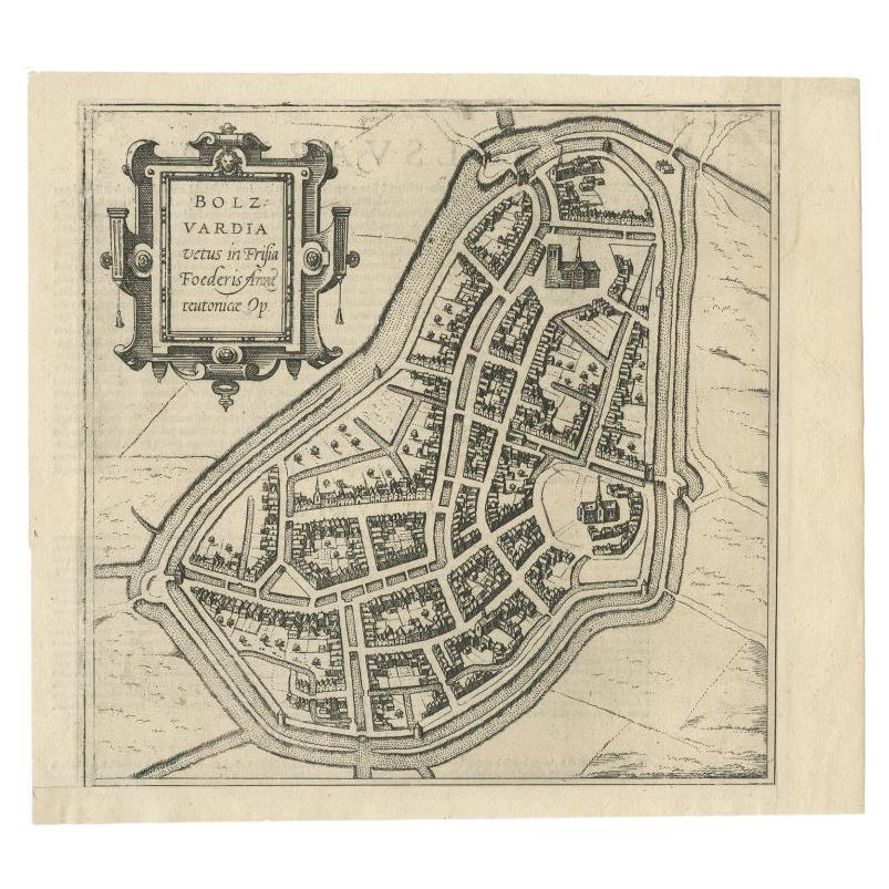
- Antique Map of the City of Bolsward, Friesland in The Netherlands, c.1598Located in Langweer, NLAntique map titled ‘Bolzvardia vetus in Frisia Foederis (..)’. Old map of the city of Bolsward, Friesland. Originally part of a sheet together with the cities of Stavoren, Harlingen ...Category
Antique 16th Century Maps
MaterialsPaper
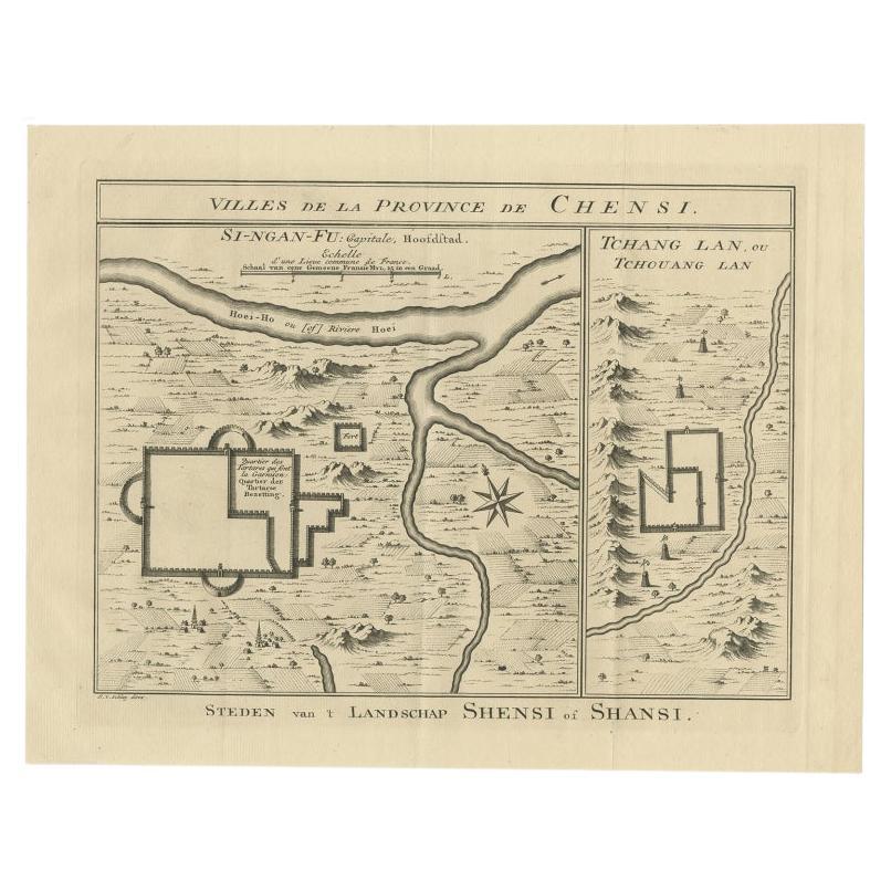
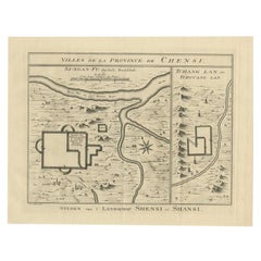
- Antique Map of Cities in the Province of Shanxi in China, 1749Located in Langweer, NLAntique print titled 'Villes de la Province de Chensi - Steden van 't Landschap Shensi of Shansi'. Interesting set of two local town plans of ""Si-Ngan-Fu: Capitale."" and ""Tchang L...Category
Antique 18th Century Maps
MaterialsPaper


You May Also Like
- Original Antique Map / City Plan of Brussels by Tallis, circa 1850Located in St Annes, LancashireGreat map of Brussels. Steel engraving. Published by London Printing & Publishing Co. (Formerly Tallis), C.1850 Free shipping.Category
Antique 1850s English Maps
MaterialsPaper
- Map of the Republic of GenoaLocated in New York, NYFramed antique hand-coloured map of the Republic of Genoa including the duchies of Mantua, Modena, and Parma. Europe, late 18th century. Dimension: 25...Category
Antique Late 18th Century European Maps
- Antique Map of Principality of MonacoBy Antonio Vallardi EditoreLocated in Alessandria, PiemonteST/619 - "Old Geographical Atlas of Italy - Topographic map of ex-Principality of Monaco" - ediz Vallardi - Milano - A somewhat special edition ---Category
Antique Late 19th Century Italian Other Prints
MaterialsPaper
- Original Antique Map of The World by Thomas Clerk, 1817Located in St Annes, LancashireGreat map of The Eastern and Western Hemispheres On 2 sheets Copper-plate engraving Drawn and engraved by Thomas Clerk, Edinburgh. Published by Mackenzie And Dent, 1817 ...Category
Antique 1810s English Maps
MaterialsPaper
- Antique 18th Century Map of the Province of Pensilvania 'Pennsylvania State'Located in Philadelphia, PAA fine antique of the colony of Pennsylvania. Noted at the top of the sheet as a 'Map of the province of Pensilvania'. This undated and anonymous map is thought to be from the Gentleman's Magazine, London, circa 1775, although the general appearance could date it to the 1760's. The southern boundary reflects the Mason-Dixon survey (1768), the western boundary is placed just west of Pittsburgh, and the northern boundary is not marked. The map has a number of reference points that likely refer to companion text and appear to be connected to boundaries. The western and southern boundaries are marked Q, R, S, for example. A diagonal line runs from the Susquehanna R to the Lake Erie P. A broken line marked by many letters A, B, N, O, etc., appears in the east. There are no latitude or longitude markings, blank verso. Framed in a shaped contemporary gilt wooden frame and matted under a cream colored matte. Bearing an old Graham Arader Gallery...Category
Antique 18th Century British American Colonial Maps
MaterialsPaper
- Map "Estuary- Mouth of the Thames"Located in Alessandria, PiemonteST/426 - Antique French Map of the estuary of the Thames, map dated 1769 - "Mape of the entrance of the Thames. Designed by filing of Navy cards fo...Category
Antique Mid-18th Century French Other Prints
MaterialsPaper


