Items Similar to Antique Map Depicting Burma, Siam, Annam (Vietnam) and Japan, 1882

Want more images or videos?
Request additional images or videos from the seller
1 of 6
Antique Map Depicting Burma, Siam, Annam (Vietnam) and Japan, 1882
About the Item
The image shows two maps side by side from the 1882 atlas by Blackie & Son. On the left, the map is titled "BURMAH SIAM AND ANAM," while the one on the right is labeled "JAPAN."
**BURMAH SIAM AND ANAM Map:**
This map depicts the regions of Southeast Asia that are today known as Myanmar (Burma), Thailand (Siam), and parts of Vietnam (Annam). The map is detailed, showing the intricate river systems, mountain ranges, and provincial divisions within each region. It uses color to differentiate between the three regions, with hachures indicating relief and topographical features. Key cities, towns, and other important geographical landmarks are marked.
**JAPAN Map:**
The map of Japan shows the main islands - Hokkaido, Honshu, Shikoku, and Kyushu, along with the Ryukyu Islands to the south. This map, too, uses hachures to represent topographical features such as mountain ranges and includes detailed coastal lines. Political divisions, significant cities, towns, and geographical features are also indicated. An inset in the bottom left corner shows the "Loo-Choo Islands" (Ryukyu Islands) on a larger scale.
Both maps are framed with latitudinal and longitudinal lines and include a scale in miles. These maps would have been used at the time for educational purposes, as well as for navigation and colonial administration purposes, reflecting the British interest in these regions during the late 19th century. The precision and detail in these maps are indicative of the level of cartographic skill and interest in geography during the Victorian era.
- Dimensions:Height: 14.97 in (38 cm)Width: 22.45 in (57 cm)Depth: 0 in (0.02 mm)
- Materials and Techniques:
- Period:
- Date of Manufacture:1882
- Condition:Good condition, folding line in the middle. The outer borders are slightly discolored due to age, but not the image. This map is ideal for framing. Study the image carefully.
- Seller Location:Langweer, NL
- Reference Number:
About the Seller
5.0
Platinum Seller
These expertly vetted sellers are 1stDibs' most experienced sellers and are rated highest by our customers.
Established in 2009
1stDibs seller since 2017
1,922 sales on 1stDibs
Typical response time: <1 hour
- ShippingRetrieving quote...Ships From: Langweer, Netherlands
- Return PolicyA return for this item may be initiated within 14 days of delivery.
More From This SellerView All
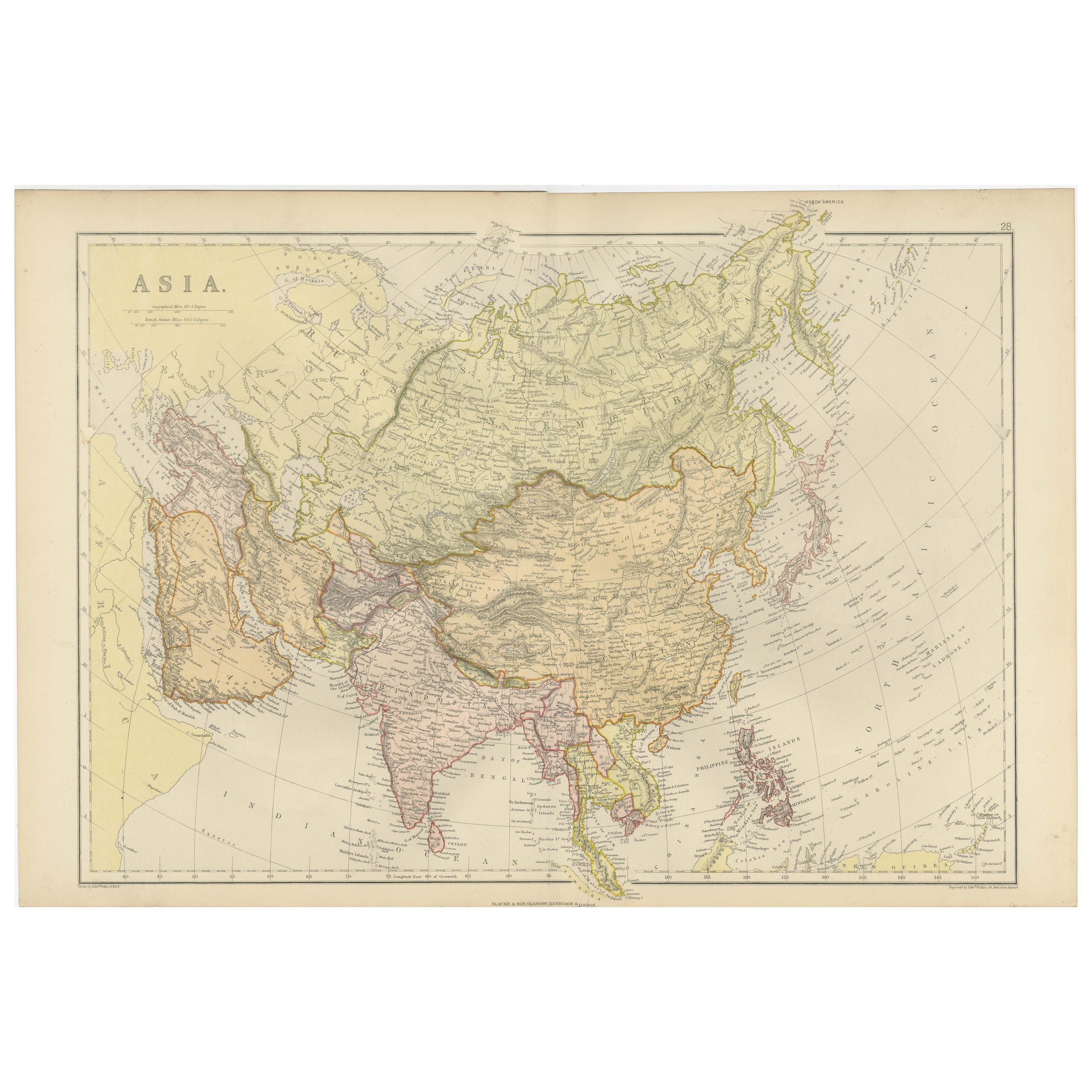
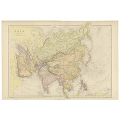
- Historical Map Depicting the Continent of Asia, 1882Located in Langweer, NLThis 1882 map presents a meticulously detailed representation of the continent of Asia, a testament to the cartographic skills of the era. Published as a part of 'Comprehensive Atlas...Category
Antique 1880s Maps
MaterialsPaper
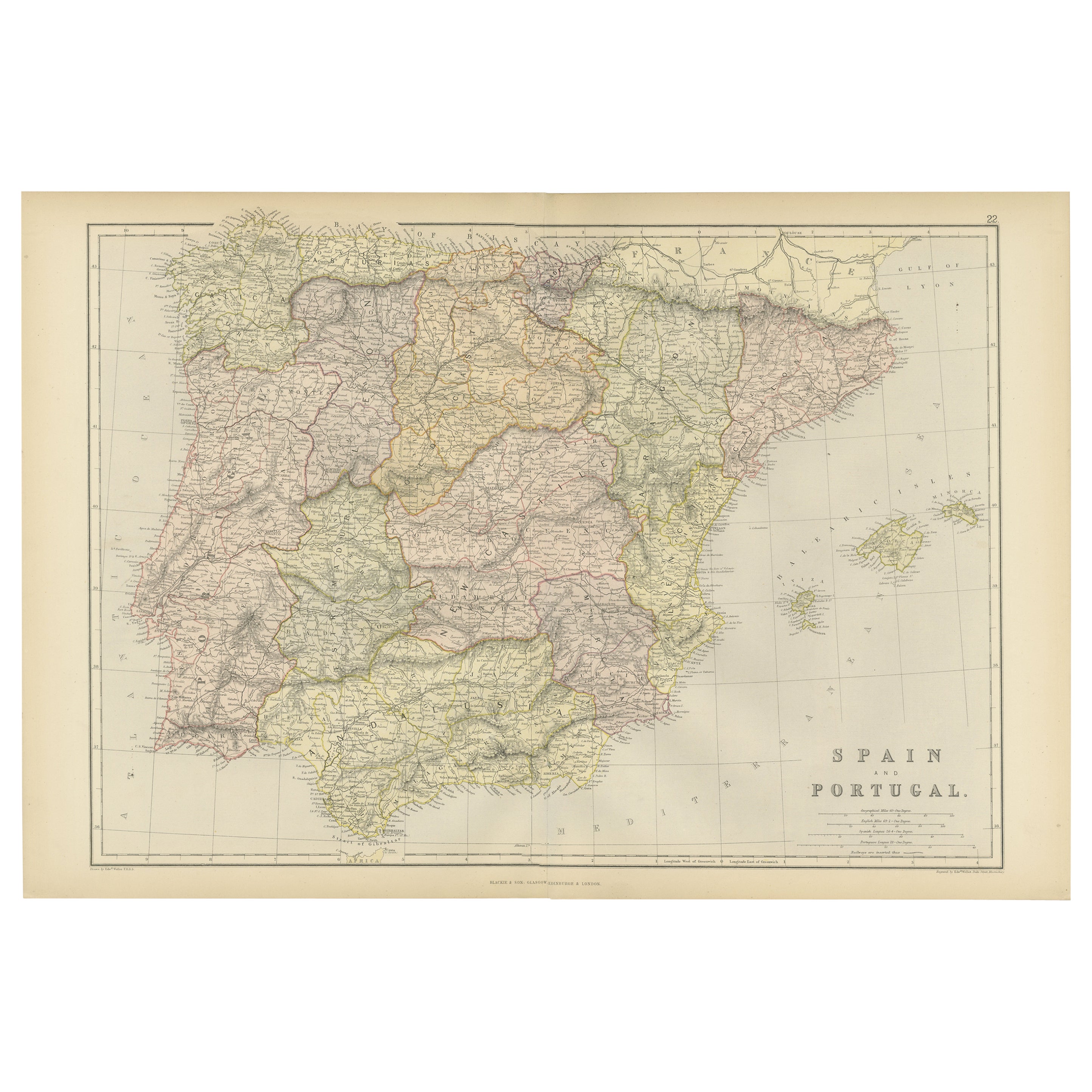
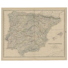
- Antique Map of Spain and Portugal, 1882Located in Langweer, NL"Antique map titled 'Spain & Portugal'. Old map of Spain and Portugal. This map originates from 'The Royal Atlas of Modern Geography, Exhibiting, in a S...Category
Antique 19th Century Maps
MaterialsPaper
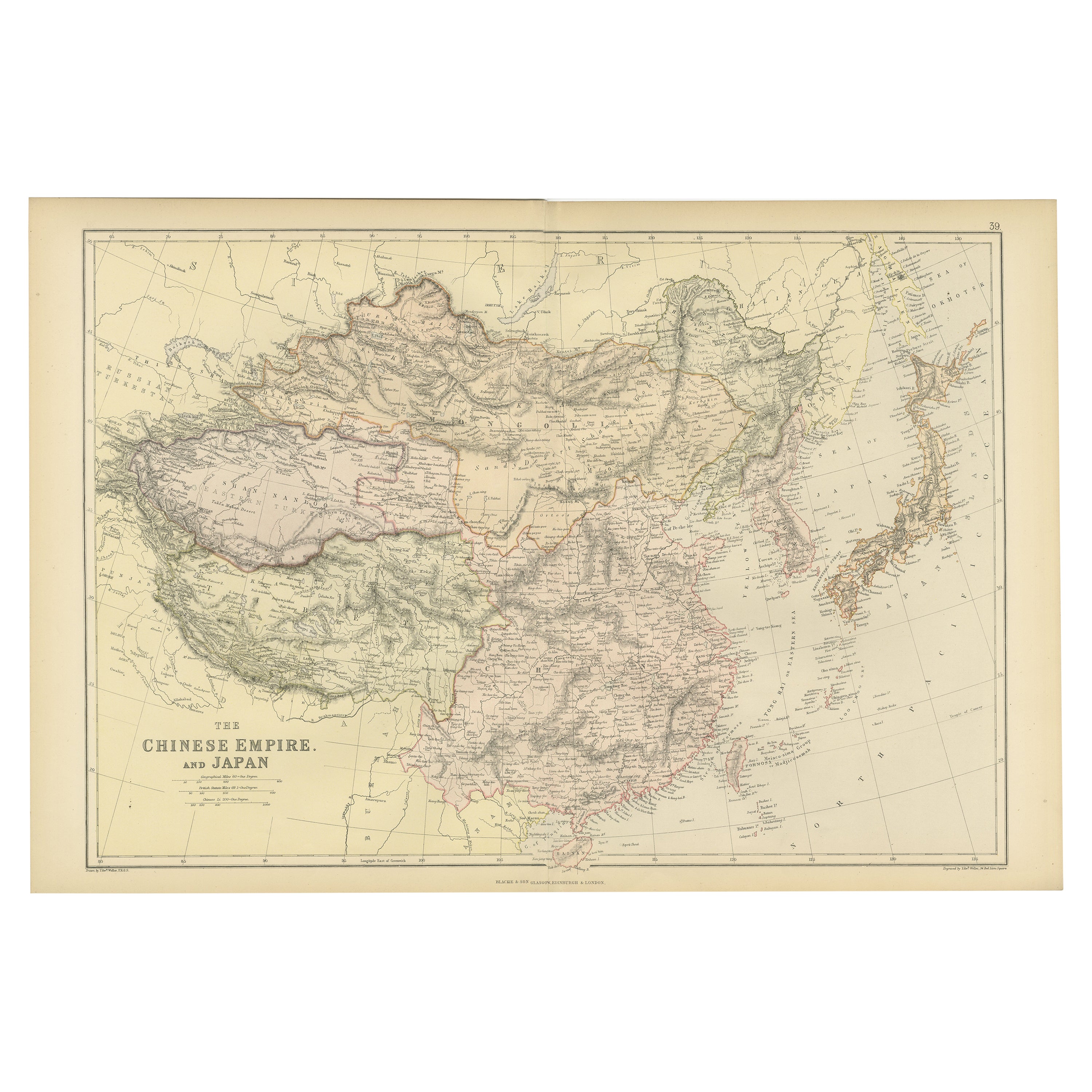
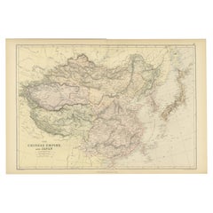
- Old Map of the Chinese Empire and Japan, 1882Located in Langweer, NLAn original antique map titled "The Chinese Empire and Japan," dating from an 1882 atlas by Blackie & Son. It is a color map with geographical features such as mountain ranges, river...Category
Antique 1880s Maps
MaterialsPaper
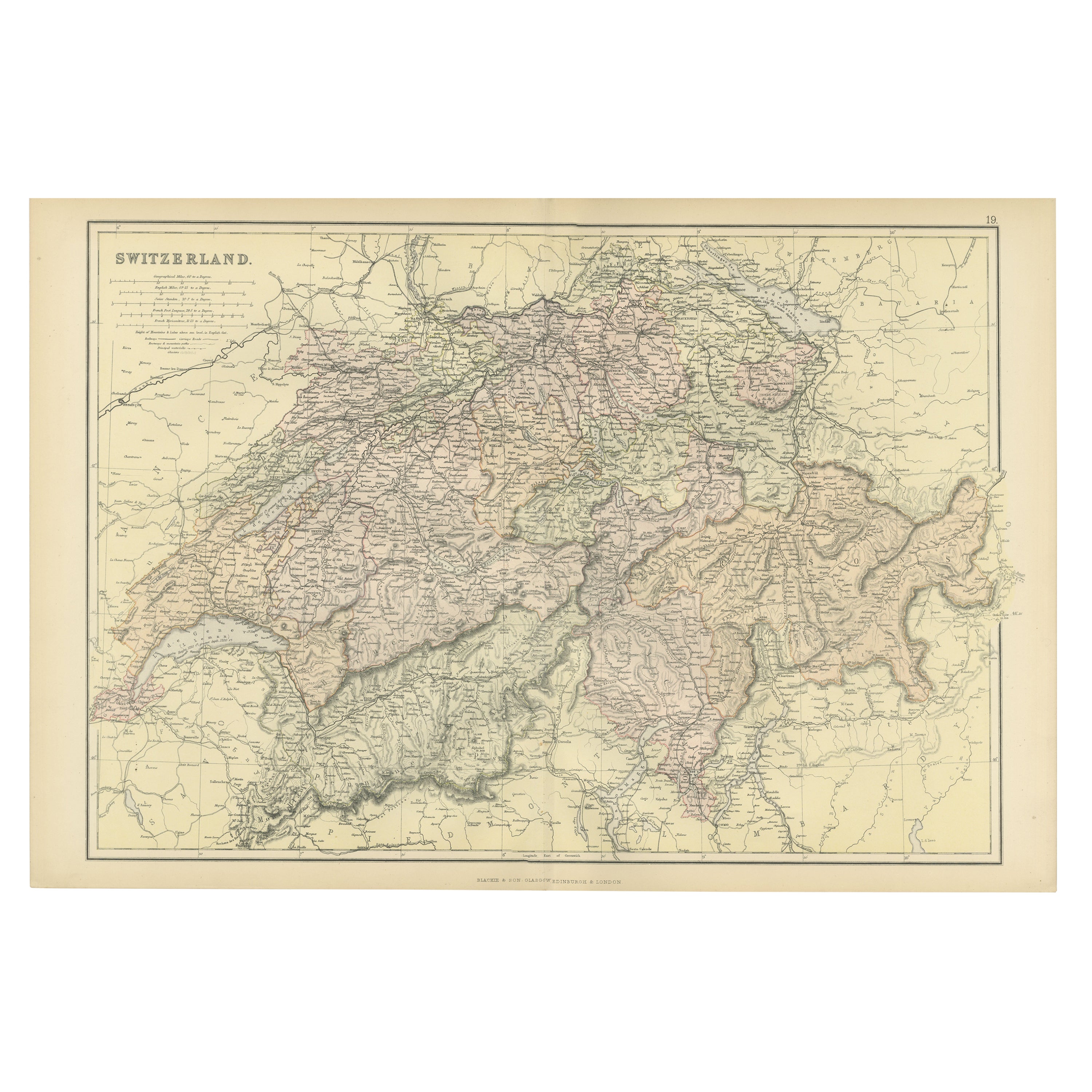
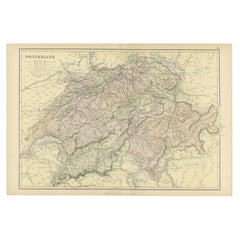
- Original Antique Map of Switzerland, 1882Located in Langweer, NLEmbark on a historical journey with an original Antique Map of Switzerland from the renowned 'Comprehensive Atlas and Geography of the World...Category
Antique 1880s Maps
MaterialsPaper
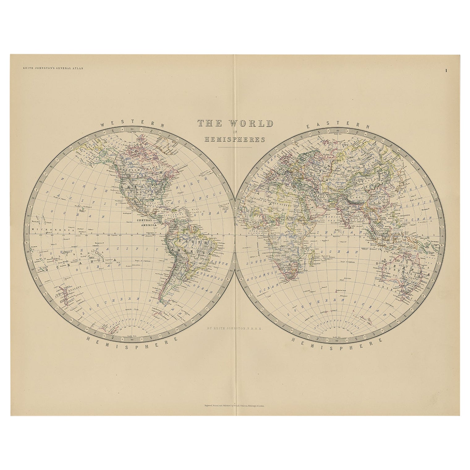
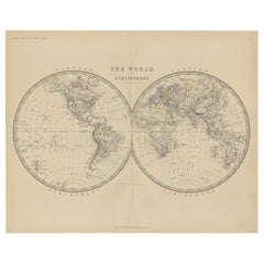
- Antique World Map by Johnston, 1882Located in Langweer, NLAntique map titled 'The World in Hemispheres'. Old double-hemisphere world map. This map originates from 'The Royal Atlas of Modern Geography, Exhibiting, in a Series of Entirely Ori...Category
Antique 19th Century Maps
MaterialsPaper
- Original Antique Map of Spain and Portugal, 1882Located in Langweer, NLEmbark on a historical voyage with an original Antique Map of Spain and Portugal from the esteemed 'Comprehensive Atlas and Geography of the World,' meticulously crafted in 1882. Thi...Category
Antique 1880s Maps
MaterialsPaper
You May Also Like
- Antique Carte de L'Inde Myanmar, Malaysia Vietnam Map of Asia the Chinese EmpireLocated in Amsterdam, Noord HollandAntique Carte de L'Inde Myanmar, Malaysia Vietnam Map of Asia the Chinese Empire Very nice map of Asia. Additional information: Type: Map Country of Man...Category
Antique 18th Century European Maps
MaterialsPaper
- Antique Puzzle of Colored Cardboard Depicting World Map, Europe and FranceLocated in Milan, ITEducational puzzle of colored cardboard composed of three folders depicting world map, Europe and France. The world map in addition to the territorial map of the continents depicts t...Category
Antique 1850s French Games
MaterialsPaper
- 1812 United States Map, by Pierre Tardieu, Antique French Map Depicting the U.S.By Pierre François TardieuLocated in Colorado Springs, CO1812 "United States of Nth America -- Carte des Etats-Unis De L'Amerique Septentrionale" Two-Sheet Map by Tardieu This attractive map, published in Paris in 1812, is one of the most rare large format maps from the period. It features a view of the East Coast of the U.S. from Maryland to just below South Carolina. Additionally, Ellicott’s plan for the City of Washington D.C. is included at the top right and an illustration of Niagara Falls is shown at the bottom right with a description in both French and English. This extremely detailed map not only depicts the mountainous regions of the southeastern U.S., but also includes names of regions, rivers, and towns. Based on the first state of Arrowsmith’s 4-sheet map of the United States, this map is completely engraved by Tardieu in Paris and showcases high quality engravings. This detailed map of the recently independent United States includes one of the largest and earliest examples of the Ellicott plan of Washington DC. The artist, Pierre François Tardieu (PF Tardieu) was a very well-known map engraver, geographer, and illustrator. Awarded a bronze medal by King Louis-Phillipe for the accuracy and beauty of his map-making, Tardieu produced many fine works including maps of Louisiana...Category
Antique 1810s French Maps
MaterialsPaper
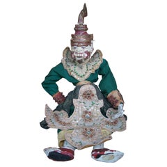
- Antique Carved Thai Burmese Ramayana Warrior Folk Art Marionette Puppet DollLocated in Dayton, OHAntique carved Thai Burmese Ramayana Warrior marionette string puppet. Hand made from wood featuring ornate beaded clothing / attire.Category
Early 20th Century Folk Art Toys and Dolls
MaterialsFabric, Hardwood
- Original Antique Decorative Map of Japan, Fullarton, C.1870Located in St Annes, LancashireGreat map of Japan Wonderful figural border From the celebrated Royal Illustrated Atlas Lithograph. Original color. Published by Fullarton, Edinburgh, C.1870 Unframed...Category
Antique 1870s Scottish Maps
MaterialsPaper
- Antique Spanish Coin Dated 1882Located in Miami, FLFine Spanish coin that was previously on a silver bracelet (sold separately). Spain, Alphonse XII (1874-1885), 5 Peseta, 1882, Year: 1882 Metal: Silver.Category
Antique 19th Century Spanish Collectible Jewelry
MaterialsSilver