Items Similar to Original Antique Map of Switzerland, 1882

Want more images or videos?
Request additional images or videos from the seller
1 of 6
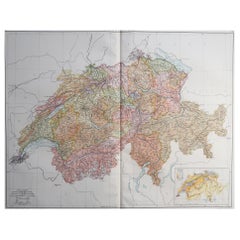
Original Antique Map of Switzerland, 1882
About the Item
Embark on a historical journey with an original Antique Map of Switzerland from the renowned 'Comprehensive Atlas and Geography of the World,' meticulously crafted in 1882. This exquisite map intricately illustrates Switzerland's charming landscapes, cities, rivers, and topography, encapsulating the essence of this picturesque country in vibrant detail.
This map isn't just a geographical depiction; it's a time capsule to a fascinating past. Adorned with vibrant colors and intricate engravings, it breathes life into the 19th-century world, inviting exploration of Switzerland's rich history and scenic beauty.
Perfect for history enthusiasts, collectors, or those captivated by antique craftsmanship, this map is a conversation piece that adds elegance to any setting. It stands as a testament to cartographic excellence, reflecting an era of exploration and scholarly dedication.
Beyond being a mere map, it's a window to another era, waiting to grace your home or office walls. Bring home this antique map today and let its historical allure infuse your space with the enchanting beauty and storied past of Switzerland, inviting you to embark on a captivating journey through time and geography.
- Dimensions:Height: 14.97 in (38 cm)Width: 22.45 in (57 cm)Depth: 0 in (0.02 mm)
- Materials and Techniques:
- Period:
- Date of Manufacture:1882
- Condition:Good condition, folding line in the middle. The outer borders are slightly yellowish discolored due to age, but not the image. This map is ideal for framing. Study the image carefully.
- Seller Location:Langweer, NL
- Reference Number:
About the Seller
5.0
Platinum Seller
These expertly vetted sellers are 1stDibs' most experienced sellers and are rated highest by our customers.
Established in 2009
1stDibs seller since 2017
1,922 sales on 1stDibs
Typical response time: <1 hour
- ShippingRetrieving quote...Ships From: Langweer, Netherlands
- Return PolicyA return for this item may be initiated within 14 days of delivery.
More From This SellerView All
- Antique Map of Switzerland by Johnston, 1882Located in Langweer, NLAntique map titled 'Switzerland and the Alps of Savoy and Piedmont'. Old map of Switzerland and the Alps of Savoy and Piedmont. This map originates from 'The Royal Atlas of Modern Ge...Category
Antique 19th Century Maps
MaterialsPaper
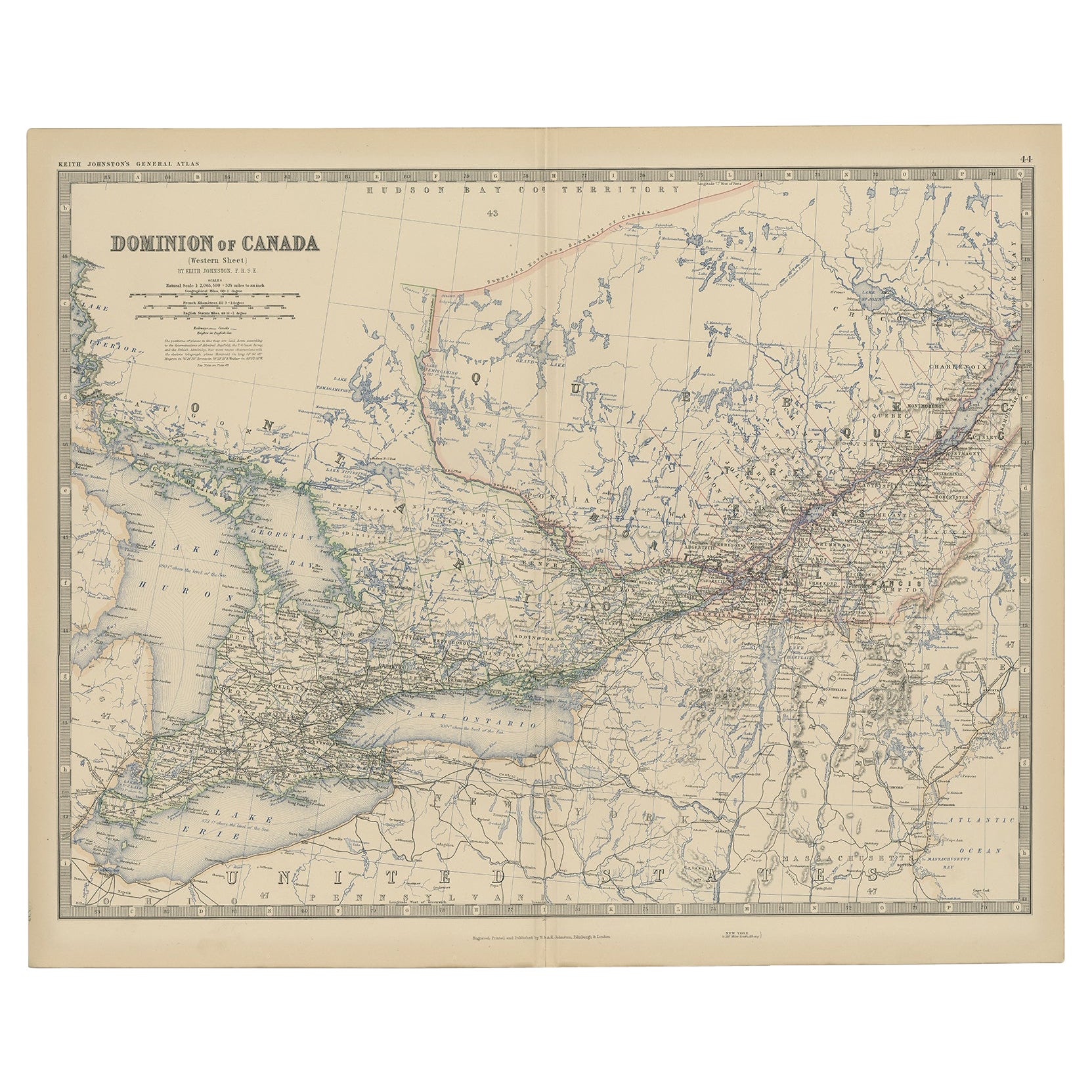
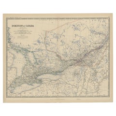
- Old Original Antique Map of Western Canada, 1882Located in Langweer, NLAntique map titled 'Dominion of Canada'. Old map of Western Canada. This map originates from 'The Royal Atlas of Modern Geography, Exhibiting, in a ...Category
Antique 1880s Maps
MaterialsPaper
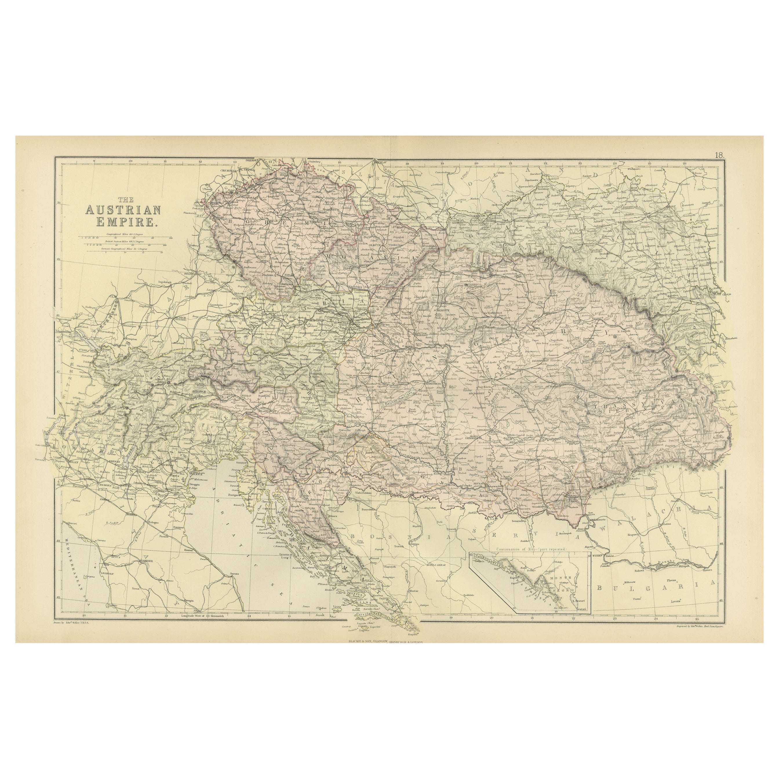
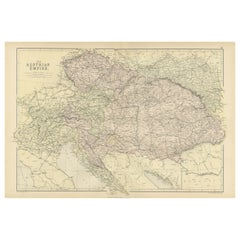
- Original Antique Map of The Austrian Empire, 1882Located in Langweer, NLStep into the past with an original Antique Map of The Austrian Empire from the esteemed 'Comprehensive Atlas and Geography of the World,' meticulously crafted in 1882. This intricat...Category
Antique 1880s Maps
MaterialsPaper
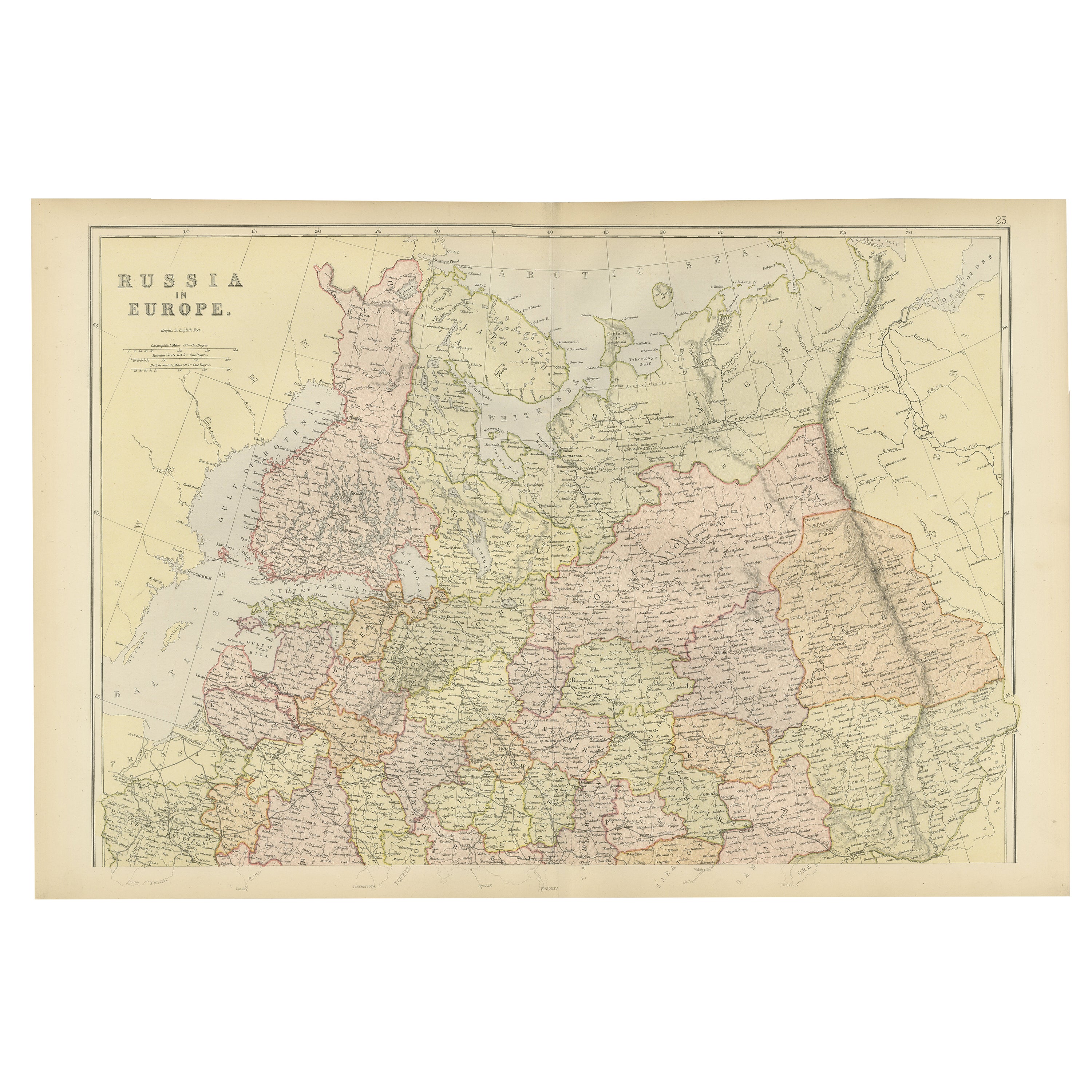
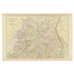
- Original Antique Map of Russia in Europe, 1882Located in Langweer, NLEmbark on an enthralling journey with an original Antique Map of European Russia from the esteemed 'Comprehensive Atlas and Geography of the World,' meticulously crafted in 1882. Thi...Category
Antique 1880s Maps
MaterialsPaper
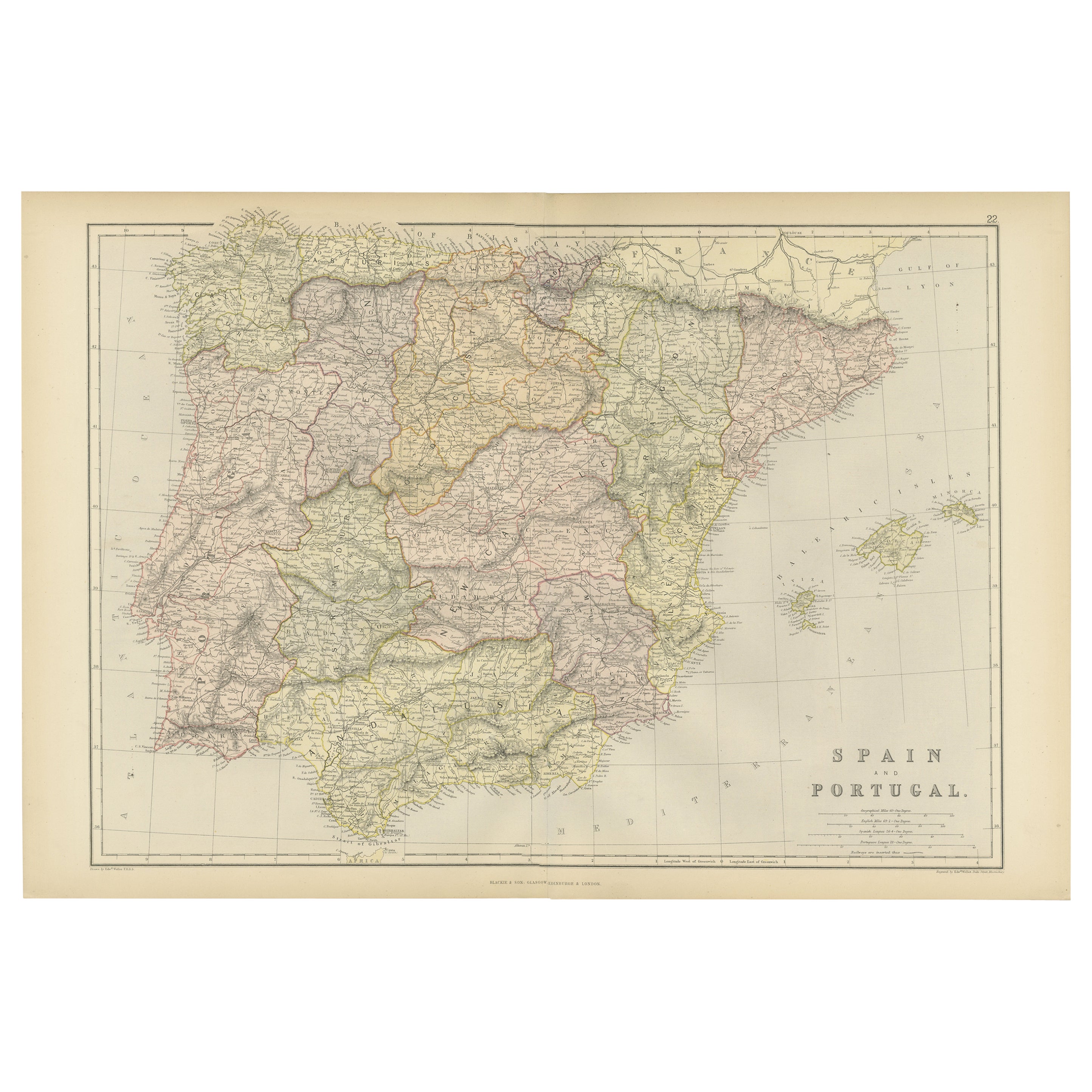
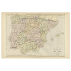
- Original Antique Map of Spain and Portugal, 1882Located in Langweer, NLEmbark on a historical voyage with an original Antique Map of Spain and Portugal from the esteemed 'Comprehensive Atlas and Geography of the World,' meticulously crafted in 1882. Thi...Category
Antique 1880s Maps
MaterialsPaper
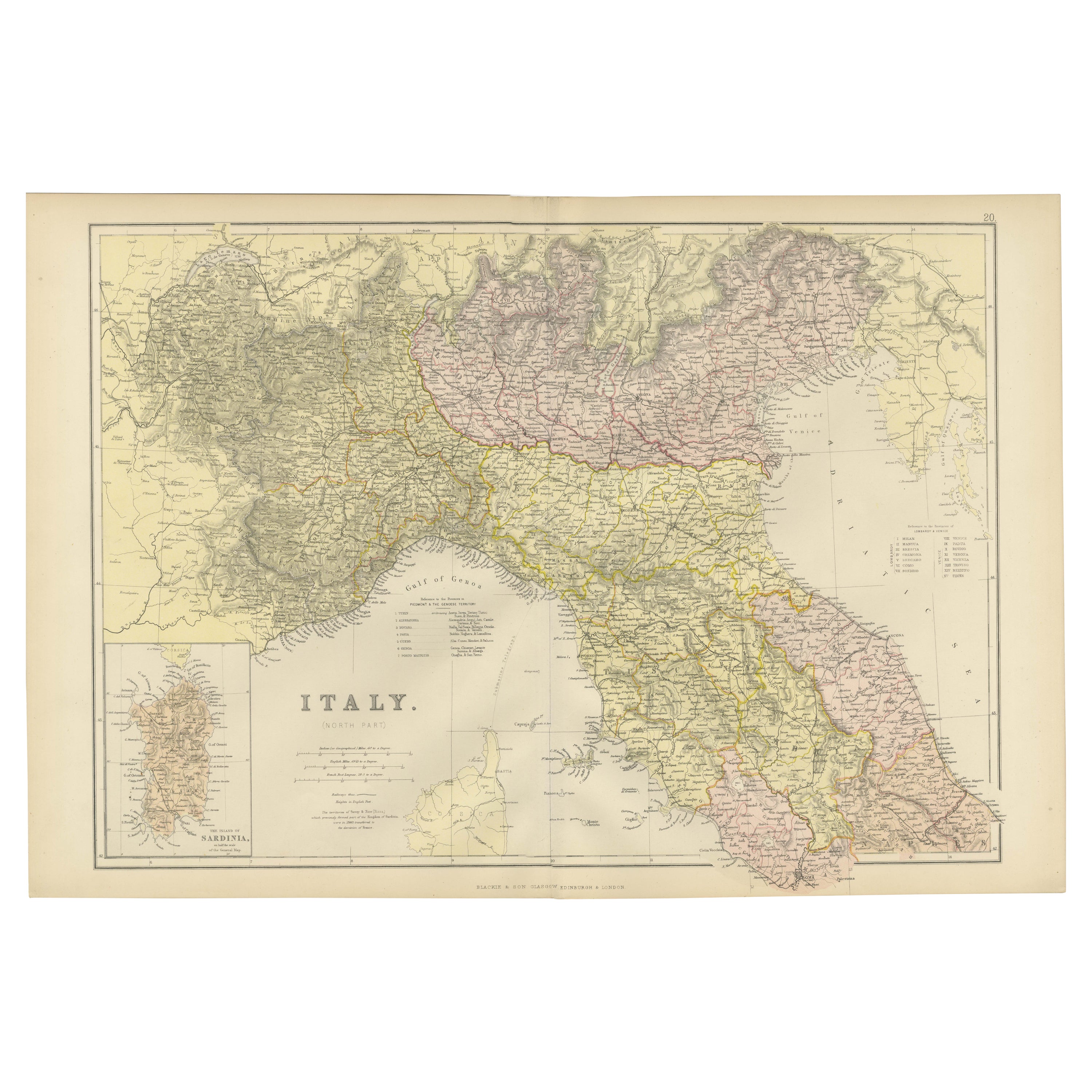
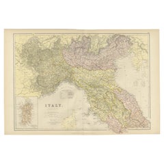
- Original Antique Map of Italy with an Inset of Sardinia, 1882Located in Langweer, NLEmbark on a historical odyssey with an original Antique Map of Italy from the esteemed 'Comprehensive Atlas and Geography of the World,' meticulously crafted in 1882. This captivatin...Category
Antique 1880s Maps
MaterialsPaper

You May Also Like
- Original Antique Map of Switzerland, Engraved By Barlow, Dated 1807Located in St Annes, LancashireGreat map of Switzerland Copper-plate engraving by Barlow Published by Brightly & Kinnersly, Bungay, Suffolk. Dated 1807 Unframed.Category
Antique Early 1800s English Maps
MaterialsPaper
- Large Original Vintage Map of Switzerland, circa 1920Located in St Annes, LancashireGreat map of Switzerland Original color. Good condition Published by Alexander Gross Unframed.Category
Vintage 1920s English Maps
MaterialsPaper
- Original Antique Map of Italy. C.1780Located in St Annes, LancashireGreat map of Italy Copper-plate engraving Published C.1780 Unframed.Category
Antique Early 1800s English Georgian Maps
MaterialsPaper

- Original Antique Map of Asia. C.1780Located in St Annes, LancashireGreat map of Asia Copper-plate engraving Published C.1780 Two small worm holes to right side of map Unframed.Category
Antique Early 1800s English Georgian Maps
MaterialsPaper

- Original Antique Map of India. C.1780Located in St Annes, LancashireGreat map of India Copper-plate engraving Published C.1780 Three small worm holes to right side of map and one bottom left corner Unframed.Category
Antique Early 1800s English Georgian Maps
MaterialsPaper

- Original Antique Map of Indonesia, 1861Located in St Annes, LancashireGreat map of Indonesia Drawn and engraved by Edward Weller Original color Published in The Weekly Dispatch Atlas, 1861 Repairs to minor e...Category
Antique 1860s English Victorian Maps
MaterialsPaper


Recently Viewed
View AllMore Ways To Browse
Map Of Mississippi
Von Allen
Antique Map Of North And East Asia 1751
Carl Probst
Levasseur A
Mid Century Maps
Atlas School Supply On Sale
Charente Map
F Colton
Ithaca Antique Map
Port Antonio Map
Rand McNally & Co. On Sale
Rand Mcnally Map Of Colorado
Asian Bassett
Wyld Globes
Antique Map Bremen
Antique Wisconsin Maps
Queensland Maps