Items Similar to Original Antique Map of The Austrian Empire, 1882


Want more images or videos?
Request additional images or videos from the seller
1 of 6
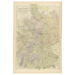
Original Antique Map of The Austrian Empire, 1882
About the Item
Step into the past with an original Antique Map of The Austrian Empire from the esteemed 'Comprehensive Atlas and Geography of the World,' meticulously crafted in 1882. This intricate map beautifully delineates the Austrian Empire's territories, showcasing its political boundaries, cities, rivers, and diverse landscapes with unparalleled detail.
More than a map, it's a doorway to a captivating historical era. Bursting with vibrant colors and intricate engravings, this piece brings the 19th-century world to life on your wall, offering a glimpse into the rich history and cultural tapestry of the Austrian Empire.
Ideal for history enthusiasts, collectors, or admirers of antique craftsmanship, this map serves as both an exquisite display and a testament to cartographic mastery. It embodies an era of exploration and scholarly dedication, preserving a snapshot of the Austrian Empire's grandeur.
Beyond its cartographic significance, it's a time-traveling artifact yearning to grace your home or office walls. Acquire this antique map today and let its historical charm captivate your space, inviting you on an immersive journey through the storied landscapes of the majestic Austrian Empire.
- Dimensions:Height: 14.97 in (38 cm)Width: 22.45 in (57 cm)Depth: 0 in (0.02 mm)
- Materials and Techniques:
- Period:
- Date of Manufacture:1882
- Condition:Good condition, folding line in the middle. The outer borders are slightly yellowish discolored due to age, but not the image. This map is ideal for framing. Study the image carefully.
- Seller Location:Langweer, NL
- Reference Number:
About the Seller
5.0
Platinum Seller
These expertly vetted sellers are 1stDibs' most experienced sellers and are rated highest by our customers.
Established in 2009
1stDibs seller since 2017
1,929 sales on 1stDibs
Typical response time: <1 hour
- ShippingRetrieving quote...Ships From: Langweer, Netherlands
- Return PolicyA return for this item may be initiated within 14 days of delivery.
More From This SellerView All
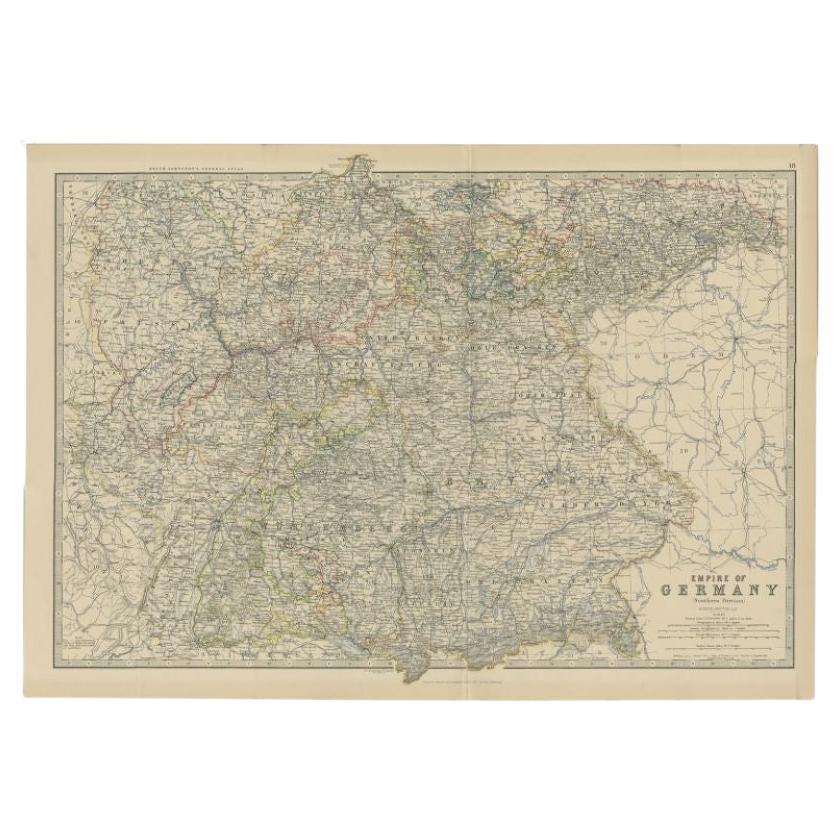
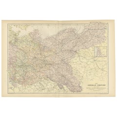
- Antique Map of the German Empire by Johnston, 1882By Alexander Keith JohnstonLocated in Langweer, NLAntique map titled 'Empire of Germany'. Old map of the German Empire with an inset map of Berlin and Potsdam. This map originates from 'The Royal Atlas o...Category
Antique 19th Century Maps
MaterialsPaper
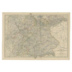
- Antique Map of The German Empire (West Sheet), 1882Located in Langweer, NLTransport yourself to the heart of history with an original Antique Map of The German Empire (west sheet) from 'The Comprehensive Atlas and Geography of the World,' meticulously craf...Category
Antique 1880s Maps
MaterialsPaper
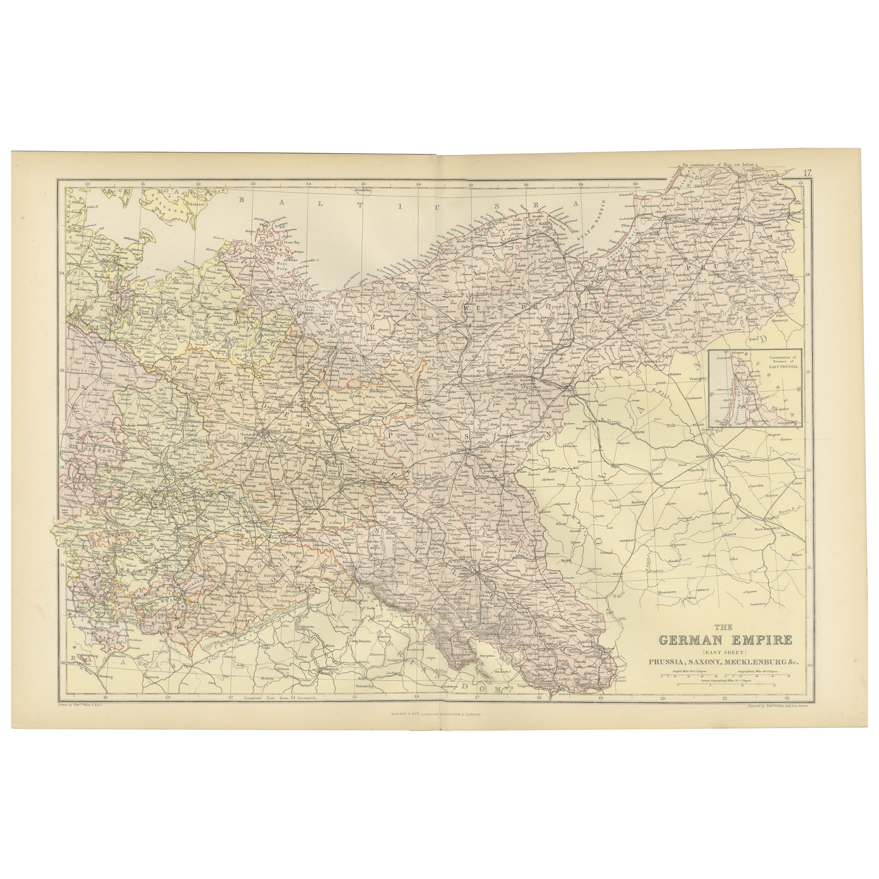
- Antique Map of The German Empire (East Sheet), 1882Located in Langweer, NLStep into history with an authentic Antique Map of The German Empire (East Sheet) from the esteemed 'Comprehensive Atlas and Geography of the World,' meticulously crafted in 1882. Th...Category
Antique 1880s Maps
MaterialsPaper
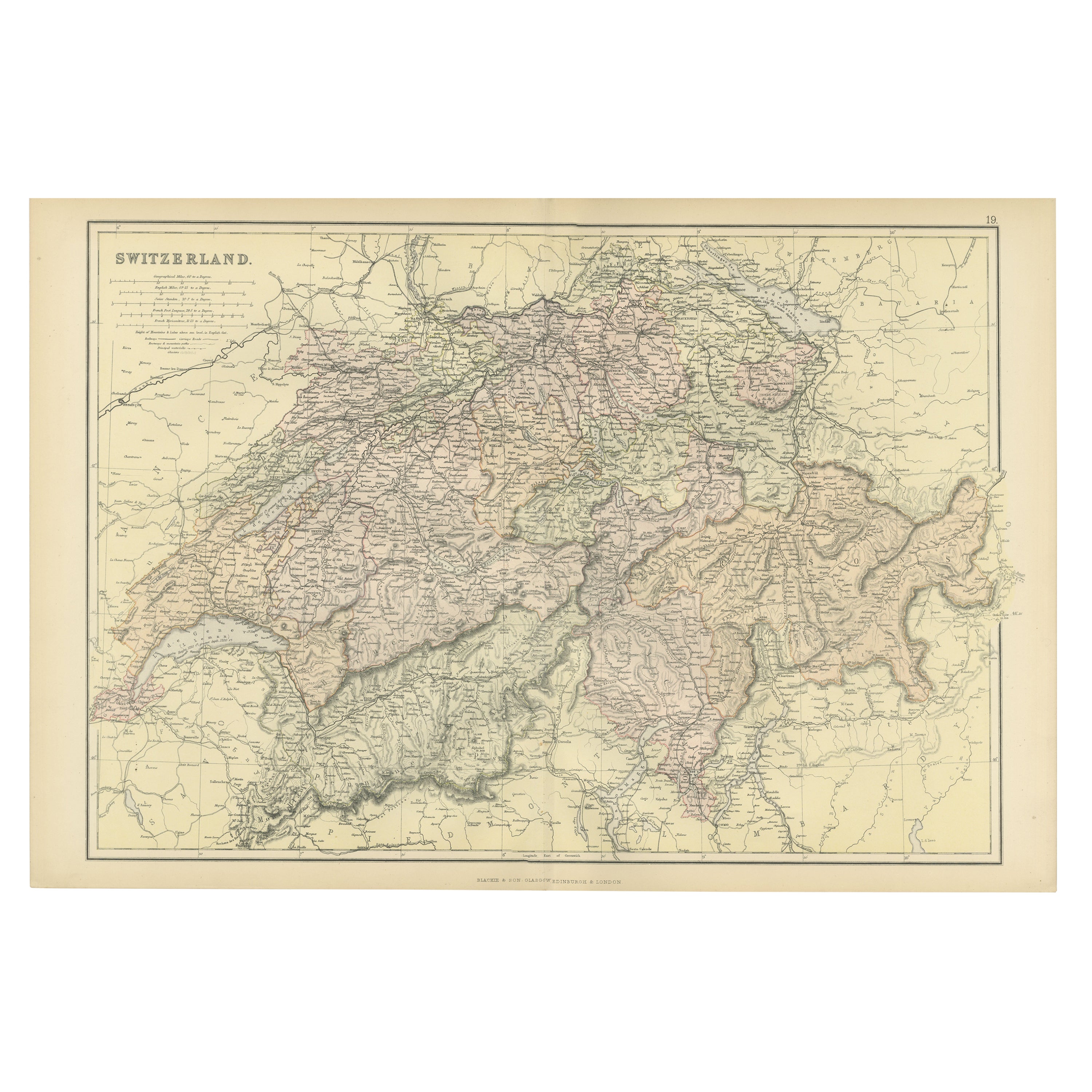
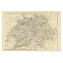
- Original Antique Map of Switzerland, 1882Located in Langweer, NLEmbark on a historical journey with an original Antique Map of Switzerland from the renowned 'Comprehensive Atlas and Geography of the World...Category
Antique 1880s Maps
MaterialsPaper
- Antique Map of the 'Southern' German Empire by Johnston, 1882Located in Langweer, NLAntique map titled 'Empire of Germany'. Old map of the southern portion of the German Empire. This map originates from 'The Royal Atlas of Modern Geography, Exhibiting, in a Series o...Category
Antique 19th Century Maps
MaterialsPaper
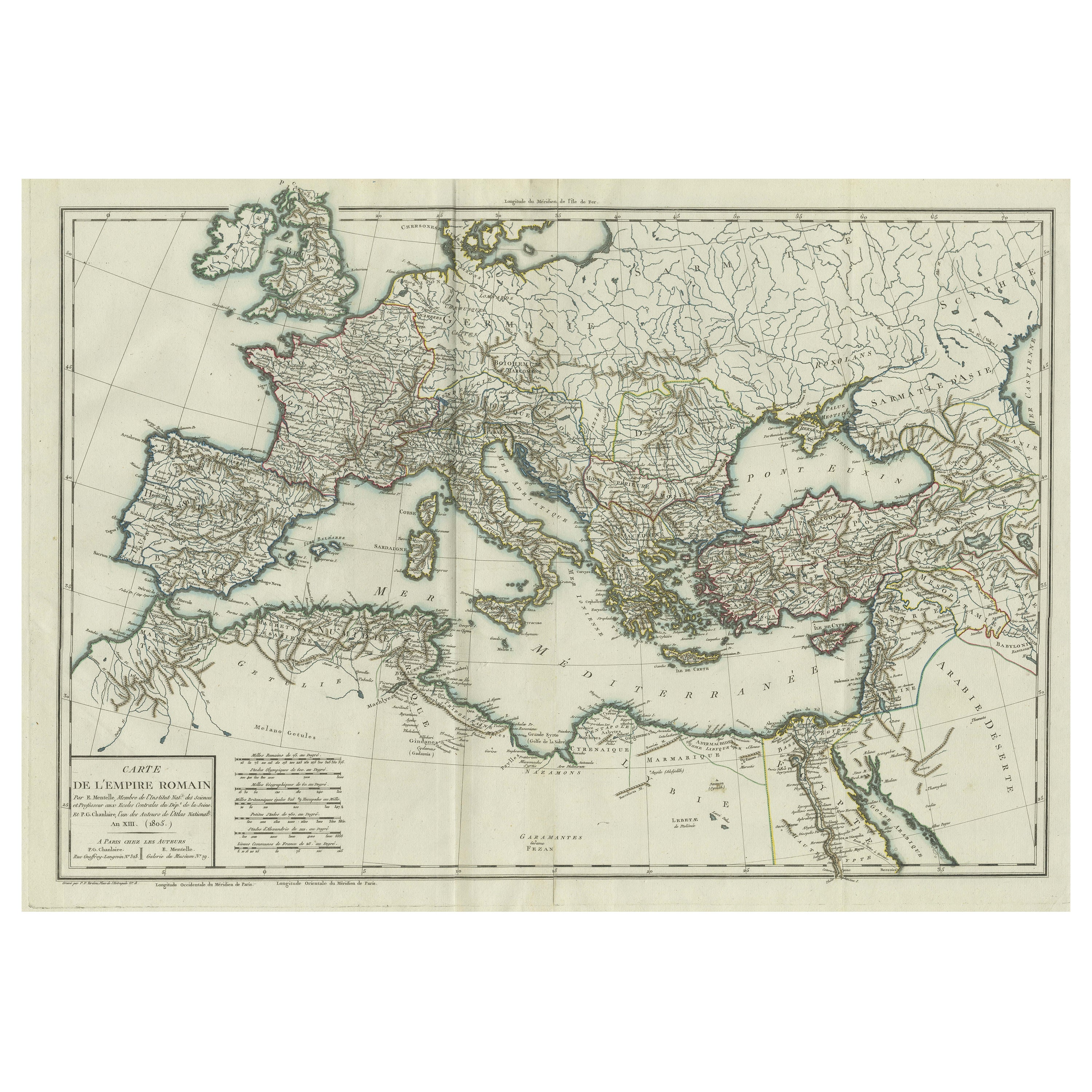
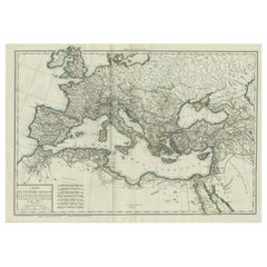
- Original Antique Map of the Roman EmpireLocated in Langweer, NLAntique map titled 'Carte de l'Empire Romain'. Original antique map of the Roman Empire, two sheets joined. Engraved by Pierre Francois Tardieu and published by Edme Mentelle, circa ...Category
Antique Late 18th Century Maps
MaterialsPaper

You May Also Like
- Vintage World Map Mirror Based on the Original by Johnson 1882 Military CampaignLocated in GBWe are delighted to offer for sale this lovely Antique style pictorial plan map of the globe based on the original by Johnson in 1882 This is a very interesting and decorative pie...Category
20th Century English Campaign Maps
MaterialsMirror
- Large Original Antique Map of The World, Fullarton, C.1870Located in St Annes, LancashireGreat map of the World. Showing both hemispheres From the celebrated Royal Illustrated Atlas Lithograph. Original color. Published by Fullarton, Edinburgh, C.1870 Unframed. Rep...Category
Antique 1870s Scottish Maps
MaterialsPaper
- Original Antique Map of the American State of Washington, 1889Located in St Annes, LancashireGreat map of Washington Drawn and Engraved by W. & A.K. Johnston Published By A & C Black, Edinburgh. Original colour Unframed.Category
Antique 1880s Scottish Victorian Maps
MaterialsPaper
- Original Antique Map of the American State of Nevada, 1889Located in St Annes, LancashireGreat map of Nevada Drawn and Engraved by W. & A.K. Johnston Published By A & C Black, Edinburgh. Original colour Unframed.Category
Antique 1880s Scottish Victorian Maps
MaterialsPaper
- Original Antique Map of the American State of Oregon, 1889Located in St Annes, LancashireGreat map of Oregon Drawn and Engraved by W. & A.K. Johnston Published By A & C Black, Edinburgh. Original colour Unframed.Category
Antique 1880s Scottish Victorian Maps
MaterialsPaper
- Original Antique Map of the American State of Pennsylvania, 1889Located in St Annes, LancashireGreat map of Pennsylvania Drawn and Engraved by W. & A.K. Johnston Published By A & C Black, Edinburgh. Original colour Unframed. Repair to a minor tear on bottom edge.Category
Antique 1880s Scottish Victorian Maps
MaterialsPaper


Recently Viewed
View AllMore Ways To Browse
Map Of Mississippi
Von Allen
Antique Map Of North And East Asia 1751
Carl Probst
Levasseur A
Mid Century Maps
Atlas School Supply On Sale
Charente Map
F Colton
Ithaca Antique Map
Port Antonio Map
Rand McNally & Co. On Sale
Rand Mcnally Map Of Colorado
Asian Bassett
Wyld Globes
Antique Map Bremen
Antique Wisconsin Maps
Queensland Maps