Items Similar to Antique Map of The German Empire (East Sheet), 1882


Want more images or videos?
Request additional images or videos from the seller
1 of 6
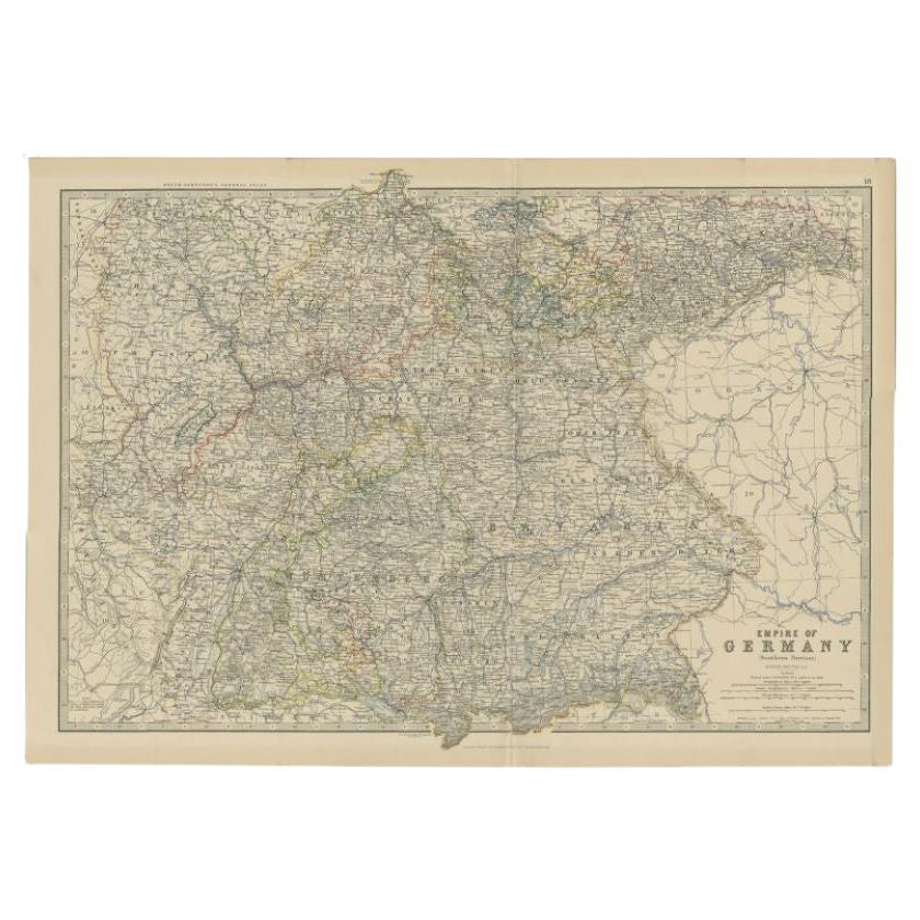
Antique Map of The German Empire (East Sheet), 1882
About the Item
Step into history with an authentic Antique Map of The German Empire (East Sheet) from the esteemed 'Comprehensive Atlas and Geography of the World,' meticulously crafted in 1882. This exquisite map intricately details the realms of Prussia, Saxony, Mecklenburg, and more, capturing the essence of a historic era through its delineated boundaries, cities, rivers, and landscapes.
More than a map, it's a portal to a compelling past. Adorned with vibrant hues and detailed engravings, this piece animates the 19th-century world on your wall, offering a glimpse into the cultural tapestry and historical significance of the German Empire's eastern territories.
Ideal for history aficionados, collectors, or those enchanted by antique artistry, this map is a conversation starter that adds refinement to any setting. It embodies a cartographic marvel, reflecting an age of exploration and scholarly dedication.
Beyond its cartographic value, it's a conduit to time's embrace, yearning to grace your home or office walls. Bring home this antique map today, and let its historical charm enchant your space, inviting you to traverse a captivating journey through the captivating landscapes of the German Empire's eastern expanse.
- Dimensions:Height: 14.97 in (38 cm)Width: 22.45 in (57 cm)Depth: 0 in (0.02 mm)
- Materials and Techniques:
- Period:
- Date of Manufacture:1882
- Condition:Good condition, folding line in the middle. The outer borders are slightly yellowish discolored due to age, but not the image. This map is ideal for framing. Study the image carefully.
- Seller Location:Langweer, NL
- Reference Number:
About the Seller
5.0
Platinum Seller
These expertly vetted sellers are 1stDibs' most experienced sellers and are rated highest by our customers.
Established in 2009
1stDibs seller since 2017
1,932 sales on 1stDibs
Typical response time: <1 hour
- ShippingRetrieving quote...Ships From: Langweer, Netherlands
- Return PolicyA return for this item may be initiated within 14 days of delivery.
More From This SellerView All
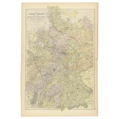
- Antique Map of The German Empire (West Sheet), 1882Located in Langweer, NLTransport yourself to the heart of history with an original Antique Map of The German Empire (west sheet) from 'The Comprehensive Atlas and Geography of the World,' meticulously craf...Category
Antique 1880s Maps
MaterialsPaper
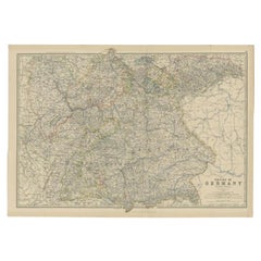
- Antique Map of the German Empire by Johnston, 1882By Alexander Keith JohnstonLocated in Langweer, NLAntique map titled 'Empire of Germany'. Old map of the German Empire with an inset map of Berlin and Potsdam. This map originates from 'The Royal Atlas o...Category
Antique 19th Century Maps
MaterialsPaper
- Antique Map of the 'Southern' German Empire by Johnston, 1882Located in Langweer, NLAntique map titled 'Empire of Germany'. Old map of the southern portion of the German Empire. This map originates from 'The Royal Atlas of Modern Geography, Exhibiting, in a Series o...Category
Antique 19th Century Maps
MaterialsPaper
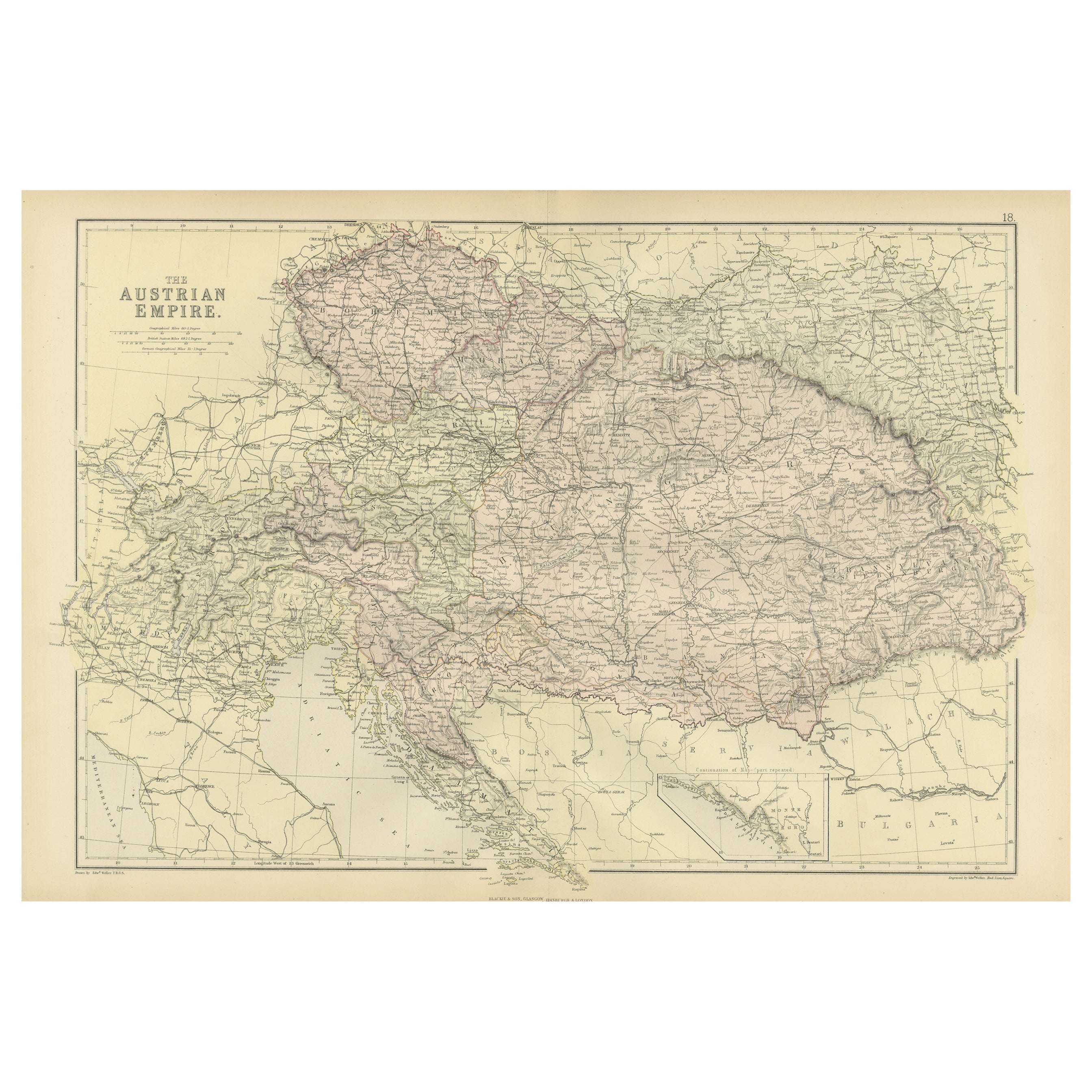
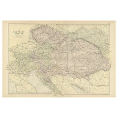
- Original Antique Map of The Austrian Empire, 1882Located in Langweer, NLStep into the past with an original Antique Map of The Austrian Empire from the esteemed 'Comprehensive Atlas and Geography of the World,' meticulously crafted in 1882. This intricat...Category
Antique 1880s Maps
MaterialsPaper
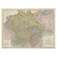
- Large Antique Map of the German EmpireLocated in Langweer, NLAntique map titled 'A Map of Germany (..)'. Large antique map of the German Empire, highly detailed. Engraved by T. Kitchin. Published J. Blair, cir...Category
Antique Late 18th Century Maps
MaterialsPaper
- Antique Map of the European Continent, 1882Located in Langweer, NLAntique map titled 'Europe'. Old map of the European continent. This map originates from 'The Royal Atlas of Modern Geography, Exhibiting, in a Series of Entirely Original and Authen...Category
Antique 19th Century Maps
MaterialsPaper


You May Also Like
- East German MapBy VEB Hermann HaackLocated in Baltimore, MDA brilliantly colourful map of the Leipzig, Karl Marx Stadt and Dresden area in the former German Democratic Republic by VEB Hermann Haack of Gotha.Category
Vintage 1970s German Maps
- Original Antique Map of South East Asia, Arrowsmith, 1820Located in St Annes, LancashireGreat map of South East Asia Drawn under the direction of Arrowsmith Copper-plate engraving Published by Longman, Hurst, Rees, Orme and Brown, 1820 Unframed.Category
Antique 1820s English Maps
MaterialsPaper
- Super Rare Antique French Map of Chine and the Chinese Empire, 1780Located in Amsterdam, Noord HollandSuper Rare Antique French Map of Chine and the Chinese Empire, 1780 Very nice map of Asia. 1780 Made by Bonne. Additional information: Type: Map ...Category
Antique 18th Century European Maps
MaterialsPaper
- Original Antique Map of South East Asia by Thomas Clerk, 1817Located in St Annes, LancashireGreat map of South East Asia Copper-plate engraving Drawn and engraved by Thomas Clerk, Edinburgh. Published by Mackenzie And Dent, 1817 Unframed.Category
Antique 1810s English Maps
MaterialsPaper
- Original Antique Map of South East Asia by Becker, circa 1840Located in St Annes, LancashireGreat map of South East Asia Steel engraving with original color outline Engraved by Becker Published by Virtue, circa 1840. Unframed.Category
Antique 1840s English Other Maps
MaterialsPaper
- Original Antique English County Map, East Yorkshire, J & C Walker, 1851Located in St Annes, LancashireGreat map of The East Riding of Yorkshire Original colour By J & C Walker Published by Longman, Rees, Orme, Brown & Co. 1851 Unframed.Category
Antique 1850s English Other Maps
MaterialsPaper


Recently Viewed
View AllMore Ways To Browse
Map Of Mississippi
Von Allen
Antique Map Of North And East Asia 1751
Carl Probst
Levasseur A
Mid Century Maps
Atlas School Supply On Sale
Charente Map
F Colton
Ithaca Antique Map
Port Antonio Map
Rand McNally & Co. On Sale
Rand Mcnally Map Of Colorado
Asian Bassett
Wyld Globes
Antique Map Bremen
Antique Wisconsin Maps
Queensland Maps