Items Similar to Antique Map of The German Empire (West Sheet), 1882


Want more images or videos?
Request additional images or videos from the seller
1 of 6
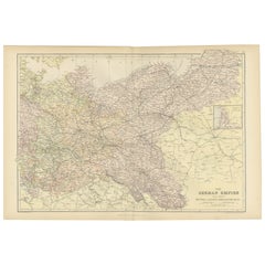
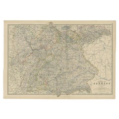
Antique Map of The German Empire (West Sheet), 1882
About the Item
Transport yourself to the heart of history with an original Antique Map of The German Empire (west sheet) from 'The Comprehensive Atlas and Geography of the World,' meticulously crafted in 1882. This stunningly detailed map paints a vivid picture of the German political landscape, adorned with boundaries, cities, rivers, and mountain ranges—a snapshot of a bygone era preserved in vibrant colors and intricate engravings. It includes Rhenish Prussia, Schleswig-Holstein, Mecklenburg, Alsace-Lorraine, Baden, Würtemburg, Bavaria & c.
This isn't just a map; it's a gateway to a captivating past. Its presence on your wall breathes life into the 19th-century world, inviting exploration into the rich tapestry of German history and diverse cultures through its unique descriptions.
Perfect for history enthusiasts, collectors, or those drawn to antique craftsmanship, this map is a conversation piece that exudes sophistication in any space. It encapsulates a cartographic masterpiece reflecting an era of discovery and scholarly dedication.
More than a mere map, it's a time-traveling companion eager to grace your home or office walls. Take home this antique map today and let its historical allure captivate you daily, inviting you on an immersive journey through time.
- Dimensions:Height: 22.45 in (57 cm)Width: 14.97 in (38 cm)Depth: 0 in (0.02 mm)
- Materials and Techniques:
- Period:
- Date of Manufacture:1882
- Condition:Good condition, folding line in the middle. The outer borders are slightly yellowish discolored due to age, but not the image. This map is ideal for framing. Study the image carefully.
- Seller Location:Langweer, NL
- Reference Number:
About the Seller
5.0
Platinum Seller
These expertly vetted sellers are 1stDibs' most experienced sellers and are rated highest by our customers.
Established in 2009
1stDibs seller since 2017
1,932 sales on 1stDibs
Typical response time: <1 hour
- ShippingRetrieving quote...Ships From: Langweer, Netherlands
- Return PolicyA return for this item may be initiated within 14 days of delivery.
More From This SellerView All
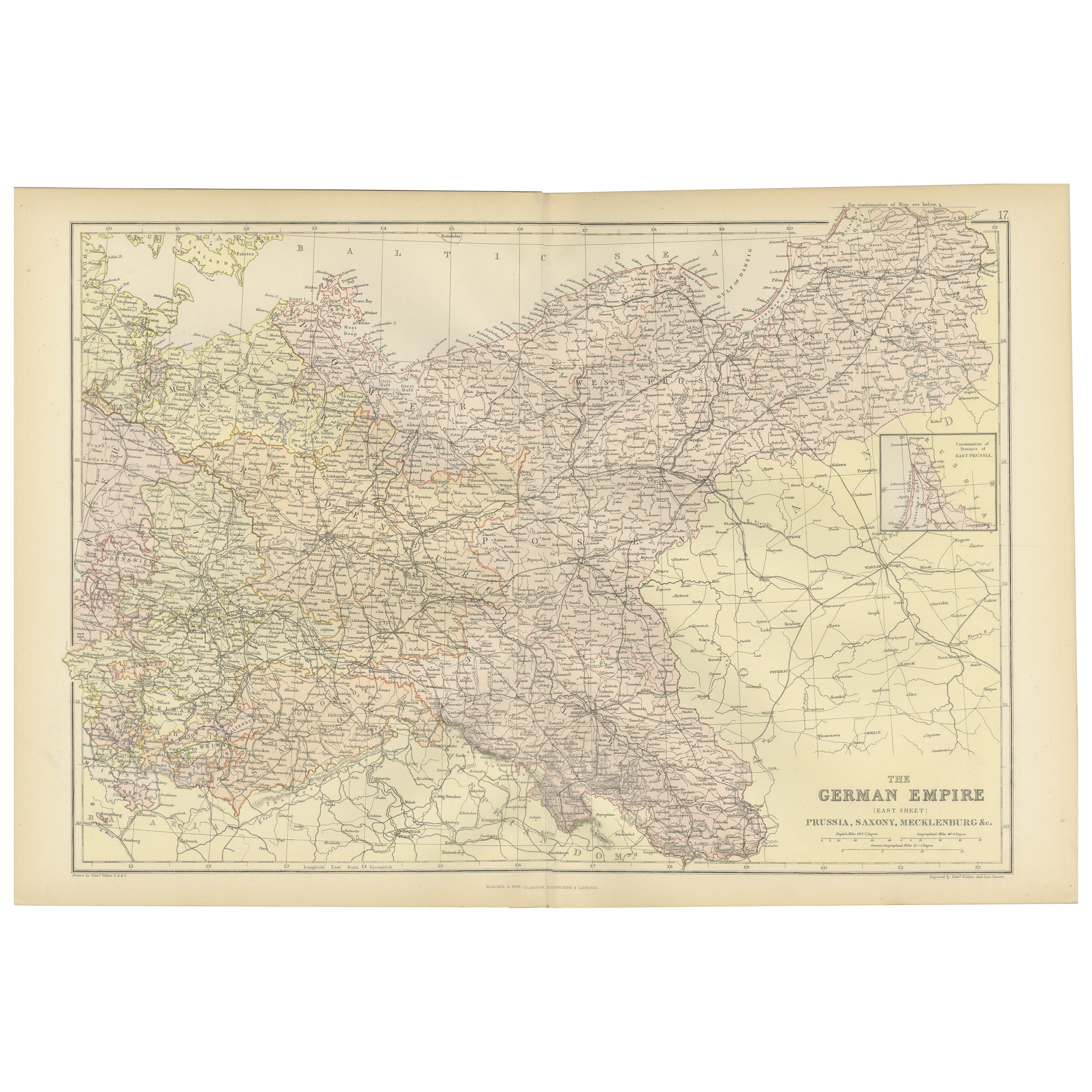
- Antique Map of The German Empire (East Sheet), 1882Located in Langweer, NLStep into history with an authentic Antique Map of The German Empire (East Sheet) from the esteemed 'Comprehensive Atlas and Geography of the World,' meticulously crafted in 1882. Th...Category
Antique 1880s Maps
MaterialsPaper
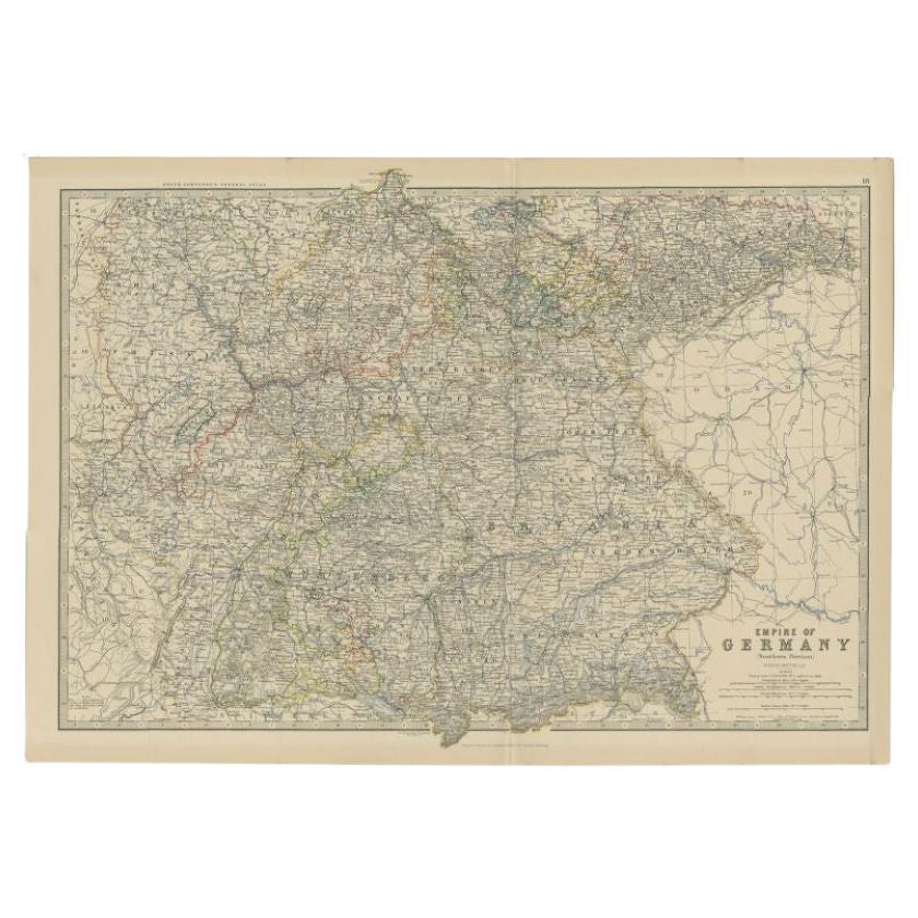
- Antique Map of the German Empire by Johnston, 1882By Alexander Keith JohnstonLocated in Langweer, NLAntique map titled 'Empire of Germany'. Old map of the German Empire with an inset map of Berlin and Potsdam. This map originates from 'The Royal Atlas o...Category
Antique 19th Century Maps
MaterialsPaper
- Antique Map of the 'Southern' German Empire by Johnston, 1882Located in Langweer, NLAntique map titled 'Empire of Germany'. Old map of the southern portion of the German Empire. This map originates from 'The Royal Atlas of Modern Geography, Exhibiting, in a Series o...Category
Antique 19th Century Maps
MaterialsPaper
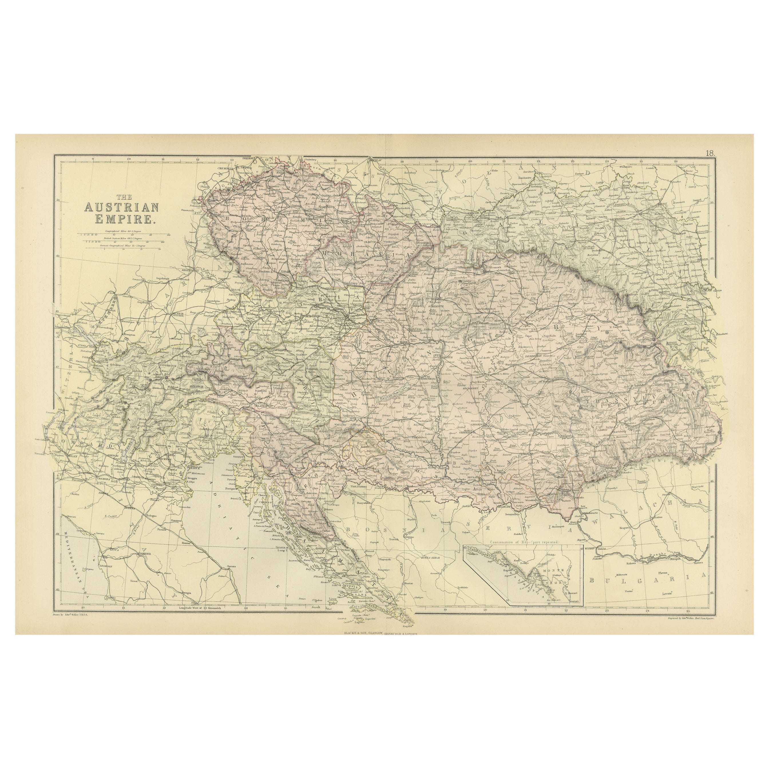
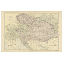
- Original Antique Map of The Austrian Empire, 1882Located in Langweer, NLStep into the past with an original Antique Map of The Austrian Empire from the esteemed 'Comprehensive Atlas and Geography of the World,' meticulously crafted in 1882. This intricat...Category
Antique 1880s Maps
MaterialsPaper
- Antique Map of Central America and the West Indies, 1882Located in Langweer, NLAntique map titled 'West India Islands and Central America'. Old map of Central America and the West Indies. This map originates from 'The Royal Atlas of Modern Geography, Exhibiting...Category
Antique 19th Century Maps
MaterialsPaper
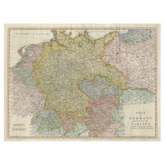
- Large Antique Map of the German EmpireLocated in Langweer, NLAntique map titled 'A Map of Germany (..)'. Large antique map of the German Empire, highly detailed. Engraved by T. Kitchin. Published J. Blair, cir...Category
Antique Late 18th Century Maps
MaterialsPaper


You May Also Like
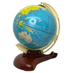
- Vintage Bakelite, Sheet Metal / Tin Globe from the 1950s, West GermanyLocated in Nuernberg, DEVintage Globe from the 1950s. Specially made on the subject of aviation. Depicted with all kinds of flying lines. Made by the company M.S. Germany. The globe is made of Tin and the stand is Bakelite. Globe and stand...Category
Vintage 1950s German Mid-Century Modern Globes
MaterialsMetal
- Germany West of the Rhine: A Hand-colored 18th Century Map by de WitBy Frederick de WitLocated in Alamo, CAThis original 18th century hand-colored map of the county of Moers, Germany entitled "Illustrissimo Celsissmo Principi GUILIELMO HENRICO D.G. Arausionum Principi Domino suo Clementis...Category
Antique Early 18th Century Dutch Maps
MaterialsPaper
- Large Original Antique Map of The West Indies by Sidney Hall, 1847Located in St Annes, LancashireGreat map of The West Indies Drawn and engraved by Sidney Hall Steel engraving Original colour outline Published by A & C Black. 1847 Unframed Free shipping.Category
Antique 1840s Scottish Maps
MaterialsPaper
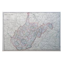
- Large Original Antique Map of West Virginia, USA, C.1900Located in St Annes, LancashireFabulous map of West Virginia Original color Engraved and printed by the George F. Cram Company, Indianapolis. Published, C.1900 Unframed Free shipping.Category
Antique 1890s American Maps
MaterialsPaper
- Gold Leaf Foil Pictorial Plan Map of the West Country of England Antique StyleLocated in GBWe are delighted to offer for sale this lovely Antique style pictorial plan map of the West Country of England etched in gold leaf foil This is a very interesting and decorative p...Category
20th Century English Adam Style Maps
MaterialsGold Leaf
- Super Rare Antique French Map of Chine and the Chinese Empire, 1780Located in Amsterdam, Noord HollandSuper Rare Antique French Map of Chine and the Chinese Empire, 1780 Very nice map of Asia. 1780 Made by Bonne. Additional information: Type: Map ...Category
Antique 18th Century European Maps
MaterialsPaper


Recently Viewed
View AllMore Ways To Browse
Map Of Mississippi
Von Allen
Antique Map Of North And East Asia 1751
Carl Probst
Levasseur A
Mid Century Maps
Atlas School Supply On Sale
Charente Map
F Colton
Ithaca Antique Map
Port Antonio Map
Rand McNally & Co. On Sale
Rand Mcnally Map Of Colorado
Asian Bassett
Wyld Globes
Antique Map Bremen
Antique Wisconsin Maps
Queensland Maps