Items Similar to Antique Map of the German Empire by Johnston, 1882


Want more images or videos?
Request additional images or videos from the seller
1 of 5
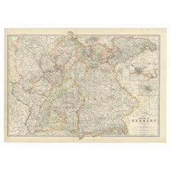
Antique Map of the German Empire by Johnston, 1882
About the Item
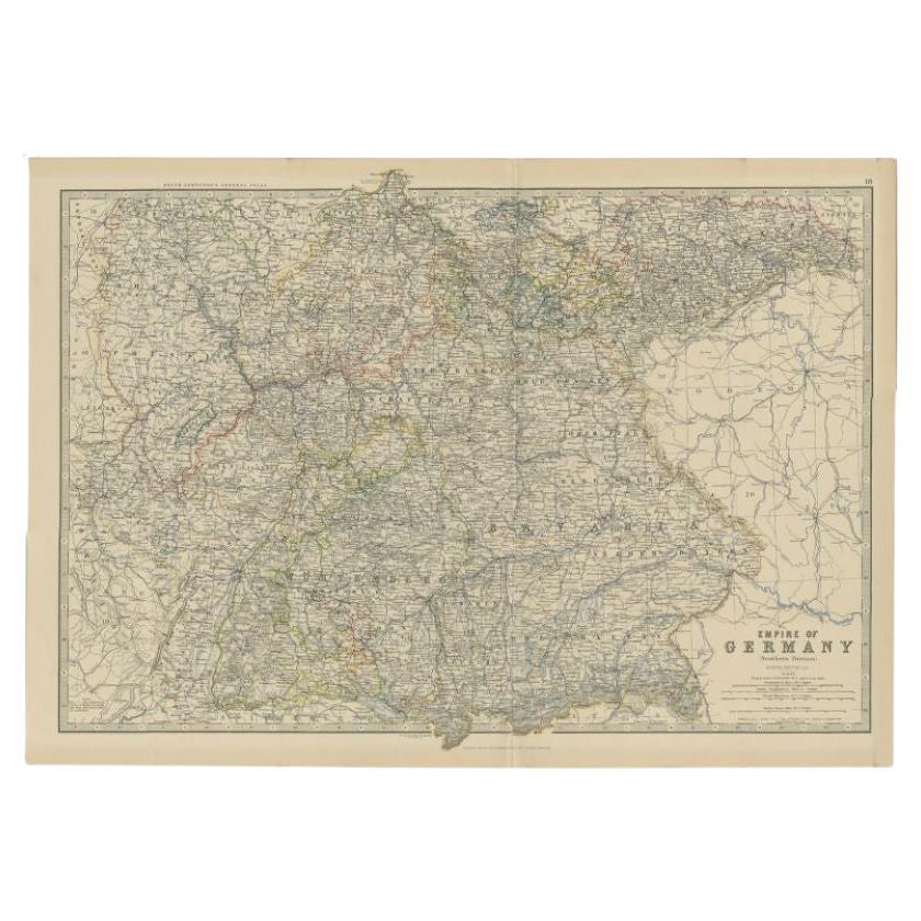
Antique map titled 'Empire of Germany'. Old map of the German Empire with an inset map of Berlin and Potsdam. This map originates from 'The Royal Atlas of Modern Geography, Exhibiting, in a Series of Entirely Original and Authentic Maps, the Present Condition of Geographical Discovery and Research in the Several Countries, Empires, and States of the World' by A.K. Johnston. Published by W. and A.K. Johnston, 1882.
Artists and Engravers: Alexander Keith Johnston LLD (1804-1871) was a Scottish geographer. He was a pupil of the Edinburgh engraver and mapmaker, James Kirkwood. In 1826, he joined his brother William (who would become Sir William Johnston, Lord Provost of Edinburgh) in a printing and engraving business, forming the well-known cartographical firm of W. and A. K. Johnston.
Condition: Fair, general age-related toning. Large split on center fold, please study image carefully.
Date: 1882
Overall size: 61.5 x 49.6 cm.
Image size: 57.2 x 44.2 cm.
We sell original antique maps to collectors, historians, educators and interior decorators all over the world. Our collection includes a wide range of authentic antique maps from the 16th to the 20th centuries. Buying and collecting antique maps is a tradition that goes back hundreds of years. Antique maps have proved a richly rewarding investment over the past decade, thanks to a growing appreciation of their unique historical appeal. Today the decorative qualities of antique maps are widely recognized by interior designers who appreciate their beauty and design flexibility. Depending on the individual map, presentation, and context, a rare or antique map can be modern, traditional, abstract, figurative, serious or whimsical. We offer a wide range of authentic antique maps for any budget.
- Creator:Alexander Keith Johnston (Artist)
- Dimensions:Height: 19.53 in (49.6 cm)Width: 24.22 in (61.5 cm)Depth: 0 in (0.01 mm)
- Materials and Techniques:
- Period:
- Date of Manufacture:1882
- Condition:Condition: Fair, general age-related toning. Large split on center fold, please study image carefully.
- Seller Location:Langweer, NL
- Reference Number:
About the Seller
5.0
Platinum Seller
These expertly vetted sellers are 1stDibs' most experienced sellers and are rated highest by our customers.
Established in 2009
1stDibs seller since 2017
1,933 sales on 1stDibs
Typical response time: <1 hour
- ShippingRetrieving quote...Ships From: Langweer, Netherlands
- Return PolicyA return for this item may be initiated within 14 days of delivery.
More From This SellerView All
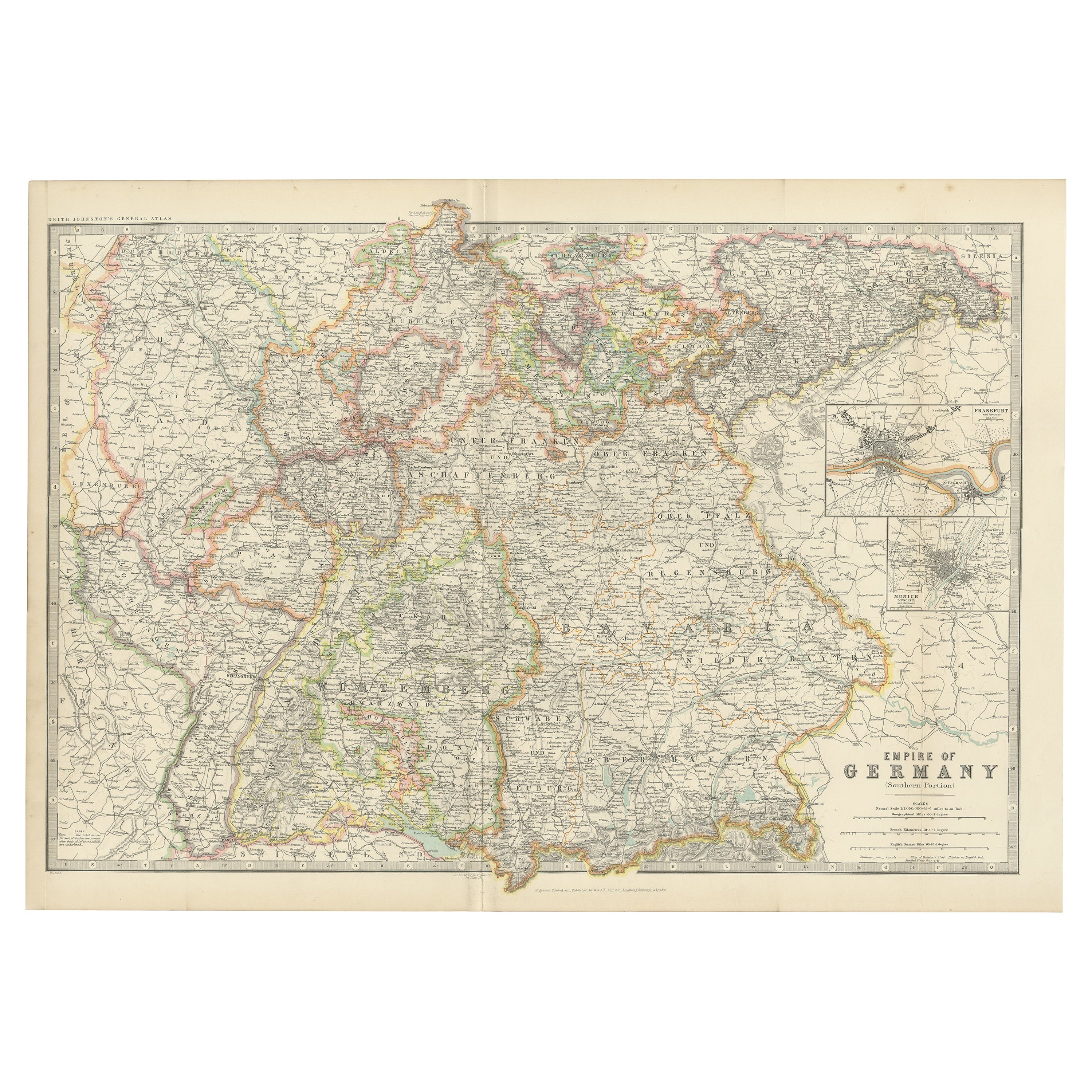
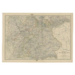
- Antique Map of the 'Southern' German Empire by Johnston, 1882Located in Langweer, NLAntique map titled 'Empire of Germany'. Old map of the southern portion of the German Empire. This map originates from 'The Royal Atlas of Modern Geography, Exhibiting, in a Series o...Category
Antique 19th Century Maps
MaterialsPaper
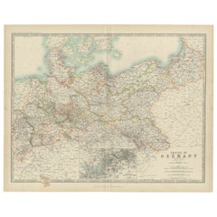
- Antique Map of the German Empire by Johnston, '1909'Located in Langweer, NLAntique map titled 'Empire of Germany'. Original antique map of the German Empire. With inset maps of Berlin and Potsdam. This map originates from the ‘R...Category
Early 20th Century Maps
MaterialsPaper
- Antique Map of North America by Johnston, 1882By Alexander Keith JohnstonLocated in Langweer, NLAntique map titled 'North America'. Old map of North America. This map originates from 'The Royal Atlas of Modern Geography, Exhibiting, in a Series of Entirely Original and Authen...Category
Antique 19th Century Maps
MaterialsPaper
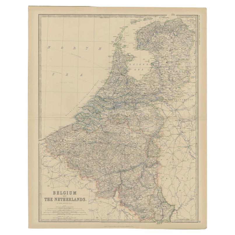
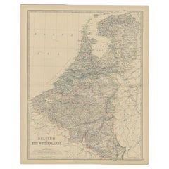
- Antique Map of Belgium and the Netherlands by Johnston, 1882By Alexander Keith JohnstonLocated in Langweer, NLAntique map titled 'Belgium and the Netherlands'. Old map of Belgium and the Netherlands. This map originates from 'The Royal Atlas of Modern Geography, Exhibiting, in a Series of En...Category
Antique 19th Century Maps
MaterialsPaper
- Antique Map of Germany by Johnston '1909'Located in Langweer, NLAntique map titled 'Empire of Germany'. Original antique map of Germany. With inset maps of Frankfurt and Munich. This map originates from the ‘...Category
Early 20th Century Maps
MaterialsPaper
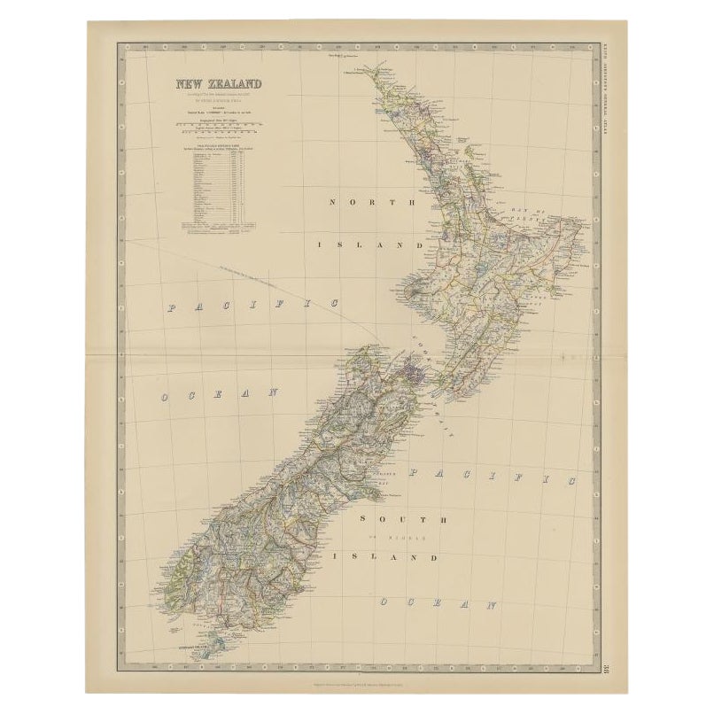
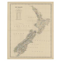
- Antique Map of New Zealand by Scottish Geographer Johnston, 1882Located in Langweer, NLAntique map titled 'New Zealand'. Old map of New Zealand. This map originates from 'The Royal Atlas of Modern Geography, Exhibiting, in a Series of Entirely Original and Authentic ...Category
Antique 19th Century Maps
MaterialsPaper

You May Also Like
- Original Antique Map of The World by Thomas Clerk, 1817Located in St Annes, LancashireGreat map of The Eastern and Western Hemispheres On 2 sheets Copper-plate engraving Drawn and engraved by Thomas Clerk, Edinburgh. Published by Mackenzie And Dent, 1817 ...Category
Antique 1810s English Maps
MaterialsPaper
- Original Antique Map of The Netherlands, Engraved by Barlow, Dated 1807Located in St Annes, LancashireGreat map of Netherlands Copper-plate engraving by Barlow Published by Brightly & Kinnersly, Bungay, Suffolk. Dated 1807 Unframed.Category
Antique Early 1800s English Maps
MaterialsPaper
- Germany West of the Rhine: A Hand-colored 18th Century Map by de WitBy Frederick de WitLocated in Alamo, CAThis original 18th century hand-colored map of the county of Moers, Germany entitled "Illustrissimo Celsissmo Principi GUILIELMO HENRICO D.G. Arausionum Principi Domino suo Clementis...Category
Antique Early 18th Century Dutch Maps
MaterialsPaper
- Map of the Republic of GenoaLocated in New York, NYFramed antique hand-coloured map of the Republic of Genoa including the duchies of Mantua, Modena, and Parma. Europe, late 18th century. Dimension: 25...Category
Antique Late 18th Century European Maps
- Antique Map of Italy by Andriveau-Goujon, 1843By Andriveau-GoujonLocated in New York, NYAntique Map of Italy by Andriveau-Goujon, 1843. Map of Italy in two parts by Andriveau-Goujon for the Library of Prince Carini at Palazzo Carini i...Category
Antique 1840s French Maps
MaterialsLinen, Paper
- Antique Map of Principality of MonacoBy Antonio Vallardi EditoreLocated in Alessandria, PiemonteST/619 - "Old Geographical Atlas of Italy - Topographic map of ex-Principality of Monaco" - ediz Vallardi - Milano - A somewhat special edition ---Category
Antique Late 19th Century Italian Other Prints
MaterialsPaper


Recently Viewed
View AllMore Ways To Browse
For The Empire
German Empire Furniture
German Empire
Alexander Antiques
Engraving Empire
Scottish Lord
Antique Map Edinburgh
Antique Map Of Edinburgh
Antique Map Series
Scottish Fold
Historical Maps Germany
Empire Berlin
Alexander Keiths
James Johnston
Johnston James
Antique Map German Empire
1871 German Empire
Map Berlin