Historical Maps Germany

6
to
40
304
17
206
104
92
89
15
13
13
9
8
8
8
7
7
6
6
5
5
4
4
4
3
3
2
2
1
1
1
1
1
1
1
1
1
1
1
1
1
13
9
4
3
3
Sort By
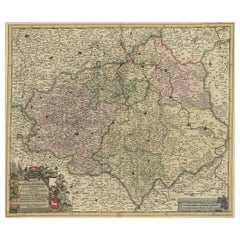
Old Detailed Map of the Historical Regions of the Duchy of Saxony, Germany, 1680
Located in Langweer, NL
et Episcopatus Hallensis.' A handsome and detailed map of the historical regions of the Duchy of
Category

Antique 1680s Maps

Materials

Paper

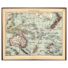
German Antique Map of Oceania, 1895
Located in Langweer, NL
/ map originates from 1885-1907 editions of a famous German encyclopedia: 'Meyers grosses Konversations
Category

Antique 19th Century Maps

Materials

Paper

German Antique Map of Oceania, 1895
H 9.85 in W 12.21 in D 0 in
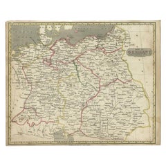
Antique Map of Germany by Walker, 1820
By R. Walker
Located in Langweer, NL
Antique map Germany titled 'Map of Germany as defined by the Peace of Paris'. Detailed antique map
Category

Antique 19th Century Maps

Materials

Paper

Antique Map of Germany by Walker, 1820
H 8.27 in W 10.24 in D 0 in
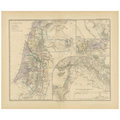
Historical Map of Canaan with Insets of Jerusalem and Surrounding Regions, 1880
Located in Langweer, NL
The map titled "CANAAN" depicts the historical region known as Canaan, located in the Levant, which
Category

Antique 1880s Maps

Materials

Paper

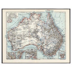
German Antique Map of Australia, Meyers, 1885
Located in Langweer, NL
original old antique print / plate / map originates from 1885-1907 editions of a famous German encyclopedia
Category

Antique 19th Century Maps

Materials

Paper

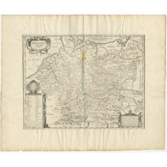
Antique Map of Germany of German in Roman Times, c.1660
Located in Langweer, NL
Antique map Germany titled 'Germaniae Veteris Typus'. Antique map probably by Blaeu or based on an
Category

Antique 17th Century Maps

Materials

Paper

Antique Map of Germany of German in Roman Times, c.1660
No Reserve
H 20.87 in W 25.2 in D 0 in
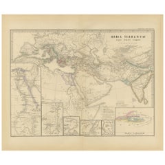
The World in the Assyrian Empire's Era: A Historical Map, Published in 1880
Located in Langweer, NL
historical and archaeological context. 4. **Ancient Cities**: The map probably marks important cities, such
Category

Antique 1880s Maps

Materials

Paper

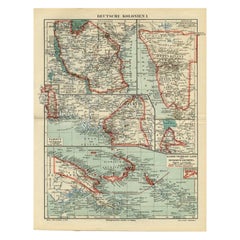
Antique Map of German Colonies by Meyer, 1895
Located in Langweer, NL
Antique map titled 'Deutsche Kolonien.' Lithographed map of the German Colonies. German East-Africa
Category

Antique 19th Century Maps

Materials

Paper

Antique Map of Bavaria with many details, Germany
Located in Langweer, NL
(..)'. Dutch map of Bavaria, showing the many cities, towns, and other features of this historically
Category

Antique Late 17th Century Maps

Materials

Paper

Antique Map of The German Empire (East Sheet), 1882
Located in Langweer, NL
Step into history with an authentic Antique Map of The German Empire (East Sheet) from the esteemed
Category

Antique 1880s Maps

Materials

Paper

Antique Map of the Nassau Region in Western Germany
Located in Langweer, NL
Germany between Koblenz, Hadamar, Giessen, Frankfurt and Mainz. The map is filled with information of
Category

Antique Early 18th Century Maps

Materials

Paper

Antique Map of the Nassau Region in Western Germany
No Reserve
H 20.67 in W 24.1 in D 0.02 in
Antique Map of The German Empire (West Sheet), 1882
Located in Langweer, NL
Transport yourself to the heart of history with an original Antique Map of The German Empire (west
Category

Antique 1880s Maps

Materials

Paper

German Antique Map of the Indian Oceaan, Meyers, 1895
Located in Langweer, NL
growing appreciation of their unique historical appeal. Today the decorative qualities of antique maps are
Category

Antique 19th Century Maps

Materials

Paper

Antique Map of the German Empire by Migeon, 1880
Located in Langweer, NL
Antique map titled 'Empire d'Allemagne'. Old map of Germany. With decorative vignette of Mainz
Category

Antique 19th Century Maps

Materials

Paper

German Antique Map of Australia and Polynesia, c.1870
Located in Langweer, NL
appreciation of their unique historical appeal. Today the decorative qualities of antique maps are widely
Category

Antique 19th Century Maps

Materials

Paper

Antique Map of the German Empire by Johnston, 1882
By Alexander Keith Johnston
Located in Langweer, NL
Antique map titled 'Empire of Germany'. Old map of the German Empire with an inset map of Berlin
Category

Antique 19th Century Maps

Materials

Paper

Antique Map of Germany by French Cartographer Lapie, 1842
Located in Langweer, NL
Antique map titled 'Carte d'Allemagne (..)'. Map of Germany. This map originates from 'Atlas
Category

Antique 19th Century Maps

Materials

Paper

Antique Map of Germany by T. Kitchin, circa 1780
Located in Langweer, NL
Attractive map with decorative cartouche from "A New Geographical, Historical, and Commercial
Category

Antique Late 18th Century Maps

Materials

Paper

Old German Antique Map of Iran and Arabia, 1866
Located in Langweer, NL
Antique map titled 'Vorder-Asien oder Iran, Turan, Arabien, Kleinasien und die Kaukasus Länder
Category

Antique 19th Century Maps

Materials

Paper

German Antique Map of Australia and New Zealand, 1857
Located in Langweer, NL
growing appreciation of their unique historical appeal. Today the decorative qualities of antique maps are
Category

Antique 19th Century Maps

Materials

Paper

Antique Map of the German Empire by Le Rouge, 1743
Located in Langweer, NL
Antique map Germany titled 'L'Empire d'Allemagne dedie a Monseigneur Amelot (..)'. Antique map of
Category

Antique 18th Century Maps

Materials

Paper

French Antique Miniature Map of Germany and Surrounding Countries, 1721
Located in Langweer, NL
Antique map Germany titled 'Allemagne Par N. Sanson le Fils Geographe du Roy'. Minitaure map of
Category

Antique 18th Century Maps

Materials

Paper

Rare Antique Map of Germany with English Text, c.1690
Located in Langweer, NL
Antique map Germany titled 'Germani by Robt. Morden'. Rare antique map of Germany. Originates from
Category

Antique 17th Century Maps

Materials

Paper

Antique Map of the Region of Zeitz in Germany, 1749
By Schreiber
Located in Langweer, NL
Antique map titled 'Das Stifft Zeitz (..)'. Map of the region of Zeitz, Germany. Zeitz is a town in
Category

Antique 18th Century Maps

Materials

Paper

Antique Map of the Region of Gommern in Germany, 1749
By Schreiber
Located in Langweer, NL
, Germany. This map originates from 'Atlas Selectus von allen Konigreichen und Landern der Welt' by Johann
Category

Antique 18th Century Maps

Materials

Paper

German Antique Map of China And Japan by Meyer, 1902
Located in Langweer, NL
antique print / plate / map originates from the 6th edition of a famous German encyclopedia: 'Meyers
Category

20th Century Maps

Materials

Paper

Antique Map of the German Empire by De Leth, 1749
Located in Langweer, NL
Antique map Germany titled 'L'Empire d'Allemagne divisé en ses dix cercles et Autres Estats
Category

Antique 18th Century Maps

Materials

Paper

Set of 4 Antique Geographical Maps French-German War 1870-71
Located in Casale Monferrato, IT
armies in the Franco-German War 1870-71. Author: Historical Section of the Great General Staff. Publisher
Category

Antique 1890s Italian Maps

Materials

Paper

Antique Map of Germany from an Old English Atlas, c.1802
Located in Langweer, NL
Antique map titled 'Germany'. Antique map of Germany engraved for 'Atlas to Walker's Geography
Category

Antique 19th Century Maps

Materials

Paper

Antique Map of Upper Saxony in Germany by Tirion, circa 1740
By Isaak Tirion
Located in Langweer, NL
growing appreciation of their unique historical appeal. Today the decorative qualities of antique maps are
Category

Antique 18th Century Maps

Materials

Paper

Antique Map of Germany from a 17th Century Pocket Atlas, 1685
Located in Langweer, NL
Antique map titled 'Nova Totius Germaniae descriptio.' Miniature map of Germany, from the pocket
Category

Antique 17th Century Maps

Materials

Paper

Antique Map of Germany, the Netherlands, Bohemia, Bavaria and Switzerland, 1785
Located in Langweer, NL
Antique map titled 'Germany and the Netherlands from the latest authorities'. Depicts Germany, the
Category

Antique 18th Century Maps

Materials

Paper

Rare Antique Map of the Region of Freyburg in Germany, 1749
By Schreiber
Located in Langweer, NL
Freyburg, Germany. This map originates from 'Atlas Selectus von allen Konigreichen und Landern der Welt' by
Category

Antique 18th Century Maps

Materials

Paper

Antique Map of Asia from a German School Atlas, c.1870
Located in Langweer, NL
Antique map titled 'Asien'. Old map of the Asian continent. This map originates from 'H. Kiepert's
Category

Antique 19th Century Maps

Materials

Paper

Antique Map of Germany in Roman Times, Showing Roman Provinces, 1825
Located in Langweer, NL
'. Old map of Germany and surroundings originating from 'Atlas der Oude Wereld'. Artists and Engravers
Category

Antique 19th Century Maps

Materials

Paper

Antique Map of Germany from an American 19th Century Atlas, 1846
Located in Langweer, NL
Antique map titled 'Germany'. Old map of Germany. This map originates from 'A New Universal Atlas
Category

Antique 19th Century Maps

Materials

Paper

Antique Map of the Hesse Region of Germany by Blaeu, 1665
Located in Langweer, NL
Antique map titled 'Hassia Landgraviatus'. Map of the Hesse Region of Germany. This map originates
Category

Antique 17th Century Maps

Materials

Paper

Antique Map of Bavaria ‘Bayern, Germany’ by N. Visscher, circa 1700
Located in Langweer, NL
regionibus," translates to "Lower Bavaria with the inserted and adjacent regions." It's a historical map that
Category

Antique Early 18th Century Maps

Materials

Paper

1859 Detailed Map of North West Germany with Bavaria Inset - Blackie's Atlas
Located in Langweer, NL
The "Antique Map of North West Germany" with an inset map of Bavaria is a distinguished piece from
Category

Antique Mid-19th Century Maps

Materials

Paper

Antique Map of Germany During the Mid-18th Century, Published in 1747
Located in Langweer, NL
Antique map Germany titled 'A New & Accurate Map of Germany'. It covers Germany during the mid-18th
Category

Antique 18th Century Maps

Materials

Paper

Original Antique Map of the Middle East, Published in Germany, c.1870
Located in Langweer, NL
Antique map titled 'Asia Citerior'. Old map of the Middle East. This map originates from 'Atlas
Category

Antique 19th Century Maps

Materials

Paper

Antique Engraved Map of South East Australia from a German Atlas, 1848
Located in Langweer, NL
appreciation of their unique historical appeal. Today the decorative qualities of antique maps are widely
Category

Antique 19th Century Maps

Materials

Paper

Antique Map of the Asian Continent from a German School Atlas, 1862
Located in Langweer, NL
Antique map titled 'Asien Politische Ubersicht'. Old map of the Asian continent. Originates from
Category

Antique 19th Century Maps

Materials

Paper

Detailed German Map of Australia Including Statistics of 1841, Published in 1854
Located in Langweer, NL
Title: "Detailed Map of Austral Land - 1854" This historic map, titled "Australland," was
Category

Antique 1850s Maps

Materials

Paper

Map of East Frisian Islands & Northwestern Tip of Germany, Ostfriesland, c.1595
Located in Langweer, NL
of historical maps and published it in the "Parergon Theatri" which was bound with the Theatrum from
Category

Antique 16th Century Maps

Materials

Paper

Antique Map of Russia in Asia from An Old German Atlas, 1845
By Meyer
Located in Langweer, NL
Antique map titled 'Asiatisches Russland'. This map depicts Russia in Asia and originates from
Category

Antique 19th Century Maps

Materials

Paper

Antique Map of Friesland, Groningen and German East Friesland by Ortelius, 1603
Located in Langweer, NL
Antique map titled 'Oost end West Vrieslandts beschrijvinghe. Utriusque Frisiorum Regionis Noviss
Category

Antique 17th Century Maps

Materials

Paper

Antique Map of the Waldeck Region of Germany by Homann Heirs, circa 1733
By Homann Heirs
Located in Langweer, NL
Antique map titled 'Waldecciae ac finitimorum Dominiorum (.)'. Map of the Waldeck region of Germany
Category

Antique 18th Century Maps

Materials

Paper

Antique Copper Engraved Map of Germany in the Early 18th Century, c.1740
Located in Langweer, NL
Antique map Germany titled 'Allemagne'. Rare miniature map of Germany and surroundings. Also
Category

Antique 18th Century Maps

Materials

Paper

Antique Map of Germany and Switzerland from an Old Dutch School Atlas, 1852
Located in Langweer, NL
Antique map titled 'Duitschland en Zwitersland'. Map of Germany and Switzerland. This map
Category

Antique 19th Century Maps

Materials

Paper

Antique Map of the Region of Athens from a German Atlas of 1893
Located in Langweer, NL
growing appreciation of their unique historical appeal. Today the decorative qualities of antique maps are
Category

Antique 19th Century Maps

Materials

Paper

Very Detailed Antique Map of the Jesuit Province of Bavaria, Germany, c.1700
Located in Langweer, NL
growing appreciation of their unique historical appeal. Today the decorative qualities of antique maps are
Category

Antique 18th Century Maps

Materials

Paper

Attractive Antique Map showing Denmark and part of Sweden and Germany c.1750
By Isaak Tirion
Located in Langweer, NL
Antique map titled 'Nieuwe Kaart van het Koninkryk van Deenemarken (..).' Attractive detailed map
Category

Antique 18th Century Maps

Materials

Paper

Antique Map of Germany and Switzerland from an Old Dutch School Atlas, c.1873
Located in Langweer, NL
Antique map titled 'Deutschland en Zwitserland'. Old map depicting Germany and Switzerland. This
Category

Antique 19th Century Maps

Materials

Paper

Antique Map Made After a Roman Papyrus Travel Map, Known as Peutinger Map, 1773
Located in Langweer, NL
Old Dutch engraving with title: 'Romeinsche Reis Kaart van K. Peutinger'. Rare antique map based
Category

Antique 18th Century Maps

Materials

Paper

Old German Map of the United States, Central America and the West Indies, c.1870
Located in Langweer, NL
Antique map titled 'Westindien, Mittelamerica und Vereinigte Staten'. Old map of the United States
Category

Antique 19th Century Maps

Materials

Paper

Antique Map of the Rhine and Moselle River Region in Germany and France, c.1680
Located in Langweer, NL
(..).' Detailed map of the Rhine and Moselle River regions and contigous parts of France and Germany, from one of
Category

Antique 17th Century Maps

Materials

Paper

Antique Map of the Coast of New Ireland, Earlier Part of German New Guinea, 1833
Located in Langweer, NL
Antique map titled 'Plan du Havre Carteret sur la Cote occidentale de la Nelle Irlande
Category

Antique 19th Century Maps

Materials

Paper

Antique Map of Greece with Two Small Inset Maps of Athens, c.1870
Located in Langweer, NL
Antique map titled 'Graecia'. Old map of Greece with two small inset maps of Athens. This map
Category

Antique 19th Century Maps

Materials

Paper

Attractive Antique Map of Italy with Inset of Maps Showing The Regions, c.1870
Located in Langweer, NL
appreciation of their unique historical appeal. Today the decorative qualities of antique maps are widely
Category

Antique 19th Century Maps

Materials

Paper

  • 1
Get Updated with New Arrivals
Save "Historical Maps Germany", and we’ll notify you when there are new listings in this category.

Historical Maps Germany For Sale on 1stDibs

At 1stDibs, there are many versions of the ideal historical maps Germany for your home. Frequently made of paper, fabric and metal, every historical maps Germany was constructed with great care. If you’re shopping for a historical maps Germany, we have 234 options in-stock, while there are 1 modern editions to choose from as well. Your living room may not be complete without a historical maps Germany — find older editions for sale from the 18th Century and newer versions made as recently as the 21st Century. Each historical maps Germany bearing Victorian or Baroque hallmarks is very popular. You’ll likely find more than one historical maps Germany that is appealing in its simplicity, but Schreiber, Homann Heirs and Romeyn de Hooghe produced versions that are worth a look.

How Much is a Historical Maps Germany?

A historical maps Germany can differ in price owing to various characteristics — the average selling price 1stDibs is $294, while the lowest priced sells for $65 and the highest can go for as much as $275,000.

Read More

Pamela Shamshiri Shares the Secrets behind Her First-Ever Book and Its Effortlessly Cool Interiors

The sought-after designer worked with the team at Hoffman Creative to produce a monograph that beautifully showcases some of Studio Shamshiri's most inspiring projects.

Moroccan Artworks and Objects Take Center Stage in an Extraordinary Villa in Tangier

Italian writer and collector Umberto Pasti opens the doors to his remarkable cave of wonders in North Africa.

Montecito Has Drawn Royalty and Celebrities, and These Homes Are Proof of Its Allure

Hollywood A-listers, ex-pat aristocrats and art collectors and style setters of all stripes appreciate the allure of the coastal California hamlet — much on our minds after recent winter floods.

Whaam! Blam! Pow! — a New Book on Pop Art Packs a Punch

Publishing house Assouline and writer Julie Belcove have teamed up to trace the history of the genre, from Roy Lichtenstein, Andy Warhol and Yayoi Kusama to Mickalene Thomas and Jeff Koons.

The Sparkling Legacy of Tiffany & Co. Explained, One Jewel at a Time

A gorgeous new book celebrates — and memorializes — the iconic jeweler’s rich heritage.

What Makes a Gem-Encrusted Chess Set Worth $4 Million?

The world’s most opulent chess set, weighing in at 513 carats, is literally fit for a king and queen.

Tauba Auerbach’s Geometric Pop-Up Book Is Mighty Rare, Thanks to a Hurricane

This sculptural art book has an epic backstory of its own.

Step inside the Storied Mansions of Palm Beach’s Most Effervescent Architect

From Spanish-style courtyards to fanciful fountains, these acclaimed structures abound in surprising and elegant details.