Items Similar to Original Antique Map of the Middle East, Published in Germany, c.1870


Want more images or videos?
Request additional images or videos from the seller
1 of 5
Original Antique Map of the Middle East, Published in Germany, c.1870
About the Item
Antique map titled 'Asia Citerior'. Old map of the Middle East. This map originates from 'Atlas Antiquus, twaalf kaarten behoorende bij de Oude Geschiedenis'.
Artists and Engravers: Kiepert, Heinrich (1818-1899), was a German geographer, and the son of a wealthy businessman.
We sell original antique maps to collectors, historians, educators and interior decorators all over the world. Our collection includes a wide range of authentic antique maps from the 16th to the 20th centuries. Buying and collecting antique maps is a tradition that goes back hundreds of years. Antique maps have proved a richly rewarding investment over the past decade, thanks to a growing appreciation of their unique historical appeal. Today the decorative qualities of antique maps are widely recognized by interior designers who appreciate their beauty and design flexibility. Depending on the individual map, presentation, and context, a rare or antique map can be modern, traditional, abstract, figurative, serious or whimsical. We offer a wide range of authentic antique maps for any budget.
- Dimensions:Height: 13.82 in (35.1 cm)Width: 17.8 in (45.2 cm)Depth: 0 in (0.01 mm)
- Materials and Techniques:
- Period:
- Date of Manufacture:circa 1870
- Condition:Condition: Good, general age-related toning. Split on folding line, please study image carefully.
- Seller Location:Langweer, NL
- Reference Number:
About the Seller
5.0
Platinum Seller
These expertly vetted sellers are 1stDibs' most experienced sellers and are rated highest by our customers.
Established in 2009
1stDibs seller since 2017
1,922 sales on 1stDibs
Typical response time: <1 hour
- ShippingRetrieving quote...Ships From: Langweer, Netherlands
- Return PolicyA return for this item may be initiated within 14 days of delivery.
More From This SellerView All
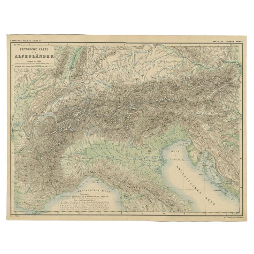
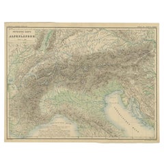
- Antique Map of the Alpine Countries, Published in Germany, c.1870Located in Langweer, NLAntique map titled 'Physische Karte der Alpenländer'. Old map of the Alpine countries. This map originates from 'H. Kiepert's Kleiner Atlas der Neueren Geographie für Schule und Haus...Category
Antique 19th Century Maps
MaterialsPaper
- Rare Antique Map of the Middle East, ca.1690Located in Langweer, NLDescription: Antique print, untitled. Two decorative maps on one sheet of the middle east in biblical times. Source unknown, to be determined. Artists and Engravers: Anonymous...Category
Antique 1690s Prints
MaterialsPaper
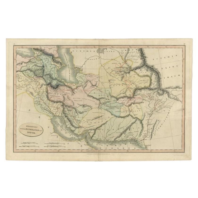
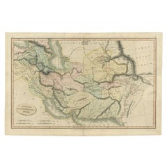
- Antique Map of the Middle East by Smith, 1809Located in Langweer, NLAntique map titled 'Regiones inter Euphraten et Indum'. Old map of the Middle East showing the region between the Euphrates and Indus river. Originates from Smith's 'Classical Atlas'...Category
Antique 19th Century Maps
MaterialsPaper
- Antique Map of the Middle East by Mortier, 1700Located in Langweer, NLAntique map titled 'Carte de la Situation du Paradis Terrestre (..)'. Detailed map of the Holy Land and the Middle East, centered on the Garden of Eden and including a large Cyprus. ...Category
Antique 18th Century Maps
MaterialsPaper
- Antique Map of the Middle East by Perthes, 1848Located in Langweer, NLAntique map titled 'Terra inter Euphratem et Indum Antiqua'. Old map of the Middle East originating from 'Orbis Terrarum Antiquus in usum Scholarum'. Artists and Engravers: Publi...Category
Antique 19th Century Maps
MaterialsPaper
- Antique Map of the East Indies by A & C. Black, 1870Located in Langweer, NLAntique map titled 'Indian Archipelago and Further India including Burmah, Siam, Anam &c'. Original antique map of Indian Archipelago and Further India. This map originates from ‘Bla...Category
Antique Late 19th Century Maps
MaterialsPaper


You May Also Like
- East German MapBy VEB Hermann HaackLocated in Baltimore, MDA brilliantly colourful map of the Leipzig, Karl Marx Stadt and Dresden area in the former German Democratic Republic by VEB Hermann Haack of Gotha.Category
Vintage 1970s German Maps
- Large Original Antique Map of The World, Fullarton, C.1870Located in St Annes, LancashireGreat map of the World. Showing both hemispheres From the celebrated Royal Illustrated Atlas Lithograph. Original color. Published by Fullarton, Edinburgh, C.1870 Unframed. Rep...Category
Antique 1870s Scottish Maps
MaterialsPaper
- Large Original Antique Map of The Pacific Ocean, Fullarton, C.1870Located in St Annes, LancashireGreat map of The Pacific Ocean From the celebrated Royal Illustrated Atlas Lithograph by Swanston. Original color. Published by Fullarton,...Category
Antique 1870s Scottish Maps
MaterialsPaper
- Large Original Antique Map of Australia, Fullarton, C.1870Located in St Annes, LancashireGreat map of Australia From the celebrated Royal Illustrated Atlas Engraved by Swanston after the drawing by Augustus Petermann Lithograph. Original color. Published by ...Category
Antique 1870s Scottish Maps
MaterialsPaper
- Large Original Antique Map of China, Fullarton, C.1870Located in St Annes, LancashireGreat map of China From the celebrated Royal Illustrated Atlas Lithograph by Swanston. Original color. Published by Fullarton, Edinburgh. C.1870 Repairs to minor edge te...Category
Antique 1870s Scottish Maps
MaterialsPaper
- Original Antique Decorative Map of Japan, Fullarton, C.1870Located in St Annes, LancashireGreat map of Japan Wonderful figural border From the celebrated Royal Illustrated Atlas Lithograph. Original color. Published by Fullarton, Edinburgh, C.1870 Unframed...Category
Antique 1870s Scottish Maps
MaterialsPaper


Recently Viewed
View AllMore Ways To Browse
Middle East Furniture
1870 German
Middle East Antiques
Old Asia Map
Middle East Map
Antique Map Middle East
Middle East Antique Map
Middle East Maps
Map Of Middle East
Pediment Metal
Russian Antique Book
Antique In The Philippines
Antique Furniture In Philippines
Antique Nursery
Medieval Plate
Atlas Globe
Antique Depot
Chinese Antique Map