Items Similar to Antique Map of the Middle East by Mortier, 1700


Want more images or videos?
Request additional images or videos from the seller
1 of 6
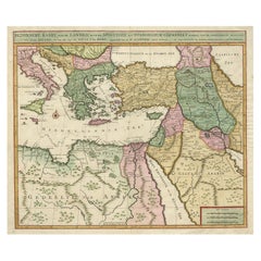
Antique Map of the Middle East by Mortier, 1700
About the Item
Antique map titled 'Carte de la Situation du Paradis Terrestre (..)'. Detailed map of the Holy Land and the Middle East, centered on the Garden of Eden and including a large Cyprus. Includes the cities Ninive, Babel, Calatua, Teredon, Sichem, Jerusalem, Antiocha (Syria), Charax Pasinis, Pasinivallum, Anuchtha, Pelodes, Suse, Nagira and others. This map originates from 'Historie des Ouden en Nieuwen Testaments' by P. Mortier.
Artists and Engravers: Pierre, or Pieter, Mortier (1661-1711) was a Dutch engraver, son of a French refugee. He was born in Leiden. In 1690 he was granted a privilege to publish French maps in Dutch lands. In 1693 he released the first and accompanying volume of the Neptune Francois. The third followed in 1700. His son, Cornelis (1699-1783), would partner with Johannes Covens I, creating one of the most important map publishing companies of the eighteenth century.
Condition: Good, general age-related toning. Repair on lower part of the folding line, please study image carefully.
Date: 1700
Overall size: 51.5 x 45 cm.
Image size: 47.5 x 40 cm.
We sell original antique maps to collectors, historians, educators and interior decorators all over the world. Our collection includes a wide range of authentic antique maps from the 16th to the 20th centuries. Buying and collecting antique maps is a tradition that goes back hundreds of years. Antique maps have proved a richly rewarding investment over the past decade, thanks to a growing appreciation of their unique historical appeal. Today the decorative qualities of antique maps are widely recognized by interior designers who appreciate their beauty and design flexibility. Depending on the individual map, presentation, and context, a rare or antique map can be modern, traditional, abstract, figurative, serious or whimsical. We offer a wide range of authentic antique maps for any budget.
- Dimensions:Height: 17.72 in (45 cm)Width: 20.28 in (51.5 cm)Depth: 0 in (0.01 mm)
- Materials and Techniques:
- Period:
- Date of Manufacture:1700
- Condition:Repaired: Repair on lower part of the folding line, please study image carefully. Condition: Good, general age-related toning. Repair on lower part of the folding line, please study image carefully.
- Seller Location:Langweer, NL
- Reference Number:
About the Seller
5.0
Platinum Seller
These expertly vetted sellers are 1stDibs' most experienced sellers and are rated highest by our customers.
Established in 2009
1stDibs seller since 2017
1,919 sales on 1stDibs
Typical response time: <1 hour
- ShippingRetrieving quote...Ships From: Langweer, Netherlands
- Return PolicyA return for this item may be initiated within 14 days of delivery.
More From This SellerView All
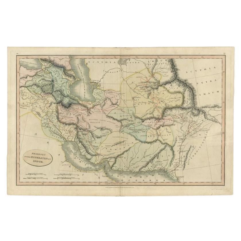
- Antique Map of the Middle East by Smith, 1809Located in Langweer, NLAntique map titled 'Regiones inter Euphraten et Indum'. Old map of the Middle East showing the region between the Euphrates and Indus river. Originates from Smith's 'Classical Atlas'...Category
Antique 19th Century Maps
MaterialsPaper
- Antique Map of the Middle East by Perthes, 1848Located in Langweer, NLAntique map titled 'Terra inter Euphratem et Indum Antiqua'. Old map of the Middle East originating from 'Orbis Terrarum Antiquus in usum Scholarum'. Artists and Engravers: Publi...Category
Antique 19th Century Maps
MaterialsPaper
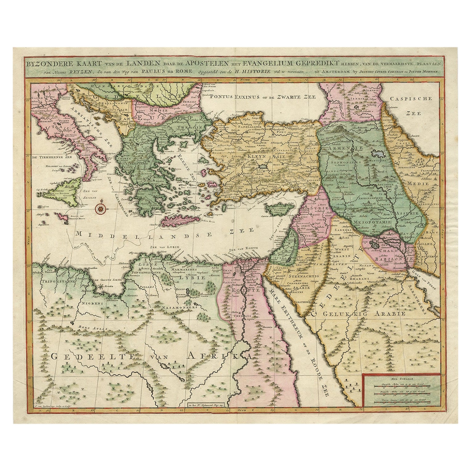
- Highly Decorative Map of The Eastern Mediterranean and The Middle East, ca.1700Located in Langweer, NLAntique map titled 'Byzondere Kaart van de Landen Daar de Apostelen Het Evangelium Gepredikt Hebben (..).' Highly decorative map of the eastern Mediterranean...Category
Antique Early 1700s Maps
MaterialsPaper
- Antique Bible Map of the Middle East by A. Schut, 1743Located in Langweer, NLAntique map titled 'De Gelegentheyt van 't Paradys en 't Landt Canaan'. Dutch Bible map covering the region between the Mediterranean and the Persian Gulf, ...Category
Antique Mid-18th Century Maps
MaterialsPaper
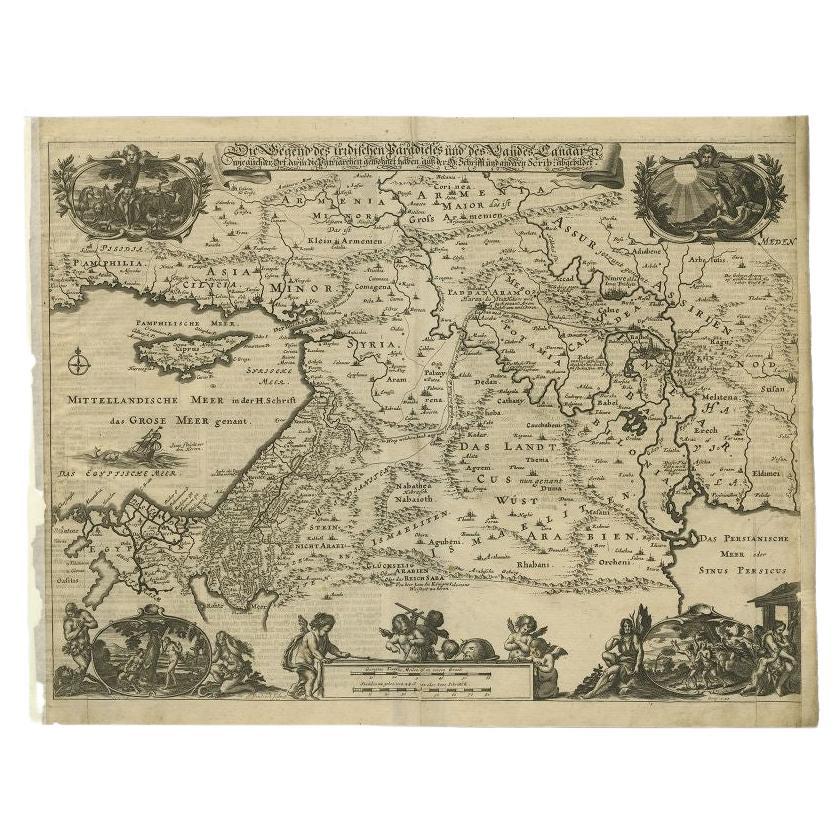
- Antique Map of the Middle East by Von Sandrart, 1708Located in Langweer, NLAntique map titled 'Die Gegend des Irdlisches Paradieses und des Landes Kanaan.' Map of the Middle East with a prominent Cyprus. The map shows the route of Abraham from Ur. Charming ...Category
Antique 18th Century Maps
MaterialsPaper
- Rare Antique Map of the Middle East, ca.1690Located in Langweer, NLDescription: Antique print, untitled. Two decorative maps on one sheet of the middle east in biblical times. Source unknown, to be determined. Artists and Engravers: Anonymous...Category
Antique 1690s Prints
MaterialsPaper


You May Also Like
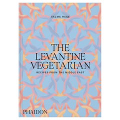
- The Levantine Vegetarian Recipes from the Middle EastLocated in New York City, NYVibrant vegetarian home-cooking recipes, capturing the essence of the Middle East, from the award-winning author of the best-selling The Lebanese Kitchen This glorious celebration of a bold vegetarian cuisine features 140 easy-to-make, bright, uplifting plant-based recipes, including classics such as falafels, hummus, and tabbouleh, as well as unique dishes reflective of region, religion, and culture across the Levant. The food is fresh and delicious, whether it’s garlic-laced mezze dishes, pittas stuffed with pickles, tahini, and grilled vegetables, or sweet and spicy desserts. Covering a vast area straddling Africa, Asia, and the gateway to Europe, the book embraces the culinary traditions of all corners of the Cradle of Civilization. Hage, one of the world’s authorities on Middle Eastern...Category
2010s Chinese Books
MaterialsPaper
- East German MapBy VEB Hermann HaackLocated in Baltimore, MDA brilliantly colourful map of the Leipzig, Karl Marx Stadt and Dresden area in the former German Democratic Republic by VEB Hermann Haack of Gotha.Category
Vintage 1970s German Maps
- Original Antique Map of South East Asia by Becker, circa 1840Located in St Annes, LancashireGreat map of South East Asia Steel engraving with original color outline Engraved by Becker Published by Virtue, circa 1840. Unframed.Category
Antique 1840s English Other Maps
MaterialsPaper
- Original Antique Map of South East Asia by Thomas Clerk, 1817Located in St Annes, LancashireGreat map of South East Asia Copper-plate engraving Drawn and engraved by Thomas Clerk, Edinburgh. Published by Mackenzie And Dent, 1817 Unframed.Category
Antique 1810s English Maps
MaterialsPaper
- 1861 Topographical Map of the District of Columbia, by Boschke, Antique MapLocated in Colorado Springs, COPresented is an original map of Albert Boschke's extremely sought-after "Topographical Map of the District of Columbia Surveyed in the Years 1856 ...Category
Antique 1860s American Historical Memorabilia
MaterialsPaper
- Original Antique Map of South East Asia, Arrowsmith, 1820Located in St Annes, LancashireGreat map of South East Asia Drawn under the direction of Arrowsmith Copper-plate engraving Published by Longman, Hurst, Rees, Orme and Brown, 1820 Unframed.Category
Antique 1820s English Maps
MaterialsPaper


Recently Viewed
View AllMore Ways To Browse
Middle Age Furniture
Middle Ages Furniture
Middle East Furniture
Middle East Antiques
General Grant
Antique Jerusalem
Large Antique City Maps
Antique Cyprus
Francois Nine
Antique Furniture Cyprus
Middle East Map
Middle East Antique Map
Antique Map Middle East
Middle East Maps
Map Of Middle East
Neptune Garden
Antique Map Of Jerusalem
Map Of Jerusalem