Items Similar to East German Map


Want more images or videos?
Request additional images or videos from the seller
1 of 11
East German Map
About the Item
A brilliantly colourful map of the Leipzig, Karl Marx Stadt and Dresden area in the former German Democratic Republic by VEB Hermann Haack of Gotha.
- Dimensions:Height: 71 in (180.34 cm)Width: 64 in (162.56 cm)Depth: 1 in (2.54 cm)
- Place of Origin:
- Period:
- Date of Manufacture:1970's
- Condition:
- Seller Location:Baltimore, MD
- Reference Number:
About the Seller
4.9
Gold Seller
These expertly vetted sellers are highly rated and consistently exceed customer expectations.
Established in 1983
1stDibs seller since 2009
427 sales on 1stDibs
Typical response time: 1 hour
- ShippingRetrieving quote...Ships From: Baltimore, MD
- Return PolicyA return for this item may be initiated within 14 days of delivery.
More From This SellerView All
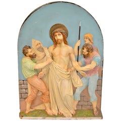
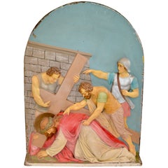
- Composition Plaster Station of the CrossLocated in Baltimore, MDThese unusual stations of the Cross are possibly by De Prado Studios. The panels are in good condition with some minor losses. The vibrant color...Category
Vintage 1910s American Architectural Elements
MaterialsPlaster
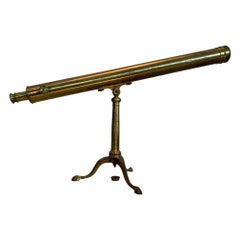
- Brass, Bardou and Son Telescope Badged James W. Queen and Co.By Bardou & SonLocated in Baltimore, MDTable top, brass refracting telescope on folding cabriole leg base. Objective lens is 3 possibly 3.25" diameter with additional solar viewing eyepiece, and lens cap. The telescope fu...Category
Vintage 1910s French Scientific Instruments
MaterialsBrass
- Composition Plaster Station of the CrossLocated in Baltimore, MDThese unusual stations of the Cross are possible De Prado Studios. The panels are in good condition with some minor losses. The vibrant colors ar...Category
Vintage 1910s American Religious Items
MaterialsPlaster
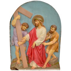
- Composition Plaster Station of the CrossLocated in Baltimore, MDThese unusual stations of the Cross are possible De Prado Studios. The panels are in good condition with some minor losses. The vibrant colors ar...Category
Early 20th Century American Religious Items
MaterialsPlaster
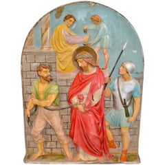
- Composition Plaster Station of the CrossLocated in Baltimore, MDThese unusual Stations of the Cross are possible De Prado Studios. The panels are in good condition with some minor losses. The vibrant colors ar...Category
Vintage 1910s American Architectural Elements
MaterialsPlaster
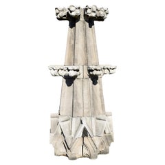
- Monumental Limestone Cathedral SpiresLocated in Baltimore, MDWe are offering two late 19th century monumental limestone finials, rescued from a Baltimore cathedral. Each spire is made up of fifteen individual carved stone blocks. The stones can be dry-stacked or permanently mortared together. Stonework on this scale is only rarely available for sale in the United States. This is a unique opportunity to own a grand garden folly...Category
Antique Late 19th Century American Gothic Architectural Elements
MaterialsLimestone
You May Also Like
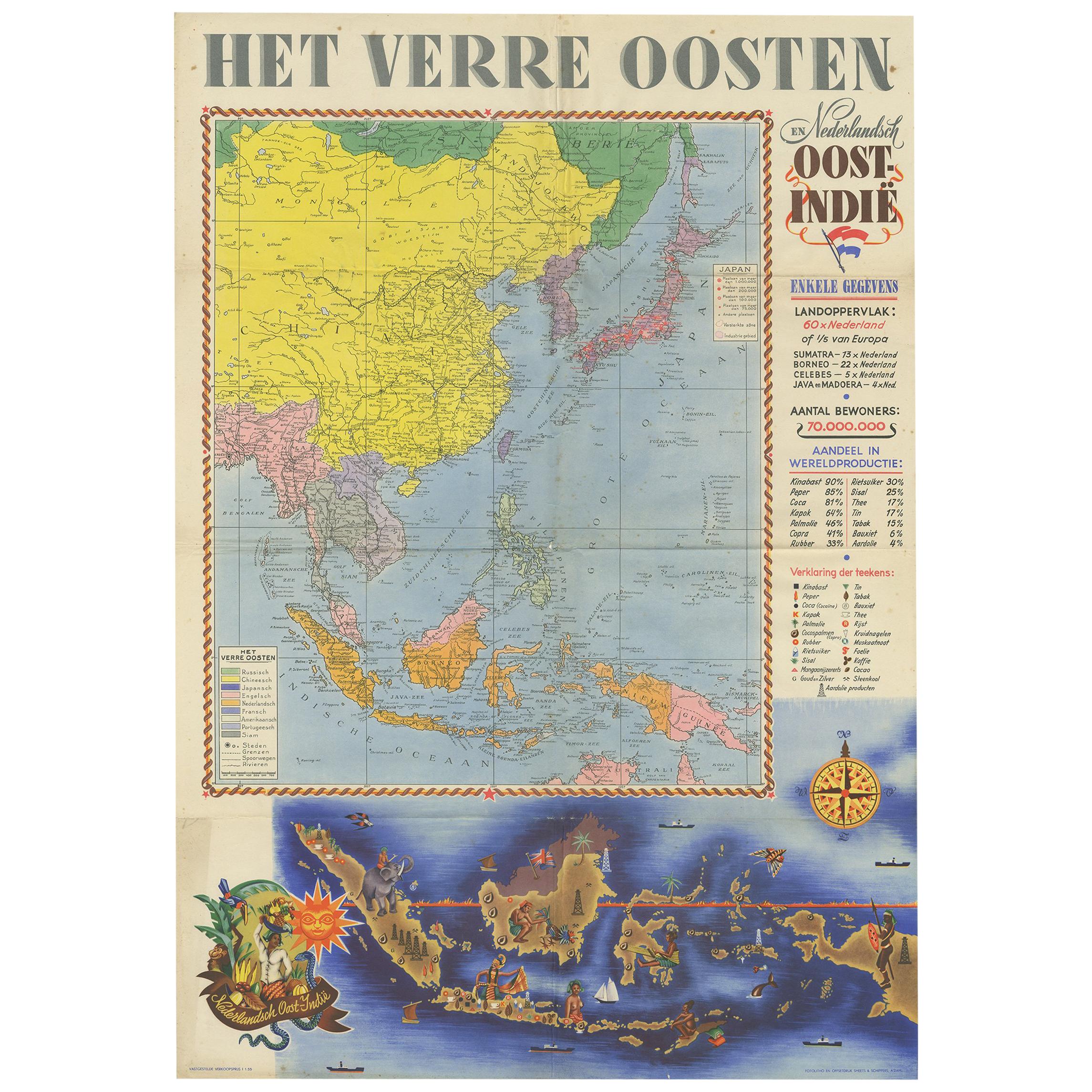
- Antique Poster Dutch East Indies, circa 1940Located in Langweer, NLBeautiful poster of the Dutch East Indies titled 'Het Verre Oosten'. This poster includes a large map of the East Indies with detailed legend. Below ...Category
Mid-20th Century Dutch Posters
MaterialsPaper
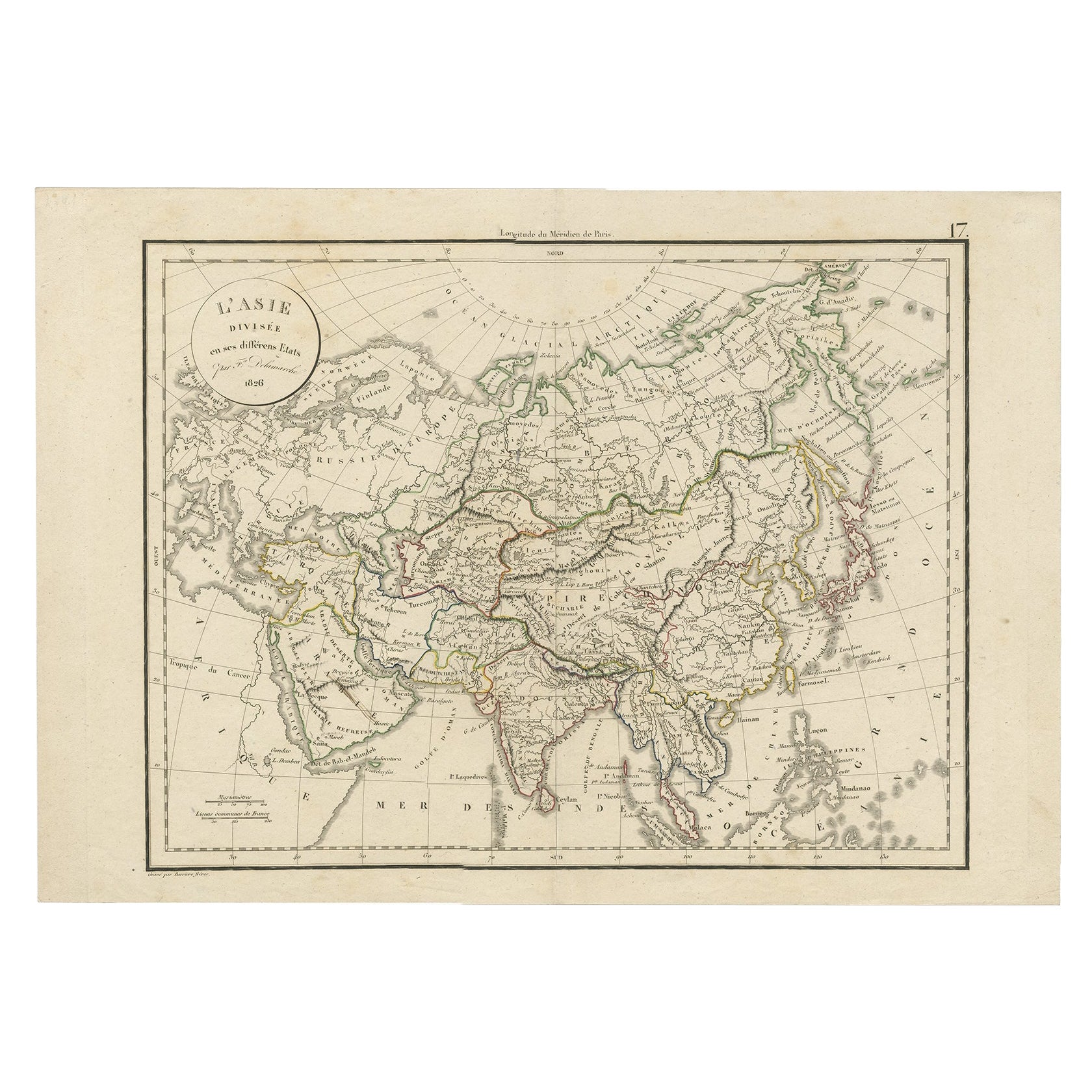
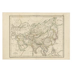
- Antique Map of Asia by Delamarche, 1826Located in Langweer, NLVaugondy's map plates and copyrights and later addes many plates from other sources as well. Charles Delamarche eventually passed control of the firm to his son Felix Delamarche (18t...Category
Antique 19th Century Maps
MaterialsPaper
- Gilt Framed Vintage Wine Regions of France MapLocated in Alton, GBFramed French wine region map 1973. The print has been removed to clean the glass, the frame has minor damage in places but nothing that detracts from ...Category
Vintage 1970s French Posters
MaterialsPaper
- Large University Chart “Political Map of North America” by BaconLocated in Chillerton, Isle of WightLarge University Chart “Political Map of North America” by Bacon W&A K Johnston’s Charts of Physical Maps By G W Bacon, This is colourful Physical map ...Category
Early 20th Century American Empire Posters
MaterialsLinen
- Large University Chart “Political Map of North America” by BaconLocated in Chillerton, Isle of WightLarge University chart “Political Map of North America” by Bacon W&A K Johnston’s Charts of Political Maps by G W Bacon, This is colorful Physical ...Category
Early 20th Century American Empire Posters
MaterialsLinen
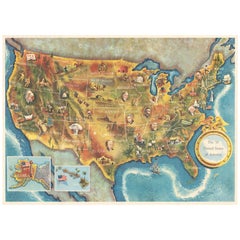
- American Election Map and 1960 Presidential Fact Sheet, Published 1960Located in Langweer, NLTitle: “The 50 United States of America” Subject: United States, Presidential Elections Date: 1960 (dated) Color: Printed Color Size: 24.9 x 17.9 inches (63.2 x 45.5 cm) This colorful map of the United States was drawn by Lorin Thompson and published by the General Foods Corporation. The map has an unusual coloring style with symbols of American history including past presidents, Native Americans, important buildings (White House, Statue of Liberty, Alamo), agriculture, industry, and more. Includes inset maps of Hawaii and Alaska with small American flags...Category
Vintage 1960s Posters
MaterialsPaper


Recently Viewed
View AllMore Ways To Browse
Marx Vintage
Germany Vintage Map
Vintage German Map
Vintage Map Of Germany
Veb Germany
German Democratic Republic
Karl Marx
Atlas China
Antique Maps Wales
Antique Furniture South East London
Antique Map Of Wales
Antique Maps Of Wales
Antique Island Caribbean
Antique Map Wales
Teak Sphere
Atlas Stand
Map Of Virginia
Antique Battle Maps