Items Similar to Highly Decorative Map of The Eastern Mediterranean and The Middle East, ca.1700


Want more images or videos?
Request additional images or videos from the seller
1 of 5
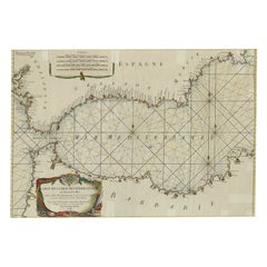
Highly Decorative Map of The Eastern Mediterranean and The Middle East, ca.1700
About the Item
Antique map titled 'Byzondere Kaart van de Landen Daar de Apostelen Het Evangelium Gepredikt Hebben (..).'
Highly decorative map of the eastern Mediterranean and the Middle East features the tract of St. Paul from Jerusalem to Rome. The map is filled with mountains, forests, and oases, and is decorated with a compass rose. Source unknown, to be determined.
Artists and Engravers: Made by 'Pierre Mortier' after an anonymous artist. Pieter and David Mortier were booksellers in Paris and have published a wide range of geographical works. After Pieter's death, his widow continued the business until their son Cornelius took over. Cornelius started a partnership with his brother-in-law Johannes Covens and established the famous publishing house "Covens and Mortier" in Amsterdam. They have re-issued Atlases of Sanson, de l'Isle, Visscher and de Wit.
Condition: Good, given age. Several small creases bottom left and right corner. Some minor spots. Original middle fold as issued. General age-related toning and/or occasional minor defects from handling. Please study image carefully.
- Dimensions:Height: 16.74 in (42.5 cm)Width: 19.89 in (50.5 cm)Depth: 0 in (0.02 mm)
- Materials and Techniques:Paper,Engraved
- Period:1700-1709
- Date of Manufacture:circa 1700
- Condition:Condition: Good, given age. Several small creases bottom left and right corner. Some minor spots. Original middle fold as issued. General age-related toning and/or occasional minor defects from handling. Please study image carefully.
- Seller Location:Langweer, NL
- Reference Number:
About the Seller
5.0
Platinum Seller
These expertly vetted sellers are 1stDibs' most experienced sellers and are rated highest by our customers.
Established in 2009
1stDibs seller since 2017
1,919 sales on 1stDibs
Typical response time: <1 hour
- ShippingRetrieving quote...Ships From: Langweer, Netherlands
- Return PolicyA return for this item may be initiated within 14 days of delivery.
More From This SellerView All
- Rare Antique Map of the Middle East, ca.1690Located in Langweer, NLDescription: Antique print, untitled. Two decorative maps on one sheet of the middle east in biblical times. Source unknown, to be determined. Artists and Engravers: Anonymous...Category
Antique 1690s Prints
MaterialsPaper
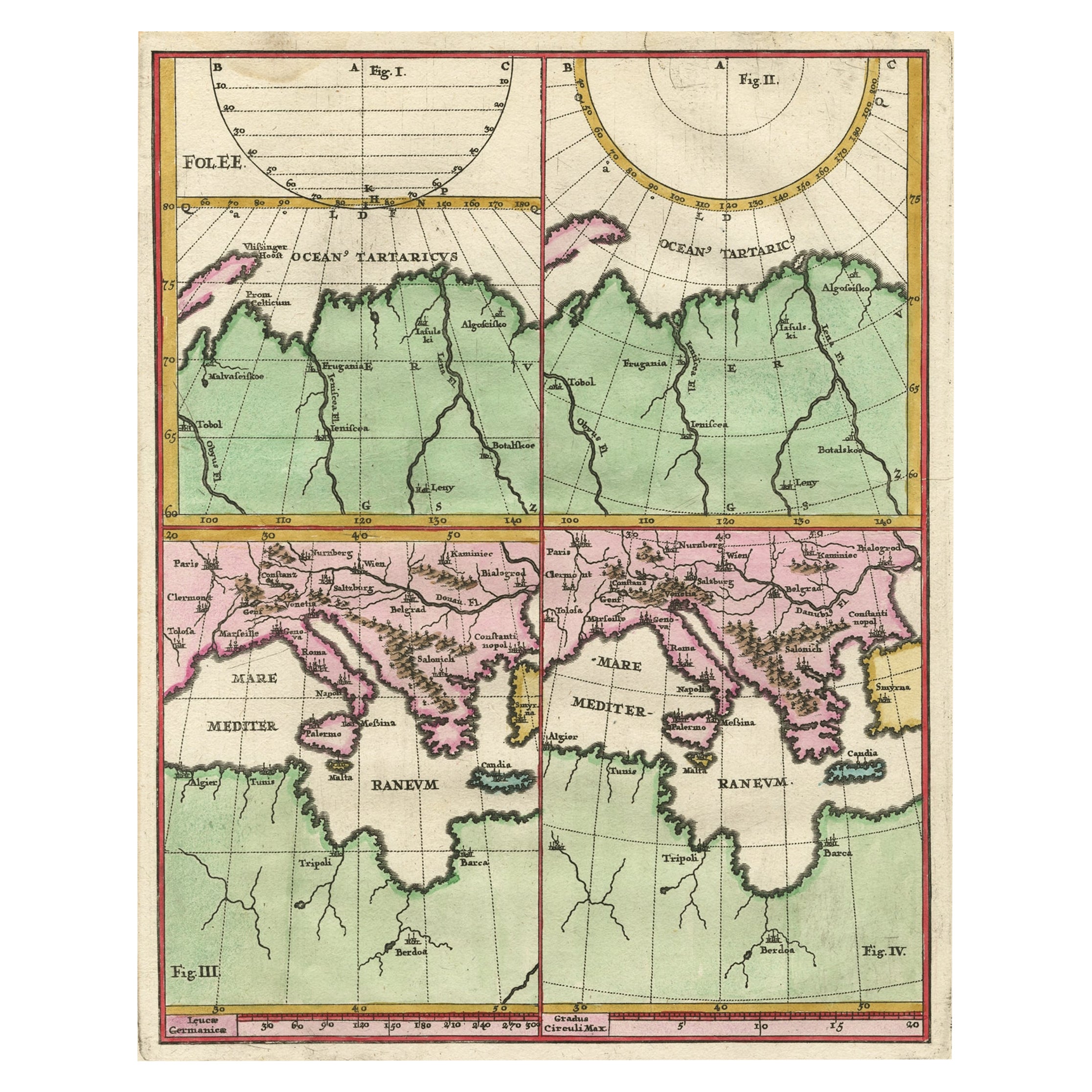
- Curious Map of the Laptev Sea 'Arctic Ocean' and the Mediterranean, ca.1700Located in Langweer, NLAntique map, untitled. Map of the Laptev Sea (Arctic Ocean) and the Mediterranean, printed for Scherer's 'Atlas Novus' (1702-1710). Scherer's 'Atlas Novus' forms an important mil...Category
Antique Early 1700s Maps
MaterialsPaper
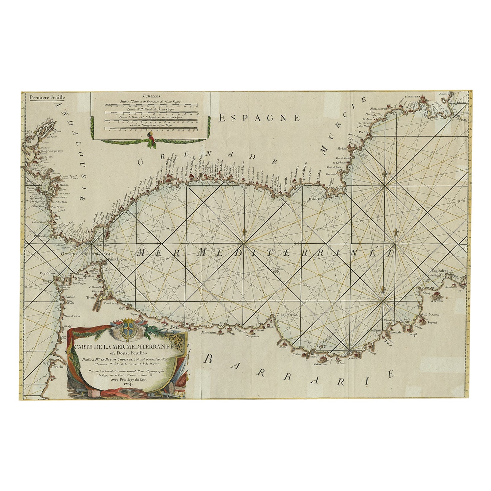
- Large Decorative Antique Map of the Mediterranean, ca.1770Located in Langweer, NLAntique map titled 'Carte de la Mer Mediterranee en Douze Feuilles'. First map out of twelve fine engraved double-page and folding maps that join to create a large wall map...Category
Antique 1770s Maps
MaterialsPaper
- Antique Map of Asia Minor, Cyprus, and the Eastern MediterraneanLocated in Langweer, NLAntique map titled 'Natoliae quae olim Asia Minor nova descriptio'. Original antique map of Asia Minor, Cyprus, and the eastern Mediterranean. Originally published on one sheet toget...Category
Antique Early 17th Century Maps
MaterialsPaper
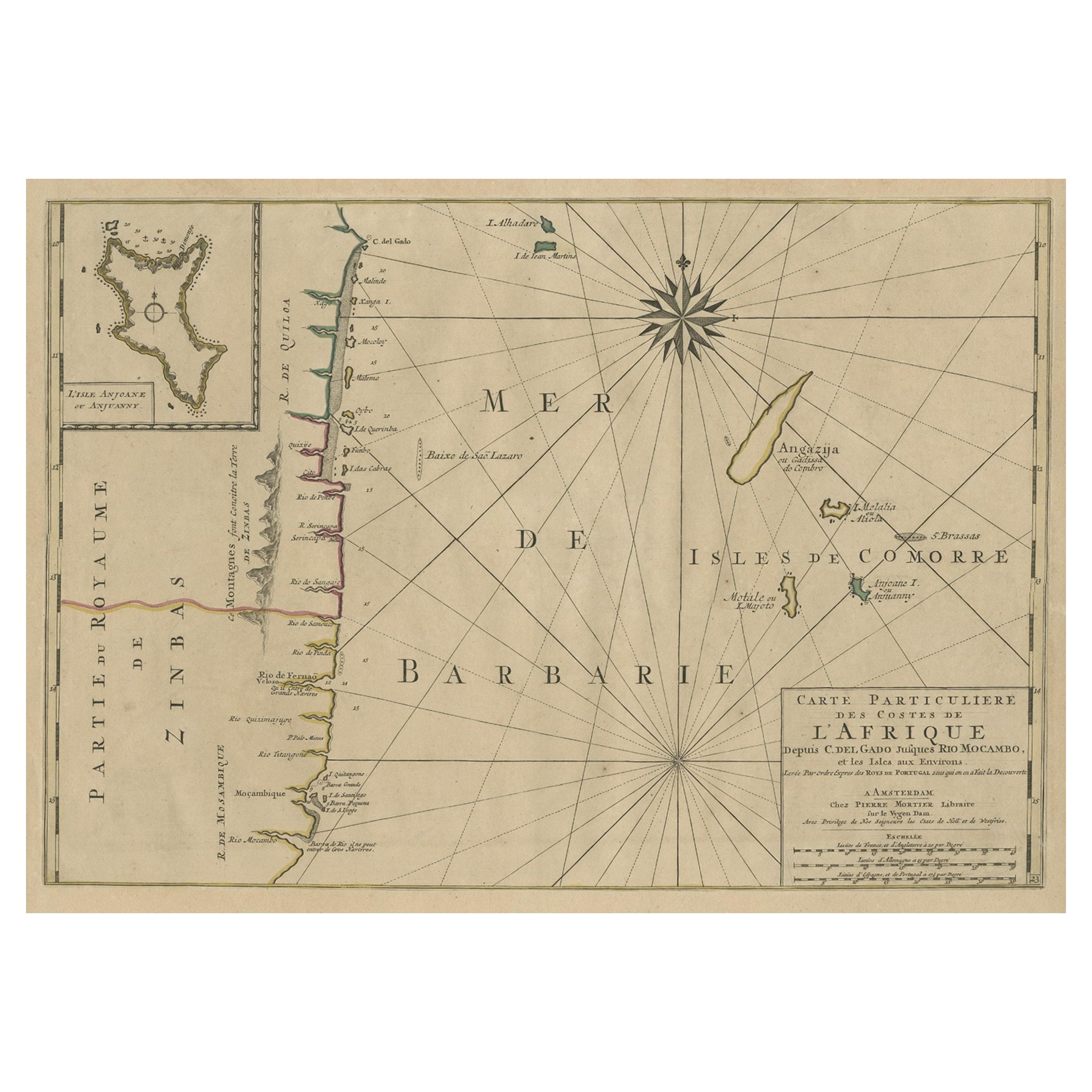
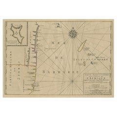
- Map of the Mozambique and Tanzania Coast & Inset Map of Anjouan Island, ca.1700Located in Langweer, NLAntique map titled 'Carte particuliere des Costes de l'Afrique'. Depicts the coasts of Mozambique and Tanzania. With an inset map of Anjouan Island. Artists and engravers: Pub...Category
Antique Early 1700s Maps
MaterialsPaper
- Antique Bible Map of the Middle East by A. Schut, 1743Located in Langweer, NLAntique map titled 'De Gelegentheyt van 't Paradys en 't Landt Canaan'. Dutch Bible map covering the region between the Mediterranean and the Persian Gulf, ...Category
Antique Mid-18th Century Maps
MaterialsPaper


You May Also Like
- Original Antique Map of South East Asia, Arrowsmith, 1820Located in St Annes, LancashireGreat map of South East Asia Drawn under the direction of Arrowsmith Copper-plate engraving Published by Longman, Hurst, Rees, Orme and Brown, 1820 Unframed.Category
Antique 1820s English Maps
MaterialsPaper
- Map of the Republic of GenoaLocated in New York, NYFramed antique hand-coloured map of the Republic of Genoa including the duchies of Mantua, Modena, and Parma. Europe, late 18th century. Dimension: 25...Category
Antique Late 18th Century European Maps
- Scandinavia & Portions of Eastern Europe: 18th Century Hand-Colored Homann MapBy Johann Baptist HomannLocated in Alamo, CAAn early 18th century hand-colored copper-plate map entitled "Regni Sueciae in omnes suas Subjacentes Provincias accurate divisi Tabula Generalis" by Johann Baptist Homann (1663-1724...Category
Antique Early 18th Century German Maps
MaterialsPaper
- Map "Estuary- Mouth of the Thames"Located in Alessandria, PiemonteST/426 - Antique French Map of the estuary of the Thames, map dated 1769 - "Mape of the entrance of the Thames. Designed by filing of Navy cards fo...Category
Antique Mid-18th Century French Other Prints
MaterialsPaper
- Original Antique Map of South East Asia by Becker, circa 1840Located in St Annes, LancashireGreat map of South East Asia Steel engraving with original color outline Engraved by Becker Published by Virtue, circa 1840. Unframed.Category
Antique 1840s English Other Maps
MaterialsPaper
- Original Antique Map of South East Asia by Thomas Clerk, 1817Located in St Annes, LancashireGreat map of South East Asia Copper-plate engraving Drawn and engraved by Thomas Clerk, Edinburgh. Published by Mackenzie And Dent, 1817 Unframed.Category
Antique 1810s English Maps
MaterialsPaper


Recently Viewed
View AllMore Ways To Browse
1700 Antique Furniture
Middle East Furniture
Mediterranean Antique
Middle East Antiques
Antique Mediterranean Furniture
Antique Middle Eastern Furniture
Middle Eastern Antiques
Compass Rose
Compass Map
Antique Furniture St Paul
Small Compasses
Small Compass
Antique Rose Compass
Antique Compass Rose
Compass Rose Antique
Compass Antique Map
Antique Map Compass
Antique Compass Map